Climb the mountains and get their good tidings. Nature's peace will flow into you as sunshine flows into trees.
The winds will blow their own freshness into you... while cares will drop off like autumn leaves (John Muir).
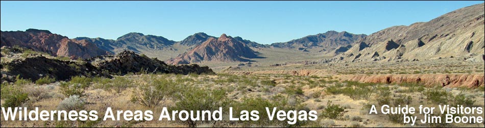
The Clark County Conservation of Public Land and Natural Resources Act of 2002 (Public Law 107-282) expanded one existing wilderness area and established 17 new wilderness areas. These lands offer solitude, grand vistas, and remarkable hiking experiences, plus they protect the land, plants, and animals from the encroachment of civilization. Wilderness areas in other counties around Las Vegas are also included.
Overviews of the wilderness areas are presented here. Follow the links for detailed information about each area, and in some cases, information on hiking and birding in the wilderness areas. Overview map of the Wilderness Areas Around Las Vegas.
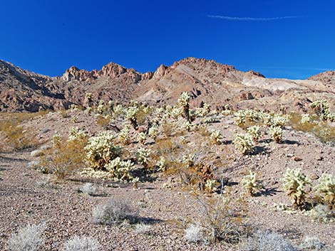
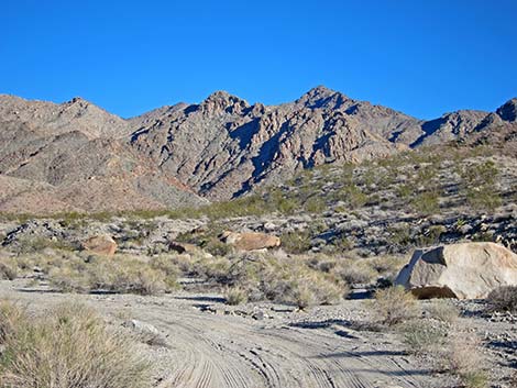
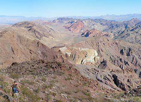
| Arrow Canyon Wilderness Area Arrow Canyon includes a north-south orientated ridge that is a striking example of fault-block topography. On the west side, the fault scarf rises nearly 3,000 feet and exposes layers of gray, black, and white rocks. The east side rises less steeply and it is cut by several deep canyons. Arrow Canyon a deep, narrow slot canyon is among the best slot canyon in southern Nevada. |
|
|
 |
Black Canyon Wilderness Area This wilderness area includes steep volcanic cliffs, deep narrow canyons, and beaches along the Colorado River. The cliffs are cut by deep canyons, some of which contain hot springs. Elevations are relatively low, ranging from about 600 to 3,000 feet. |
|
 |
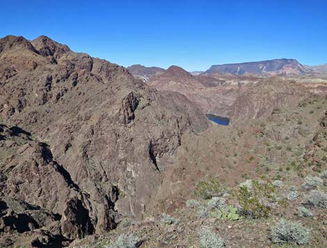
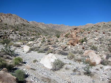
Bridge Canyon Wilderness Area This wilderness area is located in the rugged Newberry Mountains. Granite outcrops, huge boulders, and narrow canyons dominate the landscape; elevations rise to 5,600 feet. |
|
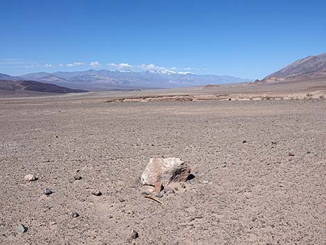 |
Death Valley Wilderness Area |
|
 |
El Dorado Wilderness Area This wilderness area is located at the northern end of the El Dorado Mountains. The west side is gently-rolling hills, while the east side is a land of rugged volcanic peaks and ridges cut by wide washes and narrow canyons. Elevations range from about 3,800 on the highest peaks to about 650 feet along the Colorado River. |
|
 |
Ireteba Peaks Wilderness Area A region of colorful landscapes, diverse geologic landforms, and grand vistas. The landscape is dominated by the long, narrow Ireteba Peaks ridge, which is the southern end of the El Dorado Mountain Range and runs parallel to Lake Mohave. Elevations on the ridge reach 5,060 feet. The eastern side of the ridge is cut by steep, short canyons that quickly drop onto a broad bajada, which in turn runs at a gentle grade to Lake Mohave. |
|
 |
Jimbilnan Wilderness Area This wilderness area includes the northeastern end of the Black Mountains, a series of rugged, rocky volcanic mountains (elevations to 3,025 ft). The mountains are cut by deep canyons and washes that flow southeast into the Overton Arm of Lake Mead (about 1,280 ft elevation). South of the Black Mountains, the colorful land slopes gently for several miles to the Lake. |
|
 |
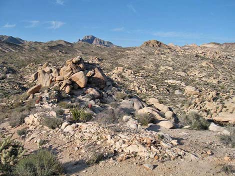
Jumbo Springs Wilderness Area A small wilderness area, measuring only 3.5 miles long and 1.5 miles wide. What it lacks in size, it makes up for in that it is located in a remote, rugged region of granitic ridges and canyons on the far east end of Lake Mead. Three major washes cut across the wilderness area, draining east and south towards the lake. Elevations range from 4,700 to 2,700 feet. The area offers grand views of Lake Mead and the lower reaches of the Grand Canyon. |
|
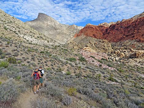 |
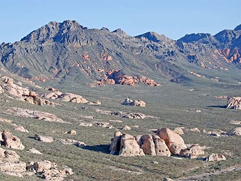
La Madre Mountains Wilderness Area A rugged complex of gray carbonate ridges and towering vertical cliffs that form the northern view-scape at Red Rock Canyon National Conservation Area. The most prominent feature is the La Madre Ridge, with La Madre Peak at 8,154 feet. From there, elevations run down to about 3,900 feet at the edge of Las Vegas. The flora is diverse, ranging from dry Mojave Desert Scrub to Pinyon-Juniper forests where snow lingers far into spring. |
|
 |
Lime Canyon Wilderness Area A long, disjointed, sparsely vegetated carbonate ridge with deep canyons and desert bajadas that overlook the Overton Arm of Lake Mead. The ridges are rocky and sparsely vegetated with a variety of Mojave Desert scrub species. |
|
 |
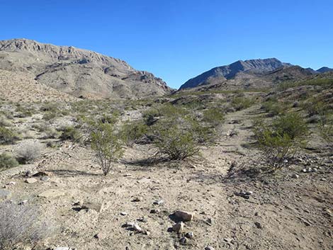
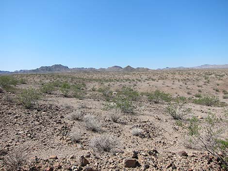
Meadow Valley Range Wilderness Area A long ridge of limestone and volcanic rocks rise above Kane Spring Valley and tail off in a long bajada to Meadow Valley Wash. There are no trails, but the area provides many opportunities for quiet recreation. |
|
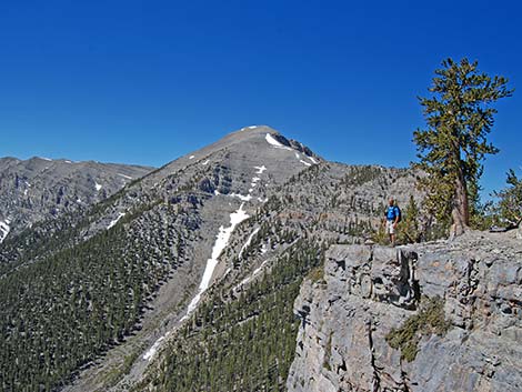 |
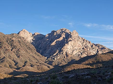
Mt. Charleston Wilderness Area All of the higher elevations in the Spring Mountains, including Mt. Charleston (11,918 feet), the highest peak in southern Nevada. These rugged mountains have towering cliffs, steep hillsides, and deep narrow canyons. The highest wind-swept ridges are barren, but lower ridges and slopes are cloaked with ancient Bristlecone Pine. Below these is an extensive forest of ponderosa pine and white fir; Pinyon-Juniper Woodlands dominate the lower elevations. |
|
 |
Mount Wilson Wilderness Area (Arizona) |
|
 |
Muddy Mountains Wilderness Area This wilderness area includes the Muddy Mountains (5,432 feet) and all land above about 3,000 feet. In the southern part of the area, tilted and folded sedimentary rocks are cut by the Anniversary Narrows, and fire-red Aztec sandstone outcrops occur in the Bowl of Fire and in Hidden Valley. |
|
 |
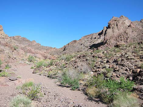
Nellis Wash Wilderness Area Includes the bajadas on the northeastern slopes of the Newberry Mountains. Several major washes, including Nellis Wash drain the Newberrys, cross the wilderness area and flow into the Colorado River. The southern end of the wilderness area has steep, nearly barren ridges separated by deep, well-vegetated washes, while the northern end is a gently rolling bajada. Spirit Mountain and the Newberry Mountains form a scenic background above the bajada. |
|
 |
North McCullough Wilderness Area This wilderness area, located on the south edge of the Las Vegas Valley, includes the northwest side of the North McCullough Range. Elevations range from 5,100 to 2,900 feet. Unlike most mountain ranges in southern Nevada, this range is volcanic. Amazing petroglyphs in Sloan Canyon. |
|
 |
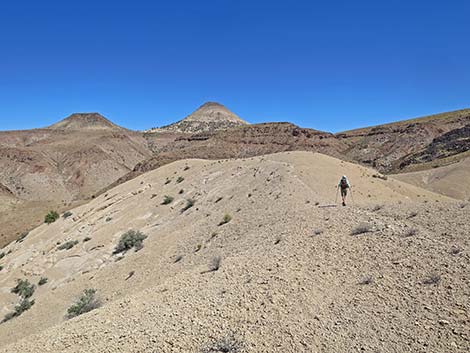
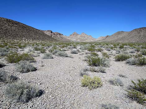
Pinto Valley Wilderness Area This is a wild and geologically complex country composed of volcanic, carbonate, sandstone, and clastic sedimentary rocks, all stirred together by major fault systems and cut by major drainages. The southern part of the area is the volcanic Black Mountains, while the northern part is titled carbonate ridges with sandstone outcrops. |
|
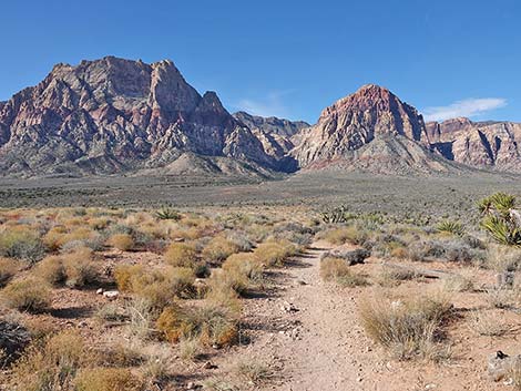 |
Rainbow Mountain Wilderness Area This wilderness area includes the red and white sandstone cliffs, rugged canyons, and limestone peaks that make up the western view-scape of Red Rock Canyon National Conservation Area. Elevations range from about 4,100 feet at the base of the escarpment to 7,070 feet at the summit of Wilson Mountain. The sandstone cliffs have been overthrust by gray carbonate rocks that form the top of the ridge behind the escarpment. |
|
 |
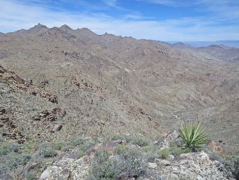
South McCullough Wilderness Area This wilderness area includes most of the Southern McCullough Mountain Range and a large bajada on the western side. The Southern McCulloughs mostly are old metamorphic rock with a very complex terrain. Elevations range from about 3,300 on the western bajada to 7,026 feet on McCullough Mountain. |
Points of Interest |
 |
Spirit Mountain Wilderness Area This wilderness area includes a portion of the Newberry Mountains and rugged country between there and Lake Mohave. The wilderness area is named for Spirit Mountain, an imposing monolith of white granite that is an important site for native peoples. Elevations range from 5,639 feet at Spirit Mountain to about 2,100 feet at the lake. |
|
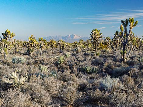 |
Wee Thump Joshua Tree Wilderness Area This wilderness area protects a dense, old-growth forest of Joshua trees. The area is relatively flat and slopes gently from west to east with elevations ranging from 1,250 to 1,500 feet. There are some amazing views out over the forest towards Spirit Mountain. |
Points of Interest |
Note: All distances, elevations, and other facts are approximate.
![]() ; Last updated 250419
; Last updated 250419
| Hiking Around Las Vegas | Glossary | Copyright, Conditions, Disclaimer | Home |