Southern Nevada Wilderness Areas
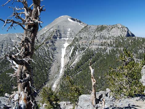 |
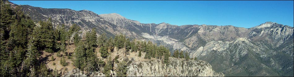
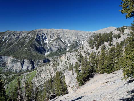
Overview Mt. Charleston is a large (56,600 acres) wilderness area that includes the highest peak in southern Nevada, Mt. Charleston (11,918 feet), and all of the higher elevations in the Spring Mountains. Much of the land over about 7,000 feet is included in the wilderness area. These mountains are rugged, with towering carbonate cliffs, steep hillsides, and deep narrow canyons. The highest, wind-swept summit ridges are barren, but the lower ridges and slopes are cloaked in a forest of ancient bristlecone pine. Lower down, extensive forests of ponderosa pine and white fir provide habitat for the Palmer's chipmunk, a species that only occurs in the Spring Mountains. Below those forests, a Pinyon-Juniper Woodland dominates the landscape. The only herd of Rocky Mountain elk in Clark County can be found near Cold Creek. Snowmelt and a few springs provide water for wildlife in the high country. |
 |
In 1989, about 43,000 acres of the Mt. Charleston National Recreation Areas was designated as the Mt. Charleston Wilderness Area. In 2002, another 13,600 acres were added, for a total of about 56,600 acres in the Mt. Charleston Wilderness Area. This wilderness area is adjacent to the La Madre Wilderness Area, which is adjacent to the Rainbow Mountain Wilderness Area. In total, these three areas combine to form about 129,000 acres of designated wilderness. Link to a map of the wilderness area. If you hike in wilderness areas, help protect them by learning about and reporting noxious and invasive weeds. |
 |
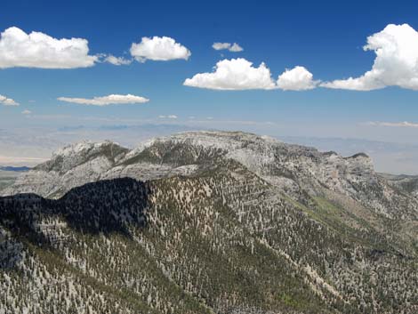
Location The Mt. Charleston Wilderness Area is located about 20 air-miles northwest of downtown Las Vegas. Boundaries The boundary of this wilderness area is complex, largely following contour lines and ridgelines. Essentially, the wilderness area includes all of the high elevation land surrounding Charleston Peak. This creates a hub at Mt. Charleston with six large lobes that extend out in all directions. The wilderness extends south to the USFS boundary (boundary of the La Madre Mountain Wilderness Area) and north to Willow Peak near the town of Cold Creek. The wilderness area extends east to encompass Mummy Mountain and southwest to include the ridge between Carpenter and Trout canyons. The developed areas in Kyle and Lee canyons are almost entirely surrounded by wilderness. |
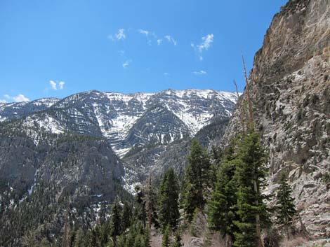 |
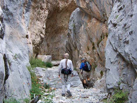
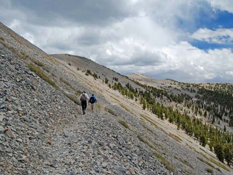
Access Access easiest access if from the paved roads into Kyle and Lee canyons. Access is also provided by several dirt roads, including the Harris Canyon Road, the road above Cold Creek, and several roads on the west side of the mountains. Terrain Mt. Charleston Wilderness area includes much of the Spring Mountains, which is a high and rugged carbonate ridge that generally runs north-south. There are towering crags, deep and wide canyons, narrow slot canyon, and steep hillsides. Elevations range from about 6,500 feet on the lowest slopes in the southwest part of the wilderness area, to nearly 12,000 feet at the summit of Mt. Charleston. Most of the land is steep. There are many deep canyons, but little flowing water after the snow melts. |
 |
Habitat Type The Spring Mountains have about a 10,000-foot elevation gradient (from desert floor to Mt. Charleston summit). As one goes up, the climate gets cooler, producing climate zones, and the climate zones produce life zones where different species of plants and animals can exist. There are six climate zones in the Spring Mountains, a change in habitat that would be similar to traveling from the Desert Southwest to the Canadian Arctic. From bottom to top, the life zones are Lower Sonoran, Upper Sonoran, Transition, Canadian (montane), Hudsonian (subalpine) and Arctic. |
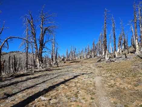 |
The Lower Sonoran and Upper Sonoran life zones provide conditions suitable for creosote bush and Joshua trees, but the Lower Sonoran is drier and hotter than the Upper Sonoran. The lower Transition Zone provides conditions suitable for pinyon pine and Utah juniper forests and sagebrush, while the upper Transition Zone provides conditions suitable for ponderosa pine, manzanita, and shrub live oak. The Canadian (montane) Zone provides conditions suitable for white fir, limber pine, and quaking aspen. The Hudsonian (subalpine) Zone provides conditions suitable for bristlecone pine and few other species. The Arctic Zone provides conditions that are unsuitable for trees; this is above treeline where only low shrubs, grasses, and forbs can exist. The wilderness area contains 18,000 acres of Bristlecone pine, the most extensive stand of these ancient trees in the Intermountain region. These trees are among the oldest living organisms in the world, and at least one in the wilderness area is over 3,000 years old. |
 |
Wildlife The diversity of elevations that provide conditions suitable for different species of vegetation also provide conditions that area suitable for different species of animals. At low elevation, species typical of the desert (for example, white-tailed antelope squirrel, black-tailed jackrabbit, kit fox) are common. At middle elevations, other species exist (for example, Palmer's chipmunk, mule deer). At higher elevations, others occur (for example, golden mantle ground squirrel). Conditions are too harsh at the highest elevations from most species, but Rock Wrens and Common Ravens can be found there. |
 |
Archaeology No specific information, but the mountain is important to local tribes. Geology The Spring Mountains are formed from tilted and uplifted carbonate rocks that date from the Cambrian through the Pennsylvanian, with a bit of Permian rock mixed in. Fossils generally are uncommon, but crinoid stems and shells are abundant in some places (for example, the summit of Griffith Peak). |
Note: All distances, elevations, and other facts are approximate.
![]() ; Last updated 240331
; Last updated 240331
| Wilderness Areas | Hiking | Guide Services | Glossary | Copyright, Conditions, Disclaimer | Home |