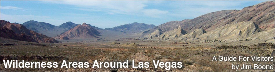
Climb the mountains and get their good tidings. Nature's peace will flow into you as sunshine flows into trees. The winds will blow their own freshness into you... while cares will drop off like autumn leaves (John Muir).
The Clark County Conservation of Public Land and Natural Resources Act of 2002 (Public Law 107-282) established 17 new wilderness areas and expanded one existing wilderness area in Clark County, Nevada. In 2004, the Lincoln County Conservation, Recreation, and Development Act (Public Law 108-424) established 14 new wilderness areas in Lincoln County, two of which extend into Clark County. These lands offer solitude, grand vistas, remarkable hiking experiences, and refreshment for the soul, plus they protect the land, plants, and animals from the encroachment of civilization.
Overviews of the 20 Clark County wilderness areas are presented below with links to detailed information. Click for an overview map of the Wilderness Areas around Las Vegas and information on hiking in the Wilderness Areas around Las Vegas. Other wilderness areas around Las Vegas are also included in this list.
For information on wilderness areas throughout Nevada and what you can do to protect them, visit the Friends of Nevada Wilderness, a group that advocates for and protects wilderness and wilderness-quality lands in Nevada.
One threat to wilderness that every hiker can help with is identifying and reporting the presence of noxious weeds. Click for details.
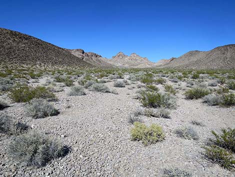
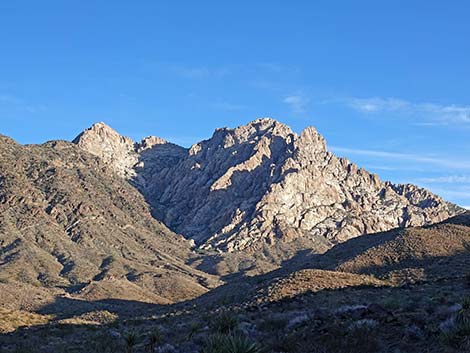
| Arrow Canyon is a medium sized (27,530 acres) wilderness area with elevations that range from about 2,000 to 5,200 feet. The area includes the northern Arrow Range and bajadas and canyons east of there. The west face of the range, a grand fault scarf with dramatic bands of quartzite and limestone, is one of the most scenic ranges in southern Nevada. The eastern boundary runs along Arrow Canyon, which for 3 miles is confined in a gorge so deep and narrow that sunlight rarely reaches the bottom. The area is thick with Bighorn sheep. There are interesting and unusual petroglyphs along Pahranagat Wash and in Arrow Canyon. | |
 |
Black Canyon is a medium-sized (17,220 acres) wilderness area with steep volcanic cliffs that border the Colorado River. The cliffs are cut by deep canyons, some of which contain hot springs. Elevations are relatively low, ranging only from about 600 to 3,000 feet. Archeological and old mining artifacts can be found within the area. Bighorn sheep are fairly common in the mountains, and desert tortoise use the bajadas. |
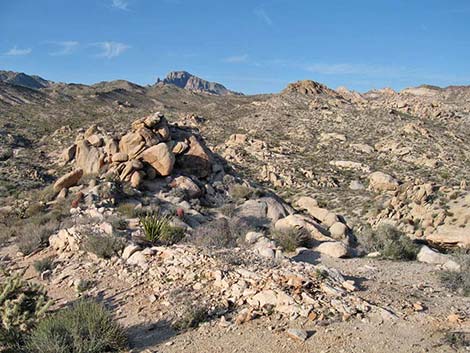 |
Bridge Canyon is a small (7,761 acres) wilderness area located in the rugged Newberry Mountains. Granite outcrops, huge boulders, and narrow canyons dominate the landscape; elevations rise to 5,600 feet. Springs and seeps provide water to wildlife in the area. |
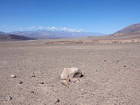 |
Death Valley is a huge (3.1 million acres) wilderness area that includes over 90% of the entire National Park Area. Paved and dirt roads crisscross the national park, subdividing the wilderness area into 35 sections and providing exceptional access for hikers, walkers, and even drivers of all abilities. The Death Valley Wilderness Area includes mountain peaks over 11,000 feet high, the lowest spot in North America at 282 feet below sea level, several entire mountain ranges, several sets of sand dunes, more that 1,000 species of plants, 350 species of birds, dozens of mammal and reptile species, vast fields of spring wildflowers, and amazing examples of Native American, mining, and other human history. The Death Valley Wilderness Area is located in California and Nye County, Nevada; it is not one of the Clark County Wilderness Areas. |
 |
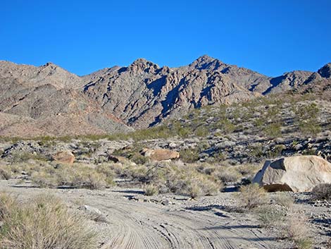
El Dorado is a medium-sized (31,950 acres) wilderness area at the north end of the El Dorado Mountains. Elevations range from peaks at 3800 feet to 650 feet along the Colorado River. The area is sparsely-vegetated. The west side is gently-rolling hills and valleys, while the east side is rugged peaks and ridges cut by wide washes and narrow canyons. The mountains are volcanic, but the basement rock is an ancient metamorphic rock. Except for the washes, the surface of the entire area is strewn with reddish-brown boulders covered in desert varnish. The name "El Dorado" refers to the legendary city of gold, and evidence of mining can be found here. Springs provide water for wildlife. |
 |
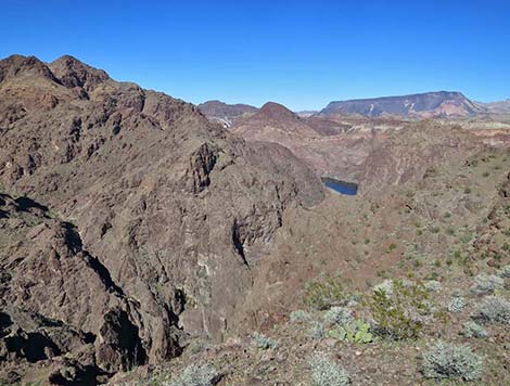
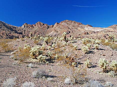
Ireteba Peaks is a large (32,745 acres) wilderness area in a region of colorful landscapes, diverse geologic landforms, and grand vistas across Lake Mohave. The land is dominated by Ireteba Peaks Ridge, which is the southern end of the El Dorado mountains and runs parallel to Lake Mohave. Elevations reach 5,060 feet. The east side of the ridge is cut by steep, short canyons that quickly drop onto a broad bajada, which in turn runs at a gentle grade to the Lake Mohave at elevations of 650 feet. Vegetation is dominated by creosote bush, bursage, yucca, barrel cactus, and a few other low-growing shrubs and grasses, including teddybear cholla. |
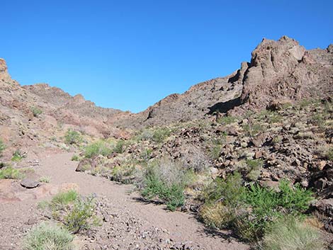 |
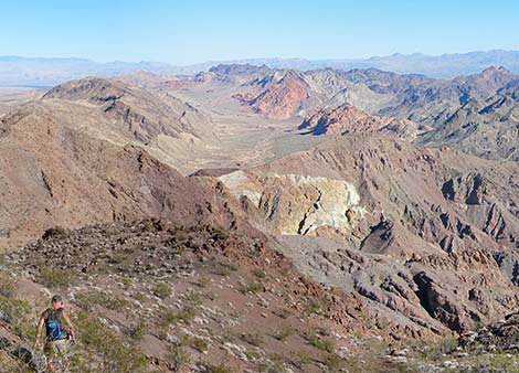
Jimbilnan is a medium-sized (18,879 acres) wilderness area that includes the northeastern end of the Black Mountains, a series of rugged, rocky volcanic mountains (elevations to 3,025 ft) that are orientated northeast-southwest. The Black Mountains record considerable igneous activity, which was followed by fracturing and the intrusion of colorful dike material. The Black Mountains are cut by deep canyons and washes that flow southeast into the Overton Arm of Lake Mead (about 1,280 ft elevation). South of the Black Mountains, the colorful land slopes gently for several miles to the Lake. This is wild, remote, and rugged country out on the eastern end of Lake Mead. |
 |
Jumbo Springs is a small (4,631 acres) wilderness area, measuring only 1.5 by 3.5 miles. What it lacks in size, it makes up for in remote, sparsely-vegetated, rugged granitic ridges and canyons on the far east end of Lake Mead. The area sits on the southeast side of Jumbo Peak, uphill from the boundary of Lake Mead National Recreation Area. Three major washes cut across the area and drain east and south towards the lake. Elevations range from 4,700 feet on the northwest side to 2,700 feet in the southeast. The area offers grand views of Lake Mead and the lower reaches of the Grand Canyon. Water can be found in springs and in the granite, water-polished potholes in Cottonwood Spring. |
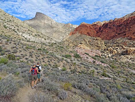 |
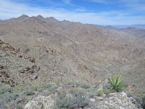
La Madre Mountains is a large (47,180 acres) wilderness area that includes the entire La Madre Range, rugged gray carbonate ridges and vertical cliffs that form the northern view at Red Rock Canyon, plus part of the Spring Mountains crest. The highest point (9,425 feet) is on the crest of the Spring Mountains south of Griffith Peak. The most prominent feature is La Madre Peak, which stands at 8,154 feet. The lowest elevations are 3,900 feet on bajadas at the edge of Las Vegas. The area supports bighorn sheep and protects archeological sites. The flora is diverse, ranging from dry Mojave Desert scrub on the lower slopes to montane forests at the highest elevations where snow lingers far into the spring. |
 |
Lime Canyon is a medium sized (23,233 acres) wilderness area that includes a long, carbonate ridge (elevations to 4,406 feet), deep canyons that cut through the ridge, and desert bajadas that overlook the Overton Arm of Lake Mead (elevations to 1,475 feet). The geology of the area is complex, but the main feature is a system of hogback ridges resulting from tilted and uplifted sedimentary rocks. The uplift blocked existing drainage systems, but new drainages cut through the ridge, making for narrow canyons and odd geologic structures. The ridges are rocky and sparsely vegetated with Mojave Desert scrub species including barrel cactus. The canyons are richly vegetated with shrubs and cryptobiotic crusts. |
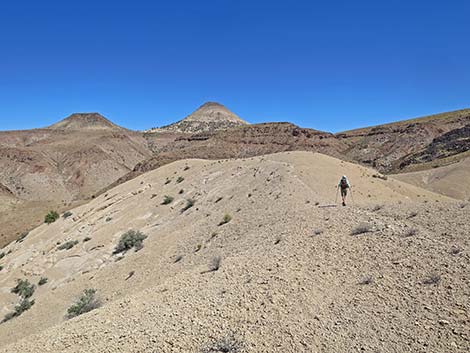 |
Meadow Valley Range is a large (123,500 acres) wilderness area on the north edge of Clark County. Most of the wilderness area is located in Lincoln County. This area is wild and rugged, with towering peaks, high cliffs, and deep canyons. The area is so remote that only one peak is named, the volcanic Sunflower Peak (5,022 ft), and it isn't even the highest peak in the range. All of the high-elevation Meadow Valley Range and a large bajada area on the east side of the range are included in this wilderness area. |
 |
Mormon Mountains is a large (157,700 acres) wilderness area on the north edge of Clark County. Most of the wilderness area is located in Lincoln County. Mormon Mountain (the mountain, proper) is a more-or-less circular sky-island standing alone (like a volcano) above the desert flats. The area has a history of human use with several cherry stem roads penetrating the wilderness areas, but it remains wild and rugged with high cliffs, deep canyons, towering peaks, and little modern human use. The mountain range used to support a hidden forest of ponderosa pines near the summit, but it burned in 2005, and with climate change, it is unclear if the forest will ever grow back. |
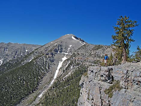 |
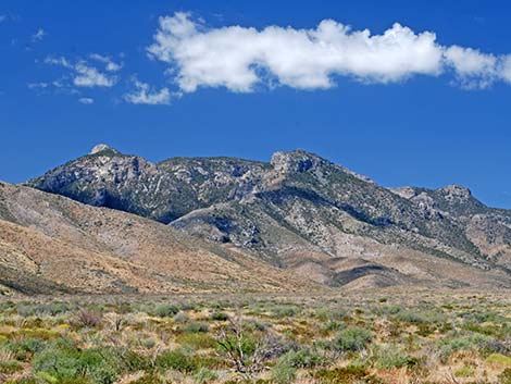
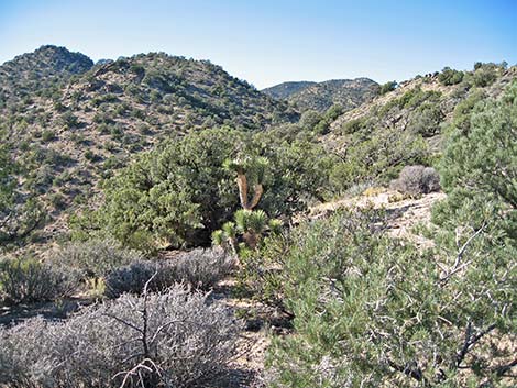
Mount Charleston is a large (56,600 acres) wilderness area that includes the highest peak in southern Nevada (Mt. Charleston at 11,918 feet), and all of the higher elevations in the Spring Mountains. These mountains are rugged, with towering carbonate cliffs, steep hillsides, and deep narrow canyons. The summit ridges are barren, but the lower ridges and slopes are cloaked in a forest of ancient bristlecone pine. Lower down, ponderosa pine and white fir provide habitat for the Palmer's chipmunk, a species occurring only in the Spring Mountains. Lower, a pinyon-juniper woodland dominates the landscape. Rocky Mountain elk can be seen near Cold Creek. Snowmelt and a few springs provide water for wildlife. |
 |
Mount Wilson (Arizona) is a medium sized (23,900 acres) wilderness area that preserves eight miles of Wilson Ridge, part of the Black Mountains in Arizona, including the summit of Mount Wilson (5,445 feet). The west side of the ridge is a stark, steep, and forbidding landscape, while the east side is more gentle mountains, broad bajadas, and three springs that support wildlife, including more than 100 desert bighorn sheep. Wilson Ridge rises to more than 3,000 feet above the desert floor, providing grand views over Lake Mead, the Colorado River, and mountains and deserts into the distance. |
 |
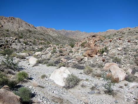
Muddy Mountains is a large (48,019 acres) wilderness area that includes the west end of the Muddy Mountain Range. The boundary follows the base of the mountains at elevations ranging from about 2,500 to 3,300 feet, staying west of Bitter Springs Road. The area includes Muddy Peak (5,387 feet) and Peak 5432 (5,432 feet), the highest peaks in the range. The east end of the area includes Bitter Ridge, a block-fault ridge with striking vertical cliffs standing up from the desert floor. In the southern part of the area, tilted and folded sedimentary rocks are cut by the Lovell Canyon Narrows, and fire-red Aztec sandstone outcrops occur in the Bowl of Fire. Smaller sandstone outcrops occur in the northeastern parts of the wilderness area. |
 |
Nellis Wash is a small (16,423 acres) wilderness area that includes bajadas on the northeastern slopes of the Newberry Mountains. The western boundary follows legal lines and captures two mountain sides with elevations to 3,515 feet. Several washes, including Nellis Wash, drain the Newberrys, cross the wilderness area, and flow into Lake Mohave (650 feet). The landform is a gently sloping bajada leading to a steep, rugged ridge cut by deep canyons (some 1,000 feet deep). The southern end of the wilderness area has steep, nearly barren ridges separated by deep, well-vegetated washes, while the northern end is a gently rolling bajada. Spirit Mountain and the Newberry Mountains form a scenic background. |
 |
North McCullough is a medium-sized (14,763 acres) wilderness area located on the northwest side of the Northern McCullough Range. The wilderness area essentially includes the entire drainage system on this side of the range. The highest elevations are on the northern end of the main ridge (about 5,100 feet) and on the ridge that runs northwest from the main ridge (about 4,200 feet). The lowest elevations are where the main wash flows north and crosses the wilderness area boundary (about 2,900 feet). Unlike most mountain ranges around Las Vegas, the Northern McCulloughs are volcanic. |
 |
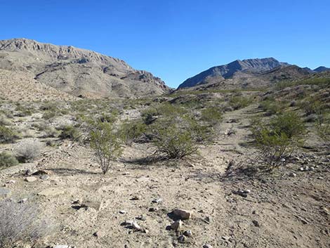
Pinto Valley is a large (39,173 acres) wilderness area located on the north edge of Lake Mead. This is a wild and geologically complex country composed of volcanic, carbonate, sandstone, and clastic sedimentary rocks, all stirred together by major fault systems and cut by major drainages. The southern part of the area is the volcanic Black Mountains (several peaks around 3,300 feet), while the northern part is titled carbonate ridges (peaks to about 3,000 feet) with sandstone outcrops. Springs provide water for bighorn and other wildlife. The vegetation generally is sparse Mojave Desert scrub, dominated by creosote bush and bursage, with cottonwood, mesquite, and acacia, and other shrubs in the washes. |
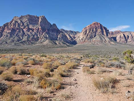 |
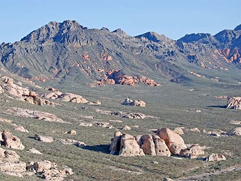
Rainbow Mountain is a medium-sized (24,997 acres) wilderness area that includes the red and white sandstone cliffs, rugged canyons, and limestone peaks on the western edge of Red Rock Canyon. Elevations range from 4,100 feet to 7,070 feet at the summit of Wilson Mountain. The sandstone cliffs are overthrust by gray limestone that forms the top of the ridge behind the escarpment. The base of the cliffs generally is typical Mojave Desert scrub, but ponderosa pines occur at the mouths of some canyons. The sandstone summits typically are barren, but behind them, ridges support an extensive pinyon-juniper forest. There is a considerable amount of rock art in the area. Springs and potholes provide water for wildlife. |
 |
South McCullough is a large (44,252 acres) wilderness area that includes most of the Southern McCullough Mountain Range and a large bajada on the western side. The Southern McCulloughs are formed of old metamorphic rock, but there is a bit of volcanic rock in the northern part of the wilderness area. These peaks have had about 1.7 billion years to erode, and they are more rounded than many in southern Nevada, but they still are rugged and exceed 7,000 feet in height. McCullough Mountain is 7,026 feet tall. The base of the mountains is at about 3,300 feet on the east side and 4,000-5,000 feet on the west side. Springs in the area provide water for wildlife and early human inhabitants. |
 |
Spirit Mountain is a large (33,518 acres) wilderness area that includes a portion of the Newberry Mountains and mountainous country between there and Lake Mohave. The wilderness area is named for Spirit Mountain, an imposing monolith of white granite that is an important site for native peoples of the Mojave and Sonoran Deserts who consider it to be the center of their creation. East of Spirit Mountain, there is a jumble of metamorphic and granitic mountains, and deep canyons that run to Lake Mohave. There are archeological sites in the area, but not on Spirit Mountain, proper. Springs and canyon potholes provide water for wildlife. Elevations range from 5,639 feet at Spirit Mountain to about 2,100 feet at the lake. |
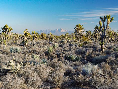 |
Wee Thump Joshua Tree is a small (6,050 acres) wilderness area that protects a dense, old-growth forest of Joshua trees. The area is relatively flat and slopes gently from west to east with elevations ranging from 1,250 to 1,500 feet. The wilderness area is entirely surrounded by dirt and paved roads that give access to the far reaches of the forest and some amazing views out over the forest towards Spirit Mountain to the southeast. Gilded Flickers (flickers with yellow wing lining) can be found here. |
Note: All distances, elevations, and other facts are approximate.
![]() ; Last updated 240401
; Last updated 240401
| Hiking Around Las Vegas | Guide Services | Glossary | Copyright, Conditions, Disclaimer | Home |