Southern Nevada Wilderness Areas
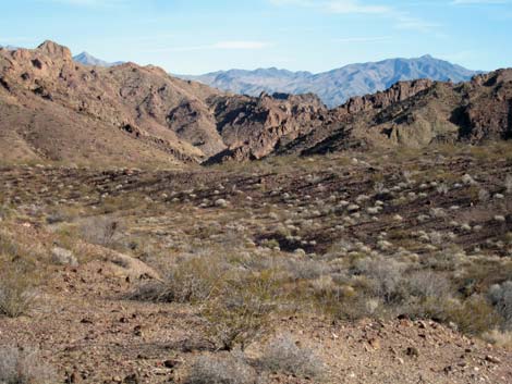 |
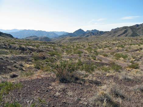
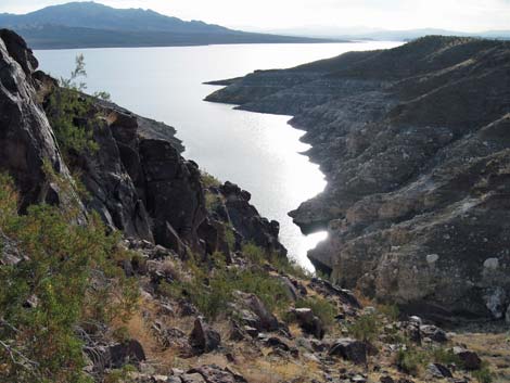
Overview Jimbilnan is medium-sized wilderness area (18,879 acres) that includes the northeastern end of the Black Mountains, a series of rugged, rocky volcanic mountains (elevations to 3,025 ft) orientated northeast-southwest. The Black Mountains record considerable igneous activity, which was followed by fracturing and the intrusion of colorful dike material. The Black Mountains are cut by deep canyons and washes that flow southeast into the Overton Arm of Lake Mead (about 1,280 ft elevation). South of the Black Mountains, white gypsum mudhills slope gently for several miles towards the Lake. This is wild, remote, and rugged country out on the eastern end of Lake Mead. |
 |
The Jimbilnan and Pinto Valley Wilderness areas are separated by a little-used, one-lane dirt road, so the two areas actually combine to form a 58,000-acre designated wilderness area, all of which is included in this wild and remote region of Lake Mead National Recreation Area. If you hike in wilderness areas, help protect them by learning about and reporting noxious and invasive weeds. Link to map of the wilderness area. |
 |
Location The Jimbilnan Wilderness Area is located about 40 air-miles east of Las Vegas, along the north side of Lake Mead overlooking the Overton Arm. This is just a few miles south of the town of Overton. |
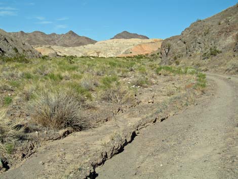 |
Boundaries The northern boundary runs along a dirt road that runs just south of the road to Echo Bay. The eastern boundary is the Overton Arm of Lake Mead. The southern boundary is the Virgin Basin of Lake Mead. The western boundary runs along the paved Northshore Road and dirt Boathouse Cove Road. Access Vehicle access is from Northshore Road and Boathouse Cove Road, and boat access is from Lake Mead. The first 1.0 miles of Boathouse Cove Road are a good, graded road, but the remainder requires, at the least, a high-clearance vehicle. In January 2006, I needed to shift into 4WD in two places. |
 |
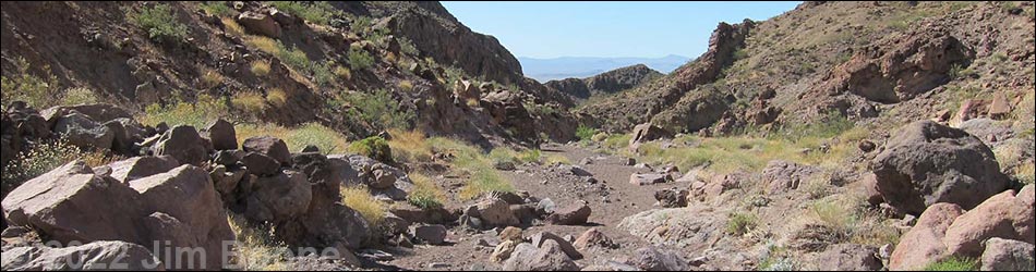
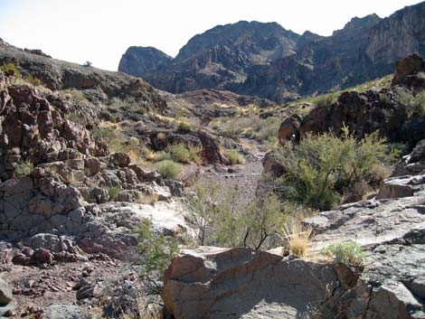
Terrain The northern portion of the Jimbilnan primarily is a volcanic mountain range orientated northeast-southwest, with deep canyons and washes that cut across the mountains and flow southeast into the Overton Arm of Lake Mead. The area has been greatly affected by tectonic activity with faulting and tilting. South of the Black Mountains, the land is gentler and slopes south towards the Virgin Basin section of Lake Mead. The south edge of the Black Mountains is bordered by an extensive area of white gypsum mudhills that slope gently towards the south and southeast. Closer to the lake, the land is defined by thick layers of alluvial outwash that has subsequently been cut by washes flowing towards Lake Mead. Despite the proximity of volcanic mountains to the Jimbilnan and Pinto Valley wilderness areas, the color of the alluvial outwash suggests a limestone origin rather than a volcanic origin. |
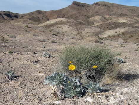 |
Habitat Type The Jimbilnan is located entirely within the Upper (Mojave Desert Scrub) life zone, and the vegetation is primarily composed of typical Mojave Desert Scrub species. The flats and bajadas are dominated by species such as Creosote Bush, White Bursage, Fremont's Dalia (Indigo Bush), Mojave Yucca, a few Beavertail Pricklypear Cactus, and many other low-growing desert shrubs. Joshua Trees seem to be absent. The mountain slopes include species such as Creosote Bush, White Bursage, Nevada Jointfir, Schott's Pygmycedar, Desert Stingbush, Sweetbush, Goldenhills (brittlebush), and Barrel Cactus. Washes support a diverse array of shrub (e.g., Catclaw Acacia, Burrobrush, and Rabbitbrush) and forb species (e.g., Desert Tobacco and Groundcherry). |
 |
The gypsum mudhills support and odd array of species, including Silverleaf Sunray, Palmer's Phacelia, Parry's Sandpaper Plant, a species of Desert Trumpet, Prickly Poppy, Desert Stingbush, and unfortunately, Russian Thistle and Saltcedar in the gullies. Las Vegas Bearpoppy is reported to be here, but I saw none. The wilderness area is reported to support several sensitive plant species, including California (Las Vegas) Bearpoppy, Threecorner Milkvetch, and Sticky Buckwheat. |
 |
Wildlife Native mammals include Desert Bighorn, Black-tailed Jackrabbits, Coyotes, a smaller dog or weasel, and white-tailed antelope squirrels. Unfortunately, wild horses seem to have invaded the area. Reptiles include side-blotched and Zebratail lizards. Birds include Red-tailed Hawk, Common Raven, Black-tailed Gnatcatcher, House Finch, Black-throated Sparrow, White-crowned Sparrow, Say's Phoebe, Canyon Wren, and Bald Eagle. Down by the lake you can find species such as American Coots, Double-crested Cormorants, and various ducks and grebes. Striped Bass and Carp are common in the lake. Archaeology No information. |
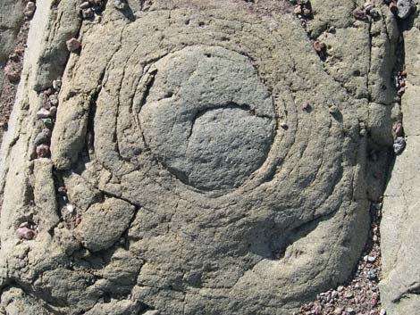 |
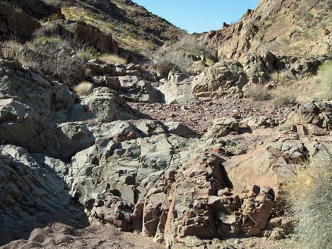
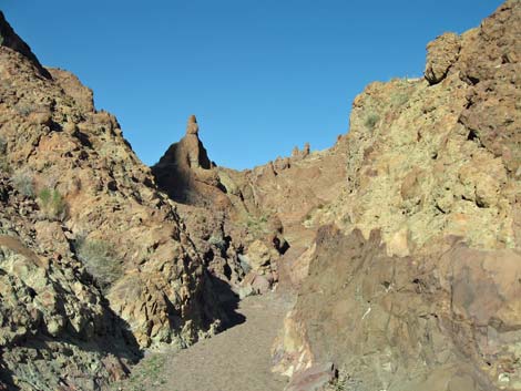
Geology The geology of this region is complex, being influenced by seemingly out-of-proportion crustal stretching and faulting, and overlain by volcanic activity. The rocks in the northern part of the wilderness area record considerable igneous activity, including Tertiary basalt flows, tuff flows, pyroclastic flows, and numerous dikes. There are some very nice examples of agglomerate rocks. The southern part of the wilderness area is composed largely of un-deformed (and therefore young) sedimentary deposits. |
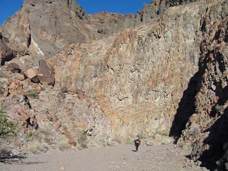 |
The Hamblin-Cleopatra Volcano story is particularly impressive. Some 13 million years ago, the Hamblin-Cleopatra Volcano was split by the Hamblin Bay Fault, which runs east-west. In the following 3 to 8 million years, the Cleopatra lobe (the southern half of the volcano) shifted to the east, while Hamblin Mountain (the northern half) shifted to the west. Hamblin Mountain is now about 12 miles west of the Cleopatra lobe -- that's a spread of nearly 2 miles per million years or faster! Hamblin Mountain is now in the Pinto Valley Wilderness Area. The Nevada Bureau of Mines and Geology publishes a nice book, "Geologic Tours in the Las Vegas Area, Expanded Edition" [ISBN 1-888035-07-2; about $20] that details the story in a format that is interesting and readable for lay people. |
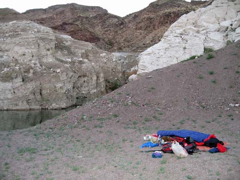 |
Threats This wilderness area is so isolated that there are few threats. It does not appear that vehicle incursion has occurred along Boathouse Cove Road, although the camping area at the end of the road is a bit trashed. Invasive species include Saltcedar and Russian Thistle. Saltcedar thickets are common along the edge of the lake, and there are some Saltcedars in gullies in the gypsum mudhills. Russian Thistle also occurs in gullies in the gypsum mudhills. Boaters camp in coves along the lake, but present little threat. |
Note: All distances, elevations, and other facts are approximate.
![]() ; Last updated 240331
; Last updated 240331
| Wilderness Areas | Hiking | Guide Services | Glossary | Copyright, Conditions, Disclaimer | Home |