Southern Nevada Wilderness Areas
 |
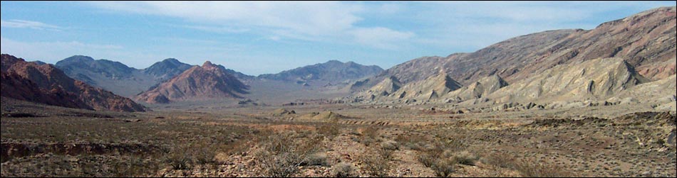
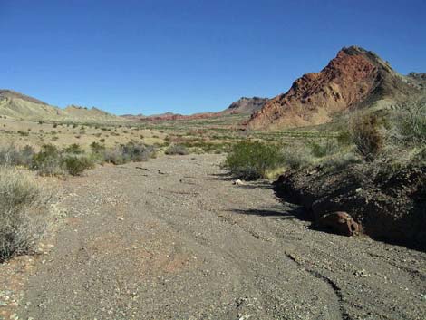
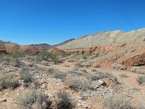
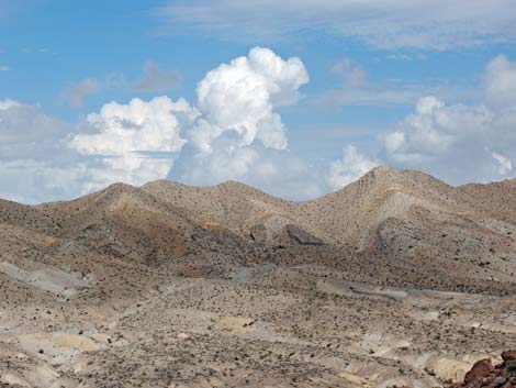
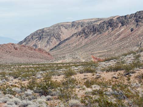
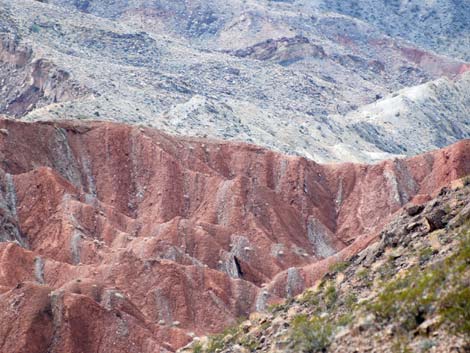
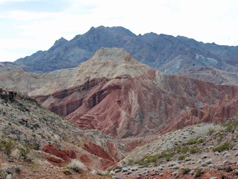
Overview Pinto Valley is a large (39,173 acres) wilderness area located on the north edge of Lake Mead. This is a wild and geologically complex country composed of volcanic, carbonate, sandstone, and sedimentary rocks, all stirred together by major fault systems and cut by major drainages. In the southern part of the wilderness area, the volcanic Black Mountains (several peaks around 3,300 feet) border Lake Mead. In the northern part, the mountains are titled carbonate ridges (peaks to about 3,000 feet) with sandstone outcrops. Between the two, gypsum mud hills provide evidence of ancient lakes and now provide habitat for rare plants. The vegetation generally is sparse Mojave Desert Scrub, dominated by creosote bush and white bursage, but with a diverse flora of annual and perennial plants. Washes support catclaw acacia, honey mesquite, and other shrubs, and the springs provide water for cottonwood trees, bighorn sheep, and other wildlife. |
 |
This wilderness area is separated from the Jimbilnan Wilderness Area by a one-lane dirt road, but combined they protect some 58,000 acres of designated wilderness. In addition, these two areas are almost connected with the Muddy Mountains Wilderness Area, which if included in the total, covers about 106,100 acres. If you hike in wilderness areas, help protect them by learning about and reporting noxious and invasive weeds. Link to map of the wilderness area. Location The Pinto Valley Wilderness Area is located about 30 air-miles east of Las Vegas, entirely within Lake Mead National Recreation Area. The wilderness area lies between Northshore Road and Lake Mead. |
 |
Boundaries The northern boundary is Lakeshore Road, extending from Callville Wash Road on the west to Boathouse Cove Road on the east. The eastern boundary is Boathouse Cove Road, which also borders the Jimbilnan Wilderness Area. The southern boundary is Lake Mead, extending from the Virgin Basin to the Boulder Basin. The western boundary is Callville Wash Road. Access Access to the wilderness area is from the paved Northshore Road and from the rough dirt roads that border the west (Callville Wash Road) and east (Boathouse Cove Road) sides of the wilderness area. The wilderness area can also be accessed from Lake Mead by boat. |
 |
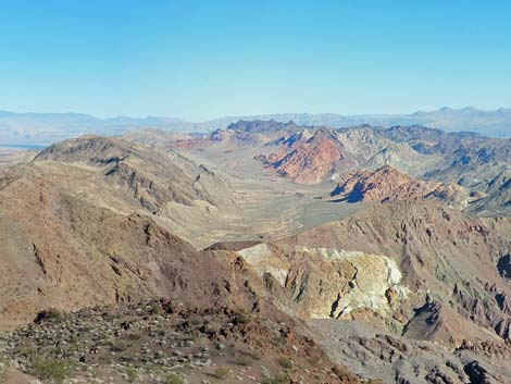
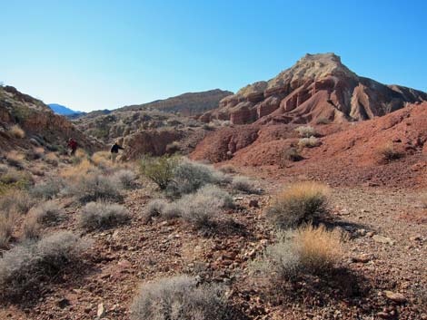
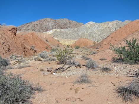
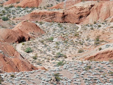
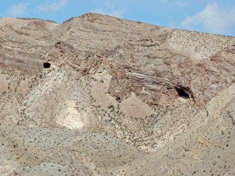
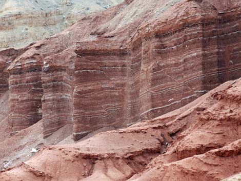
Terrain The terrain is rugged. The Black Mountains, essentially everything east, south, and west of Pinto Valley, proper, are volcanic. The mountain peaks generally are low (elevations only to about 3,300 feet), but what they lack in height, they make up for in ruggedness. North of Pinto Valley, proper, the landscape is titled carbonate ridges. Faults align a series of three major ridges (Northshore Peak, Razorback Ridge, and Pinto Ridge), where elevations reach about 3,000 feet. Included in the jumble of terrain are gypsum mudhills and red sandstone outcrops. |
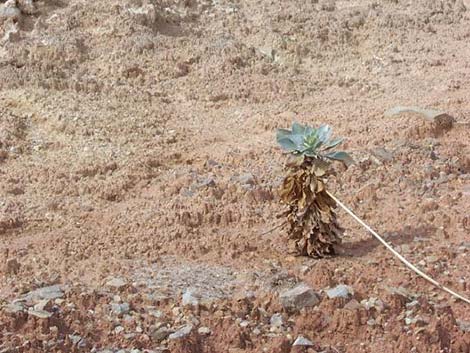 |
Habitat Type The Pinto Valley Wilderness Area is located entirely within the Upper Sonoran (Mojave Desert Scrub) life zone, and the vegetation is primarily composed of typical Mojave Desert species. The valleys and bajadas are dominated by species such as creosote bush, white bursage, Fremont's dalea (Indigo Bush), and Mojave yucca. A wide variety of less common plants also occur in these areas. A number of cactus species occur in the area, including beavertail pricklypear cactus, silver cholla, cottontop cactus, and common fishhook cactus. Even California barrel cactus, usually found on rocky hillsides, can be found on the bajadas. Joshua trees, typical of many parts of the Mojave Desert, seem to be absent. The mountain slopes support species such as creosote bush, white bursage, Nevada jointfir, Schott's pygmycedar, sweetbush, and goldenhills (Brittlebush). Washes support a diverse array of shrubs, including catclaw acacia, burrobrush, and Rabbitbrush. |
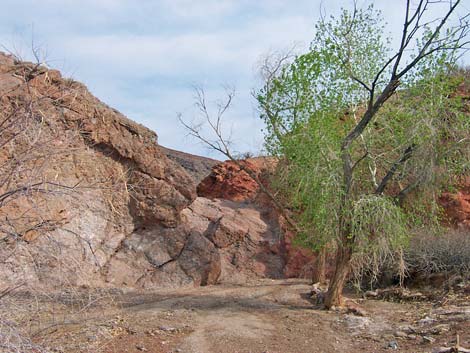 |
The gypsum mudhills support and odd array of rare species, including silverleaf sunray, California (Las Vegas) bearpoppy, and Palmer's phacelia. Cryptobiotic crusts, and even moss, grow on the seemingly inhospitable gypsum mudhills. Sandstone Spring, once developed to provide water for cattle, now supports honey mesquite, catclaw acacia, desert almond, four-wing saltbush, saltgrass, and other shrubs. The watering trough and pipes are still there, but they are nonfunctional. Bighorn sheep, coyote, and small mammals also use the spring. Cottonwood Spring provides water for two cottonwood trees, a thicket of honey mesquite, and catclaw acacia. Wild burros are making a mess here. Invasive species such as saltcedar and russian thistle occur in some washes. |
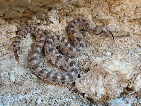 |
Wildlife Bighorn sheep, coyote, and Black-tailed Jackrabbit are common in the wilderness area. Unfortunately, wild burros seem to have invaded the area around Cottonwood Spring. Bird species in the desert portions of the wilderness area include Cactus Wren, Say's Phoebe, Common Raven, Sage Sparrow, House Finch, Black-tailed Gnatcatcher, Loggerhead Shrike, Yellow-rumped Warbler, and Bald Eagle. Along the lake, common "waterbirds" include American coots, grebes, mergansers, and gulls. |
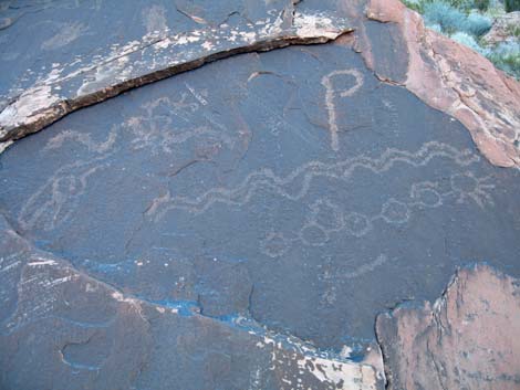 |
Archaeology No specific information on prehistoric use in the wilderness area, but native peoples provided evidence of their presence by leaving petroglyphs. Native peoples often marked on rocks faces that are readily seen from easy walking routes (such as washes) and that often seem to serve sign-posts. Here, however, they marked on out-of-the-way spots such as the top, but not the sides, of boulders. There is also evidence of early survey efforts and early white travelers in the area. In the only shady place in western Pinto Valley, there are the remains of what appears to be an old cowboy camp (rock shelter, old boards, rusty cans, and rock carvings). |
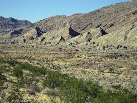 |
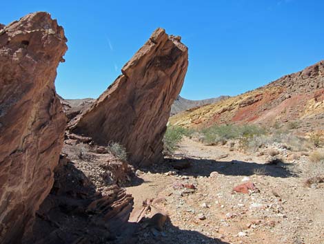
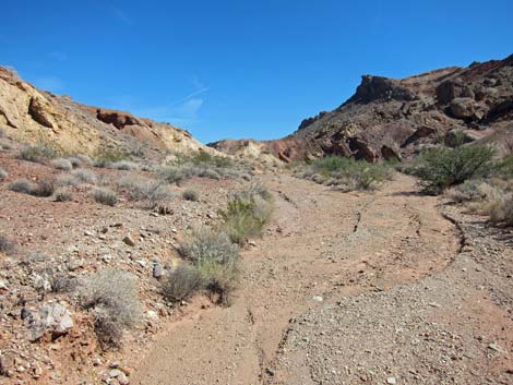
Geology The Black Mountains are Tertiary volcanics, and Pinto Valley and points north are older carbonate rocks with a bit of red Jurassic sandstone mixed in. The area is affected by the Las Vegas Valley Shear Zone, the Bitter Springs Valley Fault, and the Hamblin Bay Fault. These faults have left their mark by doing things like splitting mountains and tilted others on edge. Boulder Wash drains the area through a fault-induced canyon that cuts through the Black Mountains to Lake Mead. |
 |
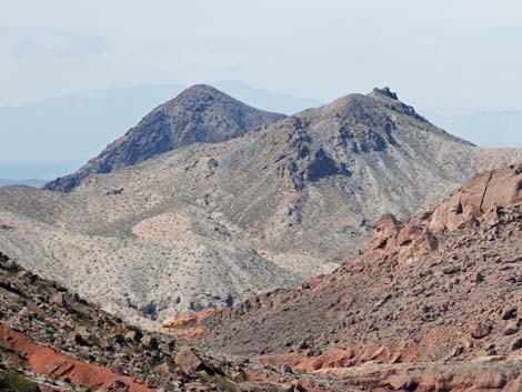
The Hamblin-Cleopatra Volcano story is particularly impressive. Some 13 million years ago, the Hamblin-Cleopatra Volcano was split by the Hamblin Bay Fault, which runs east-west. In the following 3 to 8 million years, the Cleopatra lobe (the southern half of the volcano) shifted to the east, while Hamblin Mountain (the northern half) shifted to the west. Hamblin Mountain is now about 12 miles west of the Cleopatra lobe -- that's a spread of nearly 2 miles per million years or faster! The Cleopatra lobe is now over in the Jimbilnan Wilderness Area. The Nevada Bureau of Mines and Geology publishes a nice book, "Geologic Tours in the Las Vegas Area, Expanded Edition" [ISBN 1-888035-07-2; about $20] that details the story in a format that is interesting and readable for lay people. |
 |
Threats Off-road vehicles are somewhat of a threat from the roads that border the wilderness area. There is no evidence of pervasive problems from Boathouse Cove Road, as people seem to be respecting signs and barricades blocking old roads into the wilderness area. Boathouse Cove is somewhat trashed, but cliffs contain the damage and trash to the camping area. Motorcycles have penetrated some of the canyons off Northshore Road, but the problem does not seem to be pervasive. Invasive species such as saltcedar and Russian thistle occur in some washes and along the lakeshore. Wild burros seem to have recently invaded the Cottonwood Spring area and are making quite a mess. |
 |
 |
 |
 |
 |
 |
 |
 |
 |
 |
 |
 |
 |
 |
Note: All distances, elevations, and other facts are approximate.
![]() ; Last updated 240331
; Last updated 240331
| Wilderness Areas | Hiking | Guide Services | Glossary | Copyright, Conditions, Disclaimer | Home |