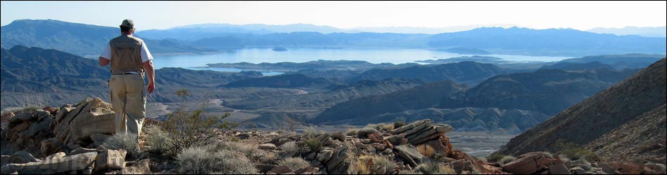
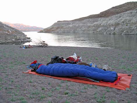
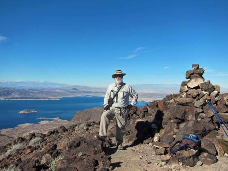
 Boulder Basin (view east) |
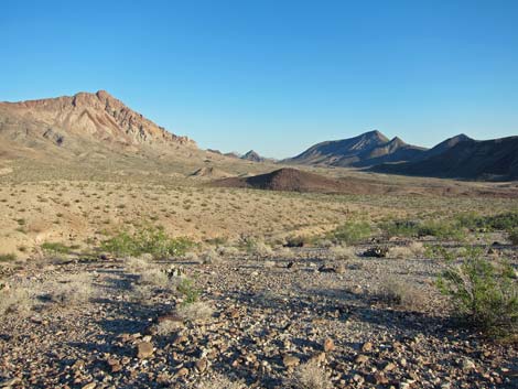
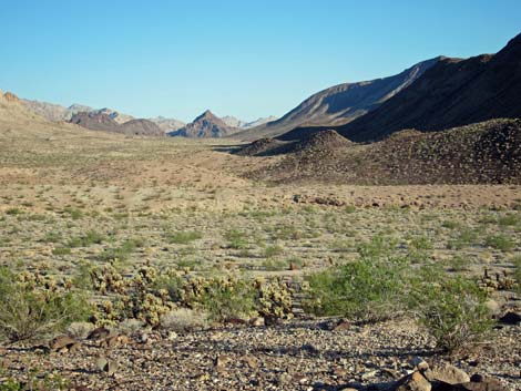
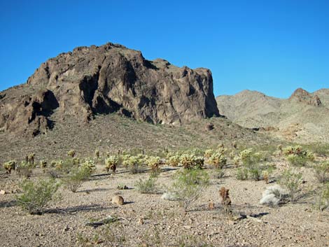
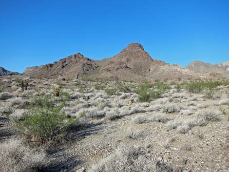
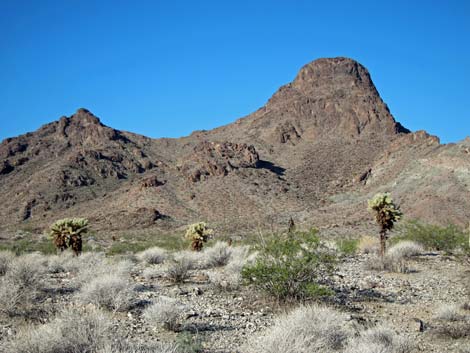
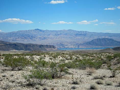
OVERVIEW Lake Mead National Recreation Area, administered by the U.S. National Park Service, is located just over the mountains that border the eastern edge of the Las Vegas Valley. The primary feature at Lake Mead is, not surprisingly, the lake. Hoover Dam blocks the Colorado River, forming a lake that floods some 60 miles of the Colorado River Valley (from Boulder City to the lower end of the Grand Canyon. The Virgin River Valley, which comes in from the north, is flooded to near the town of Overton, adding another 20 miles to the lake (referred to as the Overton Arm). Activities at Lake Mead primarily are orientated around the water (e.g., boating, fishing, and swimming). However, the lake only takes up about 13% of the park area, and the remaining 87% is mostly wild land that offers some amazing hiking opportunities. The geology of this sandstone-limestone-volcanic-metamorphic faulted-twisted-contorted-eroded land, while nearly impossible to comprehend in total, is stunningly stark and beautiful, and three of the four North American desert ecosystems (Mojave, Great Basin, and Sonoran, but not the Chihuahuan) meet here, providing for a varied and diverse flora and fauna. Ancient people lived here and left their artwork on the rock wall. |
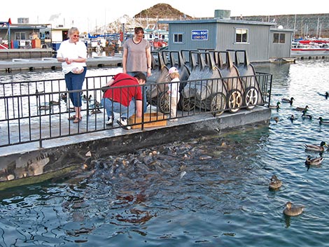 Feeding common carp, and striped bass, and ducks |
This is relatively low desert (the elevation of the lake surface is about 1,200 feet), and temperatures often are about 10 degrees higher at the lake than they are in Las Vegas. Thus, dry-land activities at Lake Mead generally are restricted to the cooler months (e.g., October through May). For more general information, including a variety of maps and images, visit the Lake Mead website. GETTING TO LAKE MEAD At the nearest point, Lake Mead (or simply "the lake") is located about 30 minutes east of Las Vegas. There are three main ways to get to western portions of the lake from Las Vegas: Lake Mead Boulevard from downtown Las Vegas, Lake Mead Parkway from Henderson, and Highway 93 from Boulder City. The Gold Butte region is located at the northeast end of the lake, about 3 hours northeast of town. |
 Lake Mead Blvd Entrance Station (view E) |
Getting to Lake Mead from Las Vegas From the intersection of Interstate-15 and Highway 93/95 (the Spaghetti Bowl; Table 1, Site 800), drive north on Interstate-15 for 1.5 miles to Lake Mead Blvd, East (Site 801). Exit right on Lake Mead Blvd and drive east, over the mountains (passing between Frenchman Mountain to the south and Sunrise Mountain to the north) to the park entrance station. Pay the entrance fee, and proceed to the T-intersection with Northshore Road (Site 653). This puts you on the north side of the lake between the Callville Bay and Las Vegas Wash marinas. Getting to Lake Mead from Henderson From the intersection of Highway 93/95 and Lake Mead Parkway (Site 723), wind through the construction zone and drive east on Lake Mead Parkway over the hills to the park entrance station. Then continue east on what is now Lakeshore Road. You will shortly pass the intersection with Northshore Road (Site 654) and arrive at the Las Vegas Wash Marina area (Site 720). |
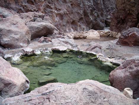 Hot spring |
Getting to Lake Mead from Boulder City From the stoplight in downtown Boulder City where Highway 93 turns north (Site 802), drive east on Highway 93 for 3.7 miles to Lakeshore Road (Site 803). Turn north (left) onto Lakeshore Road and into the park. The first building on the right is the Lake Mead (Alan Bible) Visitor Center. However (Site 655), if you are this close to the dam, you ought to drive the remaining 4.2 miles to the dam (7.9 miles from the turn in Boulder City) and check it out (Site 812). The dam is an engineering marvel (726 ft high), a testament to the determination and drive of the bosses who made it happen, and a testament to the desperation of the workers trying to feed their families during the Great Depression. OSHA regulations and labor unions were spawned from projects like this. Be sure to stop at the Hoover Dam Visitor Center to learn about the dam history. |
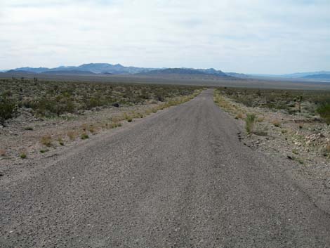 Gold Butte is wild and remote country, but the entrance road is paved |
Getting to Lake Mead in the Gold Butte Region The Gold Butte region is located at the northeast end of Lake Mead and includes a large block of land outside the Lake Mead National Recreation Area. This wild and remote country offers outstanding wilderness experiences, but make no mistake, this is wild and remote country where you are on your own. Be prepared to take care of yourself out there. To get to the Gold Butte region from Las Vegas (Table 4, Site 800), drive east on Interstate-15 for about 70 miles to Highway 170 (Exit 112 towards Bunkerville; Site 684), which is shortly before getting to Mesquite. Turn right onto Highway 170 and drive south for about 3 miles to the Virgin River Bridge (Site 685). |
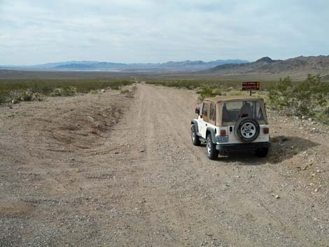 Gold Butte roads are better driven in a four-wheel drive vehicle |
Cross the bridge and immediately take a hard right turn onto Gold Butte Road (Site 686). The slope of the road makes the turn look like a pullout rather than an intersection. Follow the paved Gold Butte Road southwest along the river and then southeast into the desert until the pavement ends at Whitney Pocket (Site 462). From Whitney Pocket, continue south on the unpaved Gold Butte Road for 7.0 miles to the Devils Throat turnoff (Site 807). Take the time to go see Devils Throat; it's only 0.25 miles out. Continuing south on Gold Butte Road, stay to the right at St. Thomas Gap Road (8.7 miles south of Whitney Pocket; Site 796) and Devil's Cove Road (16.2 miles south of Whitney Pocket; Site 797). At 20.2 miles south of Whitney Pocket, the road arrives at Gold Butte Townsite on the left and the intersection (Site 806) with Red Bluff Spring Road on the right. |
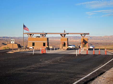
 North Entrance (view south) |
Getting to Lake Mead from the North From the north, the Overton Arm of Lake Mead is accessible from Interstate-15 through the Logandale-Overton area and through Valley of Fire State Park. From I-15, exit the interstate towards Logandale (Exit 93). Drive south on Highway 169 following the road as it winds among farm fields and through rural areas. The road eventually passes out of town and arrives at the North Entrance station. Pay the National Park fee, and continue south into the park. Alternatively, from I-15, exit the interstate towards Valley of Fire State Park (Exit 75E). Pass the smoke shop and the last of the gas, and continue east to the state park. Pay the entrance fee and continue across the state park. Valley of Fire Road eventually dead-ends into Northshore Road; turn right and drive about 100 yards to the North Entrance station. Pay the National Park fee, and continue south into the park. |
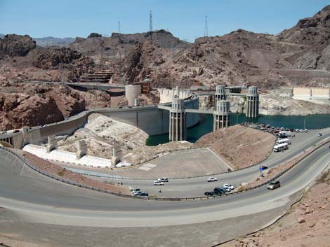 Hoover Dam |
HOURS The Lake Mead (Alan Bible) Visitor Center is open from 8:30 AM to 4:30 PM, 7 days a week except for Thanksgiving, Christmas, and New Years Day. There are seven ranger stations around the lake (generally at the marinas), but these seem to be open only when people are working in the office (as opposed to being out on patrol or giving nature walks). The rest of the recreation area is open 24 hours, although some picnic areas are designated as day-use only. There are a variety of concessions (e.g., food, marinas, and boat tours, but no gasoline for vehicles) in the recreation area. Most concessions are open during regular business hours or longer. The lake level is extremely low, and many of the marinas and boat ramps have been closed. While this is unfortunate for boaters and fishermen, it is a benefit to hikers because some previously flooded areas are on open to hiking. |
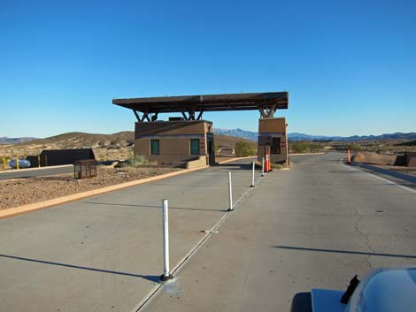
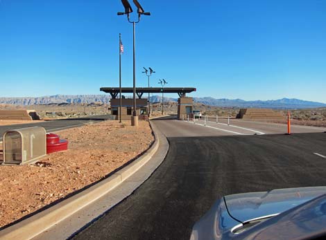
 Las Vegas Wash entrance station |
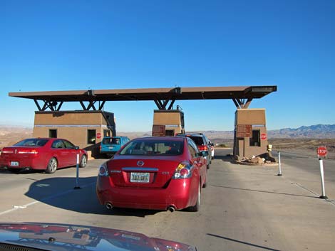
ENTRANCE FEES The entrance fee is $25 per private vehicle (Federal Lands Pass and other annual passes accepted). Fees for other than private vehicles (e.g., bikes and buses) are posted at the entrance station. CAMPING Car camping inside Lake Mead National Recreation Area is permitted only in front-country campgrounds and in designated backcountry campsites. However, BLM land borders much of the park, and camping on BLM land is wide open and free. You should, however, choose an existing site and practice Leave-No-Trace skills. For the most part, backpackers may camp anywhere in the backcountry, which is defined as anywhere farther than 0.5 miles from a designated road. The exceptions are that certain areas are posted "No Camping," and you must stay at least 100 ft from springs or other water sources. Backcountry permits are not required. Plan to cook with a stove, as collecting wood (including dead or down wood) is prohibited. |
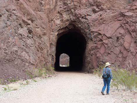 Railroad Tunnels trail |
WATCH OUT Other than the standard cautions about hiking in the desert, ...this is a pretty safe place, but several people die at the lake every year. Most of these deaths result from mixing alcohol with driving cars or boats. Remember: friends don't let friends drive drunk in cars or boats. Also, Northshore Road is popular place to race high-performance cars and motorcycles, so drive carefully and look both ways before crossing the road. Much of this land is wild and remote, and even under the best of circumstances, help would be long in coming. Given that, exercise extra caution when hiking and give yourself a little wider margin of safety. Don't push it. In case of emergency, contact any ranger, call the 24-hour emergency number 702-293-8932, or call 911. Cell phones work in some parts of recreation area, and there are pay phones at the marinas. |
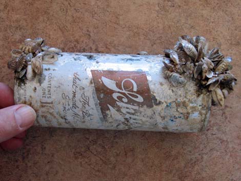 Don't move zebra mussels |
SOME RULES AND REGULATIONS This is a National Recreation Area, which is almost like a National Park. One obvious difference is that some hunting is allowed here. Other than that, act as if you were in a National Park. Do not collect or otherwise disturb plants, rocks, fossils, or artifacts, and do not disturb the wildlife (except during hunting season with the proper license). Pack it in, pack it out. Drive only on designated roads. All motor vehicles, including off-highway vehicles, must be street legal, and all drivers must have a valid license in their possession. Don't move zebra mussels! |
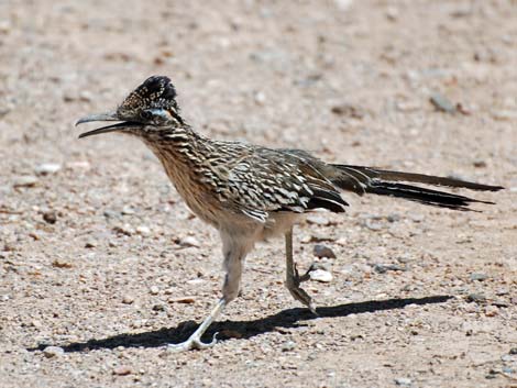 Road Runner |
Pets are allowed, but not on designated swimming beaches or in public buildings. Pets must be on a leash (six-foot maximum) and under physical control at all times. Never leave pets or kids in a vehicle because temperatures inside a car parked in the sun can exceed 120 degrees in just a few minutes, quickly cooking them. For details on these issues and other information, visit the Lake Mead website. Maps are available online. |
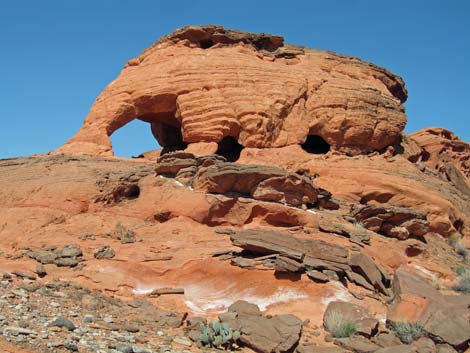 Sandstone outcrop |
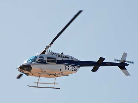 See Lake Mead from the air |
 Las Vegas Wash entrance |
 Camping in the backcountry |
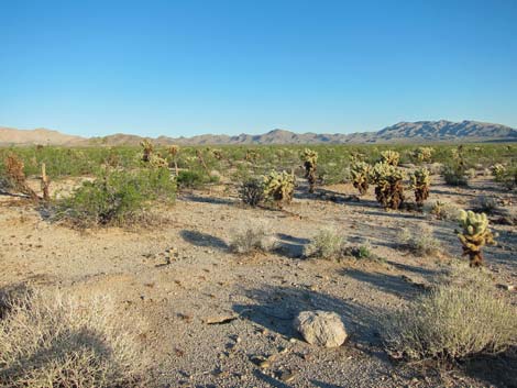 Teddybear Cholla near Cottonwood Cove, Lake Mojave |
 Stark scenery with bold colors |
 |
 |
 |
 |
 |
 |
 |
 |
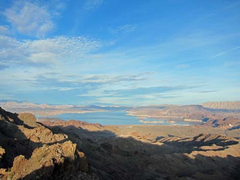
 See Lake Mead from drive-up overlooks |
 See Lake Mead from a walk-up overlook |
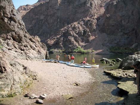 Canoing down Black Canyon |
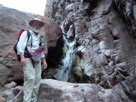 Hiking by a waterfall |
Table 1. Highway Coordinates: Las Vegas to Lake Mead (NAD27; UTM Zone 11S). Download Highway GPS Waypoints (*.gpx) file.
| Site # | Location | Latitude (°N) | Longitude (°W) | UTM Easting | UTM Northing | Elevation (feet) | Verified |
|---|---|---|---|---|---|---|---|
| 653 | Lake Mead Dr. at Northshore Road | 36.1434 | 114.8880 | 690025 | 4001715 | 1,390 | Yes |
| 800 | I-15 at Hwy 93/95 (Spaghetti Bowl) | 36.1743 | 115.1538 | 666038 | 4004658 | 2,040 | Yes |
| 801 | I-15 at Lake Mead Blvd, East | 36.1959 | 115.1380 | 667415 | 4007077 | 1,950 | Yes |
Table 2. Highway Coordinates: Henderson to Lake Mead (NAD27; UTM Zone 11S). Download GPS file (see link above).
| Site # | Location | Latitude (°N) | Longitude (°W) | UTM Easting | UTM Northing | Elevation (feet) | Verified |
|---|---|---|---|---|---|---|---|
| 654 | Lakeshore Road at Northshore Road | 36.1095 | 114.8987 | 689139 | 3997939 | 1,545 | Yes |
| 720 | Lakeshore Road at Las Vegas Wash Marina | 36.1199 | 114.8611 | 692499 | 3999163 | 1,157 | Yes |
| 723 | Hwy 93/95 at Lake Mead Pkwy | 36.0338 | 115.0131 | 679014 | 3989319 | 1,866 | Yes |
Table 3. Highway Coordinates: Boulder City to Lake Mead (NAD27; UTM Zone 11S). Download GPS file (see link above).
| Site # | Location | Latitude (°N) | Longitude (°W) | UTM Easting | UTM Northing | Elevation (feet) | Verified |
|---|---|---|---|---|---|---|---|
| 655 | Allen Bible Visitor Center | 36.0099 | 114.7958 | 698654 | 3987093 | 1,650 | Yes |
| 802 | Hwy 93 at Buchanan Rd (downtown Boulder City) | 35.9742 | 114.8453 | 694284 | 3983031 | 2,460 | Yes |
| 803 | Hwy 93 at Lakeshore Road | 36.0091 | 114.7989 | 698377 | 3987000 | 1,700 | Yes |
| 812 | Highway 93 at Hoover Dam | 36.0163 | 114.7364 | 703994 | 3987925 | 1312 | Yes |
Table 4. Highway Coordinates: Gold Butte Region (NAD27; UTM Zone 11S). Download GPS file (see link above).
| Site # | Location | Latitude (°N) | Longitude (°W) | UTM Easting | UTM Northing | Elevation (feet) | Verified |
|---|---|---|---|---|---|---|---|
| 685 | Hwy 170 at Virgin River Bridge | 36.7341 | 114.2188 | 748351 | 4068775 | 1,459 | Yes |
| 462 | Gold Butte Rd at Whitney Pockets | 36.5231 | 114.1390 | 756178 | 4045577 | 3,013 | Yes |
| 684 | Hwy I-15 at Hwy 170 | 36.7706 | 114.2337 | 746902 | 4072795 | 1,804 | Yes |
| 686 | Hwy 170 at (Meadowland Farm) GB Rd | 36.7318 | 114.2172 | 748500 | 4068528 | 1,444 | Yes |
| 687 | Gold Butte Rd leaves the Virgin River | 36.6719 | 114.2891 | 742272 | 4061700 | 1,384 | Yes |
| 796 | Gold Butte Rd at St. Thomas Gap Rd | 36.4135 | 114.1229 | 757984 | 4033458 | 2,411 | Yes |
| 797 | Gold Butte Rd at Devil's Cove Rd | 36.3132 | 114.1545 | 755475 | 4022241 | 3,497 | Yes |
| 800 | I-15 at Hwy 93 95 (Spaghetti Bowl) | 36.1743 | 115.1538 | 666038 | 4004658 | 2,040 | Yes |
| 806 | Gold Butte Rd at Red Bluff Spring Backcountry Byway (Gold Butte Townsite) | 36.2809 | 114.2002 | 751475 | 4018543 | 3,705 | Yes |
| 807 | Gold Butte Rd at Devils Throat Rd | 36.4325 | 114.1430 | 756117 | 4035512 | 2,244 | Yes |
Happy hiking! All distances, elevations, and other facts are approximate.
![]() ; Last updated 240322
; Last updated 240322
| Birding Around Las Vegas | Hiking Around Las Vegas | Glossary | Copyright, Conditions, Disclaimer | Home |