Southern Nevada Wilderness Areas
 |
Overview North McCullough is a medium-sized (14,763 acres) wilderness area located on the northwest side of the Northern McCullough Range* and entirely included inside the Sloan Canyon National Conservation Area. The wilderness area essentially includes the entire drainage system on this side of the range. The highest elevations are on the northern end of the main ridge (about 5,100 feet) and on a ridge that runs northwest from the main ridge (about 4,200 feet). The lowest elevations are where the main wash flows north and crosses the wilderness area boundary (about 2,900 feet). Unlike most mountain ranges around Las Vegas, the Northern McCulloughs are volcanic with extensive basalt and ash-flow tuffs. The area supports black gramma grass, which is not known to occur elsewhere in Nevada. This wilderness area is entirely contained within the Sloan Canyon National Conservation Area, which is administered by the BLM. Link to Wilderness Area Hikes. |
 |
Link to map of the wilderness area. If you hike in wilderness areas, help protect them by learning about and reporting noxious and invasive weeds. * Although the McCullough Range is considered a single mountain range, the northern and southern ends of the range differ and are not one geologic feature. The Northern McCulloughs were formed from recent volcanic activity, while the Southern McCulloughs are ancient mountains formed from metamorphic rock. |
 |
Location Approximately 20 air-miles south of downtown Las Vegas, along the southern edge of the metropolitan area. Boundaries This wilderness area is triangle-shaped with corners at the northeastern, southern, and northwestern points. The southeastern boundary is the crest of the Northern McCulloughs. The southwestern boundary is the south side of the base of the ridge that runs northwest from the main ridge. The northern boundary basically connects the end of the northwest ridge with the crest of the main ridge. |
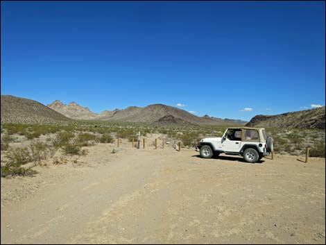 |
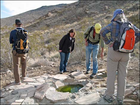
Access Traditional roads in this area have been deteriorating over the years, and construction in the Southern Highlands area provides access using construction roads. It might be easier for drivers to find a way through Southern Highlands, but with ongoing construction, it is not possible to describe a particular route. The northern edge of the wilderness area can still be reached via the traditional route, a rough dirt road that runs under powerlines, but this rocky road should be considered for high-clearance vehicles only, but not 4WD. Driving direction are provided on the Sloan Canyon Trailhead webpage. The wilderness can also be accessed from dirt roads that run up to the southern boundary, as described for the Hidden Valley Trailhead. |
 Sloan Canyon South Trailhead |
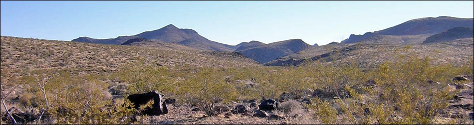
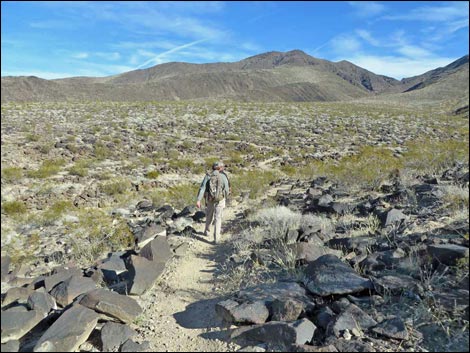
Terrain The general landscape is defined by the two long ridges that intersect at the southern end of the wilderness area. Between the ridges, a broad, shallow valley gradually slopes up to the ridges. The main ridge, to the east, is the narrow and well-defined crest of the Northern McCullough Range, while the western ridge is more of a scattered collection of smaller peaks and hills. |
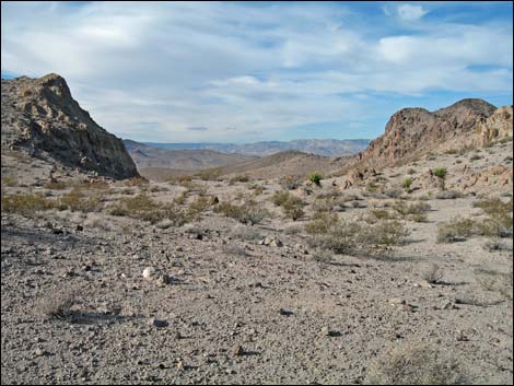 |
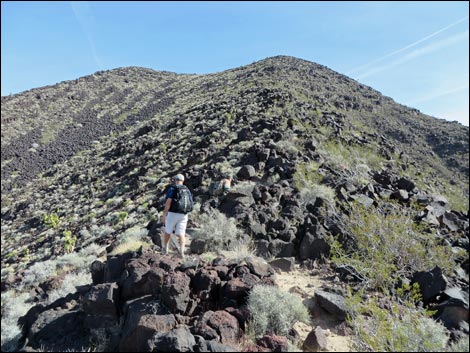
The main ridge is a series of peaks with rounded to flat-tops, a steep east-facing escarpment (outside the wilderness area), and a gradual western slope. The western slope is cut by many small washes and canyons. The highest peaks are along the crest, with Hanna Peak (at the southern apex) rising to 4,240 feet, and Peak 5058 (at the northeast corner) rising to 5,058 feet. The western ridge is formed by a wide cluster of peaks dominated by Sutor Peak at 4,186 feet. The peaks facing town are soft and rounded, but behind and somewhat hidden are steep, rugged, and craggy peaks. Between the two sets of peaks is a broad, flat valley where boulder piles and odd-shaped rocks outcrop across the landscape. In the triangle between the two main ridges, the broad, gently sloping drainage system rises from about 2,900 feet at the northern edge of the wilderness area to about 4,000 feet on the slopes of Hanna Peak. |
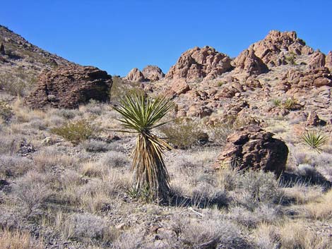 |
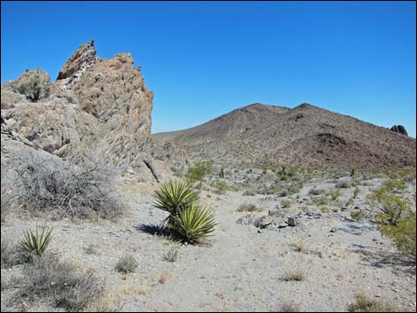
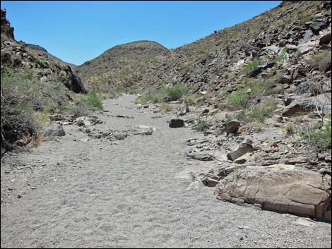
Habitat Type The habitat type primarily is Mojave Desert Scrub, with a mix of species that depends on elevation and annual rainfall amounts. On the uplands of the bajadas along the northern boundary, the dominant vegetation is Mojave Desert Scrub, composed primarily of widely scattered creosote bush and white bursage, with little else but a few Mojave yucca scattered about. In the washes on the bajada, the vegetation is more diverse, with a variety of shrubby species including creosote bush, desert globemallow, paperbag bush, broom snakeweed, and bunch grasses. |
 |
On the higher slopes and in the higher canyons, the density and diversity of shrubby species is higher. Additional species found here include indigo bush, desert almond, Nevada jointfir, catclaw acacia, various buckwheats, pencil cholla, teddybear cholla, prickly pear cactus, and lots of barrel cactus on the rocky hillsides. The rare Blue Diamond Cholla even finds a home among the rocky peaks. |
 |
Wildlife Mammals include desert bighorn sheep, black-tailed jackrabbits, white-tailed antelope squirrels, desert woodrats, and a variety of smaller rodents. Reptiles include desert tortoise and several species of lizards (e.g., side-blotched lizards) and snakes. Birds include resident species such as Verdin, Black-throated Sparrow, Rock Wren, and Red-tailed Hawk, plus winter visitors such as Ruby-crowned Kinglet and White-crowned Sparrow. Invertebrates include scorpions and tarantulas. |
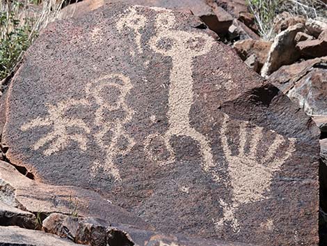 |
Archaeology Archeological artifacts include some astounding prehistoric rock art, plus campsites, pine nut caches, rock shelters, and lithic scatters. |
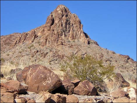 |
Geology North McCullough Mountains are formed almost entirely of Quaternary andesite and basalt flows that date from 6 to 17 million years ago. Black basalt flows are exposed on the ridges, peaks, and western slopes. The eastern escarpment consists of reddish-brown andesite breccia. |
Note: All distances, elevations, and other facts are approximate.
![]() ; Last updated 240331
; Last updated 240331
| Wilderness Areas | Hiking | Guide Services | Glossary | Copyright, Conditions, Disclaimer | Home |