and BLM 101 Trailhead
Hiking Around Las Vegas, Sloan Canyon NCA
 Nawghaw Poa Road approaching Petroglyph Trailhead (view S) |
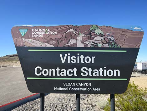
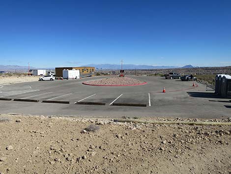
The Petroglyph Canyon Trailhead (AKA: Sloan Canyon Trailhead) is located on the north edge of Sloan Canyon National Conservation Area (NCA), on a low desert hill overlooking the Henderson neighborhood of Inspirada. The BLM 101 Trail also has a trailhead here. Nawghaw Poa Road, the 0.7 mile access road, is paved with a paved bike trail, and there is a nice visitor contact building in the parking area. Nawghaw Poa Road is open daily 8:00AM-4:30PM. The rest of the area is always open, and when the road is closed, hikers and bikers can use the paved trail to get to the trailhead. Sloan Canyon Trailhead provides access to the Sloan Canyon Petroglyph Route and other hikes on the north side of the North McCullough Wilderness Area. Link to Trailhead Map. |
 Sign at entrance to the parking area (view S) |
From town, drive south on Interstate-15 about 15 miles to St. Rose Parkway (Exit 27). Exit onto St. Rose Parkway eastbound and drive east to Las Vegas Blvd (the first traffic light). Turn right onto Las Vegas Blvd and drive south to Volunteer Blvd (again, the first traffic light). Drive east 2 miles on Volunteer Blvd to Via Inspirada. Turn right onto Via Inspirada and drive south 1.4 miles to a round-about left where the road becomes Bicentennial Parkway. Continue east on Bicentennial Parkway 0.6 miles to a stop sign at Via Firenze. Turn right onto Via Firenze and drive south 0.6 miles past Adventura Park to a T-intersection with Savella Ave. Turn left onto Savella Ave and drive east 0.1 miles to Via Firenze (yes, Via Firenze; it splits and runs one-way around the park). Turn right onto Via Firenze and drive south 0.6 miles to Democracy Drive. Turn right onto Democracy Drive and drive west 0.2 miles to Nawghaw Poa Road (Table 1, Site 1192). Turn left onto Nawghaw Poa Road and follow it south 0.7 miles to the end of the road (Site 1194). Park here, this is the trailhead. |
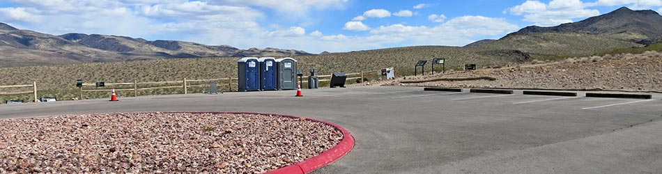
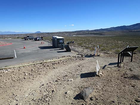
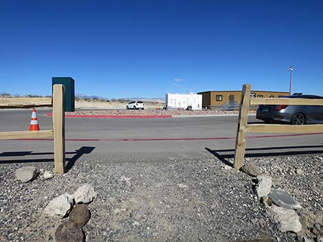
 Petroglyph Canyon Trailhead Parking and Visitor Center (view S) |
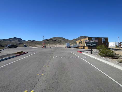
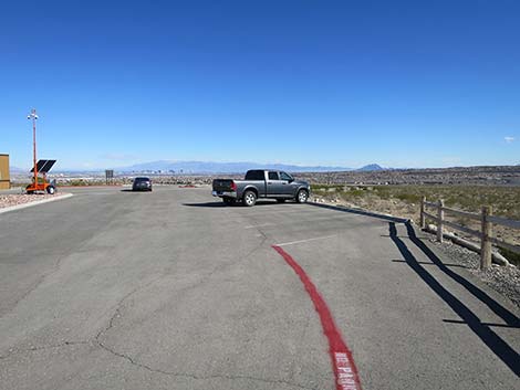
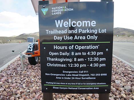 Hours of operation; when closed, hike or bike in (view S) |
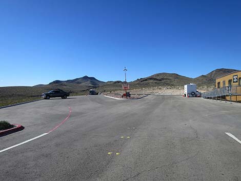
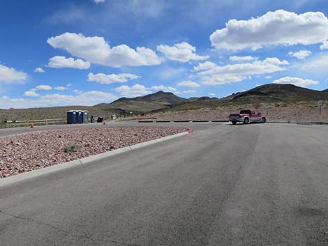 Petroglyph Canyon Trailhead parking area (view SSE) |
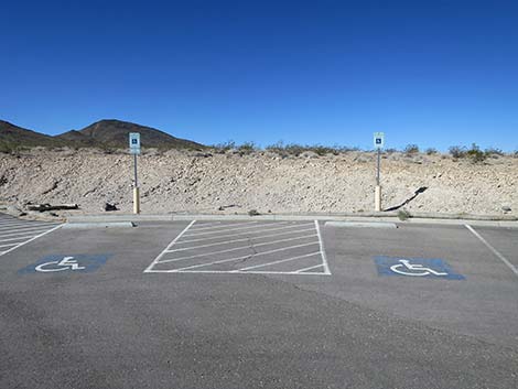 Accessible parking spaces (view SW) |
 Petroglyph Canyon Trailhead parking area (view SE) |
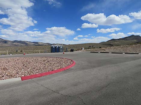
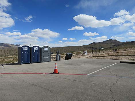 Petroglyph Canyon Trailhead and toilets (view SE) |
 Petroglyph Canyon Trailhead (view S) |
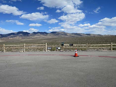
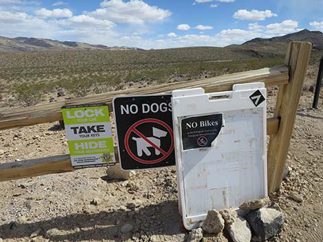 Regulatory signs at Petroglyph Canyon Trailhead (view S) |
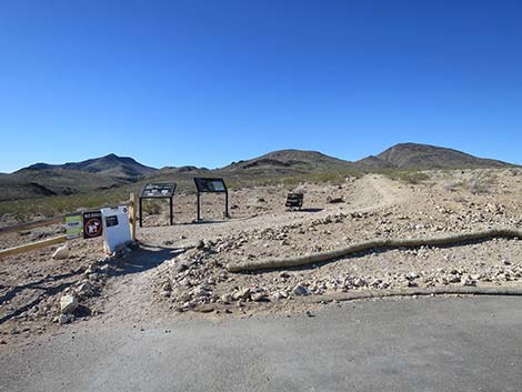
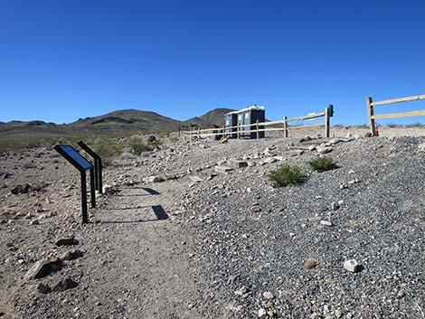
 Information signs at Petroglyph Canyon Trailhead (view SE) |
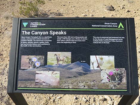 Information sign: The Canyon Speaks (view S) |
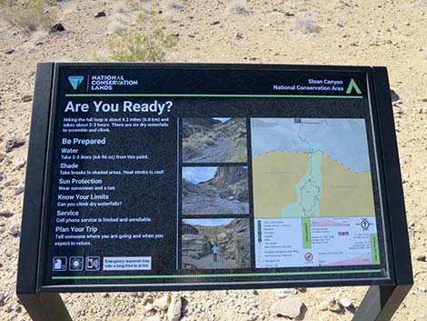 Information sign: Are You Ready? (view SE) |
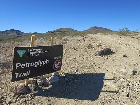 Petroglyph Canyon trail sign (view S) |
 Petroglyph Canyon Trail returning to the trailhead (view NNE) |
 Petroglyph Canyon parking (view N when returning to the trailhead) |
 Petroglyph Canyon Trail returning to the parking area (view N) |
 More to come ... |
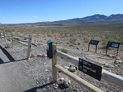
BLM 101 Trailhead
The BLM 101 Trail start at the end of Nawghaw Poa Road and runs east to connect with the Park Peak Loop Trail. On this trail, regulations permit bikes and dogs.
 Note: BLM 101 Trailhead, not the Petroglyph Trailhead (view E) |
 BLM 101 Trailhead and start of the trail (view NE) BLM 101 Trailhead and start of the trail (view NE) |
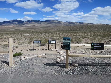 BLM 101 Trailhead (view E from parking lot) |
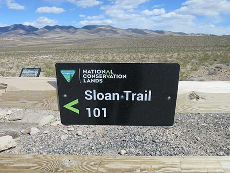 BLM 101 Trailhead sign (view E) |
 Beginning of BLM 101 trail (view E) |
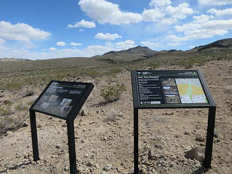
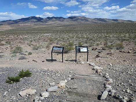
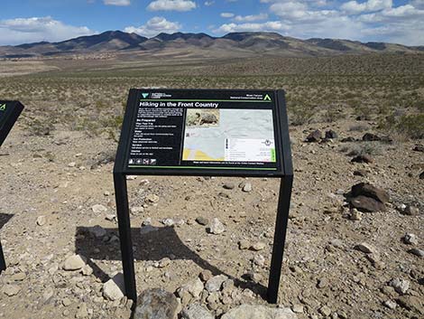 Information sign: Hiking in the Front Country (view E) |
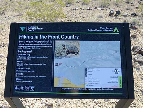 Information sign: Hiking in the Front Country (view E) |
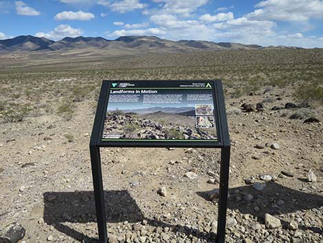 Information sign: Landforms in Motion (view E) |
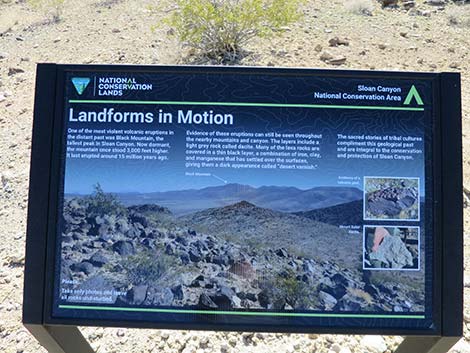 Information sign: Landforms in Motion (view E) |
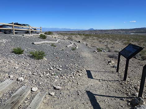 Trail starts parallel to parking area (view N) |
 Returning to the BLM 101 Trailhead (view N) |
 Returning to the parking area (view W) |
Table 1. Highway Coordinates based on GPS data (NAD27; UTM Zone 11S). Download Highway GPS Waypoints (*.gpx) file.
| Site | Location | UTM Easting | UTM Northing | Latitude (N) | Longitude (W) | Elevation (ft) |
|---|---|---|---|---|---|---|
| 1192 | Nawghaw Poa Rd Start | 669355 | 3977157 | 35.92589 | 115.12285 | 2,846 |
| 1194 | Petroglyph Trailhead Parking | 669169 | 3976094 | 35.91635 | 115.12514 | 2,895 |
Happy Hiking! All distances, elevations, and other facts are approximate.
![]() ; Last updated 240330
; Last updated 240330
| Sloan Canyon NCA | Hiking Around Las Vegas | Glossary | Copyright, Conditions, Disclaimer | Home |