Southern Nevada Wilderness Areas
 |
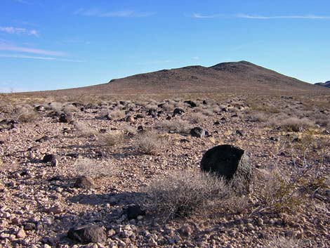
Overview El Dorado Wilderness Area is a medium-sized wilderness area (31,950 acres) at the northern end of the El Dorado Mountains. The terrain is varied: the northwest side is gently rolling hills formed by the flow and erosion of basalt, the southwest side is the rugged El Dorado Mountain range, and the east side is steep volcanic cliffs cut by deep canyons. The entire landscape is densely covered with desert-varnished volcanic boulders and very sparsely covered by vegetation. Elevations range from about 3,800 on the highest peaks in the southwest corner of the wilderness area to about 650 feet along the Colorado River. Bighorn sheep and desert tortoise are fairly common. Springs and the Colorado River provide water for wildlife. Archeological and mining artifacts can be found in the area. The name "El Dorado" refers to the legendary city of gold, and gold mining activity still occurs near the wilderness area boundary. Link to Wilderness Area Map |
 |
The El Dorado Wilderness Area is separated from the Black Canyon Wilderness Area by a powerline corridor. Combined, the two wilderness areas are fairly large, nearly 50,000 acres, and both are almost entirely contained within the boundaries of Lake Mead National Recreation Area. If you hike in wilderness areas, help protect them by learning about and reporting noxious and invasive weeds. |
 |
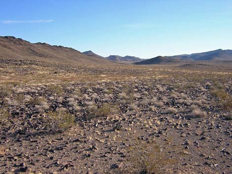
Location The El Dorado Wilderness Area is located about 35 air-miles south of downtown Las Vegas, between the Colorado River and Highway 95. This is about 10 miles south of Boulder City and just north of Nelson (Highway 165). Boundaries The northwest boundary is coincident with the boundary of Lake Mead National Recreation Area. The northern boundary follows a powerline corridor that runs down Burro Wash. The eastern boundary is the Colorado River. The southern boundary is marked by dirt roads that come off the Nelson Landing Road (Highway 165). The southwest boundary follows the contour around the base of the El Dorado Mountains, which are on BLM land at this point. |
 |
Access The wilderness area can be accessed from dirt roads that run along the northern and southern borders, from a dirt road that runs up to the western border, from the paved road near Nelson, and from the river. On the north side, the Burro Wash Road runs along a powerline corridor, and (assuming dry roads) driving to the crest of the mountains only requires a high-clearance, 2-WD vehicle. |
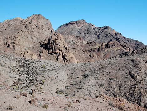
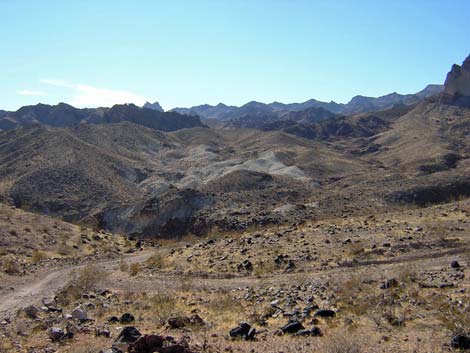 Rugged terrain along Burro Wash Road (view south) |
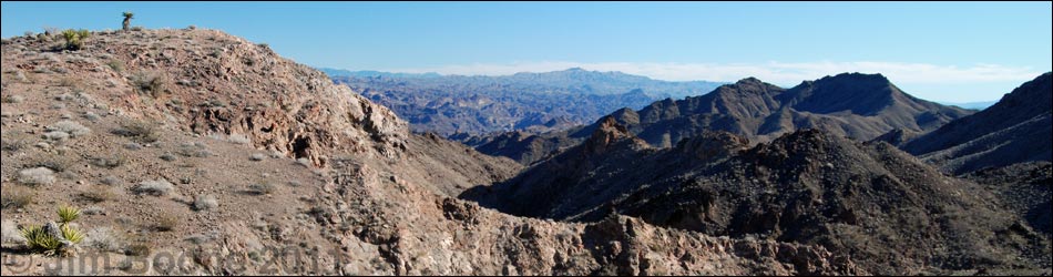
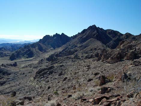
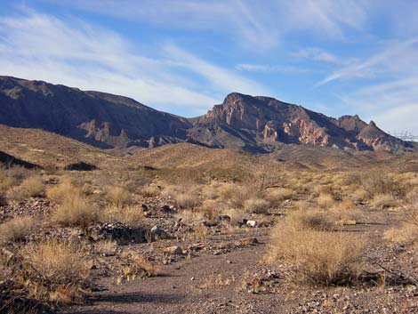
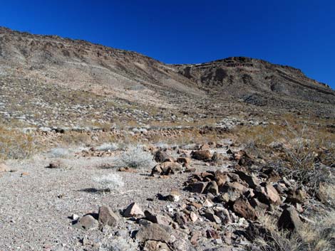
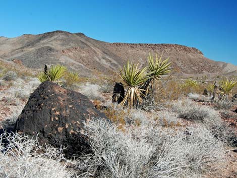
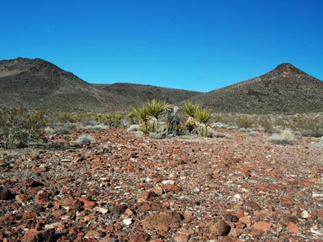
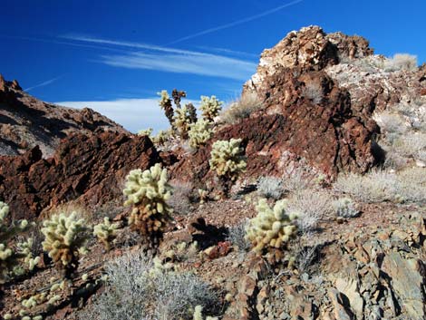
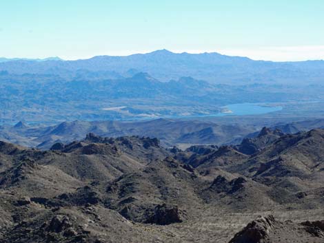
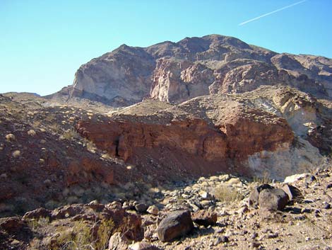
Terrain The El Dorado Mountain Range forms the backbone of the wilderness area, but different parts have distinctly different landscapes. The landscape on the northwest side of the wilderness area is gently rolling hills formed from the flow and erosion of basalt and volcanic ash. These hills slope gently up to the crest of the mountains. The hillsides are strewn with reddish brown boulders that are covered with an astounding amount of black desert varnish. The rocks are so smooth that when the sun reflects off the desert varnish, it looks like thousands of shards of broken glass scattered across the hillside. The landscape on the southwest part of the wilderness area is formed by the rugged El Dorado Mountains. The highest peaks in the wilderness area, at about 3,800 feet, are located in this area. Starting just north of Nelson, washes run down canyons, passing among the highest peaks, to emerge on the eastern side of the range. |
 |
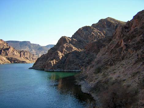
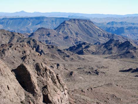
From the crest of the mountains east to the river, the terrain is a rugged maze of volcanic peaks, steep cliffs, deep canyons, and vertical cliffs that tower above the Colorado River. As on the north side, the hillsides are strewn with reddish brown, highly varnished boulders. Near the river, the hills are formed from old metamorphic rocks with steep cliffs and narrow, water-polished canyons. Much of the land bordering the river is cliffy, but there are small beaches where side canyons empty into the river. On the northeast side of the range, Burro Wash is deep and wide, with towering cliffs nearly 1,000 feet high. |
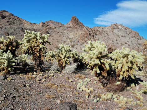 |
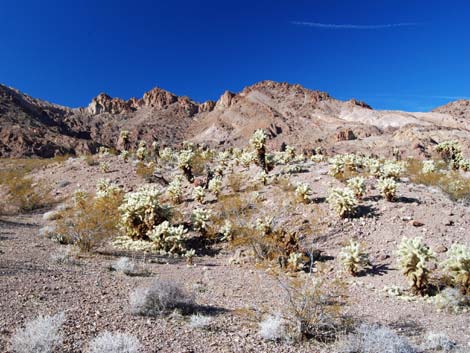
Habitat Type In general, the vegetation is Mojave Desert Scrub dominated by creosote bush, white bursage, a few other low-desert shrubs, and a variety of cacti. West of the crest, the vegetation on the flats and hillsides is sparse, stunted creosote and bursage, with little else except exotic brome grass. There are a few other shrub species mixed in, such as buckwheat and Encelia, plus a few cacti (prickly pear and cholla) scattered about, but the diversity is low and there is none of the buckhorn cholla or teddybear cholla found south of here. The vegetation in the shallow drainages is more robust and diverse. East of the crest, the vegetation on the steep, rocky hillsides is sparse, stunted creosote with little else in most places except brome grass. This country is very dry and must get very little rain. |
 |
The vegetation in Burro Wash is dense and diverse compared to the hillsides, but it still is sparse compared to other places in the Mojave Desert. The wash vegetation is dominated by creosote bush and broom snakeweed, with an occasional catclaw acacia and a limited variety of other low-growing shrubs. We found one candelabra-type desert milkweed in the wash, and several specimens of vine-type milkweeds. On the rocky hillsides just above the wash, there is a fair bit of creosote and Encelia in some places, but mostly it is stunted creosote and brome grass, plus a few barrel cactus among the rocks. In the lower wash and along the river, the taller shrubs include honey mesquite, catclaw acacia with mistletoe, desert willow, and saltcedar. There is also a fair bit of creosote, broom snakeweed, Encelia, Ephedra, and some prickly pear. The rocky hillsides and cliffs have a bit of Schott's Pygmycedar, creosote bush, Encelia, and barrel cactus. |
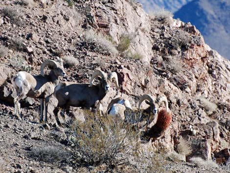 |
Wildlife Desert bighorn are common, and their trails can be seen on some hillsides. Other mammals include wild burros, Townsend's big-eared bat, bobcats, mountain lion, coyotes, and black-tailed jackrabbits. Birds of the desert include Peregrine Falcon, Red-tailed Hawk, Gambel's quail, and Phainopepla. Along the river, ducks, American coots, Common Loons, Double-crested Cormorants, Black Phoebe, and many species of migrants can be found. Reptiles include banded geckos, collared lizards, side-blotched lizards, desert spiny lizards, chuckwalla, and rattlesnakes. There are thousands of acres of desert tortoise habitat in the wilderness area. There are many scorpions here too. |
 |
Archaeology Archeological resources are said to include petroglyphs and lithic scatters, but I have no personal knowledge of these sites. The general area has been occupied by native peoples for thousands of years. |
 |
Geology The El Dorado Mountains primarily are Precambrian metamorphic rocks with intrusions that are about 1.4 billion years old. These old rocks are overlain by colorful (red, white, and brown) Tertiary volcanic tuffs and basalt flows, mostly of Oligocene and Miocene age (40-20 million years old). The El Dorado Mountains were uplifted during the Miocene Basin and Range Uplift, about 15 million years ago. Gregory's Arch, a natural bridge near Bridge Spring, lies just outside the southwest corner of the Wilderness area near Nelson. |
 |
 |
 |
 |
 |
 |
Note: All distances, elevations, and other facts are approximate.
![]() ; Last updated 240331
; Last updated 240331
| Wilderness Areas | Hiking | Guide Services | Glossary | Copyright, Conditions, Disclaimer | Home |