Southern Nevada Wilderness Areas
 |
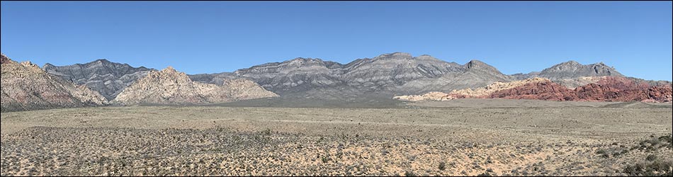
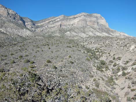
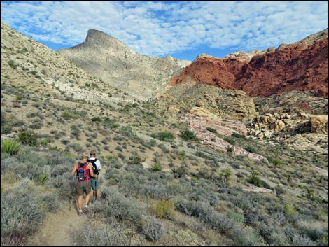
Overview The La Madre Mountains Wilderness Area is one of the largest wilderness areas (47,180 acres) in southern Nevada. This area includes the entire La Madre Mountain Range, a rugged complex of gray carbonate ridges and towering vertical cliffs that form the northern viewscape at Red Rock Canyon National Conservation Area, plus part of the Spring Mountains crest to the west of the La Madre Mountains. The highest point in the wilderness area (9,425 feet) is on the far west side, on the crest of the Spring Mountains south of Griffith Peak. The most prominent feature is the La Madre Ridge, with La Madre Peak at 8,154 feet. From there, elevations run down to about 3,900 feet on the lowest bajadas at the edge of Las Vegas. The area provides habitat for bighorn sheep, and there are lots of archeological sites. The flora is diverse, ranging from dry Mojave Desert Scrub on the lower slopes to Bristlecone Pine forests at the highest elevations where snow lingers far into the spring. |
 |
Although the La Madre is fairly large wilderness area, it lies between to the Mt. Charleston and Rainbow Mountain wilderness areas, which in total, include about 127,000 acres of designated wilderness. There are no roads between the Mt. Charleston and La Madre wilderness areas, but Rainbow Mountain is separated from the La Madre by a rough 4WD road. If you hike in wilderness areas, help protect them by learning about and reporting noxious and invasive weeds. Link to Wilderness Area map. |
 |
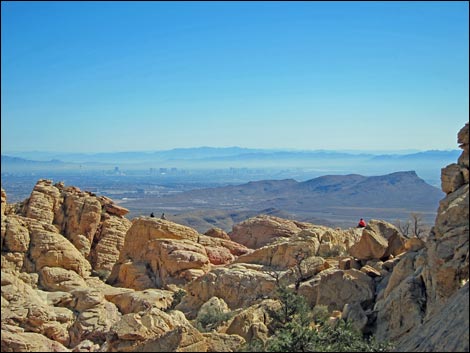
Location The La Madre Mountains Wilderness Area is located about 20 air-miles west of downtown Las Vegas, between the road to Mt. Charleston on the north, and West Charleston Blvd. and the Red Rock Scenic Loop Road on the south. This range forms part of the western boundary of the city, although the "Summerlin Peaks" are not in the wilderness area. |
 |
Boundary The boundary of this wilderness area is complex, but the eastern half generally follows the base of the La Madre Mountains (northeast, east, and southeast boundaries), and the western side generally follow the same lines westward over the crest of the Spring Mountains. The southeastern boundary runs north of Calico Basin and north of the Red Rocks Scenic Loop Road. The southwestern boundary follows the Red Rocks Summit Road from Willow Springs to Lovell Canyon Road. The southwestern boundary continues along the Lovell Canyon Road down to about treeline, then cuts north around the head of Trout Canyon. The northeastern boundary follows the base of the mountains, south of Harris Springs Canyon, to the end of the Harris Springs Road, then cuts west over the crest to meet the western boundary. |
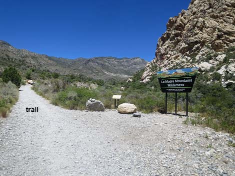 |
Access Access is from dirt roads north of W. Charleston Blvd., the Red Rocks Scenic Loop Road, Rocky Gap Road (aka Red Rocks Summit Road and Potato Flat Road; 4WD required), Lovell Canyon Road, and from the dirt roads south of the Harris Wash area. Terrain The area is a rugged complex of canyons, ridges, and mountain peaks. The desert and the La Madre Mountains dominate the eastern part of the wilderness area, while the Spring Mountains dominate the western part. The nature of the land is completely different on the two sides. |
 |
The eastern area is a rugged complex of canyons, ridges, and mountain peaks. The La Madre Range, with spectacular carbonate (Cambrian Bonanza King Formation) cliffs and steep canyons, make up the eastern side. This range runs east-west. Elevations range from 3,000 feet on the eastern bajadas, to 8,100 feet at La Madre Mountain. This land is steep, cliffy, sparsely-vegetated desert country. The western area is a rugged complex of canyons, ridges, and mountain peaks. The Spring Mountains, with steep hillsides (but few cliffs) and forested slopes make up the west side. This range runs north-south. Elevations range from about 5,600 feet on the lower slopes in Lovell Canyon to nearly 9,500 feet on the crest of the Spring Mountains. This are steep, forested slopes. |
 |
Habitat Type The large range in elevation (6,000 feet) provides for a variety of plant communities, ranging from Mojave Desert Shrub at the lowest elevations, to Juniper-Pinyon woodlands at middle elevations, to alpine communities of ponderosa pine and white fir at the highest elevations. |
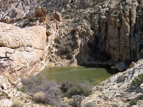 |
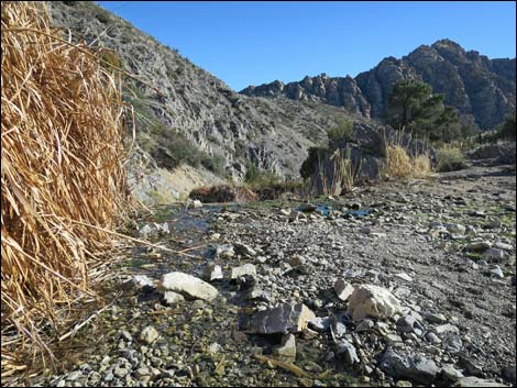
Wildlife The diversity of elevations and vegetation types provides habitat for numerous species of mammals, including desert bighorn sheep, mule deer, mountain lion, bobcats, foxes, and a plethora of bat and rodent species. Reptiles and birds are equally diverse. The higher elevations provide nesting habitat for neotropical migrants. Water is available in sandstone potholes and springs. |
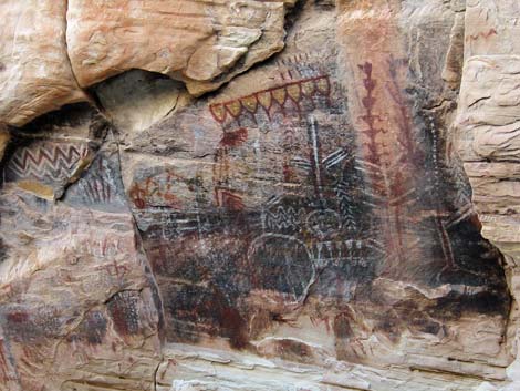 |
Archaeology Archeological sites occur throughout the area, including rock art panels (pictographs and petroglyphs), agave roasting pits, rock shelters, camp sites, milling sites, and lithic and ceramic scatters. The Brownstone Canyon Archeological District (3920 acres) is listed on the National Register of Historic Places because of the high concentration and diversity of cultural sites, including polychromatic pictographs. |
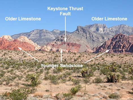 |
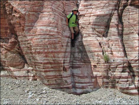
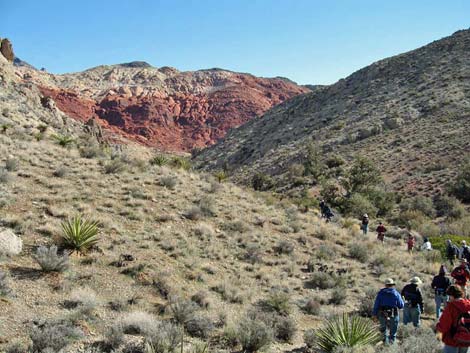
Geology The brightly colored red and white sandstone formations in the southeastern portion of the wilderness area contrast sharply with the rugged gray cliffs of La Madre Mountain. La Madre Mountain, with sheer cliffs on the south side, is the dominant geologic feature in the area. The La Madre Mountains were formed by the Keystone Thrust Fault, an earthquake fault where the land was compressed, buckled, and older limestone rocks was pushed up and over younger sandstone rocks. The Keystone Thrust Fault is internationally regarded as the finest example of such a fault. The Nevada Bureau of Mines and Geology publishes a nice book, Geologic Tours in the Las Vegas Area [ISBN 1888035129; about $28] that details the geologic story in a format that is interesting and readable for lay people. |
Note: All distances, elevations, and other facts are approximate.
![]() ; Last updated 240331
; Last updated 240331
| Wilderness Areas | Hiking | Guide Services | Glossary | Copyright, Conditions, Disclaimer | Home |