Locally know as Mount Charleston
 Mary Jane Meadow in Upper Kyle Canyon |
OVERVIEW The Spring Mountains are a long, linear, north-south aligned range of mountains that stretch for some 55 miles along the west side of the Las Vegas Valley. From the perspective of town, the Spring Mountains are anchored by Mount Charleston (11,918 ft) to the northwest and Mount Potosi (8,514 ft) to the southwest. Red Rock Canyon National Conservation Area, directly west of town, lies between these two mountains, and the Cold Creek area lies north of Mount Charleston. The mountains rise from desert valleys at elevations below 2,000 ft to nearly 12,000 ft, creating a variety of climate and vegetation zones. Because they stand so tall and are completely surrounded by desert, the Spring Mountains form an island of mountainous habitat in a sea of desert. Isolation of the upland flora and fauna has resulted in the evolution of endemic species and subspecies, about 30 of which have been named; others surely await discovery. |
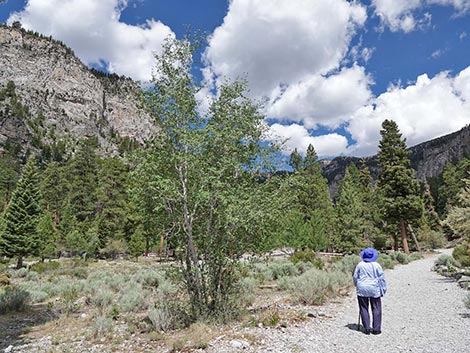
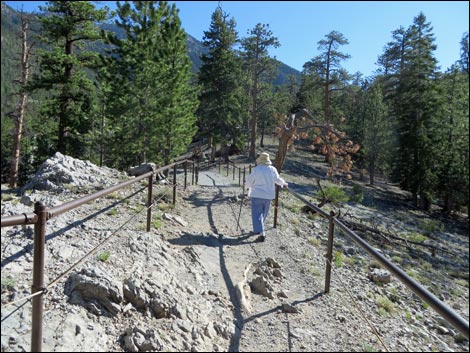
 Hiker on Mary Jane Falls trail |
Recreational opportunities include over 50 miles of maintained trails, four picnic areas, eight campgrounds, and several dirt roads. Hunting is permitted in season, and bicycles are permitted on trails outside designated Wilderness Areas (Mt. Charleston Wilderness Area, La Madre Mountain Wilderness Area, Rainbow Mountain Wilderness Area). In this guide, I divided the Spring Mountains into four regions: Mount Charleston, Mount Potosi, Cold Creek, and Red Rocks. The Mount Charleston area includes locations in and around Kyle and Lee Canyons. The Mount Potosi area includes all lands south of Highway 160 (the Pahrump Highway). The Cold Creek area includes lands in and around the town of Cold Creek and all lands northward (i.e., north of Lee Canyon). The Red Rocks area includes the lands in and around the Red Rock Canyon National Conservation Area (this area is dealt with separately). |
 Wild horses |
Administration: Except for private lands, the Spring Mountains are administered by two agencies. At higher elevations, U.S. Forest Service manages the Toiyabe National Forest, which includes the Mount Charleston Wilderness Area (43,000 acres) and the Spring Mountains National Recreation Area (which is essentially all Forest Service lands in the Spring Mountains). The lower elevations (including the Red Rock Canyon National Conservation Area) are administered by the Bureau of Land Management. There are a couple of small towns in the Spring Mountains with private lands and other lands administered by the county. |
 A spring in the desert |
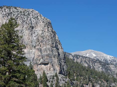
Activities: The primary activities in the Spring Mountains include hiking, picnicking, camping, skiing, and sightseeing. Most of the Spring Mountains are wild and offer great opportunities for hiking and other outdoor activities. This is relatively high elevation land (the end of the road in Kyle Canyon is over 7,600 ft, and it is over 8,600 ft in Lee Canyon), and temperatures are cooler here than in Las Vegas. This permits skiing in the winter and hiking in the summer when lower-elevation sites are to dry or too hot. Geology: The geology of the Spring Mountains is complex. The mountains generally are formed from layered and tilted limestone, which makes for stunningly stark and beautifully banded gray cliffs that are set off by forested slopes. In the Red Rocks area, red and white sandstone cliffs seem to crop out from the gray limestone cliffs (see the Red Rock Canyon, Keystone Thrust trail description for more information on local geology). |
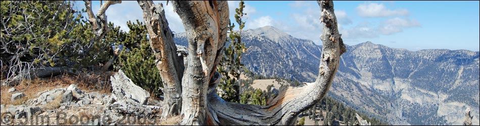
 Ancient bristlecone pine trees |
Vegetation: Vegetation in the Spring Mountains is diverse, but it tends to form zones based on differences in precipitation and rates of evaporation. These differences are related to temperature, which we mostly see as elevation. Elevations range from about 3,000 feet in the valleys to nearly 12,000 feet at the top of Mount Charleston. At lower elevations (where precipitation is lowest and evaporation is highest), the desert vegetation (Mojave Desert Scrub) is dominated by widely scattered creosote bush, white bursage, Mojave yucca, and other scrubs. Slightly higher, but still in the desert zone, the vegetation becomes more "lush" and diverse, and Eastern Joshua trees and blackbrush become common. Higher up in the foothills, the desert woodlands (Pinyon-Juniper Woodland) include pinyon pine, and Utah juniper. |
 Rare plants: Clokey's Catchfly |
Above the foothills, the slopes become forested with "real trees." The lower elevation forests (Yellow Pine Forest) tend to be dry, and ponderosa pines dominate. Middle-elevation forests are wetter (Pine-Fir Forest), and the ponderosa pine forest includes white fir. Higher-elevation forests (Bristlecone Pine Forest) are dominated by bristlecone pines and include limber pine. Mixed into all of the forested zones are riparian areas dominated by annual plants (e.g. mountain wildflowers) and quaking aspen. Above timberline (about 11,000 feet), the subalpine tundra-like vegetation (Alpine Tundra) is composed of stunted grasses, sedges, forbs, mosses, lichens, and a few shrubs. |
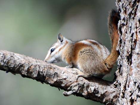 Endemic Mt. Charleston chipmunk |
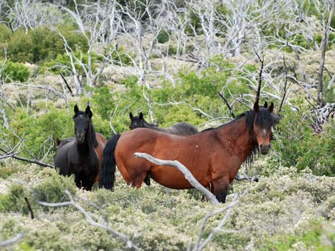
Wildlife: The most common large animals in the Spring Mountains are mule deer and bighorn sheep. Other large species (e.g., mountain lion and bobcat) are present, but rarely seen, and there is a large herd of elk around Cold Creek. Wild burros (mostly in the Red Rocks area) and wild horses (mostly in the Cold Creek area) are found throughout. Many species of small mammals, reptiles, and birds inhabit the mountains, as do a few amphibians, but this is not trout-fishing country. Most of the "snake holes" that you find at lower elevations were made by harmless kangaroo rats. You can find Palmer's chipmunk in the picnic areas -- it is found nowhere else on earth. There are a few snakes, but they are rarely seen. Please respect the snakes; they lived here first. The common lizards you might see are side-blotched lizards (small, smooth scales) and western fence lizards (larger, rough scales). There are many species of birds. The most noisy and conspicuous species include Steller's Jays (large, dark blue, crested head), Woodhouse's Scrub-Jays (large, light blue, no crest), and Clark's Nutcrackers (large, gray-and-white, loud). |
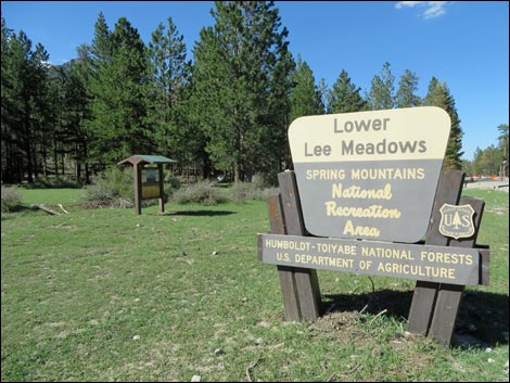
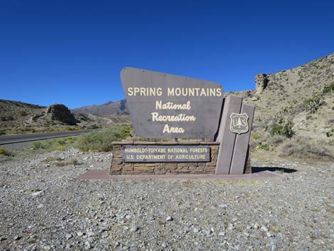 Spring Mountains NRA boundary sign along Kyle Canyon Road |
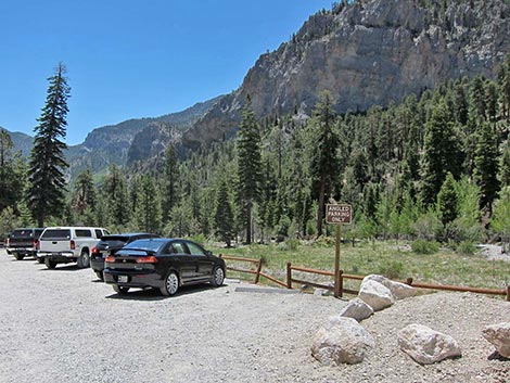
GETTING TO MT CHARLESTON AND THE SPRING MOUNTAINS Link to map. Because the area is so large and varied, a complete discussion of getting to the Spring Mountains would be lengthy. There are numerous roads, mostly dirt, that lead into the Spring Mountains, but there are four main entry points: Kyle Canyon, Lee Canyon, Cold Creek, and Mount Potosi. Details of getting to individual trailheads are presented in the route descriptions. Kyle Canyon: Kyle Canyon is located on the southeastern side of Mt. Charleston, about 60 minutes from downtown. From town, drive north on Highway 95 for about 30 minutes to Highway 157 (Kyle Canyon Road) (Table 1, Site 0667). Turn left onto Highway 157 and drive west to the Spring Mountains Visitor Center. From there, the end of the road is another 5 miles up the canyon. |
 Mary Jane Falls Trail |
Lee Canyon: Lee Canyon is located on the northeastern side of Mt. Charleston, about 90 minutes from downtown. From town, drive north on Highway 95 for about 45 minutes to Highway 156 (Lee Canyon Road) (Site 0668). Turn left on Highway 156 and drive west to the end of the road (Site 0556) just past the Lee Canyon Ski Area. Highway 158 cuts across the eastern face of the mountains connecting Kyle and Lee canyons, so a trip to Mt. Charleston can be done as a loop. Cold Creek: The Cold Creek area is located high on the far northeastern flanks of the Spring Mountains. From downtown, drive north on Highway 95 past the turnoffs to Kyle and Lee canyons (about 5 miles past Highway 156) to the State Correctional Center (Site 0341). Turn left at the prison (Cold Creek Road) and drive up the hill for about 15 miles to the town of Cold Creek (Site 0671). Stay to the left on the main paved road through Cold Creek. The pavement ends just past town, but the dirt road is graded to the end (snow is not plowed during winter). Side roads cut off, but follow the main graded dirt road to the end of the road (Site 0259). |
 Mt Charleston summit (view N) |
Mount Potosi: Mount Potosi is located on the south end of the Spring Mountains. From downtown, drive south on Interstate-15 to the southern edge of Las Vegas. Exit the interstate on Highway 160 (Pahrump Highway) west. Drive west across the valley floor and start up into the mountains. The last gasoline is at the Blue Diamond Road intersection (Site 0848). Continue west on Highway 160 for another 5.9 miles to Cottonwood Valley Road (Site 0849), an unmarked dirt road that runs south (left) along the east side of Mt. Potosi. Continue west on Highway 160 to Boy Scout Camp Road (Site 0732). Turn left onto the graded dirt road and drive south towards the Boy Scout Camp. This road leads to the west side of Mt. Potosi area. Maps are available on the Forest Service website. |
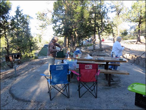
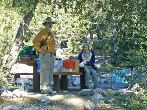 Happy campers at Hilltop Campground |
CAMPING In the developed areas (i.e., around paved roads on Mount Charleston), car camping formerly was permitted only in campgrounds. There are numerous dirt roads in the undeveloped areas where camping is legal unless marked otherwise. Please choose an existing campsite rather than trample vegetation to make a new one. For the most part, backpackers may camp anywhere, except that certain areas are posted "No Camping," and you must stay at least 100 ft from springs or other water sources. Backcountry permits are not required. Plan to cook with a stove, as restrictions on open fires seem to be more common these days because of the extended drought. Note that this discussion does not apply to Red Rock Canyon National Conservation Area, which has a different set of regulations. |
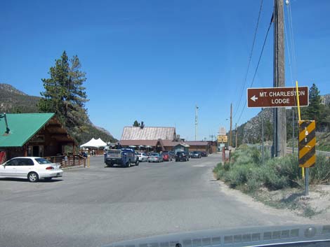 Historical Mt. Charleston Lodge was the only lodging on the mountain |
Lodging, Dining, and other Facilities Lodging up on the mountain is only available at the Mt. Charleston Lodge in upper Kyle Canyon, although there is a hotel (Resort on Mt Charleston) at the bottom of the mountain. The Lodge has quaint individual cabins (rates start at about $110), while the Resort is more of a modern hotel. The Lodge and Resort both feature restaurants. The Las Vegas Ski & Snowboard Resort (upper Lee Canyon) has a grill and bar. The Las Vegas Ski & Snowboard Resort offers skiing during winter and limited other activities, including chair lift rides, during summer. There are no gas stations on the mountain. |
 Birding Upper Kyle Canyon |
HOURS The Spring Mountains Visitor Center is open during regular business hours. The wildlands are open 24 hours. There are a variety of concessions on Mount Charleston (e.g., food, lodging, and a ski area, but no gasoline). Most concessions are open seasonally during regular business hours or longer. There are no services in Cold Creek or on Mount Potosi. ENTRANCE FEES None. The Cathedral Rock Picnic Area charges a $20 Day Use Fee. |
 Cathedral Rock (left) Mount Charleston (right) |
WATCH OUT Other than the standard warnings about hiking in the desert, ...oops, these are the mountains -- I guess there are special concerns about hiking in the mountains that don't really apply to hiking in the desert, but I can't think of any right now ... except that high elevations are problems for some people. If you haven't hiked at high elevations, check with your physician before traveling into the mountains. Altitude sickness is a common problem at high altitudes. If you are up there and suddenly develop a bad headache and start vomiting, get off the mountain. If the symptoms don't abate by the time you get back to town, seek medical attention. It is of note that a Forest Service brochure reads: "You are primarily responsible for your own safety in the forest. Look out for natural hazards and dangers and please remember to be careful!" |
 Hiker at Mount Charleston Wilderness Boundary |
In case of emergency, contact any ranger on Mount Charleston or call 911. Cell phones work in some areas and there are pay phones in the towns. There are no phones in Cold Creek, but cell phones do work there. SOME RULES AND REGULATIONS Regulations differ depending on the jurisdiction and legal designation of the land. Kyle and Lee Canyons are in the National Recreation Area, which is almost like a National Park, so treat it like a National Park. Do not collect or otherwise disturb plants, rocks, fossils, or artifacts, and do not disturb the wildlife (except during hunting season). Pack it in, pack it out. Street-legal vehicles may be driven on designated roads by licensed drivers; no off-road driving. |
 Mount Charleston from North Loop Trail |
The Mount Charleston Wilderness Area is a federally designated wilderness area. Motorized vehicles and other forms of mechanized conveyance are not permitted. As elsewhere, don't collect or otherwise disturb plants, rocks, fossils, artifacts, or wildlife. Pack it in, pack it out. Permits are required for overnight travel. Pets must be on a leash (six-foot maximum) and under your physical control at all times. Never leave your pet in a vehicle because temperatures inside a car parked in the sun can exceed 120 degrees in just a few minutes, quickly cooking your pet (ditto for kids). |
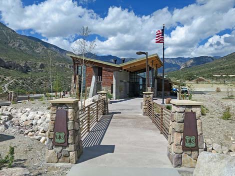 Spring Mountains Visitor Center |
FOR MORE INFORMATION For more information, including a map, visit the Spring Mountains National Recreation Area website or the Spring Mountains NRA Visitor Center (702-515-5400) located along the main road in Kyle Canyon. I've always been pleasantly surprised by the amount of information the staff in the Visitor Center has to offer. The Toiyabe National Forest is headquartered in Sparks, Nevada. The Forest has five Ranger Districts, including the Las Vegas Ranger District, which can be contacted at Spring Mountains National Recreation Area, 4701 N. Torrey Pines Dr., Las Vegas, NV 89130; (702) 515-5400. |
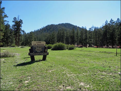 Lee Meadow (view W) |
 Lee Meadow (view E) |
 Bristlecone Trail |
 Hilltop Campground |
Table 1. Highway Coordinates based on GPS Data (NAD27; UTM Zone 11S). Download Highway GPS Waypoints (*.gpx) file.
| Site | Location | UTM Easting | UTM Northing | Latitude (N) | Longitude (W) | Elevation (ft) | Verified |
|---|---|---|---|---|---|---|---|
| 0259 | Bonanza Peak Trailhead Parking | 613021 | 4026870 | 36.38213 | 115.73994 | 7,513 | Yes |
| 0341 | Hwy 95 at Cold Creek Rd | 630061 | 4042819 | 36.52372 | 115.54734 | 2,970 | Yes |
| 0556 | Bristlecone Trailhead Parking, Upper | 618763 | 4018542 | 36.30639 | 115.67721 | 8,684 | Yes |
| 0667 | Hwy 95 at Kyle Canyon Rd | 651544 | 4021405 | 36.32758 | 115.31167 | 2,820 | Yes |
| 0668 | Hwy 95 at Hwy 156 | 637320 | 4037799 | 36.47747 | 115.46718 | 3,300 | Yes |
| 0671 | Cold Creek Town | 613264 | 4030597 | 36.41570 | 115.73669 | 6,197 | Yes |
| 0732 | Hwy 160 at Boy Scout Canyon Rd | 636663 | 3984942 | 36.00118 | 115.48374 | 5,073 | Yes |
| 0848 | Hwy 160 at Blue Diamond Rd | 647933 | 3988875 | 36.03498 | 115.35801 | 3,169 | Yes |
| 0849 | Hwy 160 at Cottonwood Valley Rd | 640022 | 3984731 | 35.99880 | 115.44652 | 4,325 | Yes |
| 1610 | Kyle Canyon Road at Visitor Center Road | 627171 | 4014889 | 36.27238 | 115.58419 | 6,601 | Yes |
Happy hiking! All distances, elevations, and other facts are approximate.
![]() ; Last updated 240730
; Last updated 240730
| Birding Around Las Vegas | Hiking Around Las Vegas | Glossary | Copyright, Conditions, Disclaimer | Home |