Hiking Around Las Vegas, Spring Mountains (Mt. Charleston), Kyle Canyon Area
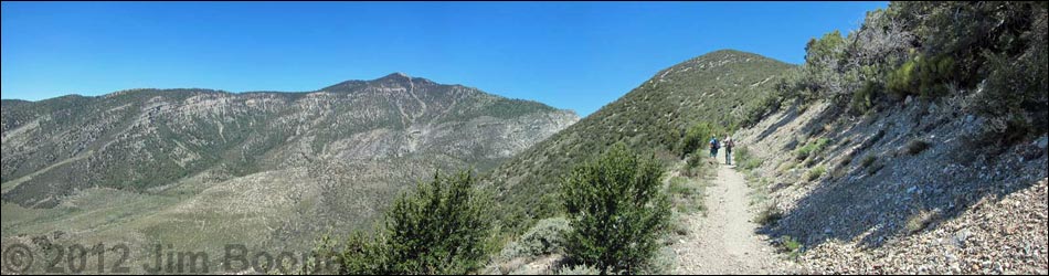
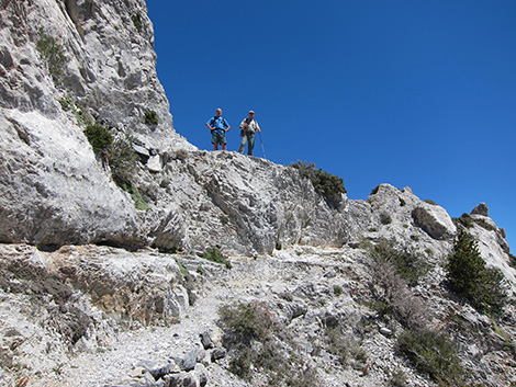
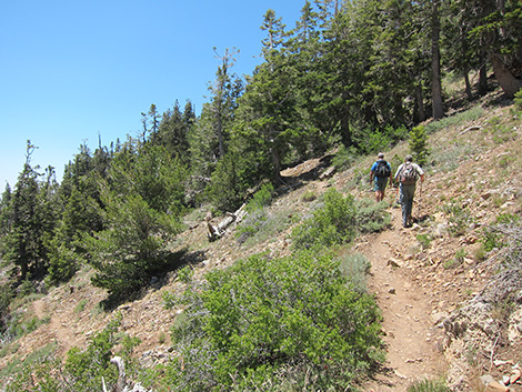
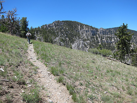
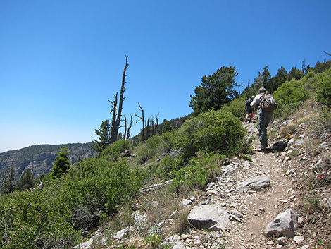
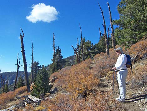
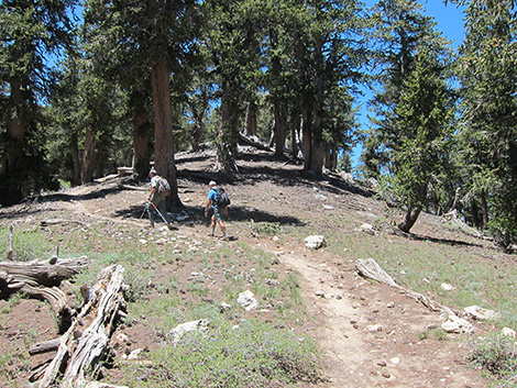
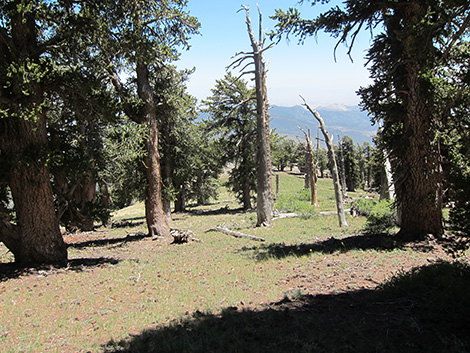
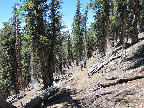
 Hikers dropping into Harris Saddle (view NW) |
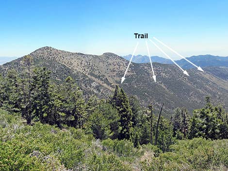
Overview This moderately strenuous, 11-mile round-trip hike climbs 2,660 feet from Griffith Peak Trailhead to the summit of Griffith Peak, mostly through the Carpenter 1 Fire burn zone (all photos predate the fire). The trail generally is open, airy, sunny, and not too steep, and views from the summit are among the best in southern Nevada. There are fascinating fossils and rare plants on the summit. The trail contours up and around Harris Mountain, and then climbs the East Ridge of Griffith Peak. Near the summit, the trail contours around the south side of the peak to the West Ridge. The trail then turns back (east) and climbs to the summit. An alternate route up Griffith Peak starts in Kyle Canyon and follows the South Loop Trail to the rim of Kyle Canyon. At the rim, the South Loop Trail joins the Griffith Peak Trail. From the junction, the route up Griffith Peak runs southeast along the ridge and heads up a spur trail following the west ridge. Link to map or elevation profile. |
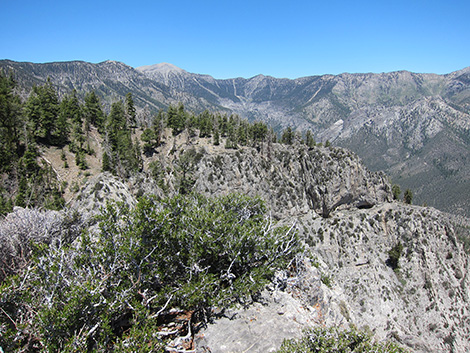
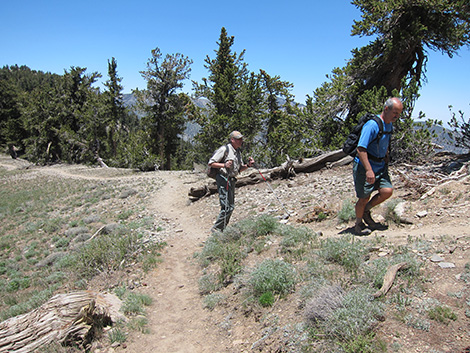
 Harris Saddle Overlook (view NW) |
Watch Out Other than the standard warnings about hiking in the desert, ...this is a pretty safe hike. The trail climbs through some limestone cliffs on narrow, exposed ledges just above Harris Saddle, so watch your step along this part. The trail is moderately strenuous, so take it easy at this elevation if you've just come up from the desert. Because of the length, this probably isn't a good trail for young children. The road to the trailhead (Harris Springs Road and Harris Mountain Road) are a bit rough, and a high-clearance vehicle is necessary on Harris Mountain Road. While hiking, please respect the land and the other people out there, and try to Leave No Trace of your passage. Also, this is a long hike, so be sure to bring the 10 Essentials. |
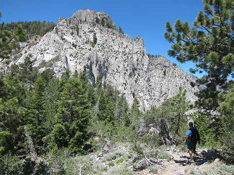
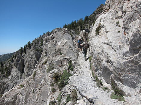
 Hiking through limestone cliffs above Harris Saddle (view SW) |
Getting to the Trailhead This hike is located in the Spring Mountains National Recreation Area (generally called Mt. Charleston) off Harris Springs Road south of Kyle Canyon Road, about 1.5 hours northwest of Las Vegas. From town, drive north on Highway 95 to Kyle Canyon Road, then to Harris Springs Road, and finally to the end of Harris Mountain Road and the Griffith Peak Trailhead. |
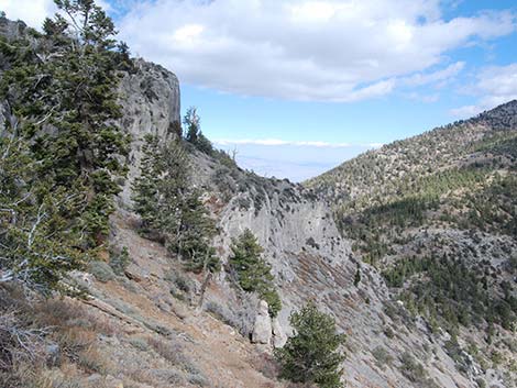
 Hiking through limestone cliffs above Harris Saddle (view N) |
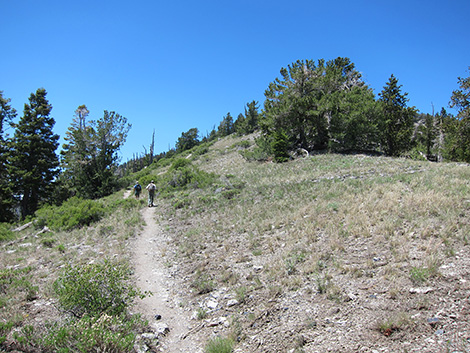
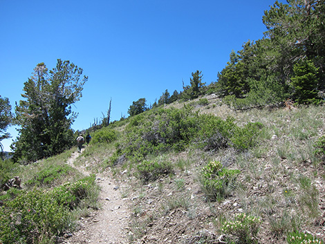
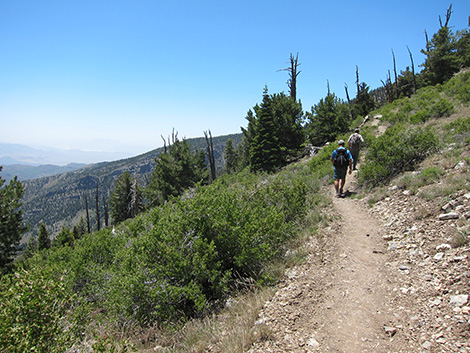
The Hike From the trailhead (Table 1, Waypoint 01), the trail enters the Mt. Charleston Wilderness Area and runs northwest up the old road until the road abruptly ends high in Lovell Canyon (Wpt. 02). From the end of the old road, a good trail continues northwest to Harris Saddle (the saddle between Griffith and Harris peaks; Wpt. 03). For details on this part of the hike, including a map, see the description of the Harris Saddle Trail. Lower down, the vegetation generally is composed of mountain mahogany, shrub live oak, sagebrush, manzanita, silk tassel, Mormon tea, other low bushes, shrubby burn areas, and a few single-leaf pinyon pines, but little shade. Along the upper section, the vegetation transitions to a cool, alpine-feeling ponderosa pine and white fir forest with a few limber pine mixed in. |
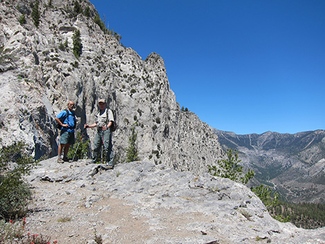
 Narrow trail through the cliffs above Harris Saddle (view SW) |
From Harris Saddle (Wpt. 3), which overlooks Kyle Canyon to the north, the trail turns west and climbs fairly steep switchbacks, rocky stairs, and narrow ledges to pass through and around craggy limestone cliffs. At the top of the cliffs (Wpt. 04), a short spur trail leads to a great overlook (Wpt. 10) out to the rim of Kyle Canyon. After climbing through the cliffs, this is a good place to rest and enjoy the view. In this area, and especially a little higher up, the vegetation becomes less dense and gives way to bristlecone pine, limber pines, wild currents, and a few open, shrubby areas. After the cliffs, the grade becomes more gentle as the trail runs along the south side of the main ridge. After a long, sweeping switchback, the trail regains the ridgeline and briefly crosses onto the north side in a meadow area that feels very alpine and provides grand views up Kyle Canyon. The trail crosses back onto the south side of the ridge, passes short switchbacks and then longer ones, and passes a nice campsite on a low saddle in the trees. |
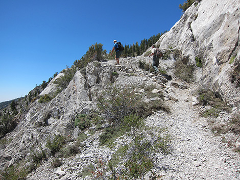
 Hikers on trail in limestone cliffs above Harris Saddle (view N) |
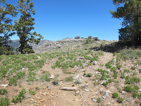
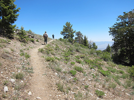
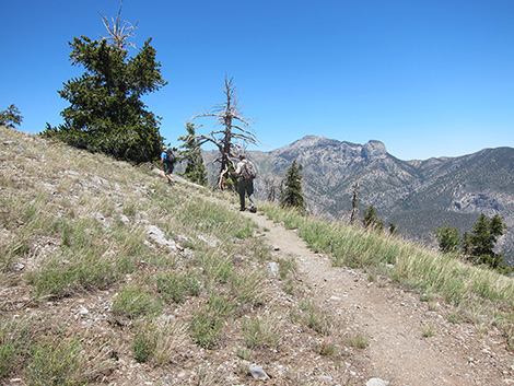
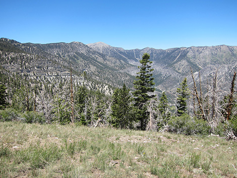
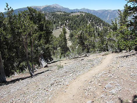
Continuing up the ridge, the trail breaks out of the bristlecone pine forest and enters a grassy area that looks like a ski slope (Wpt. 05). Some hikers leave the trail here and climb off-trail to the summit. This route is relatively long and steep, and there are faint use-trails in places. Continuing on the trail past the grassy area, the trail leaves the ridgeline and heads southward as it climbs gently around the south side of Griffith Peak. After walking for a few minutes in the forest, the trail crosses the Southeast Ridge (Wpt. 06) with views through the trees of Sandy Valley Town and places far to the south. Below the trail, open grassy areas and a rocky ridge look like they might have nice campsites. Continuing westward, the trail climbs gently across the south side of the peak, eventually crossing the South Ridge (Wpt. 07). At this point, hikers get a view to the west into the Pahrump Valley and places far to the west. This is the highest point on this part of the trail. |
 Hikers on trail in limestone cliffs above Harris Saddle (view SW) |
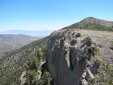
Continuing past the South Ridge (Wpt. 07), the trail descends across southwest-facing slopes to the West Ridge and the rim of Kyle Canyon. When the trail hits the crest of the ridge (Wpt. 08), a spur trail forks hard to the right and climbs steeply up the West Ridge to the summit (Wpt. 09). Newly constructed switchbacks along the spur trail make the hiking easier and encourage hikers to always follow the same route, an improvement over the environmentally damaging multiple trails that once ran up the ridgeline. Views from the summit are spectacular. Much of the South Loop Trail to Mt Charleston, the North Loop Trail, the Sheep Range and points east, Red Rocks and Las Vegas to the southeast, Mt. Potosi and other mountain ranges to the south and east into California are visible. On clear days, the view reaches far into California and Arizona. |
 Trail in limestone cliffs above Harris Saddle (view S) |
While gazing into the distance, don't overlook the close-up view: there are some interesting crinoid fossils on the summit, and some of the rock layers appear to be largely composed of crinoid fragments. Also, the thistle plants on the summit are a rare species (Charleston Mountain Thistle), so be careful around them. When ready to leave, the easiest way back to the trailhead is to retrace your footprints along the dusty trail. Alternatively, hikers can make a partial loop by descend directly down the east ridge on the "ski slope" towards Harris Saddle. For hikers continuing west, descend to the start of the summit spur trail (Wpt. 08), then continue west on the ridgeline for 0.21 miles to the South Loop Trail junction (Wpt. 11). At the junction, the trail to the north (right) drops steeply into Kyle Canyon, while the trail to the northwest (left) goes to the summit of Mt. Charleston. For hikers climbing Griffith Peak from Kyle Canyon, this is where the South Loop Trail joins the Griffith Peak Trail. |
 Hikers almost past limestone cliffs (view SW) |
 Hikers above limestone cliffs (view SW) |
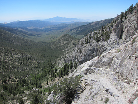
 Spur trail to overlook (view N from main trail) |
 Overlook (view NW to Mt. Charleston and North Loop Ridge) |
 Overlook (view NE to Harris Peak and Sheep Range in the distance) |
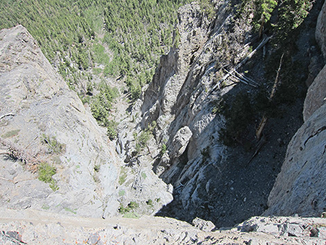 Overlook (view N straight down sheer cliff) |
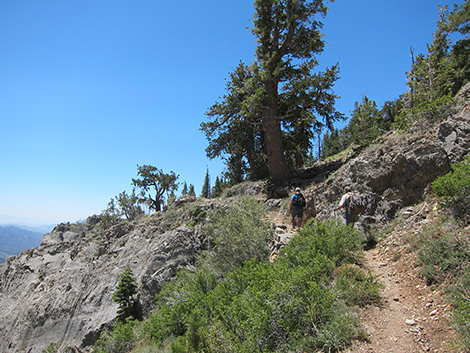
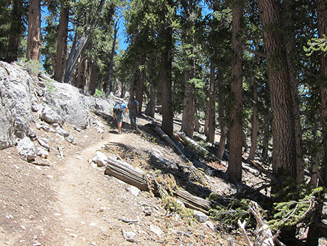
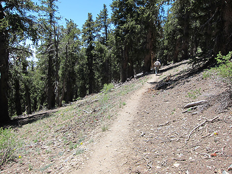
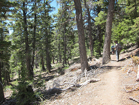 Hikers on trail in woods (view W) |
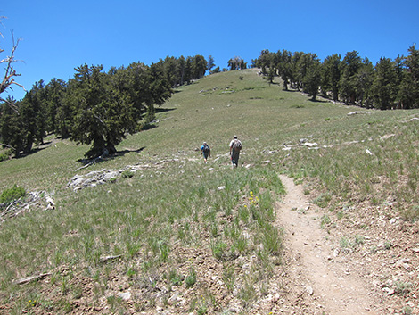
 Hikers in lower meadow (view NE) |
 Hikers in lower meadow (view N towards Mummy Mtn) |
 Hikers in lower meadow (view W towards Griffith Peak) |
 Lower meadow (view NE to Upper Kyle Canyon) |
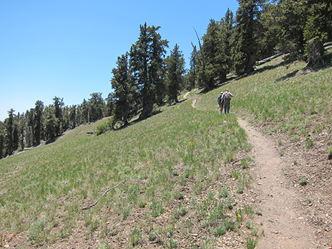
 Hikers back on S side of ridge (view SW) |
 Hikers back on S side of ridge (view SW) |
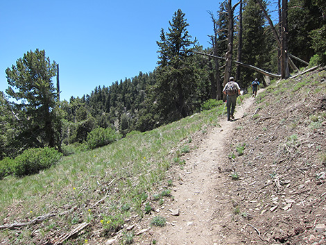
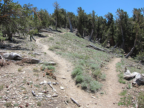
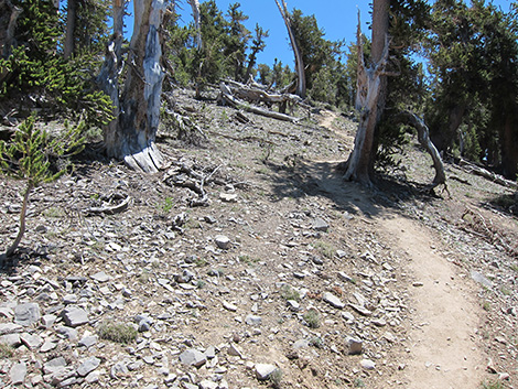
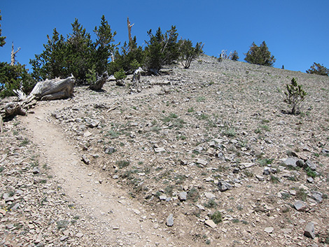
 Steep section of trail in old burn area (view SW) |
 Trail in old burn area (view E to Harris Saddle Trail) |
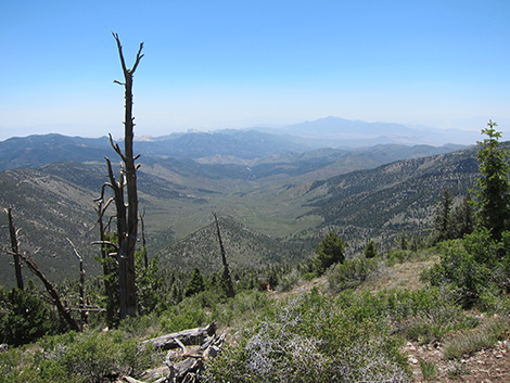 Old burn area (grand view S through Lovell Canyon to Mt. Potosi |
 Trail in old burn area (view SW) |
 Brushy area with great views to the southwest (fall colors) |
 Switchback in Bristlecone Pine forest (view NE) |
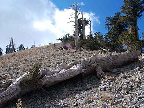
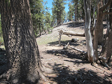 Campsite on ridgeline (view NE) |
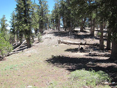 Campsite on ridgeline (view E) |
 Hikers on ridgeline (view W) |
 Hikers below "lower ski slope" (view SW towards false summit) |
 Hikers on hillside (view S) |
 Hikers on hillside (view S) |
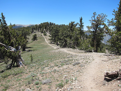
 Southeast Ridge (view SE) |
 Hikers on hillside (view W) |
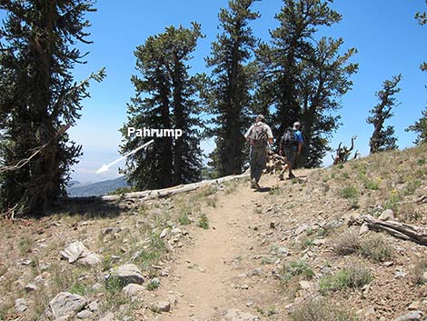 Hikers crossing South Ridge (view W into Pahrump) |
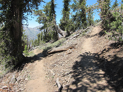
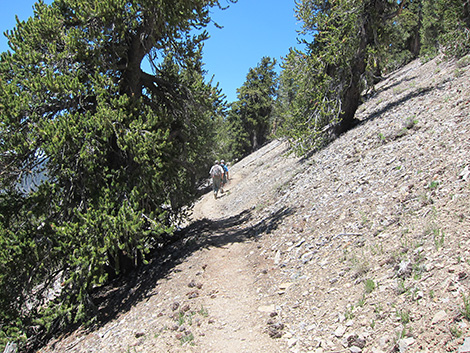 Hikers descending across southwest-facing slope (view NW) |
 Hikers descending across southwest-facing slope (view NW) |
 Hikers at Griffith Peak spur trail (view NW) |
 Ridgeline above Kyle Canyon (view W towards South Loop Trail) |
 Junction with Griffith Peak spur trail (view SW) |
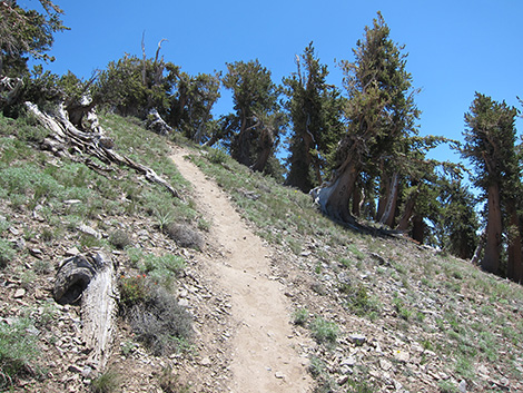
 Steep trail ascending West Ridge (view SE) |
 Looking down steep trail towards Mt. Charleston (view NW) |
 Newly built switchback on Griffith Peak spur trail (view NW) |
 Griffith Peak spur trail on steep West Ridge (view E) |
 Griffith Peak spur trail on steep West Ridge (view E) |
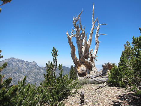 Bristlecone near Griffith Peak summit (view N to Mummy Mtn) |
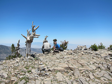 Hikers on Griffith Peak summit (view NE) |
 Hiking Down: Hiker descending the "grassy ski slope" |
 Hiking Down: Returning towards Harris Saddle (view NE) |
Table 1. Hiking Coordinates Based on GPS Data (NAD27; UTM Zone 11S). Download Hiking GPS Waypoints (*.gpx) file.
| Wpt. | Location | UTM Easting | UTM Northing | Elevation (ft) | Point-to-Point Distance (mi) | Cumulative Distance (mi) | Verified |
|---|---|---|---|---|---|---|---|
| 01 | Griffith Peak Trailhead | 626092 | 4009097 | 8,338 | 0.00 | 0.00 | Yes |
| 02 | End of Old Road | 624603 | 4010812 | 8,751 | 1.57 | 1.57 | Yes |
| 03 | Harris Saddle | 623738 | 4011300 | 9,078 | 0.76 | 2.33 | GPS |
| 04 | Trail Junction to Overlook | 623387 | 4011221 | 9,499 | 0.60 | 2.93 | GPS |
| 05 | East Ridge (Grassy Ski Slope) | 622279 | 4010671 | 10,452 | 1.52 | 4.45 | Yes |
| 06 | Southeast Ridge | 622076 | 4010249 | 10,646 | 0.33 | 4.78 | GPS |
| 07 | South Ridge (Pahrump View) | 621679 | 4010169 | 10,763 | 0.28 | 5.06 | GPS |
| 08 | West Ridge | 621499 | 4010551 | 10,550 | 0.29 | 5.35 | Yes |
| 09 | Griffith Summit | 621752 | 4010381 | 11,060 | 0.31 | 5.66 | Yes |
| 01 | Griffith Peak Trailhead | 626092 | 4009097 | 8,338 | 5.66 | 11.32 | Yes |
| . | . | . | . | . | . | . | . |
| 10 | Overlook | 623453 | 4011262 | 9,517 | . | 0.06 | GPS |
| 11 | South Loop Trail | 621317 | 4010822 | 10,550 | . | 0.21 | GPS |
Happy Hiking! All distances, elevations, and other facts are approximate.
![]() ; Last updated 240329
; Last updated 240329
| Hiking Around Mt Charleston | Hiking Around Las Vegas | Glossary | Copyright, Conditions, Disclaimer | Home |