Detailed Hiking and Camping Information | Detailed Bird Watching Information
 Boundary Sign near Corn Creek (view E) |
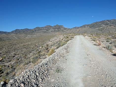
OVERVIEW Desert National Wildlife Refuge, administered by the U.S. Fish and Wildlife Service, forms the northern boundary of the Las Vegas Valley. The Wildlife Range stretches for some 59 miles northward from town and is about 50 miles wide. Encompassing 6 mountain ranges and 2,200 square miles of land, this is the largest wildlife refuge in the lower 48 states. About half of the Wildlife Range (1,320 square miles) is used by the U.S. Air Force and generally is off-limits to public access. Despite the closure, the public portion (about 1,000 square miles; 59 miles by about 22 miles; 3 entire mountain ranges) is a vast amount of land that is entirely wild and open to hiking. There are only dirt roads, one picnic area, and one campground in the Wildlife Range, and much of the land is managed as wilderness. Link to map. |
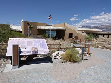 Corn Creek Visitor Center |
The primary purpose of the Wildlife Range is to protect desert bighorn sheep. Wildlife Managers actively enhance bighorn habitat, largely by constructing or improving year-round water sources. These activities also benefit wildlife such as mule deer, mountain lions, and many bird species. Managing portions of the Wildlife Range as wilderness further protects wildlife habitat. Recreational activities on the Wildlife Range primarily are orientated towards bird watching, off-highway driving (not off-road driving; all vehicles must be street legal), sightseeing, hiking, and a little deer and sheep hunting. Corn Creek, at refuge headquarters, has historically been one of the premier birding sites in southern Nevada. This is relatively high desert where elevations range from about 2,500 feet in the lowest valleys to 9,912 feet at Hayford Peak. Because of the elevation, temperatures here are cooler than in Las Vegas. Thus, outdoor activities on the Wildlife Range are pleasant when other areas get too hot, although hiking and birding still should be limited during the hottest parts of the year (e.g., not during July and August). |
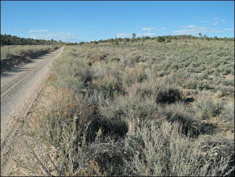
 Highway 95 at Corn Creek Road (view N) |
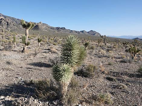
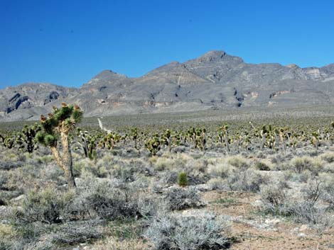
The great range in elevation on the Wildlife Range results in vegetation that is diverse, but forms regular associations (Life Zones) that change regularly with altitude because of local climatic conditions. At the lowest elevations, where temperatures are the hottest and evaporation rates are the greatest, the Upper Sonoran (Mojave Desert Scrub) Life Zone is dominated by widely spaced Creosote Bush, White Bursage, and a few Mojave Yuccas. Some areas on the west side of the Sheep Range are so dry (in the rain shadow of the Spring Mountains) that these drought-adapted shrubs are small and stunted. Somewhat higher in elevation, with more precipitation and less evaporation, the shrubby Mojave Desert Scrub is more diverse, and several species of cacti (including Silver Cholla, Barrel Cactus, and Cottontop Cactus) also become common. At elevations of about 4,000 to 6,000 feet (still in the Upper Sonoran Life Zone), Blackbrush and Joshua Trees are common, and the shrubs and other vegetation are even more diverse. In the Yucca Forest along Mormon Well Road, the vegetation is amazingly diverse, and the Joshua Trees are so abundant that it looks like a regular forest. |
 |
At about 6,000 feet, the Upper Sonoran (Pinyon-Juniper Woodland) Life Zone becomes dominated by Pinyon Pine and Utah Juniper. Sagebrush, a species more common to the north, is common in some areas. At Mormon Pass (about 7,000 feet), the Mormon Well Road climbs into the Transition (Yellow Pine Forest) Life Zone with a nice stand of Ponderosa Pine scattered among the pinyon and juniper. Still higher, the Ponderosa Pines become mixed with White Fir in the Canadian (Pine-Fir Forest) Life Zone that runs up to about 9,000 feet. At the highest elevations in the Wildlife Range, the Hudsonian (Bristlecone Pine Forest) Life Zone is dominated by Bristlecone Pines, native bunchgrasses, and a few species of cold-hardy shrubs. For more information, including a variety of maps and images, visit the official Desert National Wildlife Range website. |
 |
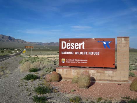
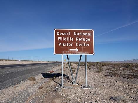
GETTING TO DESERT NATIONAL WILDLIFE RANGE Link to map. Desert National Wildlife Range is located north of Las Vegas. The main entry point is the Corn Creek Field Station, which is about 30 minutes northwest of town. From Las Vegas, drive north on Highway 95 for about 30 minutes. Drive past the first turnoff to Mt. Charleston (Kyle Canyon Road; Highway 157) and past the turnoff to the Las Vegas Paiute Indian Reservation (the highway goes under an overpass here). Just past the underpass, drivers can look northeast and see the trees and radio tower at Corn Creek. About 6 miles past the Paiute Reservation overpass, at about mile marker 101.5, turn right onto Corn Creek Road (Table 1, Site 350). The intersection of Highway 95 and Corn Creek Road is marked by a small refuge sign, a small Corn Creek Road sign, and a paved road heading east across the desert. Drive east on Corn Creek Road for 3.8 miles to the Visitor Center at Corn Creek Field Station (Site 106). |
 |
HOURS The refuge is open for entry between 4am and sunset. Visitors already on the refuge after sunset can exit (the gate opens automatically) or camp overnight. The Corn Creek Visitor Center is usually open Friday to Sunday, but call ahead for details because hour change seasonally and depending on staff levels. The Corn Creek trails are open sunrise to sunset. ENTRANCE FEE None. |
 |
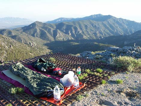
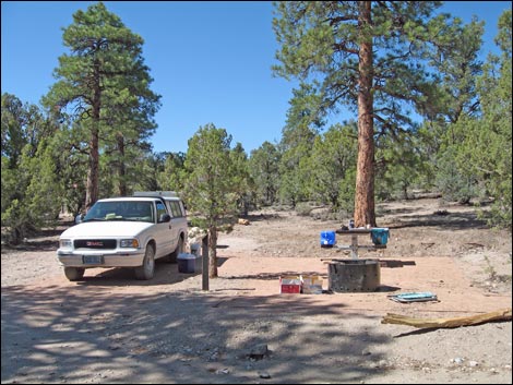
CAMPING There are no concessions (i.e., no food, gas, or lodging) on the Wildlife Range. Unless otherwise marked, car camping is permitted anywhere within 100 feet of a designated road (note that this is near the road), but not within sight or within 0.25 miles of a water source. Please use existing campsites rather than trampling new ones. There is a small campground on the north side of Mormon Pass (Mormon Well Road) with tables, fire grates, and vault toilets. Backpackers may camp anywhere, but not within sight or within 0.25 miles of a water source, and please use hard campsites or existing campsites (i.e., Leave No Trace). Backcountry permits are not required, but sign-in at the visitor center. Campfires are permitted using dead wood except when fire restrictions are in effect. There are a few springs, but generally water is not available on the refuge). |
 |
WATCH OUT Other than the standard cautions about traveling in the desert, there are no unusual hazards, but keep in mind that this is a wild and remote place -- and you are on your own. In case of emergency, call 911 if you can get out with a cell phone (but don't count on it). Refuge headquarters at Corn Creek has a phone (702-879-6110), but don't count on someone being there to answer it. You can also call the main office in Las Vegas during business hours (702-515-5455). If you can't summon help, then you are on your own. My advice: be prepared and self-reliant because this really is wild and remote country. The refuge has a few law enforcement officers who patrol the roads, but it is a big place. They will find you eventually if you are on a road, but be prepared to survive alone. |
 |
SOME RULES AND REGULATIONS This area is designated as a National Wildlife Range, which is the same as a National Wildlife Refuge, and you should act as if you were in a Wildlife Refuge. Do not collect or otherwise disturb plants, rocks, fossils, or artifacts, and do not disturb the wildlife. Pack it in; pack it out. No target shooting is allowed. Drive only on designated roads. All motor vehicles, including off-highway vehicles, must be licensed and insured for highway use (i.e., street legal). All vehicle operators must have a valid driver's license in their possession. Pets are allowed, but they must be on a leash and under your physical control at all times. Never leave your pet in a vehicle because temperatures inside a car parked in the sun can quickly exceed 120 degrees and cook your pet (ditto for little humans). |
 |
FOR MORE INFORMATION For details on these issues, and for more information, visit the Desert National Wildlife Range website or stop in at the visitor center. If the visitor center is closed, visit the kiosk (across the entrance road from the visitor center) for information and brochures. |
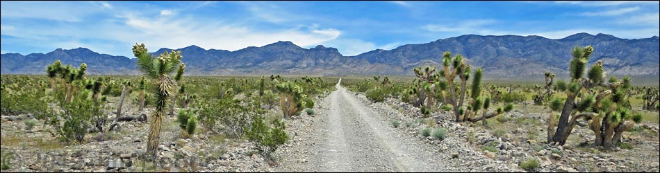
 Yucca Forest Yucca Forest |
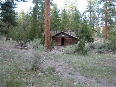 Hidden Forest Warden's Cabin |
Table 1. Highway Coordinates (NAD27; UTM Zone 11S). Download Highway GPS Waypoints (*.gpx) file.
| Site # | Location | Latitude (°N) | Longitude (°W) | UTM Easting | UTM Northing | Elevation (feet) | Verified |
|---|---|---|---|---|---|---|---|
| 106 | Corn Creek Field Station parking | 36.43845 | 115.35745 | 647225 | 4033632 | 2,814 | Yes |
| 350 | Highway 95 at Corn Creek Road | 36.42601 | 115.42251 | 641416 | 4032155 | 3,050 | Yes |
Happy hiking! All distances, elevations, and other facts are approximate.
![]() ; Last updated 240322
; Last updated 240322
| Hiking Around Las Vegas | Glossary | Copyright, Conditions, Disclaimer | Home |