(Mount Charleston National Recreation Trail)
Hiking Around Las Vegas, Spring Mountains (Mt. Charleston), Kyle Canyon
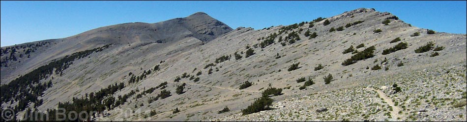
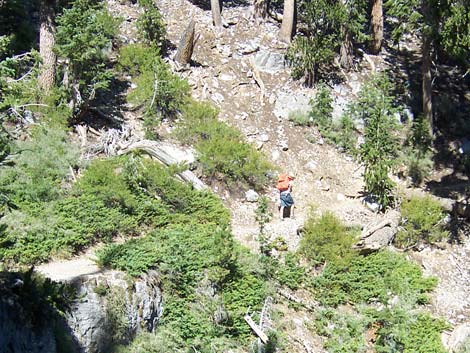
 Cathedral Rock - Mt. Charleston Trailhead (view W) |
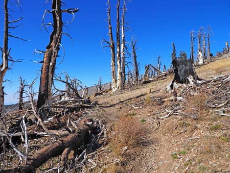
Overview This hike is very strenuous, climbing 4,278 vertical feet in 8.5 miles. The trail starts near Cathedral Rock and climbs 3,100 feet up the side of Kyle Canyon to the summit ridge in about 4 miles. The trail then runs northwest for about 1.6 miles at a more leisurely grade through a burned Bristlecone Pine forest with open meadows. After that, the trail steepens, climbs past timberline, drops into, and traverses a broad bowl, then makes a long, steep, final push up the South Ridge to the summit. On a clear day, they say hikers can see 300 miles from the summit. The forest along parts of this trail were severely affected by the Carpenter 1 Fire, which consumed some 28,000 acres during July and August 2013. The US Forest Service is trying to change the name of this trail to Mt. Charleston National Recreation Trail. Link to map. |
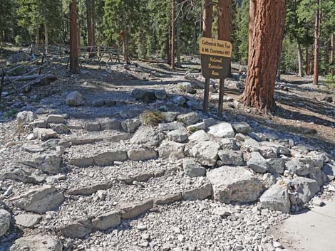
 Note: the sign is still there, but it's been knocked down (view S) |
Watch Out Other than the standard warnings about hiking in the desert, ...this is a pretty safe hike, but watch for ice during winter and early spring. The trail is strenuous, so take it easy at this elevation if you've just come up from the desert. There are places along the trail where a slip would prove fatal, but nothing out of the ordinary; watch your footing near edges. This trail is a bit long and hard for young kids. During summer, watch for thunderstorms. I've twice been run off these ridges with lightning all around -- not fun. While hiking, please respect the land and the other people out there, and try to Leave No Trace of your passage. Also, this is a long hike, so be sure to bring the 10 Essentials. This hike goes into the Mt. Charleston Wilderness Area, so pay particular attention to respecting the land. |
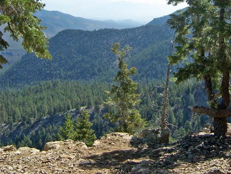 Echo Overlook (view NE) |
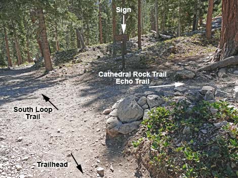
Getting to the Trailhead This hike is located in Kyle Canyon up in the Spring Mountains National Recreation Area, about 1 hour northwest of Las Vegas. From town, drive out to the Spring Mountains Visitor Center, then continue up Kyle Canyon Road to the Cathedral Rock Trailhead. An alternative start to the South Loop Trail is from the Griffith Peak Trailhead, which adds miles but cuts elevation gain. The Hike From the Cathedral Rock Trailhead (Table 1; Waypoint 01), the trail runs up and left about 200 yards to a fork (Wpt. 02). At the fork, the Cathedral Rock Trail turns right, while the South Loop Trail continues straight. |
 Traversing hillsides (view W) |
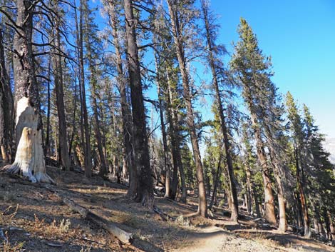
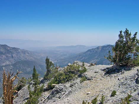
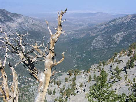
Both trails pass through a forest of ponderosa pines and white fir with an open understory of wax currents and a few other shrubs, plus some grasses, thistles, and a few forbs. In the trees, views are short but overlook the parking area and picnic area. Past the fork (Wpt. 02), the trail runs steeply up the hillside as it heads generally southeast towards the base of the Echo Cliffs. After about 20-25 minutes, the trail joins an old road (Wpt. 03), which is followed up and across an avalanche chute that comes down from Griffith Peak. This is a nice area in the fall when the Quaking Aspen leaves are changing color from green to yellow and red. The trail stays to the right at a fork in the old road (Wpt. 04) and runs very steeply up the east side of the avalanche chute below towering limestone cliffs. The trail crosses the avalanche chute (Wpt. 05) and switchbacks up the steep west side of the canyon to the top of the Echo Overlook (Wpt. 06). Echo Overlook is about halfway to the crest: only about 2 miles, 1.5 hours, and 1,500 feet to go. For details on this section of the hike, see Echo Overlook Trail. |
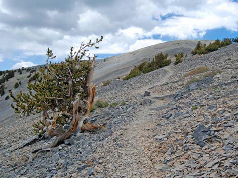
 Tall bristlecone pines on steep slope (view NW) |
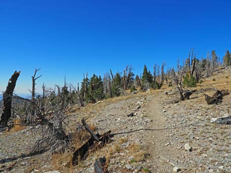
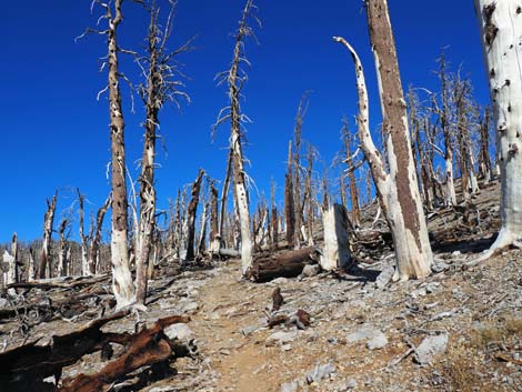
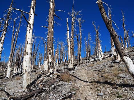
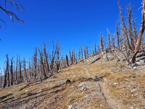
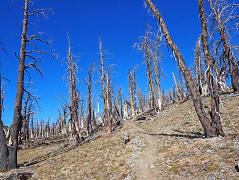
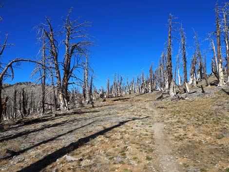
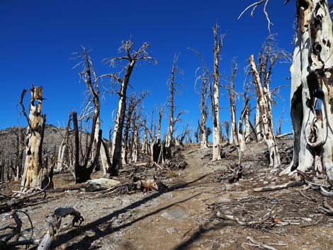
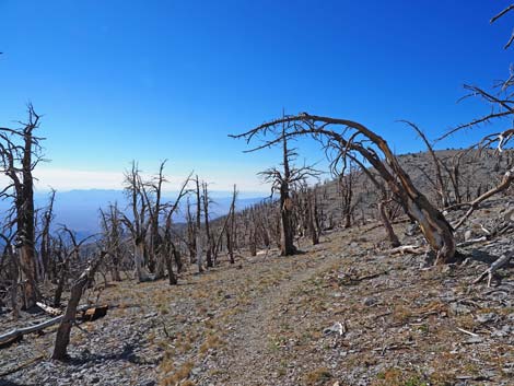
From Echo Overlook (Wpt. 06), the trail generally contours west across the hillside to another nice overlook. The trail then begins a long series of switchbacks that lead up the side of the canyon, eventually gaining the crest of the ridge at about 4 miles out (Wpt. 07). There is a nice Bristlecone Pine forest along this section of trail and a nice meadow just below the crest, but in this area, the trees are burned. Note that the trail has been rerouted since the USGS topo maps were last updated; the trail now runs up the ridge to the west of where the USGS topo map shows the trail. There is a trail junction at the crest (Wpt. 07). The trail to the southeast (left) leads around the south side of Griffith Peak and down to the Harris Canyon trailhead (5 miles out); the trail to the northwest (right) leads to the summit of Mt. Charleston. |
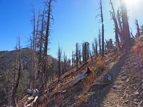 Approaching the crest of the ridge; burned trees (view SE) |
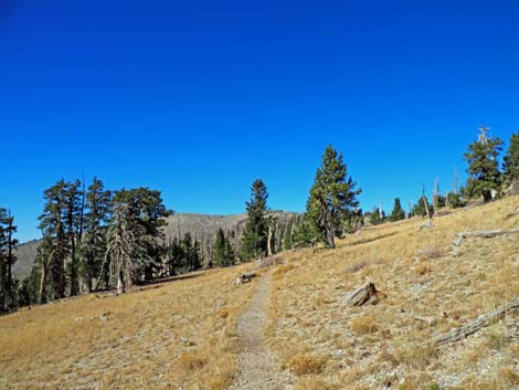
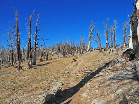
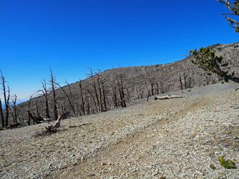
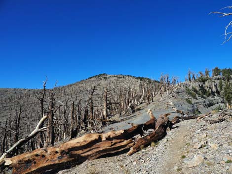
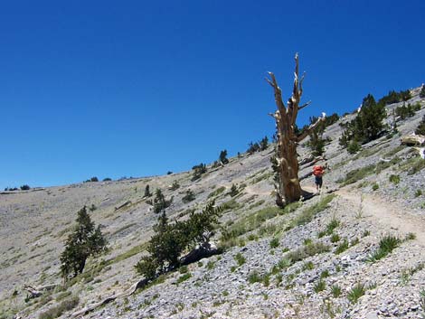
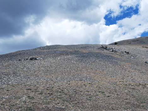
From the trail junction (Wpt. 07), the South Loop Trail runs west across mixed meadows (The Meadows) and through bristlecone pine forests at easy grades for about 1.6 miles. There are a number of campsites in the trees along the edge of the meadows that would make nice spots for an overnight backpacking trip. Campsites can also be found right on the crest. There is no water in this area. The USGS topo map shows the trail running on the crest of the ridge through here, but this part of the trail was also rerouted and now traverses the hillside a short way below the old trail. There are nice views of the meadows and points south from the new trail, but not of Kyle Canyon. After The Meadows (Wpt. 08), the grade increases as the trail passes through a bristlecone pine forest. Shortly, the trail breaks out onto the rim of Kyle Canyon (Wpt. 09) with great views of Mummy Mountain to the north, the desert to the east, and down into Kyle Canyon. The next section of trail also has been rerouted. From the viewpoint (Wpt. 09), the trail climbs steeply up the ridge before angling back to the west, passing timberline, and climbing onto another ridge that comes up from the southwest (Wpt. 10). From here, hikers get the first good view of the summit. |
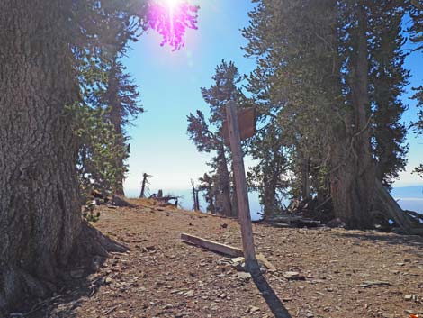 Trail sign at junction on the crest (view S) |
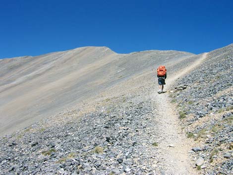
From the top of the ridge, the trail drops a bit to traverse a wide bowl. A few patches of stunted bristlecone pines grow through here, but this area essentially is above timberline. Old guidebooks say that water is available at Peak Spring (Wpt. 12), which is down in the base of the bowl (west of the crest). However, it looks like a hard hike. For hikers wanting to visit the spring, the trail junction is not where the USGS topo map shows it to be. From the top of the ridge, it is only about a 3-minute walk (220 yards) to the junction, rather than the 700 yards shown on the map. The junction (Wpt. 11) is marked by a 4x4 wooden signpost lying on the ground, plus 2 pieces of logs and a few rocks bordering the start of a faint trail that heads west and down into the canyon. Be sure to take your GPS. Regardless, the spring probably has gone dry. |
 Burned bristlecone pines along the crest (view NW) |
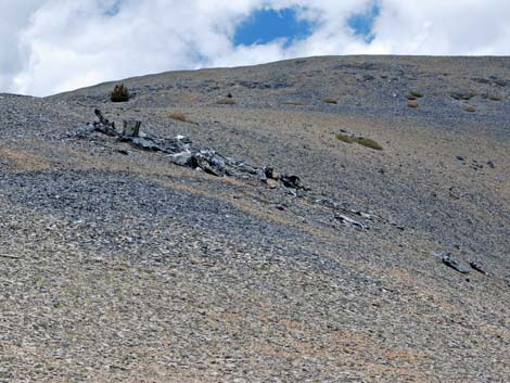
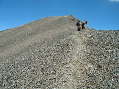
Continuing across the bowl, the trail regains the crest at the site of a plane crash (Wpt. 13) dating from 1955. What remains of the twin-engine C-54, which was being operated by the CIA, are collected in two large piles, but smaller pieces litter the hillside. This looks like a case of really bad luck. Granted the pilots were way off route, but they missed skimming over the ridge unharmed by only a few feet. From the crash site, the trail angles up onto another side-ridge that comes up from the southwest (Wpt. 14). The trail runs steeply up the north side of this ridge back to the crest, then follows the crest (nice exposure) before taking a slightly lower-angle route across the western slope for the last few minutes to the summit (Wpt. 15). The summit provides great views in all directions. To the east lie Mummy Mountain, the desert ranges beyond Mummy, and Las Vegas. To the south are Griffith Peak and Mount Potosi. To the west are Pahrump and mountain ranges in Death Valley. To the north are Mount Sterling, McFarland Peak, Mack's Peak, and the Sisters. In addition to these, hikers can see an uncountable number of other peaks, ranges, and valleys disappearing into the distance. |
 The Meadows (view NW) |
There is a weather station (in a culvert shed) on the summit powered by a solar panel that can be seen from points far below. There is also a short antenna tower (lightning rod?) by the weather station, a summit register in an ammo can, and a little quarry on the south edge of the summit that offers refuge from the wind and a possible campsite. To get back to the trailhead, retrace your steps on the South Loop Trail or continue northward on the North Loop Trail to the Trail Canyon trailhead. See photos of the return down the South Loop Trail. On the way down, stay on the trail and don't cut the switchbacks. Cutting switchbacks damages the trail and the vegetation and it makes trail conditions worse for everyone. |
 |
 |
 Burned bristlecone pines along the trail (view NW) |
 Burned bristlecone pines along the trail (view NW) |
 |
 |
 |
 |
 |
 |
 View down Kyle from the crest Canyon (view E) |
 View down Kyle from the crest Canyon (view E) |
 Burned bristlecone pines along the trail (view NW) |
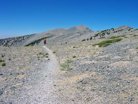
 Passing timberline (view NW) |
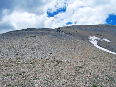
 Trees at timberline (view NW) |
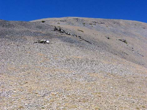
 Hiker above timberline |
 Debris litter the site of a Cold War plane crash (view N) |
 Crash site debris (CIA C-54, 1955) |
 Crash site debris (CIA C-54, 1955) |
 Crash site debris |
 The final push to the summit (view N) |
 Steep trail near summit (view N) |
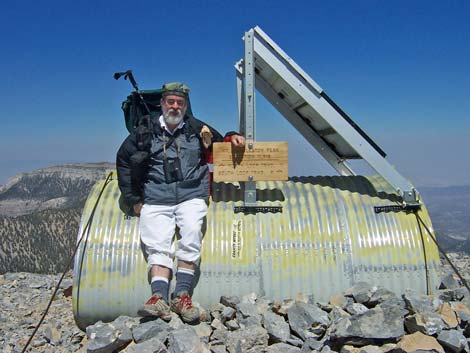 Weather station on the summit (view E) [more summit photos] |
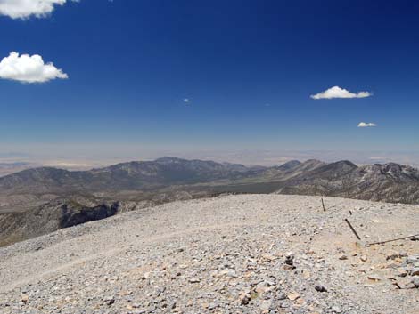 Grand view to the north [more summit scenery photos] |
Table 1. Hiking Coordinates Based on GPS Data (NAD27; UTM Zone 11S). Download Hiking GPS Waypoints (*.gpx) file.
| Wpt. | Location | UTM Easting | UTM Northing | Elevation (ft) | Point-to-Point Distance (mi) | Cumulative Distance (mi) | Verified |
|---|---|---|---|---|---|---|---|
| 01 | Cathedral Rock Trailhead | 621731 | 4013026 | 7,713 | 0.00 | 0.00 | Yes |
| 02 | Cathedral-South Loop Trail Junction | 621802 | 4012928 | 7,716 | 0.10 | 0.10 | GPS |
| 03 | Join Old Road | 622189 | 4012284 | 7,914 | 0.66 | 0.66 | GPS |
| 04 | Old Road Forks | 622517 | 4012134 | 8,186 | 0.35 | 1.01 | GPS |
| 05 | Avalanche Chute | 622283 | 4011678 | 8,586 | 0.35 | 1.36 | GPS |
| 06 | Echo Overlook | 622152 | 4011880 | 9,077 | 0.74 | 2.10 | GPS |
| 07 | Crest of the Ridge | 621303 | 4010816 | 10,741 | 2.22 | 4.32 | GPS |
| 08 | After the Meadows | 619500 | 4012137 | 10,802 | 1.58 | 5.90 | GPS |
| 09 | Rim of Kyle Canyon | 619096 | 4012848 | 11,054 | 0.54 | 6.44 | GPS |
| 10 | Ridge from the Southwest | 618179 | 4013194 | 11,328 | 0.71 | 7.15 | GPS |
| 11 | Trail to Peak Spring | 618071 | 4013381 | 11,356 | 0.14 | 7.29 | GPS |
| 12 | Peak Spring | 617100 | 4013500 | 10,370 | . | . | GPS |
| 13 | Plane Crash Site | 617329 | 4014071 | 11,424 | 0.68 | 7.97 | GPS |
| 14 | Summit Ridge | 617132 | 4014146 | 11,530 | 0.14 | 8.11 | GPS |
| 15 | Summit | 617242 | 4014665 | 11,918 | 0.39 | 8.50 | GPS |
| 01 | Cathedral Rock Trailhead | 621731 | 4013026 | 7,713 | 8.50 | 17.00 | Yes |
Happy Hiking! All distances, elevations, and other facts are approximate.
![]() ; Last updated 240329
; Last updated 240329
| Hiking Around Mt Charleston | Hiking Around Las Vegas | Glossary | Copyright, Conditions, Disclaimer | Home |