 |
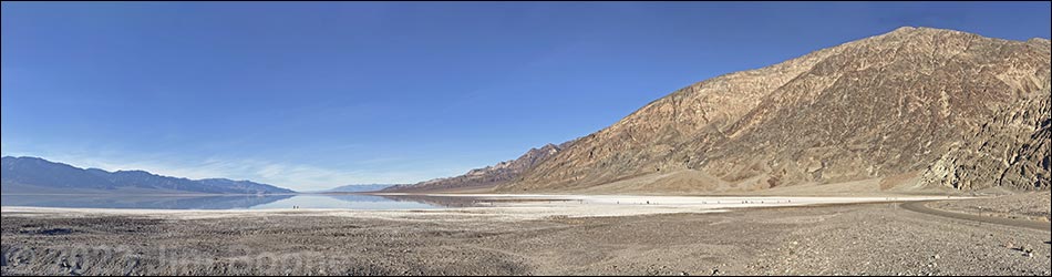
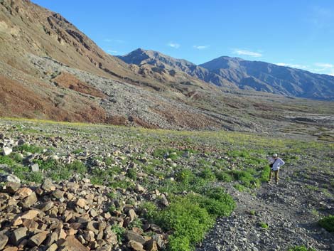
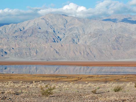
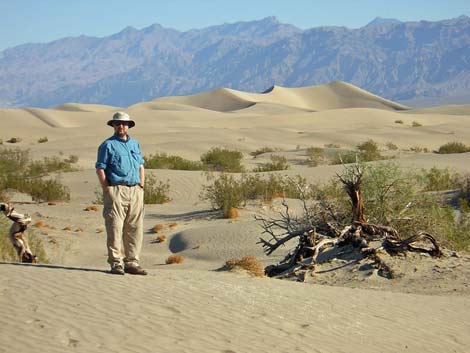
OVERVIEW Death Valley National Park, the largest national park in the continental U.S., encompasses some 3.3 million acres of the Mojave Desert in eastern California and a bit of Nevada. The land is diverse, with elevations ranging from -282 feet at Badwater (the lowest point in North America) to 11,049 feet at the summit of Telescope Peak. In this arid land, great differences in elevation lead to great differences in topography and habitat. The overwhelming impression, however, is that this land is extremely hot and dry and unencumbered by the burden of dirt and vegetation. To the untutored eye, the entire area might even look barren, and while it is true that some areas appear lifeless, most areas support at least a few species of plants and animals. Death Valley generally is warm, sunny, and dry throughout the year. Summers are unbelievably hot (temperatures commonly exceed 120 degrees) and dry, but the winters generally are mild, although with occasional bitter-cold storms. The spring and fall seasons generally are mild, but they can be windy. During summer, wear light comfortable clothes that provide sun protection (e.g., a broad brimmed hat, sunglasses, and sunscreen). Winter days might require a light jacket, but winter nights can be frigid. |
 |
Limited services (gas, food, lodging, and camping) are available at Furnace Creek, Stovepipe Wells, and Panamint Springs, and there are a number of developed campgrounds scattered throughout the central and northern portions of the park. Furnace Creek has a small store with basic camping and food supplies, and Stovepipe Wells has snacks and milk. This is wild and remote country, so plan ahead and bring what you need. Always carry extra drinking water in your vehicle. GETTING TO DEATH VALLEY NATIONAL PARK Link to map. Death Valley National Park is located west-northwest of Las Vegas, about 2.5 hours from downtown. The easiest way to get there from Las Vegas is to drive north on Highway 95 for about 90 miles to Amargosa Valley (Table 1, Site 0689). Turn left (south) on Highway 373 and drive south into California for about 23 miles to Death Valley Junction (Site 0345). Turn right (west) onto Highway 190, and drive west on Highway 190 for about 30 miles to the Furnace Creek Visitor Center (Site 0712), on the left. Exhibits in the Visitor Center provide a good introduction to the area, and rangers are available to answer questions. |
 |
Alternatively, a somewhat shorter route runs west out of Las Vegas on Highway 160. Drive west on Highway 160 for about 60 miles to Pahrump. In Pahrump, about 3 miles north of downtown (Site 0719), turn left (west) onto Bell Vista Avenue (the highway sign reads Bell Vista "Road"). Drive west on Bell Vista for about 25 miles to Highway 127 at Death Valley Junction and the Amargosa Opera House. Turn right (north) onto Highway 127 and drive north for a few hundred yards to Highway 190 (Site 0345), which is on the north side of town. Turn left (west) onto Highway 190, and follow it for 30 miles to the Furnace Creek Visitor Center (Site 0712). The Visitor Center provides a good introduction to the area. HOURS The park is always open, but some hiking areas are day-use only. ENTRANCE FEES Entrance fees are $25 per private vehicle or $12 per person (on foot, horseback, or bicycle) for a 7-day pass (Golden Eagle and other passes accepted). Other fees apply to other situations; check the park website for details. Campground fees range from free to $22 per night. |
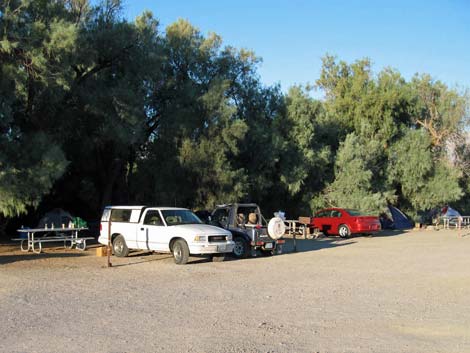 Front-country Camping |
CAMPING Front-Country Camping In front-country areas, camping is permitted only in developed campgrounds, although I use the term "developed" loosely, as most of the "developed campgrounds" in this National Park are among the worst in America. In campgrounds designed for RVs, "development" historically has meant chalk lines on a dirt parking lot. In recent years, some RV areas are paved with painted lines. In "tent areas," expect to find picnic tables and fire rings. All low-elevation campgrounds have water and flush toilets. For details on each campground, see the Death Valley campgrounds page. |
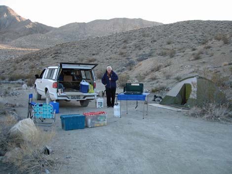 Back-country Camping |
Back-Country Camping There are three designated backcountry campgrounds in the park, but backcountry camping, camping outside of developed campgrounds, is permitted in most of the park. However, backcountry camping is prohibited on the floor of Death Valley, proper, near paved roads, and in day-use areas. In the bottom of Death Valley, from 2 miles north of Stovepipe Wells southward to Ashford Mill, backcountry camping is not permitted except at least 1 mile up side roads. Above the floor of Death Valley, proper, and away from paved roads, most places are open to "roadside car camping" and backpacking unless they are (1) designated day-use-only or (2) less than 1 mile from a paved road or day-use area. This is the general rule, but review the specifics on the park website or talk with the rangers at the Visitor Center, as there are exceptions such as Titus Canyon where camping is prohibited entirely. Camping along some dirt roads is regulated and requires a permit. Roadside camping along Echo Canyon Road, Hole in the Wall Road, Cottonwood Canyon Road, Marble Canyon Road is allowed only in designated sites with a permit. Camping along Greenwater Valley (Furnace Creek Wash) Road also requires a permit. These permits are available only in person at the Furnace Creek Visitor Center. |
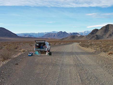 Roadside camping |
In some cases, roadside car camping literally is "roadside camping." For example, the NPS has been grading the Racetrack Road for years, and now there are big berms on both sides of the road that prevent campers from even thinking about pulling off the road to camp. Thus, along the 18-mile section of the Racetrack Road that is open for roadside camping, there are only 2-3 places where you can even pull off the road. Without knowing this in advance (and don't count on the rangers telling you), you are likely to drive past the two campsites near Ubehebe Crater (because they are too close to the road, don't look that nice, and are too close to civilization). Then, after driving for some 1.5 hours and 17 miles, you will give up and "camp" in a pullout where thoughtless drivers will race by and throw up big clouds of dust in your face. There is, as it turns out, a "camping area" by Teakettle Junction where you can get a couple of feet off the road. This problem might not be so bad in other parts of the park, but it is a problem. Permits are also required for overnight backpacking trips on the Cottonwood Canyon - Marble Canyon Loop. |
 |
PERMITS Hiking and backpacking permits generally are not required. However, the park has a voluntary backcountry registration system, which they encourage people to use. The rangers say that the permits are for hiker safety, but it seems that they really just want visitor-use statistics (nobody will look for you if you don't check out). As responsible hikers, we ought to use the permit system just so the park can get the data, and hopefully the data will help the NPS better manage the backcountry. Voluntary permits are available at ranger stations, but most seem to be always closed, so try to get one at the Visitor Center. If you arrive too late to pick up a permit, don't worry about it; go on your hike and give them the data when you get out. So far, the only exception to the general rule is the Cottonwood Canyon - Marble Canyon Loop where overnight backpacking trips require a permit. These permits are available online. |
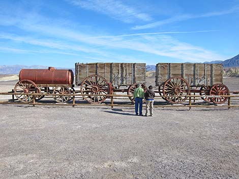 |
HISTORY Death Valley has a long history of human use. Native Americans lived here for centuries and left their marks in many places. Later, ill-prepared white settlers crossed the valley (thinking it was a shortcut to the Promised Land of California) and left behind a tale of determination and survival that still colors our view of Death Valley and American history. More recently, miners swarmed the area building roads and trails to extract valuable minerals. Their legacy provides us with many great hiking opportunities (i.e., old roads and interesting destinations). The most famous miners probably were associated with the 20 Mule Team Borax Works, entering legend through television during the 1960s. The Furnace Creek Visitor Center has nice exhibits on human history in the park, and some information is available on the park website. |
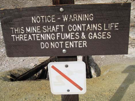 |
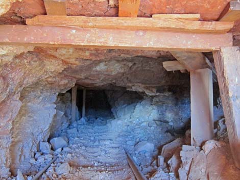
WATCH OUT Death Valley is an arid land subject to extremes of temperature. During summer, the floor of Death Valley is extremely hot, with temperatures typically exceeding 120 degrees. During hot weather, be very careful and carry lots of water. Don't count on the air conditioner in your vehicle to keep you cool. During winter, the valley and surrounding mountains can be bitter cold, especially if the wind is blowing. Plan ahead a dress accordingly. Although Death Valley is extremely arid, heavy rains and flash floods occur regularly. Stay out of washes and canyons when flash floods threaten. Don't camp in washes or narrow canyons. The summer heat combined with low humidity creates the potential for quick and extreme dehydration -- drink lots of water or sports drinks even if you think you don't need it. The historical mining activity left behind many interesting old townsites, buildings, artifacts, and mines that are fun to explore. Beware, however, that wooden floors can give away, roofs can collapse, and it is never safe to enter old mines; apply the "look but don't touch" rule. |
 |
If your vehicle breaks down and you are stuck out in the desert, stay with your vehicle. Your vehicle has lots of things that you can use to help survive a night out in the desert, and it is a lot easier for search teams to find a vehicle in the vast desert than it is to find a person. The park has a patrol plane, and it is a lot easier for the pilot to see your vehicle than it is to see you. Some years ago, I was out hiking just after dawn in the south end of the park. The patrol plane came over from the other side of the valley and flew low over my truck to check me out, but he didn't seem to notice me standing on a ridge a short distance away. Be sure to review the standard warnings about hiking in the desert. |
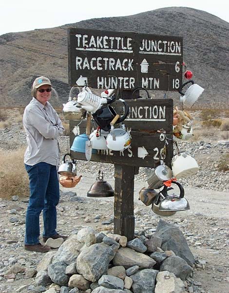 Original Teakettle Junction sign |
SOME RULES AND REGULATIONS This is a National Park, so keep some regulations in mind. Collecting or disturbing animals, plants, rocks, or other natural, historical, or archeological features are prohibited. Don't feed or disturb wildlife, including coyotes, roadrunners, and ravens. All vehicles must remain on established roads. Keep pets confined or leashed (6 feet or shorter) at all times, and pets are allowed only in developed areas and along roads, not on trails. Don't litter. Fires are permitted in developed campgrounds only, collecting wood (including dead-and-down wood) is prohibited, and fires are not permitted in the backcountry (not even for cooking, so bring a stove). FOR MORE INFORMATION Visit the Death Valley website or visit the park. The Furnace Creek Visitor Center is open all year (8 or 9 AM to 5 PM, depending on season) with exhibits on geology, climate, wildlife, natural history, human history, and the pioneer experience in the park. The park puts a daily notice (the Morning Report) on their website that summarizes current weather conditions, the road status, and other important and timely information. Park maps are available online. Even more information is available by writing (Superintendent, Death Valley National Park, P.O. 579, Death Valley, CA, 92328-0579) or calling the Visitor Center (760-786-3200). |
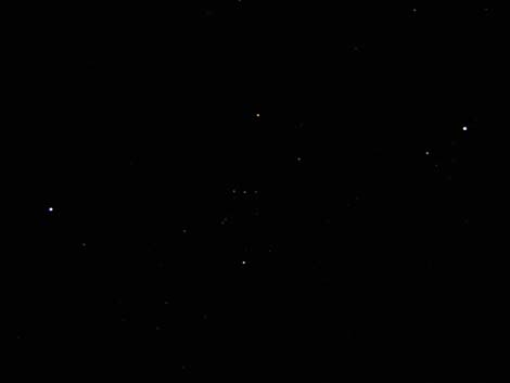 Death Valley is known for amazingly dark night skies |
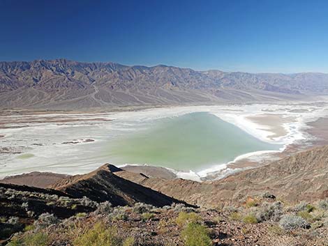
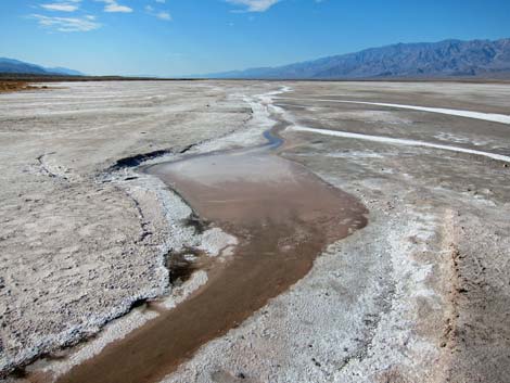
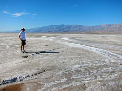
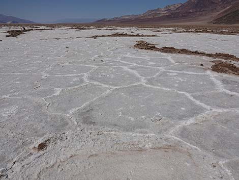 Badwater Basin |
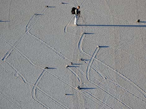 Moving rocks at the Racetrack |
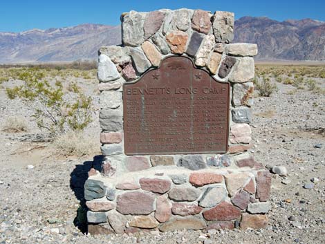 Bennett's Long Camp: campsite of the original Death Valley Party |
 |
 |
 |
 |
 |
 |
 |
 |
 |
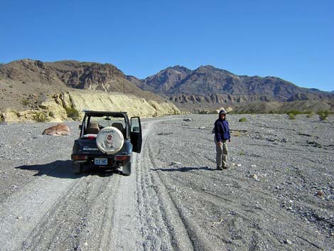 |
Table 1. Highway Coordinates (NAD27; UTM Zone 11S). Download Death Valley Area GPS Waypoints (*.gpx) file.
| Site | Location | Latitude (N) | Longitude (W) | Easting | Northing | Elevation (ft) | Verified |
|---|---|---|---|---|---|---|---|
| 0345 | Death Valley Junction | 36.30465 | 116.41433 | 552583 | 4017697 | 2,045 | Yes-2 |
| 0689 | Hwy 95 at Hwy 373 | 36.64387 | 116.39954 | 553676 | 4055332 | 2,660 | Yes |
| 0712 | Furnace Creek Visitor Center | 36.46159 | 116.86574 | 512030 | 4034954 | -186 | Yes |
| 0719 | Highway 160 at Bell Vista (Pahrump) | 36.26375 | 116.00232 | 589622 | 4013463 | 2,647 | Yes-2 |
Happy hiking! All distances, elevations, and other facts are approximate.
![]() ; Last updated 240322
; Last updated 240322
| Hiking Around Las Vegas | Glossary | Copyright, Conditions, Disclaimer | Home |