Hiking Around Las Vegas, Death Valley National Park
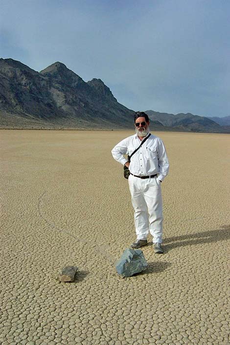
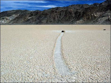
 South end of Racetrack Playa (view SE) |
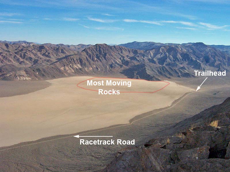
Overview This is an easy walk in an interesting place in the Death Valley Wilderness Area where rocks fall off a hillside and land on the surface of a lakebed that is dry most of the time. The rocks then slide on the mud under the force of mechanisms that geologists do not entirely understand but are linked to ice forming on the playa, then breaking into sheets under the force of wind, and the sheets of ice push the rocks about. Plowing across the surface of the playa, the rocks leave unusual "racetrack" marks in the mud. This is an oddity of nature in a remote and picturesque place that is worth seeing. The hike is entirely flat. Stay off the mud if it is wet because footprints in the mud scar the surface of the playa and take years to disappear. The access road is an adventure in itself, so come prepared. Link to map. Link to more photos. |
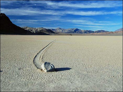
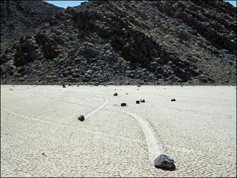
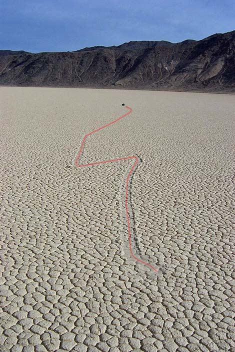 Zig-zag racetracks (view N) |
Watch Out Other than the standard warnings about hiking in the desert, ...this is an entirely safe hike, but be sure that your vehicle is in good working condition, carry plenty of water (radiator and drinking), pack a lunch, and drive slowly and carefully. Stay off the playa if it is muddy, as your footprints will scar the surface for years. While hiking, please respect the land and the other people out there, and try to Leave No Trace of your passage. This is a short walk, so you don't need to bring the 10 Essentials. Getting to the Trailhead Racetrack Playa is located in Death Valley National Park, about 5-6 hours northwest of Las Vegas. From town, drive out to Death Valley. From the Furnace Creek Visitor Center (Table 1, Site 0712), drive north and west to the south end of Racetrack Playa (Site 0759), where there is a wide parking area on the left (east) side of the road and a sign. For details on getting to Racetrack Playa, see the description of the Racetrack Road. Park here; this is the trailhead. The Hike From the trailhead (Table 2, Waypoint 01), walk east and out onto the playa. The sliding rocks start about halfway to the other side of the southern end, and the best marks are in the southeastern corner of the playa (Wpt. 02). There is no trail, so just walk out on the playa, walk around looking at things, enjoy the scenery and the wild rocks, and then wander back to the trailhead. You can see the parking area from everywhere on the playa, so there should be no chance of getting lost during daylight. Link to more photos. |
 Rocks on the playa (view SW) Rocks on the playa (view SW) |
 Rocks on the playa (view N towards Ubehebe Peak |
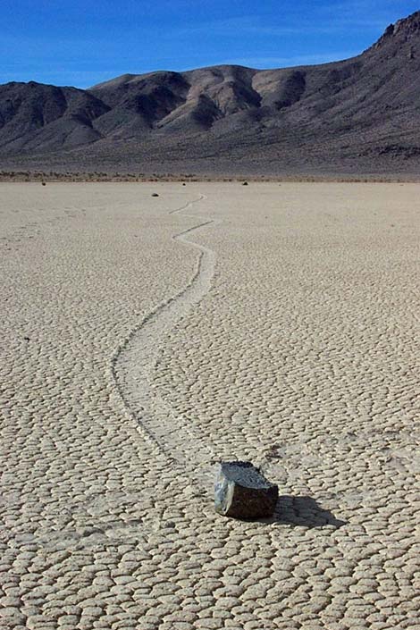
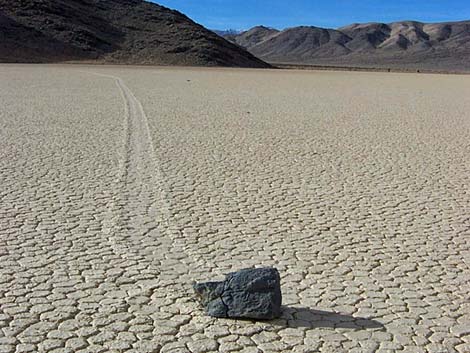 Track in the mud and rock (view S) |
 Track in the mud and rock (view N) |
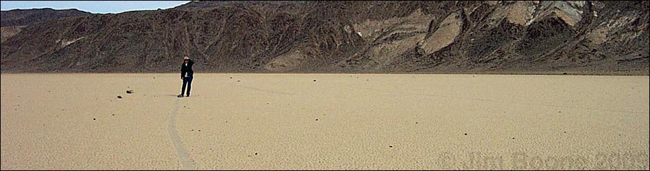
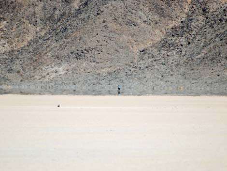 Mirage and human on the playa |
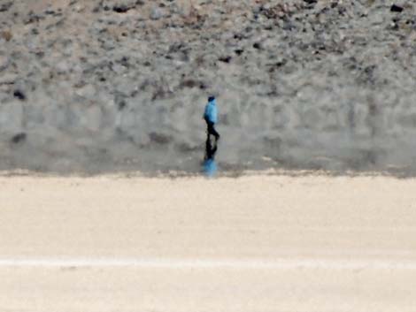 Mirage and human on the playa |
 Rocks and tracks (view S) |
 Rocks and tracks (view N) |
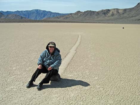 Sit on a rock, or ... |
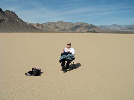 ... bring a chair |
Table 1. Road Coordinates (NAD27; UTM Zone 11S). Download Highway GPS Waypoints (*.gpx) file.
| Site # | Location | Latitude (N) | Longitude (W) | Easting | Northing | Elevation (ft) | Verified |
|---|---|---|---|---|---|---|---|
| 0712 | Furnace Creek Visitor Center | 36.46159 | 116.86574 | 512030 | 4034954 | -186 | Yes |
| 0759 | Racetrack Rd at Racetrack Parking | 36.66562 | 117.56740 | 449293 | 4057727 | 3,716 | Yes |
Table 2. Hiking Coordinates Based on GPS Data (NAD27, UTM Zone 11S). Download Hiking GPS Waypoints (*.gpx) file.
| Wpt. | Location | Easting | Northing | Elevation (ft) | Verified |
|---|---|---|---|---|---|
| 01 | Racetrack Playa Trailhead | 449293 | 4057727 | 3,716 | GPS |
| 02 | Southeast corner of the playa | 450378 | 4057760 | 3,716 | GPS |
Happy Hiking! All distances, elevations, and other facts are approximate.
![]() ; Last updated 240324
; Last updated 240324
| Death Valley | Hiking Around Las Vegas | Glossary | Copyright, Conditions, Disclaimer | Home |