Hiking Around Las Vegas, Gold Butte National Monument
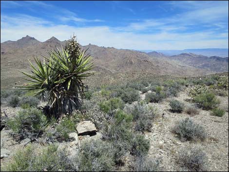
 Windmill Mine Road trailhead (view S) |
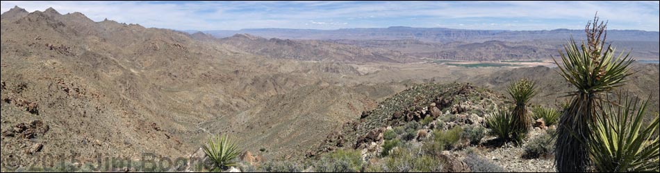
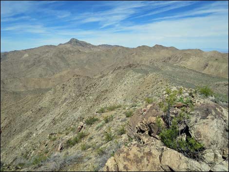
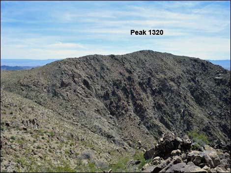
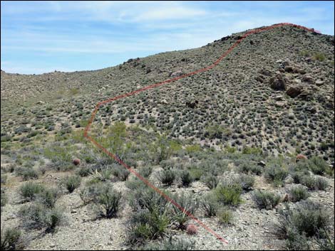
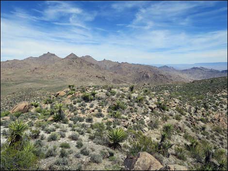
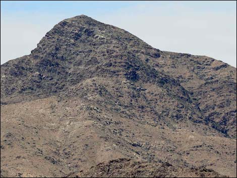
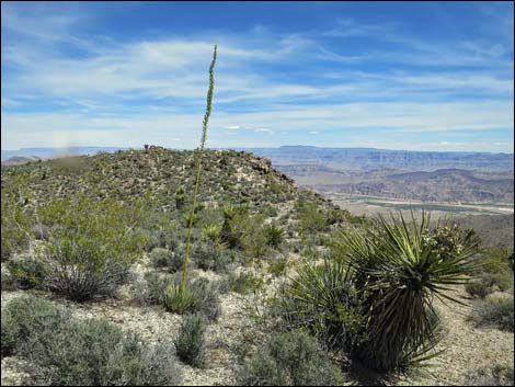
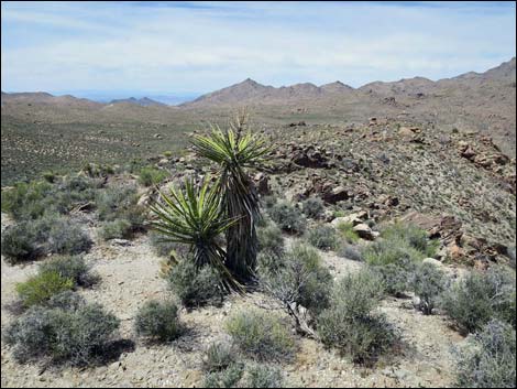
Overview Jumbo Springs Wilderness Area, located at the far southern end of Gold Butte National Monument, is extremely remote, steep, and rocky. It is so steep and rocky that there are few places where even hardy hikers can penetrate the boundaries -- truly a desert land best left to the lizards. The 3-mile Southern Ridges Loop route barely penetrates the wilderness area. Instead, the route climbs onto a ridgeline that more-or-less serves as the boundary for the wilderness area. Traversing the ridge, hikers can get views of the wilderness area better than those from within the boundaries, although technically parts of the ridge are inside the wilderness area. From Peak 1320 (1.28 miles out), hikers can return back along the ridge or make a loop returning through Jumbo Basin, the broad valley to the north. The route leads hikers to surprisingly grand views that stretch from the Grand Wash Cliffs in Northern Arizona to high peaks in southern California.Link to hiking map. |
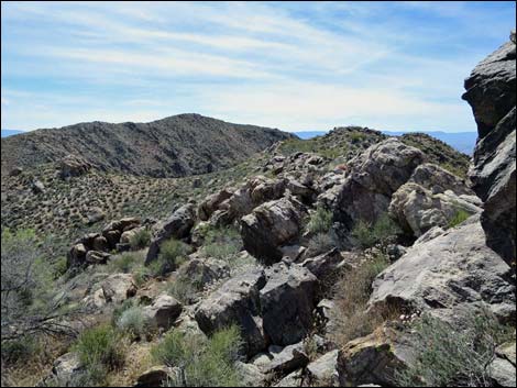
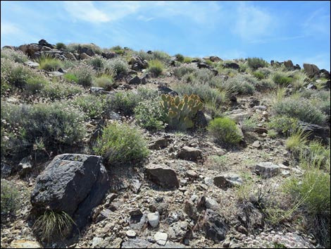
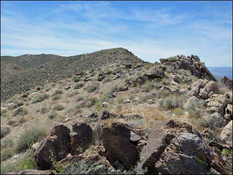
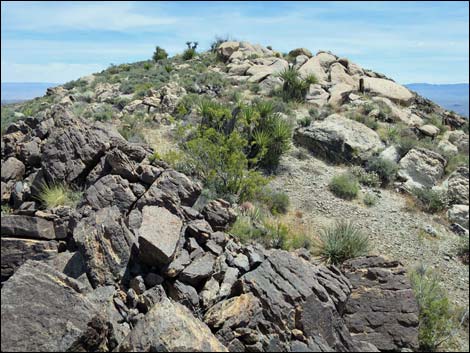
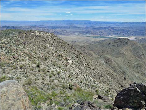
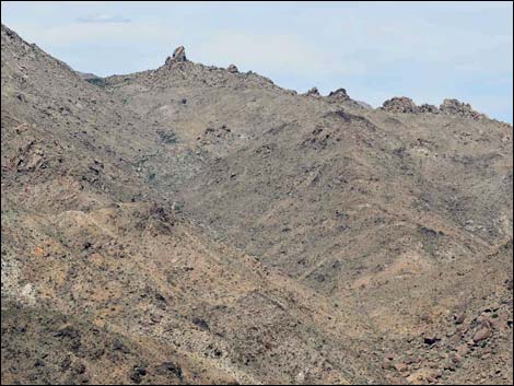
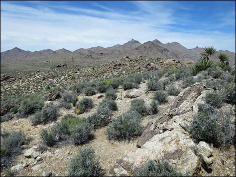
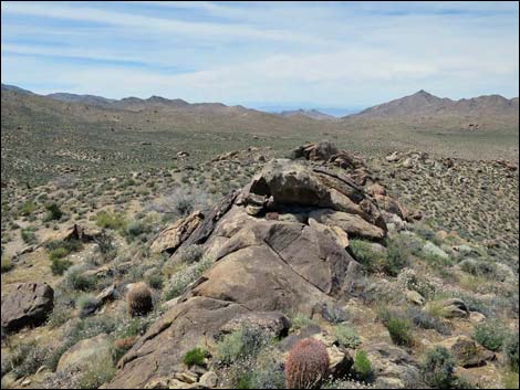
 Hillside (view SE towards highpoint on the ridge) Hillside (view SE towards highpoint on the ridge) |
Watch Out Other than the standard warnings about hiking in the desert, ... this is a wild and remote area without services of any kind (no restrooms, no water, no gas, no food). Bring what you need to survive. Be prepared and be self-reliant. It is a big place, but someone will eventually find you if you stay on a main road, but be prepared to survive alone for a day or two, or even longer on side roads. Consider signaling the tourist helicopters that traverse the area coming and going from the Grand Canyon. This hike is relatively safe, but be extra careful on rocky outcrops and in places where hikers could fall into the wilderness area. While out, please respect the land and the other people out there, and try to Leave No Trace of your passage. Also, this is a remote area, so be sure to bring the 10 Essentials. |
 |
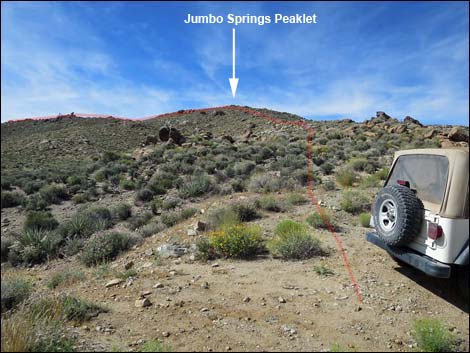
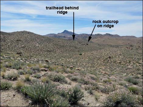
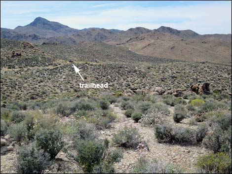
Getting to the Trailhead The Southern Ridges Route and the Jumbo Springs Wilderness Area is located out in Gold Butte National Monument at the northeast end of Lake Mead, about 5 hours northeast of Las Vegas in a wild, remote, and scenic area. From town, drive out to Gold Butte National Monument. From Whitney Pocket, continue south on the unpaved Gold Butte Road to Gold Butte Townsite. From the townsite, Scanlon Road is the main road running southwest. Drive south on Scanlon Road for 13.8 miles to Windmill Mine Road. When Scanlon Road turns right down a wash, continue straight south on Windmill Mine Road. Windmill Mine Road forks about 0.4 miles out. Stay left to the turn-about at the end of the road (0.5 miles out). Don't follow the faint spur road left from the turn-about. Park here at the turn-about; this is the trailhead. |
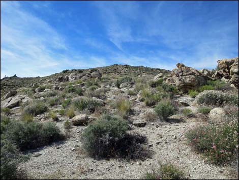 |
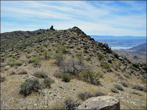
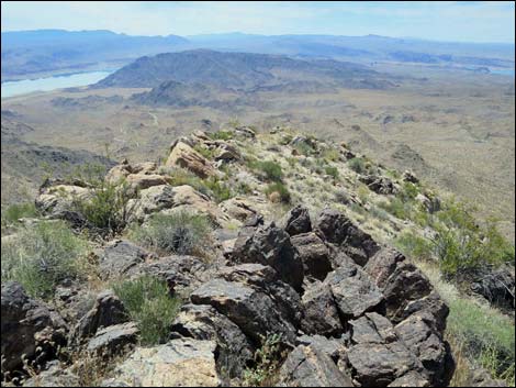
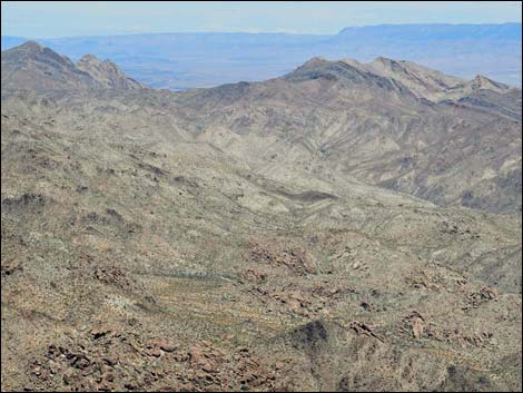
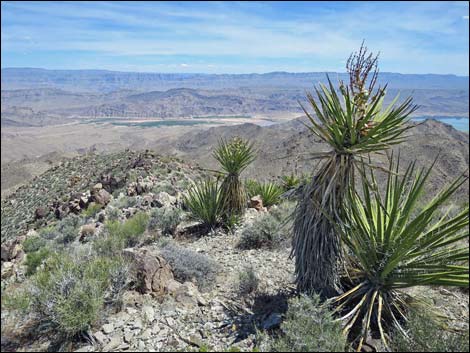
The Hike From the trailhead (Table 1, Waypoint 01), the route runs south towards a highpoint on the ridgeline (Jumbo Springs Peaklet). Hikers seem to enter the wilderness area about half-way to the ridgeline (Wpt. 02), but boundary lines on the map don't make geographic sense. Jumbo Springs Peaklet (Wpt. 03) is only 0.21 miles out and barely 200 feet above the trailhead, but climbing onto the summit feels like arriving at the top of the world. Grand views of the south-facing slopes of Jumbo Springs Wilderness Area spread out below, and for those wishing only to visit the wilderness area, this view is about as good as it gets. More broadly, views from Jumbo Springs Peaklet cover a vast landscape, including the Grand Wash Cliffs in Arizona, the mouth of the Grand Canyon, the Colorado River, peaks down across Arizona, Lake Mead, Mt. Potosi southwest of Las Vegas, Bonelli Peak, Valley of Fire, the Sheep Range, and the Jumbo Peak mountains. |
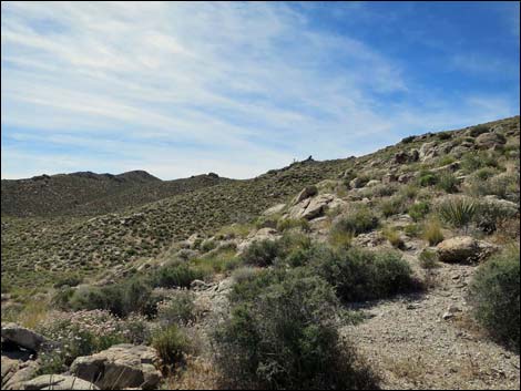 Hillside (view SE towards highpoint on the ridge; Wpt. 05) Hillside (view SE towards highpoint on the ridge; Wpt. 05) |
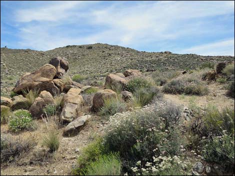
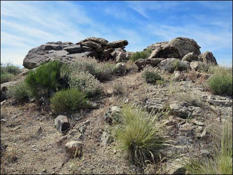
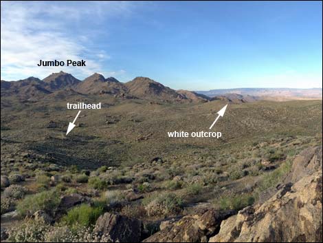
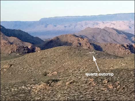
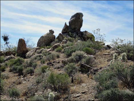
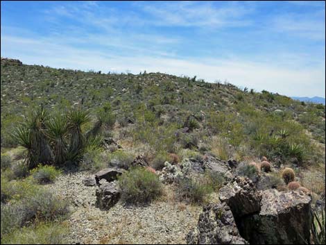
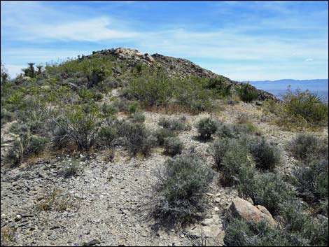
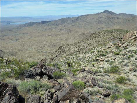
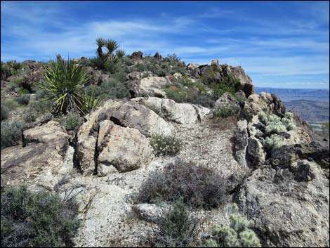
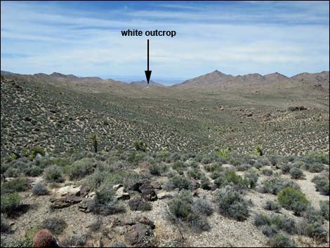
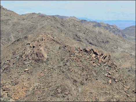
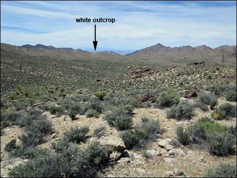
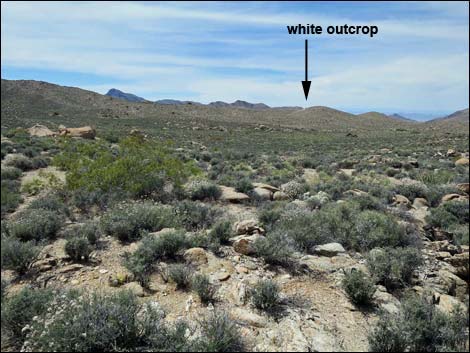
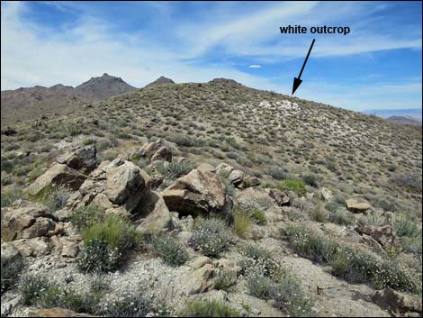
Atop Jumbo Springs Peaklet, hikers planning to do the loop should look northeast (54° true) and take note of an unusually large outcrop of bright-white quartz that can be seen near a hilltop in the distance (0.4 miles out; twice the distance back to the trailhead, which is also visible). This white outcrop serves as a useful landmark during the return across Jumbo Basin. Take note of it here, but relocate it from time to time while hiking along the ridgeline as the view changes. From Jumbo Springs Peaklet (Wpt. 03), the route turns left and runs southeast along the top of the ridge. Passing a rock spire, the route continues southeast. When the ridge turns northeast, a rocky point juts out to the south. Out on the point, Jumbo Springs Overlook (Wpt. 04), hikers get a bird's eye view of Jumbo Springs Wilderness Area. Although not a summit, this is a great place to stop for lunch, or at least a place to stop and contemplate the meaning of wilderness. Except for aircraft and a few structures in the haze to the south, the entire view is wild county unblemished by modern civilization. Continuing northeast along the ridgeline, the route dips through a saddle (Wpt. 05), then turns southeast and climbs back along the ridgeline to another highpoint (Wpt. 06), again with grand views. |
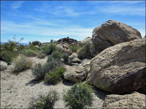
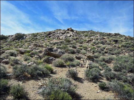 Approaching Jumbo Springs Peaklet |
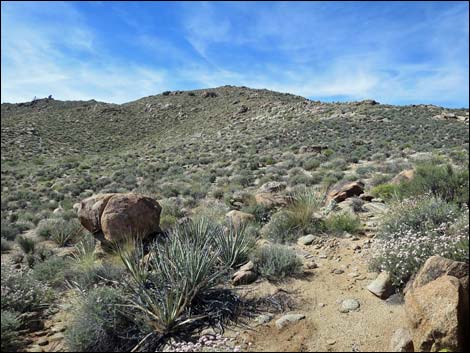
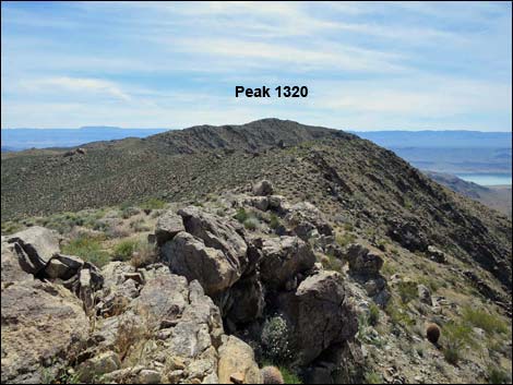
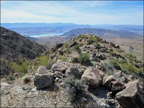
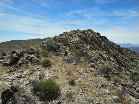
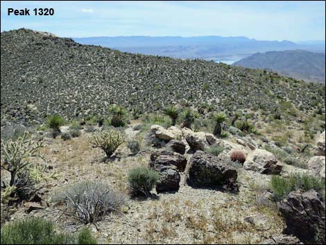
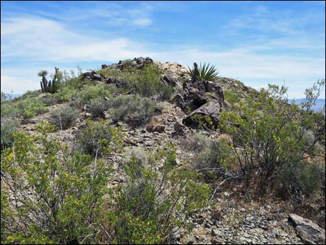
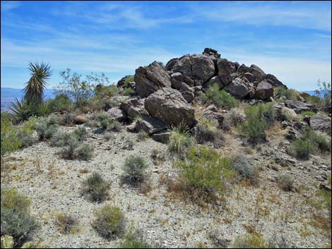
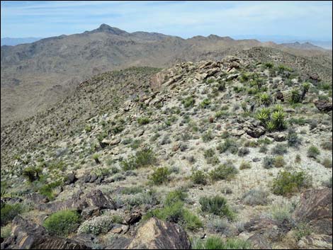
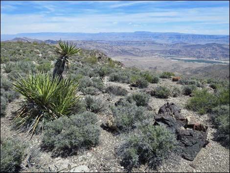
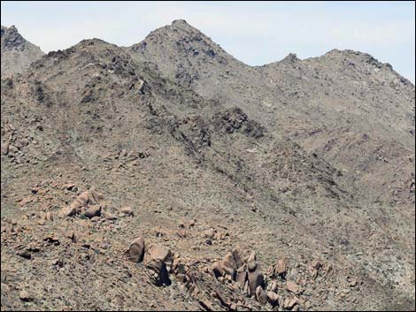
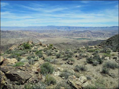
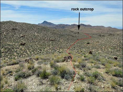
Continuing southeast and dipping through a second saddle, this one not so low, the route climbs the ridgeline again and soon arrives at Peak 1320 (Wpt. 07). Note that 1,320 is the elevation (in meters) marked on the USGS topo map, which is 4,331 ft. In contrast, the river below is only 330 m (1080 ft), about 3,000 feet difference, making this similar to standing atop El Capitan in Yosemite and looking down at the floor of Yosemite Valley. Peak 1320 lies at a bend in the ridge, making this the southeast most point along the ridgeline and providing views from the northwest around the south to the northeast: more than a 180-degree view of the southern slopes of Jumbo Springs Wilderness Area. Peak 1320 has a rocky cap that makes for a nice place to sit, admire the view, and eat lunch. During spring migration, hawks, vultures, and other soaring birds use updrafts along these south-facing slopes to speed their journey to the breeding grounds farther north. From Peak 1320, be sure to keep an eye on the white-quartz outcrop, now off to the northwest. |
 Arriving at Jumbo Springs Peaklet (Wpt. 03) |
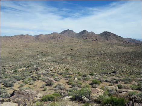
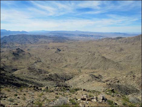
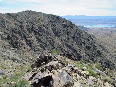
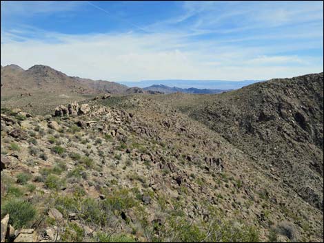
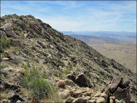
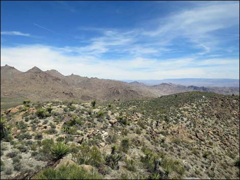
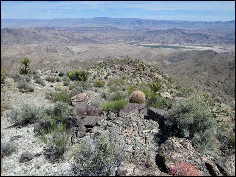
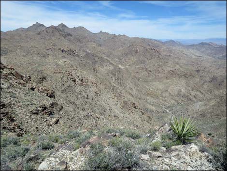
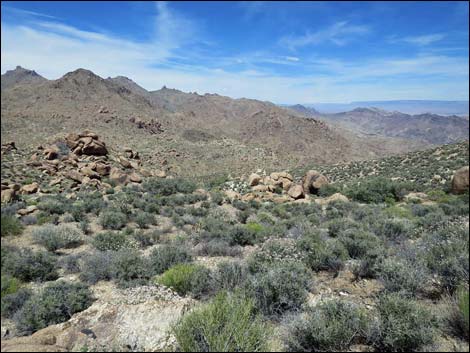
Continuing along the ridgeline beyond Peak 1320, the route runs northeast and down from the highpoint. The ridgeline eventually ends at an overlook (Wpt. 08) that provides perhaps the best view out across Jumbo Springs Wilderness Area. While the view from Peak 1320 is grand, it only overlooks the southern slopes of the wilderness area. From the overlook, views north through east survey the heart of the wilderness area, and from here, it is even more apparent that this is a wild land most fit for lizards: vast, steep, unencumbered by vegetation, and rocky. From the overlook (Wpt. 08), the route turns northwest running down what seems like a sideridge and exits (Wpt. 09) the wilderness area. Again, the boundary line makes no sense geographically. Although it seems like a sideridge, this is the main ridge and provides additional views off the edge into the wilderness area. The route runs down the ridge to another overlook (Wpt. 10) that provides the last grand view out into Jumbo Springs Wilderness Area. |
 Jumbo Springs Peaklet (view W towards Bonelli Peak; south-facing slopes are in the wilderness area) |
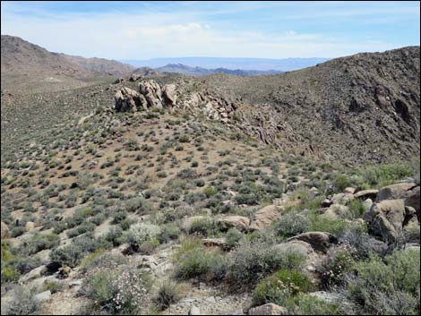
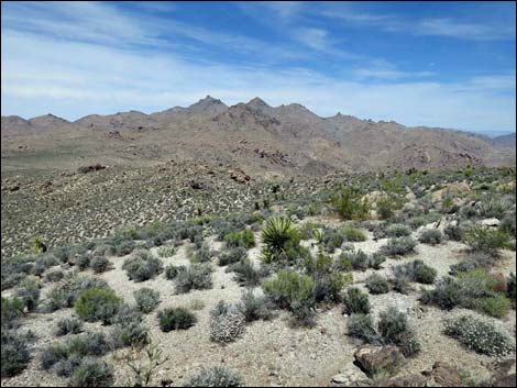
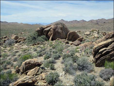
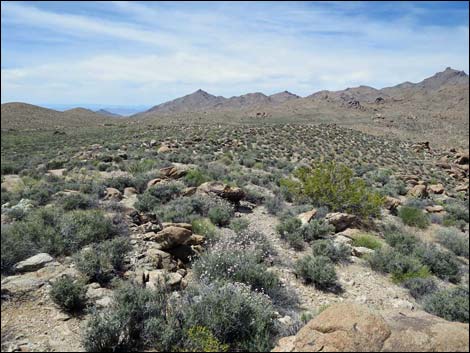
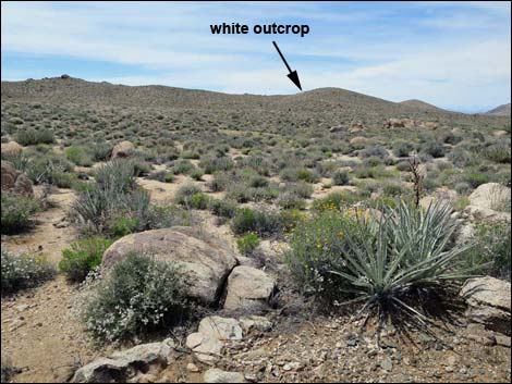
Turning more to the west, the route starts out across the broad, rolling Jumbo Basin. Keeping an eye on the white-quartz outcrop, the route runs west-northwest towards the outcrop. Rolling terrain like this is difficult to traverse with map-and-compass, so keep an eye on the quartz outcrop. The route eventually runs through a low point off the north edge of a ridge (Wpt. 11), then approaches the isolated hill holding the white-quartz outcrop. The quartz outcrop is located high on the side of an isolated hill. The route, however, runs west and up the valley on the south side of the hill. Except for geological curiosity, there is no need to climb to the quartz outcrop. Continuing west, the route follows the valley up to a north-south running ridgeline (Wpt. 12) and crosses into the valley on the other side. Running down the next wash, the route passes a rocky crag on the left, then turns left over the ridge, and from there the trailhead (Wpt. 01) can be seen not far off to the southwest. |
 Jumbo Springs Peaklet (view N towards Jumbo Peak) |
 Jumbo Springs Peaklet (broad view NE towards quartz outcrop) |
 White quartz outcrop (zoom view NE from Jumbo Springs Peaklet) |
 Jumbo Springs Peaklet (view SE towards Peak 1320) |
 Jumbo Springs Peaklet (view SW across the wilderness area) |
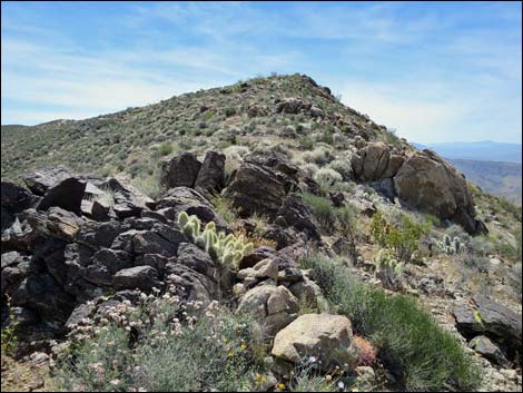
 Ridgeline past JS Peaklet (view SE towards rock spire) |
 Approaching rock spire (view SE) |
 Rock spire (view SE along rocky ridgeline) |
 Approaching Jumbo Springs Viewpoint (Wpt. 04; view SE) Approaching Jumbo Springs Viewpoint (Wpt. 04; view SE) |
 Jumbo Springs Viewpoint (view ESE; slopes are in wilderness) |
 Jumbo Springs Viewpoint (view S; slopes are in wilderness) |
 Jumbo Springs Viewpoint (view E towards Peak 1320) |
 Continuing out the ridge (view NE) |
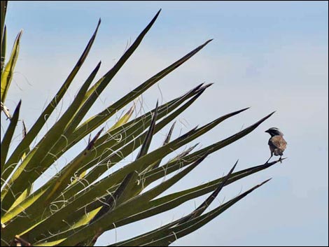 Black-throated Sparrow on Mojave Yucca |
 Route runs down the ridgeline (view NE) |
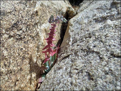 Chalk Dudleya |
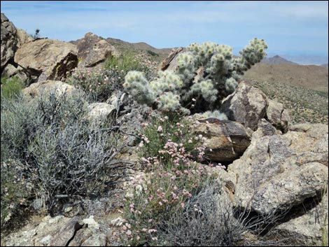 Lots of Blue-diamond Cholla along the ridge |
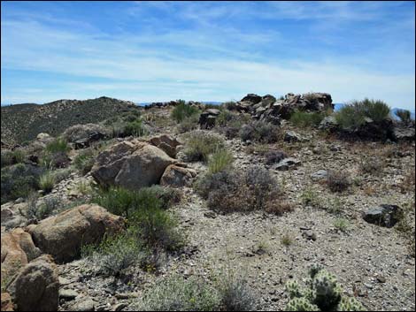
 Gentle ridgeline (view NE) |
 Route drops through deep saddle on the ridgeline (view NE) |
 Crossing the saddle (Wpt. 05), route continues along ridge (view E) |
 Beyond the saddle, the ridgeline is fairly steep (view SE) ... |
 ... but the crest is gentle, if a bit rocky (view SE) |
 The steep slope is in the wilderness area (view SE) |
 Lots of false summits along the rocky ridge (view SE) |
 Another false summit along the rocky ridge (view SE) |
 Approaching highpoint (Wpt. 06) along this part of ridge (view SE) Approaching highpoint (Wpt. 06) along this part of ridge (view SE) |
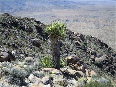 Mojave Yucca stands as a sentinel guarding wilderness slopes |
 Route drops through shallow saddle before true summit (view SE) |
 Crossing the shallow saddle (view ESE) |
 Route continues up the ridgeline (view E) Route continues up the ridgeline (view E) |
 Route continues along the ridgeline (view E) |
 Route continues along the ridgeline (view E) |
 True summit finally comes into view (view E) |
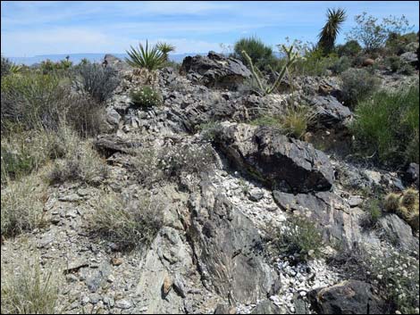 Veins of white quartz and sparkly mica (view E) |
 Approaching Peak 1320 (view SE) |
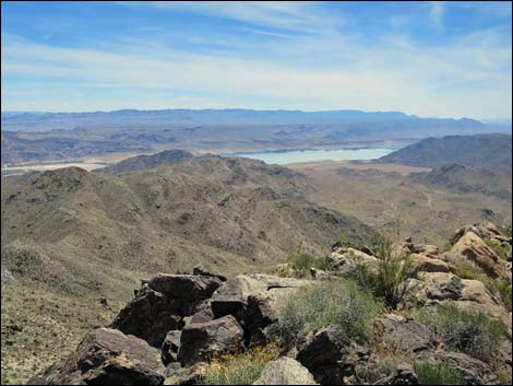
 Peak 1320 (view S towards Lake Mead) |
 Peak 1320 (view SW; slope in wilderness) |
 Peak 1320 (view SW back along the route; slope in wilderness) |
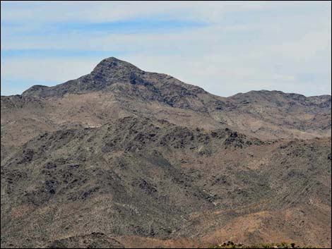
 Peak 1320 (view NE towards Jumbo Peak) |
 Peak 1320 (view E towards Grand Wash Cliffs; slope in wilderness) |
 Peak 1320 (view SE; slope in wilderness) |
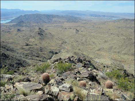
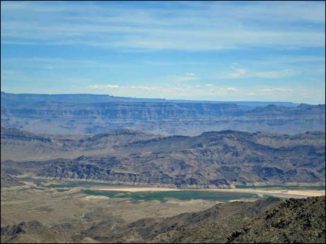 Peak 1320 (view SE towards Colorado River Delta) |
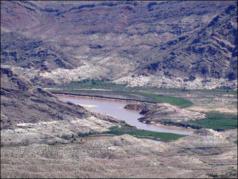 Peak 1320 (view SE; Colorado River exiting Grand Canyon, zoom) |
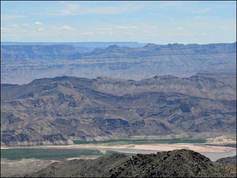 Peak 1320 (view SE; end of Colorado River Delta) |
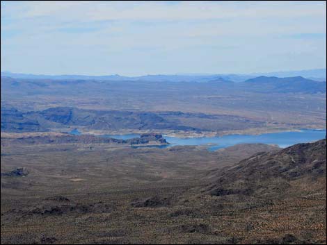 Peak 1320 (view SW towards Lake Mead and Temple Bar) |
 Peak 1320 (view SW; Temple Bar, zoom) |
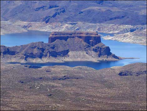
 Peak 1320 (view W; Bonelli Peak) |
 Peak 1320 (view W; Bonelli Peak, zoom) |
 Continuing out the ridge (view NE) |
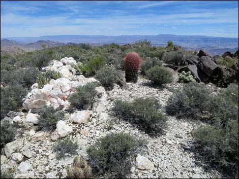 White quartz, Barrel Cactus, and Blue-diamond Cholla |
 Mojave Yucca and Blackbrush along the ridgeline (view SE) |
 Mojave Yucca along the ridgeline (view NE) |
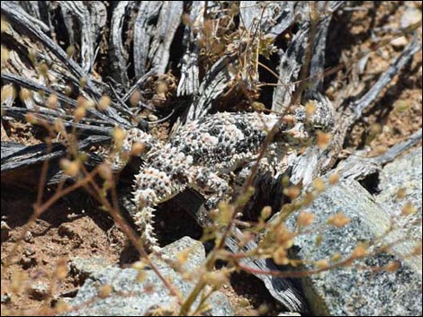 Cryptic resident: Desert Horned Lizard |
 Buckhorn Cholla in flower (view E) |
 Route continues down the ridgeline (view NE) |
 Blooming Utah Agave along the ridgeline (view E) |
 Route along edge of the ridgeline (view NE) |
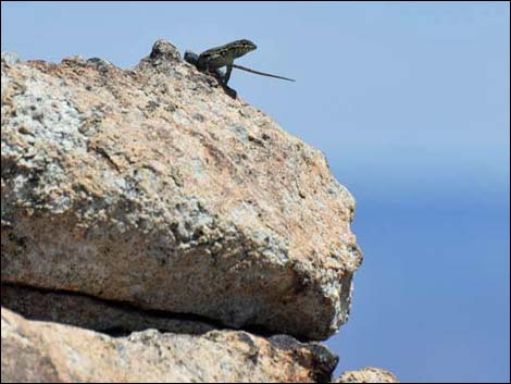 Another local resident: Side-blotched Lizard |
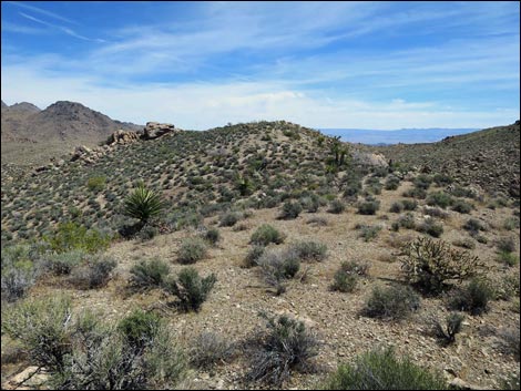
 Ridgeline begins to curve northwards |
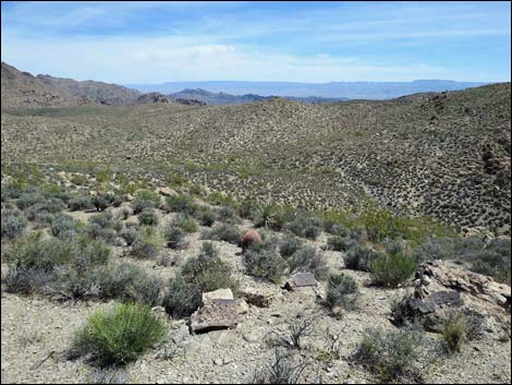
 Jumbo Basin (view NE towards white-quartz outcrop) |
 Approaching Jumbo Springs Overlook (view E) |
 JS Overlook (view NE; best view of Jumbo Springs Wilderness Area |
 JS Overlook (view N; Jumbo Springs Wilderness Area; zoom) |
 JS Overlook (view NNE; Jumbo Springs Wilderness Area; zoom) |
 JS Overlook (view NE; Jumbo Springs Wilderness Area; zoom) |
 JS Overlook (view ENE; Jumbo Springs Wilderness Area; zoom) |
 JS Overlook (view E; Jumbo Springs Wilderness Area; zoom) |
 Exiting wilderness area (view NW) |
 Route continues down the ridge (view NW) |
 Jumbo Basin (view NW towards white-quartz outcrop) |
 Ridgeline (view E into the wilderness area) |
 Route continues down rocky ridgeline (view NW) |
 Large granite outcrop with shade (view NW) |
 Ridgeline (view N off the side of the ridge) Ridgeline (view N off the side of the ridge) |
 Ridgeline is flattening out into Jumbo Basin (view NW) |
 Route runs across Jumbo Basin (view NW) Route runs across Jumbo Basin (view NW) |
 Last view into Jumbo Springs Wilderness Area (view NE) |
 Jumbo Basin (view W) |
 Natural cairns seem to mark the way across Jumbo Basin (view W) |
 Natural cairn (art in the park) in Jumbo Basin (view N) |
 North-south ridgeline (Wpt. 12; view N towards white outcrop) |
 North-south ridgeline (Wpt. 12; view W towards trailhead) |
 Route runs down ridge into wash, then over ridge past outcrop |
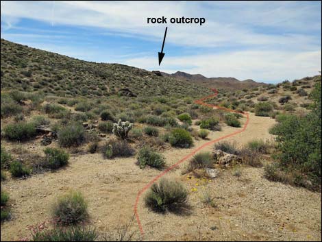 Route runs down wash, then over ridge past outcrop |
 On ridge past rock outcrop (view W to trailhead) |
 Returning to the trailhead (view W) |
Table 1. Hiking Coordinates and Distances based on GPS Data (NAD27; UTM Zone 11S). Download hiking GPS waypoints (gpx) file.
| Wpt. | Location | UTM Easting | UTM Northing | Elevation (ft) | Point-to-Point Distance (mi) | Cumulative Distance (mi) | Verified |
|---|---|---|---|---|---|---|---|
| 01 | Windmill Trailhead | 752700 | 4005254 | 4,032 | 0.00 | 0.00 | GPS |
| 02 | Entering Wilderness Area | 752646 | 4005093 | 4,105 | 0.12 | 0.12 | GPS |
| 03 | Jumbo Springs Peaklet | 752651 | 4004978 | 4,195 | 0.09 | 0.21 | GPS |
| 04 | Jumbo Springs Viewpoint | 752864 | 4004832 | 4,186 | 0.19 | 0.40 | GPS |
| 05 | Saddle | 753159 | 4005038 | 4,061 | 0.28 | 0.68 | GPS |
| 06 | Highpoint | 753392 | 4004697 | 4,297 | 0.29 | 0.97 | GPS |
| 07 | Peak 1320 | 753714 | 4004529 | 4,344 | 0.31 | 1.28 | GPS |
| 08 | Jumbo Springs Overlook | 754216 | 4004819 | 4,213 | 0.44 | 1.72 | GPS |
| 09 | Wilderness Boundary | 754175 | 4004844 | 4,190 | 0.04 | 1.76 | GPS |
| 10 | Last Good View | 753898 | 4005232 | 4,063 | 0.38 | 2.14 | GPS |
| 11 | Toe of Ridge | 753352 | 4005341 | 4,011 | 0.39 | 2.53 | GPS |
| 12 | Crossing Ridgeline | 753132 | 4005310 | 4,058 | 0.16 | 2.69 | GPS |
| 01 | Windmill Trailhead | 752700 | 4005254 | 4,032 | 0.33 | 3.02 | GPS |
Happy Hiking! All distances, elevations, and other facts are approximate.
![]() ; Last updated 240325
; Last updated 240325
| Hiking Around Las Vegas | Gold Butte | Glossary | Copyright, Conditions, Disclaimer | Home |