Hiking Around Las Vegas, Lake Mead National Recreation Area
 Mile 18.2 Trailhead |
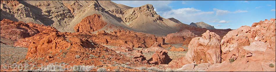
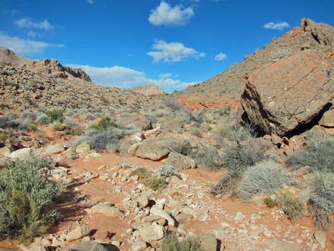
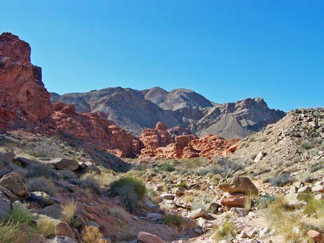
Overview The Bowl of Fire is an area inside the Muddy Mountains Wilderness Area where brilliant-red Jurassic-Age sandstone outcrops are surrounded by gray limestone mountains. The limestone forms the sides of the bowl, and the red sandstone forms the fire in the bottom. The southwestern section of the Bowl of Fire is a place to wander about in a wonderland of jumbled piles of red sandstone; a place to go and just hike about with no particular destination. Hikers with a map can keep track of where they are (more or less), but confused hikers can just hike downhill to get out. From the pavement, getting into and back out of the Bowl of Fire requires about 2-1/2 miles round-trip, but the length of the hike depends on the desires of the hiker. Link to map. |
 Hiker departing trailhead (view N; evening light) |
Watch Out Other than the standard warnings about hiking in the desert, ...this is fairly safe hiking area if you stay in the washes that dissect the sandstone outcrops. The outcrops are inviting, however; so for those who climb on the rocks, watch your step and watch your kids. This is a backcountry area, so rescue would be time consuming and fairly difficult. It would be easy to get turned around in the maze of side canyons and boulder piles, so if you get "lost," just hike down any wash (always go downhill) and you will come out were you went in. While hiking, please respect the land and the other people out there, and try to Leave No Trace of your passage. Also, this hike is moderately long, so be sure to bring the 10 Essentials. This hike goes into the Muddy Mountains Wilderness Area, so pay particular attention to respecting the land. |
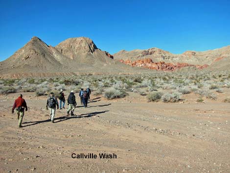
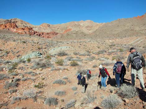
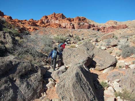
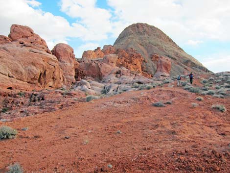
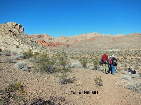 Hikers crossing Toe of Hill 651 (view NW) |
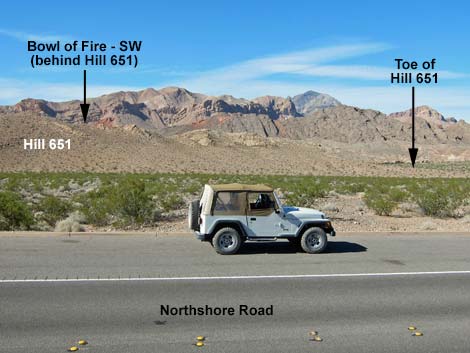
Getting to the Trailhead This hike is located along Northshore Road in Lake Mead National Recreation Area, about 45 minutes northeast of Las Vegas. From town, drive out to Lake Mead. In a 2WD vehicle, drive north on Northshore Road to Mile 18.2 Trailhead. Park here; this is the 2WD trailhead. In a 4WD vehicle, drive north on Northshore Road to the Mile 16.0 (Anniversary) Trailhead. Turn left into the dirt and drive up Callville Wash North Road (Road 94) for about 1.8 miles to the mouth of a large wash that comes in from the north (Site 0786). Park here; this is the Bowl of Fire Wash trailhead parking. For hikers using the 4WD Trailhead, see Bowl of Fire -- Southwest, 4WD Trailhead and Approach. |
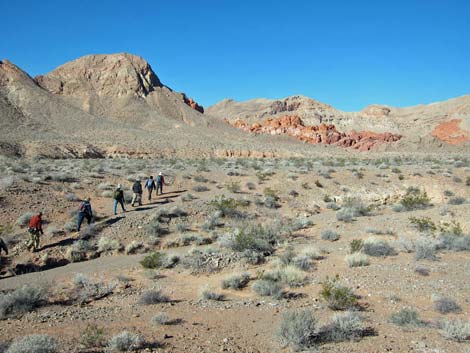
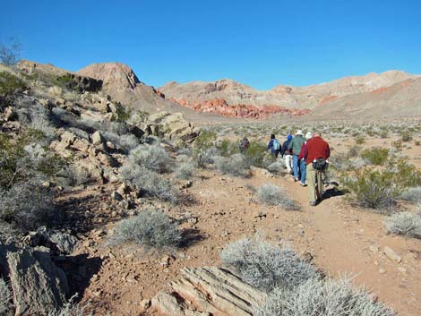 Past the Toe of Hill 651, BOF-SW comes into full view (view NW) |
The Hike From the Mile 18.2 Trailhead (Table 1, Waypoint 01), the hike runs north across the open desert towards the northern toe of Hill 651 (Wpt. 02). There is no trail until the route nears the toe of Peak 651, but then a use-trail wraps around the south side of the hill. The use-trail fades away past the toe; but from there, the route runs northwest across Callville Wash and heads towards the red sandstone cliffs that can be seen ahead in the Bowl of Fire. Hikers can look for a faint use-trail that runs towards the entrance to the Bowl of Fire. Crossing the desert flats, the use-trail hits Bowl of Fire Wash just below an outcrop of red rocks (Wpt. 03). Dropping into the wash, the route runs upstream. The wash forks (Wpt. 04), and the route stays left into the south fork. The wash eventually narrows, and the canyon walls rise as the route approaches a narrow point between two limestone ridges. |
 Hikers crossing the near-side Callville Wash (view NW) |
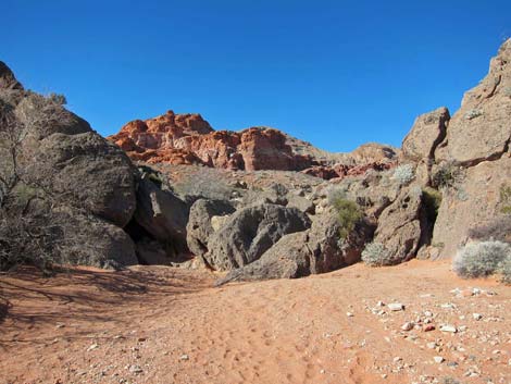
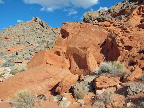
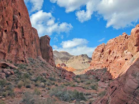
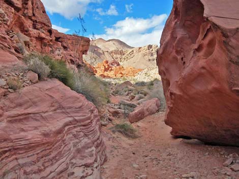
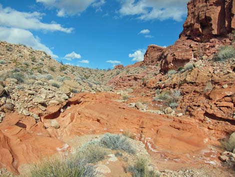
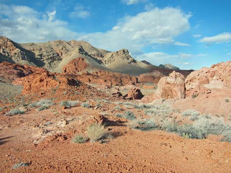
At the narrow spot between limestone ridges (Wpt. 05), the wash cuts through a layer of gray conglomerate rock where a jumble of boulders create a small pour-over that is passed towards the right. The conglomerate is composed of coarse limestone fragments set in a matrix of smaller limestone fragments, which is interesting enough, but where it was polished by flowing water, the color is blue and very pretty. Above the pour-over (Wpt. 05), the wash splits and hikers are on the edge of the Bowl of Fire. From there, hikers can wander about the washes admiring how the eroded red sandstone outcrops contrast with the surrounding gray limestone hills. The red rocks seem to go on forever, or at least to the mountains in the distance. This is a place to hike about with no particular destination. |
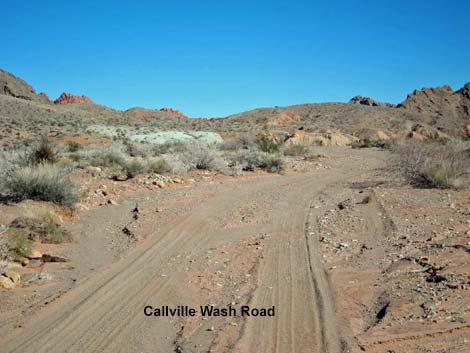 Callville Wash Road (view NE) |
An easy route starts at the jumble of conglomerate boulders (Wpt. 05) and runs up the right-most fork, heading north. Shortly, the wash forks (Wpt. 06), and the route stays left heading for a deep cleft between red sandstone crags. Beyond the cleft, the wash forks again (Wpt. 07), and again the route stays left. The wash curves hard to the west (Wpt. 08), forks again (Wpt. 09), and again the route stays left. Still following the main wash, the canyon splits three ways (Wpt. 10), and the route stays left. Shortly, the route encounters a 5-ft pour-over in the wash at the base of a sandstone crag that forms the left side of the pour-over. The pour-over is easily climbed or bypassed on the left. Atop the pour-over, the route exits the wash to the left and loops around the side of the sandstone crag heading south. |
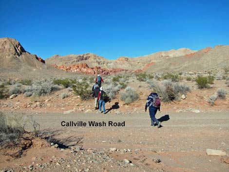 Hikers exiting the far-side Callville Wash (view NW) |
It would seem that looping around the crag would deposit the hiker back in the wash, but instead the route climbs onto a low saddle (Wpt. 12) where it becomes apparent that the wash runs more to the west. The route continues south on the low ridge to a bit of a highpoint. This is a good place to stop and enjoy a snack before returning back down the wash and out. With a map, hikers can keep track of their location in the Bowl of Fire area (at least in general), but for hikers who get disorientated in the maze of boulder piles, just hiking downhill in any wash (always go downhill) eventually leads back out to Callville Wash. |
 |
 |
 Hikers descending into BOF Wash (view SE) |
 BOF Wash approaching a jumble of conglomerate boulders (view N) |
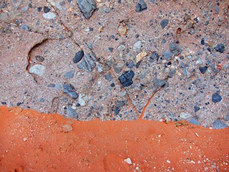 Conglomerate boulder and red sand |
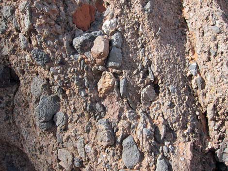 Conglomerate boulder |
 Passing through the jumble of conglomerate boulders |
 Wash to the right |
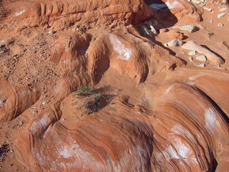
 Red sandstone and gray limestone |
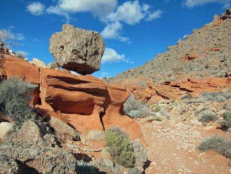 Balanced Rock |
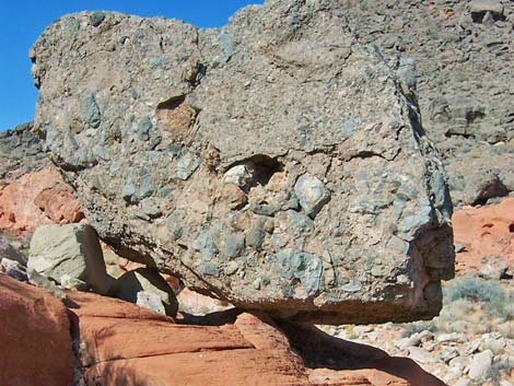 Balanced Rock |
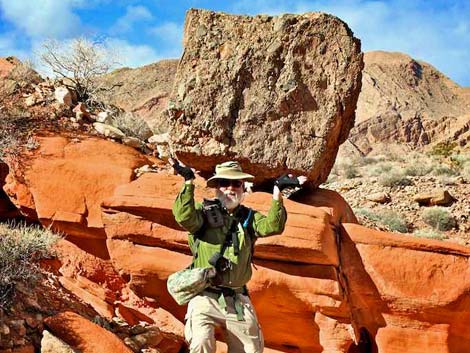 Holding up Balanced Rock |
 |
 |
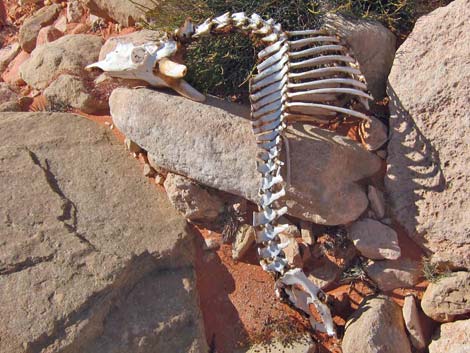 Cycle of life in the desert |
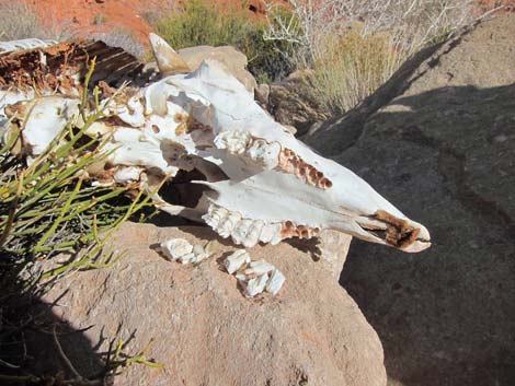 Skull, bighorn sheep |
 Approaching deep "narrows" (view NW) |
 Deep "narrows" aren't so narrow (view NW) ... |
 ... except at one spot |
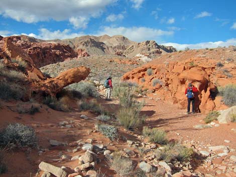
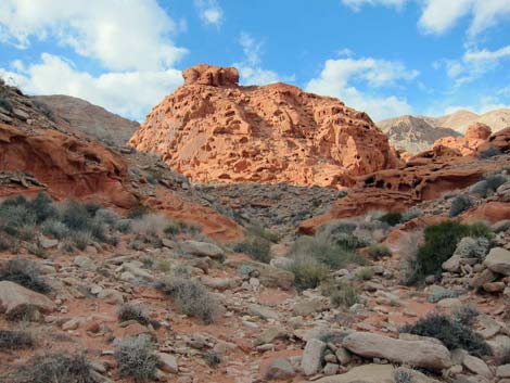
 Sandstone outcrops in the Bowl of Fire |
 Side wash |
 Approaching bend to the left in the wash (view NW) |
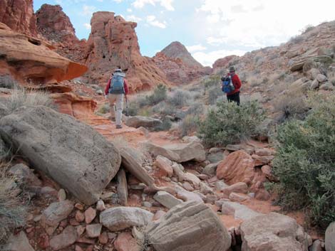 Hikers in upper wash |
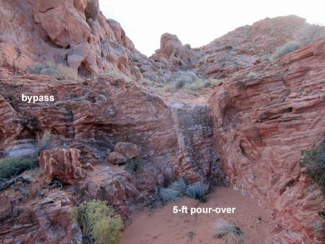 5-ft pour-over blocks wash; turn left (view SW) |
 Hikers on low ridge heading for highpoint (view S) |
 Highpoint (view N, back down the route) |
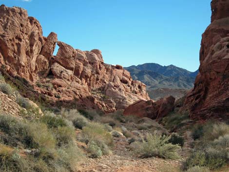 Heading back down, arch in the "narrows" (view SE) |
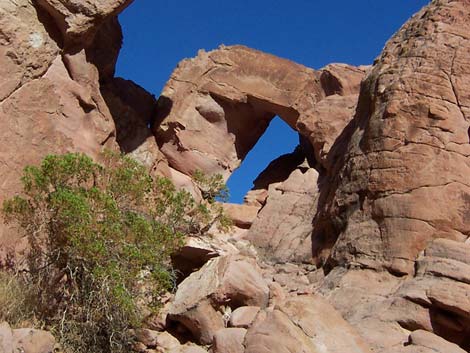 Arch in the "narrows" (view E) |
Table 1. Hiking Coordinates Based on GPS Data (NAD27; UTM Zone 11S). Download Hiking GPS Waypoints (*.gpx) file.
| Wpt. | Location | UTM Easting | UTM Northing | Elevation (ft) | Point-to-Point Distance (mi) | Cumulative Distance (mi) | Verified |
|---|---|---|---|---|---|---|---|
| 01 | Mile 18.2 Trailhead | 710752 | 4009690 | 1,909 | 0.00 | 0.00 | Yes |
| 02 | North Toe of Ridge | 710638 | 4010209 | 1,868 | 0.34 | 0.34 | GPS |
| 02a | 4WD Trailhead | 710068 | 4010221 | 1,846 | . | . | Yes |
| 03 | Trail Drops into Wash | 709992 | 4010571 | 1,858 | 0.62 | 0.96 | GPS |
| 04 | Wash Forks | 709963 | 4010665 | 1,863 | 0.05 | 1.01 | Yes |
| 05 | Entrance to BOF-SW | 709711 | 4010841 | 1,905 | 0.21 | 1.22 | Yes |
| 06 | Wash Forks | 709684 | 4011028 | 1,939 | 0.14 | 1.36 | GPS |
| 07 | Wash Forks | 709528 | 4011277 | 1,932 | 0.21 | 1.57 | Yes |
| 08 | Wash Bends West (x2) | 709418 | 4011424 | 2,005 | 0.13 | 1.70 | Yes |
| 09 | Wash Forks (x2) | 709271 | 4011371 | 2,021 | 0.11 | 1.81 | Yes |
| 10 | Wash Forks | 709034 | 4011168 | 2,007 | 0.24 | 2.05 | GPS |
| 11 | Pour-Over | 709014 | 4011120 | 2,017 | 0.03 | 2.08 | GPS |
| 12 | Low Saddle | 708975 | 4010973 | 2,072 | 0.12 | 2.20 | GPS |
| 13 | Ridgeline | 709016 | 4010865 | 2,084 | 0.08 | 2.28 | GPS |
| 01 | Mile 18.2 Trailhead | 710752 | 4009690 | 1,909 | 2.28 | 4.56 | Yes |
Happy Hiking! All distances, elevations, and other facts are approximate.
![]() ; Last updated 240326
; Last updated 240326
| Hiking Around Lake Mead | Hiking Around Las Vegas | Glossary | Copyright, Conditions, Disclaimer | Home |