Hiking Around Las Vegas, Lake Mead National Recreation Area
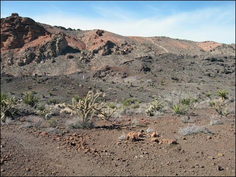
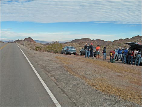 Trailhead (view N along Nelson Road) |
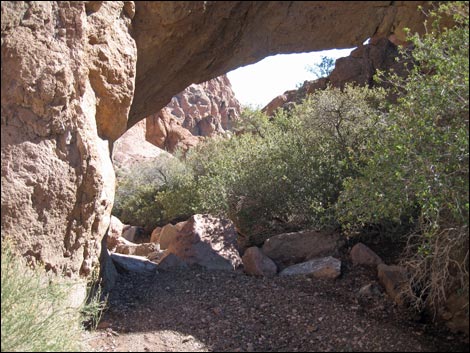
Overview This somewhat contrived traditional route runs about 5.0 miles through a geologically interesting area to Virlis-Fisher Arch, Bridge Spring, and Natural Bridge. Hikers could walk a shorter route to the arch (see the map and the description of the Natural Bridge route), but the direct route is so short that a bit of extra hiking makes the drive worthwhile. The traditional route starts down washes to the north, then turns southeast following washes to a saddle on the high ridge to the east. Crossing rolling terrain across the next valley east leads to another ridge, this one with Virlis-Fisher Arch high on the side. Getting under the arch require some Class-3 scrambling with a bit of exposure. Returning back across the valley and climbing again onto the saddle, the route turns south into Natural Bridge Canyon. The route then runs down the shrub live oak-filled canyon past Bridge Spring to Natural Bridge. The arch is about 25 feet long and 10-feet thick at the center -- quite impressive. The route then loops back to the trailhead. Link to map or elevation profile. |
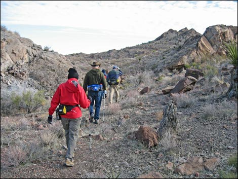
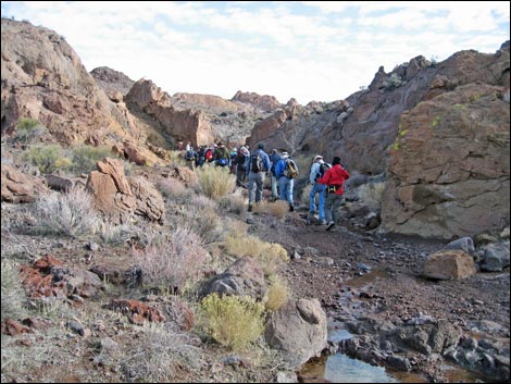
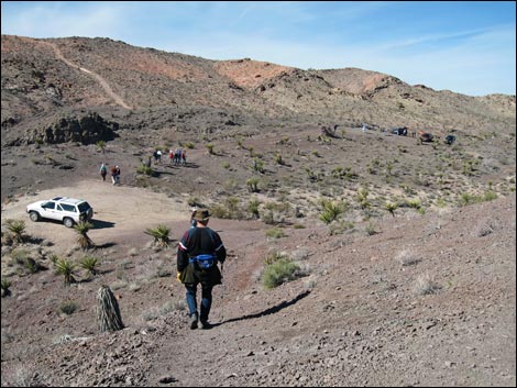
 Hikers going down the washes (view NE) |
Watch Out Other than the standard warnings about hiking in the desert, ...this off-trail hike is fairly safe, but be extra careful on the Class-3 scrambling up to the arch, and be careful on the smooth and water-polished boulders near the natural bridge. While hiking, please respect the land and the other people out there, and try to Leave No Trace of your passage. Also, this hike goes into remote country, so be sure to bring the 10 Essentials. This hike is just outside the El Dorado Wilderness Area, so pay extra attention to respecting the land. Getting to the Trailhead This hike is located south of Las Vegas near the town of Nelson, just outside the Lake Mead National Recreation Area and adjacent to the El Dorado Wilderness Area. |
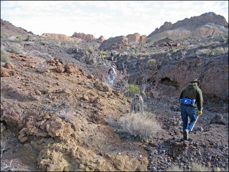
 Hikers above a wash (view NE) |
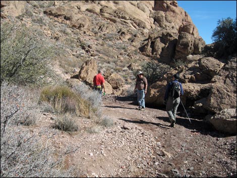
From Las Vegas, drive south on Highway 95 towards Searchlight to Nelson Road (Highway 165) (Table 1, Site 0913), on the left. Drive east on Nelson Road for about 9.5 miles to the trailhead (Site 0910). Watch for a "steep downhill road ahead" symbol sign, and then a dirt parking area on the left. Park here; this is the trailhead. The Hike From the trailhead adjacent to the pavement (Table 2, Waypoint 01), the route runs north into a wash (Wpt. 02) parallel to the roadway. Following the wash downhill, the road and wash gradually diverge. The vegetation community here is unusual; it is dominated by Mojave yucca and California buckwheat, with little else. The wash eventually merges with another large wash (Wpt. 04), and the route turns back to the right to head up the large wash. At the next fork in the wash (Wpt. 05), the route stays right, and at the next (Wpt. 06), the route stays left. |
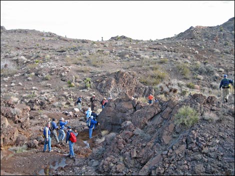
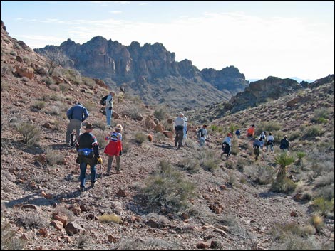
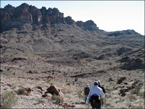
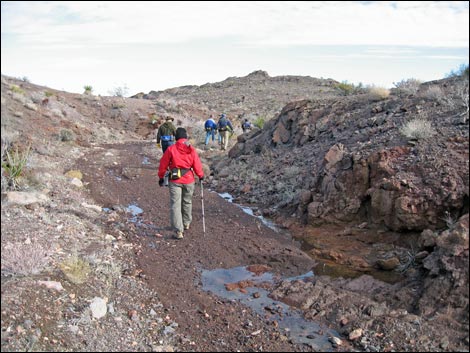 Hikers going down a wash (view NE) |
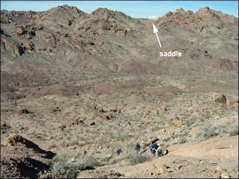
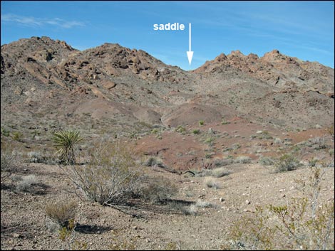
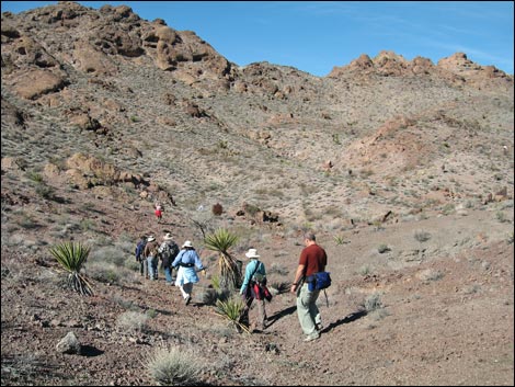
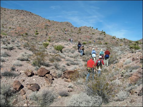
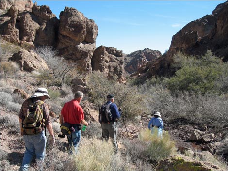
The wash bends to the right and arrives at yet another fork (Wpt. 07) and stays right, generally continuing southeast. The wash eventually bends left (Wpt. 08) to run more to the east. At this point, the wash is running directly towards the major saddle on the ridge to the east. Heading in that direction, the route leaves the sandy wash when the wash bends left (Wpt. 09). Climbing over a low ridge into the next wash, it appears a bit easier to walk down the wash to the next confluence (Wpt. 10), then turn up that wash, all of this with the goal of climbing onto the saddle (Wpt. 11). On these ridges, the vegetation is sparse, but more diverse than at the trailhead. Along here, the shrubs include species such as creosote bush, Nevada ephedra, and indigo bush; plus some bitterbrush in gullies. There are also several species of cactus here, including teddybear cholla, buckhorn cholla, strawberry hedgehog cactus, and beavertail cactus. |
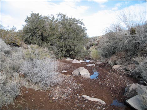
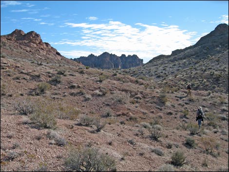
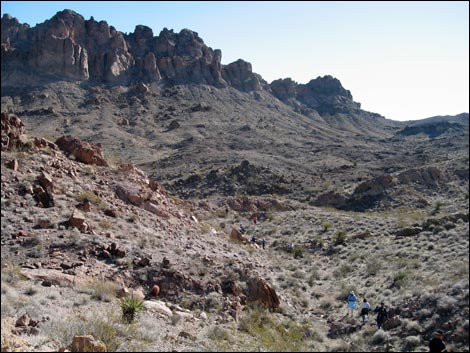
 Confluence of washes (view E) |
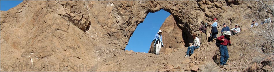
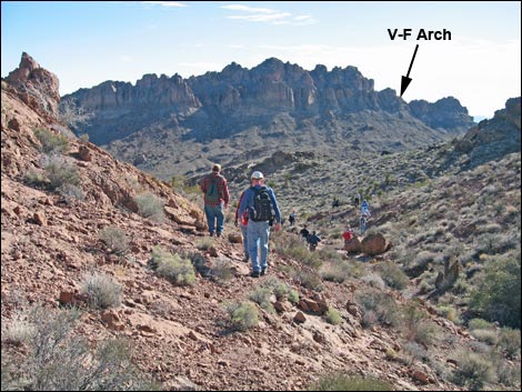
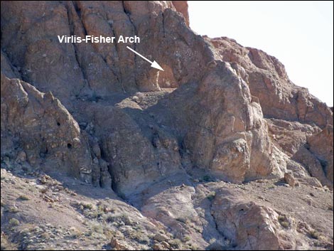
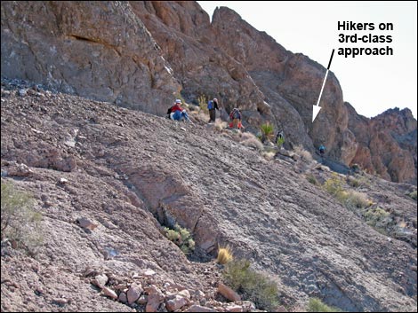
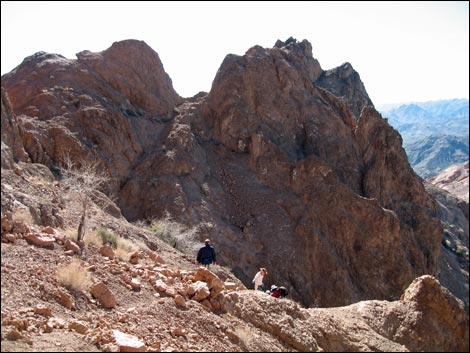
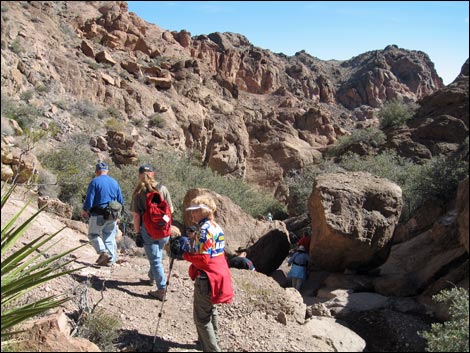
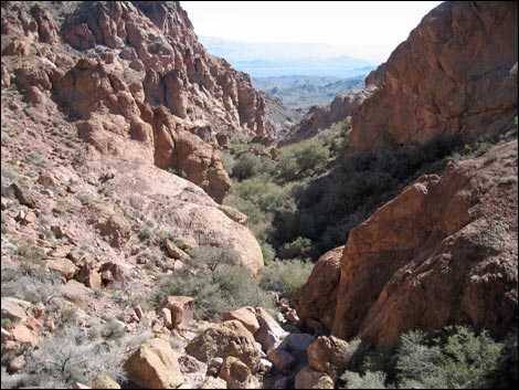
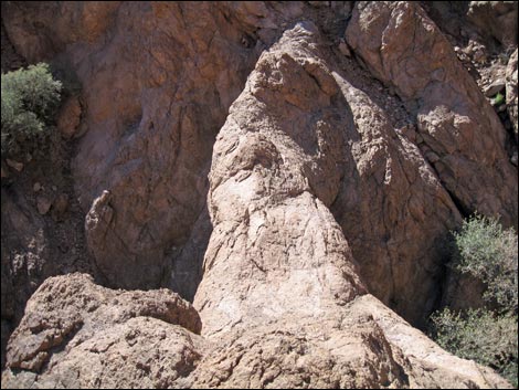
From the saddle (Wpt. 11), Virlis-Fisher Arch is visible about 0.8 miles as the crow flies to the ESE (110 degrees true). There are lots of possibilities for getting there: directly crossing a ridge (Wpt. 12) or more round-about by staying in the wash a bit farther and swinging north around the ridge. Regardless, this is rolling terrain, so there is no easy route. Hiking across the valley, the natural tendency is to approach the arch from the north, and this is a fine route, but it requires some steep 3rd-class scrambling on rock with a bit of loose scree. It might be better to climb up under the arch, cross below it to the south, and then climb a somewhat easier and safer gully (Wpt. 13) that bring hikers up to the south side of Virlis-Fisher Arch (Wpt. 14). The arch is high on the side of the ridge and provides views sweeping from the southwest to the northwest. Through the high saddle hiked over, Mt. Potosi can be seen in the distance. |
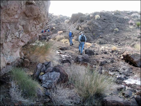
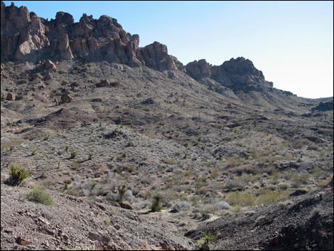
 Turning up a wash (view SE) |
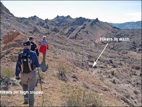
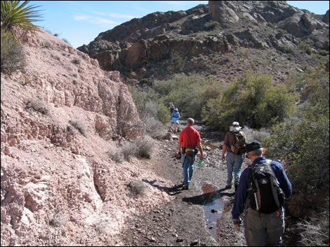
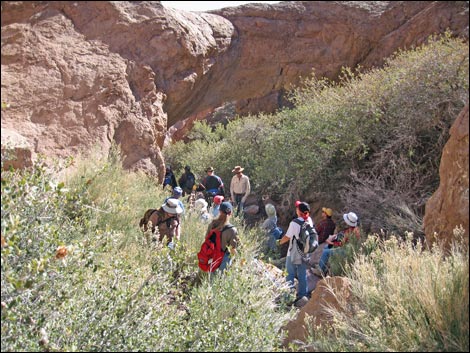
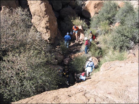
Descending from the arch, the route returns to the high saddle (Wpt. 11) and continues over the west side, this time turning hard to the left and heading south. Hikers can traverse the high slopes or drop into the main wash (Wpt. 10) below the saddle, as both head in the right direction. Following the wash south (Wpt. 10), the wash gradually bends left and eventually merges into Bridge Wash (Wpt. 15). Continuing down the wash, the route enters the canyon and runs past many shrub live oak trees to Bridge Spring (Wpt. 18), which is high on the south hillside. The canyon is choked with shrub live oak, skunk bush, and other shrubs here, and a use-trail cuts around the north side of thicket, bypassing where water from the spring hits the wash. Scrambling around boulders in the bottom of the canyon, the route continues the last few yards down to Natural Bridge (Wpt. 10). The rock here is volcanic tuff: gray-brown and full of black flecks. The bridge spans the canyon, which is about 20-25 ft wide. The bridge is about 10-12 ft thick in center. Around the bridge, the vegetation is dominated by shrub live oak on the sides of the wash and squaw waterweed in the wash. |
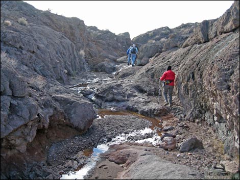
 Hikers following wash (view S) Hikers following wash (view S) |
After contemplating the geologic and erosional forces that created such a place, hikers begin the return to the trailhead. Hiking back up the canyon, past Bridge Spring, a use-trail (Wpt. 17) exits the wash to the south. This use-trail can be followed southwest and then west, or hikers can stay in the wash. Following the wash upstream, the route passes the confluence (Wpt. 15) where the route merged Bridge Wash, and then it curves gently to the southwest, passing an open area with few landmarks (Wpt. 20) to a cairn (Wpt. 21) where the use-trail leaves the wash. If hikers get lost crossing this area, they can just hike west (towards the sunset) and hit the paved road. Following the use-trail (Wpt. 21) right, the route heads west onto a low saddle (Wpt. 22), then contours around to the left and back north following the ridgeline. A trail junction is passed (Wpt. 23) as the use-trail climbs onto the next low ridge (Wpt. 24) from where the end of an old dirt road (Wpt. 25) can be seen below. Dropping onto the dirt road, the route runs back towards the pavement and the trailhead (Wpt. 01), completing the loop. |
 Hikers following wash (view S) |
 Turning up a wash (view NE) |
 Hikers following wash (view E) |
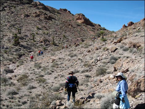
 Crossing hillsides towards the high saddle (view SE) |
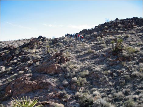
 Hikers at the high saddle (view SE) |
 Hikers descending past the high saddle (view SE) |
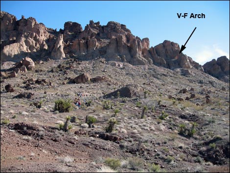
 Virlis-Fisher Arch in the distance (view SE) |
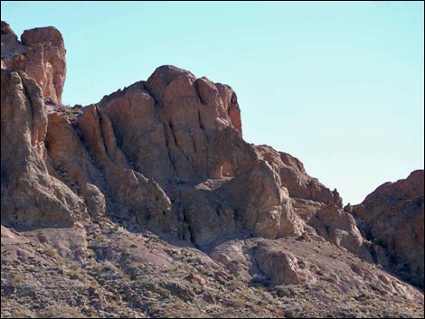
 Virlis-Fisher Arch in the distance (zoom; view SE) |
 Crossing rolling terrain (view SE) |
 Crossing rolling terrain (view SE) |
 Crossing rolling terrain (view SE) |
 Crossing rolling terrain (view SE) |
 Crossing rolling terrain (view SE) |
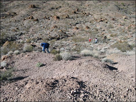 Look back down on hikers climbing towards the arch (view NW) |
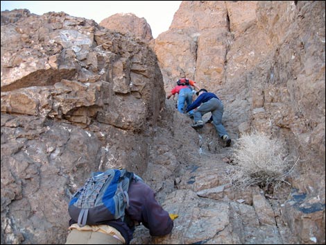
 Hikers on ledge system below Virlis-Fisher Arch (view SE) |
 Hikers on 3rd-class approaching the arch from the north (view E) |
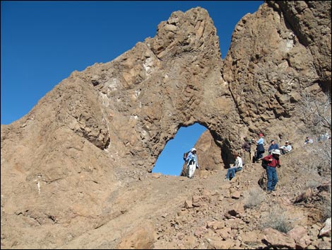 Hikers at Virlis-Fisher Arch (view N) |
 Hikers descending from the arch to the south (view S) |
 Crossing rolling terrain (view NW) |
 Crossing rolling terrain (view NW) |
 Crossing rolling terrain (view NW) |
 Crossing rolling terrain (view NW) |
 Approaching the high saddle (view NW) |
 Heading south towards Natural Bridge Canyon (view S) |
 Natural Bridge Wash (view SE) |
 Natural Bridge Wash (view SE) |
 Natural Bridge Canyon (view SE) |
 Natural Bridge Canyon (view SE) |
 Hikers below Natural Bridge (view SE) |
 Canyon below Natural Bridge (view SE) |
 Natural Bridge (view N from above) |
 Hikers below Natural Bridge (view NW) |
 Natural Bridge (view SE) |
 Hikers on rolling terrain (view W) |
 Hikers returning to the old road (view NW) |
 More to come ... |
Table 1. Highway Coordinates Based on GPS Data (NAD27; UTM Zone 11S). Download Highway GPS Waypoints (*.gpx) file.
| Site | Location | UTM Easting | UTM Northing | Latitude (N) | Longitude (W) | Elevation (ft) | Verified |
|---|---|---|---|---|---|---|---|
| 0910 | Nelson Road at Natural Bridge Trailhead | 35.72983 | 114.83081 | 696188 | 3955953 | 3,482 | Yes |
| 0913 | Highway 95 at Nelson Road | 35.82849 | 114.93654 | 686394 | 3966691 | 1,821 | Yes |
Table 2. Hiking Coordinates Based on GPS Data (NAD27; UTM Zone 11S). Download Hiking GPS Waypoints (*.gpx) file.
| Wpt. | Location | UTM Easting | UTM Northing | Elevation (ft) | Point-to-Point Distance (mi) | Cumulative Distance (mi) | Verified |
|---|---|---|---|---|---|---|---|
| 01 | Trailhead | 696198 | 3955973 | 3,489 | 0.00 | 0.00 | Yes |
| 02 | Wash | 696216 | 3956091 | 3,461 | 0.09 | 0.09 | GPS |
| 03 | Washes Merge | 696255 | 3956450 | 3,431 | 0.29 | 0.38 | GPS |
| 04 | Confluences of Washes | 696336 | 3956595 | 3,363 | 0.11 | 0.49 | GPS |
| 05 | Wash Forks | 696446 | 3956462 | 3,374 | 0.12 | 0.61 | GPS |
| 06 | Canyon Forks | 696483 | 3956355 | 3,395 | 0.08 | 0.69 | GPS |
| 07 | Wash Forks | 696552 | 3956350 | 3,432 | 0.07 | 0.76 | GPS |
| 08 | Wash Bends | 696667 | 3956186 | 3,465 | 0.13 | 0.89 | GPS |
| 09 | Depart Wash | 696878 | 3956163 | 3,478 | 0.14 | 1.03 | GPS |
| 10 | Confluence of Washes | 697001 | 3956098 | 3,465 | 0.11 | 1.14 | GPS |
| 11 | Saddle on Ridgeline | 697196 | 3956171 | 3,513 | 0.16 | 1.30 | GPS |
| 12 | Crossing Ridge | 697553 | 3956061 | 3,440 | 0.27 | 1.57 | GPS |
| 13 | Bottom of Gully | 698386 | 3955749 | 3,525 | 0.70 | 2.27 | GPS |
| 14 | Virlis-Fisher Arch | 698399 | 3955775 | 3,599 | 0.03 | 2.30 | GPS |
| 11 | Saddle on Ridgeline | 697196 | 3956171 | 3,513 | 1.01 | 3.31 | GPS |
| 10 | Confluence of Washes | 697001 | 3956098 | 3,465 | 0.16 | 3.47 | GPS |
| 15 | Confluence of Washes | 696964 | 3955764 | 3,419 | 0.23 | 3.70 | GPS |
| 16 | Big Boulder in Wash | 697070 | 3955738 | 3,392 | 0.08 | 3.78 | GPS |
| 17 | Trail at Wash | 697153 | 3955690 | 3,378 | 0.06 | 3.84 | GPS |
| 18 | Bridge Spring | 697244 | 3955690 | 3,375 | 0.07 | 3.91 | GPS |
| 19 | Natural Bridge | 697345 | 3955650 | 3,359 | 0.10 | 4.01 | GPS |
| 15 | Confluence of Washes | 696964 | 3955764 | 3,419 | 0.29 | 4.30 | GPS |
| 20 | Open Area | 696669 | 3955660 | 3,468 | 0.20 | 4.50 | GPS |
| 21 | Cairn in Wash | 696621 | 3955601 | 3,478 | 0.05 | 4.55 | GPS |
| 22 | Top of Ridge | 696498 | 3955638 | 3,531 | 0.08 | 4.63 | GPS |
| 23 | Trail Junction | 696394 | 3955673 | 3,493 | 0.11 | 4.74 | GPS |
| 24 | Ridge | 696345 | 3955719 | 3,531 | 0.04 | 4.78 | GPS |
| 25 | End of Old Road | 696310 | 3955737 | 3,508 | 0.03 | 4.81 | GPS |
| 01 | Trailhead | 696198 | 3955973 | 3,489 | 0.17 | 4.98 | Yes |
Happy Hiking! All distances, elevations, and other facts are approximate.
![]() ; Last updated 240328
; Last updated 240328
| Hiking Around Lake Mead | Hiking Around Las Vegas | Glossary | Copyright, Conditions, Disclaimer | Home |