Hiking Around Las Vegas, Lake Mead National Recreation Area
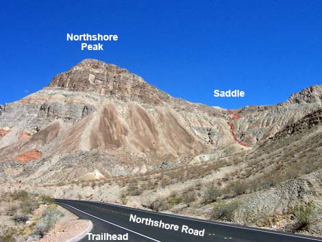 Route as seen from Northshore Road (view E) |
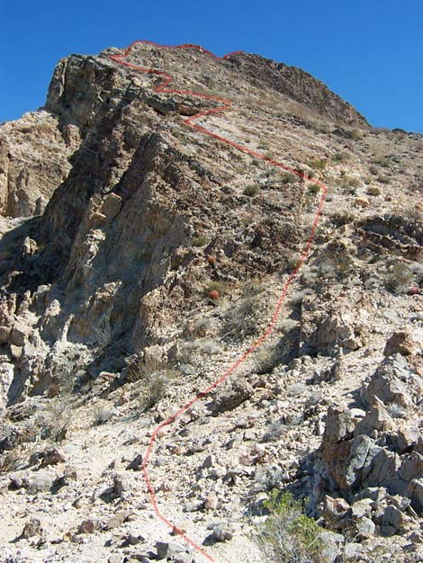
Overview This difficult and exposed route heads cross-country from the trailhead to the summit of Northshore Peak. The route ascends a gully and very steep scree slopes to the west ridge, and then follows the 3rd-class summit ridge to the peak. Despite the relatively low elevation at the summit, the lay of the land is such that the views from the peak are spectacular. However, the views are the same if you walk up the mountain via the east ridge, and I would recommend using the East Ridge Route to climb this mountain. This difficult and exposed route should only be climbed by experienced mountaineers; while most routes look easier up close, this one looks harder up close. Link to map. |
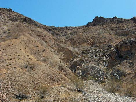 Gully leading to saddle (view SE) |
Watch Out Other than the standard warnings about hiking in the desert, ...this is a difficult and dangerous route. A slip on the scree slopes, in the chute, from the summit ridge, or from the summit would result in serious injury or sudden death. If climbing with a friend, rockfall would be a constant danger. While hiking, please respect the land and the other people out there, and try to Leave No Trace of your passage. Also, this is a rough hike in a remote area, so be sure to bring the 10 Essentials. |
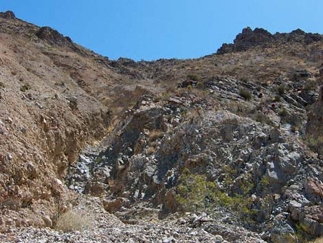 Steep chute (view SE) |
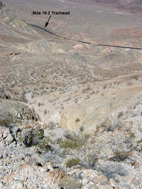
Getting to the Trailhead This hike is located along Northshore Road in Lake Mead National Recreation Area, about 50 minutes northeast of Las Vegas. From town, drive out to Lake Mead, then drive north on Northshore Road for about 19.2 miles to the Mile 19.2 Trailhead. Park here; this is the trailhead. |
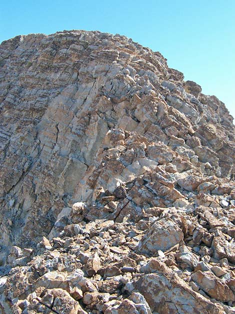
 Airy Class-3 ridgeline at the summit (view E) |
The Hike From the trailhead (Table 2, Waypoint 08), the route crosses the highway and runs up washes to the base of a steep chute (Wpt. 07) that drops off the west ridge, just right of the summit cliffs. The route ascends the steep chute to the crest of the ridge (Wpt. 06). The top of the chute, perhaps the most difficult part, can be bypassed by following narrow game-trails, more or less horizontally westward, across the slope towards the lowest point on the saddle. |
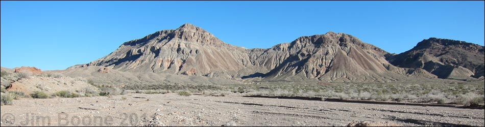
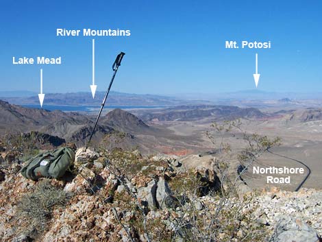 Grand scenery (view SW from summit) |
After gaining the summit ridge, the route runs up and east, staying on the crest of the ridge. The route looks improbable from below, but it goes 3rd-class. The final headwall can be passed on the crest of the ridge to gain the summit (Wpt. 05). Enjoy the views from the summit (see more photos here: East Ridge Route). The views should be particularly sweet after a climb like this. To get back to the trailhead, walk down the East Ridge Route and follow the road back to your vehicle. |
 Looking down the ascent gully (view NW) |
 Route along the lower ridge (view E) |
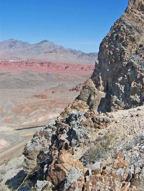 Muddy Mountains (view NE past summit crags) |
 Route climbs crest of the upper ridge (view E) |
Table 2. Hiking Coordinates Based on GPS Data (NAD27; UTM Zone 11S). Download Hiking GPS Waypoints (*.gpx) file.
| Wpt. | Location | Easting | Northing | Elevation (ft) | Verified |
|---|---|---|---|---|---|
| 08 | Trailhead at Mile Marker 19.2 | 712394 | 4010266 | 2,141 | GPS |
| 07 | Base of Steep Chute | 713075 | 4010007 | 2,625 | Map |
| 06 | Crest of Ridge | 713194 | 4009966 | 2,854 | GPS |
| 05 | Northshore Peak Summit | 713277 | 4010320 | 3,330 | GPS |
Happy Hiking! All distances, elevations, and other facts are approximate.
![]() ; Last updated 240326
; Last updated 240326
| Hiking Around Lake Mead | Hiking Around Las Vegas | Glossary | Copyright, Conditions, Disclaimer | Home |