Hiking Around Las Vegas, Lake Mead National Recreation Area
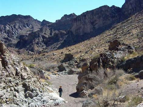
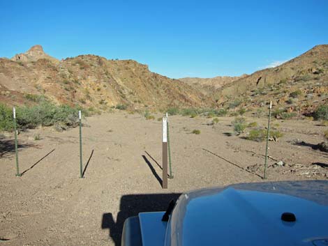 4WD Trailhead (view NE) |
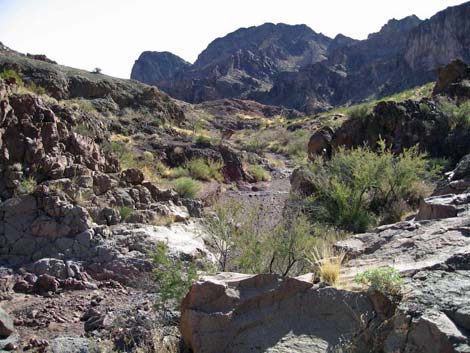
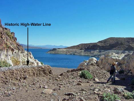
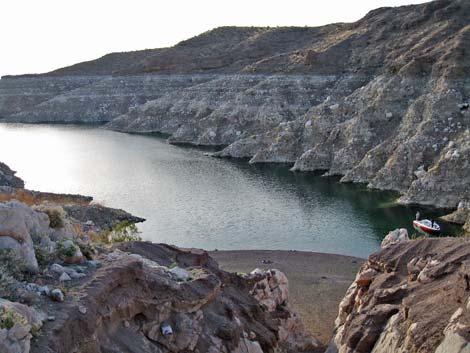
Overview This hike starts at the top of Cleopatra Wash and follows the canyon all the way to Lake Mead, traversing the width of the Black Mountains and dropping some 900 feet in elevation. The route passes amazing geology, towering cliffs, deep narrows, and several pour-overs. When the lake level was high, more than 40 feet of gravel filled the lower canyon and hikers could walk directly to the water. With the lake level so low, flash floods cleared out the gravel to reveal two high pour-overs that require a rope for safety. Most hikers now bypass the cliffs by climbing out of the wash, over a low saddle, and down the side of a ridge to the lake. Link to route map. |
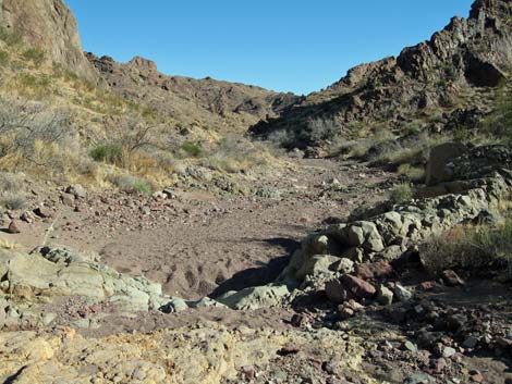 Upper Cleopatra Wash (view SE) |
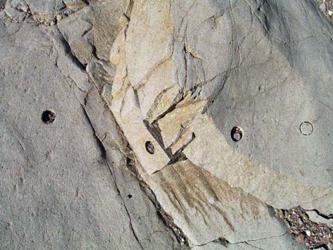
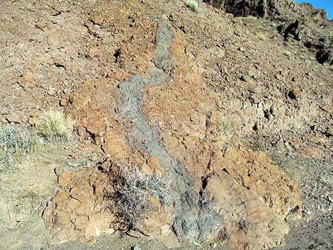
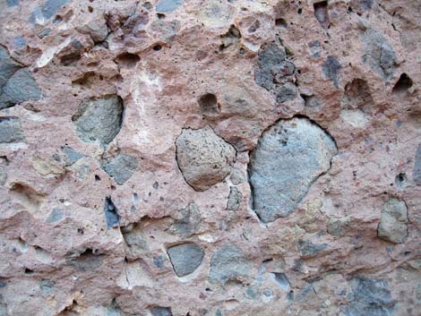
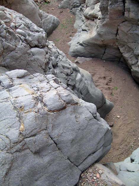
The geology along the wash is amazing and varied. The Black Mountains are volcanic, and the Cleopatra Lobe is actually half of a volcano that was split by an earthquake fault. The other half of the volcano is Hamblin Mountain, which is now over by Callville Bay, some 12 air-miles away. In the upper part of the canyon, dikes across the wash create little dams about 3 to 4-feet wide and are formed from rock that generally is darker than the surrounding rock and are gray, green, purple, red, yellow, and other colors. In some places, rocks were formed when hot volcanic ash roared down from an erupting volcano, and much like a flash flood, picked up rocks and other surface debris. As the ash slowed and cooled, it solidified, and the rocks that had been picked up (inclusions) "froze" in place. Good examples of these pyroclastic rocks (purple and reddish inclusions embedded in a green matrix) can be seen along the water-polished sides of narrows about 1/3 to 1/2 of the way to the lake. A few of the dikes in the upper part of the wash also contain colorful inclusions. |
 Looking back up a series of little pour-overs (view NE) |
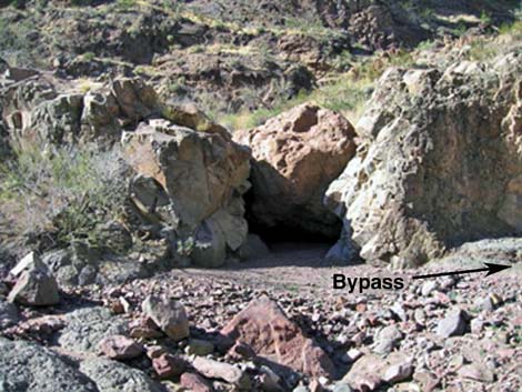
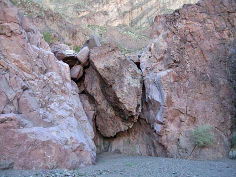
Near the lake, pyroclastic rocks can be seen that formed from dark reddish ash (cinder colored) that picked up dark reddish rocks. It looks like cinder-colored matrix with cinder-colored rocks included in it. The matrix erodes more quickly than the inclusions, leaving cinder-colored boulders in a novel bas-relief surface. Watch Out Other than the standard warnings about hiking in the desert, ... there are several pour-overs in the wash where SUV-sized boulders block the narrow wash. From above, all of the pour-overs look worse than they are. All pour-overs except the last two can be avoided or down-climbed fairly easily (minimal 3rd-class). At the end of the wash, however, declining lake levels combined with flash floods have eroded about 40 feet of sediment and revealed two pour-overs that are considerably higher and more difficult than the others. The first looks impossible from above; but the east wall can be climbed with minimally 5th-class climbing skills. The first step and the last few feet are the worst. Take a climbing rope. |
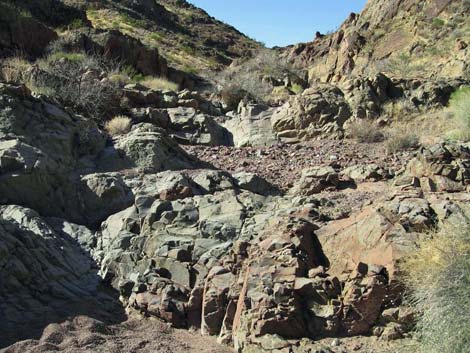
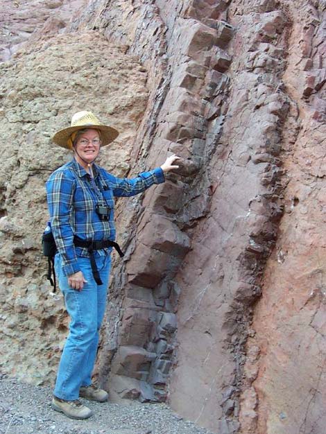
 The geologists have been having fun |
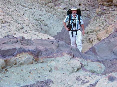
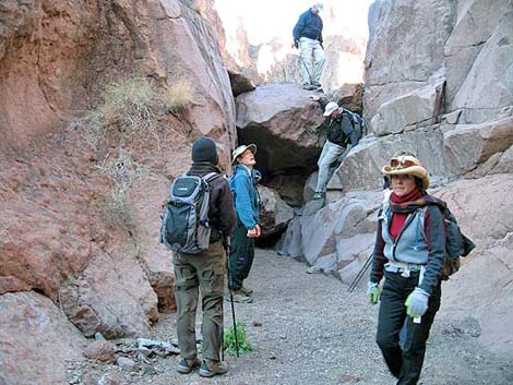
The second can be avoided by 3rd-class climbing to get out of the canyon and onto the east ridge. Both of these pour-overs can be bypassed by climbing out of the canyon and hiking down the side of a ridge to get to the lake. Even if bypassing the last two pour-overs, less experienced hikers might want a safety rope for some of the other pour-overs because the area is so remote and because rescue from the bottom of a narrow canyon would be particularly difficult. Because of washouts along the road, getting to the trailhead requires a 4WD vehicle (I drove a jeep in using 2WD, but I needed 4WD to get back out!), but hikers with a high-clearance vehicle can stop about 0.13 miles short of the trailhead and walk down the washed-out road. While hiking, please respect the land and the other people out there, and try to Leave No Trace of your passage. Also, this is a fairly long hike in a remote area, so be sure to bring the 10 Essentials, and be sure that your hiking skills match the level of difficulty for this hike. |
 |
Getting to the Trailhead This hike is located off Northshore Road in Lake Mead National Recreation Area, about 1-1/3 hours northeast of Las Vegas. From town, drive out to Lake Mead. From the intersection of Northshore Road and Lakeshore Road, drive north on Northshore Road for 30.0 miles to Boathouse Cove Road, which is just past Mile Marker 30. Turn right (east) onto Boathouse Cove Road and drive 2.4 miles to the 2WD trailhead or 3.0 miles to the 4WD trailhead. Driving all the way to the trailhead requires a 4WD high-clearance vehicle. For details of the road and GPS waypoints, see Boathouse Cove Road. |
 Colorful rocks and dike across the wash |
The Hike The route is pretty simple: from any parking spot past the 1.7-mile Saddle, hike downhill to the lake. To get home, turn around and walk back to the trailhead. There are, of course, some details... From the 2WD trailhead (Wpt. 01A), the route runs down the wash, intermittently running on the road and passing the first 4WD trailhead (Wpt. 01B), for 0.53 miles to where the side canyon from the main 4WD trailhead (Wpt. 01C) meets the main wash (Wpt. 02). The trailheads are in the Upper Sonoran (Mojave Desert Scrub) life zone, where the common shrubs on the hillsides are Creosote Bush, White Bursage, Nevada Jointfir, and Goldenhills. In the wash, the common shrubs are Catclaw Acacia and Burrobrush. The rocks are volcanic, with layers of pyroclastic rocks and welded ashflow tuff with dikes of harder material cutting across the wash. |
 |
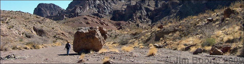
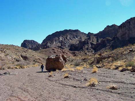
From the confluence of the two washes (Wpt. 02), the route runs down the rocky wash crossing many little pour-overs formed by volcanic dikes of various colors. The geologists seem to be having a lot of fun drilling into the rock to remove cores for study back in the lab. Some of the pour-overs hold water, so watch for wildlife around here. The route runs down the fairly open canyon to the first major pour-over (Wpt. 03). This pour-over is formed by a dike across the canyon with an enormous boulder blocking a break in the wall. The pour-over is about 10-feet high and can be easily bypassed along the north edge of the canyon; the south edge works too. Below the first pour-over, the route passes several small pour-overs, then the wash opens into a wide, sandy canyon with a huge boulder sitting out in the middle of the wash (Wpt. 04). |
 |
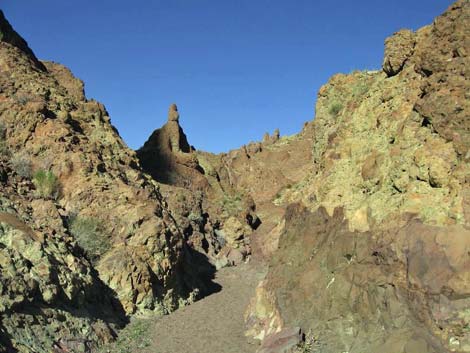
A few minutes beyond the boulder, the canyon narrows and starts into the first set of shallow narrows (Wpt. 05). The walls of these narrows are red pyroclastic rock with purplish and green inclusions -- quite spectacular. Keep an eye out for Bighorn Sheep; there is a lot of scat in these narrows. The canyon opens again somewhat, then narrows again into a second set of shallow narrows (Wpt 07). A few minutes down these narrows, the canyon is blocked by the second major pour-over (Wpt 08). This pour-over looks bad from above, but it is only 10-12 feet high and is easy to downclimb. Alternatively, it can be bypassed by climbing onto the north wall about 5 yards back from the pour-over (behind a catclaw acacia) and climbing along ledges to get beyond the pour-over. About 2 minutes below the second major pour-over is the third major pour-over (Wpt. 09) that looks really bad from above. Again, however, it is only 8-10 feet high and an easy downclimb. |
 Pretty lady and wild rocks |
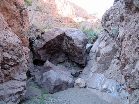
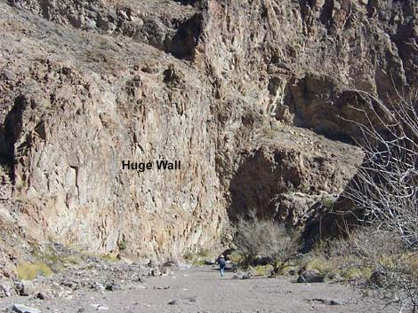
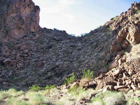
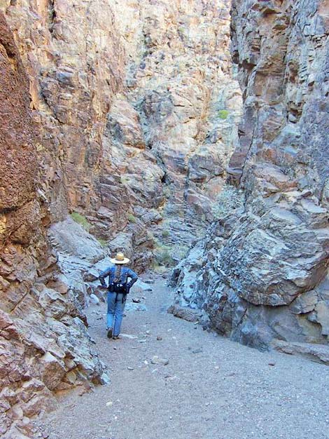
The canyon opens a little, runs through more narrows, then opens again where another dike forms a wall that cuts across the canyon. As with the first major pour-over, an enormous boulder is stuck in the gap in the wall, but this pour-over, the fourth major pour-over, is about 25-feet tall (Wpt 10). It is possible to downclimb the face of the pour-over or hike around the south edge of the canyon, but it is easier to walk back up the wash about 100 feet, scramble up through a gap in the dike, and then hike down the gravel-covered, rocky slope to the wash below. Below the pour-over, the wash is broad and flat, and there are some big, old Catclaw Acacia with trunks 6-8 inches in diameter growing in the wash. It is unusual to see them this big. The wash runs down to a huge wall on the northeast side of the wash, then turns and starts into the final set of narrows. There are some amazing volcanic rocks in this section. The high wall is made of several layers of pyroclastic flows with inclusions separated by layers of welded tuff. The wall is capped by a thick layer that looks like welded tuff. In the wash, there are huge boulders that appear to be conglomerate rock, some of which are a yellowish matrix with included boulders. The rock cliff is vegetated with Desert Stingbush and Schott's Pygmycedar, with a bit of Desert Tobacco along the wash. About 3 minutes beyond the point where the wash hits the huge wall, the canyon turns a corner and hikers can, for the first time during the hike, look down through the narrow canyon and see Lake Mead in the distance. Just beyond this point, the canyon opens a bit (Wpt. 11), and the wall on the southwest (right) side of the canyon gives way to a rocky slope and a low saddle about 75 vertical feet above the wash. Without a rope, the hiking route to the lake leaves the wash at this point (Wpt. 11) and runs up the hillside on a use-trail to the saddle (Wpt. 13). Crossing over the saddle and curving to the left, the route follows faded use-trails down the rocky hillside to the lake (Wpt. 14). |
 Middle Cleopatra Wash (view SE) |
With a rope, hikers can continue down the main canyon. A minute or two into the narrows, a large boulder spans the canyon. Depending on the way floods have moved the gravel in the wash, this is either a high pour-over that is awkward to pass, or it is an easy step-down. In December 2009, it was high and awkward. About two minutes below that boulder, the canyon is again blocked by a boulder and a major pour-over (Wpt. 12) that, from above, looks impossible to downclimb (this is the rope-down pour-over). Before the lake level dropped and the floods of 2005 cleared out some 40 feet of gravel, this pour-over was completely buried. Now, using a 60-foot climbing rope, I was able to tie off a boulder in the wash and lower myself over the pour-over (leaving the rope in place). On the way out, I climbed the minimally 5th-class east wall to avoid the overhang. The last step was a doosey. A few yards below that pour-over, there is another, even higher pour-over. Here, the route climbs the east wall (3rd-class) to escape the bottom of the canyon, then follows ledges onto the ridgeline, which runs down to a gravel beach on the edge of the lake (Wpt. 14). Return to the trailhead by retracing your route. |
 First major pour-over (view NW from below) |
 Middle Cleopatra Wash (view W) |
 Boulders roll down the hillside from time to time |
 Second major pour-over from below (pass on right) |
 Third major pour-over from below (pass on right) |
 Fourth pour-over from below (pass on far right) |
 Huge wall on the NE side of the wash (view E) |
 Bypass runs over low saddle (view S from main wash) |
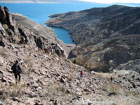 Hiking down rocky hillside to the lake (view SE) |
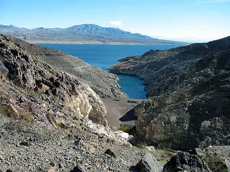 Lake level on New Year's Eve, 2009 (view SE) |
 Gravel in wash during 2002. Compare with level of the gravel in 2006 (photo at right). |
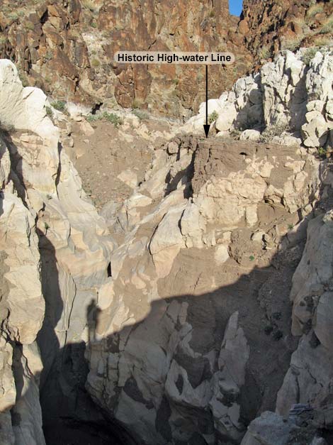 Level of gravel during 2006. Some 40 feet of gravel washed out revealing two high pour-overs (my shadow falls on the 2nd) |
 Cleopatra Wash in 2002; compare the level of gravel on the left side of the wash with the gravel in 2006 (photo at right) |
 Same point in Cleopatra Wash in 2006 (notice remnants of the 2002 level of gravel on the left side of the cliff (view S) |
 This pour-over had been completely covered over with gravel in 2002, but with lake levels down and major flash floods, the gravel is gone |
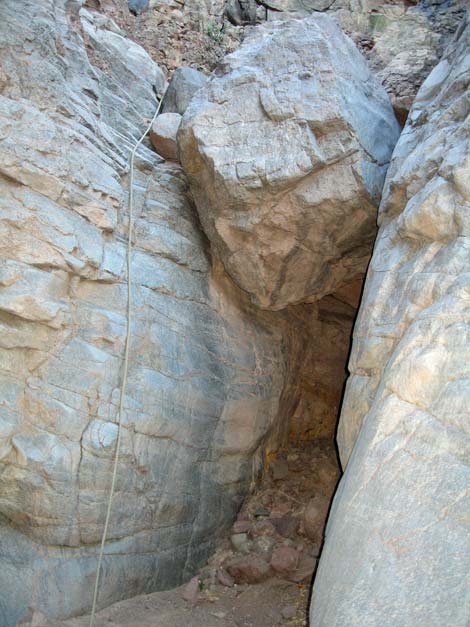 Fourth major (rope-down) pour-over from below. The water-polished right wall is minimal Class 5. |
Table 1. Hiking Coordinates Based on GPS Data (NAD27, UTM Zone 11S). Download GPS Waypoints (*.gpx) file.
| Wpt. | Location | Easting | Northing | Elevation (ft) | Point-to-Point Distance (mi) | Cumulative Distance (mi) |
|---|---|---|---|---|---|---|
| 01A | 2WD Trailhead | 727358 | 4013334 | 2,044 | . | . |
| 01B | 4WD Trailhead | 727837 | 4013084 | 1,990 | . | . |
| 01C | 4WD Trailhead | 727865 | 4012949 | 1,972 | 0.00 | 0.00 |
| 02 | Main canyon | 728046 | 4013035 | 1,927 | 0.16 | 0.16 |
| 03 | Pour Off 1 | 728790 | 4012422 | 1,694 | 0.73 | 0.89 |
| 04 | Boulder | 728920 | 4012301 | 1,694 | 0.13 | 1.02 |
| 05 | Narrows Top | 728958 | 4012143 | 1,665 | 0.11 | 1.13 |
| 06 | Narrows End | 729109 | 4012009 | 1,635 | 0.15 | 1.28 |
| 07 | 2nd Narrows | 729505 | 4012124 | 1,570 | 0.28 | 1.56 |
| 08 | Pour Off 2 | 729624 | 4012023 | 1,547 | 0.12 | 1.68 |
| 09 | Pour Off 3 | 729728 | 4011985 | 1,520 | 0.09 | 1.77 |
| 10 | Pour Off 4 | 730348 | 4011695 | 1,410 | 0.46 | 2.23 |
| 11 | Leave Wash | 730769 | 4011663 | 1,294 | 0.43 | 2.66 |
| 12 | Rope Down | 730867 | 4011534 | 1,200 | . | 500-ft detour |
| 13 | Saddle | 730707 | 4011604 | 1,363 | 0.07 | 2.73 |
| 14 | Cove 2010 | 730935 | 4011380 | 1,100 | 0.22 | 2.95 |
Happy Hiking! All distances, elevations, and other facts are approximate.
![]() ; Last updated 240326
; Last updated 240326
| Hiking Around Lake Mead | Hiking Around Las Vegas | Glossary | Copyright, Conditions, Disclaimer | Home |