Hiking Around Las Vegas, Red Rock Canyon National Conservation Area
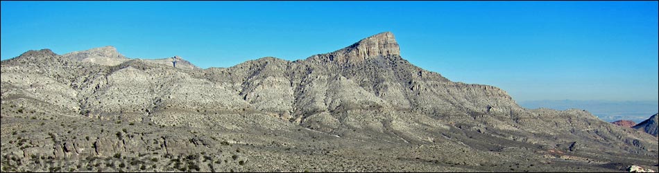
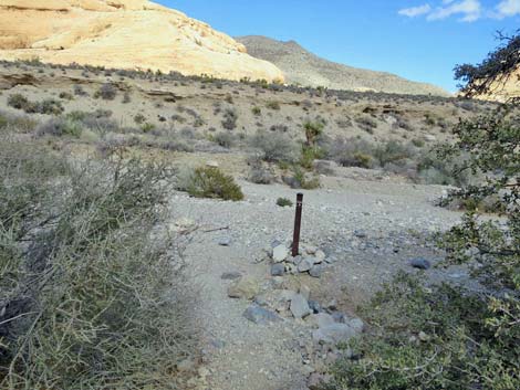
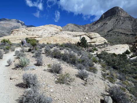
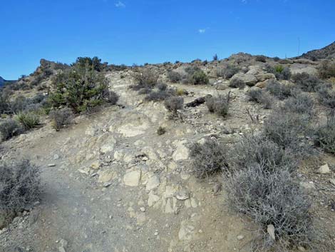
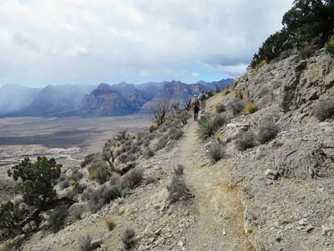
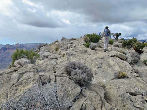
 Turtlehead Peak (view N; note: area under construction) |
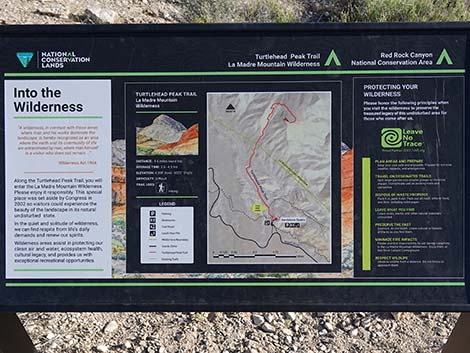
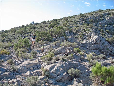
Overview Turtlehead Mountain, commonly referred to a Turtlehead Peak, is fairly difficult hike with the reward of grand views. The route climbs 2,000 feet in 2.5 miles, which is steep, but the hard part is climbing the 800 vertical-feet in the gully system in only 0.4 miles. There is now (late 2017) an official "trail" to the summit, but it is more of a route scratched out of the steep, rocky hillside than a real trail. The route winds among rocky outcrops and takes two unexpected switchbacks. There are a couple of short Class-3 sections and provides plenty of places to fall off the steep slopes. The rewards for hikers are a tough workout and grand views from the summit. One clear days, views stretch to southern Utah, Arizona, and probably even California, not to overlook, of course, Red Rock Canyon. Link to map or elevation profile. See also Summit Views and the Hike Back Down. Link to BLM Georeference PDF map file. |
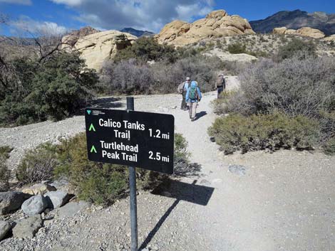
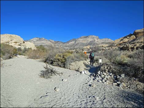
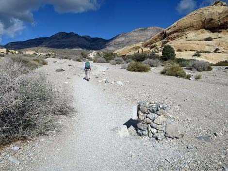
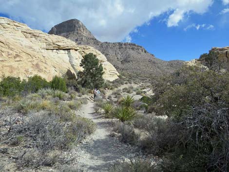
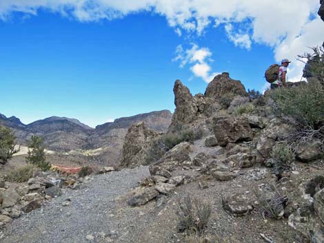
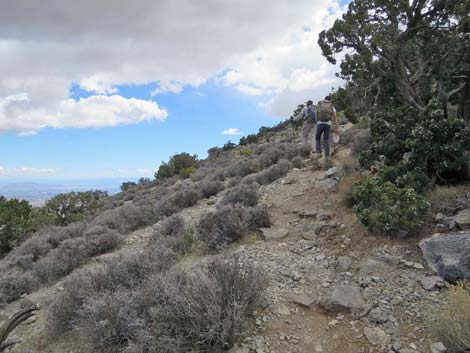
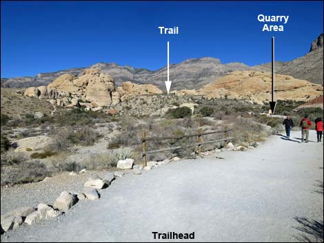 Hikers departing trailhead and heading towards Quarry area (view N) |
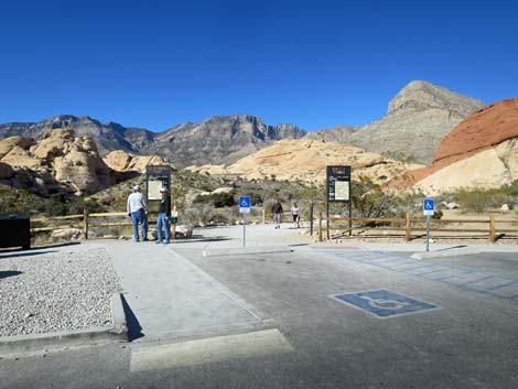
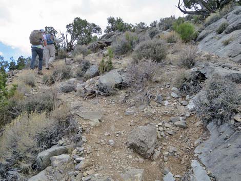
Watch Out Other than the standard warnings about hiking in the desert, ...this is a very strenuous hike that requires some 3rd-class scrambling over and around boulders. Falls from some places along the trail would result in serious injuries or worse. This hike probably is not appropriate for children. Watch carefully for the switchbacks, as missing them leads hikers into dangerous terrain. While hiking, please respect the land and the other people out there, and try to Leave No Trace of your passage. Also, even though this is a short hike, be sure to bring what you need of the 10 Essentials. Getting to the Trailhead This hike is located along the Scenic Loop Road in Red Rock Canyon National Conservation Area, about 45 minutes west of Las Vegas. Drive out to Red Rocks, pay the entrance fee, and drive up the Scenic Loop Road for about 3 miles to the Sandstone Quarry Trailhead. Park here; this is the trailhead. |
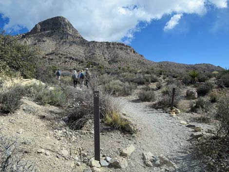
 Trail entering Quarry area (view N) |
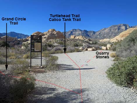
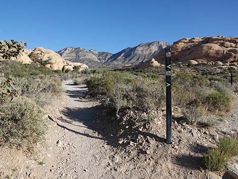
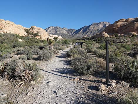
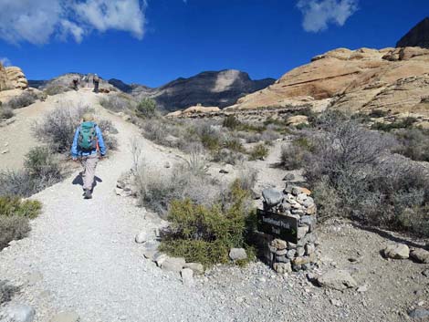
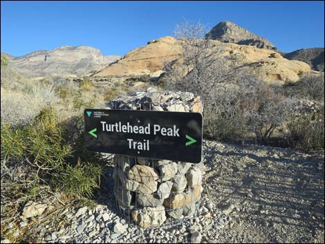
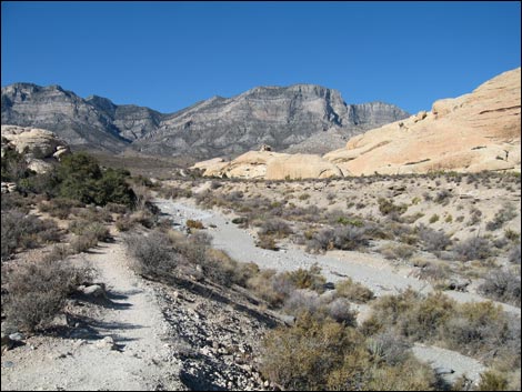
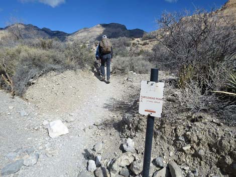
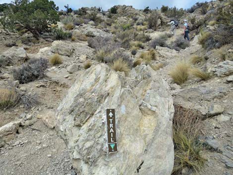
The Hike From the trailhead (Table 1, Waypoint 01), the trail runs north into the historical Sandstone Quarry area. The trail passes a trail junction with the Grand Circle Loop Trail, stays to the left of the main quarry site, passes a trail sign (Wpt. 02). The trail then drops into a wash, crosses to the other side, and continues northward. About 2 minutes beyond the quarry area, the trail forks (Wpt. 03). The Turtlehead Trail continues straight (left; north), while the Calico Tanks Trail bends right (east). The Turtlehead Trail continues north between white sandstone crags with nice singleleaf pinyon and canyon live oaks growing along the western cliffs. Trying to stay on firm soils where the walking is easier, the trail mostly stays out of the loose gravel in the wash. The trail shortly climbs onto a low bench on the west edge of the wash where the ground is firm, the walking is easier, and there are nice views all around. |
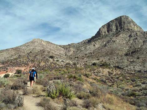
 Sign missing: exiting Quarry area on Turtlehead Peak Trail (view N) |
The trail eventually drops off the bench (Wpt. 04), crosses a braid of the gravel wash, and then drifts right onto firm soils in the center of the wash. The trail eventually angles farther right, into the main course of the gravel wash, before exiting the wash (Wpt. 05) and climbing onto a bench on the east side of the wash. On this bench, the views are again grand, and be sure to notice the arch in the sandstone back to the west. Atop the bench, the trail runs north towards sandstone crags, then bends right to pass through a gap in the crags (Wpt. 06). For people looking for a nice picnic, the flat sandstone slabs on the right are hard to beat. |
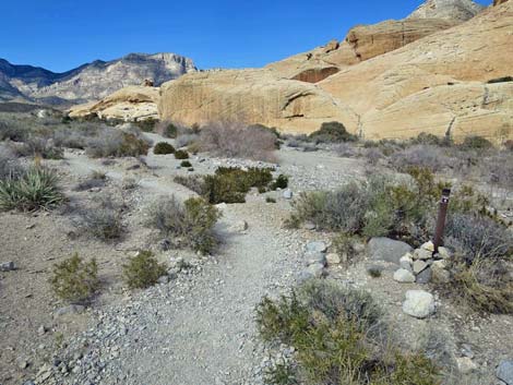
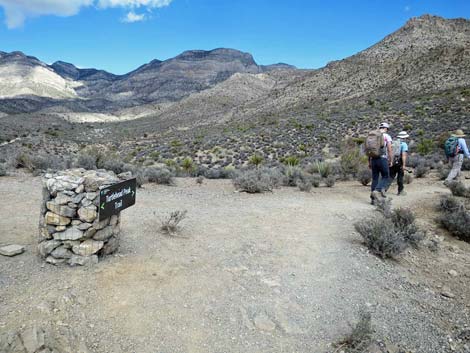
 Turtlehead-Calico Tanks trail junction sign -- stay left (view NE) |
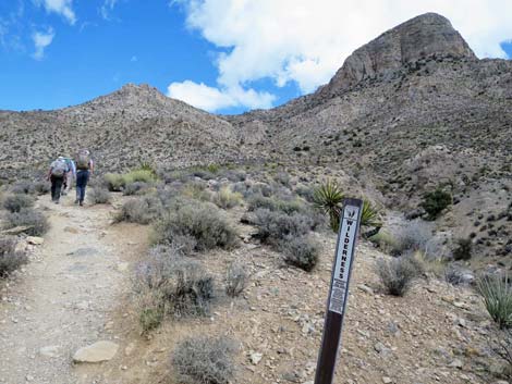
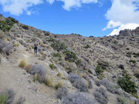
Turning towards the peak, the trail crosses between the sandstone crags and heads toward the big gully on the northwest side of the peak. The trail runs up a wash, then exits left onto mountain slopes thick with blackbrush, typically a higher-elevation species. On this slope, the trail ascends to the base of first rocky step. Crossing the rocks, the trail climbs onto an overlook (Wpt. 07) with the last of the big trail signs. The trail continues up the blackbrush-covered hillside staying on the north edge of the big gully that comes down from the peak. The trail enters the La Madre Wilderness Area (Wpt. 08) and continues straight up the hillside to the toe of the second rocky step. |
 Approaching a trail counter (view NE) |
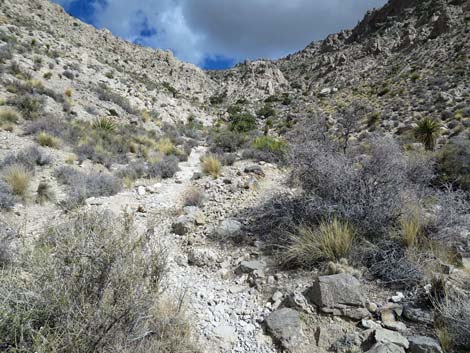
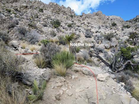
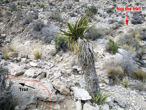
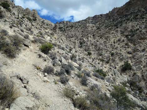
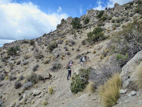
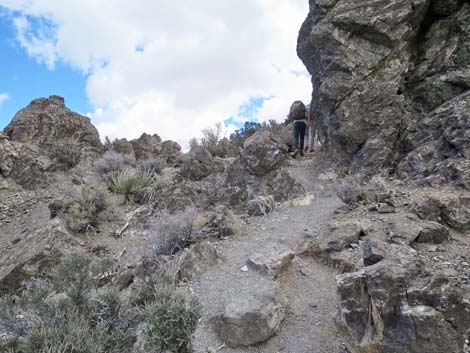
In this area, use-trails begin to proliferate rapidly, and the proper route up the rocky step is hard to determine. However, the trail quickly crosses the toe of the rocky outcrop to the far side, then bends left to climb the hillside. The proper trail continues across the hillside staying just above the rocky gully. The trail eventually drops into the rocky gully (Wpt. 09). Many use-trails diverge and converge in the gully. The main trail stays on the north side of the gully. Shortly, however, the main trail climbs out of the gully onto the hillside on the left. Staying low on the rocky hillside, the trail climbs to a switchback (Wpt. 10) where a well-used use-trail continues straight up the canyon. Be careful here, as the use-trail leads into somewhat dangerous terrain. Bending hard to the left, the trail switchbacks and traverses up across the steep hillside. |
 Approaching a trailhead sign with map (view NE) |
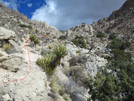
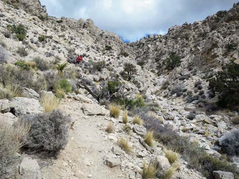
The trail eventually turns straight up the hillside before bending right and continuing up across the steep, rocky slopes. In this area, paint spots begin to appear on the rocks where someone tried to mark the best way through the rocky outcrops. Unfortunately, they were not entirely successful in this endeavor (some dots are off-trail), so hikers need to be judicious and not blindly follow the dots. Also in this area the trail passes some short, minimally Class-3 sections that are always easier when going uphill. The trail runs up to a second major switchback (Wpt. 11) where the "straight" is blocked by a large Utah Juniper tree. Even so, some hikers persist and a faint use-trail continues around the tree. Switchbacking hard to the left, the trail crosses around the corner into the next gully to the north. A small trail sign indicates that the trail turns uphill, and several use-trails head steeply upward. After climbing steeply, the trail angles off to the southeast more or less contouring up across this steep side slopes with fewer rocky spots. Nearing the summit ridge, the trail contours across the hillside until switchbacking up to the left and finally gaining the ridgeline (Wpt. 12). |
 Trailhead sign with map (view NE) |
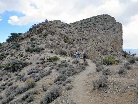
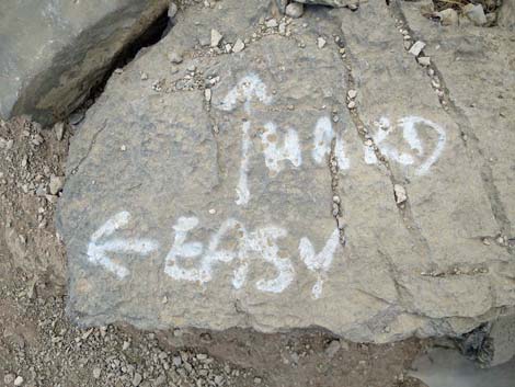
Heading south, the trail passes east of several large boulders perched on the ridgeline (Wpt. 12) and contours onto the backside of the peak where the summit ridge quickly becomes a steep summit slope. Shortly, the trail forks (Wpt. 14). Here, vandals used paint to mark on the rocks, but at least this vandalism is useful. Arrows point to the "hard" route and the "easy" route. Perhaps it should read "very steep" and "steep," as neither are easy. On the "hard" route, as on the steep slopes below, and there is considerable multiple-trailing, but staying on use-trails as far to the west as possible seems to provide a reasonable and direct route. The west edge is the cliff, so don't get too extreme in staying far to the west. Because of the lay of the land, the summit (Wpt. 15) sneaks up quickly. On the "easy" route, the trail mostly contours up and around onto the east side of the summit slope, although there are some steep, rocky parts. Out on the east side of the summit slope, the trail turns more steeply uphill until running straight up the East Ridge to the summit (Wpt. 15). |
 Trailhead sign with map (view NE) |
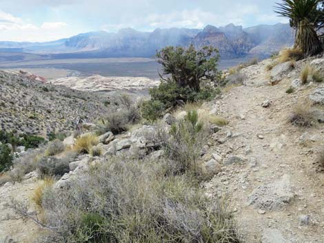
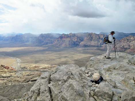
The summit is large and provides many options for resting, eating lunch, signing the summit register, and hanging your feet over the cliff. The summit views are grand. The view to the south and west overlooks Sandstone Quarry and most of the route to the summit. The Las Vegas urban area lies to the southeast; I can even see my house. Seeing the city and the traffic makes one appreciate the peace and quiet of the summit. To the east, views extent to southwest Utah and the Grand Wash Cliffs in Arizona (edge of the Grand Canyon), including high peaks in Gold Butte National Monument. To the north lies the La Madre Range and the grand south faces of La Madre and La Padre peaks. To the west lies the red and white sandstone of the Wilson Cliffs and their overlying limestone ridges. The easiest way to hike down is to retrace your steps down the summit slopes to the ridgeline, and then down the steep rocky slopes to the gully below. The descent is steep and hard on the knees, so be sure to stop and rest on the way down. |
 Hiker passing trail sign (view NW) |
 Trail sign (view N) |
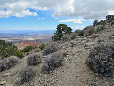
 Trail runs on bench above wash (view N) |
 Trail returns to wash at trail sign (view NE) |
 Trail crosses to east side of wash (view N) |
 Hikers passing trail sign (view N) |
 Hikers passing another trail sign (view N) |
 Trail crosses wash again (view N) |
 Hiker exiting the main wash to climb onto another bench (view N) |
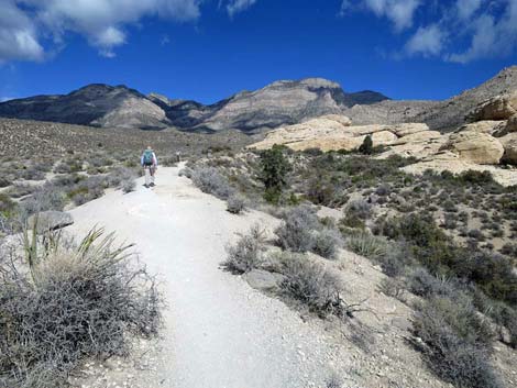 Trail runs on bench above the wash (view N) |
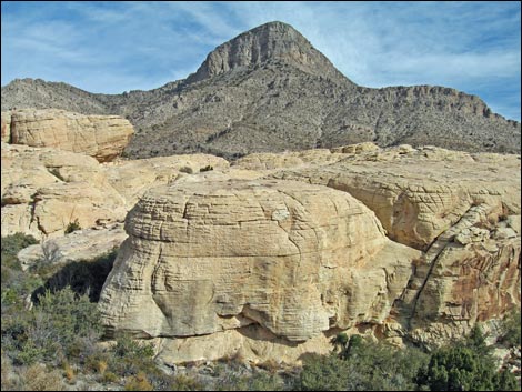 View right: Turtlehead Peak above sandstone crags (view E) |
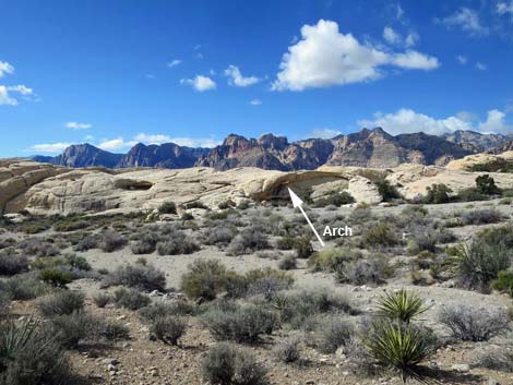 View left: Nice little arch across the main wash (view W) |
 Trail bends right to cross sandstone crags (view NE) |
 Hikers passing pinyon pine at base of sandstone crags (view NE) Hikers passing pinyon pine at base of sandstone crags (view NE) |
 Trail signs at toe of sandstone crag (view NE) |
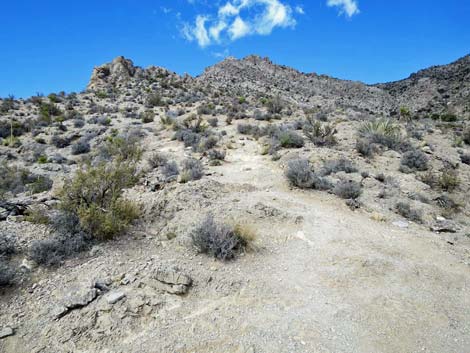
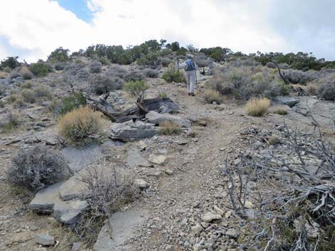
 After climbing out of a wash, the trail runs up a low ridge (view NE) |
 Trail at base of first rocky step (view N) |
 Trail sign atop the first rocky step (view N) |
 On low ridge, trail enters La Madre Wilderness Area (view NE) |
 Trail at base of second rocky step (view NE) |
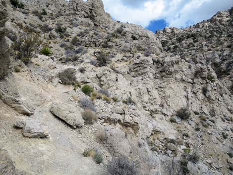
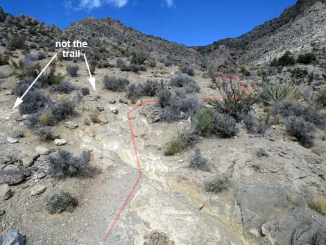 Second rocky step: trail gets confusing (view NE) |
 After following base of hillside, trail drops into the wash (view NE) |
 Trail climbs back onto rocky hillside (view NE) |
 Trail continues along base of rocky hillside (view NE) |
 Approaching the first switchback (view NE) |
 First switchback (use-trail leads to dangerous terrain; view NE) |
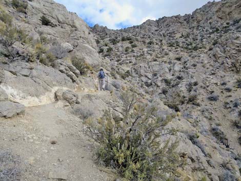
 First switchback: trail climbs up across hillside (view SW) |
 Past switchback, trail climbs across rocky slopes (view NW) |
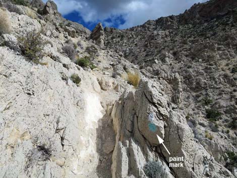 Trail on rocky slope: note paint mark trail sign (view NW) |
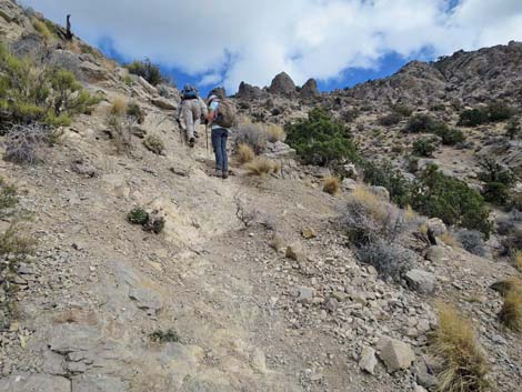
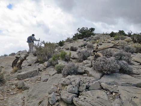
 Trail climbs across rocky slopes (view NW) |
 Trail climbs across rocky slopes (view NW) |
 Trail climbs across Class-3 rocky slopes (view NW) |
 Second switchback (view SW) |
 After second switchback, trail turns up loose hillside (view NW) |
 Sign where trail turns up loose hillside (view NW) |
 Past difficult parts, trail contours towards ridgeline (view E) |
 Hikers approaching the summit ridge (view SE) |
 Atop summit ridge, first view over the other side (view E) |
 Passing rocky crags on the summit ridge (view SE) |
 Summit ridge (view S towards summit) |
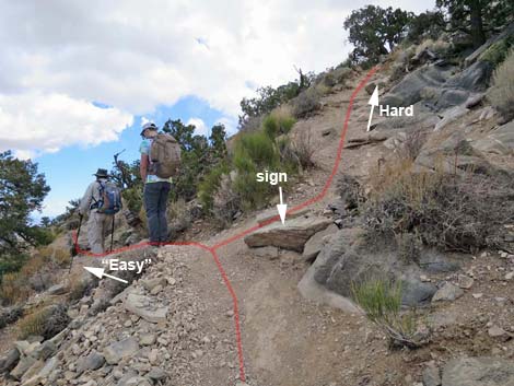 Hikers at trail junction: hard vs. "easy" routes (view SE) |
 Of the many paint marks, the first useful one (view S) |
 The Hard Way: hikers on summit slopes (view SE) |
 The Hard Way: upper summit slopes (view SE) |
 The "Easy" Way: hikers traversing the lower summit slopes (view SE) |
 The "Easy" Way: hikers traversing the lower summit slopes (view SE) |
 Nice views over the ridgeline (view SE into Las Vegas Valley) |
 The "Easy" Way: hiker on upper summit slopes (view S) |
 The "Easy" Way: hiker on upper summit slopes (view SW) |
 The "Easy" Way: hiker approaching the summit (view W) |
 Hiker on summit (view SW to Red Rock Cliffs) [more summit views] |
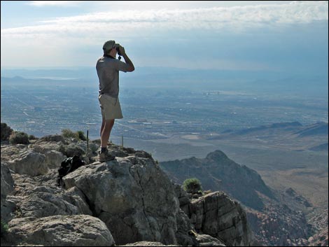 Hiker on summit (view SE to urban Las Vegas) [more summit views] |
 Hikers on the summit (view W) |
 Trashed summit register (note: don't do this) |
Table 1. Hiking Coordinates Based on GPS Data (NAD27; UTM Zone 11S). Download Hiking GPS waypoints (*.gpx) file.
| Wpt. | Location | UTM Easting | UTM Northing | Elevation (ft) | Point-to-Point Distance (mi) | Cumulative Distance (mi) |
|---|---|---|---|---|---|---|
| 01 | Trailhead | 639464 | 4002881 | 4,306 | 0.00 | 0.00 |
| 02 | Leaving Sandstone Quarry | 639461 | 4003003 | 4,311 | 0.09 | 0.09 |
| 03 | Trail Junction | 639419 | 4003162 | 4,339 | 0.11 | 0.20 |
| 04 | Crossing out of Wash | 639227 | 4003459 | 4,439 | 0.23 | 0.43 |
| 05 | Crossing out of Main Wash | 639068 | 4003770 | 4,535 | 0.24 | 0.67 |
| 06 | Crossing Sandstone | 639044 | 4003990 | 4,628 | 0.17 | 0.84 |
| 07 | Toe of Bluff | 639124 | 4004312 | 4,804 | 0.24 | 1.08 |
| 08 | Wilderness Boundary | 639171 | 4004439 | 4,885 | 0.09 | 1.17 |
| 09 | Bottom of Gully | 639361 | 4004769 | 5,126 | 0.28 | 1.45 |
| 10 | Switchback, Lower | 639417 | 4004930 | 5,276 | 0.13 | 1.58 |
| 11 | Switchback, Upper | 639513 | 4005161 | 5,630 | 0.22 | 1.80 |
| 12 | Top of the Ridge, Northern | 639601 | 4005253 | 5,858 | 0.19 | 1.99 |
| 13 | Top of the Ridge southern | 639662 | 4005217 | 5,871 | 0.05 | 2.04 |
| 14 | Trail Forks | 639709 | 4005216 | 5,928 | 0.03 | 2.07 |
| 15 | Summit | 639822 | 4004859 | 6,285 | 0.40 | 2.47 |
| 01 | Trailhead | 639464 | 4002881 | 4,306 | 2.47 | 4.94 |
Happy Hiking! All distances, elevations, and other facts are approximate.
![]() ; Last updated 240330
; Last updated 240330
| Hiking Around Red Rocks | Hiking Around Las Vegas | Glossary | Copyright, Conditions, Disclaimer | Home |