Hiking Around Las Vegas, Lake Mead NRA, Pinto Valley Wilderness Area
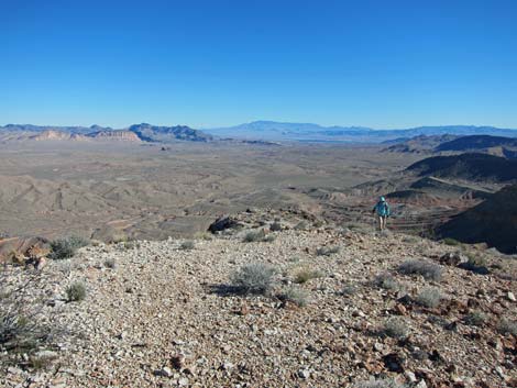
 Hikers on trail (view SW) |
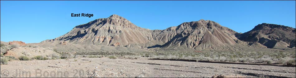
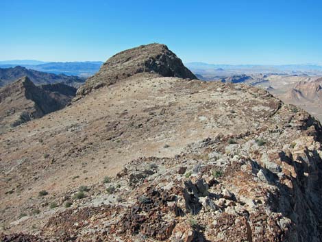
Overview This moderate off-trail route runs for about 1.3 miles from the Northshore Summit parking area to the top of Northshore Peak. The route follows the east ridge, which is fairly easy except for a few, short 3rd-class sections. Despite the relatively low elevation of the summit, the lay of the land is such that the views from the peak are spectacular. This is a great hike. Link to map. |
 Gully with cairn on ridgeline (view S) |
Watch Out Other than the standard warnings about hiking in the desert, ...this hike is fairly safe, but there are a few spots where a slip would result in sudden death, so be careful and watch your kids. The 3rd-class sections require some care, as a fall would result in injury, but they are not difficult. While hiking, please respect the land and the other people out there, and try to Leave No Trace of your passage. This route goes into the Pinto Valley Wilderness Area, so pay particular attention to respecting the land. Also, this is a moderate hike in a remote area, so be sure to bring the 10 Essentials. |
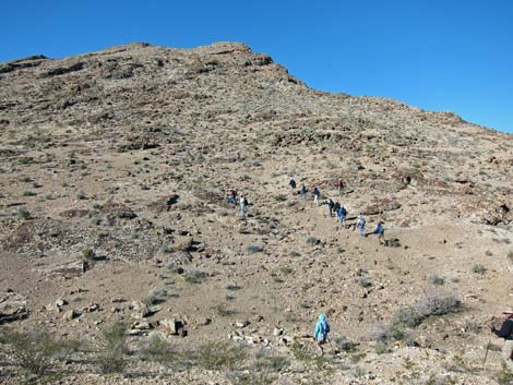
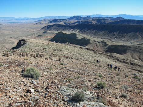
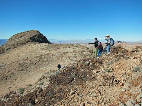
 Hikers on hillside above cairn (view W from Wpt. 03) |
Getting to the Trailhead This hike is located along Northshore Road in Lake Mead National Recreation Area, about 50 minutes northeast of Las Vegas. From town, drive out to Lake Mead, then drive north on Northshore Road for about 20.6 miles to the Mile 20.6 (Northshore Summit) Trailhead. Park here; this is the trailhead. |
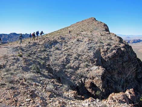
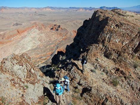
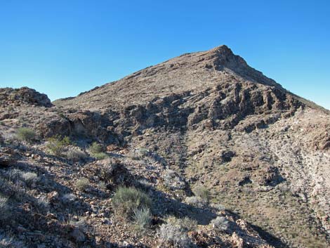 Summit ridge (view W from afar) |
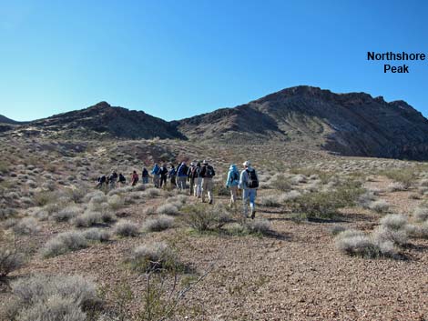
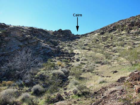
The Hike From the trailhead (Table 1, Waypoint 01), the route crosses the highway, climbs the far roadcut (Wpt. 02), and runs more-or-less due south, passing to the east (left) of a hill near the highway, heading across the open desert towards the toe of the east ridge of Northshore Peak. There is some nice desert pavement in this section, and washes will tend to push you towards the canyon just west of the toe of the ridge. Follow the path of least resistance across the desert towards the toe of the ridge. Before you get too close to the crags, look up through a long, broad gully towards what appears to be a saddle. A large cairn sits atop the "saddle" (Wpt. 03). Perhaps the easiest route runs up the gully to the cairn (Wpt. 03), but it doesn't matter much as all routes lead to the West Ridge. |
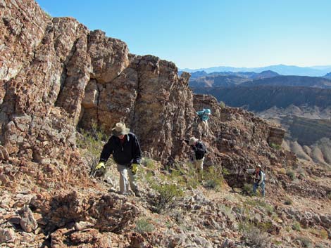
 Hikers on hillside (view W) |
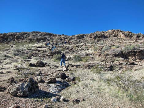
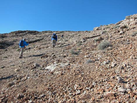
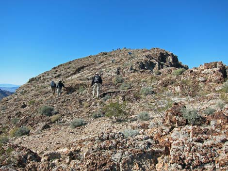
From the cairn, the route runs steeply up the ridge until reaching gentler summit slopes (near to Wpt. 4). On the "gentle" summit slopes, there are two short, 3rd-class down-climbs and one up-climb between Wpt. 04 and Wpt. 05. It is a little easier to pass these by moving a few yards down the south (left) side of the ridge, but use your own good judgment. The first 3rd-class section can be bypassed entirely by following faint sheep trails along the south side of the ridgetop. However, because of the lay of the land, hikers will be on top of a knob and looking down the 3rd-class section before realizing that it could be passed to the south, but look for the game-trail on the way down. After passing the 3rd-class sections (past Wpt. 05), continue up the ridgeline to the summit (Wpt. 06). |
 Looking back down on hikers on the hillside (view E) |
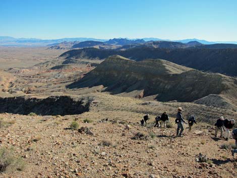
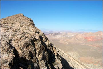
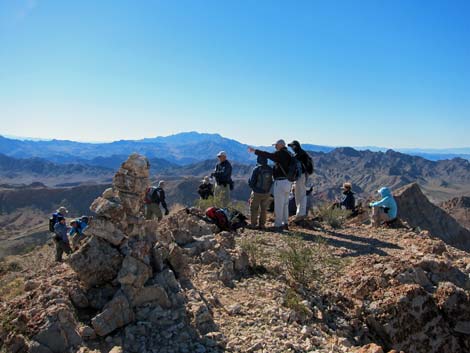
Views from the summit are spectacular. On a clear day, you can see west to the Spring Mountains (Mt. Charleston), east to the Virgin Mountains and the Grand Wash Cliffs, north to the Sheep Range and the Muddy Mountains, and south across Lake Mead to Mount Wilson in Arizona. There are also many fossils along the summit ridge, and parts of the summit block are carpeted in fossil corals. Return to the trailhead by retracing your footprints down the ridge or consider making a loop by hiking down the West Ridge route and circling back along the highway to the trailhead. The West Ridge, however, is a difficult and dangerous route. |
 Hikers on hillside (view W) |
 Hiker approaching bench (view E from above) |
 Hikers on bench (view W) |
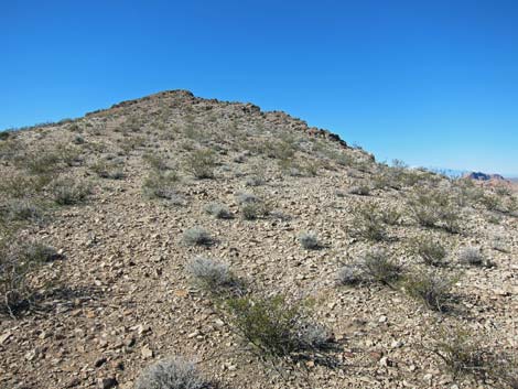 Final hillside before summit slopes (view W) |
 Hikers coming up final hillside (view E from above) |
 First view of gentle summit slopes (view W) |
 Hikers on gentle summit slopes (view W) |
 Hikers bypassing rocky crag (view E from above) |
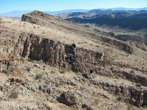 Hikers on Class-3 scramble down (view E from above; Wpt. 05) |
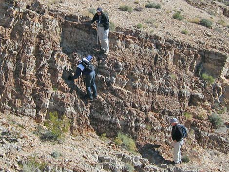 Close-up: hikers on Class-3 scramble down (view E) |
 Close-up: hikers on Class-3 scramble down (view E) |
 Hikers past Class-3 scramble down (view E from above) |
 Hikers on Class-3 scramble up (view W) |
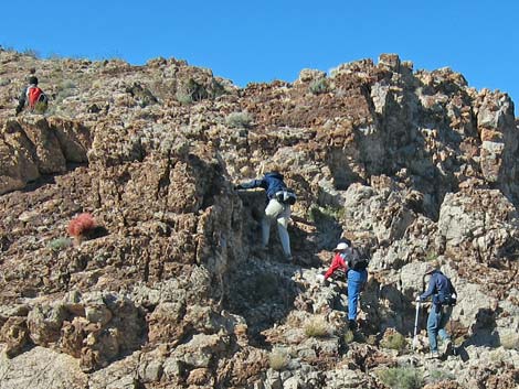 Close up: hikers on Class-3 scramble up (view W) |
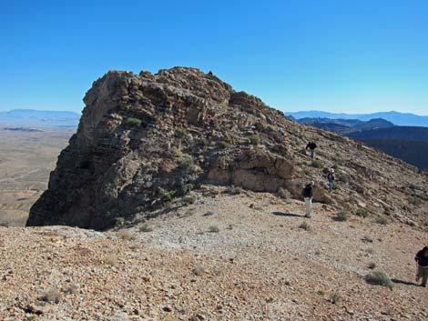
 Summit crags (view W) |
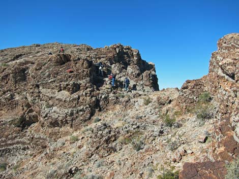
 Hikers approaching the summit (view W) |
 Hikers on summit (view S) [additional summit views] |
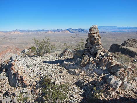 Summit cairn (view NE) [additional summit views] |
Table 1. Hiking Coordinates Based on GPS Data (NAD27; UTM Zone 11S). Download Hiking GPS Waypoints (*.gpx) file.
| Wpt. | Location | UTM Easting | UTM Northing | Elevation (ft) | Point-to-Point Distance (mi) | Cumulative Distance (mi) | Verified |
|---|---|---|---|---|---|---|---|
| 01 | Trailhead Parking | 713897 | 4011567 | 2,391 | 0.00 | 0.00 | GPS |
| 02 | Edge of Road | 713956 | 4011527 | 2,368 | 0.04 | 0.04 | GPS |
| 03 | Ridge | 714146 | 4010908 | 2,575 | 0.45 | 0.49 | GPS |
| 04 | Top of 1st Scramble Down | 713455 | 4010434 | 3,256 | 0.62 | 1.11 | GPS |
| 05 | Top of 2nd Scramble Down | 713372 | 4010365 | 3,216 | 0.08 | 1.19 | GPS |
| 06 | Northshore Peak Summit | 713264 | 4010322 | 3,303 | 0.10 | 1.29 | GPS |
| 01 | Trailhead Parking | 713897 | 4011567 | 2,391 | 1.29 | 2.58 | GPS |
Happy Hiking! All distances, elevations, and other facts are approximate.
![]() ; Last updated 240326
; Last updated 240326
| Hiking Around Lake Mead | Hiking Around Las Vegas | Glossary | Copyright, Conditions, Disclaimer | Home |