Hiking Around Las Vegas, Gold Butte National Monument
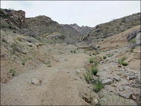
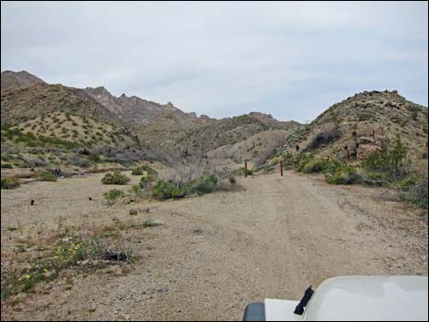 Trailhead access road (view NW into Cottonwood Canyon) |
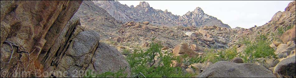
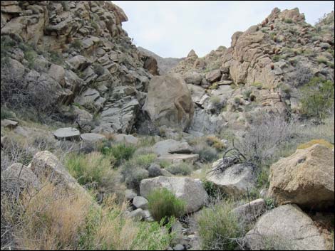
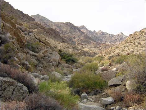
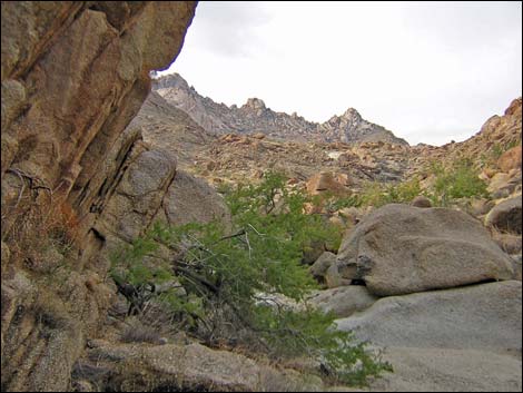
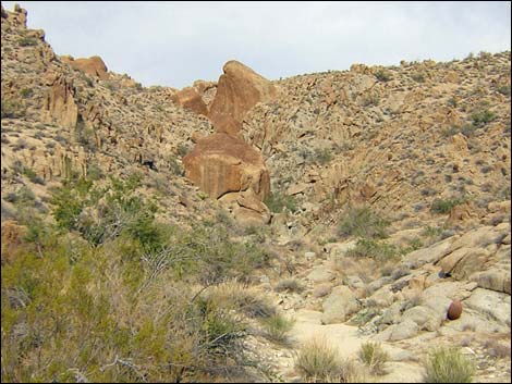
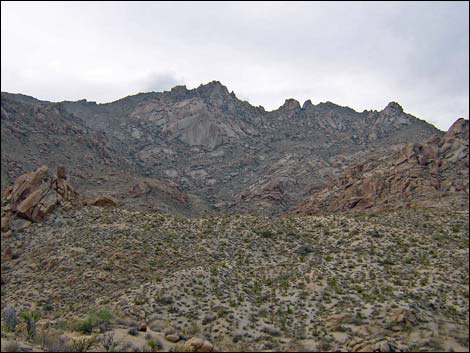
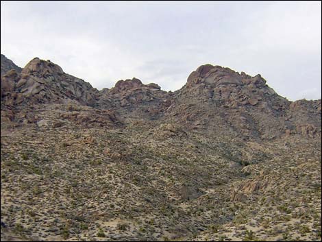
Overview Cottonwood Canyon makes for a nice route that leads to near the east edge of the Jumbo Springs Wilderness Area. Original maps of this wilderness area showed Cottonwood Canyon inside the Wilderness Area, but apparently those maps were wrong. Even so, this canyon displays wilderness character as it runs up into granitic mountains, which are a nice change from the sandstone and limestone with which southern Nevada hikers are so familiar. The canyon starts narrow and rocky, then gets narrower with several little water-polished pour-overs to climb, and finally opens into a wider desert canyon. From high in the canyon, hikers can turn northeast, pick up an old road, and follow it back to the trailhead. There are no trails. Link to map or elevation profile. |
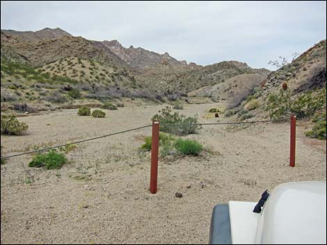 Trailhead parking (view NW) |
Watch Out Other than the standard warnings about hiking in the desert, ...this is a wild and remote area. I encountered no unusual hazards, but be careful climbing the pour-overs as a twisted ankle out there would be more serious than in less-remote areas. This is a wild and remote area without services of any kind (no restrooms, no water, no gas, no food). Bring what you need to survive. Be prepared and be self-reliant. Someone will find you eventually if you stay on a main road, but be prepared to survive alone for a day or two. Cell phones only work along parts of the paved road. While hiking, please respect the land and the other people out there, and try to Leave No Trace of your passage. Also, this is a remote hike, so be sure to bring the 10 Essentials. Don't even bring your cell phone. Note that this hike is located in Lake Mead National Recreation Area, so Park Service rules apply here. |
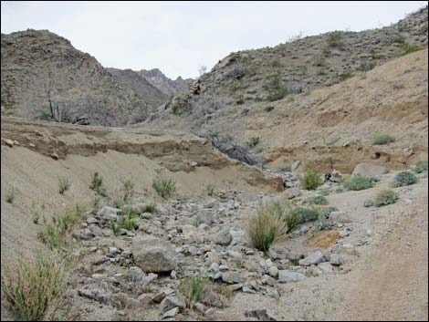
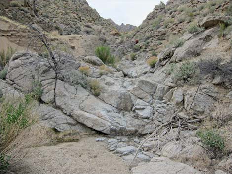
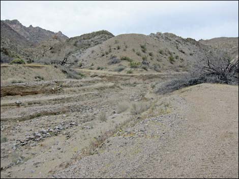 Results of flash floods (view NW) |
Getting to the Trailhead Cottonwood Canyon is located out in Gold Butte National Monument at the northeast end of Lake Mead, about 3-4 hours northeast of Las Vegas in a wild, remote, and scenic area adjacent to the Jumbo Springs Wilderness Area. From town, drive out to Gold Butte National Monument. From Whitney Pocket, continue south on the unpaved Gold Butte Road for 16.2 miles to a fork in the road. Stay left onto Devils Cove Road and drive southeast for an additional 11.6 miles to a nondescript sandy spur road to the west. Turn right and drive a few yards northwest to a pipe and cable fence strung across Cottonwood Wash. Park here; this is the trailhead. |
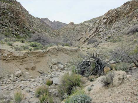
 Route follows old road (view NW) |
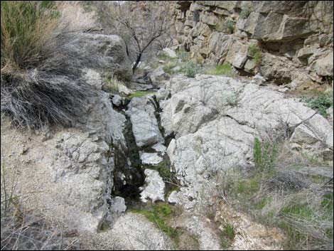
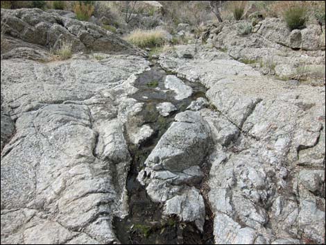
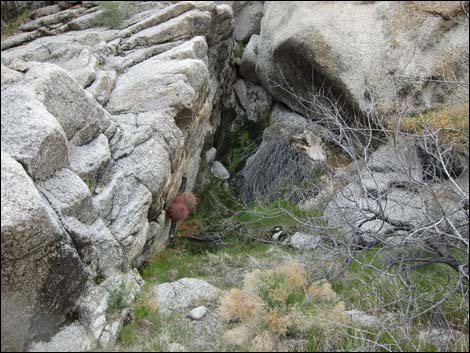
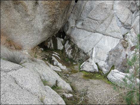
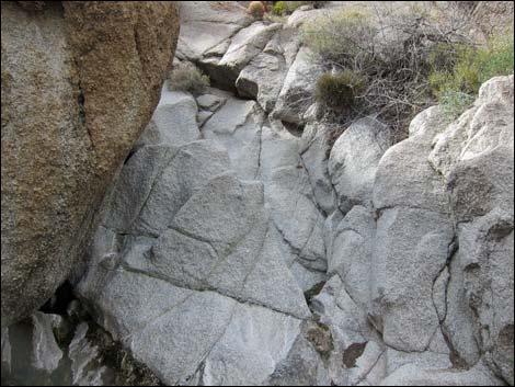
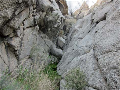
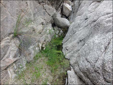
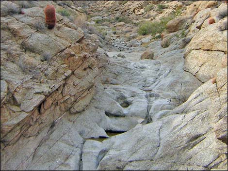
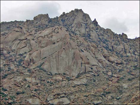
The Hike From the trailhead (Table 1, Waypoint 01), the route crosses the main wash and runs up the side canyon (Cottonwood Canyon) to the west. The route starts up Cottonwood Canyon on an old road. About 2 minutes out, the old road cuts north up a narrow cleft in the canyon wall and heads north. The route stays in the bottom of Cottonwood Canyon and continues northwest. Initially, the bottom of the canyon is hard to walk in because of flash floods, but there are burro trails along the edge of the wash that can be followed in some places. Shortly, the canyon narrows at the first of several water-polished granite pour-overs (Wpt. 02). The pour-overs are nicely sculpted, and some have what appear to be carbonate flowstone deposits. The deposits seem odd because the area is granitic, so the origin of the carbonate materials is curious. |
 Route drops into wash (view NW) |
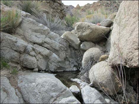
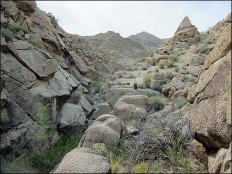
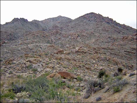
Cottonwood Canyon includes sparsely vegetated granitic ridges and canyons that overlook the eastern end of Lake Mead. The geology of the area is complex and includes a variety of oddly juxtaposed rock types. The lower strata seems to be metamorphic, and these are overlain by granitic rocks. There are granitic domes and smooth cliffs along the ridge tops, and the side slopes are strewn with coarse-grained granitic boulders and deeply cut by canyons. Carbonate and basalt rocks also occur in the region, but the granitic boulders and cliffs remind me of Joshua Tree National Park. After climbing several low pour-overs (about 1 mile out), the main canyon jogs to the north into what seems to be a side canyon. Climb the pour-over (Wpt. 03) that seems to be on the north side of the canyon. There are water pockets above this pour-over where there is enough water to support a small patch of cattail and other aquatic plant species. |
 Route stays in Cottonwood Canyon all the way up (view NW) |
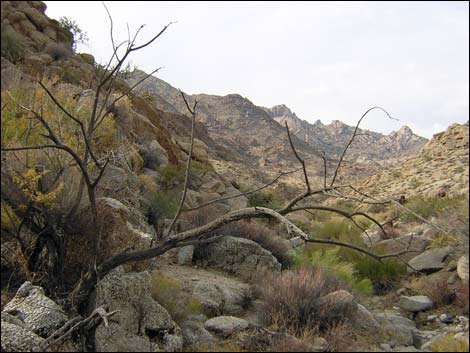
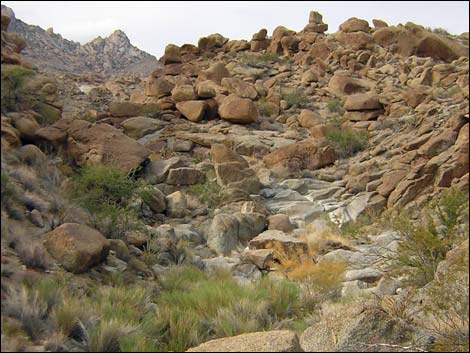
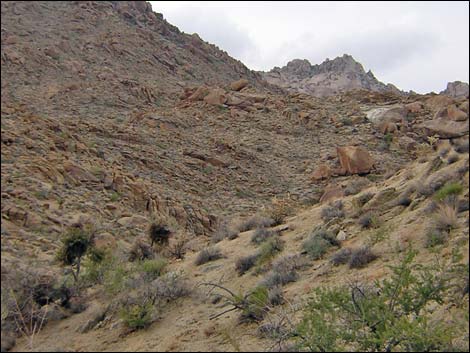
Hiker can continue up the canyon for as far as they want. I didn't have much time, and I only got to a wide, open spot in the canyon 1.2 miles out. At this point, a major side canyon comes in from the north (Wpt. 04). I exited Cottonwood Canyon at this point and climbed side canyon to the northeast, crawling under two enormous boulders part way up the side canyon. There are more water-polished pour-overs under the boulders. I climbed to the ridge above and east of the enormous boulders, headed east to the old road (Wpt. 05), and followed it back to the trailhead (Wpt. 01). The side slopes are rocky and sparsely vegetated with a fair variety of Mojave Desert Scrub species that include creosote bush, catclaw acacia, Mojave yucca, Nevada ephedra, California buckwheat, a few cacti (e.g., beavertail and hedgehog cactus), and there are thick cryptobiotic crusts in some places. There are lots of barrel cactus on the rockier slopes. In Cottonwood Canyon, the dominant species include rabbitbrush, catclaw acacia, desert willow, honey mesquite, and buckhorn cholla. |
 |
 |
 |
 |
 |
 |
 |
 |
 |
 |
 |
 |
 Cottonwood Canyon (view NW) |
 Cottonwood Canyon (view NW) |
 Water-polished granite with potholes (view NW) |
 Cottonwood Canyon (view NW) |
 Cottonwood Canyon (view NW) |
 Side canyon with enormous boulders (view NE) |
 |
 |
 |
 |
 |
 |
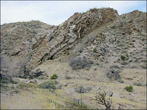
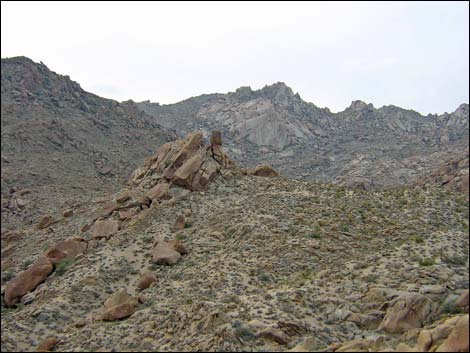
 Rocky crags (view W) |
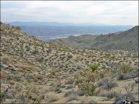 Returning to the trailhead (view S towards Lake Mead) |
Table 1. Hiking Coordinates Based on GPS Data (NAD27, UTM Zone 11S). Download Hiking GPS Waypoints (*.gpx) file.
| Wpt. | Location | UTM Easting | UTM Northing | Elevation (ft) | Point-to-Point Distance (mi) | Cumulative Distance (mi) | Verified |
|---|---|---|---|---|---|---|---|
| 01 | Trailhead | 759120 | 4008616 | 1,945 | 0.00 | 0.00 | GPS |
| 02 | Granite Pour-Over | 758700 | 4008866 | 2,085 | 0.36 | 0.36 | GPS |
| 03 | Pour-Over | 758031 | 4009281 | 2,377 | 0.57 | 0.93 | GPS |
| 04 | Major Side Canyon to North | 757796 | 4009519 | 2,494 | 0.23 | 1.16 | GPS |
| 05 | Illegal Road | 758416 | 4009939 | 2,593 | 0.63 | 1.79 | GPS |
| 01 | Trailhead | 759120 | 4008616 | 1,945 | 1.46 | 3.25 | GPS |
Happy Hiking! All distances, elevations, and other facts are approximate.
![]() ; Last updated 240325
; Last updated 240325
| Hiking Around Gold Butte | Hiking Around Las Vegas | Glossary | Copyright, Conditions, Disclaimer | Home |