(aka Lovell Wash Narrows, Anniversary Mine)
Hiking Around Las Vegas, Lake Mead National Recreation Area
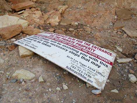 Private property sign (Feb 2019) |
NOTE: March 2024: The owner does not seem to be defending his property line, and lots of hikers are visiting the Narrows. If you value public lands and our right to access them, you need to vote Democratic because Republicans want to sell off our public lands. Make no mistake, this situation serves as an example of where republicans want to take us: to convert our shared public lands to private interests. If you value your access to public lands (be it for hiking, hunting, OHVs, or whatever), you need to help prevent our public lands from being sold, we'll never get them back. |
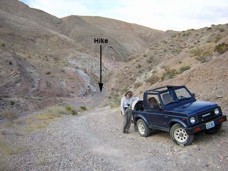 4WD parking and trailhead (view N) |
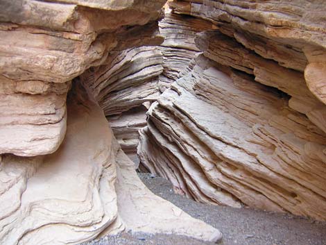
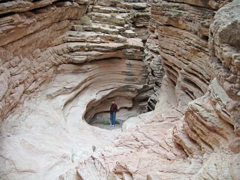
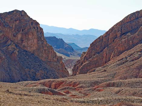
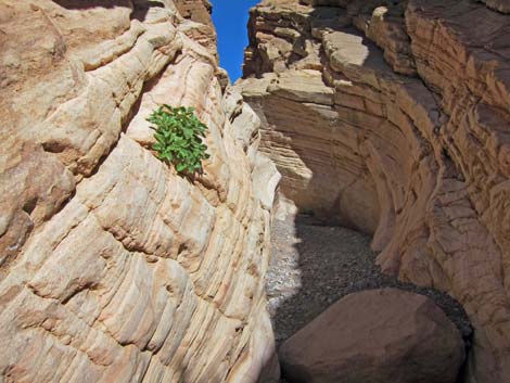
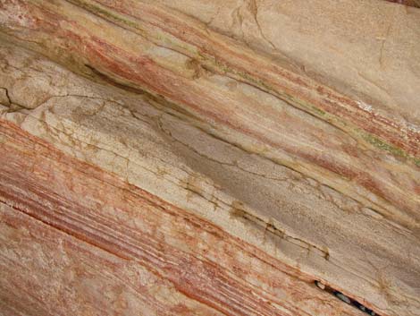
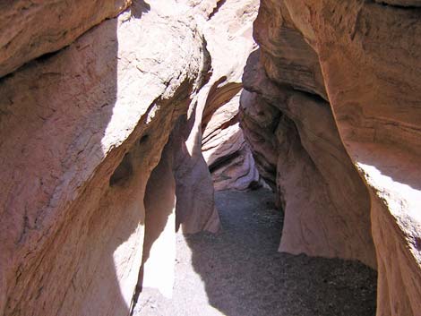
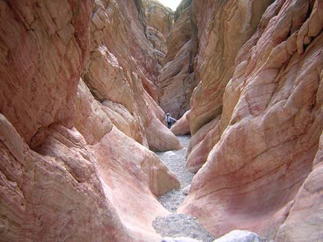
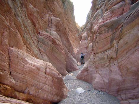
Overview This is an easy hike into an area with some amazing geology and a few mines. This land was laid down as sheets of mud in the bottom of some vast playa lake where ancient animals once roamed. The mud turned to stone, and earthquake activity jumbled the area and turned the lakebed on edge. Now we see several mountain-sized ridges of sedimentary materials (sandstone, limestone, and mudstone of various colors including purple, red, green, yellow, and gray) that have been steeply tilted up; some nearly vertically. Lovell Wash cut through the ridges, creating spectacular narrows that are about 500 yards long (0.3 mi), hundreds of feet deep in places, and only a few feet wide. In many places, hikers can touch the walls on both sides. Link to map. |
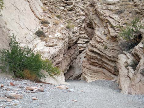
 Lovell Wash below the mines (view N) |
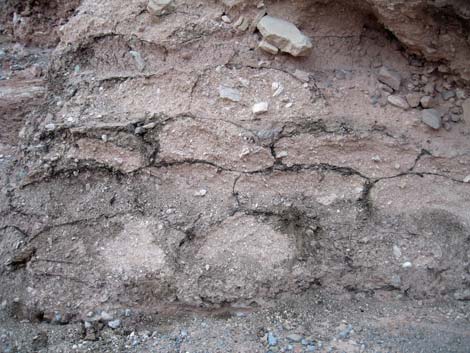
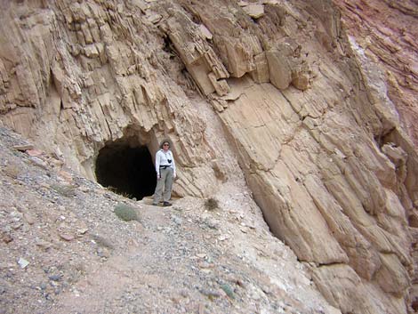
Watch Out Other than the standard warnings about hiking in the desert, ...this is an old mining district. While mines are inherently interesting, they are always dangerous. It is never safe to go into old mines. If you go into a mine, don't touch anything, watch for holes in the floor, and if there is rubble on the floor, assume that it fell from the roof and get out. Be sure to review the standard warnings about holes in the ground. If rain threatens, don't hike in the narrows because a flash flood would ruin your whole day. There are several old borax (colemanite) mines in this area and some new ones. The government tried to close the old mines by blasting the entrances with explosives, but they were only partially successful. Remember, old mines are never safe to enter -- especially after someone ties to blast the entrance shut. |
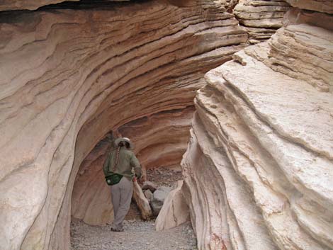
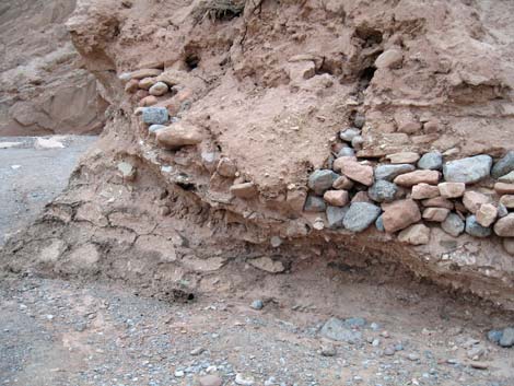
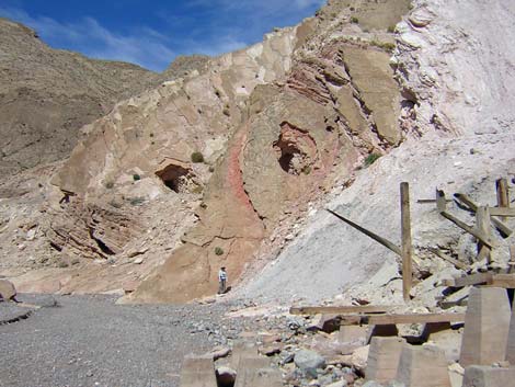 Two historic ore-car tunnels (view N) |
While hiking, please respect the land and the other people out there, and try to Leave No Trace of your passage. Also, even though this hike is short, be sure to bring what you need of the 10 Essentials. The active mining area is on private property. Please respect private property rights and help to ensure continued good relations between the landowner and hikers. Getting to the Trailhead This hike is located along Northshore Road in Lake Mead National Recreation Area, about 1 hour northeast of Las Vegas. From town, drive out to Lake Mead, then drive north on Northshore Road for about 16.0 miles to the 16.0 Mile (Anniversary) Trailhead. From the trailhead, hikers can walk or drive 2WD-HC vehicles farther out Anniversary Mine Road. |
 Lovell Wash above the mines (view N) |
The Hike From the parking area along Northshore Road, hikers may either use the mining roads (driving or walking) to access the narrows, or they may avoid the dusty road and walk up Lovell Wash. Using Lovell Wash, hikers should park in the west-most end of the parking area, then from the trailhead (Table 1, Waypoint 01), walk west on the shoulder of Northshore Road (watching carefully for cars) for about 0.3 miles (500 yards) to Lovell Wash. This route drops into the wash (Wpt. 01A) and turns upstream. Staying to the right in the main wash (Wpt. 01B), this route joins the road route (Wpt. 05) in about 2 miles. Using the roads, from the trailhead (Wpt. 01), drive or walk up Callville Wash Road North (Road 94) for 0.21 miles to the intersection with Anniversary Mine Road (Road 94a) (Wpt. 02). Road 94a turns out of Callville Wash and runs northwest up a side wash towards the hills to the north. The road is used by the miners and can become quite dusty. |
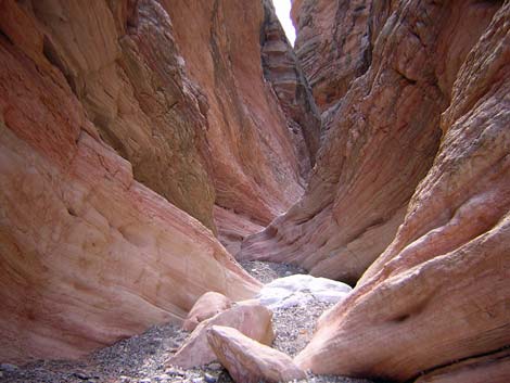
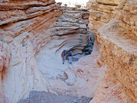
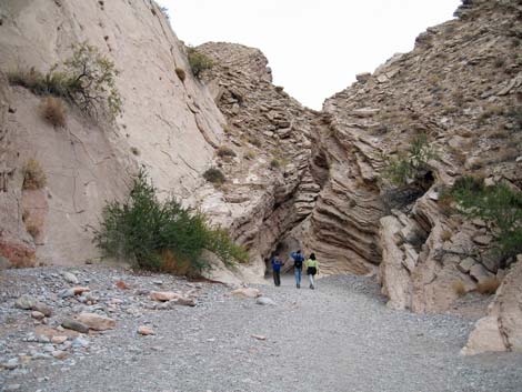
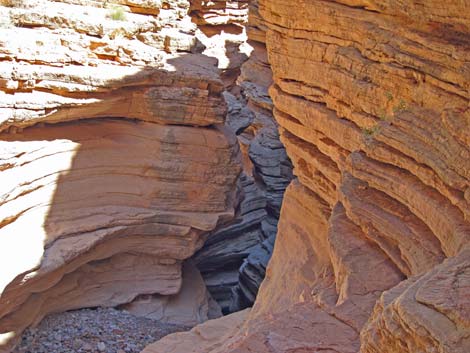
 Lovell Wash (view upstream, NE, into the narrows) |
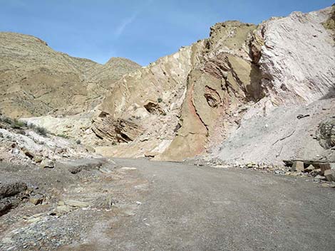
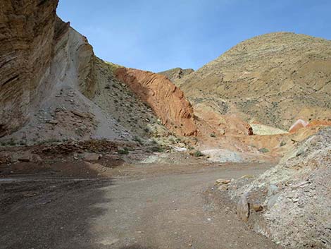
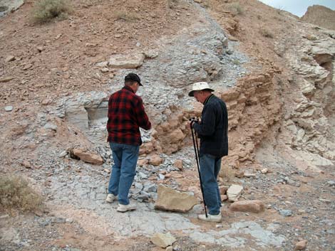
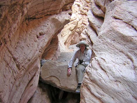
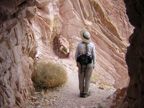
At 1.22 miles out, a big sign announces Ore Car Mine (Wpt. 03), which is outside Lake Mead National Recreation Area. The local Gem and Mineral Club owns this claim, and members can prospect for gemstones. There are a number of mine in this area, and a large, conical, pink-colored tailings pile sits to the north across Lovell Wash. Staying to the left are road intersection, at about 1.86 miles from the trailhead, there is a good place to park 2WD vehicles (Wpt. 04) because the road into the wash can be steep and hard to climb when coming back out without 4WD. From the 2WD parking area (Wpt. 04), the route drops into Lovell Wash (Wpt. 05) and runs upstream (north). The wash is narrow and bordered by upturned sedimentary cliffs at this point, and the wash continues to deepen and narrow. Shortly, the canyon jogs to the north (left) and passes two short railroad tunnels (Wpt. 06) on the wall above the wash on the right. Here, the 1920s miners cut through vertical sedimentary layers (fins) so they could bring ore cars down the wash to an ore-loading facility associated with the Anniversary Mine that formerly sat against the hillside (burned by vandals and removed up by the current miners). |
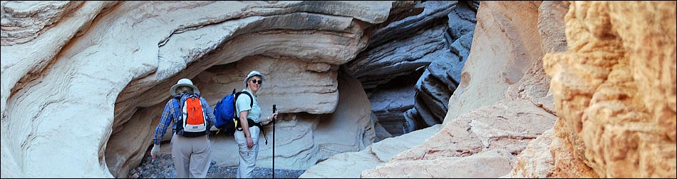
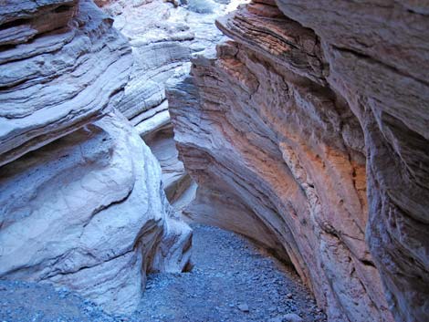
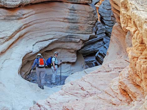
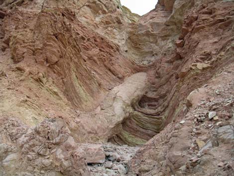
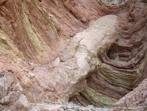
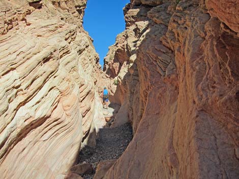
 Inside the narrows |
These short tunnels appear to be safe enough to investigate, but use your own good judgment. The twisting and faulting recorded in the multicolored sedimentary rocks is spectacular. When clambering on the hillside, be careful not to step on the Las Vegas Bearpoppies, which are an endemic species of concern. Also, stay out of the new mine opening. A few yards past the ore-loading facility, the wash jogs to the northeast (right). The remains of a dam (earthworks and cement spillway) sit on the south side of the wash. Mines used to burrow into the hill on the north side of the wash, but they are now closed. Upstream from the dam, the wash widens. The route continues up the wash for 0.18 miles, where it passes below the entrance to the Anniversary Mine, which is located on the south side of the wash above some tailings. They mined a lot of borax (colemanite) here during the 1920s, and the mine is very large and deep. The mine is active again, so stay away and respect private property rights. |
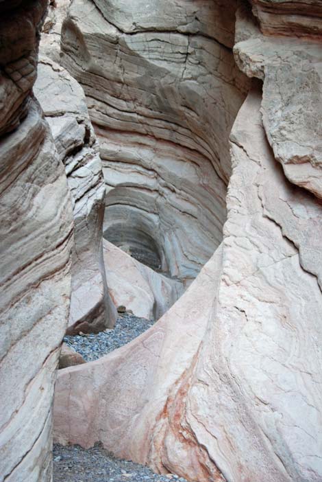
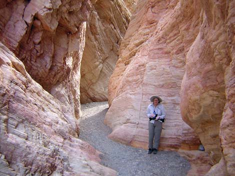
 Inside the narrows. |
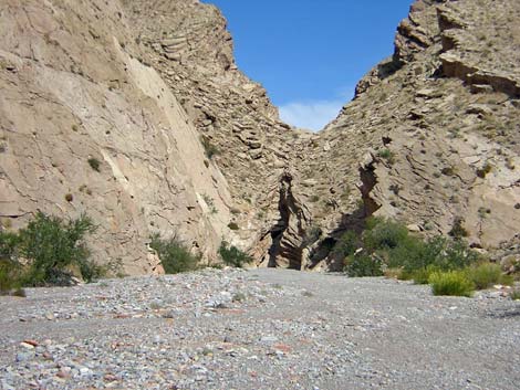
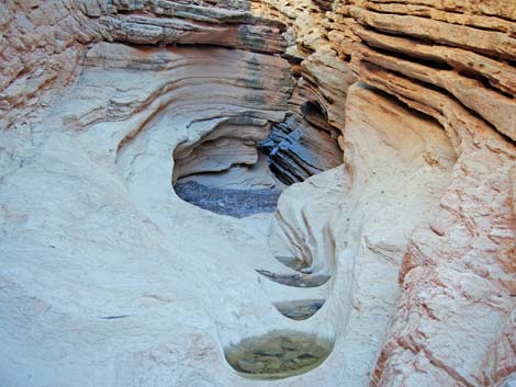
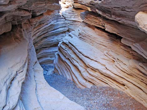
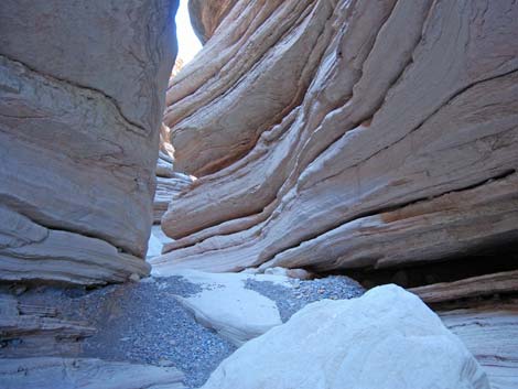
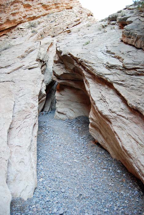
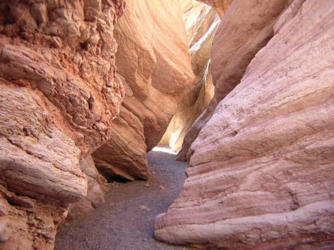
A few yards past the mine, there is a cleft in the south wall of the wash with an odd, tubular structure. When I first saw it, I thought that maybe it was a petrified log partially buried in the mudstone. There are plenty of petrified logs just over the mountains in Valley of Fire, so one here would not be out of place. On more careful inspection, however, the structure looks more like a mud-filled and fossilized burrow of some giant beaver-like creature. Perhaps giant catfish lived here that dug burrows in mud riverbanks like some species do today. Continuing up the wash for about 0.19 miles past the mine, the wash narrows suddenly and dramatically at the lower end of the Lovell Wash Narrows (Wpt. 07). The narrows run for about 500 yards of twists and turns to the upper end (Wpt. 08). Sculpted and water-polished sandstone and sedimentary rocks are spectacular throughout this area. Don't get caught in a flash flood! |
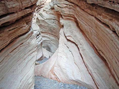
 Inside the narrows |
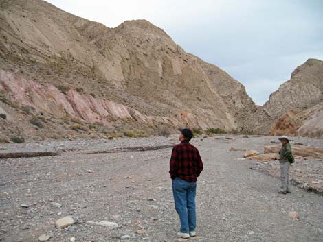
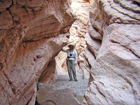
Upstream from the narrows (Wpt. 08), the wash opens into a broad valley that runs north for a few miles to the Muddy Mountains. The scenery is spectacular. The sedimentary cliffs through which Lovell Wash cut are tall, multi-colored, and tilted with some amazing erosion patterns. At one spot just above the narrows, a part of the north wall of the canyon is formed by upturned, purple-colored mudstone that shows ripple marks from some ancient lake or riverbed. The stark beauty of the upturned and eroded multicolored cliffs, and the whole scene, is too much for words. |
 Upper end of inside the narrows |
Hiking up the wash, a fork in the wash (Wpt. 09) eventually leads to a nice place for lunch (Wpt. 10) with great view of the entire area. The place is hard to leave, but when you do, retrace your steps down the wash. Walking at a brisk pace, the upstream end of the narrows is about 30 minutes from where Road 94a hits Lovell Wash (the 2WD parking spot). |
 Lovell Wash above the narrows (view E, upstream) |
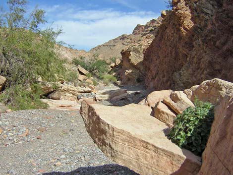
 Lovell Wash (view downstream towards narrows) |
 |
 |
 |
 |
 |
 |
 |
 |
 |
 |
 |
 |
 |
|
|
 |
 |
 |
 |
 |
 |
 |
 |
 |
 |
|
 |
 |
 |
 |
 |
 |
|
 |
 |
 |
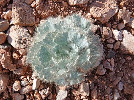 Las Vegas Bearpoppy |
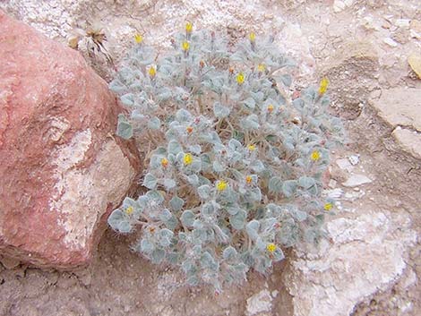 Hairybeast Turtleback |
Table 1. Hiking Coordinates Based on GPS Data (NAD27, UTM Zone 11S). Download Hiking GPS Waypoints (*.gpx) file.
| Wpt. | Location | UTM Easting | UTM Northing | Elevation (ft) | Point-to-Point Distance (mi) | Cumulative Distance (mi) | Verified |
|---|---|---|---|---|---|---|---|
| 01 | Trailhead (2WD) | 708015 | 4008070 | 1,683 | 0.00 | 0.00 | GPS |
| 02 | Callville Rd at Anniversary Mine Rd | 708253 | 4008250 | 1,653 | 0.21 | 0.21 | GPS |
| 03 | Ore Car Mine Parking | 707190 | 4009306 | 1,851 | 1.01 | 1.22 | GPS |
| 04 | 2WD Parking | 706296 | 4009743 | 1,891 | 0.65 | 1.87 | GPS |
| 05 | Anniversary Mine Rd at Lovell Wash | 706237 | 4009871 | 1,870 | 0.09 | 1.96 | GPS |
| 06 | Railroad Tunnels | 706311 | 4010162 | 1,936 | 0.21 | 2.17 | GPS |
| 07 | Narrows, Lower End | 706556 | 4010679 | 1,964 | 0.44 | 2.61 | GPS |
| 08 | Narrows, Upper End | 706884 | 4011022 | 2,067 | 0.32 | 2.93 | GPS |
| 09 | Fork in Canyon | 707211 | 4011298 | 2,148 | 0.37 | 3.30 | GPS |
| 10 | Lunch Spot | 707708 | 4012228 | 2,279 | 0.84 | 4.14 | GPS |
| . | . | . | . | . | . | . | . |
| 01 | Trailhead (2WD) | 708015 | 4008070 | 1,683 | 0.00 | 0.00 | GPS |
| 01A | Lovell Wash at Northshore Rd | 707479 | 4008046 | 1,693 | 0.30 | 0.30 | GPS |
| 01B | Wash Forks | 707284 | 4008579 | 1,729 | 0.38 | 0.68 | GPS |
| 05 | Anniversary Mine Rd at Lovell Wash | 706237 | 4009871 | 1,870 | 1.29 | 1.97 | GPS |
| 07 | Narrows, Lower End | 706556 | 4010679 | 1,964 | 0.65 | 2.62 | GPS |
Happy Hiking! All distances, elevations, and other facts are approximate.
![]() ; Last updated 240326
; Last updated 240326
| Hiking Around Lake Mead | Hiking Around Las Vegas | Glossary | Copyright, Conditions, Disclaimer | Home |