Backroads Around Las Vegas, Lake Mead National Recreation Area
Mark Petterson, Henderson, contributed to this article
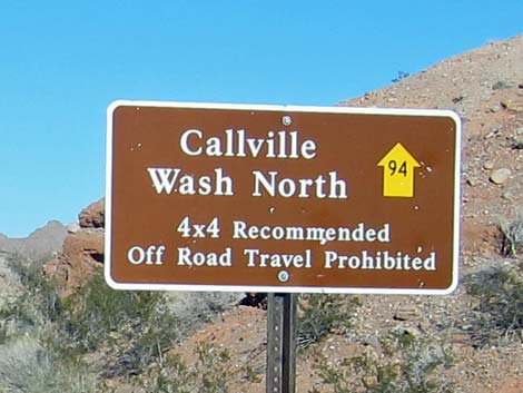 Callville Wash North Road sign (view N) |
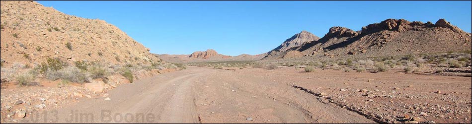
Overview Callville Wash North Road is a backcountry road that follows the bed of Callville Wash northeast from Northshore Road through the wild backcountry of Lake Mead National Recreation Area and out onto BLM land. This road dead-ends about 6 miles out, but runs through country with spectacular layered, twisted, and faulted multicolored sedimentary rocks. This road provides hiker access the Bowl of Fire Southwest and Bowl of Fire North, which are in the Muddy Mountains Wilderness Area. There are no structures or services of any kind along this road. This road gives the feeling of true wilderness even though it is never more than about 2 miles from the paved Northshore Road. Link to map. |
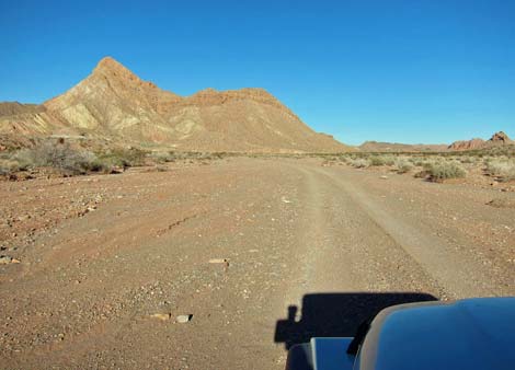
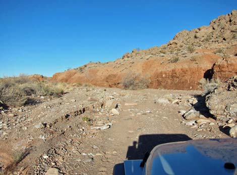
 Northshore Rd at Callville Wash North Road (view N) |
Watch Out Other than the standard warnings about hiking in the desert, ...this is a fairly easy drive, especially during the first half. In January 2013, the road was passable in a jeep using only 2WD, but having 4WD was safer. Historically, much of the road surface in the first half was sand and loose gravel with considerable evidence of vehicles having been stuck. After flash floods, the road surface is firmer, but it gets rougher and rockier when the road enters the narrow canyon. Check with local rangers on the road conditions before driving into the backcountry. Maps of approved backcountry roads are available online and at the Alan Bible Visitor Center. While out, please respect the land and the other people out there, and try to Leave No Trace of your passage. Also, even though this road is short, be sure to bring what you need of the 10 Essentials. Be aware of the weather report and stay out of this area if rain is expected; you don’t want to get caught in a flash flood. |
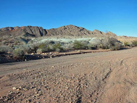
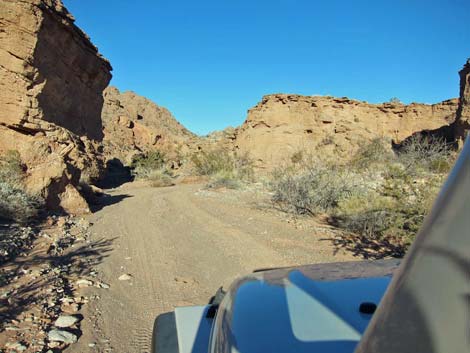
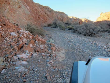
 Dropping into Callville Wash (view NE) |
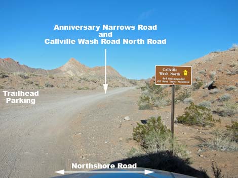
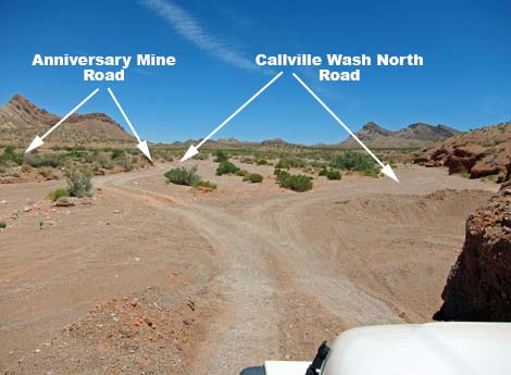
Getting to the Roadhead This road is located in Lake Mead National Recreation Area, about 1 hour northeast of Las Vegas. From town, drive out to Lake Mead, and then drive north on Northshore Road to Mile Marker 16 and the Anniversary Narrows Trailhead. At the turnoff, watch for a brown backcountry road sign giving the name of the road and a numbered yellow arrow. Approved roads are signed with yellow arrows. The black number in the center of the arrow designates the road number. Driving on roads or trails not marked with the yellow arrow is prohibited. Driving off roads, in washes, or cross country damages the fragile desert soil and is prohibited by National Park Service regulations. |
 Dropping into Callville Wash (view NE)/> |
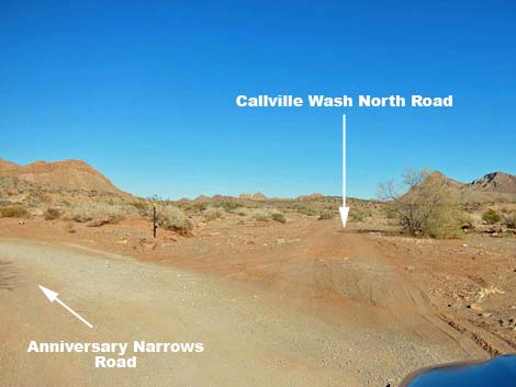
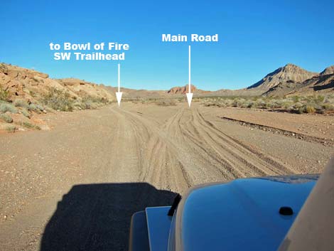
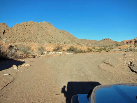
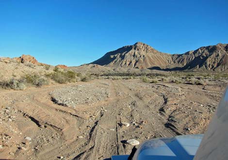
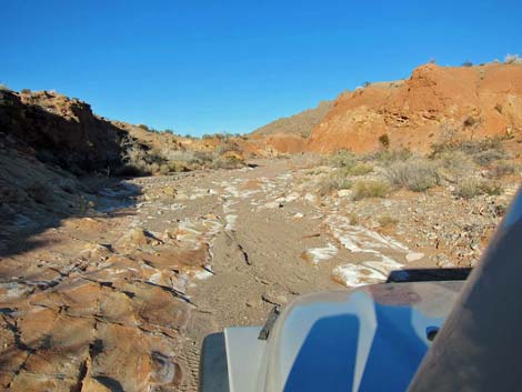
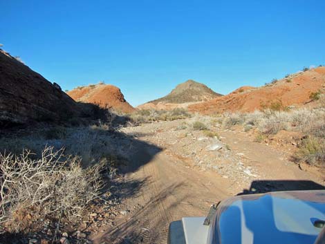
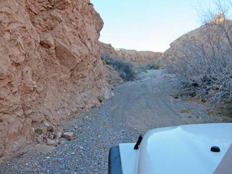
The Road From the pavement (Table 1, Site 0782), the road passes a parking area on the left where people with 2WD vehicles often park for hikes in this area (Site 1061). The road then goes down a short but relatively steep ramp into Callville Wash and forks. Technically, the legal road goes left, but the "illegal" road to the right quickly connects with the legal road. Staying to the left, the road quickly forks again (Site 0784). Here, the Anniversary Mine Road stays left as the main road, while the Callville Wash North Road continues straight. Note the small brown sign with a yellow arrow and the number 94: this is a "legal road" marker. |
 Anniversary Mine Road (Rd 94A) forks left (view NE) |
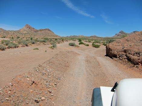
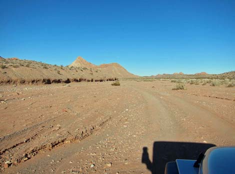
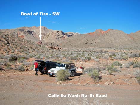
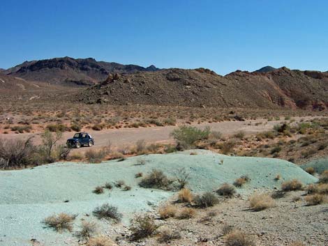
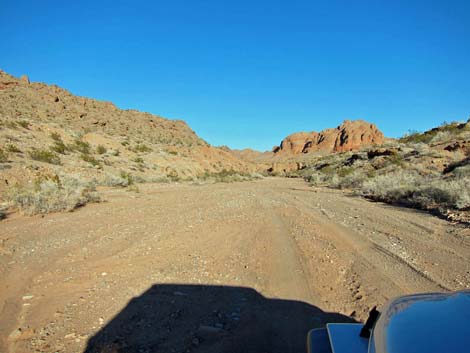
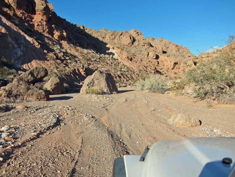
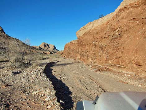
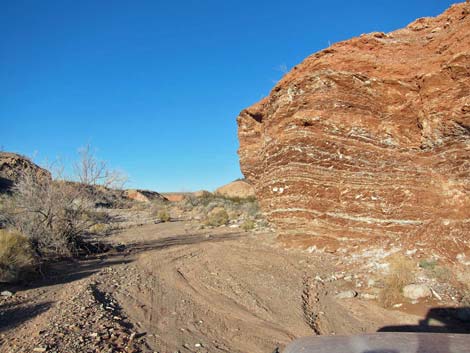
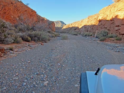
The road runs up the broad Callville Wash. The left side of the wash generally is a colorful bluff, while the right side opens onto a broad, open desert. The road surface (two-tracks in the sand) generally is firm, but some parts are more sandy than others, and a few places are a bit rocky. Vegetation in the wash is sparse, but includes catclaw acacia loaded with mesquite mistletoe (staple food of Phainopepla), desert willow, and mojave rabbitbrush. The road is pretty easy, and as it passes an isolated mountain on the left (Murphy Peak), the road forks (about 1.8 miles out). The fork to the left goes to the Bowl of Fire Southwest trailhead parking, while the fork to the right stays in the main part of Callville Wash. At about 2.4 miles out, the two forks rejoin. |
 Callville Wash: broad and open (view NE) |
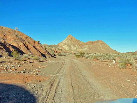
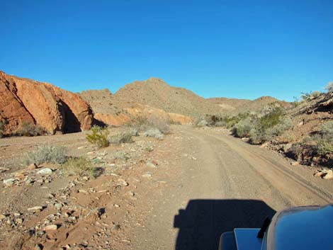
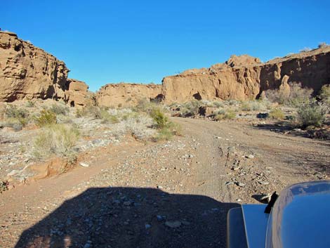
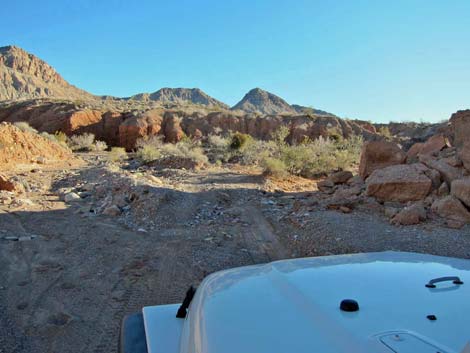
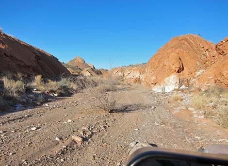
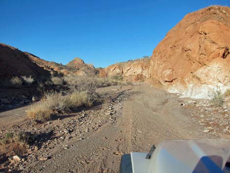
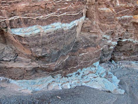
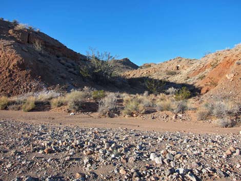
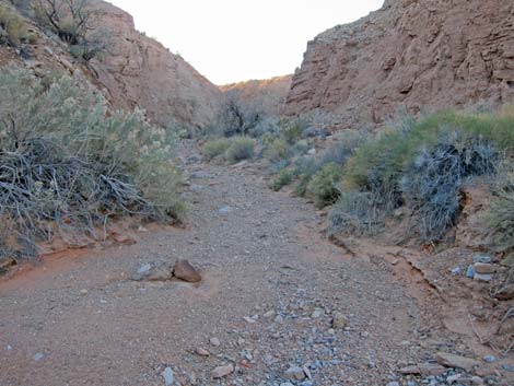
Just beyond where the roads merge, there is an interesting outcrop of green mudstone that forms a flattop hill on the left side of the wash. The green is part of a layer of volcanic ash that covered much of the region, but nowhere else is there such a large and thick outcrop. Farther along, there are some incredible cliffs with white veins of gypsum spider-webbing through the reddish-brown rock, and keep an eye out for narrow veins of green mudstone. The road continues up the wash, and at about 2.8 miles out the wash forks (Site 1235). The wash to the left is blocked off with white boulders, but it provides hiker access to the south side of the Bowl of Fire North. The road bends to the east, then resumes its generally northeasterly direction and soon runs up into a canyon. There are some interesting erosion patterns in this area, including cave-ins demonstrating that erosion continues in the area and foretelling more to come. |
 Callville Wash: up along the bluffs (view NE) |
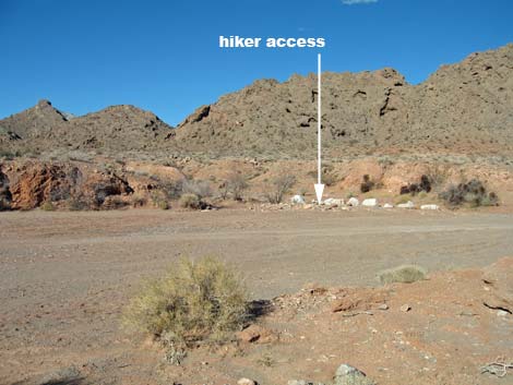
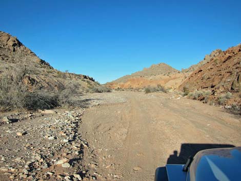
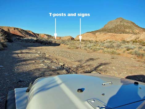
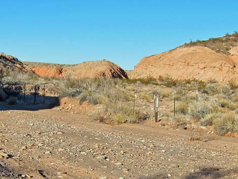
The wash winds around into a narrow section of canyon and quickly reaches a washout area that provides a bit of nearly 4WD excitement, then continues up the canyon. At about 4.6 miles out, a side wash comes in from the left (Site 1236). The side wash is closed to vehicles, but provides hikers access to the south side of the Bowl of Fire North. At about 4.8 miles out, a side wash comes in from the right (Site 1237). Again, closed to vehicles, but providing hiker access to the paved Northshore Summit parking area. Similarly, at about 4.9 miles out, another side wash on the right (Site 1238) is closed to vehicles (notice t-posts and carsonite signs) but provides alternate hiker access to Northshore Summit parking area. |
 Murphy Peak on the left (view NE) |
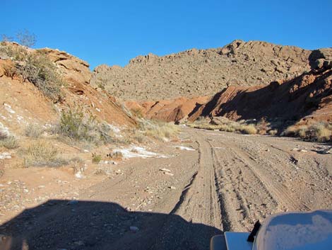
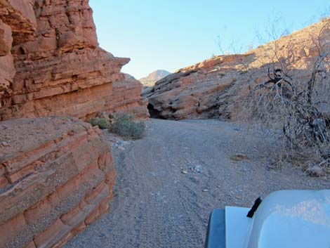
Continuing up the canyon, the walls keep getting taller and narrower. The road winds back and forth across the narrow wash, sometimes brushing up against the left wall then squeezing between the right wall and some trees or clambering over a rough and rocky spot. At about 5.7 miles out, a side wash comes in from the left (Site 1239). The side wash is closed to vehicles, but provides hiker access to the north side of the Bowl of Fire North. Finally, at 5.8 miles out, the road ends at a mini-slot canyon (Site 1240). The layers of twisting, faulting, and erosion recorded in the multicolored sedimentary rocks is spectacular. If hikers climb around on the hillsides, be careful not to step on the Las Vegas Bearpoppies, which are an endemic species of concern. |
 Road forks to Bowl of Fire trailhead parking (view NE) |
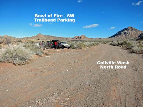 Approaching Bowl of Fire trailhead parking (view NW) |
 Bowl of Fire trailhead parking (view NW) |
 Roads have merged (view N |
 Outcrop of green volcanic-ash mudstone (view N) |
 Outcrop of green volcanic-ash mudstone (view S) |
 Road in wash |
 Approaching hiker access to Bowl of Fire North (view NE) |
 Hiker access to Bowl of Fire North (view N) |
 Northshore Peak in the distance (view NE) |
 |
 |
 |
 |
 Rough patch in the road (view N) |
 Smooth patch in the road (view N) |
 |
 |
 |
 |
 |
 |
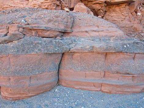
 Layered mudstones |
 Side canyon provides hiker access to Bowl of Fire North (view NW) |
 |
 |
 Approaching hiker access to Northshore Summit (view NE) |
 Hiker access to Northshore Summit (view NE)Callville Wash North Road |
 Canyon walls frequently cave in (view N) |
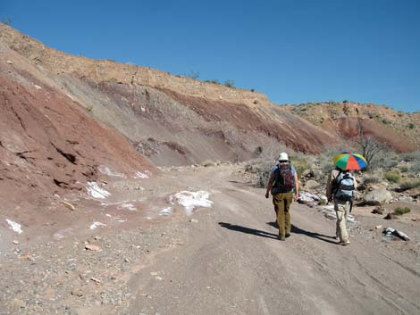 Hikers using the road (view N) |
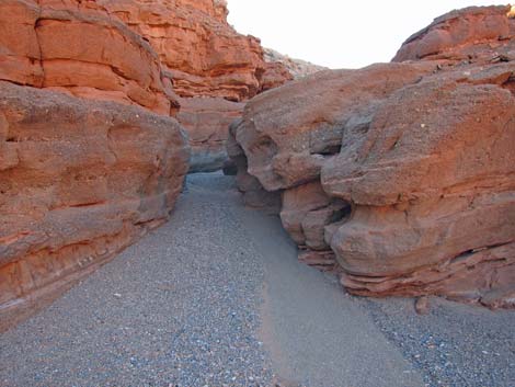
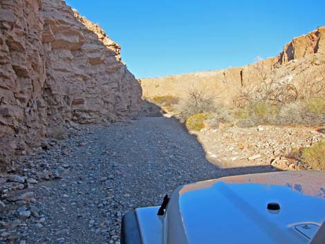 Canyon narrows |
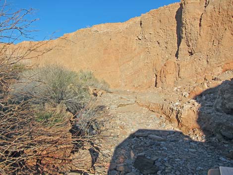 Cave-in forms a rocky patch of washed-out roadway (view N) |
 |
 |
 Side canyon provides hiker access to Bowl of Fire North (view W) |
 Approaching end of the road (view NW) |
 Layered sandstone at the end of the road (view W) |
 Narrows at end of the road (view NW) |
Table 1. Highway Coordinates Based on GPS Data (NAD27; UTM Zone 11S). Download Highway GPS Waypoints (*.gpx) file.
| Site | Location | UTM Easting | UTM Northing | Latitude (N) | Longitude (W) | Elevation (ft) | Verified |
|---|---|---|---|---|---|---|---|
| 0782 | Northshore Rd at Callville Wash North Rd | 708039 | 4008021 | 36.19647 | 114.68622 | 1,673 | Yes |
| 0784 | Callville Wash North Rd @ Rd 94a | 708254 | 4008249 | 36.19848 | 114.68377 | 1,702 | Yes |
| 0786 | Callville Wash North Rd at BOF SW TH | 710123 | 4010238 | 36.21599 | 114.66247 | 1,870 | Yes |
| 1061 | Anniversary Narrows 2WD Park | 708052 | 4008089 | 36.19709 | 114.68606 | 1,707 | Yes |
| 1235 | Callville Wash North Rd at BOF-N trail 1 | 710981 | 4010950 | 36.22223 | 114.65273 | 1,910 | GPS |
| 1236 | Callville Wash North Rd at BOF-N trail2 | 712502 | 4012571 | 36.23649 | 114.63539 | 2,102 | GPS |
| 1237 | Callville Wash North Rd at Northshore Trail 1 | 712753 | 4012806 | 36.23855 | 114.63253 | 2,110 | GPS |
| 1238 | Callville Wash North Rd at Northshore Trail 2 | 712762 | 4012944 | 36.23979 | 114.63239 | 2,126 | GPS |
| 1239 | Callville Wash North Rd at BOF-N Trail3 | 712666 | 4014024 | 36.24954 | 114.63317 | 2,201 | GPS |
| 1240 | Callville Wash North Rd, End | 712658 | 4014157 | 36.25074 | 114.63322 | 2,218 | GPS |
Happy Hiking! All distances, elevations, and other facts are approximate.
![]() ; Last updated 240326
; Last updated 240326
| Backroads Around Lake Mead | Hiking Around Las Vegas | Glossary | Copyright, Conditions, Disclaimer | Home |