Backroads Around Las Vegas, Desert National Wildlife Refuge
 Caution: deep, soft playa dust |
Alamo Road Conditions For several years, Alamo Road was closed at the playa. This is no longer true -- the road is open. From the DNWR website: Motorists on Alamo Road stand a good chance of getting stuck at Desert Dry Lake. The playa dirt has turned to powder (poof dirt). Conditions are hazardous. Given extreme heat and the slim chances of being found quickly, anyone whose vehicle gets stuck in that area is putting their life at risk. My recommendation: don't try to drive across the playa during summer when if you get stuck -- you die. Greg writes (May 2018): The poof-dirt looks treacherous. We sailed right through in a Range Rover and a Range Rover Sport with 11.4" clearance when raised, and of course, 4-wheel drive. I'm guessing either vehicle might have gotten stuck at normal height, and it will almost certainly render any lesser vehicles immobile. Drivers: please send an email with current conditions. |
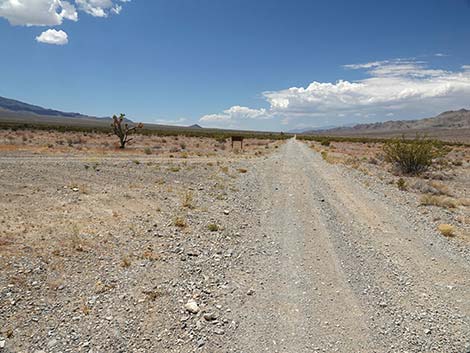
 Pahranagat Visitor Center Road (view W from Highway 93) |
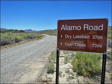
Overview Alamo Road, so named because it connects Corn Creek Field Station in the south with the town of Alamo in the north. Perhaps not surprisingly, this road is also called "Old Corn Creek Road" because, from the northern perspective, it connects Alamo with Corn Creek. Starting at Pahranagat NWR, this 70-mile, bumpy dirt road climbs westward over the East Pahranagat Range into the next valley, and then runs south along the west side of the Sheep Range complex. The road provides backroad access to big, wild country, sand dunes, a challenging playa crossing, and plenty of wild places to camp along under the stars. Alamo road was closed some 30 miles out because of road conditions on Dry Lake Playa, but the road is now open all the way from Highway 95 to Highway 93. Link to map. |
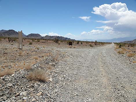
 Pahranagat HQ Road at Alamo Road North (view W) |
There are a number of primitive campsites along Alamo Road. Camping is unrestricted, so campers can stop anywhere, but be kind to the land and choose an existing campsite; don't drive off-road into the bushes to camp and be sure to practice Leave No Trace techniques in these undeveloped campsites. The road usually is suitable for 2WD-HC vehicles, but it can also be rough and washed out. Drivers should stop at the visitor center and inquire about current road conditions. This road runs into wild and remote country where one storm can change the road conditions to 4WD only or worse. At the southeast edge of Desert Dry Lake, signs used to prohibit crossing the playa and connecting with the remaining 40 miles of road to Corn Creek Field Station. Deeply rutted roads and extremely deep playa dust, which is surprisingly difficult to drive through even in 4WD, resulted in too many people getting stuck and stranded on the playa in life-threatening summer conditions, so the refuge closed the section of road that crosses the playa. It is open now, but drive carefully on the playa. |
 Alamo Road departing the pavement (view SW) |
Alamo Road traverses typical middle-elevation Mojave Desert Scrub habitat with species such as Creosote Bush, White Bursage, and scattered Joshua Trees. The road often traverses washes, so Cheesebush and Mojave Rabbitbrush can be common too. During spring, there can be many flowers along the road, including Bigelow's Monkeyflower, Desert Woollystar, and Golden Evening-Primrose. Typical mammal species along Alamo Road North include Black-tailed Jackrabbit, Desert Cottontail, White-tailed Antelope Squirrel, Mule Deer, and even Desert Bighorn Sheep. At night, Desert Woodrats can be found in rocky areas, Merriam's Kangaroo Rats are widespread, and Desert Kangaroo Rats live in the sand dunes. |
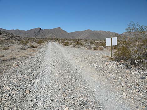
 Sign at start of Alamo Road North (view SW) |
Watch Out Other than the standard warnings about being in the desert ... Alamo Road generally is a good dirt road, but it runs out into wild and remote country. There are no services (no fuel) or developments of any kind. Cell phones don't work. Bring water and food, a spare tire, a shovel, tools, a tow rope, bailing wire (I learned the hard way), and anything else needed to survive a night or two stuck in the desert. Close in, the road is graded occasionally, but farther out the road has rocky spots and washouts that tend to sneak up in a way that could break an axle. The speed limit is 25 mph, and sticking to the speed limit will help prevent breaking axles on unseen rills across the road. While out, please respect the land and the other people out there, and try to Leave No Trace of your passage. Also, this road leads into remote country, so be sure to bring the 10 Essentials. This is a wildlife refuge, so pay extra attention to respecting the land. |
 Historic stone cabin (mile 0.73; view N) |
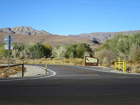
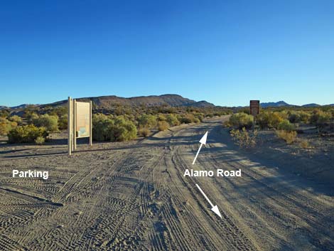
Location Alamo Road is located on the Desert National Wildlife Refuge, but the northern end starts up near Alamo, about 1-1/4 hours northeast of Las Vegas. From town, drive north on Interstate-15 for 21 miles to Exit 64. Exit onto Highway 93 northbound. Consider topping off the gas tank at the truck stop, as this is the last of the gas except for going out of the way to Alamo to get gas. Drive north on Highway 93. At about 58 miles out, the road enters Pahranagat National Wildlife Refuge, and at 63 miles out, there is a primitive roadside rest area on the right. At 66.5 miles out, turn left onto Pahranagat Visitor Center Road (Table 1, Site 0486). Turn here; this is the roadhead. |
 Alamo Road exiting Pahranagat NWR (2.26 miles out, view S) |
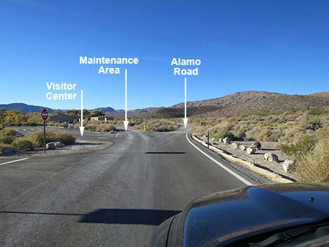
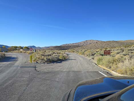
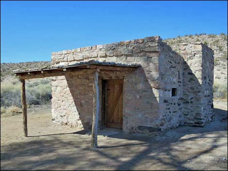
The Road Alamo Road Southbound -- Highway 93 to Desert Sand Dunes From Highway 93 (Site 0486; 0.00 miles out), the paved entrance road winds westward 0.4 miles towards the Pahranagat Visitor Center. Approaching the Visitor Center, the road forks three ways. The pavement forks to the left into the Visitor Center parking lot. The middle fork leads into the headquarters-maintenance area, and the right fork is Alamo Road. Staying right onto the graded dirt Alamo Road (Site 0943; 0.44 miles out), the road passes behind the maintenance and housing area (please drive slowly to keep the dust down in the residential area). Shortly (0.74 miles out), the road passes a stone cabin on the right: the Petroglyph Cabin. This old structure was built partly out of stones into which petroglyphs have been carved. This would be considered an atrocity these days, but even so, it is interesting to stop and have a look and to contemplate about why we don't damage petroglyphs. |
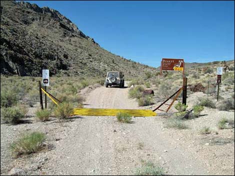
 Road sign entering Desert NWR |
Past the Petroglyph Cabin, the road bends south to run between Middle Marsh and the base of the arid hills, and then crosses a cattle guard. (1.22 miles out). The road continues south along Middle Marsh to a fork in the road (Site 0492; 2.30 miles out). Parking and information signs about Pahranagat Wildlife Refuge mark the fork. Here, Alamo Road bends right and starts angling away from the riparian area, exiting Pahranagat Wildlife Refuge and entering Desert Wildlife Refuge, although the signs are not clear about entering Desert NWR. Alamo Road runs up and across the bajada (with a few sharp curves), then runs up into an open canyon in the East Pahranagat Range, which at this point is a loosely connected jumble of ridges. At about 5.29 miles out, Alamo Road passes a primitive campsite that is easier seen when coming down the road. High in the canyon, Alamo Road crosses a cattle guard (Site 1878; 6.29 miles out) where a large sign announces entry into Desert National Wildlife Refuge. Expansion of the refuge in 2002 pushed the border all the way to the edge of Pahranagat National Wildlife Refuge, but the sign remains here. |
 Old boundary of Desert NWR (mile 6.25; view SW) |
Continuing up the canyon, Alamo Road runs up onto a low saddle (7.82 miles out) that marks the crest of the East Pahranagat Range in this area. To the left of the saddle, a short spur road runs up onto a knoll with nice views to the west (Pahranagat Range), southwest (East Desert Range), and south (Sheep Range). Other mountain ranges stretch off into the distance. The knoll makes for a suitable primitive campsite. Past the saddle, Alamo Road starts down into the next valley. Note that the USGS topo map and some GPS devices show that, at about 300 yards below the saddle (7.97 miles out), Alamo Road bends to the right and heads up a sandy canyon. This is no longer true: there is no road to the right. Alamo Road stays left and heads down the canyon for about 3/4 miles. At the bottom of the canyon, Alamo Road bends hard to the right and passes a service road (Site 1541; 8.61 miles out) on the left, which runs out to a guzzler visible on a hillside far to the southeast. |
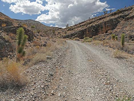
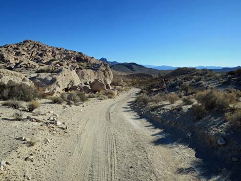 Alamo Road passing cliffs (mile 10.32; view S) |
Still curving to the right past the service road, the road begins to ascend a sandy canyon. At about 0.4 miles past the guzzler service road, the wash forks (9.03 miles out), and Alamo Road stays left at the confluence. Also at the confluence, the non-existent road noted near the saddle returns to Alamo Road. Some GPS devices show that Alamo Road goes up the wash to the right -- this is not correct. Emerging from the narrow, sandy canyon and now running up the broad valley, Alamo Road curves to the left and reaches a fork in the road (Site 0493; 9.65 miles out). This is the first corner of a triangular intersection with Badger Valley Connector Road. Alamo Road stays left, while the road to the right heads north 2.3 miles to connect with Badger Valley Road, which leads northwest to Tikaboo Peak or northeast to Highway 93. Staying left at the first fork, in about 100 yards, Alamo Road stays left and passes the second point on the triangle. Alamo Road climbs south into a narrower canyon and runs past some rocky fins formed of volcanic ash. |
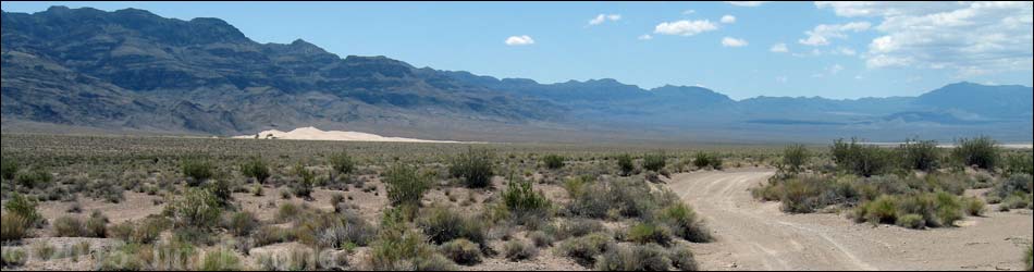
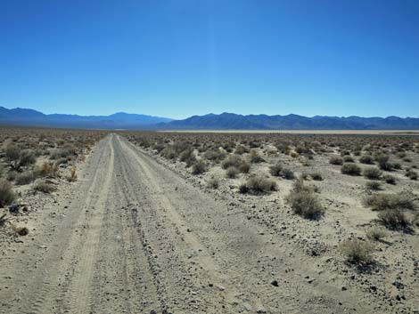
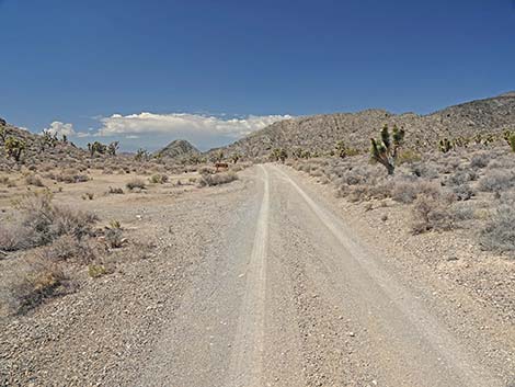
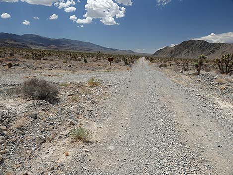
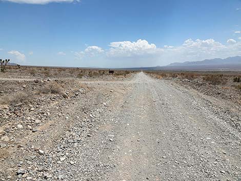
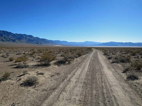 Alamo Road in Desert Dry Lake Valley (view S) |
Climbing onto a high saddle, the highest point on the road (4,320 ft; 10.36 miles out), Alamo Road descends steeply past rocky cliffs onto broad, open desert flats. Running southwest, generally down the drainage system, Alamo Road eventually bends to run more southerly through a broad sandy valley. Alamo Road eventually bends southeast around the base of an isolated mountain and curves to the right to drop through a rocky canyon. Emerging from the canyon, now heading southwest, Alamo Road passes a closed road (Site 1963; 14.17 miles out), on the left. The closed road is Old Corn Creek Road, which can be hiked some 10 miles down to Highway 93. Now heading southwest, Desert Dry Lake, in the far distance, comes into view for the first time. Running more-or-less straight southwest, the road forks (Site 0542; 16.56 miles out). Here, the right fork is a closed service road; Alamo Road bends left to run due south. This closed road runs out into military controlled land on the Air Force bombing range. |
 Alamo Road arriving at North Dunes trailhead parking (view S) |
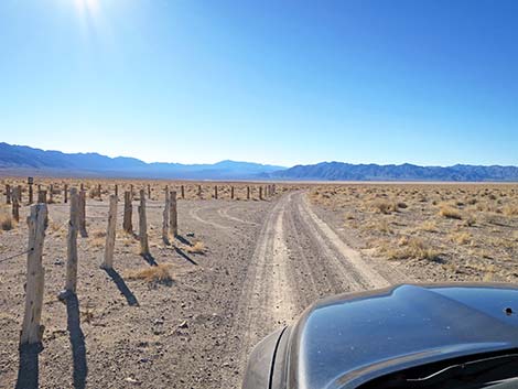
At about 17.62, 17.91, and 18.08 miles out, the road passes nice desert pavement areas with low-impact campsites. Desert pavement makes for nice, clean campsites, but be sure not to stir up the veneer of tiny, interlocking stones because they hold down the dust. On the desert pavement, drivers should turn widely and accelerate slowly to preserve the pavement. Except for a few wash crossings, Alamo Road runs more-or-less straight due south across the broad, open Dry Lake Valley with the North Sand Dunes looming ever closer. Finally, at Mile 21.30, drivers reach a parking corral at the North Dunes Trailhead (Site 0735), on the left. The parking corral makes a suitable, if dusty, campsite. This short trail follows a closed road southeast for 0.7 miles to the northwest edge of the North Dunes dunefield. |
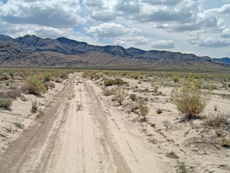
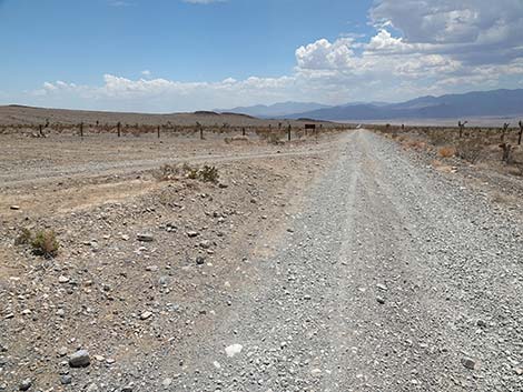
 Alamo Road following the edge of Desert Dry Lake Playa (view S) |
Alamo Road Southbound -- Desert Sand Dunes to Desert Dry Lake Continuing south, a bit beyond the North Dunes Trailhead, there is an area that, when wet, has nasty mud. It might be wise to stop at the North Dunes Trailhead during wet weather. Alamo Road runs south another 1.42 miles to South Dunes Trail (Site 0736; 22.72 miles out) on the left. This is another closed-road trail that runs northeast 0.5 miles to the southwest edge of the North Dunes dunefield. Note that this is a wildlife refuge, and it is not legal to drive in the dunes or on the playa. Continuing south along the edge of Desert Dry Lake Playa, Alamo Road passes a faint trail (Mile 23.20; Site 1788) to the right. Visitors can walk out the old road to an old corral and a dugout water catch-basin on the edge of the playa. |
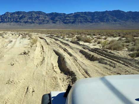
 Alamo Road getting into the playa soils (view S) |
Still continuing south along the edge of the playa, Alamo Road passes another faint trail (Site 1789; 26.70 miles out), on the right. This trail follows an old road out to the historic site of a windmill, another dugout cattle tank, and some old ranching equipment, but the windmill is gone, and some of the ranching equipment has been stolen in recent years. Also at this point, the South Dunes become apparent to the south on the left. Now heading southwest, Alamo Road runs across firm playa dirt to a short bit of playa where the playa dust (poof-dirt) can be stirred up and deep. Often, this is the first bad part of the road. Crossing this dusty area, Alamo Road arrives at a low mud ridge where, in the old days, the road was closed (Site 0543; 27.51 miles out). This spot also makes for a reasonable trailhead for walking out to South Dunes, which lies to the southeast. Here, at the southeast corner of Desert Dry Lake Playa, road conditions on the playa can become treacherous when the poof-dirt is stirred up. At a time (2010s) when the Refuge was doing too many rescues and people were getting in trouble crossing the playa, they closed the road here. The road is open now, but be careful in the deep playa dust because it can suck a jeep into the earth even when dry. |
Looking north, but crossing the playa poof-dirt |
Alamo Road Southbound -- Desert Dry Lake to Cabin Canyon Road Crossing the short bit of playa (Site 0543) and climbing onto the low ridge can be the first test of driving in poof-dirt. Past this point, however, Alamo Road runs west for about 0.8 miles on slightly higher terrain where the ground surface remains firm. At a curve to the left, the road drops into the poof-dirt again, and for the next 1.2 miles, drivers are left to dodge deep holes and wheel ruts while plowing through the poof-dirt. The road runs southwest for about 0.5 miles to an old cattle tank, then curves right to head northwest for about 0.3 miles. The road curves left again to head southwest for another 0.5 miles before exiting the playa and gradually climbing onto the bajada and firmer soils. |
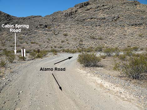 Alamo Road arriving at Cabin Spring Road (view S) |
When drivers start to feel as if their vehicle is bogging down in the poof-dirt, there is a tendency to try driving farther off the established track on fresh, and presumably firmer soils. This can be problematic, however, because the playa in this area is covered with shrubs, and broken shrub stems do a good job of puncturing tire sidewalls. As Alamo Road climbs onto soils suitable for creosote bushes, it passes the other end of the formerly closed section of road (Site 0489; 39.72 miles out). The signs are gone, and there is little to see here now, but it marks the south side of the poof-dirt area. Now staying on the base of the bajada, Alamo Road runs south to the base of the East Desert Range and to an intersection with Cabin Spring Road (Site 0098; 30.22 miles out). |
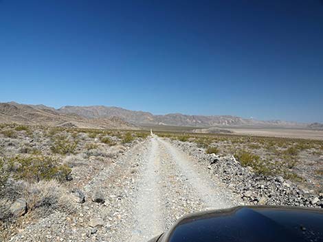 Alamo Rd traversing the bajada south of Desert Dry Lake (view NW) |
Alamo Road Southbound -- Cabin Canyon Road to Sheep Pass At the intersection (Site 0098; 30.22 miles out), Alamo Road turns hard to the right to run northwest up the bajada, while Cabin Spring Road forks to the left along the base of the East Desert Range. Cabin Spring Road runs southeast about 9 miles over seriously bumpy terrain to Cabin Canyon in the Sheep Range. The spring has been dry for decades, and little cattle infrastructure remains. Continuing on Alamo Road, the road begins to climb onto the bajada, and as is often the case on bajada soils, there are lots of rocks in the road. The road climbs northwest to a curve, then bends left and climbs more to the west. The road crests the hillside adjacent to an isolated limestone knob on the right with curious caves that might have been prospects, but it's hard to tell. |
 Alamo Road passing a service road (view SW) |
Continuing northwest on gentler terrain, Alamo Road soon arrives at another desert pavement camp area (Site 0593; 31.29 miles out), on the left. As before, be sure to tread gently on desert pavement to keep this campsite clean and dust free. Just past the campsite, Alamo Road dips steeply through a gully where people in 2WD vehicles spin their tires and dig divots in the roadway, making road conditions less pleasant for everyone. Continuing on a more pleasant roadway, Alamo Road eventually curves to the left to head southwest away from Desert Dry Lake. Nearing the northwest toe of the East Desert Range, Alamo Road reaches an intersection (Site 0554; 33.44 miles out) to the right marked with several signs. This road is the south end of the service road passed 5 miles north of North Dunes Trailhead; the one that runs out onto the Air Force Bombing Range. Signs here announce that the service road is closed and give directions (stay on Alamo Road) to points northward (look back to read the signs). |
 Entering the narrow canyon below Sheep Pass (view S) |
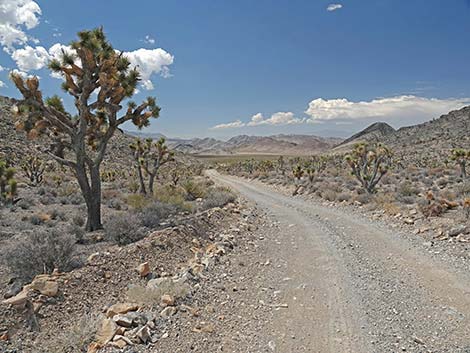
Beyond the service road, Alamo Road bends more to the left and begins to climb southward into Snow Basin Canyon, a name that surely had more relevance back in the pioneer days when conditions were much cooler and wetter than today. Snow Basin Canyon is nestled between the Desert Range (right) and the East Desert Range (left). In Snow Basin Canyon, Alamo Road runs almost due south for about 5 miles. Most of this road is in reasonably good condition, but some parts are rockier than others, and there are two short, steep bits where people in 2WD vehicles spin their tires and dig divots into the roadway. Snow Basin Canyon is quite scenic. It is full of Eastern Joshua Trees and relatively lush desert vegetation, all of which is surrounded by steep limestone mountains and cliffs that are deeply incised by canyons. In the East Desert Range, canyons with names like Chowderhead and Twin Caves invite exploration. Spring wildflowers can be plentiful. |
 Alamo Road arriving at Sheep Pass (view SW) |
Near the top of Snow Basin Canyon, the canyon forks. Snow Canyon is off to the left (southeast), and Alamo Road continues due south up an unnamed canyon between the two ranges. In this area, be sure to take a minute and stop, turn around, and look to the north: the view out across the Desert Dry Lake is grand. This unnamed canyon between the two ranges eventually narrows, and as the steep walls push in, the road snakes past several blind curves up through the break in the cliffs. Above the narrows, the canyon opens up a bit, and the road heads southwest on more gentle terrain. Alamo Road soon arrives atop Sheep Pass (Site 0553; 40.28 miles out), which is marked with a sign. A large pull out, on the left, is suitable for camping, but unfortunately, there are no grand views from the pass, and it can be quite windy. |
 Alamo Road descending past Sheep Pass (view S) |
Alamo Road Southbound -- Sheep Pass to Hidden Forest Road From Sheep Pass (Site 0553; 40.28 miles out), Alamo Road descends at moderate grades through a long, unnamed canyon between the Desert Range and the East Desert Range. Before long, the canyon opens and visitors get great views out across the desert valley to the south. In particular, on the left, Dead Horse Ridge (part of East Desert Range) is spectacular with deeply incised light and dark colored layers of limestone. At about 2 miles below Sheep Pass, there are nice views to the west looking through a gap in the mountains deep into the Air Force bombing range. Alamo Road eventually bends to the left and begins to descend into a short canyon between limestone hills. Just before the canyon narrows, Alamo Road passes a service road to the right marked with a metal gate, red posts, and a keep-out sign. This service road leads west onto Air Force lands. This road is seldom used (never?), and the wide spot in front of the gate is suitable for a campsite. |
 Alamo Road passing Dead Horse Canyon Road (view S) |
Passing through the narrow point between limestone ridges, the road bends back to the right to resume a southward trajectory, now more-or-less running on the bottom of the valley. Soon, drivers are again afforded a nice view west through another gap in the mountains into Three Lakes Valley on military lands. Before long, Alamo Road arrives at a T-intersection with Dead Horse Road (Site 0552; 46.20 miles out), on the left. Dead Horse Road runs east between Dead Horse Ridge (left) and Banded Ridge (right) into the East Desert Range. It ends in the Pinyon Juniper Woodland Zone where several primitive campsites can be found. Beyond Dead Horse Road, Alamo Road runs south to pass along the base of a rocky ridge. On the south edge of this rocky ridge, Alamo Road arrives at a spur road (Site 0738; 47.90 miles out), on the right, leading into White Dirt Campsite (Site 0494), which is recognized by the parking corral. There is an accumulation of white playa dust at this campsite, so campers are advised to try not to stir up the crust and release the dust. |
 Alamo Road passing White Rock Road (view S) |
Continuing past White Dirt Campsite, looking ahead to the right, the bottom of the basin is visible. In those heavy mud soils, Winterfat grows profusely giving the area a white appearance. Winterfat is sometimes called White Sage, and the bottom of the valley is named White Sage Flat. Although playa dust accumulates in that area, water flows to the west through White Sage Gap down into Three Lakes Valley. Soon, Alamo Road arrives at a T-intersection with White Rock Road (Site 0455; 49.24 miles out). White Rock Road Runs east, past the south edge of Banded Ridge, into the foothills of the Sheep Range. The road ends below White Rock Spring, which has been dry for decades. Still traversing the bottom of the valley, Alamo Road heads southwest through big open country to a T-intersection with White Sage Flat Road (Site 1228; 50.07 miles out), a service road that leads down into cattle infrastructure on White Sage Flat. This road is closed to the public. |
 Alamo Road arriving at Hidden Forest Road (view S) |
Continuing southwest but now climbing at a very gentle grade, Alamo Road reaches another T-intersection, this time with Slate Mine Road (Site 1227; 52.94 miles out), on the right. Slate Mine Road runs west into the foothills of the Desert Range to an old mining prospect, which is on military lands. This road is closed to the public. Still continuing southwest and still climbing at a very gentle grade, Alamo Road reaches yet another T-intersection, this time with Pine Canyon Road (Site 1226; 53.96 miles out), on the left. Pine Canyon Road runs east into the foothills of the Sheep Range and is closed to the public. This road has a prominent "service road only" sign. Still continuing southwest but traversing nearly flat country, Alamo Road reaches another T-intersection, this time with Hidden Forest Road (Site 0882; 55.00 miles out), on the left. Hidden Forest Road leads east to the base of Dead Man Canyon, which is the trailhead for perhaps the most popular hike in the Desert Refuge: Hidden Forest Trail. |
 Cow Camp Road merging into Alamo Road (view SW) |
Alamo Road Southbound -- Hidden Forest Road to Corn Creek Road Continuing past Hidden Forest Road (Site 0882; 55.00 miles out), it instantly becomes obvious that the bulk of the traffic in this area is heading for the Hidden Forest Trailhead. For the previous 55 miles, Alamo Road has essentially been a one-lane, sometimes graded, wild and remote roadway. Beyond this point however, Alamo Road often feels more like a 2-lane graded road. Continuing southwest, Alamo Road descends at moderate grades into a broad valley between the Desert Range (right) and the Black Hills (left). Behind the Black Hills, the Sheep Range towers above, forming the eastern skyline. After some time, Alamo Road reaches a Y-intersection with Cow Camp Road (Site 0992; 61.14 miles out), on the left. Cow Camp Road leads northeast through a gap in the Black Hills to the base of the Sheep Range and ends at an old corral. There is a large camping area at the Y-intersection marked by a large parking corral that is large enough for a Boy Scout troop. |
 Alamo Road traversing rolling terrain with stunted shrubs (view SW) |
Beyond Cow Camp Road, Alamo Road continues to descend at moderate grades into the broad valley between the Desert Range and the Black Hills. Near the toe of the Black Hills, Alamo Road passes Wellhead Camp (Site 1336; 62.31 miles out), a primitive campsite with a parking corral and an old wellhead. Alamo Road begins to bend to the southeast wrapping around the toe of the Black Hills. In this area, Alamo Road runs across the terrain climbing over several ridges and dipping through deep gullies. Drivers should use caution approaching the crests of the ridges because the site distances are extremely short. Passing the toe of the Black Hills, Alamo Road enters the uppermost reaches of the Las Vegas Valley. In this area, in the rain shadow of the Spring Mountain Range to the west, the vegetation is sparse and stunted. Most of the Eastern Joshua Trees in this area are quite small, and even the Creosote Bushes, White Bursage, and cactus (e.g., Silver Cholla and Engelmann's Hedgehog Cactus) struggle to survive. |
 Alamo Road approaching Joe May Road (view S) |
After running nearly straight southeast for more than 3 miles, Alamo Road bends slightly to the right for the last time. At this point, looking straight down the slight grade, drivers can see the end of the road at Corn Creek, although it is still several miles away. Not far beyond the final curve, Alamo Road reaches a T-intersection with Joe May Road (Site 0780; 66.66 miles out), on the left. Joe May Road leads to a trailhead in the foothills of the Sheep Range at the base of Joe May Canyon. The more popular trail at the end of the road leads to a guzzler up in Joe May Canyon. Past Joe May Canyon, Alamo Road continues to run nearly straight and almost due south for 3 more miles. Along this section of road, there are several unmarked primitive campsites adjacent to the roadway. In the last mile or so before Corn Creek, the road passes through an area of mesquite hammocks. This area once was covered by blowing sand dunes, and the sand dunes are still there, but now Honey Mesquite trees have colonized the dunes and stabilize the sand. Water from the Sheep Range soaks into the ground, moves down through the bajadas, and seeps out in this area. Not much water, but enough to nourish the mesquite woodlands we see today. |
 Alamo Road ending at the paved Corn Creek Road (view S) |
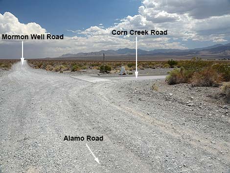
Approaching Corn Creek, the visitor center and field headquarters for the Desert Refuge, Alamo Road passes a small day-use parking area (Site 1517; 69.53 miles out), on the right. This spot used to be available for camping, but it is now marked with a no camping sign. There are also several road signs in this area, all relevant for drivers heading north. Ahead, on the right, visitors can see the tops of the tall trees at Corn Creek, and area fed by a real spring. Continuing south, the road passes a service road on the left and pinched between mesquite trees to emerge onto a T-intersection (Site 1295; 69.83 miles out). Alamo Road ends here, as does Mormon Well Road (straight ahead) and Corn Creek Road (right). Turning right onto Corn Creek Road, visitors quickly arrive at the Corn Creek Visitor Center (Site 0106; 69.90 miles out), which might best be considered the end of the road. |
Table 1. Highway Coordinates based on GPS Data (NAD27; UTM Zone 11S). Download Highway GPS Waypoints (gpx) file.
| Wpt. | Location | UTM Easting | UTM Northing | Elevation (ft) | Point-to-Point Distance (mi) | Cumulative Distance (mi) |
|---|---|---|---|---|---|---|
| 0486 | Hwy 93 at Pahranagat VC Rd | 667133 | 4126732 | 3,335 | 0.00 | 00.00 |
| 0943 | Pahranagat Rd at HQ Rd | 666681 | 4126297 | 3,322 | 0.44 | 00.44 |
| 0492 | Pahranagat Rd at Alamo Rd | 667067 | 4123522 | 3,282 | 1.86 | 02.30 |
| 1878 | Alamo Rd at Old DNWR Boundary | 664312 | 4118684 | 3,924 | 3.99 | 06.29 |
| 1541 | Alamo Rd N at Service Road | 662562 | 4115851 | 4,006 | 2.32 | 08.61 |
| 0493 | Alamo Rd at Alamo-Badger Connector Rd | 661202 | 4115981 | 4,123 | 1.04 | 09.65 |
| 1963 | Alamo Road at Old Corn Creek Road | 661039 | 4109852 | 4,004 | 4.52 | 14.17 |
| 0542 | Alamo Rd at Service Road | 659672 | 4106391 | 3,653 | 2.39 | 16.56 |
| 0735 | Alamo Road at North-Dune Road North | 659840 | 4098880 | 3,255 | 4.74 | 21.30 |
| 0736 | Alamo Road at North-Dune Road South | 660491 | 4096942 | 3,238 | 1.42 | 22.72 |
| 1788 | Alamo Road at Dry Lake Corral Road | 660570 | 4096188 | 3,206 | 0.48 | 23.20 |
| 1789 | Alamo Road North at Dry Lake Well Road | 660691 | 4090867 | 3,233 | 3.50 | 26.70 |
| 0543 | Alamo Rd at South Dunes Trailhead | 659772 | 4089937 | 3,221 | 0.81 | 27.51 |
| 0489 | Alamo Rd at South Closure | 657093 | 4088514 | 3,231 | 2.21 | 29.72 |
| 0098 | Alamo Rd at Cabin Spr Rd | 656773 | 4087799 | 3,235 | 0.50 | 30.22 |
| 0593 | Alamo Rd at Dry Lake Camp Rd | 655369 | 4088573 | 3,283 | 1.07 | 31.29 |
| 0123 | Dry Lake Camp | 655376 | 4088538 | 3,303 | 0.00 | 31.29 |
| 0554 | Alamo Rd at Desert Dry Lake Rd | 652465 | 4087819 | 3,477 | 2.15 | 33.44 |
| 0553 | Alamo Rd at Sheep Pass | 651931 | 4077996 | 4,981 | 6.84 | 40.28 |
| 0552 | Alamo Rd at Deadhorse Rd | 651727 | 4068747 | 4,272 | 5.92 | 46.20 |
| 0738 | Alamo Rd at White Dirt Camp Rd | 651421 | 4066033 | 4,264 | 1.70 | 47.90 |
| 0494 | White Dirt Camp | 651382 | 4066058 | 4,260 | 0.00 | 47.90 |
| 0455 | Alamo Rd at White Rock Rd | 650590 | 4064035 | 4,230 | 1.34 | 49.24 |
| 1228 | Alamo Rd at White Sage Road | 650049 | 4062820 | 4,249 | 0.83 | 50.07 |
| 1227 | Alamo Rd at Slate Mine Rd | 648121 | 4058626 | 4,426 | 2.87 | 52.94 |
| 1226 | Alamo Rd at Pine Canyon Rd | 647637 | 4057079 | 4,492 | 1.02 | 53.96 |
| 0882 | Alamo Rd at Hidden Forest Rd | 647279 | 4055442 | 4,490 | 1.04 | 55.00 |
| 0992 | Alamo Rd at Cow Camp Rd | 643589 | 4046289 | 3,547 | 6.14 | 61.14 |
| 1336 | Alamo Rd at Wellhead Camp Rd | 643035 | 4044499 | 3,411 | 1.17 | 62.31 |
| 1337 | Wellhead Camp | 643104 | 4044467 | 3,430 | 0.00 | 62.31 |
| 0780 | Alamo Rd at Joe May Canyon Rd | 646366 | 4038614 | 3,240 | 4.35 | 66.66 |
| 1517 | Alamo Rd at Corn Creek Day-Use | 647212 | 4034068 | 2,969 | 2.87 | 69.53 |
| 1295 | Corn Creek Rd at Alamo-Mormon Rd | 647311 | 4033593 | 2,933 | 0.30 | 69.83 |
| 0106 | Corn Creek parking area | 647198 | 4033568 | 2,814 | 0.07 | 69.90 |
Happy Hiking! All distances, elevations, and other facts are approximate.
![]() ; Last updated 240324
; Last updated 240324
| Backroads Around DNWR | Hiking Around Las Vegas | Glossary | Copyright, Conditions, Disclaimer | Home |