Backroads Around Las Vegas, Desert National Wildlife Refuge
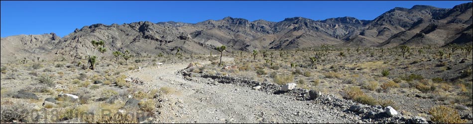
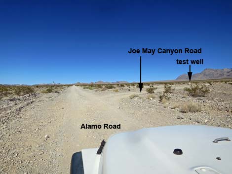
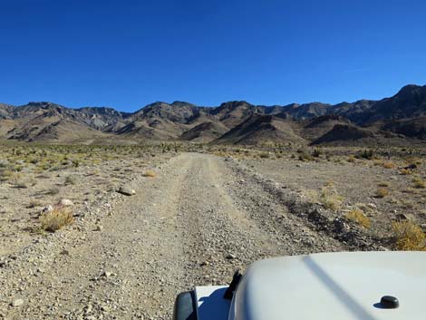
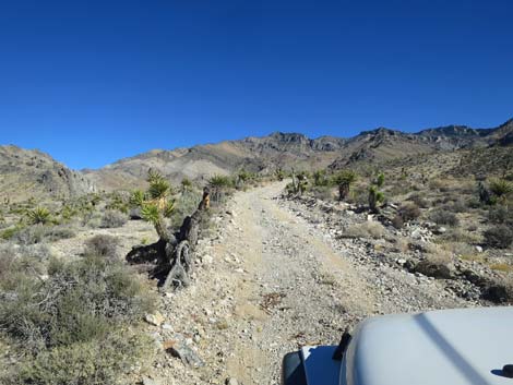
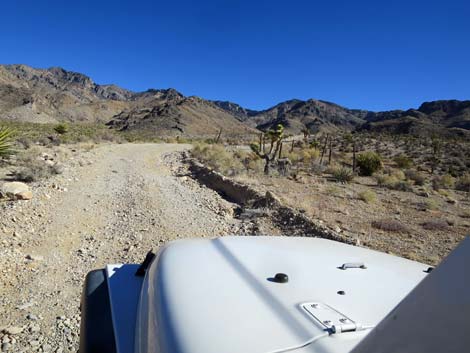
 Alamo Road approaching Joe May Road sign (view N) |
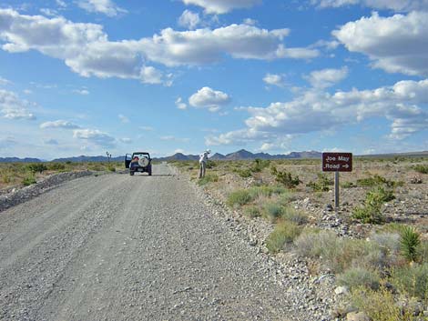
Overview Joe May Road, sometimes called Joe May Canyon Road, is a side road off Alamo Road that runs from desert flats up the west flanks of the Sheep Range to the Joe May Canyon and Black Gate Canyon trailheads. The road is washed in a few places and bumpy overall, and it gets rougher farther out, but is a 2WD_HC road in good weather and is graded occasionally. This is a good road for a short drive in the desert or an easy get-away from town to camp in the desert or to look for wildflowers. There are several primitive campsites along the road, an old corral marks the Joe May Canyon trailhead, and the end of the road is the trailhead for Black Gate Canyon (and a not-so-nice campsite). For general information on camping, hiking, regulations, other issues, and the natural history of the Wildlife Refuge, see the Desert National Wildlife Refuge -- Area Overview page. Link to map. |
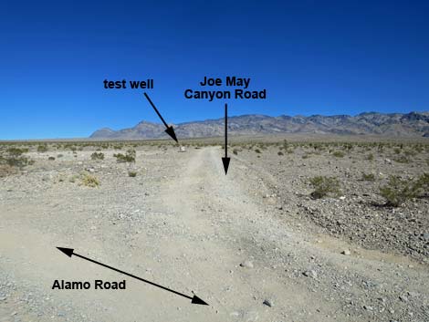
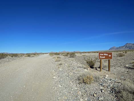 Alamo Road at Joe May Road sign (view N) |
Watch Out Other than the standard warnings about the desert... Joe May Road generally is a good dirt road, at least out to the old corral, but it runs out into wild and remote country. There are no services or developments of any kind. Cell phones should work, but don't count on it. Bring water and food, a good spare tire, a shovel, tools, a tow rope, bailing wire (I learned the hard way) and anything else that you might need to survive a night stuck out in the desert. While out there, please respect the land and the other people out there, and try to Leave No Trace of your passage. Also, this road leads to remote country, so be sure to bring the 10 Essentials. This is a wildlife refuge, so pay extra attention to respecting the land. |
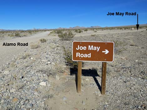 Joe May Road sign (view N) |
Location Joe May Road is located on the Desert National Wildlife Refuge and starts about 45 minutes northwest of Las Vegas. To get there, drive out Corn Creek Road to the Visitor Center at Corn Creek Field Station. Continue east on Corn Creek Road for about 250 feet to a T-intersection with a large directional sign. Turn left onto Alamo Road and drive north for 3.1 miles to the signed intersection with Joe May Road. |
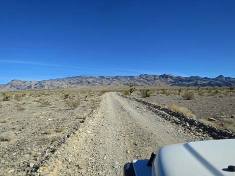
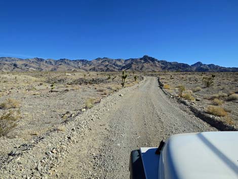
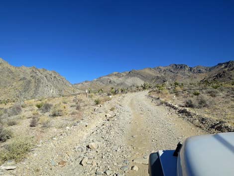
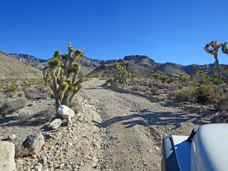
 Alamo Road approaching Joe May Road sign (view N) |
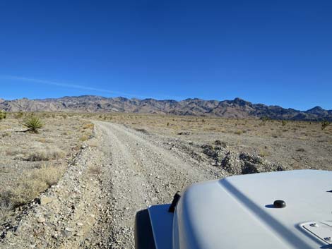
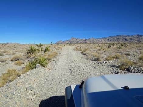
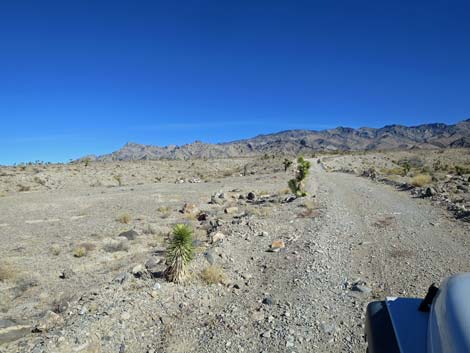
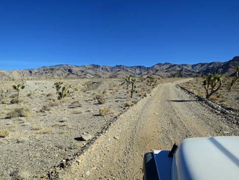
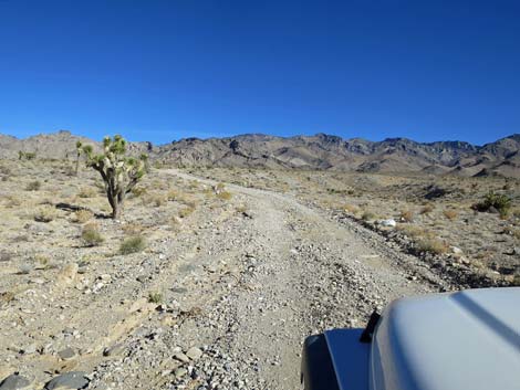
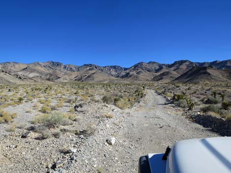
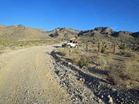
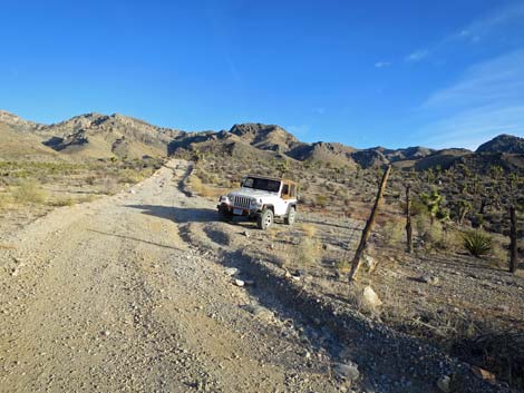
The Road From Alamo Road (Table 1, Site 0780), Joe May Road angles off to the right and quickly passes a test well on the left, then continues northeast towards the Sheep Range. The road runs up the bajada, angling left and right to cross washes, avoid difficulties, or to run on higher terrain, but generally heading northeast. In this area, the vegetation is sparse and stunted, the result of a "rain shadow" caused by the Spring Mountains to the west. The Spring Mountains wring moisture from the prevailing winds, leaving relatively little to fall in this lower-elevation area. At about 1.0 miles out, the road passes a small, but well used campsite on the right. Then, at about 1.6 miles out, the road passes another campsite on the left. This second site is a bit bigger than the first. Both of these campsites are on open terrain with grand views southwest, west, and northwest. |
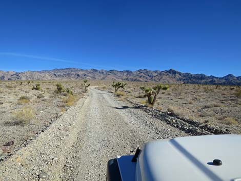
 Joe May Road (view NE from Alamo Road) |
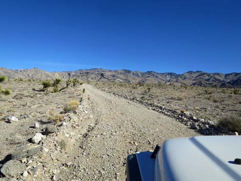
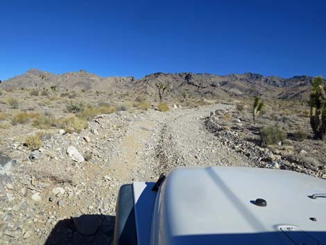
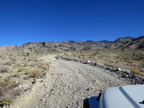
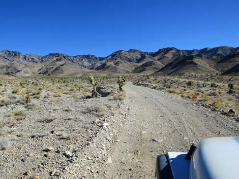
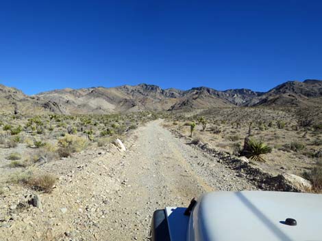
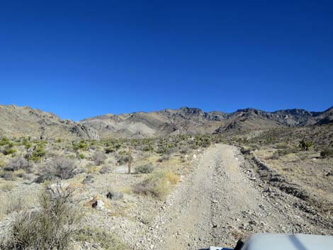
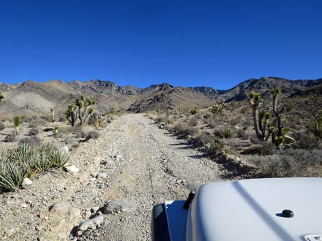
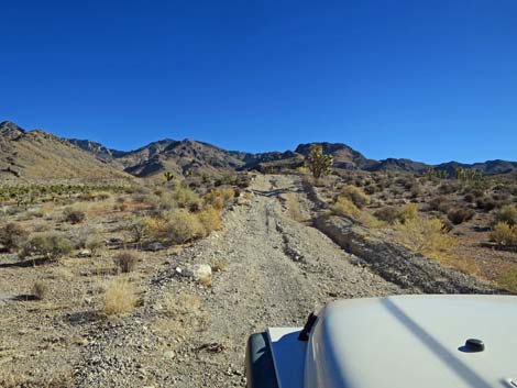
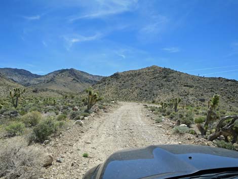
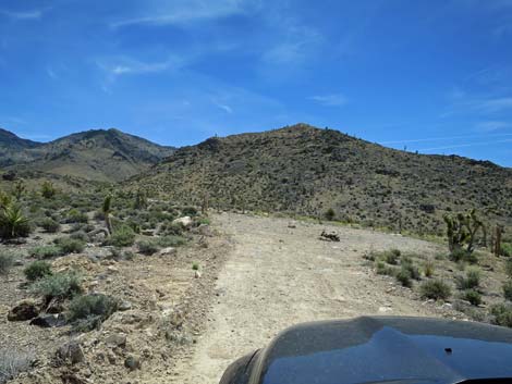
Just past the second campsite, the road climbs a steeper bit of road on a white-dirt hillside. This marks the beginning of the decline in road quality, and from here on up, a 2WD-HC vehicle is necessary due to rocks and ruts (unless the road was recently graded). The road continues generally northeast and gradually gets steeper and rockier. At about 3.3 miles out, it passes the third and last of the nicer campsites. At 3.7 miles out, the road passes a 4x4 wooden post on the left that marks where Joe May Road used to head up towards Joe May Guzzler. Then at 3.8 miles out, a "no vehicles" symbol sign marks where the more recent road turned off to head towards the guzzler. This is a possible trailhead for the hike up Joe May Canyon, but a more convenient trailhead lies just up the main road. At 4.0 miles out, the main road passes historical corrals and the Joe May Canyon trailhead. From the Joe May Canyon trailhead, the road climbs a bit steeply on a patch of nearly 4WD road, then continues another 0.2 miles to end (4.2 miles out) at the Black Gate Canyon trailhead. For photos of the return down the road, see Joe May Road - Return. |
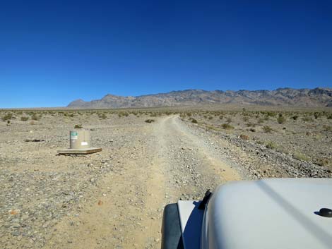 Joe May Road at test well (view NE) |
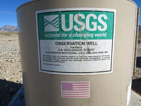 Notice on the observation well (view NE) |
 Sparsely vegetated bajada (view NE) |
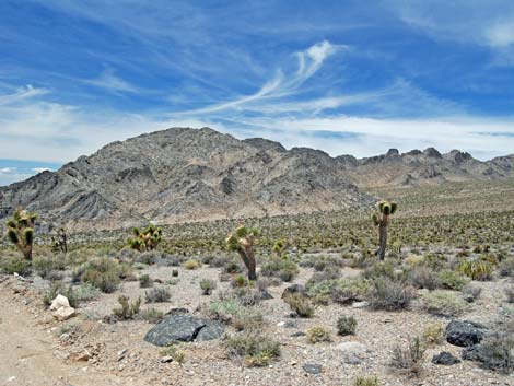
 Stunted Joshua Trees (view NE) |
 First campsite, on the right (view NE) |
 Winding up the bajada (view N) |
 Winding up the bajada (view E) |
 Second campsite, on the left (view NE) |
 |
 |
 |
 |
 |
 |
 Third campsite, on the right (view NE) |
 More rainfall and more vegetation higher on the bajada (view NE) |
 Still stunted Joshua Trees (view NE) |
 Wooden 4x4 post (view NE) |
 Generally steeper road higher on the bajada (view NE) |
 Generally rockier road higher on the bajada (view NE) |
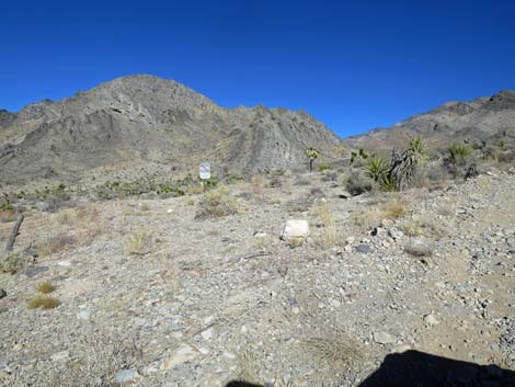 No Vehicles sign (view N) |
 Avoiding a gully and rocks on the left (view NE) |
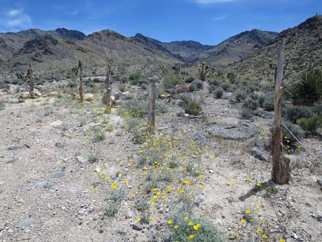
 Approaching Joe May Corral, on the right (view E) |
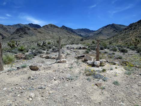
 Joe May Corral and trailhead parking (view E) |
 Joe May Corral and trailhead parking (view SE) |
 A bit of a climb on a rutted road hillside (view SE) |
 |
 |
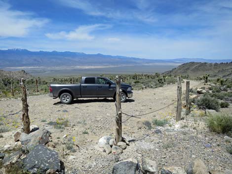
 Approaching end of Joe May Road (view SE) |
 End of Joe May Road (view SE) |
 End of Joe May Road; not the best campsite (view SE) |
 Spring wildflowers |
 Black Gate Canyon Trailhead (view W) |
 Black Gate Canyon trail, returning to trailhead parking (view NW) |
 At the end of road, looking north up Joe May Canyon |
 More to come ... |
Table 1. Highway Coordinates Based in GPS Data (NAD27; UTM Zone 11S). Download Highway GPS Waypoints (*.gpx) file.
| Site | Location | Latitude (N) | Longitude (W) | UTM Easting | UTM Northing | Elevation (feet) | Verified |
|---|---|---|---|---|---|---|---|
| 0779 | Joe May Cyn Trailhead | 36.51006 | 115.30653 | 651650 | 4041656 | 5050 | Yes |
| 0780 | Alamo Rd at Joe May Cyn Rd | 36.48346 | 115.36594 | 646379 | 4038613 | 3240 | Yes |
| 0881 | Black Gate Cyn Trailhead | 36.50930 | 115.30308 | 651960 | 4041577 | 5200 | Yes |
Happy Hiking! All distances, elevations, and other facts are approximate.
![]() ; Last updated 240324
; Last updated 240324
| Backroads Around DNWR | Hiking Around Las Vegas | Glossary | Copyright, Conditions, Disclaimer | Home |