Interstate Highway 15 to Caliente
Backroads Around Las Vegas
 |
Overview U.S. Highway 93 isn't really a "backroad," but it provides access to many of the places and backroads we love. The highway is long and mostly straight, with a speed limit of 70 mph. Gas, food, and supplies are scattered along at intervals of about 80-100 miles as the highway runs north through eastern Nevada. Highway 93 provides access to hikes in the Arrow Canyon Range, Desert National Wildlife Range, Pahranagat National Wildlife Refuge, various Wilderness areas, plus access to some amazing rock art sites in Lincoln County and even a nice trilobite quarry. Excellent birding opportunities can be found in the Pahranagat National Wildlife Range and Key-Pittman Wildlife Management Area. Link to Road Map. |
 |
Watch Out Other than the standard warnings about being in the desert, ...this road is pretty safe, but be sure that your vehicle is in good working condition, carry plenty of water, and pack a few snacks. Always drive carefully; even though the road is maintained, there are occasional hazards such as errant rocks and holes in the roadway. Southern parts of the highway are desert tortoise crossing zones, and northern parts are mule deer crossing zones, so always keep an eye out for wildlife and stray cattle. The highway is narrow, and winding in some places, so keep a wary eye out for drunk or aggressive drivers. When people get stuck behind a slow line of trucks, they sometimes do crazy things to pass. While out, please respect the land and the other people out there, and try to Leave No Trace of your passage. This road goes into remote areas, so be sure to bring what you need of the 10 Essentials. Cell phones don't work in some areas, especially north of Alamo. |
 |
Getting to the Road Highway 93 starts in central Arizona and runs north through Las Vegas en route to the Canadian border in Montana, but for the purpose here, Highway 93 begins where it separates from Interstate-15, just north of Las Vegas. From Las Vegas, drive north on Interstate-15 for 21 miles to Exit 64. Watch for signs to Pioche, Ely, Alamo, Caliente, and Great Basin National Park. Exit right, then curve left under the interstate. |
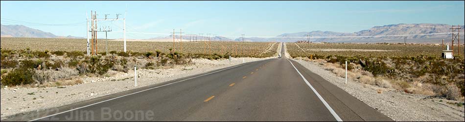
 Highway 93 Northbound between Highway I-15 and Alamo |
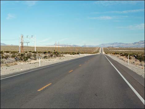
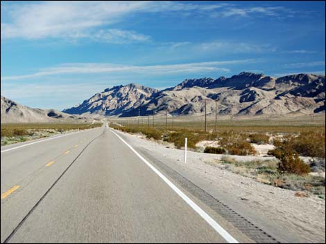
Section 1: U.S. Highway 93 Northbound Highway I-15 to Alamo This section of Highway 93 runs north from Interstate-15 for 73 miles to the town of Alamo. Departing the interstate, Highway 93 passes Love's Truck Stop, the last gas and food before Alamo. Passing the Apex industrial zone, the highway begins a long run through open Mojave Desert where Joshua trees, Mojave Yucca, and creosote bushes span the successive valleys between towering limestone mountains. Eventually, Highway 93 winds through a narrow canyon and opens into the verdant Pahranagat Valley where a wildlife refuge protects marshes, cottonwood trees, and lakes for migrating waterfowl and snowbirds. Towards the northern end of Pahranagat Valley, Highway 93 arrives in small town of Alamo where gas, food, groceries, and lodging are available to travelers. |
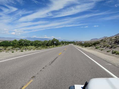 |
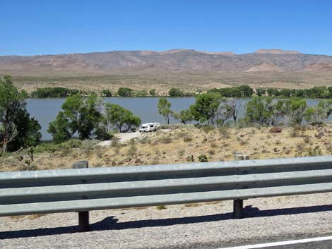
Section 2: U.S. Highway 93 Northbound from Alamo to Highway 318 This section of Highway 93 runs north from the town of Alamo for 12 miles to the intersection with Highway 318. Departing Alamo, Highway 93 runs up the east side of Pahranagat Valley between towering limestone mountain ranges with the verdant valley stretching out between. Cottonwood trees mark the trace of White River that mostly flows underground, and cows graze in the grassy fields. At about 7 miles out from Alamo, the highway passes Ash Springs, where food and gas or available. In another 5 miles, Highway 93 Reaches Highway 318, which is marked by highway signs and an Alien Jerky shop. |
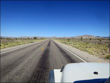 |
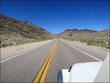
Section 3: U.S. Highway 93 Northbound from Highway 318 to Caliente This section of Highway 93 runs north from Highway 318 for 43 miles to the town of Caliente. Passing Highway 318, Highway 93 climbs into the hills and winds into a narrow canyon that cuts through the Hiko Hills. The highway climbs onto a broad plain to pass between the ends of several mountain ranges with vast views in all directions. Hidden from view by distance, the surrounding playas and hills are full of prehistoric and mining history. Highway 93 dips through Dry Lake Valley and begins to climb over the Delamar Range. Winding up through a canyon into the mountains, the highway leaves behind the last Joshua trees. Now winding down through mountain canyons, the highway eventually reaches the town of Caliente where gas, food, groceries, and lodging are available to travelers. |
Table 1. Highway Coordinates based on GPS Data (NAD27; UTM Zone 11S). Download highway GPS waypoints (gpx) file.
| Wpt. | Location | UTM Easting | UTM Northing | Elevation (ft) | Point-to-Point Distance (mi) | Cumulative Distance (mi) | Verified |
|---|---|---|---|---|---|---|---|
| 0674 | I-15 at Hwy 93 (Apex) | 36.38089 | 114.89084 | 2,215 | 00.0 | 000.0 | Yes |
| 1026 | Hwy 93 at White Quarry Rd | 36.59221 | 114.91864 | 2,790 | 16.4 | 016.4 | Yes |
| 0876 | Hwy 93 at Big Arrow Parking | 36.64944 | 114.91958 | 2,659 | 03.9 | 020.3 | Yes |
| 1599 | Hwy 93 at Arrow West Access Rd | 36.67315 | 114.92349 | 2,507 | 01.7 | 022.0 | Yes |
| 0880 | Hwy 93 at Hidden Peak Parking | 36.68827 | 114.92635 | 2,430 | 01.0 | 023.0 | Yes |
| 0649 | Hwy 93 at Mormon Well Rd | 36.76748 | 114.94043 | 2,507 | 05.5 | 028.5 | Yes |
| 0877 | Hwy 93 at Hwy 168 | 36.79916 | 114.94567 | 2,532 | 02.3 | 030.8 | Yes |
| 1549 | Hwy 93 at Meadow Valley Wash Rd | 36.96162 | 114.97425 | 2,547 | 11.3 | 042.1 | Yes |
| 0700 | Hwy 93 at Maynard Lake | 37.19162 | 115.02637 | 3,130 | 16.3 | 058.4 | Yes |
| 0442 | Hwy 93 at Lower Pahranagat Lake | 37.22540 | 115.08310 | 3,205 | 04.1 | 062.5 | Yes |
| 1527 | Hwy 93 at Lower Lake Rd | 37.22935 | 115.08699 | 3,202 | 00.3 | 062.8 | Yes |
| 1550 | Hwy 93 at Roadside Rest Area | 37.23296 | 115.08979 | 3,279 | 00.3 | 063.1 | Yes |
| 1528 | Hwy 93 at Middle Lake Road | 37.26433 | 115.10899 | 3,287 | 02.5 | 065.6 | Yes |
| 0486 | Hwy 93 at Pahranagat HQ Rd | 37.27401 | 115.11495 | 3,335 | 00.8 | 066.4 | Yes |
| 0871 | Hwy 93 at Old Corn Creek Rd | 37.28039 | 115.11845 | 3,326 | 00.4 | 066.8 | Yes |
| 0701 | Hwy 93 at Upper Lake Rd | 37.31674 | 115.12896 | 3,430 | 02.7 | 069.5 | Yes |
| 0675 | Hwy 93 at Alamo | 37.36478 | 115.15907 | 3,474 | 03.7 | 073.2 | Yes |
| 1119 | Hwy 93 at S Richardville Rd | 37.38962 | 115.16163 | 3,550 | 01.8 | 075.0 | Yes |
| 1120 | Hwy 93 at N Richardville Rd | 37.41348 | 115.17111 | 3,585 | 01.7 | 076.7 | Yes |
| 1093 | Hwy 93 at Ash Spring Petro Entrance | 37.45958 | 115.19282 | 3,606 | 03.4 | 080.1 | Yes |
| 0444 | Hwy 93 at Ash Spring | 37.46089 | 115.19297 | 3,700 | 00.1 | 080.2 | Yes |
| 0677 | Hwy 93 at Hwy 318 | 37.52891 | 115.21911 | 3,831 | 05.0 | 085.2 | Yes |
| 1096 | Hwy 93 at Crystal Wash Entrance Rd | 37.54952 | 115.17253 | 4,077 | 03.2 | 088.4 | Yes |
| 1099 | Hwy 93 at Crystal Wash Upper Rd | 37.54839 | 115.15708 | 4,225 | 00.9 | 089.3 | Yes |
| 1551 | Hwy 93 at Oak Springs Trilobite Site Rd | 37.60942 | 114.70723 | 5,865 | 26.3 | 115.6 | Yes |
| 0014 | Hwy 93 at Caliente Picnic Area | 37.60406 | 114.63185 | 5,663 | 04.9 | 120.5 | Yes |
Happy Hiking! All distances, elevations, and other facts are approximate.
![]() ; Last updated 240331
; Last updated 240331
| Backroads | Hiking Around Las Vegas | Glossary | Copyright, Conditions, Disclaimer | Home |