Backroads Around Las Vegas, Desert National Wildlife Refuge
 Mormon Well Road Conditions Mormon Well Road Conditions |
Mormon Well Road Conditions June 2022. The road is in fairly good condition and passable in a 2WD truck, although 4WD is better for the short sections of bumpy steep hills, and I like 4WD when driving uphill on washboarded roads. There were no deep ruts or large rocks, but overall, the road is very bumpy because parts are like a cobblestone road. December 2022. Glen writes: I drove from Corn Creek to Highway 93 in a 2WD Chevy Equinox (SUV-style vehicle) and made it fine. Somebody however, appears to have popped an oil pan near the campgrounds not long before we were there. Drivers: please send an email with current conditions. |
 Corn Creek Road, approaching Mormon Well Road (view E) |
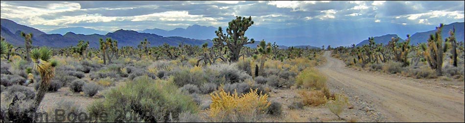
Overview Mormon Well Road is a long, rough, dirt road that runs across the Desert National Wildlife Refuge from Corn Creek to Highway 93. The road runs across the desert and over the mountains through spectacular country, including towering limestone cliffs; broad, flat valleys; and narrow, winding canyons. The road runs through several desert vegetation life zones, starting in the very dry (stunted) Mojave Desert Scrub Zone and climbing to the Yellow Pine (Ponderosa Pine) Zone. The variety of life zones provides different habitats for birds and other wildlife. Link to map. |
 Corn Creek Road ends at Mormon Well Road (view E) |
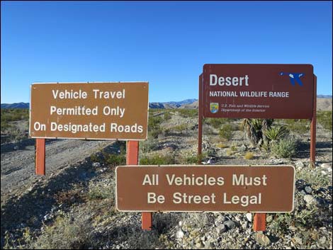
Refuge personnel occasionally maintains their roads, and the road as far as Mormon Well usually is in pretty good shape (easy in high-clearance vehicles). Beyond there, however, the road is pretty rough (almost 4WD). For a nice day out, consider driving out to the Mormon Well, visiting the historical corral, then turning around to go back. Other than a campground with restrooms, picnic tables, and fire rings, there are no structures or services of any kind, but the road passes near an old corral, listed on the National Register of Historic Places, that was built by Mormon pioneers. Please help preserve Nevada heritage by treading lightly on this fragile land. There are a number of undeveloped traditional campsites along the Mormon Well Road, and there is a campground just north of Mormon Pass. Other than that, camping is unrestricted, and drivers can camp anywhere, but be kind to the land and choose an existing campsite; it is illegal to drive off-road to camp. For general information on camping, hiking, regulations, other issues, and the natural history of the Wildlife Refuge, see the Desert National Wildlife Refuge -- Area Overview page. |
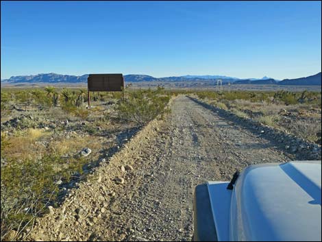
 Sign at T-intersection of Corn Creek, Alamo, and Mormon Well roads (view E) |
Watch Out The Mormon Well Road is long and rough. A 2WD, high-clearance vehicle is required if the road is dry, and a 4WD vehicle might be needed if the road is wet or washed out. There are no services. If you go out there, take at least 1 gallon of water per person, some food, and expect to be the only people out there. Be prepared to break down and spend a night waiting for help to find you. Your cell phone probably won't work. Although the road is rough, much can be driven at 15 mph in 2WD-HC vehicles, but there are rocky spots and tight turns that seem to sneak up, even at low speeds. In particular, starting into Yucca Forest and out near Sawmill Canyon always seem to be rough. The Sawmill Canyon Road is 4WD only due to deep gravel. The Mormon Well Road is great place to get away from it all, but remember that this is wild and remote country -- you could be the only person out there for a long time. |
 Mormon Well begins by turning right and running south |
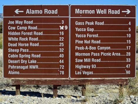
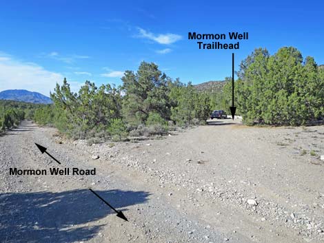
Location Mormon Well Road is located on the Desert National Wildlife Refuge, starting about 30 minutes northwest of Las Vegas. To get there, drive out to the Visitor Center (Table 1, Site 106) at Corn Creek Field Station. Continue east for about 250 feet to a T-intersection with a large sign. The Mormon Well Road starts here and runs south (right), while the Alamo Road starts here and runs north (left). For drivers wishing to experience the road in the opposite direction, from Las Vegas, drive north on I-15 for 21.4 miles to Exit 64 (Great Basin Highway). Exit the interstate, turn left, and drive north for 28.6 miles towards Alamo. Driving north, no signs announce Mormon Well Road (also called Sawmill Canyon Road at this point). Instead, watch for a highway sign warning of "low flying aircraft" at mile marker 78. Continue north for 2.5 miles (about mile 80.5) and watch for power lines crossing the highway. At the powerlines, turn left onto the graded road, curve around the power substation, and continue southwest: this is the Mormon Well Road. |
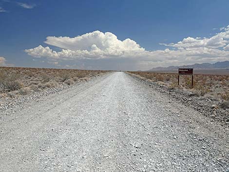
 Heading up the bajada towards Yucca Gap (view E) |
The Road From the Corn Creek T-intersection (mile 0.0), the Mormon Well Road turns right and runs south to curve (mile 0.3) where the road turns hard to the left and starts up the bajada towards the mountains to the east. The road quickly passes a side road on the left to the historic picnic area (notice the grove of cottonwood trees off to the left), and then runs straight up the bajada towards Yucca Gap, the gap in the mountains between the Sheep Range (left) and Fossil Ridge (right). Just before getting to Yucca Gap, the road passes a T-intersection on the right with Gass Peak Road (Wpt. 0884; mile 4.35), which provides access to primitive campsites and some nice hikes. Mormon Well Road continues straight into Yucca Gap. At about 1.0 miles past Gass Peak Road, the road passes a remarkable fossil site where many snail shells are exposed on the surface of a limestone slab (Site 1950). Mormon Well Road continues straight through Yucca Gap and heads out into the Yucca Forest, a broad, gently sloping valley with a dense "forest" of Joshua trees. |
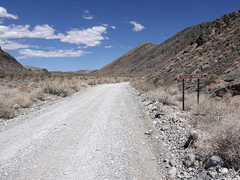 Mormon Well Road at Yucca Gap (Fossil Ridge sign; view E) |
The road gradually bends to the north and starts running up along the southeastern edge of the Sheep Range. About 8.9 miles out, the road cuts right, crosses a large wash (mile 8.9), then cuts back left and resumes heading northward. About 0.2 miles past the wash, the road again cuts right and heads eastward (mile 9.0). The Yucca Peak and Long Canyon hikes start at the large parking and traditional camping area on the outside of this curve, which is the Long Canyon Trailhead (Site 0883). Shortly past the camping area, the road turns south and starts the process of winding south and north (back and forth) several times as it continues east cutting across two deep, narrow gullies where the road can get rough. After climbing out of the last gully (mile 10.1), the road resumes heading eastward through the Yucca Forest (Site 0096) on a relatively good dirt road. At about 11.9 miles out, the road passes a traditional camping area on a bluff overlooking the Yucca Forest (Site 1045). |
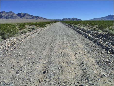
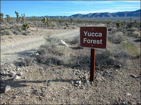 Mormon Well Road at Yucca Forest |
The Mormon Well Road passes Pine Nut Road (Site 0424; 14.3 miles out), which leads to a primitive camping area and hiking opportunities. The road continues into Peek-a-Boo Canyon (Site 0108; 14.9 miles out), a deep, narrow limestone canyon with ledges and caves. The road runs up the gravel wash, but the base is firm, and the road remains suitable for 2WD high-clearance vehicles (depending on conditions). Peek-a-boo Canyon winds around, but the road generally trends northeast until breaking out of the top of the canyon into sagebrush flats. Sagebrush flats are uncommon this far south, but the elevation (over 6,000 feet) and other environmental conditions combine to form suitable habitat for this species. The road passes two gated service roads to the east (leading to Wamp Spring) and continues north to a forested saddle (Site 0648; mile 25.3) in the Yellow Pine (Ponderosa Pine) vegetation zone. This is the high point on the road (6,700 feet), and from here, the road starts down into canyons to the north and east. |
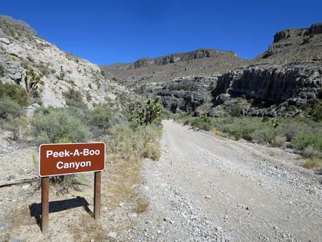 Mormon Well Road at Peek-A-Boo Canyon |
Just beyond the saddle (mile 25.5), ponderosa pine trees shade campsites at Desert Pass Campground (formerly Mormon Pass Campground). The camp area has several campsites with picnic tables, fire pits, and vault toilets. The campground is a bit spread out. Just before arriving at the obvious campground, a spur road to the west leads to two campsites on the hillside. At the first obvious camp area, there are several sites and the first outhouse. The remaining campsites are located farther north along the main road (all on the west side). About 2 miles beyond Desert Pass, the road passes Mormon Well Corral Trail (Site 0630, mile 27.3), which is off to the right on the hillside. Watch for a pullout (old road intersection) on the east (right) side of the road at a place where the road bends hard to the north (left) (Site 0650). |
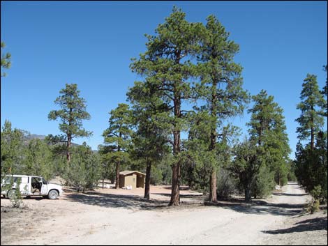 Mormon Well Road at Desert Pass Campground (view N) |
Hikers can get to the spring from here, but it is easier to drive down the road for another 0.1 miles to a parking area on the east (right) side of the road with an old cement watering trough (Site 0651). Park by the trough and walk south and east on the old road for about 5 minutes to the historic Mormon corral (Site 0652), which is in a flat area on a bench above the bottom of the canyon. The spring is by the cliff behind (south) the corral. For details and a map of the Mormon Well area, see the Mormon Well hike. From Mormon Well (Site 0630), the road continues north. The canyon gets narrower, and the road gets a bit rough before getting to Sawmill Canyon (mile 30.9). Two roads run west to a gate in Sawmill Canyon, both of which can require 4WD because of deep, loose gravel (depending on recent storms). |
 Turnoff to main parking for Mormon Well Corral and spring (view NE) |
Sawmill Canyon Road (30.9 miles out) runs west for about 0.4 miles to a gate and the Sawmill Canyon Trailhead. This is a 4WD-only road because of deep, loose gravel at the gate. Driving along, the road is fine until it drops into the wash, and then you realize that you are in loose gravel. At that point, in a 2WD you have to keep going to prevent getting stuck, but then you get to the gate, and it is all over. Where the road hits Sawmill Canyon Wash, it turns right and runs east. This part of the road is pretty good, but a bit bumpy. The road runs down through Elbow Canyon and around the Elbow Range, and eventually runs down the bajada to Highway 93 (mile 41.7), arriving at the highway where powerlines cross the road (about 2 miles south of Highway 168 (Site 0649)). |
 Mormon Well Road exiting the Wildlife Refuge (view E) |
Photos - Corn Creek to Yucca Gap Photos - Yucca Gap to Yucca Forest Photos - Yucca Forest to Peek-a-Boo Canyon Photos - Peek-a-Boo Canyon Photos - Peek-a-Boo Canyon to Desert Pass Photos - Desert Pass to Sawmill Canyon Photos - Sawmill Canyon to Highway 93 |
Table 1. GPS Coordinates Based on GPS Data (NAD27; UTM Zone 11S). Download Highway GPS Waypoints (*.gpx) file.
| Wpt. | Location | UTM Easting | UTM Northing | Elevation (ft) | Point-to-Point Distance (mi) | Cumulative Distance (mi) | Verified |
|---|---|---|---|---|---|---|---|
| 0731 | Corn Creek Rd at Mormon-Alamo Jct | 36.43836 | 115.35654 | 2,814 | 00.00 | 00.00 | Yes |
| 0884 | Mormon Rd at Gass Peak Rd | 36.43980 | 115.28450 | 3,652 | 04.41 | 04.41 | Yes |
| 0999 | Mormon Rd at Yucca Gap Cyn 2 | 36.44649 | 115.25461 | 4,026 | 01.77 | 06.18 | Yes |
| 0883 | Mormon Rd at Yucca Peak Trailhead | 36.47679 | 115.23250 | 4,988 | 02.85 | 09.03 | Yes |
| 0096 | Mormon Rd at Yucca Forest | 36.47713 | 115.22068 | 4,830 | 01.28 | 10.31 | Yes |
| 1045 | Yucca Forest Camp | 36.47887 | 115.19517 | 4,855 | 01.46 | 11.77 | Yes |
| 0424 | Mormon Rd at Pine Nut Rd | 36.50162 | 115.16437 | 5,282 | 02.45 | 14.22 | Yes |
| 0108 | Mormon Rd at Peek-a-boo Canyon | 36.50276 | 115.15149 | 5,480 | 00.77 | 14.99 | Yes |
| 1044 | Mormon Rd at Quartzite N trail | 36.51356 | 115.13516 | 5,549 | 01.30 | 16.29 | Yes |
| 1046 | Mormon Rd at Old Road Trail | 36.53241 | 115.10628 | 5,822 | 02.38 | 18.67 | Yes |
| 0647 | Mormon Pass | 36.62273 | 115.11104 | 6,700 | 06.63 | 25.30 | Yes |
| 0648 | Desert Pass Camp | 36.62438 | 115.11093 | 6,700 | 00.12 | 25.42 | Yes |
| 0650 | Mormon Rd at Mormon Well, S | 36.64616 | 115.09930 | 6,350 | 01.76 | 27.18 | Yes |
| 0651 | Mormon Rd at Mormon Well, N | 36.64730 | 115.09910 | 6,350 | 00.08 | 27.26 | Yes |
| 1000 | Mormon Rd at Sawmill Cyn S Rd | 36.69385 | 115.09118 | 5,572 | 03.42 | 30.68 | Yes |
| 1001 | Mormon Rd at Sawmill Cyn Rd | 36.69577 | 115.08864 | 5,510 | 00.19 | 30.87 | Yes |
| 0649 | Hwy 93 at Mormon Well Rd | 36.76750 | 114.94020 | 2,507 | 10.77 | 41.64 | Yes |
Happy Hiking! All distances, elevations, and other facts are approximate.
![]() ; Last updated 240324
; Last updated 240324
| Backroads | Hiking Around Las Vegas | Glossary | Copyright, Conditions, Disclaimer | Home |