Hiking Around Las Vegas, Desert National Wildlife Refuge
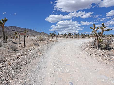 Mormon Well Road approaching Long Canyon Trailhead (view N) |
Overview Long Canyon requires a 2WD-HC vehicle to reach the trailhead, but the road leads to a nice, remote-feeling desert hike that is less than an hour from town. At the south end of the Sheep Range, the route follows an old road across open Mojave Desert Scrub habitat into a deep, narrow canyon that runs up into Pinyon-Juniper Woodlands. The top of the narrows is about 3.3 miles out, but hikers can keep going up Long Canyon Wash for as far as they want -- as it is a long canyon. Link to map or elevation profile. |
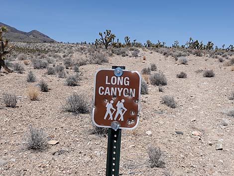
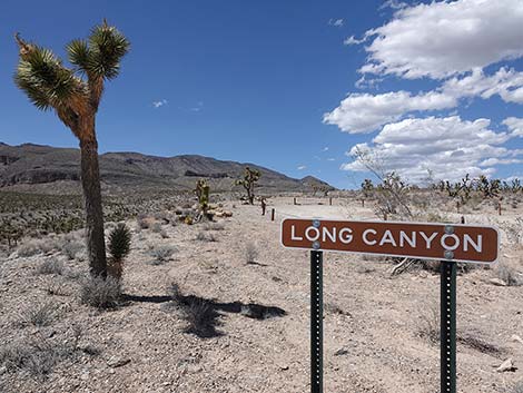 Long Canyon Trailhead sign (view N) |
Watch Out Other than the standard warnings about hiking in the desert, this is a wild and remote area. There are no unusual dangers, but be prepared to take care of yourself. It is just an hour from town, but this area is seldom traveled. While hiking, please respect the land and the other people out there, and try to Leave No Trace of your passage. Also, this hike is in a remote area, so be sure to bring the 10 Essentials. This is a wildlife refuge, so pay extra attention to respecting the land. Please, don't bother the bighorn sheep. They have a hard enough time making a living in these arid lands. |
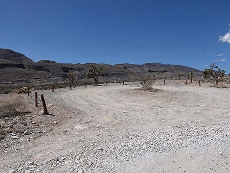
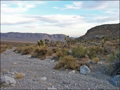
 Mormon Well Road at Long Canyon Trailhead parking (view N) |
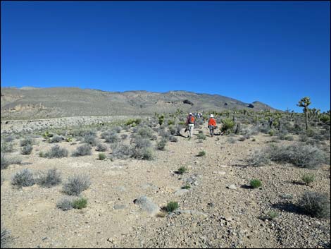
Getting to the Trailhead This hike is located on the Desert National Wildlife Refuge, about 2 hours north of town. From town, drive out to Corn Creek Field Station and continue east 50 yards to a T-intersection. Turn right onto Mormon Well Road and drive south then east and finally north for a total of 9.3 miles. The road winds up through Yucca Gap and around to the east side of the Sheep Range. Stop at a large parking area on the left at a hard curve to the right. Park here; this is the trailhead. For more details, see the Mormon Well Road. The Hike The trailhead is on the top of a dirt cliff overlooking Long Canyon Wash. From the trailhead (Table 1, Waypoint 01), the route starts past a trail sign following an old road that runs north along the top of the bluff overlooking Long Canyon Wash. |
 Long Canyon Trailhead parking (view NW from Mormon Well Road) |
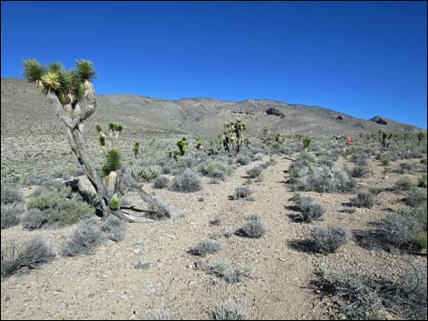
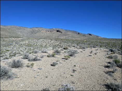
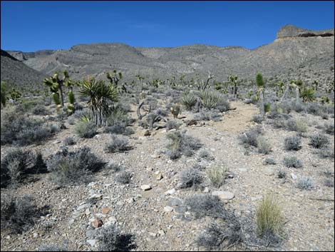
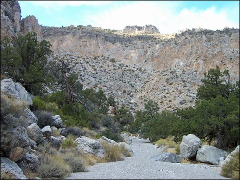
This part of the route runs across open country with great views in all directions. Off to the east is the Yucca Forest, a broad valley that seems to get a fair amount of precipitation and is full of Joshua trees and other vegetation. To the south is Fossil Ridge, a striking ridge that is, in fact, full of fossils. To the west is Yucca Peak with imposing summit cliffs. Long Canyon wraps around the east and north sides of Yucca Peak before turning north into the narrows. About 1.0 miles up the old road, the route bends right onto a constructed trail and passes to the right of several large agave roasting pits (Wpt. 02). Agave roasting pits are places where native peoples brought Utah Agave plants and other foods to centralized roasting areas. It is always interesting to me that there can be so many agave roasting pits in an area with so little firewood and so few agave plants. Vegetation along the hike includes Joshua tree, a few Mojave Yucca, lots of Banana Yucca, Blackbrush, Four-winged Saltbush, Spiny Menodora, few spring and fall flowers, and Nevada Jointfir. Near the trailhead, the vegetation is fairly sparse, but near the hills it gets more dense, and in the wash it is much more dense and diverse because of underground water. |
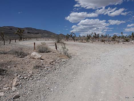
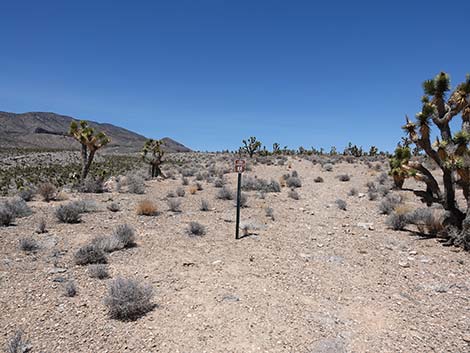 Long Canyon trail sign (view N from edge of parking area) |
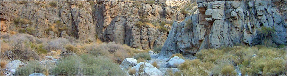
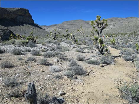
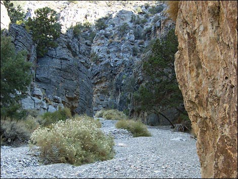
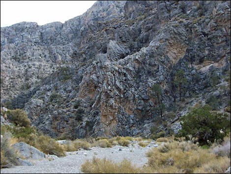
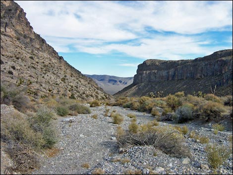
Past the agave roasting pits, the trail turns west and drops abruptly (Wpt. 03) into Long Canyon Wash. In the wash, the route continues up-canyon and westward for another 1.5 miles to what appears to be the head of a box canyon (Wpt. 04). The wash passes interesting carbonate (limestone or dolomite) cliffs and caves high on the sides of the canyon, and there are a few glimpses of Yucca Peak. At the head of the canyon (Wpt. 04), beneath the towering cliffs on the north side of Yucca Peak, the canyon takes a hard turn to the north and cuts up through carbonate cliffs. The canyon is fairly narrow for about 0.8 miles to the top of the narrows (Wpt. 05). Beyond the narrows, hikers can continue up the wash into Long Valley for as far as they wish, as Long Canyon really is a long canyon. Returning to the trailhead, it is common to simply walk down the wash, ignoring the trail to the old road (Wpt. 03), until there is a convenient place to climb the bluffs and get out of the wash. A few yards upstream from the trailhead is one option for climbing out of the wash. |
 Long Canyon trail sign (view N) |
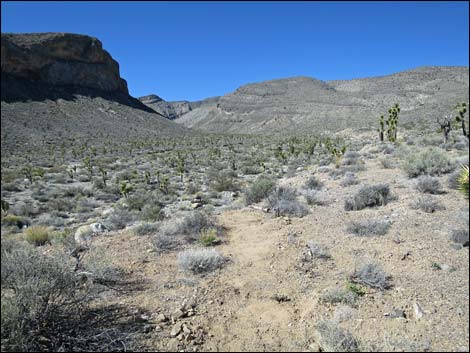
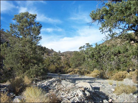
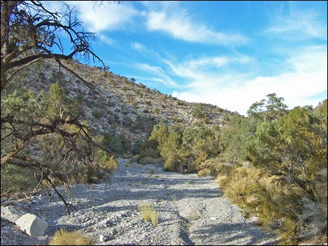
 Old road running north along Long Canyon Wash (view N) |
 Old road running north along Long Canyon Wash (view N) |
 Old road running north along Long Canyon Wash (view N) |
 Trail departs old road to the right (view NW) |
 Trails run around agave roasting pits (view W) |
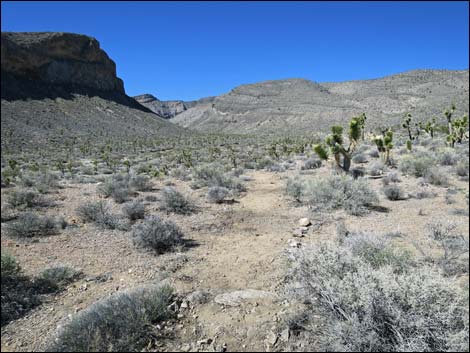 Trails run towards the edge of the wash (view W) |
 Trails disappears over the edge of the wash (view W) |
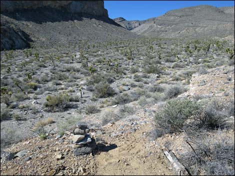 Watch for the cairn with hiking back down the wash (view W) |
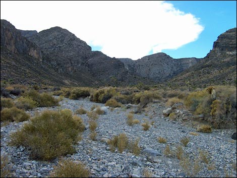 Long Canyon Wash (view W) |
 The canyon begins to narrow (view N) |
 In the narrows (view N) |
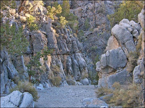 In the narrows (view N) |
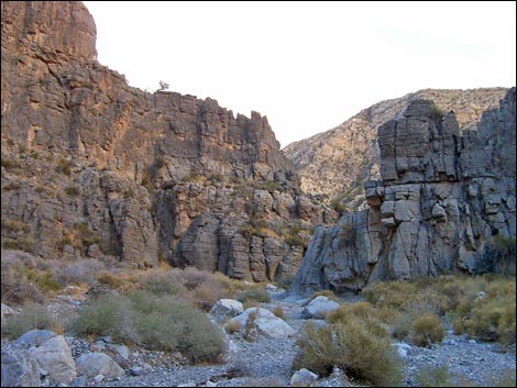 Near the top of the narrows (view N) |
 Long Canyon Wash above the narrows (view NE) |
 Above the narrows, the route is a mystery to me (view N) |
Hiking Back Down the Long Canyon Wash
 |
 |
 |
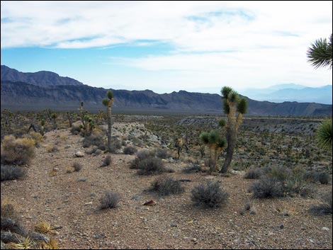 |
Table 1. Hiking Coordinates and Distances based on GPS Data (NAD27; UTM Zone 11S). Download hiking GPS waypoints (gpx) file.
| Wpt. | Location | UTM Easting | UTM Northing | Elevation (ft) | Point-to-Point Distance (mi) | Cumulative Distance (mi) | Verified |
|---|---|---|---|---|---|---|---|
| 01 | Long Canyon Trailhead | 658347 | 4038085 | 4,988 | 0.00 | 0.00 | GPS |
| 02 | Agave Roasting Pit | 658118 | 4039591 | 5,377 | 1.03 | 1.03 | GPS |
| 03 | Drop into Wash | 658063 | 4039631 | 5,290 | 0.07 | 1.10 | GPS |
| 04 | Head of Canyon | 655948 | 4039625 | 5,963 | 1.48 | 2.58 | GPS |
| 05 | Above the Narrows | 656230 | 4040827 | 6,584 | 1.30 | 3.88 | GPS |
| 01 | Long Canyon Trailhead | 658347 | 4038085 | 4,988 | 3.88 | 7.76 | GPS |
Happy Hiking! All distances, elevations, and other facts are approximate.
![]() ; Last updated 240324
; Last updated 240324
| Hiking Around DNWR | Hiking Around Las Vegas | Glossary | Copyright, Conditions, Disclaimer | Home |