Hiking Around Las Vegas, Desert National Wildlife Refuge
Overview | Southwest Section | Middle Section | Northeast Section
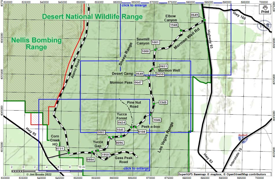
Note: Roads are black (solid = paved; dashed = unpaved). Trails and routes are red (solid = main; dashed = adjacent or alternate). Map based on USGS 7.5-minute topo map, which may have red grid lines and various numbers. North is at the top. Grid is UTM NAD27 CONUS. Wildlife Refuge (boundaries solid green, fill light green) based on USFWS data. Military Reservation (boundaries solid orange, fill crosshatch) based on Nevada State data. BLM areas (white) based on BLM data. Download waypoint coordinates from route description page.
Happy Hiking! All distances, elevations, and other facts are approximate.
![]() ; Last updated 220615
; Last updated 220615
| Mormon Well Road | Desert National Wildlife Refuge | Hiking Around DNWR | Glossary | Copyright, Conditions, Disclaimer | Home |