Hiking Around Las Vegas, Desert National Wildlife Refuge
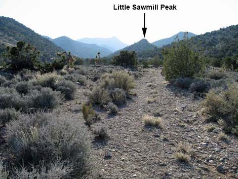
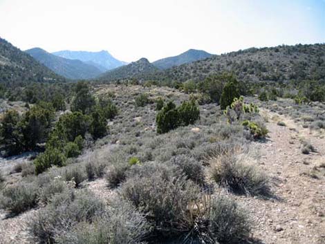
 Little Sawmill Peak Trailhead (view SW) |
Overview For people driving across the Mormon Well Road hoping to hike up Sawmill Canyon, this little peak is a consolation prize for those who get a late start or just find too many interesting things to stop and see along the road. The route starts up the Sawmill Canyon Trail, but after about 1.35 miles it cuts off to climb the rocky summit of the first little peak along the trail. The summit (6,561 feet) is airy and standing on the summit require 4th class scrambling, but the views are great and far better than just turning around on the Sawmill Canyon Trail when you run out of daylight. Link to a map or elevation profile. For general information on camping, regulations, other issues, and the natural history of the Wildlife Refuge, see the Desert National Wildlife Refuge -- Area Overview page. |
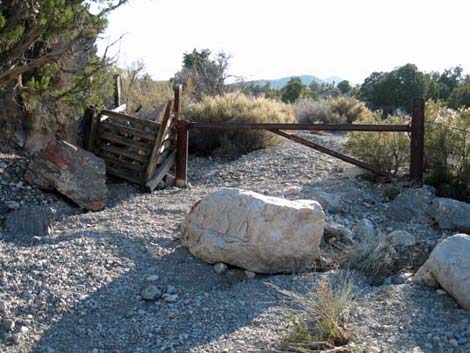
 The other fork at the end of Sawmill Wash Road (view W) |
Watch Out Other than the standard warnings about hiking in the desert, ... this is a safe hike until you leave the trail. Hiking up the hillside is steep with lots of blackbrush, banana yucca and prickly pear cactus (all of which will stab your legs and feet), and the actual summit requires a tiny bit of Class-4 scrambling. While hiking, please respect the land and the other people out there, and try to Leave No Trace of your passage. Also, even though this hike is fairly short, it is remote, so be sure to bring the 10 Essentials. This is a wildlife refuge, so pay extra attention to respecting the land. Please, don't bother the bighorn sheep. |
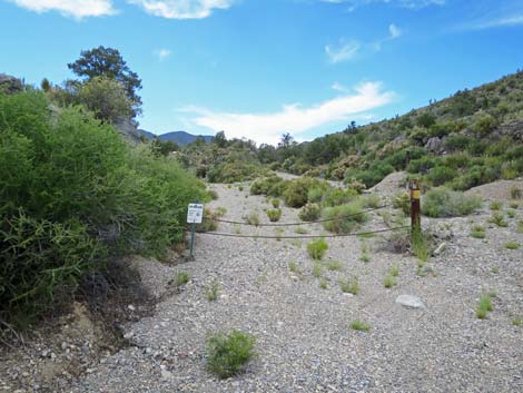
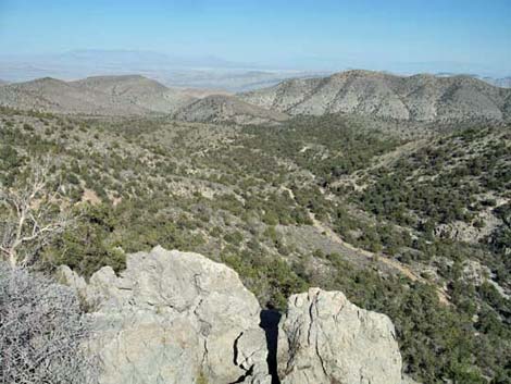
 Old Sawmill Canyon Road (view SW) |
Getting to the Trailhead This hike is located on the Desert National Wildlife Refuge, 2 or more hours north of town. From town, drive out to Corn Creek Field Station and continue east 50 yards to a T-intersection. Turn right onto Mormon Well Road (mile 0.0) and drive south past Desert Pass Campground (mile 25.5) to Sawmill Wash Road (Table 1, Site 1000; mile 30.7). Turn here, or continue another 0.2 miles (mile 30.9) to the other side of the Sawmill Wash Road (Site 1001) triangular intersection. Either way, turn left and drive west and up into Sawmill Canyon for about 0.4 miles to a gate. When driving up Sawmill Wash Road, the canyon forks about 50 yards before the end of the road, and gates can be seen up both canyons. The trailhead is in the left (southern) canyon. Continue to the gate. Park here; this is the trailhead (Site 1002). |
 Old Sawmill Canyon Road (view SW) |
Alternatively, for a longer paved highway and shorter dirt road approach, drive west on I-15 to Highway 93. Drive north on Hwy 93 for 42.7 miles to a dirt road on the left where powerlines cross the highway to a power substation. If you miss the turn, turn around at Coyote Springs (Hwy 168) and go back 2.2 miles. Turn west and drive up the dirt road for about 10.8 miles to Sawmill Wash Road (Site 1001). Turn right and drive up the wash to the gate in the left fork (Site 1002). |
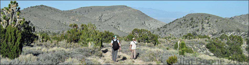
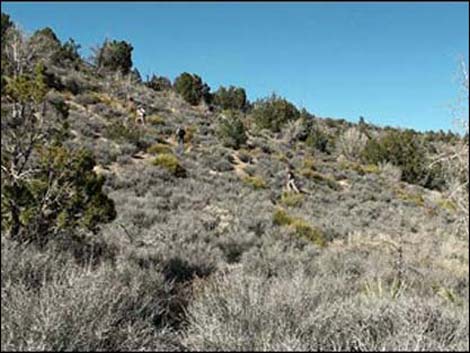 Hikers heading towards the ridgeline (view NE) |
The Hike From the trailhead (Table 2, Waypoint 01), the trail runs west-southwest up the wash, passes the gate, and almost immediately climbs out of the wash onto an old road. This area is in the transition zone between the Mojave Desert Scrub habitat type and the Pinyon-Juniper Woodland habitat type (Upper Sonoran Life Zone). Common lower-elevation species include Joshua Tree, Banana Yucca, and Blackbrush, and common higher-elevation species include Singleleaf Pinyon, Utah Juniper, and Mormon tea. The route follows the old road for 1.35 miles to a high point on the road (Wpt. 02) below the prominent peaklet on the north side of the road. Turn north to climb the ridge, then follow the cactus and tree covered ridge westward to the rocky limestone summit (Wpt. 03). While this peak is just a consolation prize, the views are grand, especially back to the east with the Arrow Canyon Range and the Mormon Mountains in the distance. The summit blocks are a bit loose, so be careful up there. |
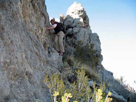 Climbing onto the summit (view N) |
From the peak, the late afternoon view to the west is washed out in the setting sun, but Hayford Peak looms on the horizon as the highest point in the Sheep Range. To the east (photo at left), the Mormon Mts., Moapa Peak, and the Arrow Canyon Range can be seen in the distance (view east). When ready to depart the summit, follow the route you came up, or cut more directly back to the old road, then head downhill to the trailhead. |
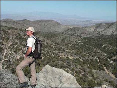 Hiker on the summit (view NE) |
 Summit (view E) |
Table 1. Highway Coordinates Based on GPS Data (NAD27, UTM Zone 11S). Download Highway GPS Waypoints (*.gpx) file.
| Site # | Location | Latitude (N) | Longitude (W) | UTM Easting | UTM Northing | Elevation (feet) | Verified |
|---|---|---|---|---|---|---|---|
| 1000 | Mormon Rd at Sawmill Rd South | 36.69386 | 115.09118 | 670531 | 4062407 | 5,572 | GPS |
| 1001 | Mormon Rd at Sawmill Wash | 36.69577 | 115.08864 | 670754 | 4062624 | 5,510 | GPS |
| 1002 | Sawmill Canyon Trailhead | 36.69542 | 115.09518 | 670170 | 4062573 | 5,663 | GPS |
Table 2. Hiking Coordinates Based on GPS Data (NAD27, UTM Zone 11S). Download Hiking GPS Waypoints (*.gpx) file.
| Wpt. | Location | Easting | Northing | Elevation (ft) | Point-to-Point Distance (mi) | Cumulative Distance (mi) | Verified |
|---|---|---|---|---|---|---|---|
| 01 | Trailhead | 670168 | 4062572 | 5,663 | 0.00 | 0.00 | GPS |
| 02 | Leave Road | 668313 | 4061571 | 6,222 | 1.35 | 1.35 | GPS |
| 03 | Little Sawmill Peak | 668042 | 4061576 | 6,561 | 0.22 | 1.57 | GPS |
| 01 | Trailhead | 670168 | 4062572 | 5,663 | 1.65 | 3.22 | GPS |
| 04 | Wrong Gate | 670163 | 4062621 | 5,656 | . | . | GPS |
| 05 | Sawmill Spring | 662949 | 4060813 | 8,140 | . | about 5 miles | Map |
Happy Hiking! All distances, elevations, and other facts are approximate.
![]() ; Last updated 240324
; Last updated 240324
| Hiking Around DNWR | Hiking Around Las Vegas | Glossary | Copyright, Conditions, Disclaimer | Home |