Hiking Around Las Vegas, Red Rock Canyon National Conservation Area
 Calico Hills trailhead (view N) |
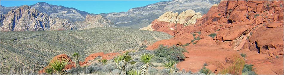
Overview This pleasant, 3.2-mile trail runs among low ridges, washes, canyons, and red sandstone boulders along the base of the brilliantly red Calico Hills. The trail generally traverses open country with interesting rocks, fossils, birds, rock art, contrasting vegetation types, and grand scenery all around. The Calico Hills Trail runs one-way from the Entrance Station to Sandstone Quarry. From that point, there are a number of trails that can be used to start, end, or make a loop using the Calico Hills Trail.Link to map or elevation profile. Link to BLM Georeference PDF map file. |
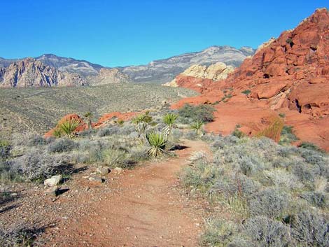
 Calico Hills Trail near Entrance Station (view N) |
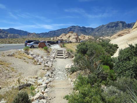
Watch Out Other than the standard warnings about hiking in the desert, ...this hike is fairly safe, even for kids, but there are some short, steep scrambles through rocky areas near the Calico II parking area. Always be extra careful when you get high enough to fall and hurt yourself. Most of this trail is well groomed, relatively free of rocks, and makes for easy walking. Be careful crossing or walking on the roads. While hiking, please respect the land and the other people out there, and please try to Leave No Trace of your passage. Also, even though this is a short hike, be sure to bring what you need of the 10 Essentials. |
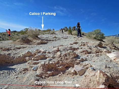
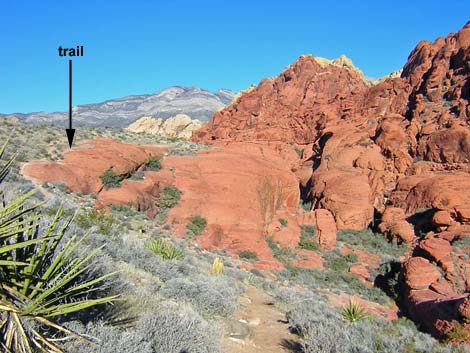
 Hillside nearing Calico I parking (view N) |
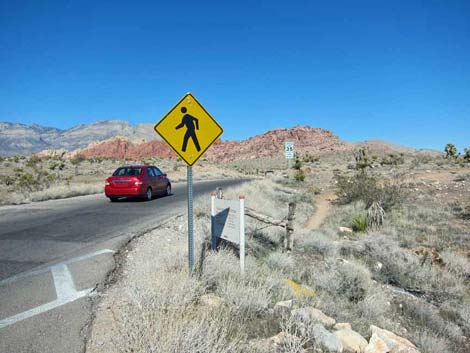
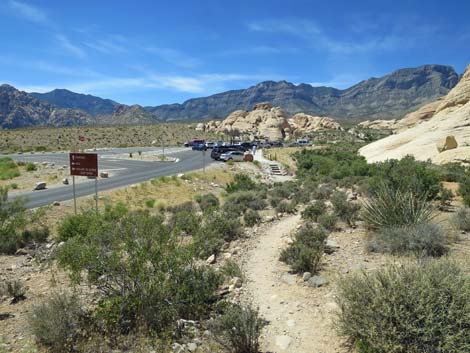
Getting to the Trailhead This hike is located along the Scenic Loop Road in Red Rock Canyon National Conservation Area, about 30 minutes west of Las Vegas. Drive out to Red Rocks, pay the fee, then drive forward and turn left onto the exit road and left again into the Entrance Station Trailhead behind the fee booths. Park here; this is the trailhead. Alternatively, park at the Visitor Center Trailhead or one of the three places along the Scenic Loop Road that access this trail system: Calico I Trailhead, Calico II Trailhead, and Sandstone Quarry Trailhead. These alternative trailheads add variety to the hiking possibilities and provide places to drop hikers off and pick them up later. |
 Calico 1 Trail leads to Calico Hills I Trailhead parking area (view W) |
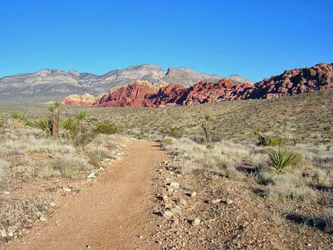
The Hike From the Entrance Station parking lot, the trail starts across the entrance road on the northeast corner of the 4-way intersection (Table 1, Waypoint 2). The trailhead is marked by a Calico Hills Trail System sign that gives mileages to several destinations. From the trailhead (Wpt. 02), the trail angles away from the Scenic Loop Road and runs east across a hillside for a short distance to an old road (Wpt. 03). The trail turns left onto the old road and runs north towards the Calico Hills. The shrubby vegetation here is dominated by scattered Mojave yucca, Joshua tree, and creosote bush, set in a mix of low growing shrubs (including Mojave ephedra, blackbrush, and indigo bush) and brome grass. The trail climbs over a low ridge and drops into a wash. Notice the contrast between vegetation on the ridge and vegetation in the wash. Not only is the vegetation in the wash more robust, but several species (including paperbag bush) can survive in the wash that cannot tolerate the dry, shallow soil conditions on the ridge. |
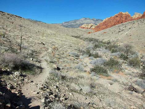
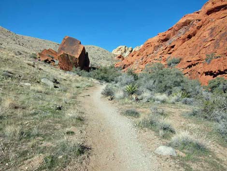
 Beyond Calico I, the trail crosses the wash and climbs onto ridge |
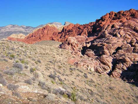
The trail runs northwest up the wash a short way, then curves north (Wpt. 04) and starts up another low ridge. The trail runs across some exposed limestone slabs on the top of the ridge. The limestone is gray, and the dark brown protrusions on some of the limestone are fossiliferous materials. Most of these materials look like algal mats (bio-ooze), but there are some fossil sponges and a bit of crinoid rubble scattered about. Continuing north from the fossil site, the trail descends to a gully and a trail junction (Wpt. 05). The trail to the west runs 0.5 miles to the Visitor Center. The Calico Hills Trail continues north on a low ridge between Calico Hills Wash and the Scenic Loop Road, providing nice views of the escarpment to the west. The road is not close enough to be bothersome, and in places the trail runs just over the ridge so that you can't quite see the road. Just south of the Calico I parking, the trail runs up along edge of Scenic Loop Road. This segment of the trail ends at the main Calico I trailhead, which is located on the east edge of parking area and marked with another Calico Hills Trail System sign (Wpt. 09). |
 Alternative low-road between Calico I and 2 (view N) |
From the Calico I trailhead (Wpt. 09), the Calico Hills Trail continues by running east for about 100 yards straight down the hillside towards Calico Hills Wash (heading towards the Calico Hills). At a trail sign just before the hillside drops more steeply into the wash (Wpt. 10), the trail turns north and runs along the hillside parallel to the wash for about 100 yards. The trail drops into and crosses Calico Hills Wash (Wpt. 011), staying close against the red sandstone boulders that form the base of the Calico Hills (several use-trails continue along the hillside; but stay against the rocks). With the relatively large amount of runoff from Calico Hills, there is enough water to support a dense thicket of shrub live oak, honey mesquite, catclaw acacia, paperbag bush, and desert almond in the wash. The area burned several years ago, but plants are growing back. |
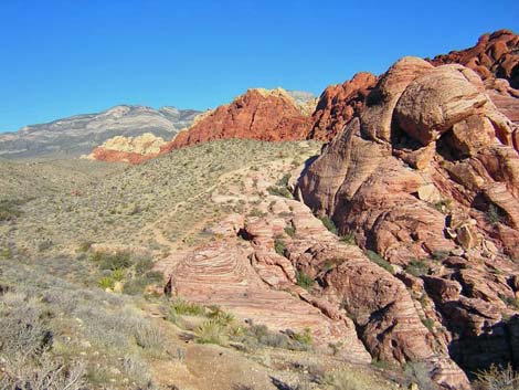
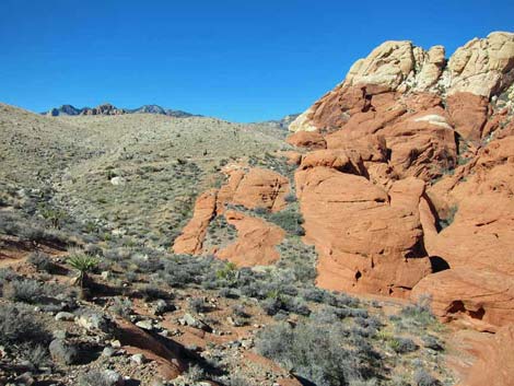
 Hillsides between Calico I and Calico II (view N) |
An alternative trail stays on the west side of the wash, but the main trail crosses the wash and runs steeply up the hillside (on a trail or on red slickrock) to the top of a low ridge that is about as high as the Calico I parking area. The trail then continues north along an east-facing sidehill, about halfway up from the bottom of the wash, which is nice because the hillside shields you from sights and sounds of the Scenic Loop Road. In a few minutes, the trail climbs back onto the top of the ridge, where you realize that there is another canyon between you and the road. On the ridgeline, the trail runs across a bit of slickrock, and then hits red sandstone crags (Wpt. 012). At the base of the crags, the trail turns left and drops steeply to the west in a little slickrock gully into what appears to be the bottom of the canyon, but actually is a gully among a jumble of red outcrops. The route naturally curves north and runs through a narrow canyon between red sandstone crags. When the canyon opens up a bit, the trail takes an odd jog to the west, over a low wall of red rock, and down another slickrock gully to the actual bottom of the canyon. |
 Hillsides between Calico I and 2 (view N) |
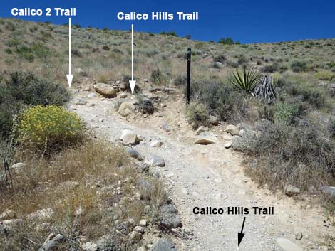
In the bottom of the canyon, the trail stays on the east side of the wash (although there are several use-trails on the other side) until the trail is just below the Calico II parking area. At that point, the trail takes a jog to the west and crosses the wash under a single-leaf pinyon pine growing in the bottom of the wash (Wpt. 013). The pine is flanked by thickets of shrub live oak and ashy silktassel. The trail continues north along the west side of the wash for another minute or so to a trail junction on a switchback (Wpt. 014) where you can still see Calico II above you. A use-trail continues up the canyon, while the main trail switchbacks to the southwest and starts up towards the parking area. The trail quickly passes another trail junction (Wpt. 015) where a use-trail heads up the canyon and the main trail continues towards Calico II. At a third trail junction, this one marked with a trail sign (Wpt. 016), one trail runs up to the Calico II parking area (Wpt. 017), while the other continues north to Sandstone Quarry. |
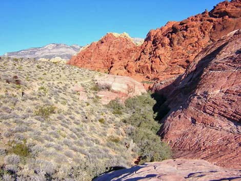
 Highpoint between Calico I and 2 (view N) |
From the trail junction (Wpt. 016), either walk the short distance (about 150 yards) to the Calico II parking area or continue north to Sandstone Quarry, which is about 1.2 miles north. If you hike up to Calico II (Wpt. 017), which has another Calico Hill Trail System sign, you can walk back to the Entrance Station on the road. From the trail junction with the sign (Wpt. 016), the Calico Hills trail continues north towards Sandstone Quarry. The trail winds around the hillside, climbing at a moderate grade for about 75 yards to an unmarked junction (Wpt. 018) where a use-trail comes in from the south (it connects back with the trail to Calico I). From the unmarked trail junction, the trail runs north, working up over a red slickrock ridge, angling down the other side of the ridge, and running down into the bottom of a little hidden canyon. The effects of differing levels of soil moisture are clearly evident here. The vegetation along the wash includes two fairly tall single-leaf pinyon pine (one dead), lots of shrub live oak, some Stansbury cliffrose, few other species of shrub crowded into the bottom of the canyon. In contrast, the adjacent hillside is vegetated primarily with blackbrush and scattered creosote bush and Mojave yucca. This area burned too, but the vegetation is slowly growing back. |
 Calico Hills Trail at Calico 2 Trail; left to Calico II parking (view NW) |
Towards the far end of the hidden canyon, an enormous boulder and several other huge boulders clustered around lie out away from the cliffs (Wpt. 019). Native peoples used this area and left rock art pecked into the black desert varnish patina. Some of the petroglyphs are unusual in that they are located on the top surfaces of the boulders -- please don’t walk on these rocks as you will hasten erosion and loss of the artwork. From the rock art site, the trail continues up the canyon climbing the hillside, crossing over a red-rock ridge, and running up and across more red slickrock. The trail runs north, winding along the hillside intermittently on dirt and slickrock, but always staying on the hillside above the fairly narrow red-rock gorge. The trail eventually runs to the top of the hillside and crosses a low ridge (Wpt. 20), providing the first view of Sandstone Quarry. Through this section, several use-trails branch off, but the main trail always stays high on the hillside. |
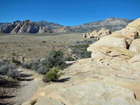
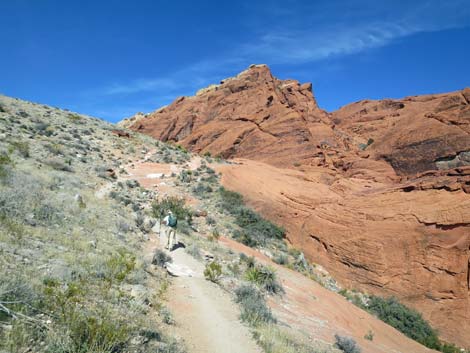 Hiker continuing past Calico II area (view NE) |
From the ridge, the trail runs down to the Sandstone Quarry trailhead (Wpt. 021), which is located on the Sandstone Quarry access road, about 50 feet before the parking lot. The vegetation at the trailhead is similar to that in the canyon: lots of shrub live oak, yerba buena, and manzanita along base of the cliffs where the soil catches runoff from the rocks, and blackbrush, creosote bush, and yucca on the flats. From Sandstone Quarry, consider hiking up to Calico Tank or use the paved road to walk back to the trailhead. |
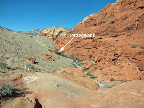 From highpoint, petroglyphs are visible in the distance (view N) |
 Approaching an archeological site (view N) |
 Red and white sandstone (view N) |
 Approaching Sandstone Quarry trailhead (view NW) |
 Approaching Sandstone Quarry trailhead (view NW) |
 Arriving at the Sandstone Quarry trailhead (view NW) |
Table 1. Hiking Waypoints and Distances Based on GPS Data (NAD27, UTM Zone 11S). Download Hiking GPS Waypoints (*.gpx) file.
| Wpt. | Location | UTM Easting | UTM Northing | Elevation (ft) | Point-to-Point Distance (mi) | Cumulative Distance (mi) |
|---|---|---|---|---|---|---|
| 02 | Trailhead | 641876 | 3999619 | 3,691 | 0.05 | 0.05 |
| 03 | Junction Old Road | 641992 | 3999729 | 3,682 | 0.11 | 0.15 |
| 04 | Leaving Wash | 641841 | 4000007 | 3,709 | 0.21 | 0.36 |
| 05 | Trail to Visitor Center | 641693 | 4000348 | 3,786 | 0.24 | 0.60 |
| 06 | Trail to Red Spring | 641719 | 4000528 | 3,816 | 0.12 | 0.72 |
| 07 | Calico I trail sign south of parking | 641303 | 4001008 | 3,910 | 0.40 | 1.12 |
| 08 | Calico I, south edge of Parking | 641270 | 4001053 | 3,928 | 0.04 | 1.16 |
| 09 | Calico I Trailhead | 641256 | 4001106 | 3,932 | 0.03 | 1.19 |
| 10 | Trail turns North | 641326 | 4001170 | 3,889 | 0.07 | 1.26 |
| 11 | Calico Hills Wash | 641265 | 4001235 | 3,869 | 0.07 | 1.33 |
| 12 | Cut down Gully | 640992 | 4001666 | 4,014 | 0.37 | 1.70 |
| 13 | Wash Crossing | 640724 | 4001814 | 3,954 | 0.26 | 1.96 |
| 14 | Low Junction | 640686 | 4001854 | 3,950 | 0.04 | 2.00 |
| 15 | Middle Junction | 640645 | 4001856 | 3,950 | 0.03 | 2.03 |
| 16 | Upper Junction with Sign | 640616 | 4001855 | 4,012 | 0.04 | 2.07 |
| 17 | Calico II Trailhead | 640656 | 4001724 | 4,030 | . | . |
| 18 | Unmarked Trail Junction | 640630 | 4001902 | 4,033 | 0.04 | 2.11 |
| 19 | Archeological Site | 640424 | 4002210 | 4,024 | 0.26 | 2.37 |
| 20 | Ridge Crossing | 639653 | 4002709 | 4,285 | 0.69 | 3.06 |
| 21 | Sandstone Quarry Trailhead | 639535 | 4002785 | 4,308 | 0.09 | 3.15 |
Happy Hiking! All distances, elevations, and other facts are approximate.
![]() ; Last updated 240330
; Last updated 240330
| Hiking Around Red Rocks | Hiking Around Las Vegas | Glossary | Copyright, Conditions, Disclaimer | Home |