Hiking Around Las Vegas, Spring Mountains (Mt. Charleston), Kyle Canyon
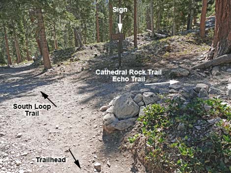
 Cathedral Rock and South Loop trailhead sign (view SW) Cathedral Rock and South Loop trailhead sign (view SW) |
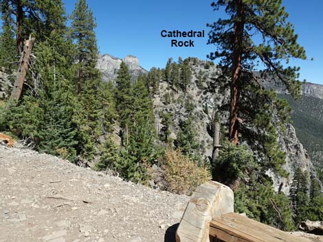
Overview The Upper Little Falls Trail is a short (0.4 miles one-way), easy stroll through the Pine-Fir Forest on a nearly level trail, but getting to the start of the trail is moderately strenuous because it forks off from the Cathedral Rock Trail just below the summit of Cathedral Rock. For most people, Upper Little Falls is not a destination, but rather a nice little add-on to the hike up Cathedral Rock. From the Cathedral Rock Trailhead, this hike starts on the Cathedral Rock Trail and climbs at moderately strenuous grades for about 1.2 miles. This part of the hike follows an old road up an avalanche chute along the east side of Cathedral Rock to a saddle behind the summit. From there, the Upper Little Falls Trail forks left and runs out another 0.4 miles on a nearly level old road to the spring at the top of Little Falls. During springtime when snow is melting, there can be quite a stream flowing down the canyon here. While some hikers might rappel off the falls, most of us will return to the trailhead by turning around and wandering back down the trail. Link to map. |
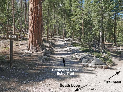
 Start of Cathedral Rock, South Loop, and Echo trails (view SW) |
Watch Out Other than the standard warnings about hiking in the mountains, ...this trail passes through an avalanche chute that could be dangerous during winter. The trail is strenuous, so take it easy at this elevation. There are no railings near the spring or at the top of the falls, so be careful near the edge, as a slip over the falls would result in certain death. Watch the kids and pets carefully. While hiking, please respect the land and the other people out there, and try to Leave No Trace of your passage. Also, even though this hike is short, be sure to bring what you need of the 10 Essentials. This hike goes into the Mt. Charleston Wilderness Area, so pay particular attention to respecting the land. |
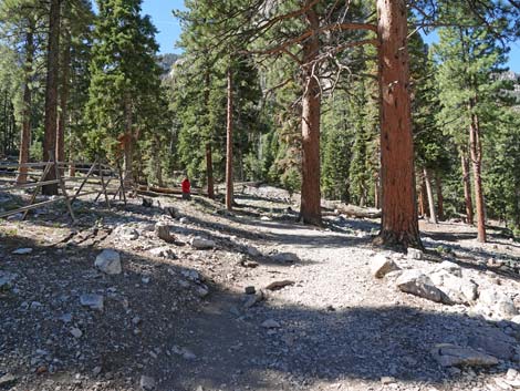
 Trails pass Cathedral Rock Trailhead sign (view SW) |
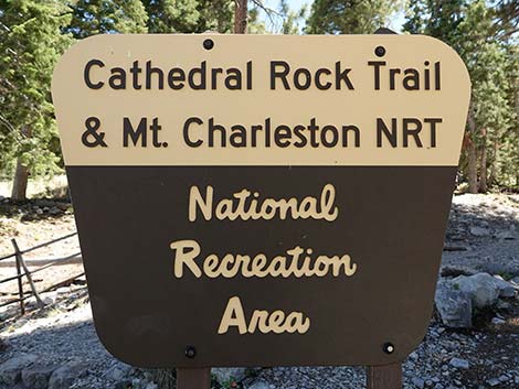
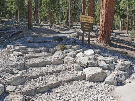
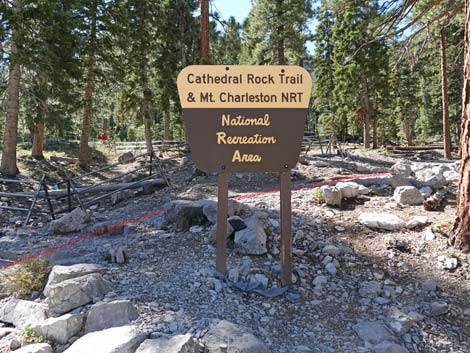
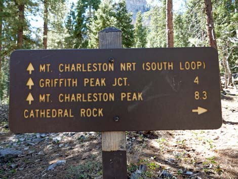
Getting to the Trailhead This hike is located in Kyle Canyon up in the Spring Mountains National Recreation Area, about 45 minutes northwest of Las Vegas. From town, drive Highway 95 to Kyle Canyon Road to the Spring Mountains Visitor Center. From the round-about, continue up Kyle Canyon Road for 4.7 miles (8 minutes) to Cathedral Rock Trailhead. This is the trailhead for the Cathedral Rock Trail, but also the South Loop Trail and Echo Trail. All start on the same trail. Note that for a time, the Forest Service referred to the South Loop Trail as the "Mt. Charleston NRT" (where NRT is National Recreation Trail). |
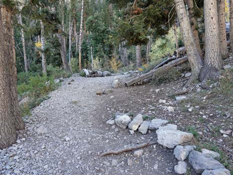
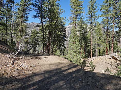
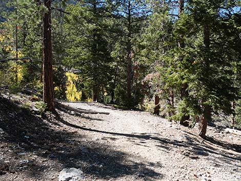
 Trail runs outside of fenced area (view W) |
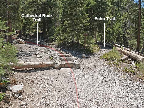
The Hike From the trailhead (Table 1; Waypoint 01), the Cathedral Rock Trail runs up and left around a fenced habitat restoration area where hikers get their first glimpse through the trees of Cathedral Rock towering above. In about 200 yards the trail arrives at a fork (Wpt. 02). At the fork, the Cathedral Rock Trail turns right, while the South Loop Trail continues straight. To this point, the trail is passing through a mixed forest of Ponderosa Pines and White Fir with an open understory of Wax Currents and a few other shrubs, plus some grasses, thistles, and a few forbs. In the trees, views are short, but hikers can look back down on the trailhead parking area. From the trail junction (Wpt. 02), the Cathedral Rock Trail turns right and starts up the hillside. In about 100 yards, the trail forks again (Wpt. 03). Here, the Cathedral Rock Trail bends left climbing stone stairs, while the Echo Trail stays to the right (straight) with a dirt tread. |
 Cathedral Rock Trail at trail junction (view SE) |
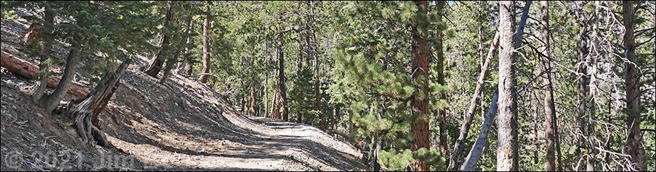
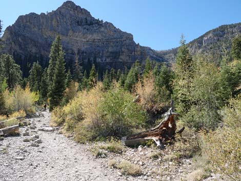
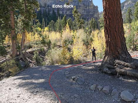
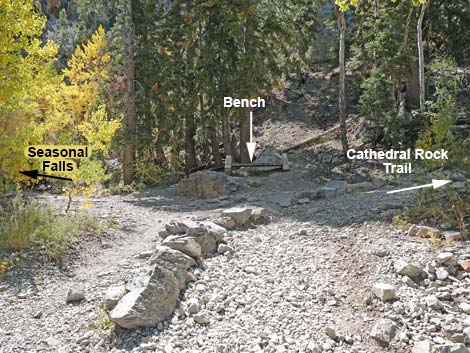
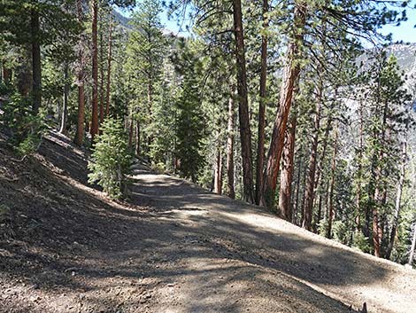
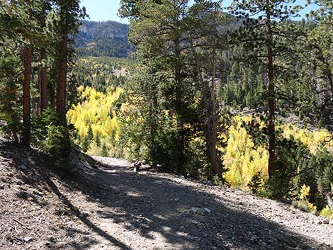
From the fork (Wpt. 03), the Cathedral Rock Trail follows an old road as it zig-zags up Mazie Canyon, which forms an avalanche chute between Cathedral Rock (on the right) and Echo Rock (on the left). Repeated avalanches prevent conifer trees from growing too tall here, thus opening the forest and allowing Quaking Aspen to grow (they bend under the snow). There are several species of shrubs and lots of spring wildflowers here too. The quaking aspen have grown so tall that it is hard to notice the open avalanche chute, but when the aspen get too tall, they too will be knocked down. A tangle of old logs reveals the history of the area and the cycle of life. The trail runs up under Echo Cliffs (3rd switchback), then switchbacks over to the base of Cathedral Rock (4th switchback), and switchbacks again up under Echo Cliffs (5th switchback; Wpt. 04) into a wooded area about 0.8 miles out. At the 5th switchback, hikers see a wooden bench above the trail, and to the left an unmarked use-trail east heads into the trees towards the cliffs. This use-trail leads a short distance to a seasonal waterfall (Wpt. 10). |
 Cathedral Rock - South Loop junction sign (view S) |
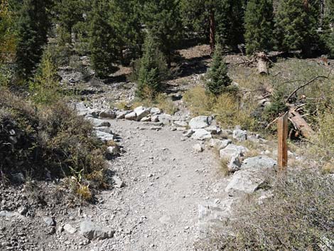
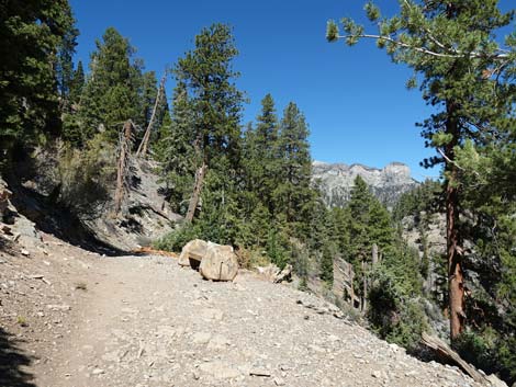
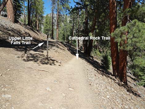
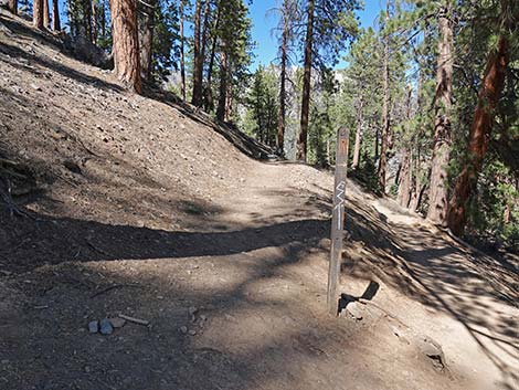
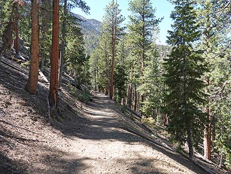
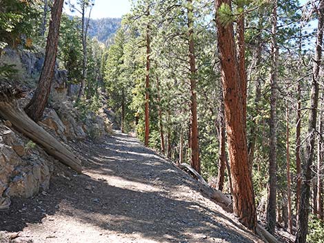
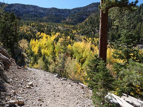
From the 5th switchback (Wpt. 04), the Cathedral Rock Trail continues up following the old road through wooded and open areas with great views down the canyon and of the steep east face of Cathedral Rock. After two shorter switchbacks, Cathedral Rock Trail circles around the top of Mazie Canyon and begins to approach Cathedral Rock from the south. Near the back of Cathedral Rock, the trail forks (Wpt. 05) for a last time. Here, the old road stays left and continues level as the Upper Little Falls Trail. In contrast, a narrow foot-trail forking right towards Cathedral Rock drops into a saddle; historically there has not been a trail sign the trail junction. Staying left onto Upper Little Falls Trail, the trail continues northwesterly for a few more yards, then bends left to contour across the side of the mountain. The trail drops a bit to another trail intersection (Wpt. 11) where a trail merges from the right. This trail runs back to the Cathedral Rock Trail, but it does so through a cut through the narrow ridge. This trench was dug to facilitate the water pipe that now runs under the old road. |
 Cathedral Rock and Echo trails turn right (view W) |
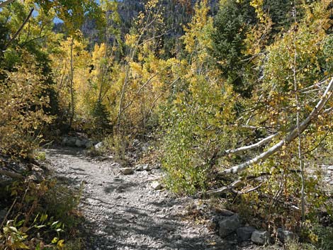
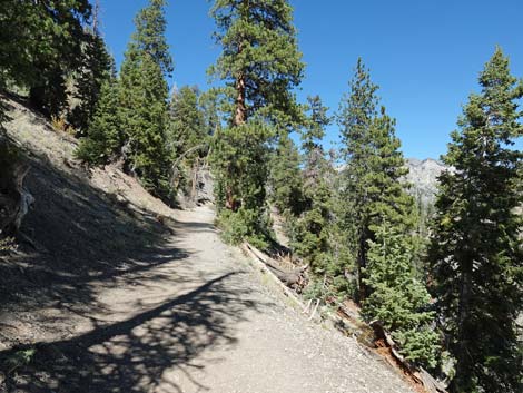
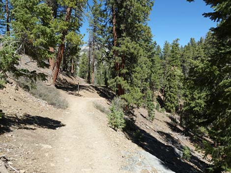
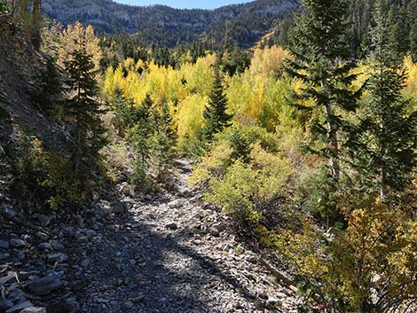
Continuing west on the old road, the road winds across the hillside at a nearly level grade. Through the tall trees, hiker can glimpse mountain peaks across Kyle Canyon or look back to the summit of Cathedral Rock. The dense forest here is a diverse mix of conifers composed mostly of White Fir and Limber Pine, but with Great Basin Bristlecone Pine and Ponderosa Pine mixed in. Keep an eye out for low-growing Common Juniper too. After about 0.32 miles on the Upper Little Falls Trail, the trail begins to curve left into Little Falls Canyon and hikers pass a flattish area below the trail that serves as an acceptable campsite for backpackers (Wpt. 12). Curving left into Little Falls Canyon, the trail descends into the bottom of the gully. People looking for the top of the waterfall should turn right down the watercourse, but others might want to continue uphill on the trail to the spring-box (Wpt. 13) where local residents used to capture water from the stream and pipe it down to town. From here, either rappel off the falls or turn around and hike back down the trail. For those who skipped the summit of Cathedral Rock on the way up, consider hiking up there on the way down -- the views are spectacular. |
 Cathedral Rock - Echo Trail junction (view W) |
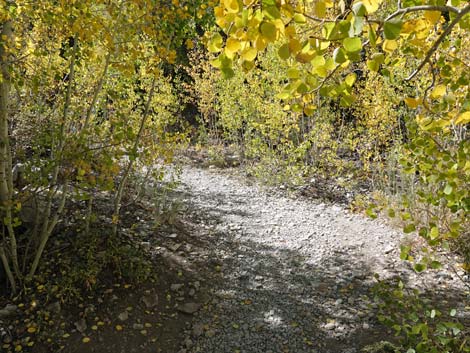
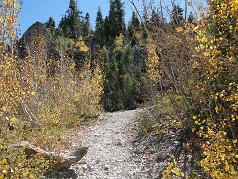
 Trail enters avalanche chute with Quaking Aspen (view S) |
 First switchback is near base of Echo rock (view S) |
 Cathedral Rock Trail approaching second switchback (view NW) |
 Cathedral Rock Trail approaching third switchback (view SE) |
 Cathedral Rock Trail at fourth switchback (view SW) |
 Cathedral Rock Trail at fifth switchback (view S) |
 Cathedral Rock Trail approaching sixth switchback (view W) |
 Cathedral Rock Trail approaching seventh switchback (view SE) |
 Easy trail continues across top of Maize Canyon (view NW) |
 Cathedral Rock Trail approaching fifth bench (view N) |
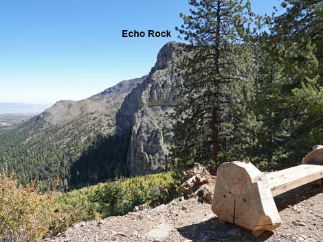 Grand scenery (view E from fifth bench) |
 Grand scenery (view N from fifth bench) |
 Cathedral Rock Trail approaching a trail junction (view N) |
 Cathedral Rock Trail at Upper Little Falls Trail junction (view N) |
 Upper Little Falls Trail stays left (view N) |
 Upper Little Falls Trail passes above a trench (view NW) |
 Trail drops a few feet to a merge with trail from the right (view N) |
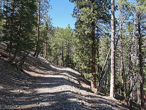
 Upper Little Falls Trail runs across the hillside (view W) |
 Ponderosa pine on the right (view W) |
 Upper Little Falls Trail runs across the hillside (view W) |
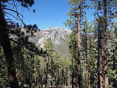 View through the trees: crags across Kyle Canyon |
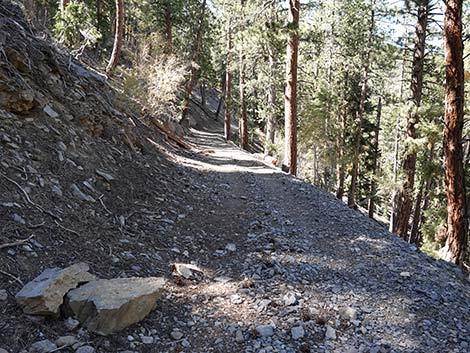
 The hillside is caving in on the old road (view W) |
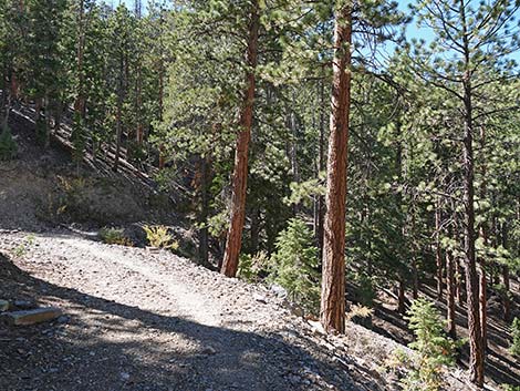 Upper Little Falls Trail contours across the hillside (view SW) |
 Upper Little Falls Trail contours across the hillside (view W) |
 Upper Little Falls Trail curves left above campsite (view SW) |
 Upper Little Falls Trail curves into Little Falls Canyon (view SW) |
 Upper Little Falls Trail drops into Little Falls Canyon (view SW) |
 Upper Little Falls Trail dropping into Little Falls Canyon (view SW) |
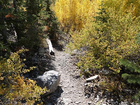 Upper Little Falls Trail in Little Falls Canyon (view SW) |
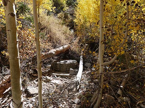 A short uphill walk leads to the old springbox (view S) |
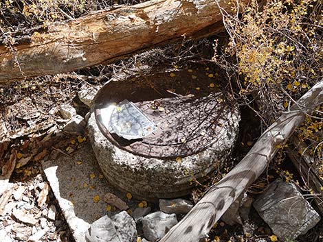 Old springbox (view SE) |
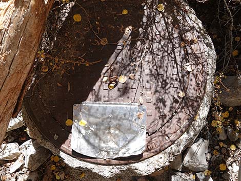 Old springbox: water pours out during wet years (view down) |
 More to come ... |
Table 1. Hiking Coordinates Based on GPS Data (NAD27; UTM Zone 11S). Download Hiking GPS Waypoints (*.gpx) file.
| Wpt. | Location | UTM Easting | UTM Northing | Elevation (ft) | Point-to-Point Distance (mi) | Cumulative Distance (mi) |
|---|---|---|---|---|---|---|
| 01 | Cathedral Rock Trailhead | 621731 | 4013026 | 7,713 | 0.00 | 0.00 |
| 02 | Cathedral-South Loop Trail Junction | 621802 | 4012928 | 7,716 | 0.10 | 0.10 |
| 03 | Cathedral-Echo Trail Junction | 621724 | 4012921 | 7,728 | 0.05 | 0.16 |
| 04 | Trail Junction, Waterfall | 621485 | 4012413 | 8,183 | 0.63 | 0.79 |
| 05 | Trail Junction, Upper Little Falls | 621224 | 4012692 | 8,433 | 0.43 | 1.22 |
| 11 | Trail Junction | 621206 | 4012764 | 8,432 | 0.05 | 1.27 |
| 12 | Campsite | 620820 | 4012869 | 8,435 | 0.27 | 1.54 |
| 13 | Little Falls Creek, End of Trail | 620755 | 4012795 | 8,447 | 0.06 | 1.60 |
| 01 | Cathedral Rock Trailhead | 621731 | 4013026 | 7,713 | 1.60 | 3.20 |
Happy Hiking! All distances, elevations, and other facts are approximate.
![]() ; Last updated 240329
; Last updated 240329
| Hiking Around Mt Charleston | Hiking Around Las Vegas | Glossary | Copyright, Conditions, Disclaimer | Home |