Hiking Around Las Vegas, Red Rock Canyon National Conservation Area
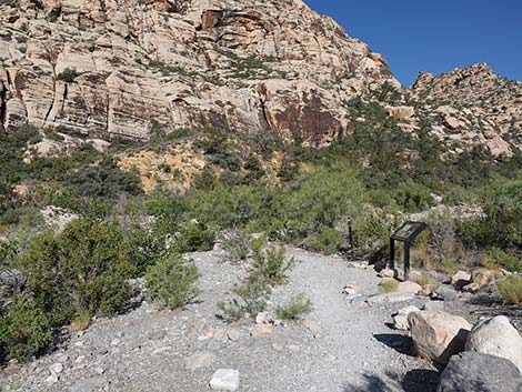
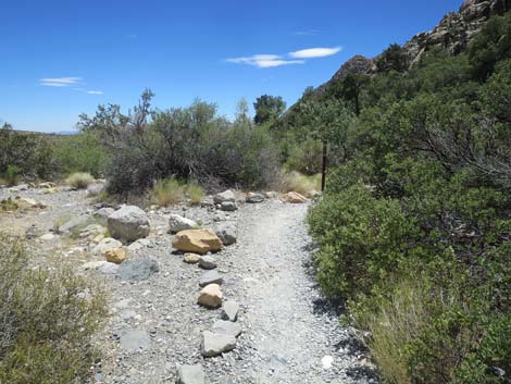
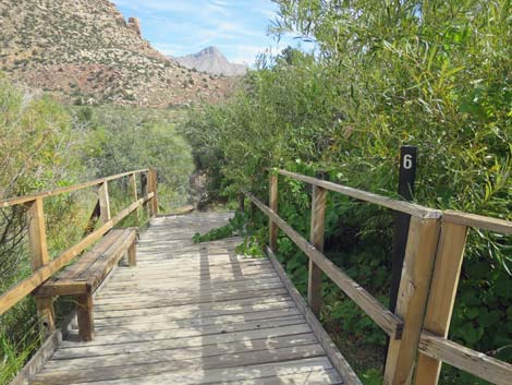
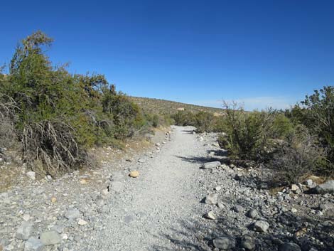
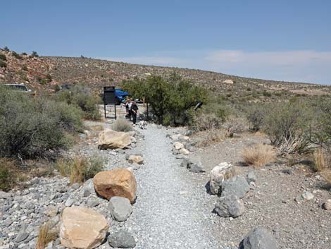
 Childrens Discovery trailhead (view NW) |
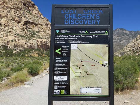
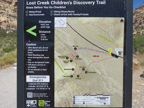
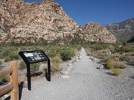
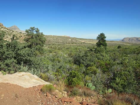
Overview The Childrens Discovery Trail is a pleasant 0.61-mile loop trail with nine numbered signposts that correspond to a 16-page workbook: Lost Creek; Children's Discovery Trail Guide. The workbook is available at the Visitor Center, but not at the trailhead nor online from the BLM (but snatch a PDF here). From the trailhead, Childrens Discovery Trail runs northwest across Red Rock Wash and climbs onto the hillside below red and white sandstone cliffs. The trail turns south and winds along the hillside (passing an archeological site) to a spring in a dense willow thicket with a boardwalk. From there, the trail runs back across Red Rock Wash to the trailhead. A spur trail off the loop runs up a side canyon to Lost Creek Falls. Childrens Discovery Trail is a good, easy trail where kids (and perhaps their parents) can learn about plants and other things in the desert. The cliffs above the trail are the best place in Red Rocks to look for bighorn sheep. Link to topographic map, aerial photo map, or BLM Georeference PDF map file. |
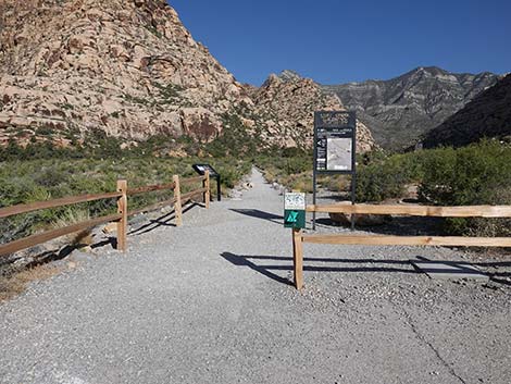
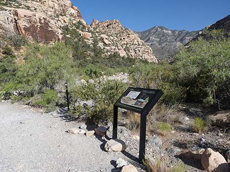
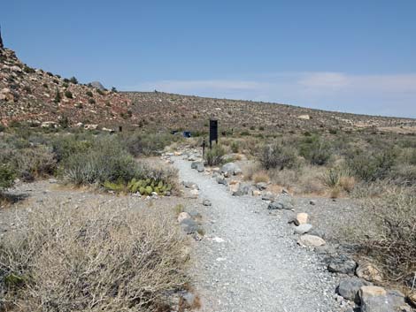
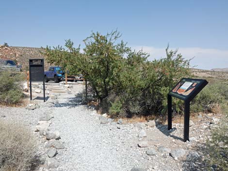
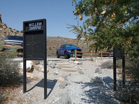
 Childrens Discovery trailhead sign (view NW) |
Watch Out Other than the standard warnings about hiking in the desert, ...this is a safe hike, although the trail on the hillside is rocky and might be unsuitable for people with walking difficulties. Care should always be taken on wet and icy rocks, and if you get wet sand on your feet, the smooth sandstone rocks in the trail can be slippery. In fact, the dust-covered rocks along the trail near the boardwalk seem more slippery than they ought to be. Always watch for flashfloods when crossing desert washes. While hiking, please respect the land and the other people out there, and try to Leave No Trace of your passage. Also, even though this hike is short, be sure to bring what you need of the 10 Essentials. |
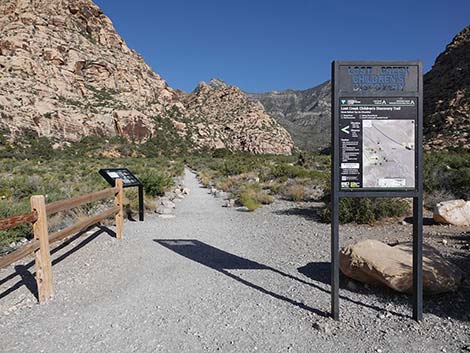
 Childrens Discovery trailhead sign (view NW) |
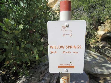
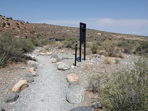
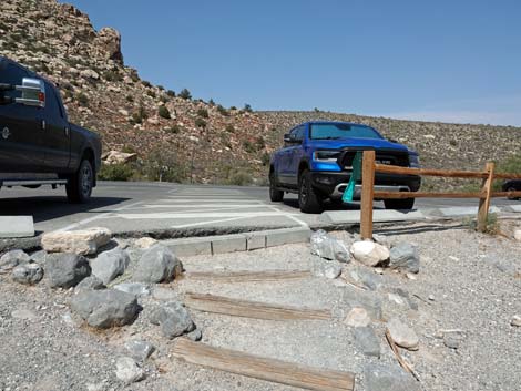
Getting to the Trailhead This hike is located along the Scenic Loop Road in Red Rock Canyon National Conservation Area, about 1 hour west of Las Vegas. Drive out to Red Rocks, pay the fee, and then drive about half-way around the Scenic Loop Road to Willow Spring Road. Turn right and drive north 0.2 miles to the Lost Creek Trailhead. Park here; this is the trailhead. |
 Childrens Discovery trailhead sign (view NW) |
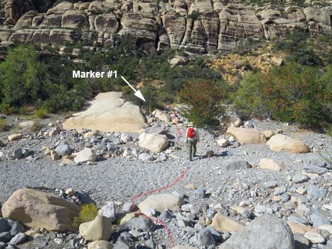
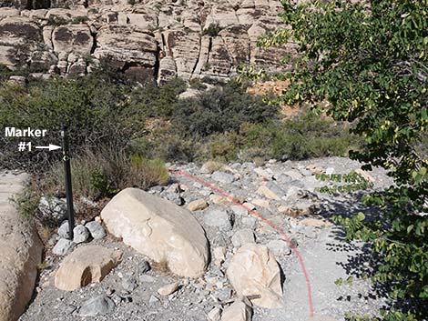
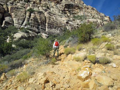
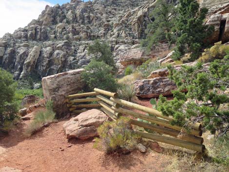
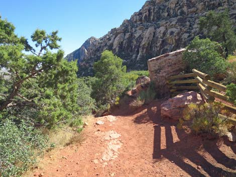
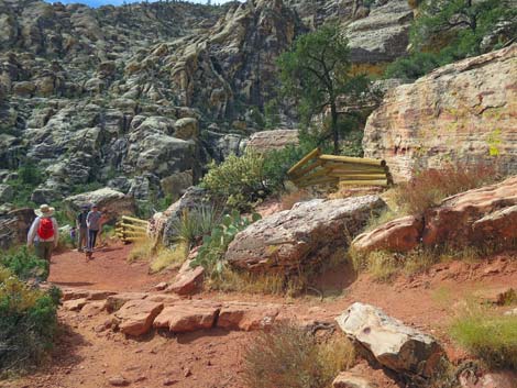
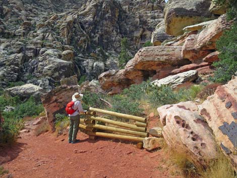
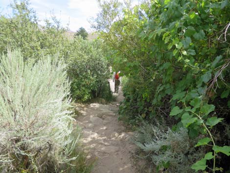
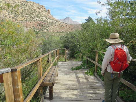
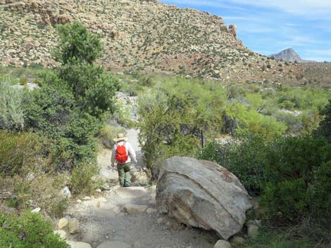
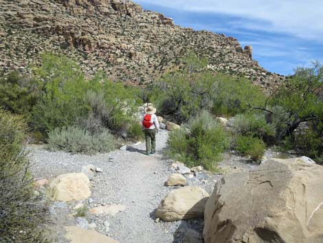
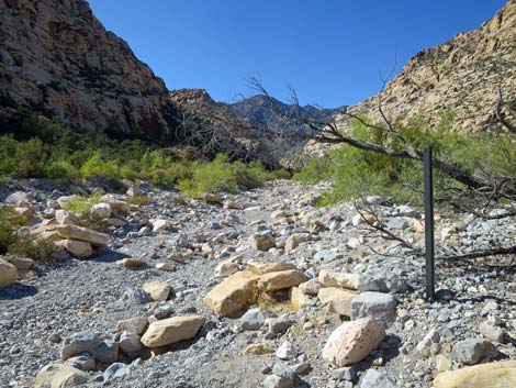
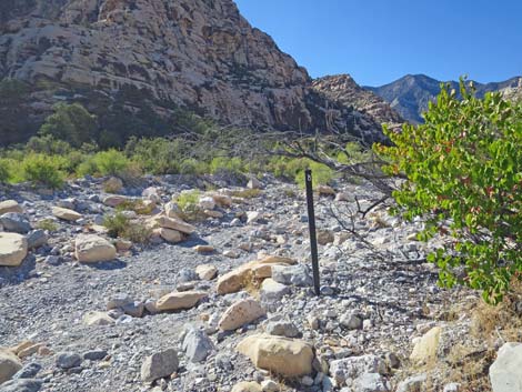
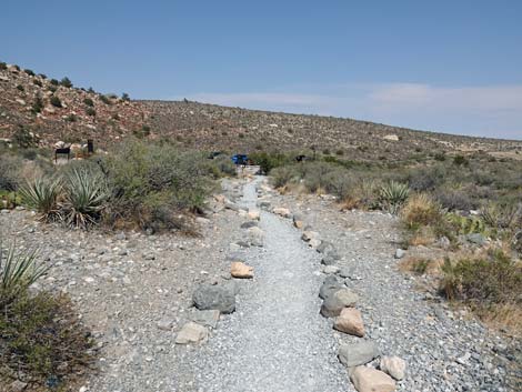
The Hike Two trails run west from the paved parking lot. The Lost Creek Trail starts on the west side of the parking lot (near the middle) and runs straight (southwest) across Red Rock Wash towards a big willow thicket, a tall pine tree, and the mouth of Lost Creek Canyon. The Childrens Discovery Trail starts at the northwest corner of the parking lot (by the big sign) and angles upstream across the wash (northwest). From the Childrens Discovery trailhead (Table 2, Waypoint 01), the well-defined trail runs up and across the canyon for 0.15 miles to the edge of Red Rock Wash and Marker #1, Wash Out (Wpt. 02). Here the brochure discusses desert washes (washes are normally dry streambeds), mentioning that during summer thunderstorms, washes can quickly fill with a raging torrent of water that is strong enough to move big boulders down the wash. Long after the water is gone, the evidence of past flashfloods can be seen by the scattered boulders and debris caught in shrubs along the wash. The water is not actually gone, most of the time the water runs underground where wash-side vegetation sends deep roots to soak it up. |
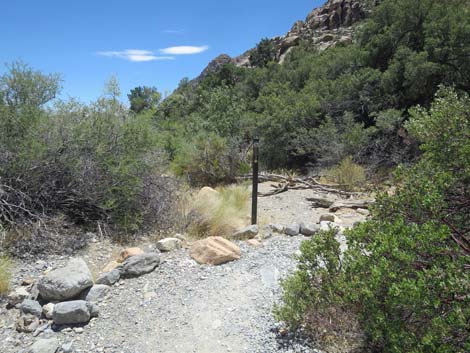
 Approaching an information sign (view NW) |
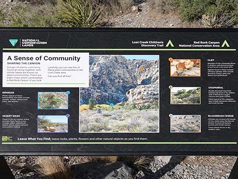
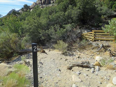
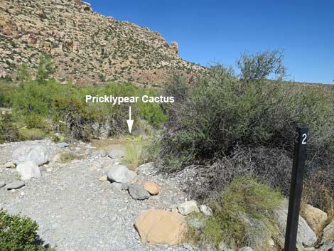
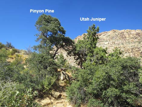
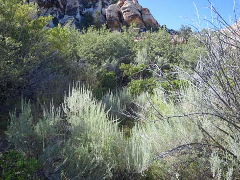
From Marker #1, the trail crosses the wash, climbs onto the bank on the other side, and turns south (left), running behind some large shrub live oak “trees” to Marker #2, Plants along the Trail (Wpt. 03). Here the brochure asks hikers to use sketches to identify five species of plants: Pointleaf Manzanita, Tulip Pricklypear Cactus, Singleleaf Pinyon Pine, Utah Juniper, and Utah Agave. There are many Pointleaf Manzanita near the marker post. Look for shrubs with red bark, oval green leaves, and in season, red berries that look like little apples. The name, in Spanish, means “little apple.” The little apples are eaten by coyotes and small mammals. The vegetation on this east-facing slope is lush for a desert, with lots of singleleaf pinyon pine, Utah juniper, shrub live oak trees, and several species of shrubs. |
 Information sign (view W) |
The trail passes many Tulip Pricklypear Cactus on the way to this point, but here there is only one specimen within sight of the marker post. After the long spines and the tiny, hair-like spines are removed, the pads can be cooked and eaten, and in season, the red fruits (cactus apples) are quite tasty, but the tiny, hair-like spines need to be removed first. Modern people use cactus apples to make cactus jelly. The brochure mentions that Singleleaf Pinyon Pine, a tall specimen of which can be seen up the trail, can be recognized because they have one short pine needle per bundle (most pines have 3 or 5 needles per bundle). The “pine nuts” that we buy in grocery stores are the seeds of pinyon trees, and these were an important food for Native People. The brochure mentions Utah Juniper, but none are clearly visible from the marker post. When continuing up the trail, a nice example can be found adjacent to the trail about 40 yards out. The Utah Agave, erroneously described in the booklet as a cactus, was another important source of food for Native People. The heart of the plant was cooked for a source of starch. Unfortunately, there were no Utah Agave along the trail. |
 Information sign: A Sense of Community; info about plants |
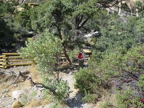
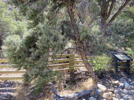
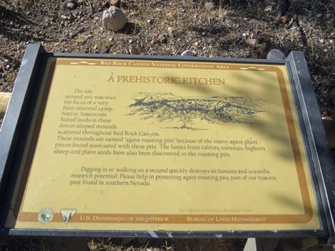
There is an agave-roasting pit under the tall pinyon tree. This is a place where native Americans dug a pit, lined it with rocks, filled it with wood, and burned it down to coals, then put food (including agave plants) into the pit, covered it up, and let the coals and hot rocks slow-cook the food for a day or two. The bits of charcoal on the ground are hundreds of years old. A sign a few yards up the trail explains this prehistoric kitchen. From Marker #2, the trail turns west (right) and runs about 15 yards to a fence. Just in front of the fence, there is a Singleleaf Pinyon Pine on the left with needles low enough to inspect. Next is a sign (A Prehistoric Kitchen), and just behind the fence, an agave-roasting pit. When thinking about an agave-roasting pit, think of a Hawaiian luau and the pig cooked in a pit. The Hawaiian pit, or "earth oven," is the same thing as an agave-roasting pit. People would dig a pit, line it with rocks, build a fire to heat the rocks, let the fire burn down, put the food on the rocks, and cover everything up for a couple of days. When ready, they dug it up and had a feast! While the Hawaiians are known for roasting pigs, Native People here cooked Bighorn Sheep, Mule Deer, Common Chuckwalla, Desert Tortoises, Utah Agave, and probably other things. |
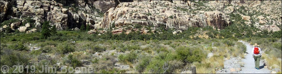
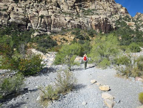
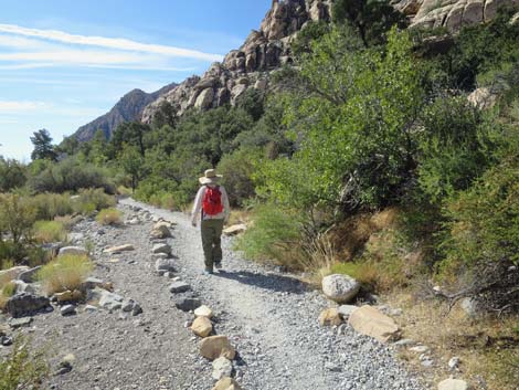
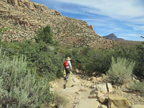
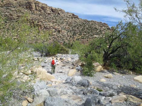
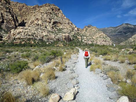 Hiker starting out on the Childrens Discovery Trail (view NW) |
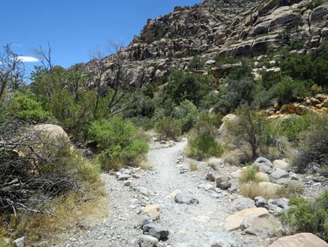
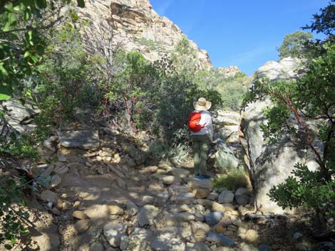
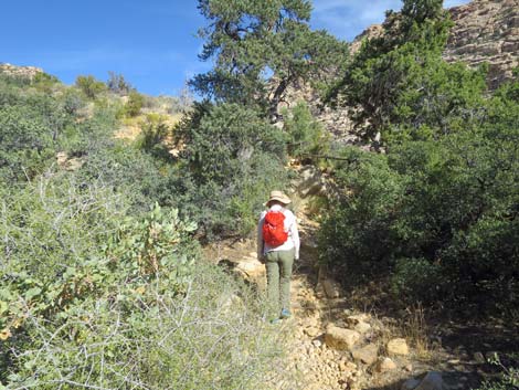
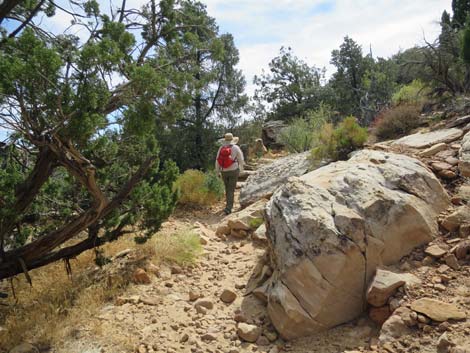
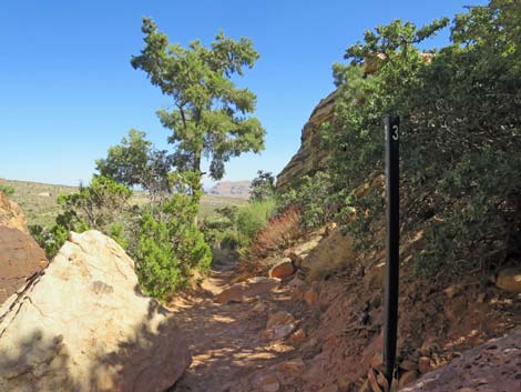
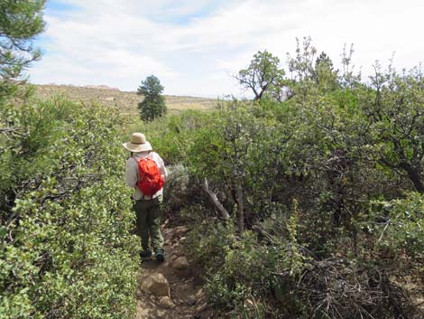
From the Prehistoric Kitchen sign, the trail turns north (right) and starts up the hillside on a steep, rocky trail. The trail passes between a large Singleleaf Pinyon Pine on the left and a large, shaggy-barked Utah juniper on the right before turning west towards the cliffs. The trail crosses a gully, passes under a large shrub live oak, and arrives at a trail junction (Wpt. 04). Here, the Willow Springs Loop Trail branches off to the right and climbs up the steep slope. From the trail junction, the Childrens Discovery Trail runs south along the hillside climbing at a gentle grade. After winding around boulders and through the shrubs, the trail arrives at Marker #3, Plant and Wild Food Finds (Wpt. 05). Here, the brochure discusses the use of Utah Agave by Native Peoples. Unfortunately, there were no Utah Agave in sight at Marker #3, nor are any seen elsewhere along the trail. There were, however, lots of Banana Yucca that could be confused with Agave, so all is not lost because Native Peoples used Banana Yucca too. They consumed the fruits, and they used the leaves as a source of fiber for rope, mats, sandals, and other things. |
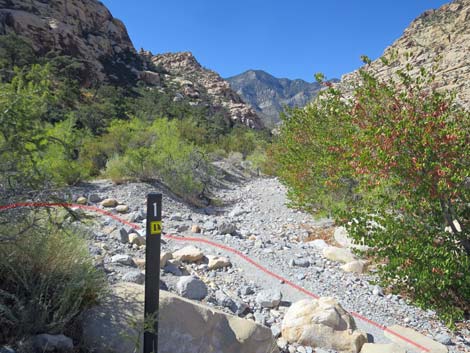
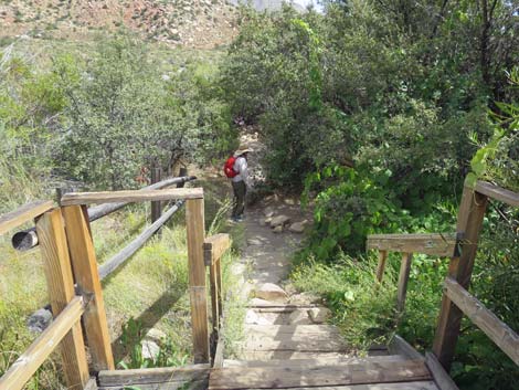
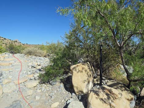
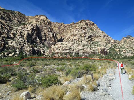 Red line traces the route (view NW) |
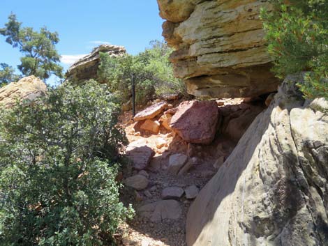
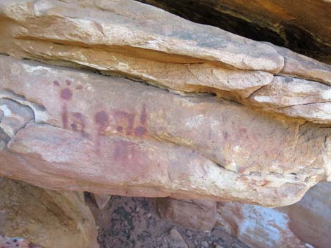
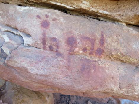
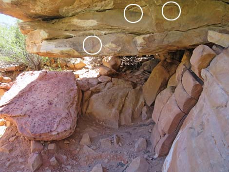
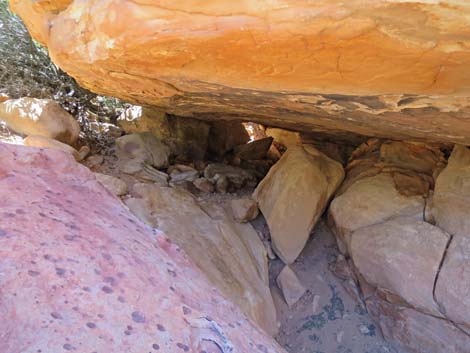
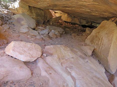
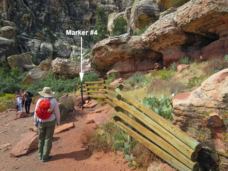
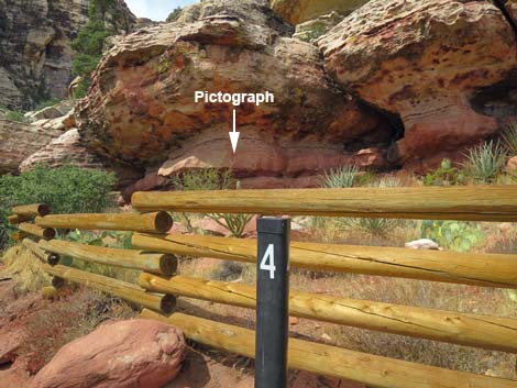
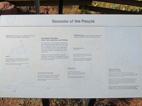
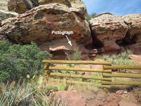
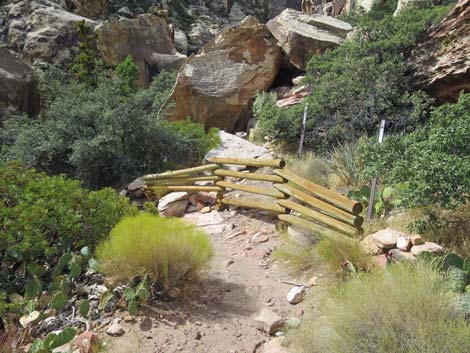
At Marker #3, however, there is a remarkable rock shelter that was used by Native Peoples, and they even painted messages (pictographs) above the door. We don't know what the messages say, but be sure not to touch them because the oils on human hands (the same oils that leave fingerprints) will damage the ancient paint. Read the message, peek into the rock shelter, and image life if this was your home 1,000 years ago. The Childrens Discovery Trail continues southward winding among boulders as it descends across the hillside. Shortly, hikers will encounter wooden fencing along the trail, and around a corner Marker #4, Hunters and Gatherers (Wpt. 06), comes into view behind an information sign. Here, the brochure discusses the seasonal movement of Native Peoples in this area. They moved higher into the mountains during summer where temperatures were cooler, then moved lower during winter where temperatures were warmer. They may have stopped under the rock shelter here (behind the fence) during spring and fall when temperatures were moderate. |
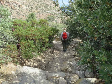
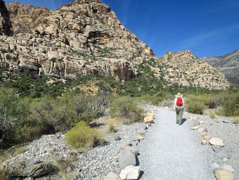 Hiker crossing desert flats (view NW) |
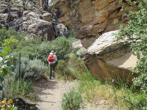
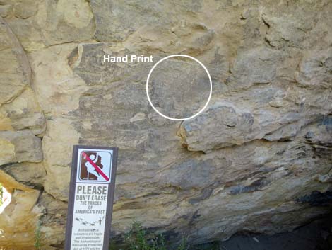
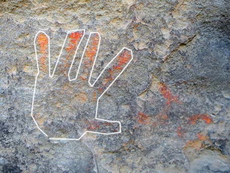
While they were here, they used red ochre paint to leave messages on the stone. We don't understand the message, but we can appreciate that someone was leaving a message for the future. Please respect rock art. Look for the pictograph on the rock face behind the fence. There is more rock messages nearby on the Willow Springs Loop Trail and on the Petroglyph Wall Trail. From Marker #4, the trail continues winding along the hillside and passes under a large, boulder. Stop for a minute in the shade and look carefully for the handprint on the wall. Someone put paint on their hand, then pressed it against the stone. While we will never know the meaning of the handprint, it seems that someone was saying "I was here." After winding only a few more yards, the Children’s Discovery Trail reaches a trail junction with the Lost Creek Trail. The Children’s Discovery Trail turns east (left), while the trail to the west (right) runs a short distance up the canyon to Lower Lost Creek Falls where water flows in the winter and spring. |
 Hiker arriving at the edge of Red Rock Wash (view NW) |
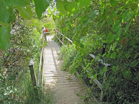
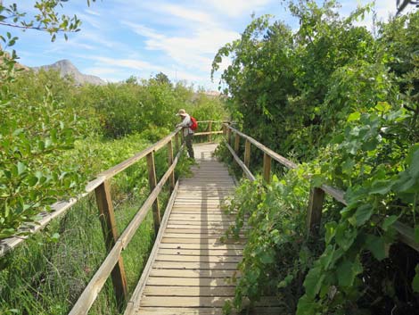
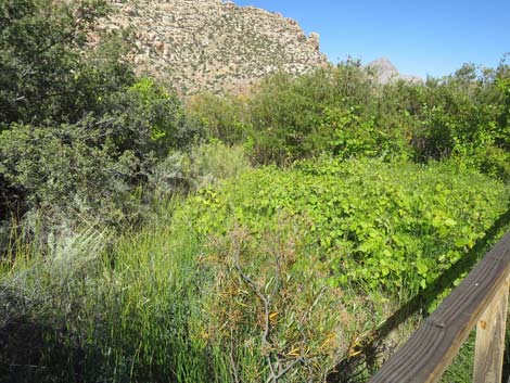
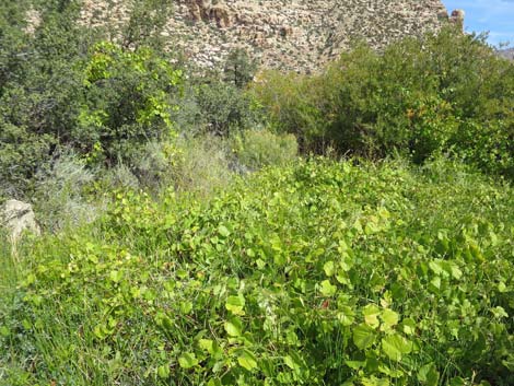
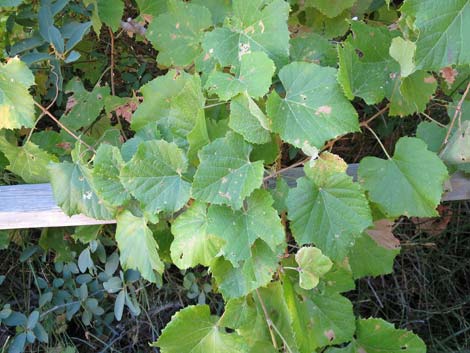
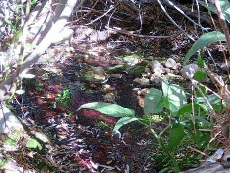
From the trail junction (Wpt. 07), the Children’s Discovery Trail runs east for about 20 yards to a boardwalk and Marker #5, Environments (Wpt. 08), on the right side of the boardwalk. Here the brochure discusses habitat types: areas where different kinds of plants thrive because of different growing conditions. For instance, the trail started on desert flats where certain shrubs thrive, then dropped into Red Rock Wash where only certain other plants can survive flash floods, climbed onto the hillside where pine and juniper grow, and now has arrived in a wet area with a spring and a desert meadow where aquatic plants live. In the desert meadow, the most striking plant species include wild grape and smooth horsetail. These species require moisture all year. Wild grapes produce fruit in late summer that are eaten by birds and small mammals. The brochure mentions grasses and rushes, but you have to look carefully for these species in the desert meadow. They are a bit more common farther down the boardwalk where it is too dry for grapes and horsetail. |
 Approaching an information sign (view NW) |
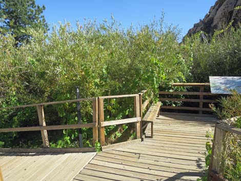
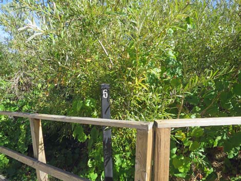
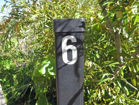
From Marker #5, the trail runs down the boardwalk for a few yards to a platform with benches where hikers can look down on Lost Creek under with willow thicket. This is Marker 6, Water Music (Wpt. 09). Here, the brochure encourages hikers to sit and listen to the sounds of the desert. Sitting quietly, the sounds of flowing water can be heard off the edge of the boardwalk -- quite unusual in the desert. While listening, we might also hear the sounds of birds singing on breeding territories in the spring or just chirping at other times of year. Watch for little yellow birds with black caps (Wilson’s Warblers) in the springtime, and watch for Gamble’s Quail and Woodhouse's Scrub-jays (similar to Blue Jays, but no crest) year-round. |
 |
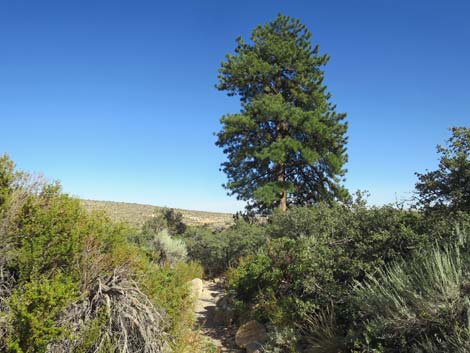
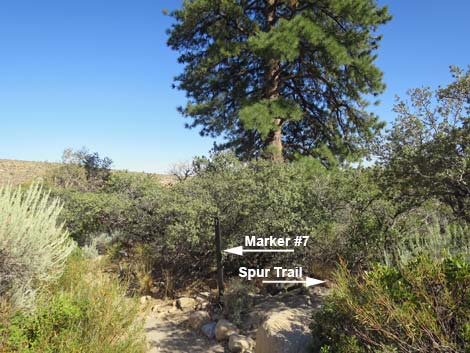
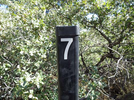
From Marker #6, the trail runs west down off the boardwalk towards Red Rock Wash. The rocky trails winds a bit, then arrives near a tall Ponderosa Pine on the south (right) side of the trail. Just before the ponderosa, Marker #7, Old Friends (Wpt. 10) is tucked into the shrubbery. The brochure encourages hikers to touch the bark of the Pine, but the shrubs are too thick to get through, and the brochure doesn't mention the short spur trail the goes south just to the side of the marker post. The short spur trail climbs over some rocks through a hole in the wall of shrubs, then leads out into a scrub oak thicket to a wooden fence. Just before the fence, the trail loops back to the Ponderosa Pine. |
 Second information sign (view W) |
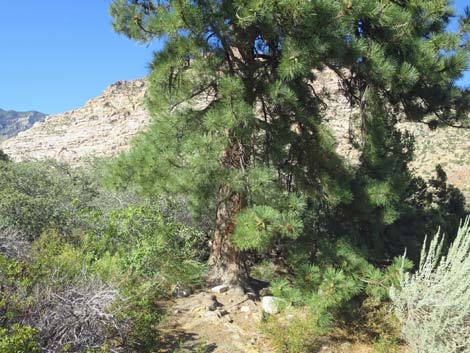
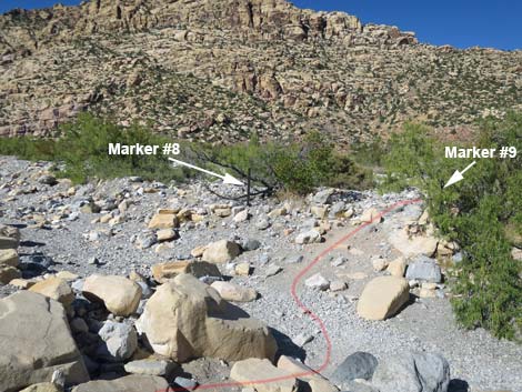
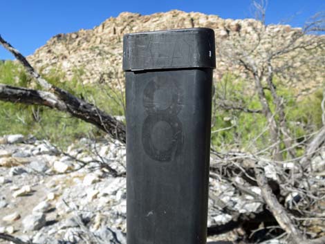
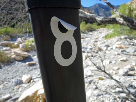
The brochure discusses the ponderosa pine (recognized by long needles in bundles of three), the bark of which smells like butterscotch (sometimes vanilla). It is unusual to see ponderosa pine growing at this low elevation; they usually grow high in the mountains in such places as Kyle Canyon on Mt. Charleston where there is more water and the temperatures are cooler. Here, the tree has tapped underground water from Lost Creek, and the cool breezes that blow down Lost Creek Canyon from the high country are sufficient for the tree to grow here. There are more ponderosa pine up the canyon towards Lost Creek Falls, and even more grow in Pine Creek Canyon. From Marker #7, the Childrens Discovery Trail continues down the rocky hillside into Red Rock Wash. Just across the deepest part of the wash, Marker #8, New Friends (Wpt. 11) sits off to the north (left) side of the trail. The number sometimes falls off the sign post, so look for an unmarked post. |
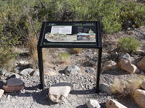
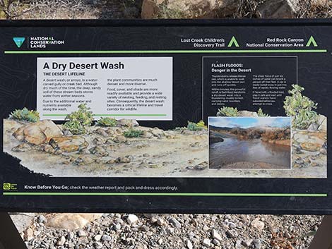 Information sign: A Dry Desert Wash |
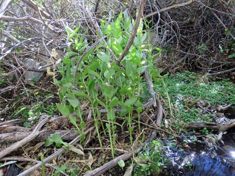
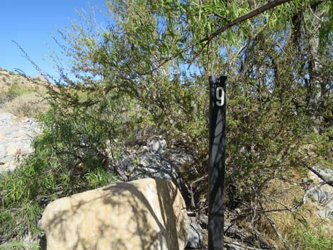
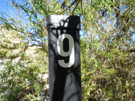
Here, the brochure discusses Desert Willow “trees.” This species is often found along washes where they can send roots down to get water flowing deep below the surface. Desert willows, which get to the size of a small tree, have long, narrow leaves and long, narrow seedpods. In spring, they also have tubular, orchid-like pink flowers. Desert Willow are well suited to life in washes because they have deep roots to reach moisture all year, and the stems bend under the force of flashfloods. Just across the trail from Marker #8, Marker #9, Considerations (Wpt. 12) sits tucked up under a Desert Willow. Here, the brochure asks hikers to consider the lives of the Native People who lived here years ago. Red Rock Canyon provided everything they needed to live, but today, do we still need places like Red Rock Canyon National Conservation Area? From Marker #9, the trail climbs out of the wash and runs back onto the broad flats in the middle of the canyon. The trail passes the SMYC Trail junction and continues straight for a few more yards to the parking lot and trailhead (Wpt. 13). |
 Hiker entering Red Rock Wash (view NW) |
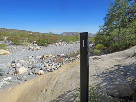
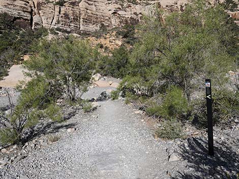 Trail signs mark the route (view W) |
 Hiker crossing Red Rock Wash (view W) |
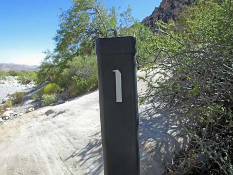 Marker #1 (view S) |
 Marker #1 Wash Out (view N up the wash; trail in red) |
 Marker #1 Wash Out (view S) |
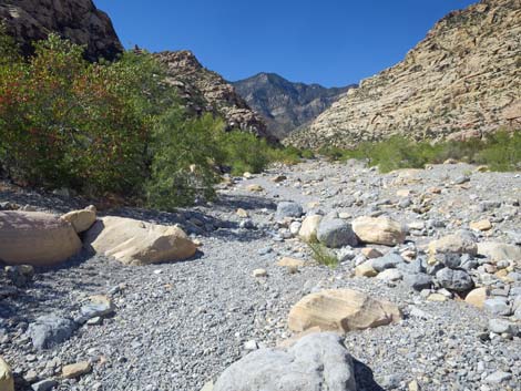 Red Rock Wash upstream (view N) |
 Red Rock Wash downstream (view S) |
 Trail continues across the wash (view SW) |
 Trail turns to run downstream along the edge of the wash (view S) |
 Trail continues downstream along the edge of the wash (view S) Trail continues downstream along the edge of the wash (view S) |
 Trail runs downstream along the base of the cliffs (view S) |
 Childrens Discovery Trail approaching Marker #2 (view S) |
 Childrens Discovery Trail arriving at Marker #2 (view S) |
 Marker #2. Plants along the Trail (view S) |
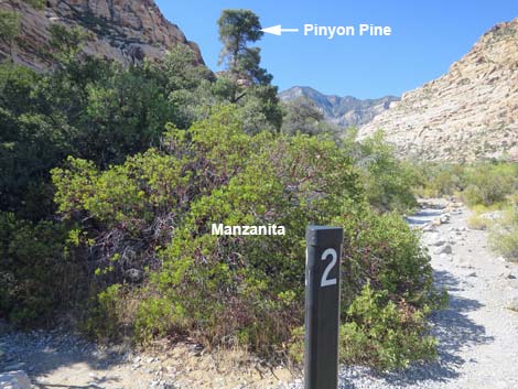 Marker #2. Manzanita and Pinyon Pine (view N) |
 Marker #2. Pricklypear (view E) |
 Marker #2. Approaching the agave-roasting pit (view W) |
 Marker #2. Pinyon Pine (view W) |
 Sign: A Prehistoric Kitchen (view W) |
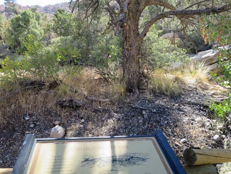 Above the sign, an agave roasting pit (view W) |
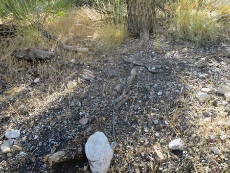 Soil is blackened by the ash of kitchen fires (view SW) |
 Hiker on trail leaving the agave roasting pit area (view N) |
 Hiker on trail climbing onto hillside (view N) |
 Marker #2. Pinyon Pine and Utah Juniper growing side by side (view N) |
 Hiker on trail traversing hillside (view NW) |
 Hiker approaching trail junction (view W) |
 Hiker at trail junction; looking up Willow Springs Trail (view SW) |
 Trail junction sign (view W) |
 Hiker continuing on Childrens Discovery Trail (view S) |
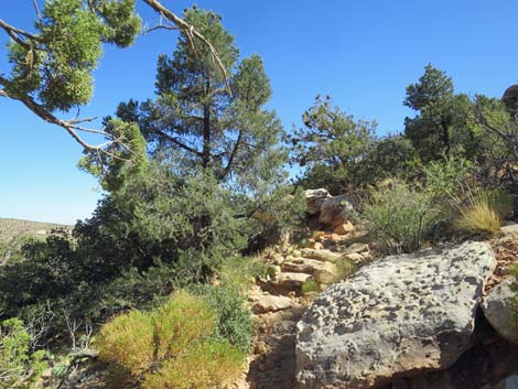 Childrens Discovery Trail with stone stairs on steeper parts (view S) |
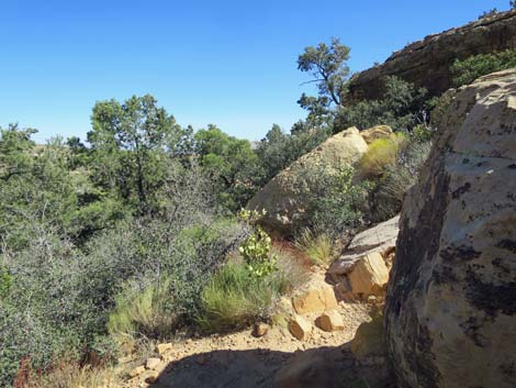 Childrens Discovery Trail winding among boulders (view S) |
 Childrens Discovery Trail approaching Marker #3 (view S) |
 Marker #3 Plant and Wild Food Finds (view W) |
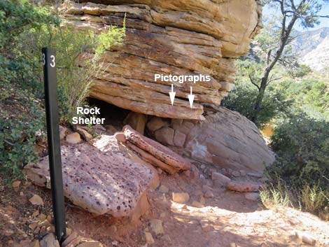 Marker #3. Looking back down the trail to rock shelter (view SE) |
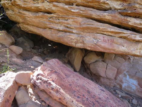 Rock shelter with pictographs (view N) |
 Don't touch pictographs! (view NW) |
 Ochre paint on sandstone -- precious artifact -- don't touch! |
 More pictographs on the north side (view S) |
 Looking under the rock shelter (view W) |
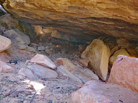 Inside the rock shelter (view NW) |
 Plenty of dry sleeping space under the rock shelter (view W) |
 Marker #3. Continuing up the trail past the marker (view SE) |
 Trail continues down across the hillside (view SE) |
 |
 |
 |
 |
 Hiker approaching Marker #4. Pictograph (view W) |
 Marker #4. Hunters and Gatherers (view W) |
 Marker #4. Pictograph (see inset) (view NW) |
 Marker #4. Sign: Seasons of the People (view NW) |
 Marker #4. Pictograph (view N) |
 Marker #4. Turning around, nice view to the southeast |
 The trail bends left at the end of the fence (view W) |
 Hiker on trail winding through dense shrub thickets (view E) |
 The trail passes under a large, overhanging rock (view SW) |
 Stop and look carefully for the handprint (view W) |
 Color-enhanced close-up photo of the handprint with outline |
 Trail junction; consider turning right to Lost Creek Falls (view S) |
 Trail junction; turning left on Childrens Discovery Trail (view E) |
 Trail passes through dense thicket of shrubs and trees (view E) |
 Approaching start of boardwalk and Marker #5 (view E) |
 Marker #5. Environments (view E) |
 Marker #5 (view E) |
 Hiker on boardwalk that crosses over the desert meadow (view E) |
 Desert meadow (view NE) |
 Desert meadow (view N) |
 Wild Grape (view S) |
 Horsetail (view N) |
 Horsetail, Wild Grape, and other species (view N) |
 Grasses below the meadow (view N) |
 Rushes below the meadow (view N) |
 Big Sagebrush below the meadow (view N) |
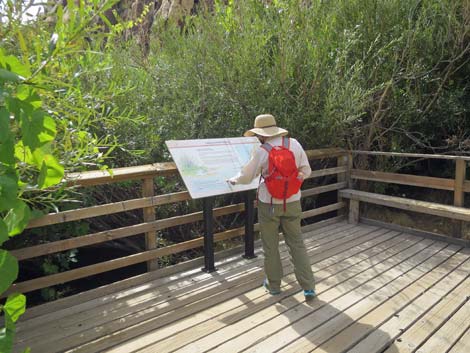
 Approaching Marker #6 (view SE) |
 Marker #6 at the edge of the boardwalk (view SE) |
 Marker #6. Water Music (view E) |
 Marker #6. Information sign on the boardwalk (view SW) |
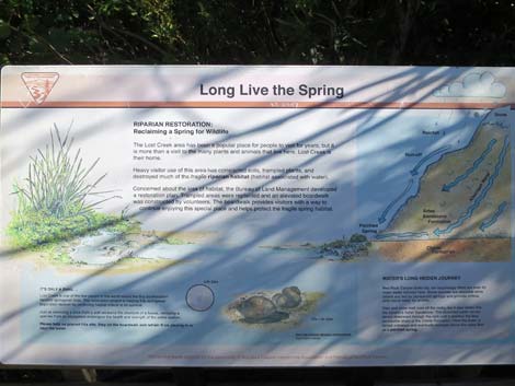 Sign: Long Live the Spring |
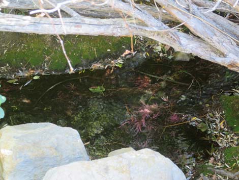
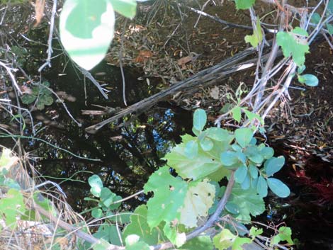
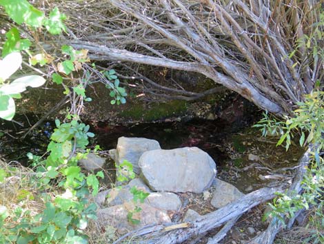 Marker #6. Lost Creek below the boardwalk (view S) |
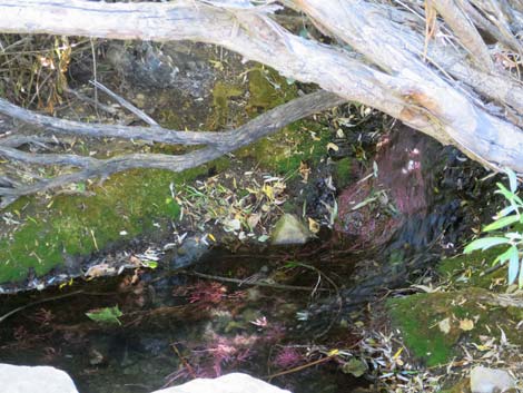 Marker #6. Lost Creek below the boardwalk (view S) |
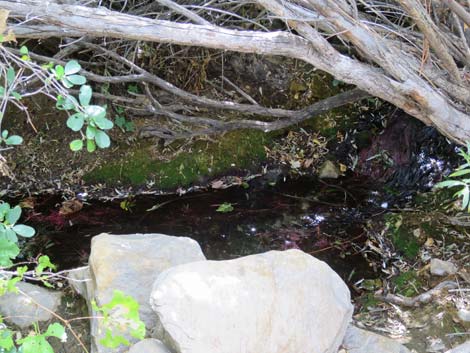 Marker #6. Lost Creek below the boardwalk (view S) |
 |
 |
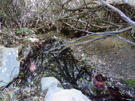 Marker #6. Lost Creek below the boardwalk (view S) |
 Boardwalk continues past Marker #6 (view E) |
 Hiker continuing on boardwalk |
 Trail enters a thicket of shrubs (view E) |
 Childrens Discovery Trail continues past the boardwalk (view E) |
 Rocky trail and shrub thickets (view E) |
 Approaching Marker #7 and Ponderosa Pine (view E) |
 Marker #7. Ponderosa pine accessed by spur trail (view E) |
 Marker #7 Old Friends (view SE) |
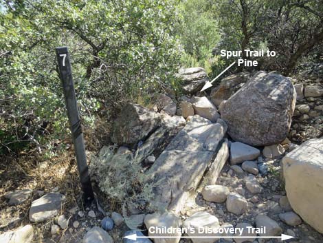 Marker #7. Spur trail to Ponderosa Pine (view E) |
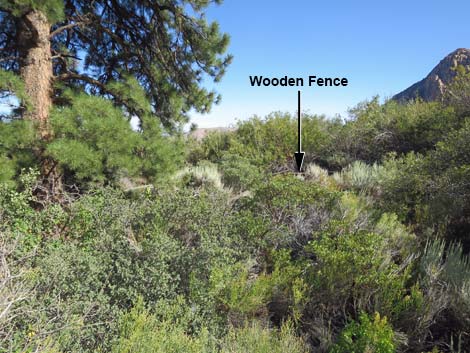 Marker #7. Follow spur trail through shrubs towards fence (view SE) |
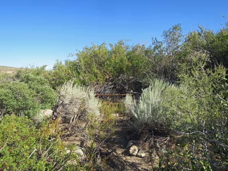 Marker #7. Spur trail approaching fence (view SE) |
 Marker #7. Spur trail turning back towards Ponderosa Pine (view N) |
 Marker #7. Ponderosa Pine (view N) |
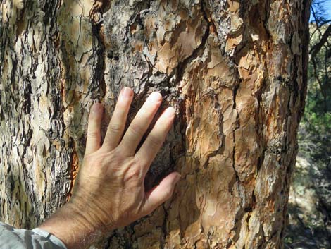 Marker #7. Ponderosa Pine with hand on the bark (view N) |
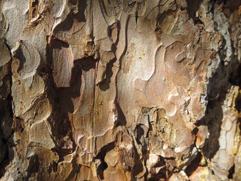 Marker #7. Ponderosa Pine bark (view N) |
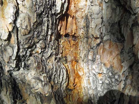 Marker #7. Ponderosa Pine furrow in the bark (view NE) |
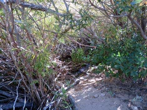 By the fence, another spur trail to the stream (view S) |
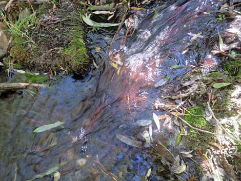
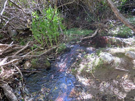 Lost Creek |
 Small cascade on Lost Creek |
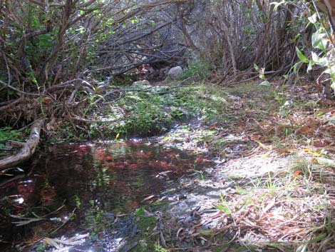 Lost Creek |
 Lost Creek |
 Stream Orchids along Lost Creek |
 Childrens Discovery Trail continues downhill (view E) |
 Childrens Discovery Trail approaching Red Rock Wash (view E) |
 Childrens Discovery Trail returns to Red Rock Wash (view E) |
 Approaching Marker #8 and Marker #9 (view NE) |
 Marker #8. New Friends (view N) |
 Backside of Marker #8 |
 Red Rock Wash (view N past Marker #8) |
 Red Rock Wash (view S) |
 Coming from the other direction, Marker #8 is easier to see (view NW) |
 Approaching Marker #9 (view E) |
 Marker #9 under a Desert Willow Tree (view E) |
 Marker #9. Considerations (view SE) |
 Banana Yucca is common along the trail (view SE) |
 Childrens Discovery Trail runs back across the wash (view E) |
 Childrens Discovery Trail runs across desert flats (view E) |
 Childrens Discovery Trail approaching SMYC trail (continue straight) |
 Childrens Discovery Trail at SMYC trail (continue straight) |
 Childrens Discovery Trail continues across desert flats (view E) |
 Childrens Discovery Trail approaching the trailhead (view E) |
 Childrens Discovery Trail approaching information sign (view E) |
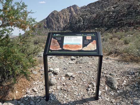 Childrens Discovery Trail at information sign (view S) |
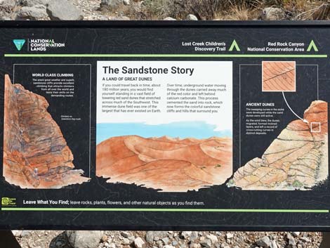 Information sign: The Sandstone Story (view S) |
 Childrens Discovery Trail arriving at trailhead signs (view E) |
 Childrens Discovery Trail arriving at Lost Creek Trailhead (view E) |
 More to come ... |
Table 2. Hiking Coordinates Based on GPS Data (NAD27; UTM Zone 11S). Download Hiking GPS Waypoints (*.gpx) file.
| Wpt. | Location | UTM Easting | UTM Northing | Elevation (ft) | Point-to-Point Distance (mi) | Cumulative Distance (mi) |
|---|---|---|---|---|---|---|
| 01 | Childrens Discovery Trailhead | 635553 | 4002266 | 4,451 | 0.00 | 0.00 |
| 02 | Marker #1. Wash Out | 635297 | 4002300 | 4,521 | 0.18 | 0.18 |
| 03 | Marker #2. Plants along the Trail | 635299 | 4002254 | 4,573 | 0.03 | 0.21 |
| 04 | Trail Junction | 635240 | 4002256 | 4,520 | 0.06 | 0.27 |
| 05 | Marker #3. Plant and Wild Food Finds | 635277 | 4002228 | 4,600 | 0.04 | 0.31 |
| 06 | Marker #4. Hunters and Gatherers | 635291 | 4002177 | 4,587 | 0.04 | 0.35 |
| 07 | Trail Junction | 635280 | 4002125 | 4,552 | 0.05 | 0.40 |
| 08 | Marker #5. Environments | 635299 | 4002126 | 4,577 | 0.01 | 0.41 |
| 09 | Marker #6. Water Music | 635319 | 4002125 | 4,577 | 0.02 | 0.43 |
| 10 | Marker #7. Old Friends | 635374 | 4002155 | 4,501 | 0.05 | 0.48 |
| 11 | Marker #8. New Friends | 635398 | 4002207 | 4,501 | 0.03 | 0.51 |
| 12 | Marker #9. Considerations | 635402 | 4002203 | 4,498 | 0.00 | 0.51 |
| 13 | Lost Creek Trailhead | 635571 | 4002256 | 4,442 | 0.12 | 0.63 |
Happy Hiking! All distances, elevations, and other facts are approximate.
![]() ; Last updated 240330
; Last updated 240330
| Hiking Around Red Rocks | Hiking Around Las Vegas | Glossary | Copyright, Conditions, Disclaimer | Home |