Hiking Around Las Vegas, Red Rock Canyon National Conservation Area

 Public Trailhead parking area (view S) |
Overview A number of nice use-trails have been established in the Red Rock Canyon Campground Area. The Gun Range Ridge Loop (2.6 miles round trip) runs east from the public trailhead towards Gun Range Ridge, then makes a long loop south and back around to the trailhead, following the paved road at the end. Except for crossing one wash, this loop is gentle and easy with broad expansive views. After hiking this loop, consider hiking one of the other short or long loops in the campground area. This hike is nice because it is close to town and not on the Scenic Loop Drive. This makes it free, a quick little get away from town, and it minimizes time driving to and from the trailhead. Link to map. |
 |
Watch Out Other than the standard warnings about hiking in the desert, ...this hike is about as safe as hiking in the desert can be, but watch out for dog poop near the trailhead. Watch for vehicles on Moenkopi Road on the way back: the speed limit is low, but drivers don't necessarily drive slowly. While hiking, please respect the land and the other people out there, and please try to Leave No Trace of your passage. Also, even though this hike is short and close to civilization, be sure to bring what you need of the 10 Essentials. |
 Trailhead (gate through fence) (view NE) |
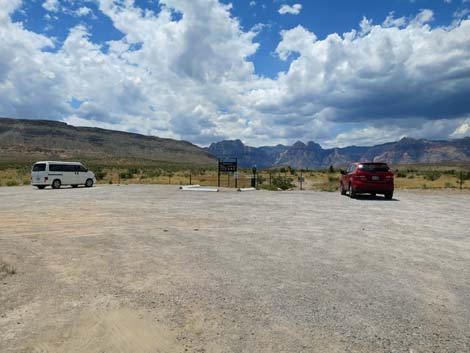
Getting to the Trailhead This hike is located in Red Rock Canyon National Conservation Area, about 30 minutes from town, but not on the Scenic Loop Road. Drive out West Charleston Blvd to Moenkopi Road and turn left towards Red Rock Campground. For non-campers, drive south on Moenkopi Road about 0.3 miles to Moenkopi Road Trailhead (Moenkopi Road Recreation Site parking area). Park here; this is the trailhead. For campers, continue south into the campground, park at your campsite, then walk out into the desert and pick up the trails. |
 Starting out; Gun Range Ridge in the distance (view E) Starting out; Gun Range Ridge in the distance (view E) |
The Hike From the public trailhead (Table 1, Waypoint 17), the Gun Range Ridge Loop Trail crosses the road, passes through the fence at a man-gate, and heads east across the desert. Initially the trail runs through an old burn area with little vegetation. In the burn area, the vegetation is sparse, but it is coming back. Common species here include big galleta grass, common Mediterranean grass (a weed), tumbleweed (another weed), and five-needle prickly leaf, a native species with little yellow flowers that I have growing in my yard. Unfortunately, too many inconsiderate dog owners let their dogs poop on the trail along here, so watch your step. Past the burn area, the trail approaches the first Eastern Joshua trees. Adjacent to the first Joshua tree, almost close enough to touch from the trail, the trail forks (Wpt. 18). The Gun Range Ridge Loop Trail stays right and heads south. |
 Hiker crossing the old burn area on the desert flats (view E) Hiker crossing the old burn area on the desert flats (view E) |
From the fork, the trail bends southeast and runs out to a second fork (Wpt. 19). The more heavily used Gun Range Ridge Loop Trail takes a hard left turn here, while a little used path continues straight to an old road, which also is little used. In the unburned area, the vegetation is diverse, but typical Mojave Desert Scrub habitat type with lots of creosote bush and white bursage, plus Nevada ephedra, spiny menodora, desert globemallow, littleleaf ratany, and galleta grass. Also watch for beavertail cactus, matted cholla, pencil cholla, and silver cholla. Staying left (Wpt. 19), the trail runs east-southeast until merging with an old road (Wpt. 21). The old road to the right has been used for a trail, but it is now little used. Staying left on the old road, the Gun Range Ridge Loop Trail runs northeast along the edge of a low caliche cliff that drops off into a shallow wash. Atop the rocky edge, the soil is shallow, and the vegetation is somewhat different from the surrounding desert. Growing along here are lots of indigo bushes, a few pincushion cactus, and lots of cryptobiotic crust. |
 Trail forks; route stays right (note shadow of Joshua Tree; view NE) |
The old road along here follows the edge of the wash, but then bends left to avoid dropping into a side wash. For the first time along the trail, hikers might notice that behind them have been grand views of the Calico Hills and Red Rock Cliffs. Bending back to the right to follow the main wash again, the trail forks, but the fork is faint. The Gun Range Ridge Loop Trail stays right along the wash, but for a shorter hike, the Campground Flats Loop Trail stays left here and loops back to the trailhead. From the faint fork in the old road, the Gun Range Ridge Loop Trail continues a few yards to a T-intersection (Wpt. 25). The Gun Range Ridge Loop turns right here, drops into, and crosses the broad wash to the south, then continues southeast on a gentle incline. It is a bit hard to see the trail amidst the old roads here, so before starting down into the wash, look south (across the wash) to see where the trail passes left of a big Mojave yucca on the far side of the wash. Beyond the wash, the trail climbs the hillside at a gentle grade. The views to the north keep getting better and better (so be sure to turn around and notice the view). |
 Big, open country with gentle slopes (view SE) |
The Gun Range Ridge Loop Trail eventually runs up onto a low knoll overlooking the campground area and intersects another old road (Wpt. 26). The loop turns right here and starts back down towards the campground. For a longer loop, turn left and follow the Campground Knoll Loop farther south. Turning right to head west, the Gun Range Ridge Loop Trail starts down the old road on a ridge overlooking the group campground in the near distance and the family campground in the far distance. The loop stays right at a trail junction (Wpt. 34) where the left leads down into the group campground. From that fork, the Gun Range Ridge Loop Trail continues westward towards Moenkopi Road. Just before reaching the road, hikers must climb through the barbed-wire fence. In December 2019 there were two good places to cross, but hikers can also detour left to the end of the barbed wire fence several yards to the south. Beyond the fence, the route follows Moenkopi Road north and back to the trailhead (Wpt. 17) to finish the loop. Be sure to watch for fast-moving vehicles. |
 Trail bends left (view SE) |
 Big Mojave Yucca (view SE) |
 Big, open country with gentle slopes (view SE) |
 Big, open country with gentle slopes (view SE) |
 Trail merges with an old road (view SE) |
 Trail follows old road (view NE) |
 Trail follows the edge of shallow gully (view E) |
 Trail curves to the left (view NE) |
 Now looking back: grand views (view NW) |
 Trail forks; route stays right (view NE) |
 T-intersection; route turns right (view NE) |
 Across the wash, a big yucca marks the trail (view SE) |
 Hiker entering a broad wash (view SE) |
 Trail runs across a broad wash (view SE) |
 This big Mojave Yucca is a good landmark (view SE) |
 The trail climbs at easy grades (view SE) |
 |
 |
 |
 |
 The grade becomes gentle towards the top of the ridge (view SE) |
 Approaching the toe of Gun Range Ridge (view SE) |
 T-intersection; route turns right (view SE) |
 Helium balloon -- don't release these into the air! |
 The trail turns right at the T-intersection (view SW) |
 Grand view of the La Madre Range (view NW) |
 The trail runs down gentle slopes (view SW) |
 Grand views of the Red Rock Cliffs (view W) |
 The trail forks; route stays right (view W) |
 At the fork, route stays right (left goes into campground; view W) |
 Grand views of the Red Rock Cliffs (view W) |
 The group campground comes into view (view SW) |
 The trail runs down gentle slopes (view W) |
 The group campground is fairly close now (view S) |
 The trail runs down gentle slopes (view W) |
 The main campground comes into view (view SW) |
 Grand scenery (view W) |
 The trail runs down gentle slopes (view W) |
 Hiker approaching the highway fence (view W) |
 Looking back: carsonite sign with "no motor vehicles" |
 The route turns right along the fence (view NW) |
 Parts of the fence are spread to permit hiker passage (view NW) |
 Outside the fence, the route turns right again (view N) |
 The route passes around a gate (view N) |
 The route follows the pavement back to the trailhead (view N) |
 Don't hike too fast! |
 Hiker passing the campground sign (view N) |
 Looking back at the campground sign (view S) |
 Grand scenery, even if from a paved road (view N) |
 Hiker arriving back at the trailhead (view N) |
Table 1. Hiking Coordinates Based on GPS Data (NAD27; UTM Zone 11S). Download Hiking GPS Waypoints (*.gpx) file.
| Wpt. | Location | UTM Easting | UTM Northing | Elevation (ft) | Point-to-Point Distance (mi) | Cumulative Distance (mi) |
|---|---|---|---|---|---|---|
| 17 | Moenkopi Road Trailhead | 644738 | 4000437 | 3,445 | 0.00 | 0.00 |
| 18 | Trail Forks | 645104 | 4000504 | 3,437 | 0.25 | 0.25 |
| 19 | Trail Bends Left | 645300 | 4000383 | 3,429 | 0.15 | 0.40 |
| 21 | Merge onto Old Road | 645514 | 4000349 | 3,413 | 0.14 | 0.54 |
| 25 | T-intersection | 645812 | 4000561 | 3,628 | 0.25 | 0.79 |
| 26 | T-intersection | 646386 | 4000045 | 3,501 | 0.51 | 1.30 |
| 34 | Trail Forks | 646215 | 3999988 | 3,469 | 0.11 | 1.41 |
| 33 | Fence | 645295 | 3999814 | 3,470 | 0.62 | 2.03 |
| 17 | Moenkopi Road Trailhead | 644738 | 4000437 | 3,445 | 0.56 | 2.59 |
Happy Hiking! All distances, elevations, and other facts are approximate.
![]() ; Last updated 240330
; Last updated 240330
| Hiking Around Red Rocks | Hiking Around Las Vegas | Glossary | Copyright, Conditions, Disclaimer | Home |