Hiking Around Las Vegas, Gold Butte National Monument
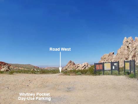 Whitney Pocket day-use parking area (view SW) |
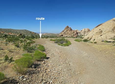
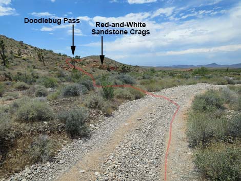
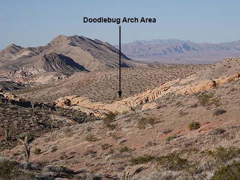
Overview The Doodlebug Arch Route is an interesting 3-mile round-trip hike through the wild and scenic red-and-white sandstone country of Gold Butte. The route ends at a long sandstone arch, and hikers may even find doodlebugs in the soft sand under the arch. The route runs down a jeep road and then hops over a low ridge into Doodlebug Canyon. The arch is towards the end of the canyon, and some hikers may simply return directly from the arch. Others might hike down the wash and return by one of several loop routes; returning up Amber Cat Canyon is the main loop. This is a convenient hike because it is easily accessible from Whitney Pocket, a popular camping and picnic area in Gold Butte National Monument, that is accessible in 2WD vehicles. Link to map. |
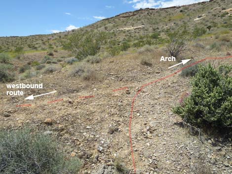
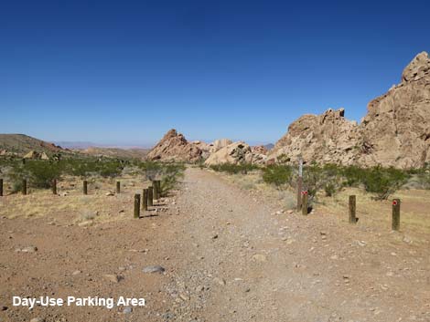 Dirt road exits the day-use parking area westbound (view W) |
Watch Out Other than the standard warnings about hiking in the desert, ... this is a relatively safe hike for those who stay in the bottom of the wash. This is, however, a wild and remote area without services of any kind (no restrooms, no water, no gas, no food). Bring what you need to survive. Be prepared and be self-reliant. Someone will find you eventually if you stay on a main road, but be prepared to survive alone for a day or two. Cell phones don't work in this area. While visiting Gold Butte, please respect the land and the other people out there, and try to Leave No Trace of your passage. Also, this is a remote area, so be sure to bring the 10 Essentials. |
 Route follows dirt road (view W) |
Getting to the Trailhead Doodlebug Arch is located west of Whitney Pocket out in Gold Butte National Monument at the northeast end of Lake Mead, about 2 hours northeast of Las Vegas in a wild, remote, and scenic area. From town, drive out to Gold Butte National Monument. Drive east on Interstate-15 to Highway 170. Take Exit 112 south towards Riverside and Bunkerville. Drive south and cross the Virgin River, then quickly turn right onto the paved Gold Butte Road. Follow the pavement (there are no paved side roads) for 21 miles until it ends at Whitney Pocket. Continue south on the unpaved Gold Butte Road for about 120 yards to a graded spur road to the right. Turn right onto the Whitney Pocket Day-Use Parking Lot where visitors will see information signs on the right. The trail starts on the dirt road just west (left) of the signs. Park here; this is the trailhead. |
 The route stays left past a campsite (view W) |
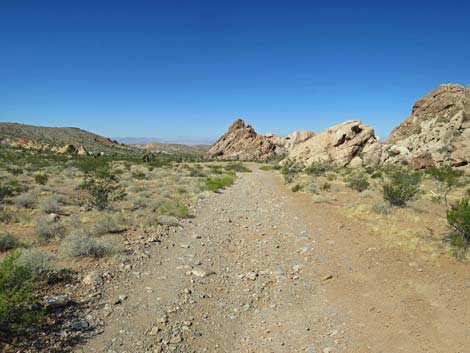
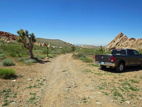
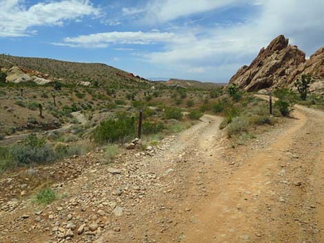
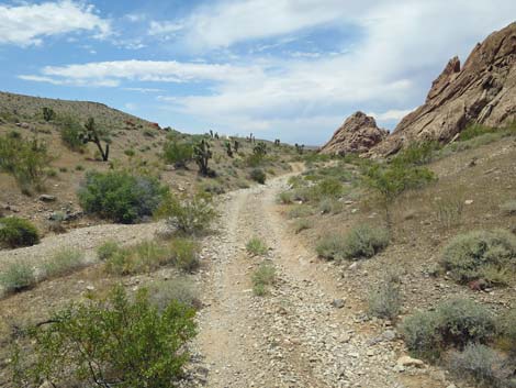
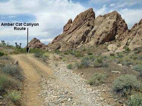
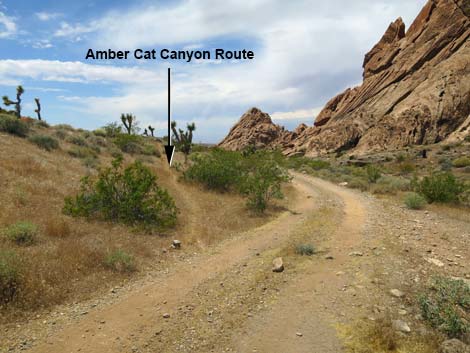
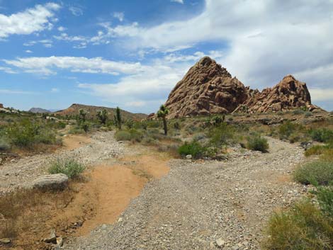
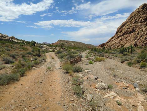
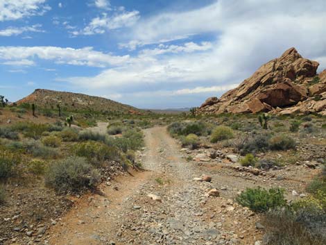
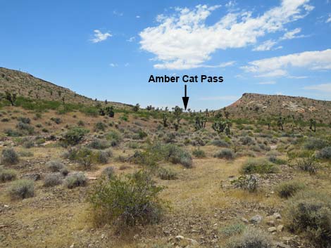
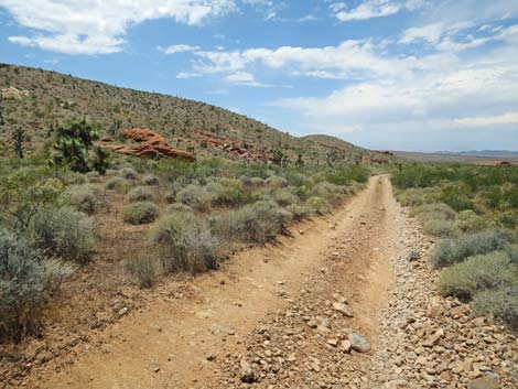
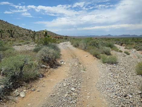
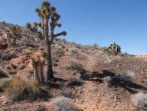
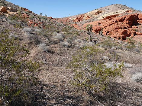
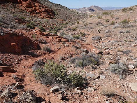
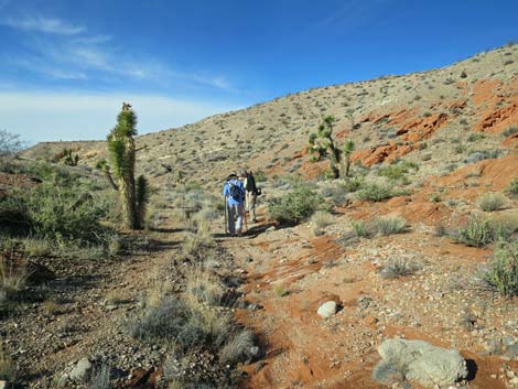
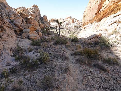
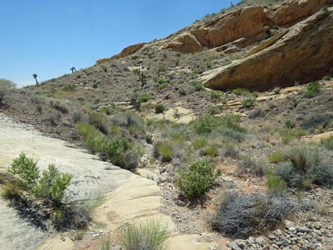
The Hike From the Whitney Pocket Day-Use Trailhead (Table 1, Waypoint 01), the route heads west on a dirt road that leads to two primitive campsites. Staying left at the first campsite (an alternative 2WD trailhead), the road continues west and forks. The route stays left at the fork and follows the jeep trail down towards the wash. The right fork runs a short distance to the second, tiny campsite. The road crosses the wash to the south side, and in about 20 yards, a faint use-trail (Wpt. 02) departs the road to the left -- this is the return route for hikers doing the loop that returns up Amber Cat Canyon. The jeep road continues down the canyon following a line of rocky crags on the right, crossing the wash from time to time. At about 0.6 miles out, a saddle on the horizon to the left is clearly visible: this is Amber Cat Pass, which is on the return route for hikers doing the loop. |
 Last good trailhead parking by the campsite (view W) Last good trailhead parking by the campsite (view W) |
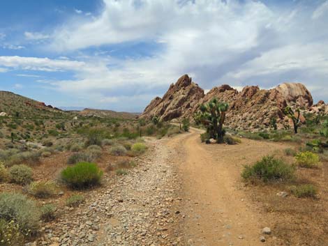
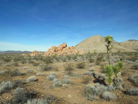
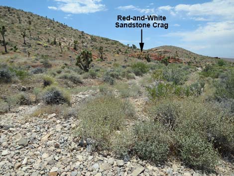
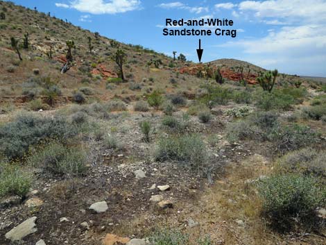
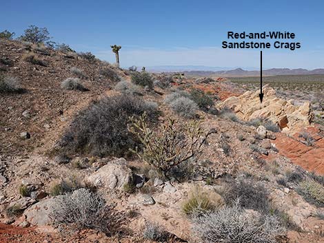
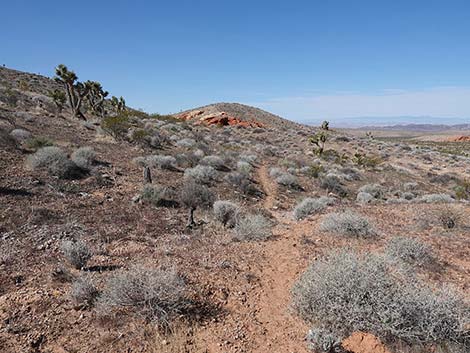
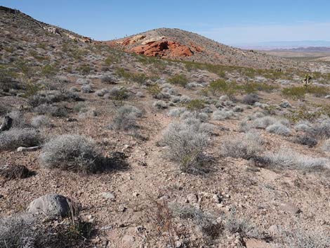
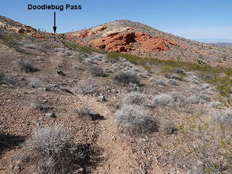
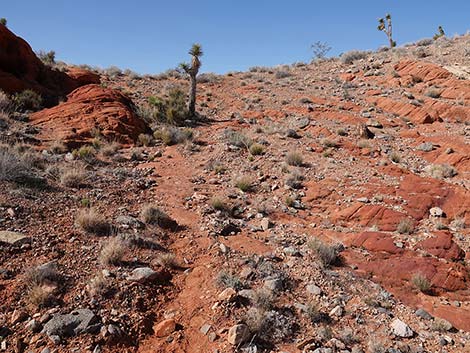
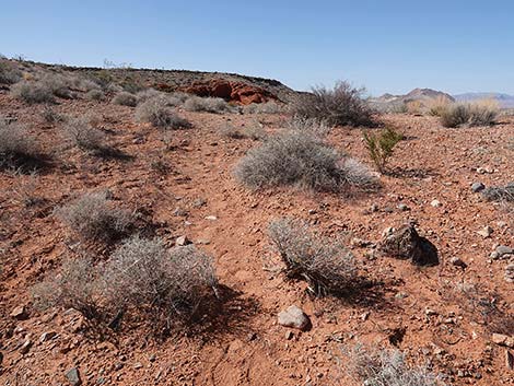
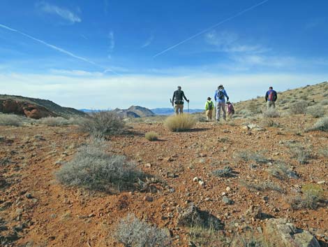
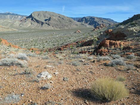
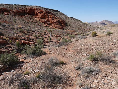
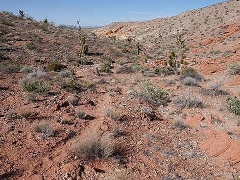
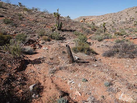
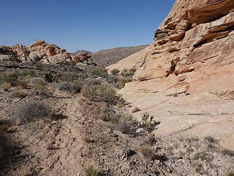
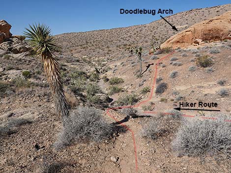
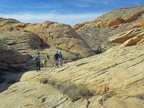
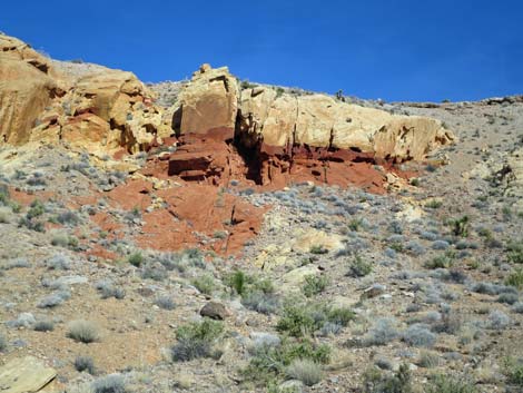
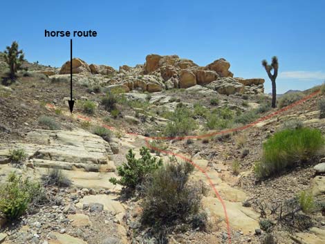
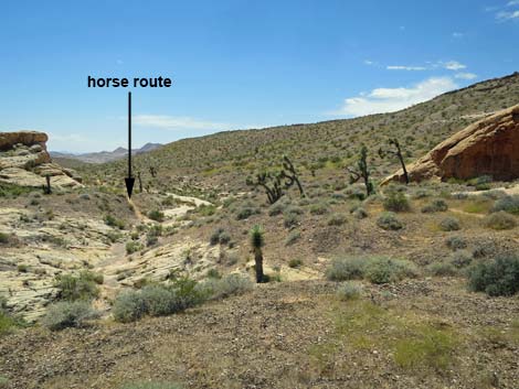
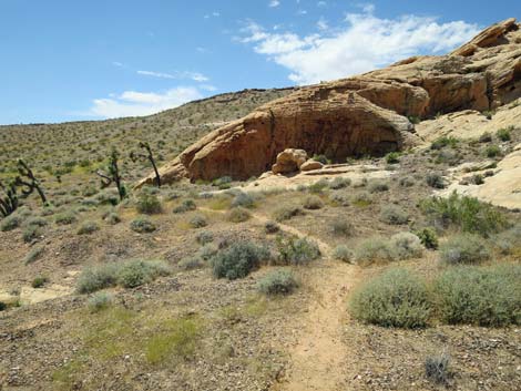
In this area, another saddle on the ridge to the left begins to come into view: this is Doodlebug Pass. The route will cross the ridge using this pass. Vegetation here on the desert flats is not very diverse, and typical for this elevation, creosote bush and white bursage dominate the area with a sprinkling of cactus (e.g., buckhorn cholla and California barrel cactus) and Joshua trees mixed in. While Doodlebug Pass is still ahead in the distance, the route approaches a fractured red-and-white sandstone outcrop on the hillside above the wash on the left. At a nondescript spot before the outcrop (Wpt. 03), the jeep trail bends right, and the route exits the road to the left. Crossing the wash, a faint use-trail can be seen climbing onto the hillside. This use-trail eventually runs across the top edge of the fractured sandstone outcrop. The use-trail continues west traversing the hillside and climbing at a gentle grade. While hiking in this area, be careful to stay on the trail to avoid trampling the abundant cryptobiotic soils in this area. |
 The route continues on the road past the trailhead (view W) |
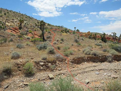
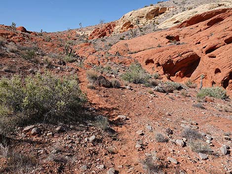
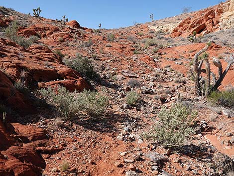
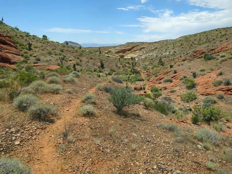
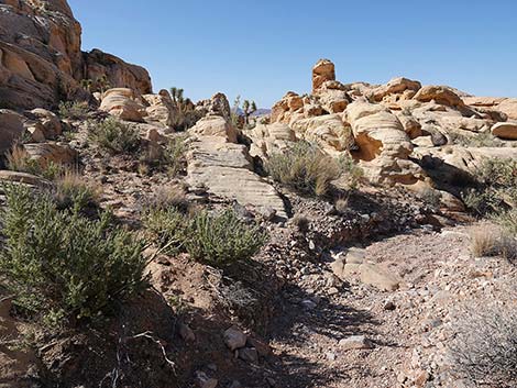
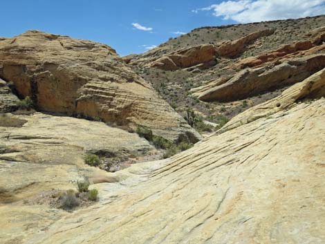
As the use-trail approaches Doodlebug Pass, the grade steepens as the route climbs across red slickrock onto Doodlebug Pass (Wpt. 04). From atop the pass, the view back towards Whitney Pocket is grand, but the view ahead provides few hints of the terrain ahead. From atop Doodlebug Pass (Wpt. 04), the route continues over the saddle and descends southwest into Doodlebug Canyon on a use-trail that stays on the east side of the gully bottom. Parts of the route traverse slickrock, but the route is easy to follow. The route hits the bottom of Doodlebug Canyon at the confluence (Wpt. 05) of the gully to the right and a somewhat larger wash that comes in from the left. Looking down the slope, the trail ahead is plain to see, but when hiking out, it would be easy to miss the turn at the confluence and hike up the wrong wash. Heading down Doodlebug Canyon, the route passes sandy areas, red sandstone slickrock, white sandstone slickrock, tinajas, and even mini-narrows. |
 Route stays left onto jeep trail dropping towards wash (view W) |
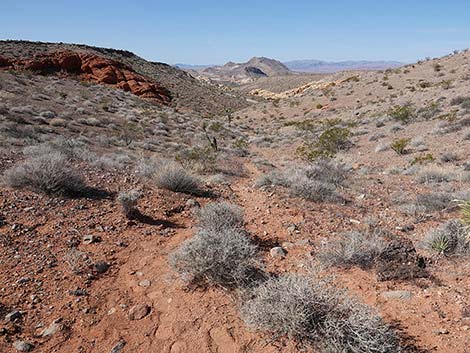
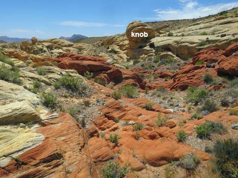
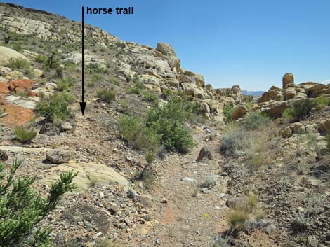
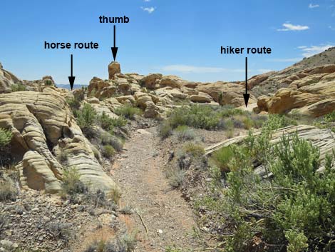
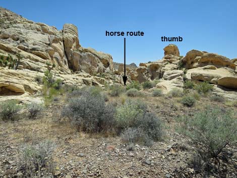
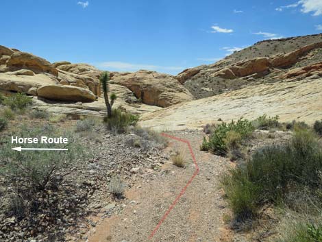
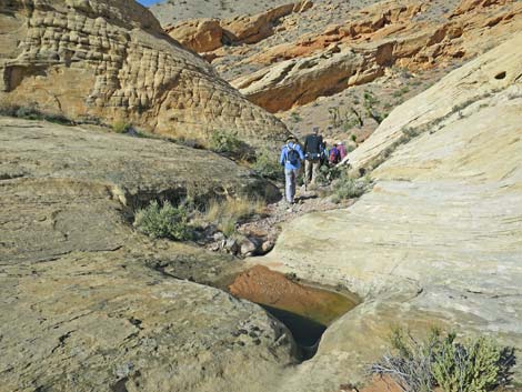
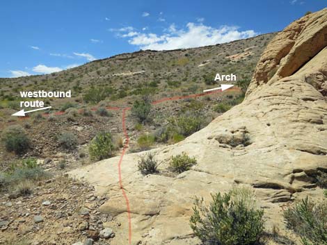
Along Doodlebug Wash, the vegetation is much more diverse than the previous desert flats. Species typical of this elevation include desert willow, catclaw acacia, matchweed, brittlebush, turpentinebroom, and bunchgrasses. After passing white slickrock and a patch of jumbled red sandstone, the gravel wash passes under a large knob of white sandstone that appears ready to tumble into the wash. A few yards farther, a use-trail (Wpt. 06) exits the wash onto the left bank. Although easy to miss, it is important that horsemen follow the use-trail left because slickrock narrows just ahead in the wash block horse travel. As the wash bends right into the narrows, a gap between towering sandstone crags can be seen to the left. A tall thumb of white sandstone sits atop the west crag, marking easier passage for horses. For hikers, after scrambling over the slickrock and through the shallow narrow spots, the wash runs due south for about 120 yards to a confluence of washes (Wpt. 07). Here, a well-used use-trail can be seen crossing the wash just before the confluence: this is the horse route converging with the hiker route. |
 Jeep trail drops into the wash (view W) |
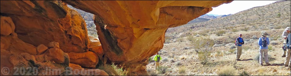
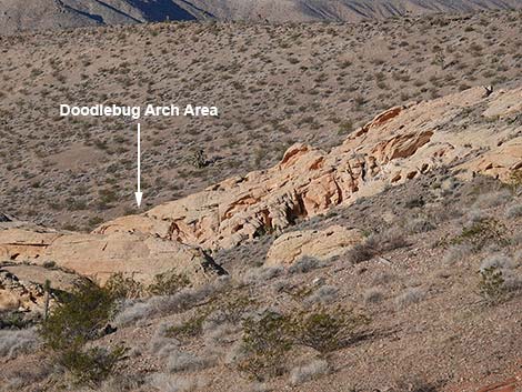
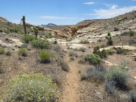
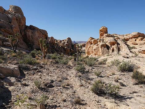
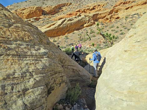
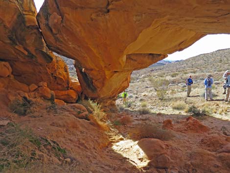
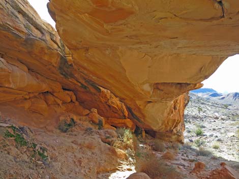
Staying right onto the use-trail, the trail climbs out of the wash and heads due west above the wash-bottom. Shortly, the use-trail approaches the last of the sandstone crags on the right side of the canyon. Crossing the toe of the sandstone crag, the use-trail bends right, climbs the hillside several yards, and suddenly arrives at Doodlebug Arch (Wpt. 08). The arch is quite large, but it lies on the west side of the sandstone outcrop, so it is not visible when coming down the canyon. The arch is a shady place for lunch. From the arch, hikers can return back up the canyon and out over Doodlebug Pass to the trailhead (Wpt. 01), or they can make a longer loop by hiking farther down the canyon and returning via Amber Cat Canyon or one of several other loops (see the map for ideas). |
 Jeep trail crosses the wash (view W) |
 Passing return route from Amber Cat Canyon (view W) |
 The route follows the jeep trail (view W) |
 Jeep trail crosses the wash again (view W) |
 Jeep trail runs above the wash (view W) |
 Jeep trail crosses the wash again (view W) |
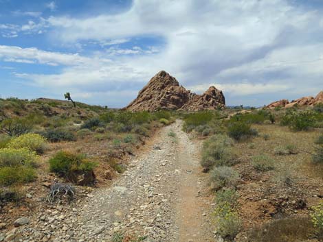
 First saddle on the southern skyline: Amber Cat Pass (view SW) |
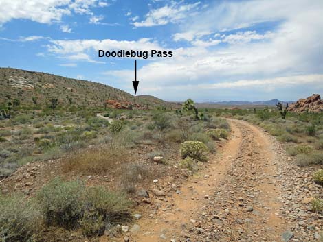 Doodlebug Pass, in the distance, comes into view (view W) |
 Jeep trail runs below hillside with sandstone outcrops (view W) |
 Looking right of the jeep trail: last sandstone crag (view NW) |
 Jeep trail crosses the south side of the wash again (view W) |
 The route departs the jeep trail to cross above sandstone crags |
 The route runs through shrubs towards sandstone crags (view SW) |
 Use stepping stones to avoid trampling cryptobiotic soils (view SW) |
 The route starts up the hillside (view SW) ... |
 The trail starts up the hill past a tall Joshua tree (view SW) |
 ... then crosses above the red-and-white sandstone crags (view W) |
 The use-trail across the hillside is obvious in most places (view SW) |
 The use-trail across the hillside is obscure in some places (view SW) |
 Doodlebug Pass comes into view (view SW) |
 |
 |
 The use-trail runs onto red slickrock sandstone (view SW) |
 Use-trail disappears onto red slickrock sandstone (view SW) |
 Use-trail arriving atop Doodlebug Pass (view SW) |
 Hikers atop Doodlebug Pass (view SW) |
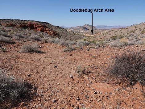 Doodlebug Arch area is visible from Doodlebug Pass (view SW) |
 Doodlebug Arch area is visible from the pass (zoom; view SW) |
 Doodlebug Arch area is visible from the pass (super-zoom; view SW) |
 Looking back from Doodlebug Pass towards Whitney Pocket (view NE) |
 Use-trail continues over Doodlebug Pass (view SW) |
 Use-trail descends towards bottom of Doodlebug Canyon (view SW) |
 Use-trail descends towards bottom of Doodlebug Canyon (view SW) |
 Use-trail descends towards bottom of Doodlebug Canyon (view SW) |
 Use-trail arriving in bottom of Doodlebug Canyon (view SW) |
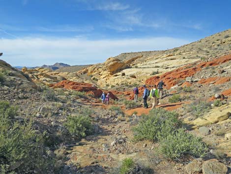
 Hikers heading down Doodlebug Wash (view SW) |
 Well used use-trail runs down Doodlebug Canyon (view SW) |
 Well defined use-trail approaching sandstone slickrock (view SW) |
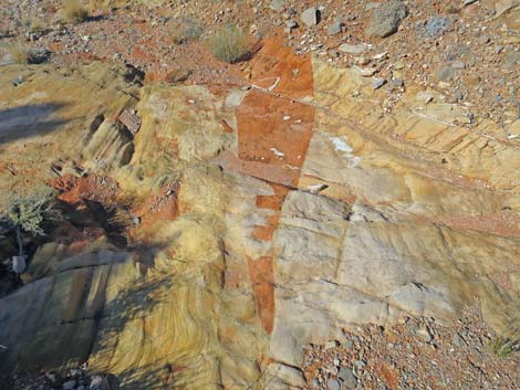 Interesting patterns in the sandstone |
 The route crosses red sandstone (view SW) |
 Jumbled red sandstone and knob ready to tumble into the wash |
 Horse route exits the wash onto the hillside (view S) |
 Horsemen and hiker routes diverge (view S) |
 More to come ... |
Horse Bypass Route
 Horse route exits the wash to the left (view SW) |
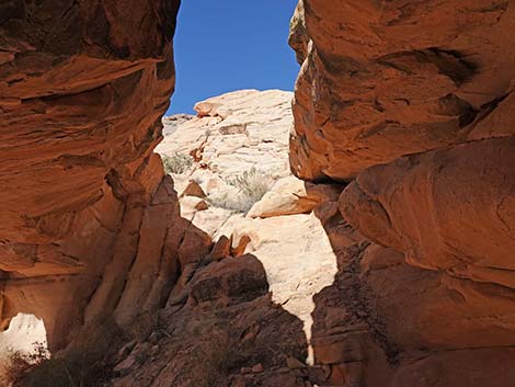
 Horse route goes through gap between towering sandstone crags |
 Well used use-trail runs down between sandstone fins (view SW) |
 Well used use-trail runs down between sandstone fins (view SW) |
 Well used use-trail runs down between sandstone fins (view SW) |
 Use-trail stays right around the end of the sandstone (view SW) |
 Horsemen and hiker routes converge (view W) |
More to come ... |
Hiker Route Continues
 Hiker route continues down the wash (view SW) |
 Hiker route crosses white sandstone (view SW) |
 Hiker route crosses white sandstone (view SW) |
 Hiker route crosses white sandstone with tinajas (view SW) |
 Hiker route pinches between sandstone crags (view W) |
 Looking right: route passes below colorful sandstone crags (view N) |
 The wash opens and bends left (view SW) |
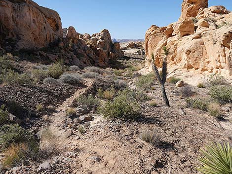
 Hiker route rejoins with horse route at confluence of washes (view S) |
Horse and Hiker Routes Converge and Continue
 At confluence, use-trail climbs onto north hillside (view W) |
 Above confluence, the next segment of horse trail is visible (view W) |
 Well defined use-trail continues above wash (view W) |
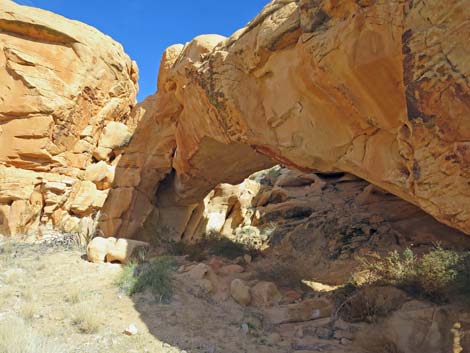
 Use-trail approaching toe of last sandstone crag (view W) |
 Use-trail crossing toe of last sandstone crag (view W) |
 Intersection of use-trails just past toe of last sandstone crag |
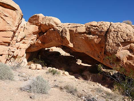
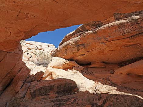
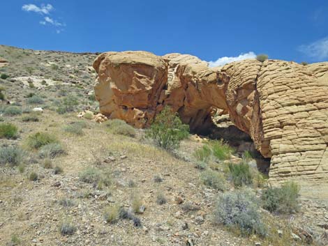 Doodlebug Arch comes into view (view NE) |
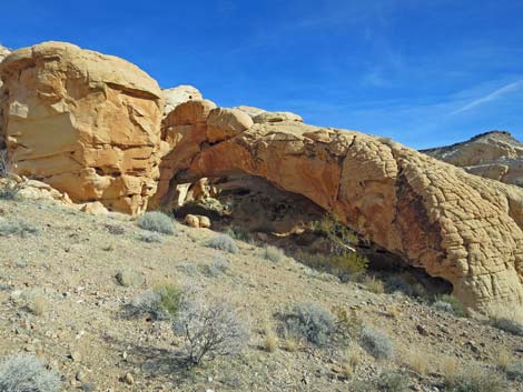 Doodlebug Arch (view NE) |
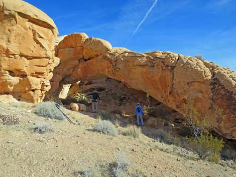 Hikers under Doodlebug Arch (view NE) |
 |
 Doodlebug Arch (view NE) |
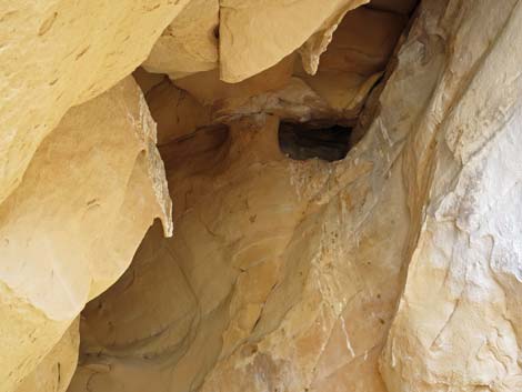
 Under Doodlebug Arch (view SW) |
 Under Doodlebug Arch (view SW) |
 Under Doodlebug Arch (view SW) |
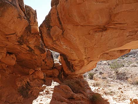
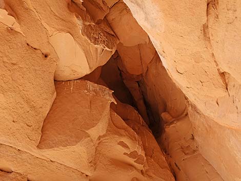
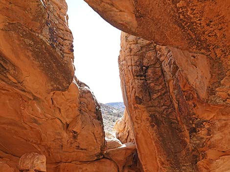 Under Doodlebug Arch; looking down the slot (view SW) |
 Under Doodlebug Arch (view SW) |
 Under Doodlebug Arch; looking up the slot (view SW) |
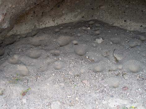
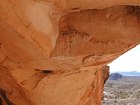 Rock Wren roost under Doodlebug Arch |
 Owl roost under Doodlebug Arch |
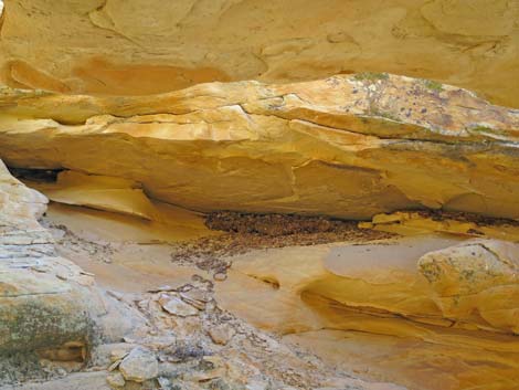 Desert Woodrat midden under Doodlebug Arch |
 Owl roost under Doodlebug Arch |
 Doodlebug, or Antlion, sand traps |
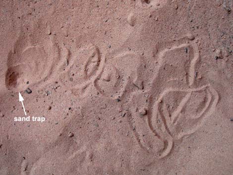 Doodlings of a doodlebug as it looks for a good sand-trap site |
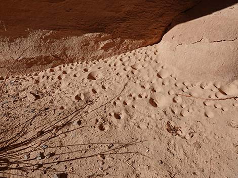 Doodlebug, or Antlion, sand traps |
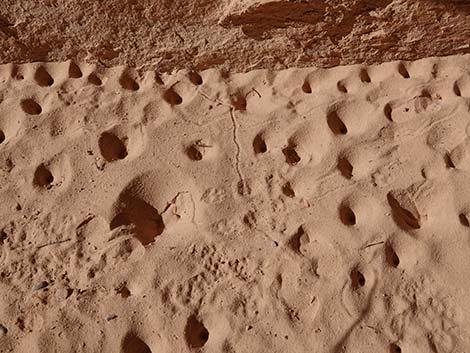 Doodlebug, or Antlion, sand traps and mouse footprints |
More to come ... |
Table 1. Hiking Coordinates and Distances based on GPS Data (NAD27; UTM Zone 11S). Download Hiking GPS Waypoints (gpx) file.
| Wpt. | Location | UTM Easting | UTM Northing | Elevation (ft) | Point-to-Point Distance (mi) | Cumulative Distance (mi) |
|---|---|---|---|---|---|---|
| 01 | Trailhead | 756119 | 4045566 | 3,102 | 0.00 | 0.00 |
| 02 | Amber Cat route at Jeep Road | 755730 | 4045487 | 3,059 | 0.25 | 0.25 |
| 03 | Doodlebug Route at Jeep Road | 754887 | 4045454 | 2,893 | 0.51 | 0.76 |
| 04 | Doodlebug Pass | 754494 | 4045242 | 2,976 | 0.34 | 1.10 |
| 05 | Wash Forks | 754372 | 4045124 | 2,778 | 0.11 | 1.21 |
| 06 | Horse Route at Wash | 754222 | 4045068 | 2,736 | 0.12 | 1.33 |
| 07 | Trail Junction | 754104 | 4044940 | 2,692 | 0.15 | 1.48 |
| 08 | Doodlebug Arch | 754040 | 4044968 | 2,838 | 0.06 | 1.54 |
| 01 | Trailhead | 756119 | 4045566 | 3,102 | 1.54 | 3.08 |
Happy Hiking! All distances, elevations, and other facts are approximate.
![]() ; Last updated 240325
; Last updated 240325
| Hiking Around Gold Butte | Hiking Around Las Vegas | Glossary | Copyright, Conditions, Disclaimer | Home |