Backroads Around Las Vegas, Gold Butte
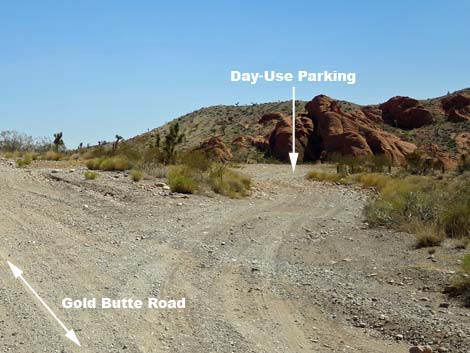
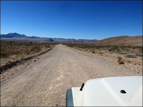
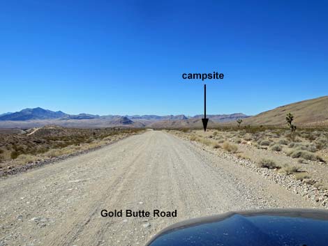
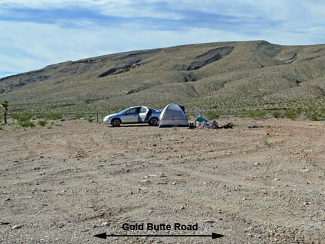
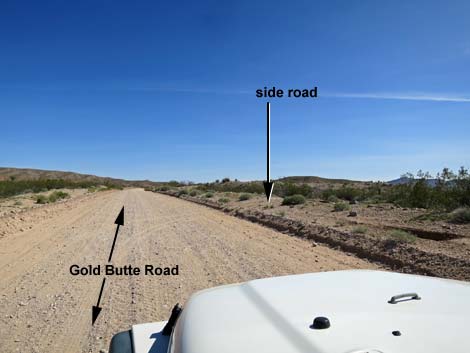
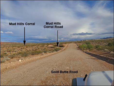
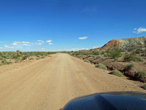
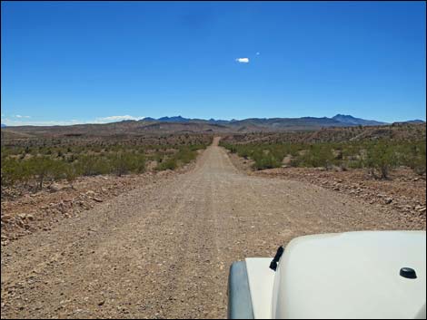
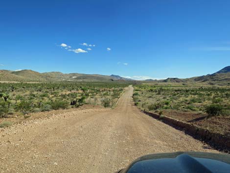
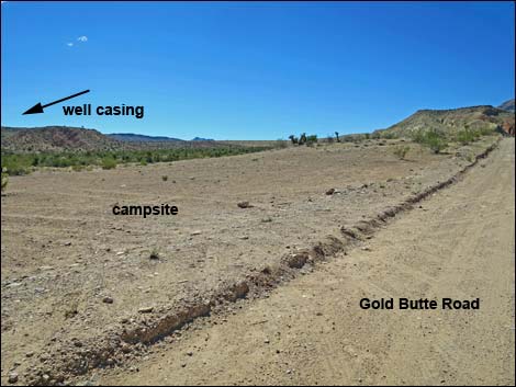
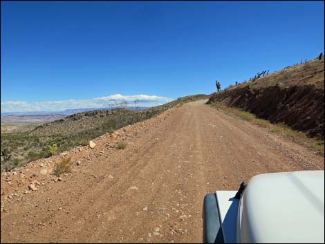
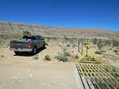
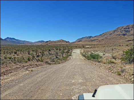
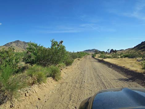
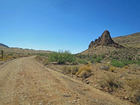
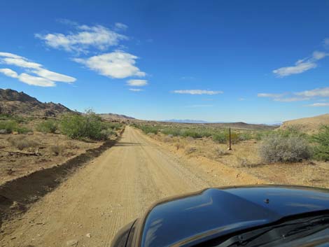
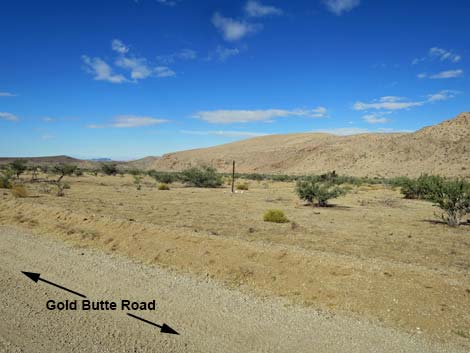
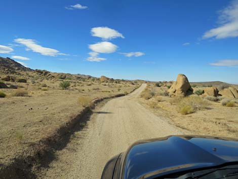
 End of Pavement -- Start of Dirt: Gold Butte Road (view S) |
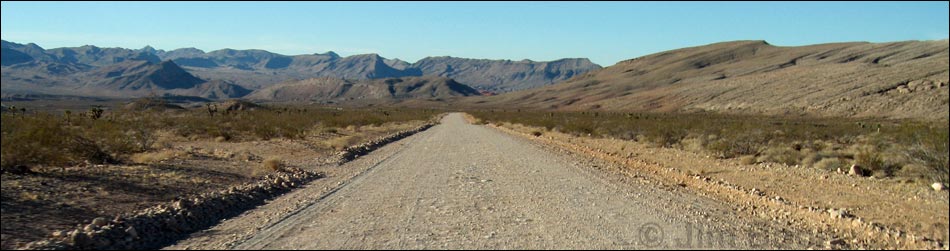
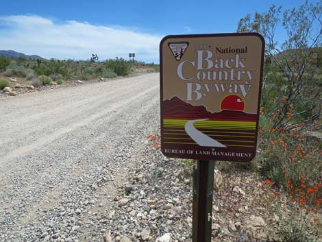
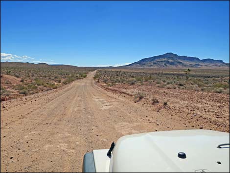
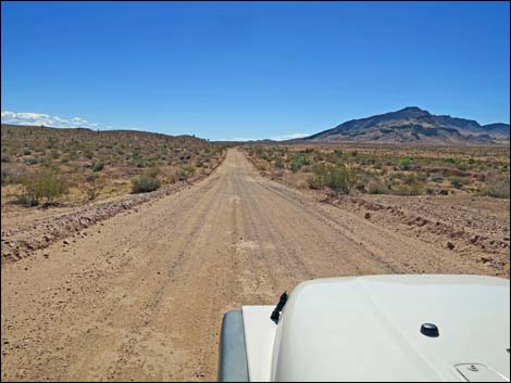
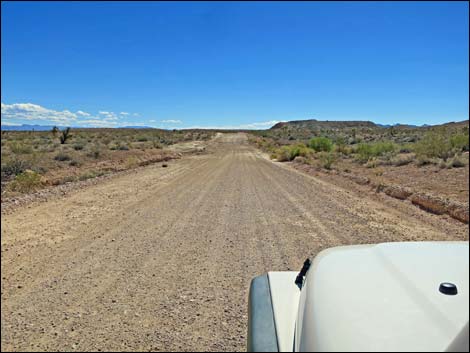
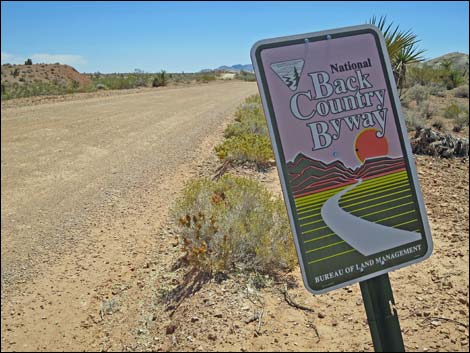
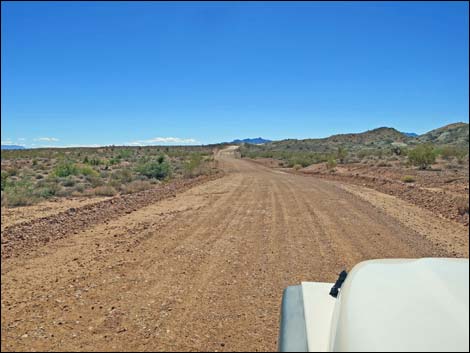
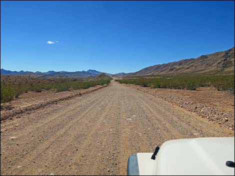
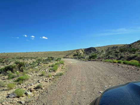
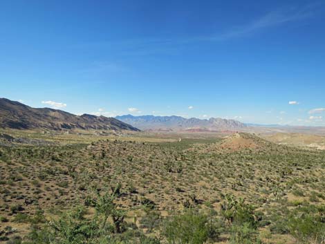
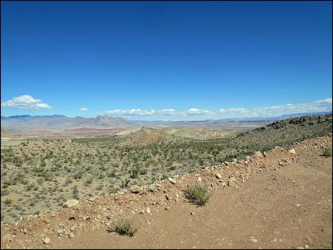
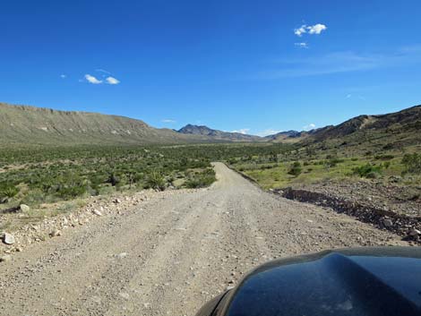
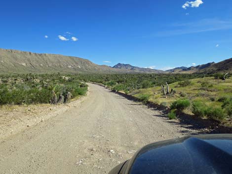
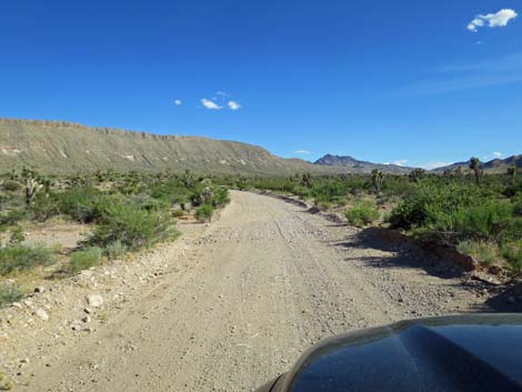
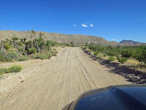
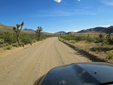
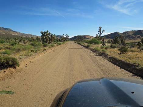
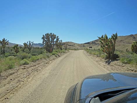
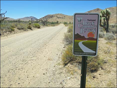
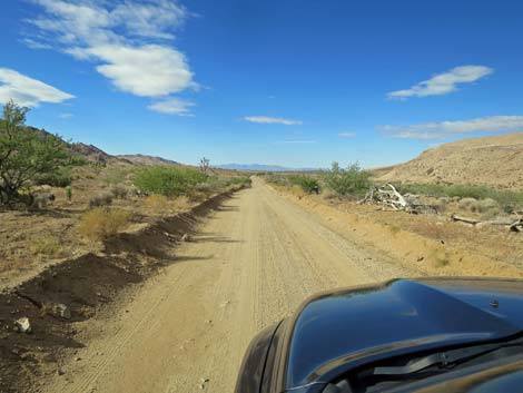
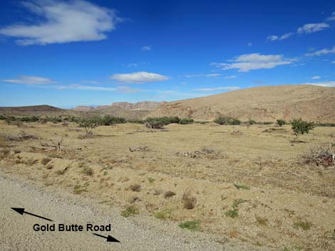
Overview Gold Butte Road, which starts near the town of Mesquite, Nevada, is the gateway to the wild and rugged Gold Butte region. The first 21 miles to Whitney Pocket are paved, such as it is. Beyond Whitney Pocket, the road becomes graded dirt, and the real wildness begins, but the road normally is suitable for carefully driven sedans. This occasionally maintained road runs through spectacular country and leads to places such as Gold Butte Townsite, Devils Throat, Scanlon Dugway, tall peaks, deep canyons, and a whole lot of grand scenery. Gold Butte Road is part of the Gold Butte Backcountry Byway, a grand loop that runs through this wild, remote, and scenic land. Link to map. Going the other direction? See Gold Butte Road -- Unpaved Section Northbound |
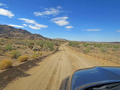
 On the right, Whitney Pocket campsite #1 (view W) |
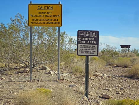
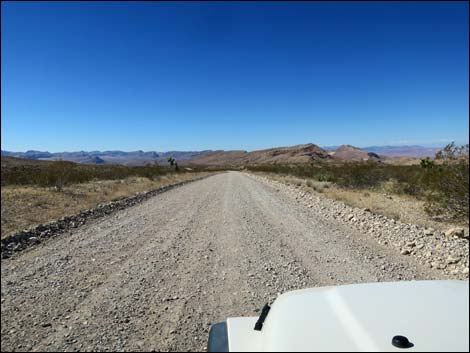
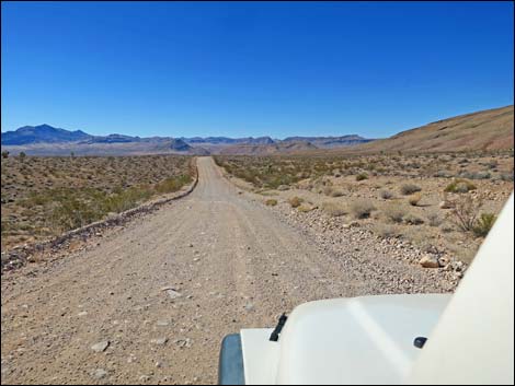
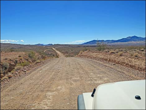
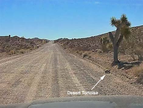
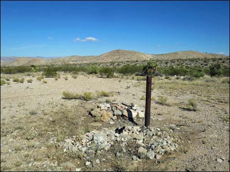
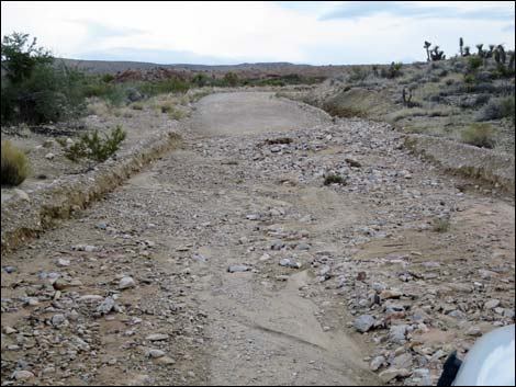
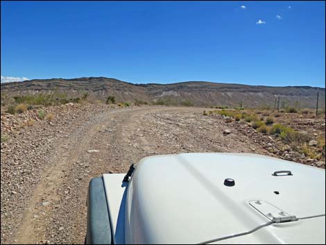
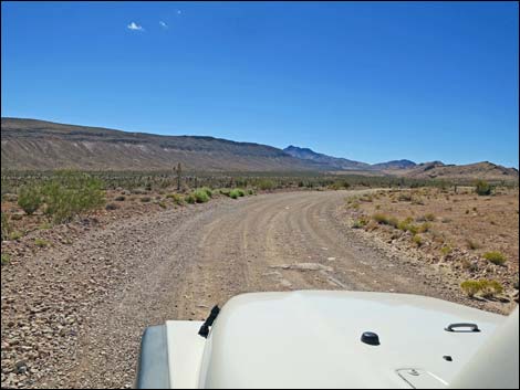
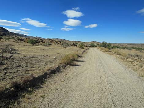
Watch Out Other than the standard warnings about hiking in the desert, ... there are no unusual hazards on this road, but it can suddenly become rough, so drive carefully and don't drive too fast even if you can. The first two miles, in particular, are pretty rough with a cobblestone-like surface where dirt has washed and blown away revealing the underlying rocky surface. Several of the steeper downhill runs in the first 10 miles are booby-trapped with road hazards. This is wild and remote country without services of any kind (no restrooms, no water, no gas, no food). Bring what you need to survive. Be prepared and be self-reliant. It is a big place, but someone will eventually find you if you stay on a main road, but be prepared to survive alone for a day or two, or even longer on side roads. Cell phones work in a few places depending on carrier, but don't expect cell service. While out, please respect the land and the other people out there, and try to Leave No Trace of your passage. Also, this is a remote area, so be sure to bring the 10 Essentials. |
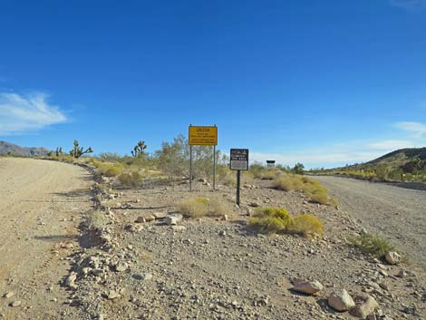
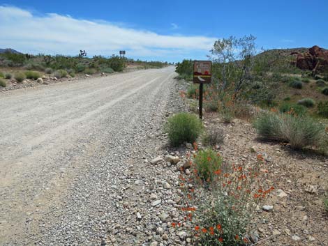
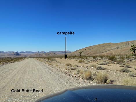
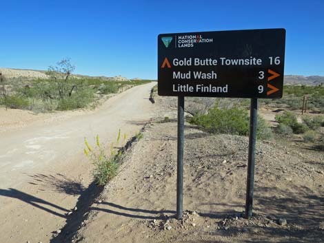
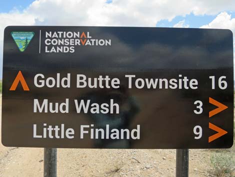
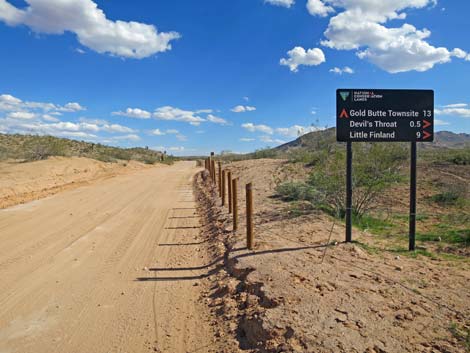
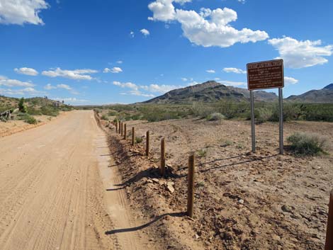
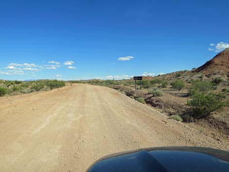
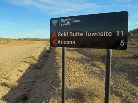
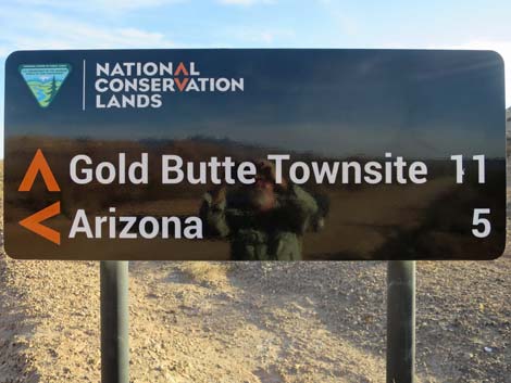
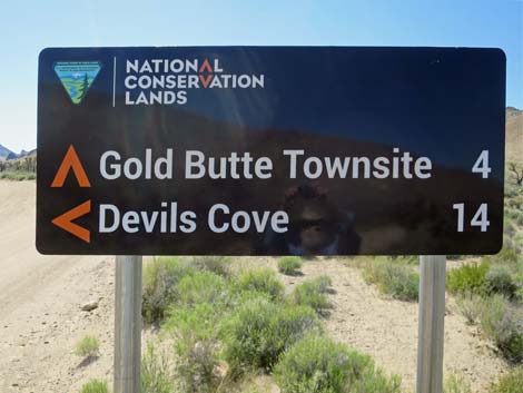
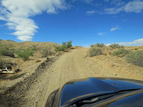
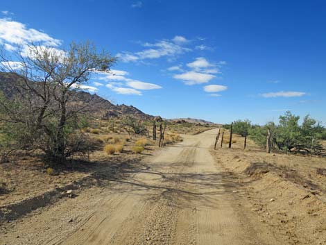
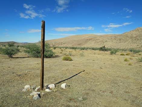
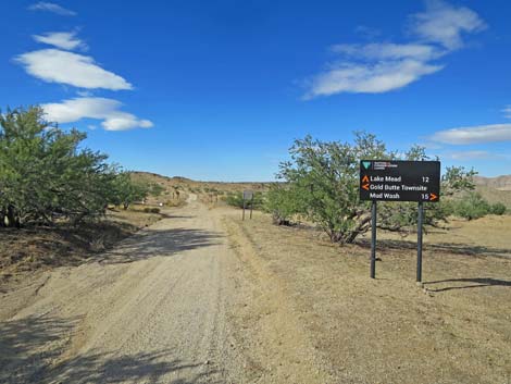
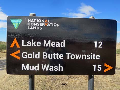
 Road sign at start of dirt road at Whitney Pocket (view S) |
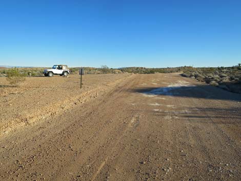
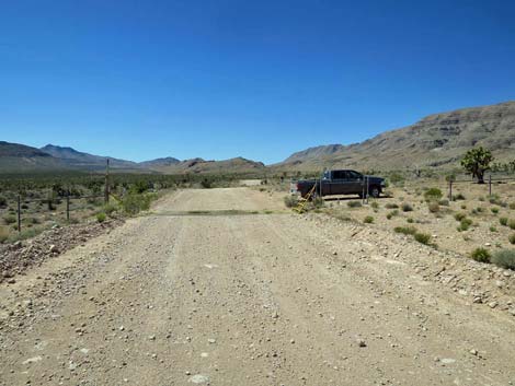
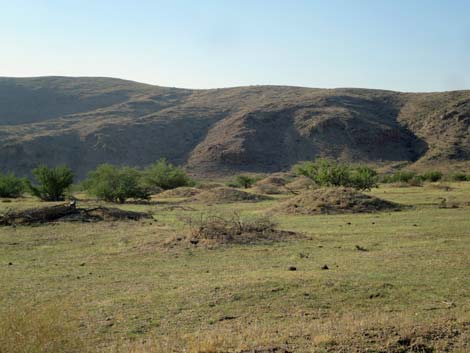
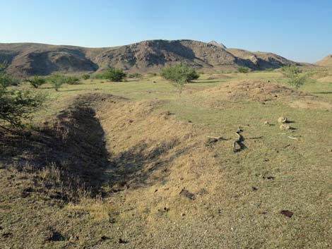
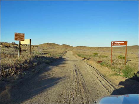
Getting to Gold Butte Road -- Unpaved The unpaved section of Gold Butte Road is located out in Gold Butte northeast of Lake Mead, about 2 hours northeast of Las Vegas. From Las Vegas, drive north on Interstate 15 to Highway 170 (Exit 112), about 8 miles before Mesquite. Drive south on Highway 170, cross the Virgin River, and turn right onto Gold Butte Road (paved section). Then, staying on the pavement, head south to Whitney Pocket. Road Guide The pavement ends (Table 1, Site 0491) at Whitney Pocket, a scenic area with upturned and sculpted red-and-white sandstone crags. This area is popular with campers, and it makes a good place to stop and enjoy the solitude and scenery for those who don't want to stray far from the paved road. |
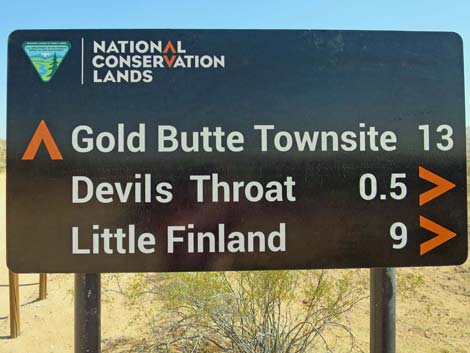
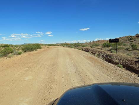
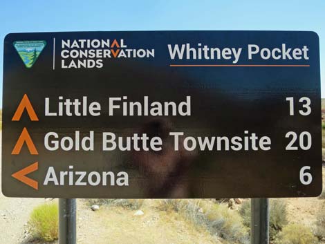 Places and distances; assume 15-20 mph travel times (view S) |
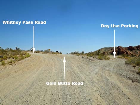
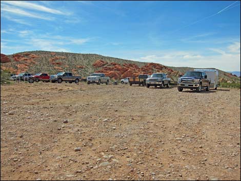
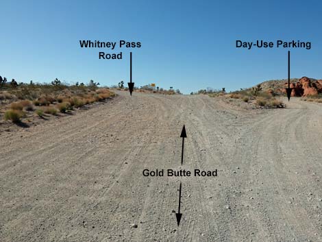
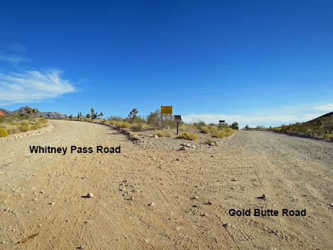
From the end of the pavement (Site 0491), Gold Butte Road continues south between sandstone crags into Whitney Pocket, proper. Immediately, the road passes a large campsite back in the rocks on the right, and then shorty, a side road (Site 1657) forks to the right into a large day-use parking area with information signs and seasonal porta-potties. This parking area is a good place to drop trailers and unload ATVs. The side road actually continues west through the parking area and leads to several campsites nestled against the sandstone crags. Only a few yards farther south, Gold Butte Road passes Whitney Pass Road (Site 0462), which forks to the left and runs east up over the Virgin Mountains and down into Arizona. There are several camping areas along the sandstone bluffs and farther into the desert along Whitney Pass Road. Birders might want to take Whitney Pass Road up into the mountains to look for birds of the desert mountains, and history buffs will enjoy seeing the CCC Dam, the masterpiece from the time the Corps was here. |
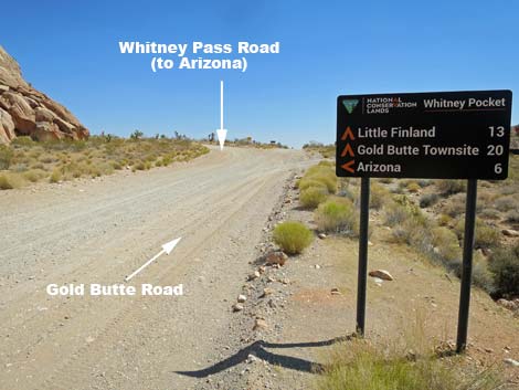 Whitney Pass Road, towards Arizona, forks left (view S) |
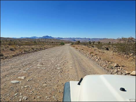
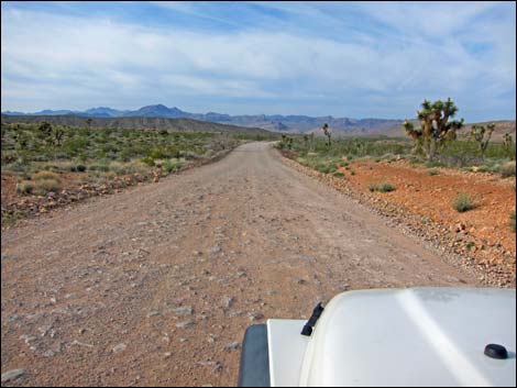
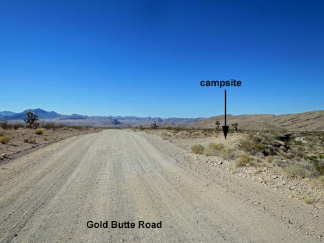
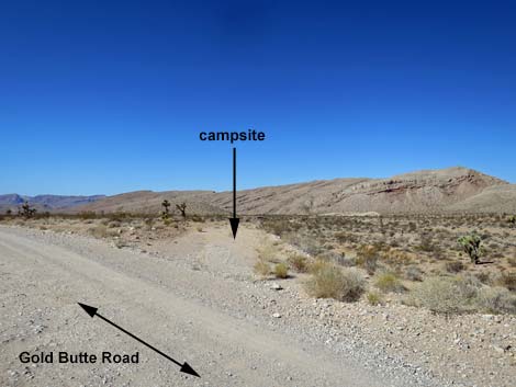
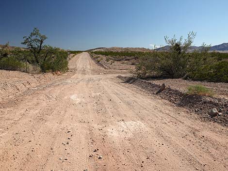
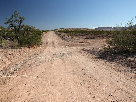
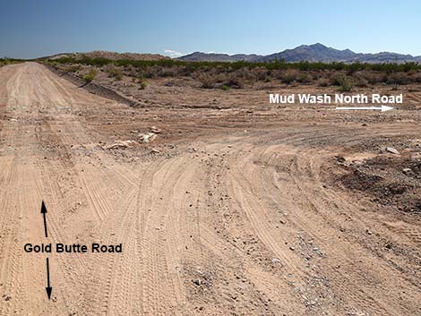
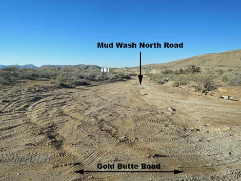
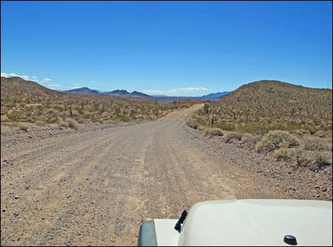
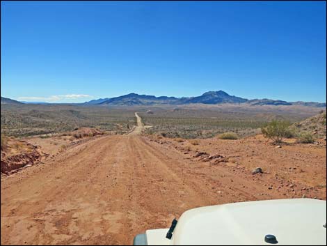
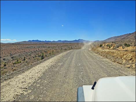
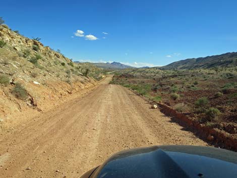
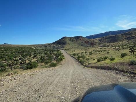
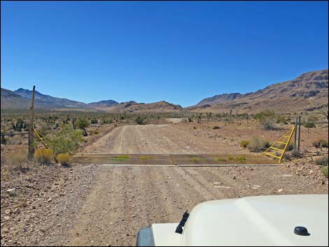
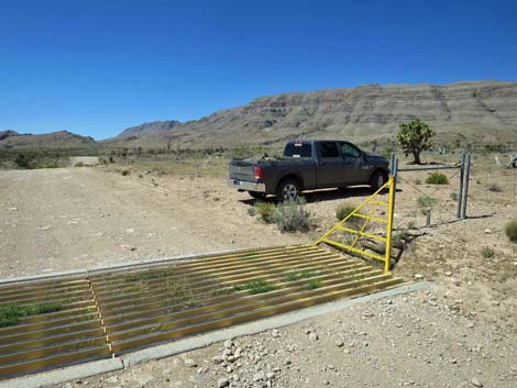
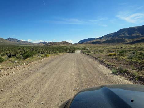
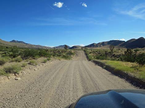
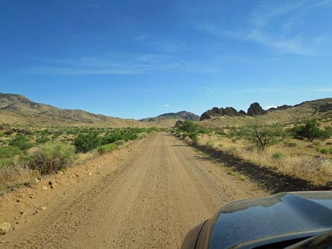
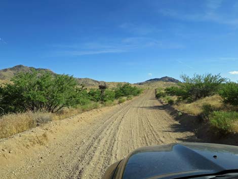
For adventuresome drivers, Gold Butte Road continues south as a graded dirt road into the wildness and grandeur of Gold Butte. The road generally runs downhill for the first 7 miles, which eases somewhat the bumpy cobblestone-surface of the road. At about 3.5 miles out, the road crosses an old cattle guard (Site 1904; now covered with sand) and passes through an old rangeland fence. Just past the fence, a large camping area (Site 1670) on the right is suitable for several trailers and RVs. At 3.9 miles out, Gold Butte Road passes a signed intersection (Site 1649) with Mud Wash North Road. To the right, Mud Wash North Road runs down the North Fork of Mud Wash for 3 miles to a confluence with Mud Wash and Mud Wash Road (and eventually to Little Finland). To the left, a faint spur road runs 0.6 miles up the wash (stay right when leaving Gold Butte Road) and ends at an old cattle fence. This road runs, for no apparent reason, to nowhere, not even a nice campsite. |
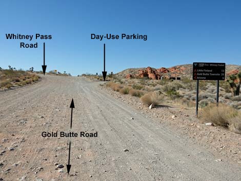 Day-Use parking road (not on sign) forks right (view S) |
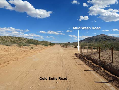
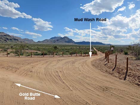
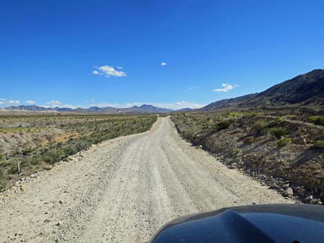
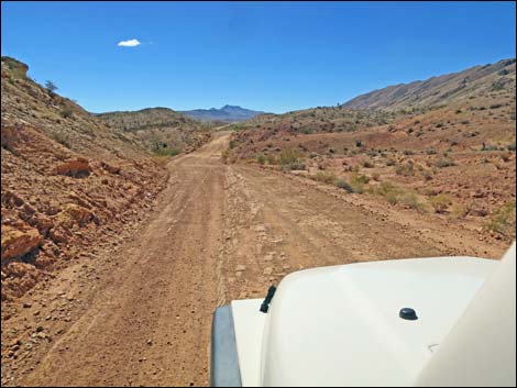
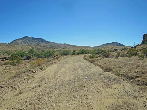
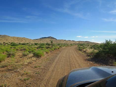
Climbing out of the North Fork of Mud Wash, Gold Butte Road quickly passes a minor road, Gypsum Road North (Site 1891), on the right. Shortly thereafter, Gold Butte Road passes another minor road on the right, Gypsum Road South (Site 1892). Both roads run south through a Gypsum prospect area and eventually connect with Mud Wash North Road. Neither road is particularly interesting, but they provide a slower way to get to Mud Wash. Gold Butte Road now begins a long run south across the broad Mud Wash Valley. Near the bottom of the valley, a minor side road forks left. Here the north end of Old Gold Butte Loop Road (Site 1893) runs up over a low ridge before descending back to Gold Butte Road (Site 1894). This 0.4-mile slow-road alternative add a bit of interest (at least once) to driving up and down Gold Butte Road, but offers no campsites. Shortly after crossing Pussy Willow Wash near the bottom of Mud Valley, Gold Butte Road arrives at a signed intersection (Site 0807) with Mud Wash Road, which branches to the right. Mud Wash Road runs out 0.4 miles to Devils Throat and then on down Mud Wash 8 miles to Red Bluff Spring. Mud Wash Road is part of the loop on the Gold Butte Backcountry Byway, and it leads to Little Finland Road. |
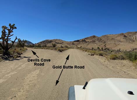
 Gold Butte Road forking three ways (view S) |
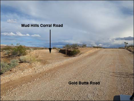
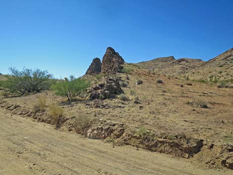
It is worth taking a few minutes to see Devils Throat, a deep sink hole that will make you look at terra firma in an entirely new way. From the main road, visitors can look down Mud Wash Road and see the chain-link fence that surrounds the sink hole. Beyond Mud Wash Road, Gold Butte Road continues south, quickly crosses Mud Wash, and begins to climb towards the northeast edge of Tramp Ridge. Before passing the tip of Tramp Ridge, Gold Butte Road passes a minor road (Site 1895), on the right. This road runs southwest for about 0.5 miles and ends. This little-used road doesn't provide any nice campsites, but it can be used to hike along the base of Tramp Ridge, although a closer trailhead can be reached from Devils Throat. At about 8.3 miles out, a short side road (Site 1694) left leads 100 yards to the historic Mud Hills Corral, which can be seen from the main road. There is a nice campsite by the corral, but be sure to protect the historic structures and find firewood elsewhere. |
 Gold Butte Road at Day-Use Parking Road (view SW) |
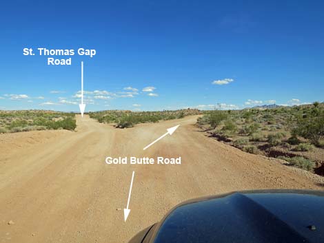
At 9.0 miles out, Gold Butte Road forks at a signed intersection (Site 0796). Gold Butte Road curves right, while St. Thomas Gap Road forks left and heads southeast into Arizona. Shortly beyond the fork, a minor side road (Site 1898) branches right. This narrow road runs about 0.2 miles to an old mining prospect. A small vehicle could make camp back there, but nearby sites are nicer. At about 12.9 miles out, Gold Butte Road passes an old oil well drill pad (Site 1968), on the left. The site was worked in the 1980s, and it is interesting to see how little vegetation has grown back in 50 years. Even so, this makes for a campsite suitable for a couple of large vehicles. They found no oil. Just beyond the drill-site camp, Gold Butte Road begin to climb at a moderate grade. At about 13.4 miles out, the road bends hard to the left and cuts up across a steep hillside with grand views off the cliff over into Arizona. At the top of the hill, the road cuts hard to the right, crosses a cattle guard, and continues south. On the way back, remember this cattle guard as it is easy to drive too fast in this area and not see the cliff and sharp turn coming up (especially in the dark). |
 Day-use parking (on the right; view SW) |
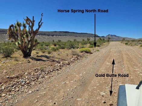
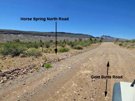
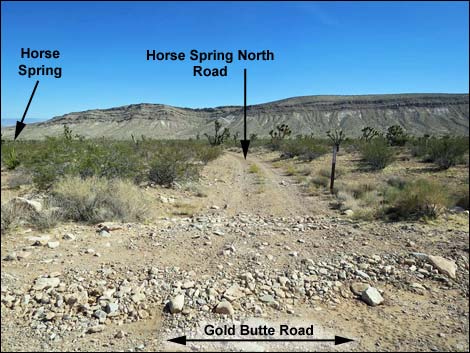
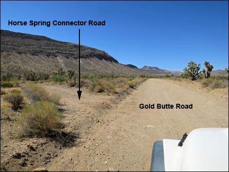
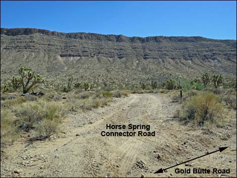
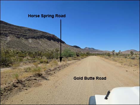
On the far side of the cattle guard, Gold Butte Road passes Paradise Ridge Trailhead (Site 1969) and campsite, on the right. This hike leads to the highpoint on the ridge hard to the right. About 0.5 miles past the cattle guard, Gold Butte Road passes Horse Spring North Road (Site 1785), on the left. This minor road runs northeast, drops into a sandy wash, and winds around to Horse Spring and an historical stone corral. In 2022, Horse Spring went dry for the first time. Continuing south, Gold Butte Road runs up over gentle hills before dropping into and crossing Horse Wash, the major drainage in Horse Valley. Gold Butte Road climbs out of Horse Wash and resumes the gentle climb. About 0.6 miles past Horse Wash, Gold Butte Road passes Horse Spring Connector Road (Site 1780), on the left. Continuing another 0.2 miles, Gold Butte Road passes Horse Spring Road (Site 1780), on the left. All three of these roads run northeast to Horse Spring. |
 Gold Butte Road passing the day-use turnoff (view S) |
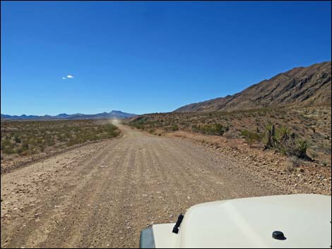
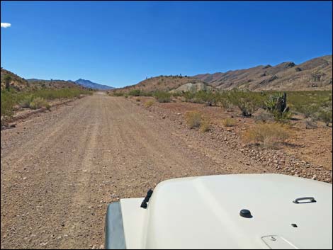
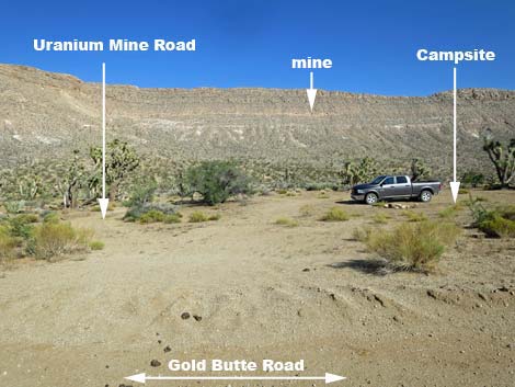
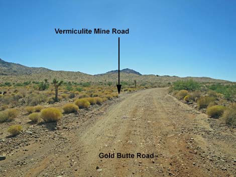
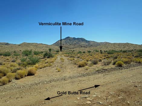
Continuing south along Tramp Ridge, at 16.3 miles out (Site 1880), Gold Butte Road pass Uranium Mine Road and a campsite on the left. The 1950s-era uranium mine left a bit of moderately radioactive ore on the ground. For most people, park at the campsite and hike up the old road to the shallow mine, which is visible on the ridge. Continuing south, at 16.5 miles out, Gold Butte Road passes a signed intersection (Site 0797) with Devils Cove Road, on the left. Devils Cove Road forks to the left and heads southeast down through some rough country to near the Colorado River. In the old days, people could haul boats and trailers down to Lake Mead, but the road has washed out many times since then. Inside Gold Butte National Monument, the road usually is pretty good, but when the road crosses into Lake Mead National Recreation Area, it immediately deteriorates. Now, hikers with serious 4WD vehicles can drive this washed-out road down to a trailhead, and from there hike out to the Colorado River (Devils Finger Route). Gold Butte Road continues south and begins to swing around the south end of Tramp Ridge. Bending west, Gold Butte Road passes an obscure side road (Site 1696) to the left. |
 Intersection of Whitney Pass and Gold Butte roads (view S) |
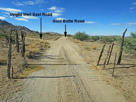
Here, Vermiculite Mine Road runs south to the old mine site, which also serves at the trailhead for Mica Peak, visible straight up Vermiculite Mine Road. Folks with 4WD vehicles can find quiet campsites near the old surface mine. Winding over hills and now heading southwest, Gold Butte Road passes Paradise Guzzler Road (Site 1857), a short spur to the right leading to the guzzler. This is also the trailhead for hiking down Paradise Valley. A few miles farther, Gold Butte Road arrives in the Gold Butte Townsite area. At about 19.6 miles out (Site 1901), Gold Butte Road passes an obscure minor side road to the right. Here, Black Jack Mine Road cuts back to the right and runs up the valley to a high point. Hikers can continue to the mine site, but there are no nice campsites. Gold Butte Road continues southwest and arrives at a cattle guard. Just beyond the cattle guard, Voight Well East Road (Site 1650) forks left and runs south into the Voight Well area (this is the east end of the Gold Butte Townsite area). There is an old corral and some water structures in the area, and staying left on the access road leads visitors back towards Granite Spring (now dry) that once served the area and the old "Spanish" arrastra (like a grist mill). |
 Signs at intersection of Whitney Pass and Gold Butte roads (view S) |
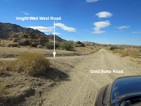
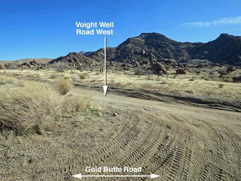
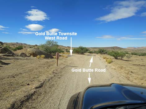
Beyond Voight Well East Road, Gold Butte Road continues southwest and passes a minor side road (Site 1902), on the right. This is Gold Butte Airstrip Road, with runs down across the old airstrip and connects with Red Bluff Spring Road, although this is not a short cut to get there. Catclaw trees have grown up in the unused airstrip, so this isn't a place to land a plane. A bit farther along, Gold Butte Road passes Voight Well West Road (Site 1651), hard to the left, which leads back into the Voight Well area. In another 0.3 miles, Gold Butte Road arrives at an intersection (Site 1650) with Gold Butte Townsite Road, on the left. This well-used side road leads into Gold Butte Townsite, proper ("Downtown" Gold Butte). Here, in the open area on the right, the historic mining town is remembered only by two concrete foundation slabs, some rusting equipment, and a covered mine shaft. On the left is the site of the historic post office and the graves of the last two inhabitants (Mr. Coleman and Mr. Garrett). Beyond the graves, a narrow road leads up to one of their last gold mines (now grated). |
 Signs at intersection of Whitney Pass and Gold Butte roads (view S) |
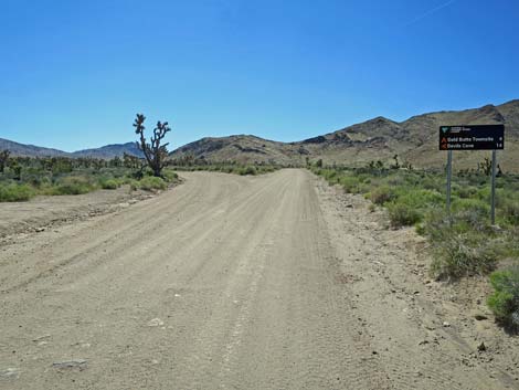
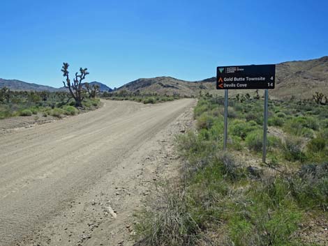
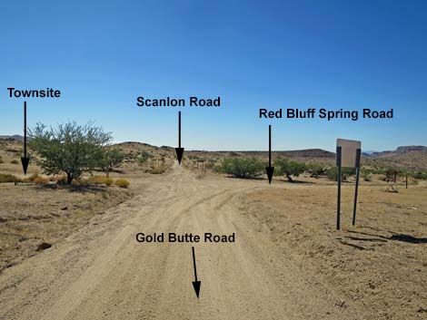
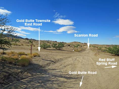
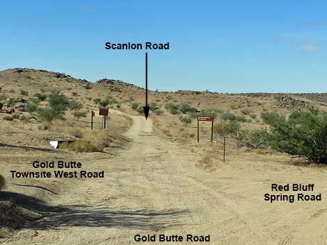
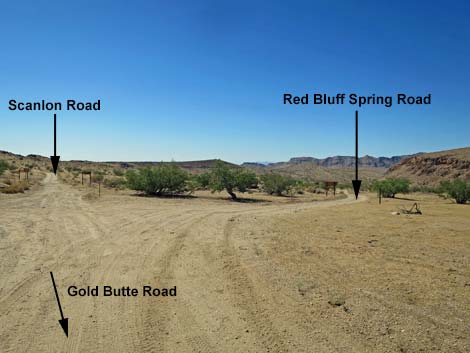
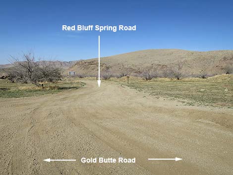
Continuing on Gold Butte Road, in only a few more yards, Gold Butte Road ends (20.2 miles out) at a signed intersection (Site 0806) with Red Bluff Spring Road, on the right. At this point, to the left, another dirt road cuts back into the Townsite area. The main road continues southwest (straight) as Scanlon Road. Scanlon Road continues south deep into the most wild and rugged parts of Gold Butte, giving access to such places as Jumbo Springs Wilderness Area, Bonelli Peak, and the infamous Scanlon Dugway. In a serious 4WD vehicle, Scanlon Road is drivable to the top of Scanlon Dugway. The first couple of miles aren't bad, but it wouldn't be wise to drive too far down Scanlon Road without a 4WD vehicle. Somewhat less wild and rugged than Scanlon Road, Red Bluff Spring Road runs northwest to run north between Lime Ridge and Tramp Ridge, giving access to hikes in the Lime Canyon Wilderness Area and on Tramp Ridge. Red Bluff Spring Road usually is drivable northbound in a medium-clearance vehicle (Subaru Forrester), but driving the other direction is better in a 4WD. This road is also part of the loop on the Gold Butte Backcountry Byway: drivers can connect with Mud Wash Road, return to Gold Butte Road, and then back to Whitney Pocket. |
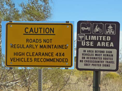 Caution signs, although the main roads don't normally require 4x4 |
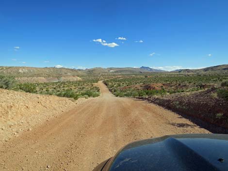
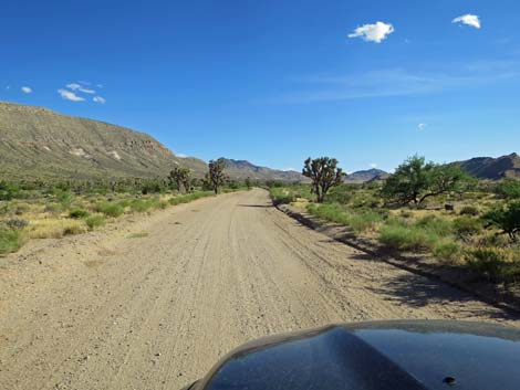
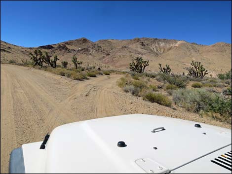
 Rough road surface beyond Whitney Pocket |
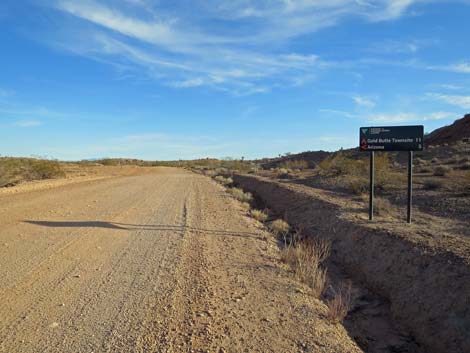
 Approaching Gold butte Back Country Byway Sign (view S) |
 Approaching Gold butte Back Country Byway Sign (view S) |
 Not-so-rough road surface (view S) |
 Rough road surface (view SW) |
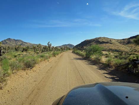
 Smooth road surface (view S) |
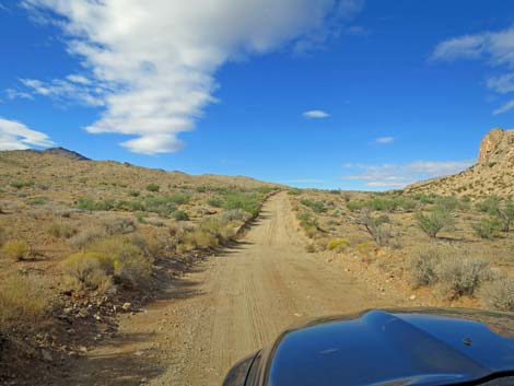
 Gold Butte Road (view SW) |
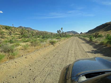
 Gold Butte Road approaching a small campsite (view SW) |
 Gold Butte Road at a small campsite (view SW) |
 Gold Butte Road approaching a small campsite (view SW) |
 Gold Butte Road at a campsite (view SW) |
 Campsite on original GB Road (view SW) |
 Cattle guard; note campsite on the right (view SW) |
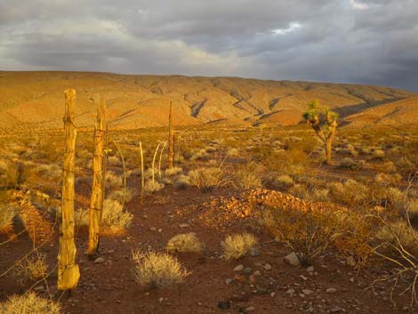 Stormy sunrise at old fenceline (view W) |
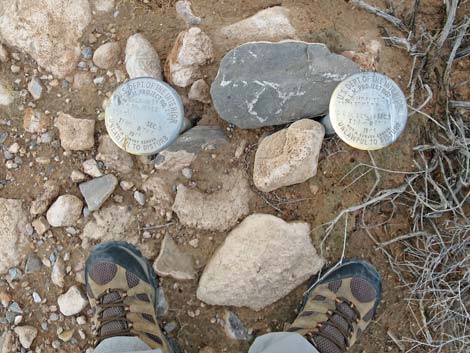 Two survey markers by fence |
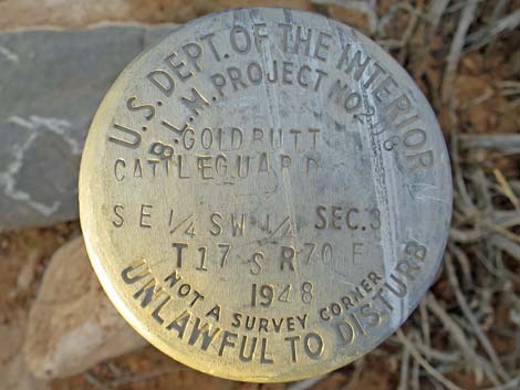 Survey marker for cattle guard; 1948 |
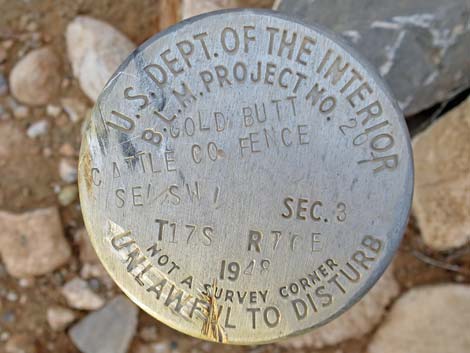 Survey marker for Gold Butte Cattle Co. Fence; 1948 |
 Gold Butte Road Cattle Guard campsite (view W) |
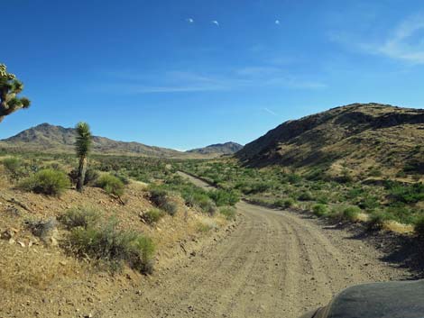
 Dropping into Mud Wash Valley (view SE) |
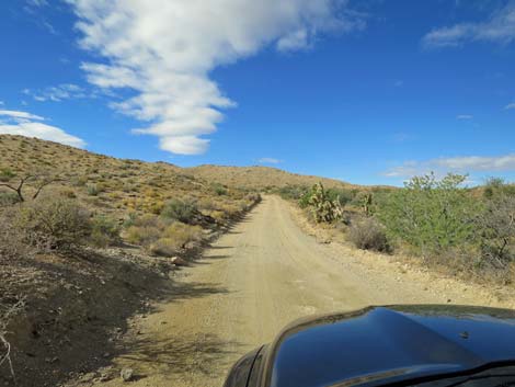
 Gold Butte Road (view SE) |
 Approaching at intersection with Mud Wash North Road (view SE) |
 Sign at Mud Wash North Road (view SE) |
 Sign at Mud Wash North Road (view SE) |
 Gold Butte Road approaching Mud Wash North Road (view SE) |
 Gold Butte Road approaching Mud Wash North Road (view SE) |
 Gold Butte Road at Mud Wash North Road (view S) |
 Mud Wash North Road (view SW from Gold Butte Road) |
 Mud Wash North Road (view SW from Gold Butte Road) |
 Gold Butte Road at minor side road right (view SE) |
 Gold Butte Road at minor side road right (view SE) |
 Gold Butte Road (view SE) |
 Watch Out! Desert Tortoise on edge of road (view S) |
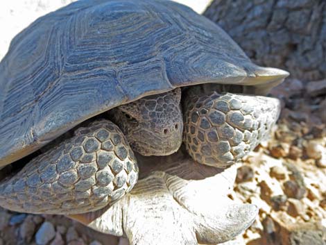 Big, healthy male Desert Tortoise |
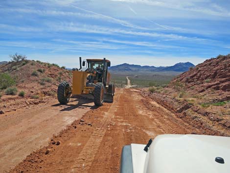 Road grader cleaning up Gold Butte Road after a storm (view S) |
 Dropping into Wechech Basin (view S) Dropping into Wechech Basin (view S) |
 Crossing Wechech Basin towards Tramp Ridge (view S) |
 Crossing Wechech Basin towards Tramp Ridge (view S) |
 Crossing Wechech Basin towards Tramp Ridge (view S) |
 Crossing Wechech Basin towards Tramp Ridge (view S) |
 Spectacular sunsets in Wechech Basin (view W) |
 Approaching Mud Wash Road (view S) |
 Road sign approaching intersection (view S) |
 Road sign approaching intersection (view S) |
 Gold Butte Road at Mud Wash Road (view S) |
 Mud Wash Road (view W from Gold Butte Road) |
 Tramp-and-Fork Fire info sign just past Mud Wash Rd (view S) |
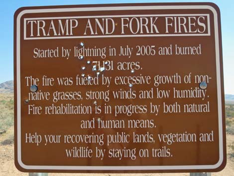 Info sign: 2005 Tramp and Fork Fires (vandalized with bullets) Info sign: 2005 Tramp and Fork Fires (vandalized with bullets) |
 Gold Butte Road (view S) |
 Scenery (Mud Hills) along Gold Butte Road (view S) |
 Approaching Mud Hills Corral on left (view S) |
 Gold Butte Road at Mud Hills Corral on left (view S) |
 Gold Butte Road (view S) |
 Gold Butte Backcountry Byway sign (view S) |
 Gold Butte Road (view S) |
 Gold Butte Road approaching St. Thomas Gap Road sign (view S) |
 Gold Butte Road at St. Thomas Gap Road sign (view S) |
 Gold Butte Road at St. Thomas Gap Road sign (view S) |
 St. Thomas Gap Road sign (view S) |
 St. Thomas Gap Road sign (view S) |
 Vehicle at campsite just before road intersection (view S) |
 Gold Butte Road at St. Thomas Gap Road (view S) |
 Gold Butte Road departing St. Thomas Gap Road intersection (view S) |
 Gold Butte Road (view S towards vehicle causing dust) |
 Gold Butte Road (view S) |
 Running along Tramp Ridge (view S) |
 Running along Tramp Ridge (view S) |
 Gold Butte Road (view S) |
 Gold Butte Road (view S) |
 Gold Butte Road (view S) |
 Gold Butte Road (view S) |
 Rare plants growing in gypsum-mud hills (view W) |
 Gold Butte Road (view S) |
 Road crosses major wash (view S) |
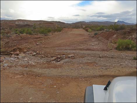 Flashflood damage to roadway (view S; Oct 2015) |
 Road climbs out of major wash (view S) |
 Road crosses major wash (view S) |
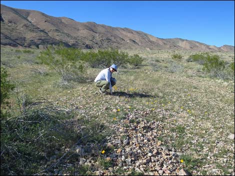 Stopping to smell the yellow poppy flowers |
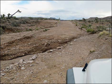 Flashfloods can damage the entire roadway (view S; Oct 2015) |
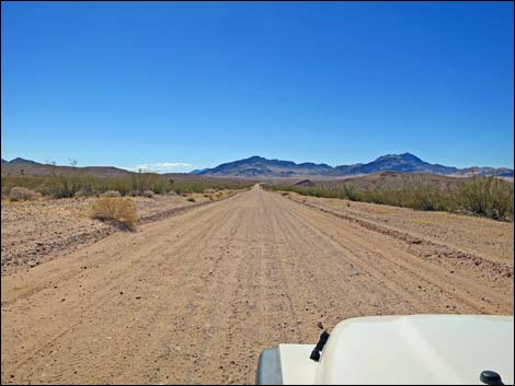
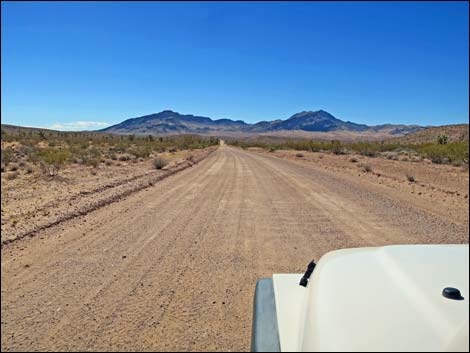
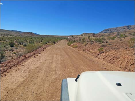 Road runs through rolling country (view S) |
 Large campsite on the left (view S) |
 Test well casing (oil exploration) in the campsite (view NE) |
 Gold Butte Road (view S) |
 Gold Butte Road (view S) |
 Flashflood damage to roadway (view S; Oct 2015) |
 Gold Butte Road climbs towards ridgeline (view S) |
 Gold Butte Road climbs towards ridgeline (view S) |
 Road cuts up and across hillside (view SE) |
 Road cutting across hillside; approaching sharp curve (view E) |
 Grand view across Gold Butte (view N) |
 Grand view into Arizona (view NE) |
 Sharp curve at top of hill (remember on the return; view E) |
 Sharp curve at top of hill (remember on the return; view E) |
 Beyond sharp curve, cattle guard ahead (view S) |
 Gold Butte Road at cattle guard (view S) |
 Vehicle at Paradise Peak trailhead (view S) |
 Vehicle at Paradise Peak trailhead (view W to Paradise Ridge) |
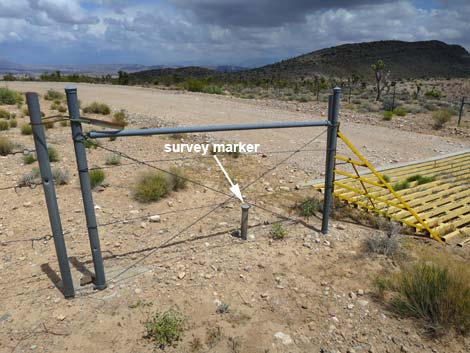 Fence and survey marker adjacent to cattle guard (view NE) |
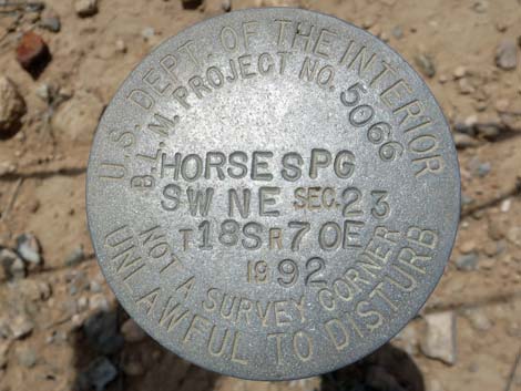 Survey marker placed in 1992 |
 Continuing past the cattle guard (view S) |
 Road dips across wash (view SW) |
 GB Rd approaching Horse Spring North Road (view S) |
 GB Rd at Horse Spring North Road (view S) |
 Horse Spring North Road (view E from Gold Butte Rd) |
 Gold Butte Road (view S across Horse Valley) |
 Gold Butte Road dipping towards Horse Spring Wash (view SE) |
 Gold Butte Road at Horse Spring Wash (view SE) |
 Gold Butte Road climbing out of Horse Spring Wash (view SE) |
 Gold Butte Road (view S) |
 Gold Butte Road at Horse Spring Road connector (view S) |
 Horse Spring Connector Road (view E from Gold Butte Road) |
 Gold Butte Road at Horse Spring Road (view S) |
 Gold Butte Road (view S) |
 Gold Butte Road (view S) |
 Approaching Uranium Mine Road and campsite (view S) |
 Uranium Mine Road and campsite (view E from GB Road) |
 Gold Butte Road (view S) |
 Gold Butte Road (view S) |
 Gold Butte Road approaching Devils Cove Road (view S) |
 Gold Butte Road at Devils Cove Road sign (view S) |
 Gold Butte Road at Devils Cove Road sign (view S) |
 Gold Butte Road at Devils Cove Road sign (view S) |
 Gold Butte Road at Devils Cove Road (view S) |
 Far side of triangular intersection with Devils Cove Road (view S) |
 Gold Butte Back Country Byway road sign (view S) |
 Short side road to quail guzzler GB-01 (view SW) |
 Gold Butte Road (view S) |
 Gold Butte Road dipping back into Horse Spring Wash (view S) |
 |
 |
 Gold Butte Road approaching Gold Butte Fault (view S) |
 Crossing Horse Spring Wash and Gold Butte Fault (view W) |
 Crossing Gold Butte Fault (view W) |
 Crossing Horse Spring Wash for the last time (view SW) |
 Gold Butte Road (view SW) |
 Gold Butte Road approaching Vermiculate Mine Road (view SW) |
 Vermiculate Mine Road (view S from Gold Butte Road) |
 Upturned limestone crags along Gold Butte Fault (view SW) |
 Upturned limestone crags along Gold Butte Fault (view SW) |
 More to come ... |
 Gold Butte Road (view W) |
 Gold Butte Road (view W) |
 Approaching the highest point on Gold Butte Road (view SW) |
 Highpoint on Gold Butte Road (view SW) |
 Descending towards Gold Butte Townsite (view SW) |
 Descending towards Gold Butte Townsite (view SW) |
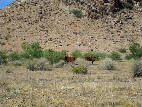 Bundy trespass cattle at Gold Butte Townsite (view N) |
 Descending towards Gold Butte Townsite (view SW) |
 Approaching Blackjack Mine Road (view SW) |
 Approaching Gold Butte Townsite area (view SW) |
 Gold Butte Road approaching cattle guard (view SW) |
 Gold Butte Road at cattle guard (view SW) |
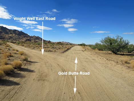 Gold Butte Road approaching Voight Well East Road (view SW) |
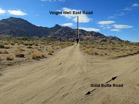 Voight Well East Road (view S from Gold Butte Road) |
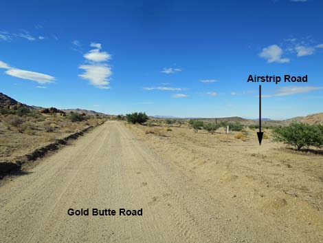 Approaching Gold Butte Airstrip Road (view SW) |
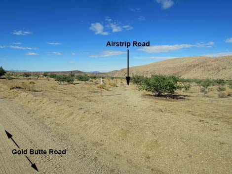 Gold Butte Airstrip Road (view W from Gold Butte Road) |
 Gold Butte Airstrip windsock pole (view S from GB Road) |
 Gold Butte Airstrip windsock pole (view SW) |
 Gold Butte Road approaching Voight Well West Road (view SW) |
 Voight Well West Road (view SE from Gold Butte Road) |
 Gold Butte Road (view SW) |
 Gold Butte Road (view SW) |
 Gold Butte placer prospects (view W from Gold Butte Road) Gold Butte placer prospects (view W from Gold Butte Road) |
 Gold Butte placer prospects (view W) |
 Placer prospects at Gold Butte Townsite (view N) |
 Placer prospect at Gold Butte Townsite (view N) |
 Lots of historic, rusty cans scattered around the Townsite area |
 Gold Butte Road approaching Gold Butte Townsite (view SW) |
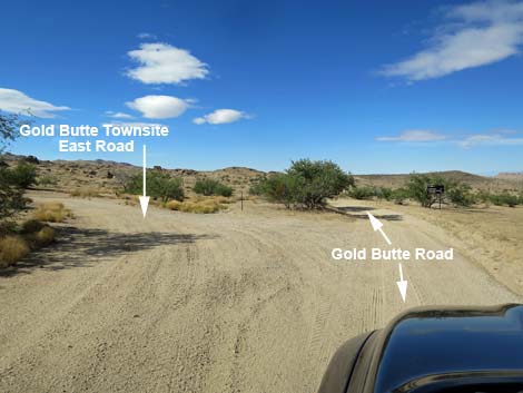 Gold Butte Road at Gold Butte Townsite East Road (view SW) |
 Gold Butte Townsite East Road (view S from Gold Butte Road) |
 Gold Butte Road (view SW) |
 Gold Butte Road approaching road intersection (view SW) |
 Directional sign at road intersection (view SW) |
 Directional sign (view SW) |
 Gold Butte Road approaching road intersection (view SW) |
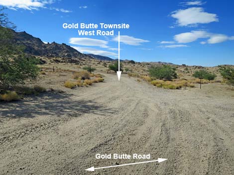
 Gold Butte Road at Gold Butte Townsite West Road (view SW) |
 Gold Butte Road at Scanlon Road (view SW) |
 Scanlon Road (view SW from Gold Butte Road) |
 Gold Butte Road at Red Bluff Spring Road (view SW) |
 Red Bluff Spring Road (view NW from Gold Butte Road) |
Table 1. Highway Coordinates Based on GPS Data (NAD27; UTM Zone 11S). Download Highway GPS Waypoints (*.gpx) file.
| Site | Location | UTM Easting | UTM Northing | Latitude (N) | Longitude (W) | Elevation (ft) |
|---|---|---|---|---|---|---|
| 0686 | Hwy 170 at Gold Butte Rd | 36.73178 | 114.21806 | 1,444 | 0.00 | 00.00 |
| 1888 | Gold Butte Rd Kiosk Parking #1 | 36.73129 | 114.21867 | 1,476 | 0.05 | 00.05 |
| 0687 | Gold Butte Rd at side road | 36.67138 | 114.29045 | 1,384 | 6.50 | 06.55 |
| 1772 | Gold Butte Rd at Virgin River Overlook Rd | 36.65782 | 114.28518 | 1,661 | 1.00 | 07.55 |
| 1964 | Gold Butte Rd at Little Virgin Wash Rd | 36.61553 | 114.23275 | 2,512 | 4.56 | 12.11 |
| 1965 | Gold Butte Rd at Key West Rd | 36.60962 | 114.21658 | 2,769 | 1.00 | 13.11 |
| 1652 | Gold Butte Rd at Little Virgin Pk TH | 36.60264 | 114.20972 | 2,775 | 0.67 | 13.78 |
| 1653 | Gold Butte Rd at Fisherman Cove Rd | 36.59582 | 114.21142 | 2,692 | 0.48 | 14.26 |
| 1661 | Gold Butte Rd at Borrow Pit Camp Rd | 36.58982 | 114.20947 | 2,638 | 0.43 | 14.69 |
| 1966 | Gold Butte Rd at side road | 36.56352 | 114.19561 | 2,761 | 1.99 | 16.68 |
| 1967 | Gold Butte Rd at twin side roads | 36.53771 | 114.16791 | 2,879 | 2.39 | 19.07 |
| 1004 | Gold Butte Rd at Black Butte Rd | 36.53038 | 114.16183 | 2,776 | 0.61 | 19.68 |
| 1768 | Gold Butte Rd at First Rock Camp Rd | 36.52907 | 114.15882 | 2,782 | 0.20 | 19.88 |
| 0461 | Gold Butte Rd at End of Pavement | 36.52424 | 114.14045 | 3,023 | 1.19 | 21.07 |
| 1657 | Gold Butte Rd at Day-Use Parking | 36.52359 | 114.14025 | 2,961 | 0.05 | 21.12 |
| 0462 | Gold Butte Rd at Whitney Pass Rd | 36.52332 | 114.14001 | 3,013 | 0.02 | 21.14 |
| 1939 | Whitney Pocket Day-Use Parking | 36.52282 | 114.14057 | 3,012 | 0.00 | 21.14 |
| 1889 | Gold Butte Rd at Hill Climb Rd | 36.48434 | 114.16511 | 2,481 | 3.15 | 24.29 |
| 1904 | Gold Butte Rd at Cattle Guard | 36.48021 | 114.16730 | 2,423 | 0.31 | 24.60 |
| 1649 | Gold Butte Rd at Mud Wash N Rd | 36.47545 | 114.16421 | 2,388 | 0.39 | 24.99 |
| 1891 | Gold Butte Rd at Gypsum Rd N | 36.47423 | 114.16292 | 2,456 | 0.11 | 25.10 |
| 1892 | Gold Butte Rd at Gypsum Rd S | 36.47299 | 114.16118 | 2,484 | 0.13 | 25.23 |
| 1893 | Gold Butte Rd at Old GB Loop Rd N | 36.44186 | 114.14999 | 2,287 | 2.33 | 27.56 |
| 1894 | Gold Butte Rd at Old GB Loop Rd S | 36.43668 | 114.14736 | 2,250 | 0.40 | 27.96 |
| 0807 | Gold Butte Rd at Mud Wash Rd | 36.43257 | 114.14381 | 2,244 | 0.36 | 28.32 |
| 1895 | Gold Butte Rd at Tramp Ridge NE Rd | 36.42542 | 114.13705 | 2,222 | 0.63 | 28.95 |
| 1694 | Gold Butte Rd at Mud Hills Corral Rd | 36.42202 | 114.13044 | 2,379 | 0.44 | 29.39 |
| 1897 | Gold Butte Rd at Mud Wash Spur Rd | 36.41919 | 114.12799 | 2,356 | 0.24 | 29.63 |
| 0796 | Gold Butte Rd St Thomas Gap Rd | 36.41359 | 114.12358 | 2,427 | 0.46 | 30.09 |
| 1898 | Gold Butte Rd at St Thomas Gap Spur Rd | 36.41174 | 114.12302 | 2,316 | 0.14 | 30.23 |
| 1968 | Drill Site campsite | 36.35972 | 114.13756 | 2,887 | 2.90 | 33.13 |
| 1969 | Gold Butte Rd at Paradise Peak Trail | 36.35112 | 114.13913 | 3,090 | 0.79 | 33.92 |
| 1785 | Gold Butte Rd at Horse Spr North Rd | 36.34499 | 114.14417 | 3,067 | 5.07 | 35.30 |
| 1780 | Gold Butte Rd at Horse Spring Rd North | 36.32794 | 114.14609 | 3,036 | 1.19 | 36.49 |
| 1781 | Gold Butte Rd at Horse Spring Rd South | 36.32584 | 114.14652 | 3,218 | 0.15 | 36.64 |
| 1880 | Gold Butte Rd at Uranium Mine Rd | 36.31597 | 114.15198 | 3,438 | 0.75 | 37.39 |
| 0797 | Gold Butte Rd at Devils Cove Rd | 36.31314 | 114.15531 | 3,509 | 0.27 | 37.66 |
| 1900 | Gold Butte Rd at Horse Valley Guzzler | 36.31226 | 114.15683 | 3,638 | 0.10 | 37.76 |
| 1696 | Gold Butte Rd at Vermiculite Mine Rd | 36.29655 | 114.16691 | 3,723 | 1.24 | 39.00 |
| 1857 | Gold Butte Rd at Paradise Guzzler | 36.29287 | 114.17728 | 3,862 | 0.66 | 39.66 |
| 1901 | Gold Butte Rd at Black Jack Mine Road | 36.28747 | 114.19254 | 3,929 | 0.97 | 40.63 |
| 1650 | Gold Butte Rd at Voight Well Rd E | 36.28509 | 114.19479 | 3,755 | 0.21 | 40.84 |
| 1902 | Gold Butte Rd at Gold Butte Airstrip Rd | 36.28458 | 114.19542 | 3,677 | 0.05 | 40.89 |
| 1651 | Gold Butte Rd at Voight Well Rd W | 36.28353 | 114.19650 | 3,751 | 0.09 | 40.98 |
| 1648 | Gold Butte Rd at GB Townsite Rd E | 36.28113 | 114.20041 | 3,727 | 0.28 | 41.26 |
| 0806 | Gold Butte Rd at Red Bluff Spr Rd | 36.28093 | 114.20109 | 3,727 | 0.04 | 41.30 |
Happy Hiking! All distances, elevations, and other facts are approximate.
![]() ; Last updated 240326
; Last updated 240326
| Backroads Around Las Vegas | Hiking Around Las Vegas | Glossary | Copyright, Conditions, Disclaimer | Home |