Doodlebug Arch to Trailhead
Hiking Around Las Vegas, Gold Butte National Monument
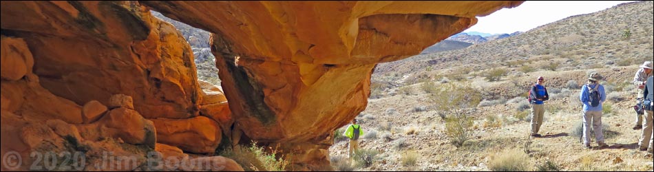
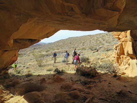
 Hikers under Doodlebug Arch (view NE) |
Overview The Doodlebug Arch Route is an interesting hike through the wild and scenic red-and-white sandstone country of Gold Butte. The route leads to a long sandstone arch where hikers might find doodlebugs in the soft sand under the arch. There are two main ways to get to Doodlebug Arch: hiking directly from Whitney Pocket to Doodlebug Arch (Doodlebug Arch Route) or hiking from Whitney Pocket down Amber Cat Canyon, then continuing down to Doodlebug Canyon, and finally hiking back up to Doodlebug Arch (Amber Cat - Doodlebug Loop). Presented here are details of the route from Doodlebug Arch directly back to the Whitney Pocket trailhead. For getting to the trailhead and safety concerns, or getting to Doodlebug Arch, see Doodlebug Arch Route and Amber Cat - Doodlebug Loop. Link to map. |
 Doodlebug Arch (view NE) |
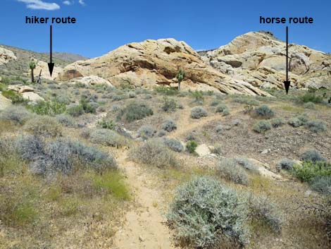
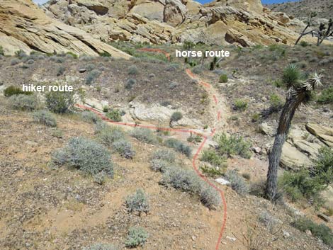
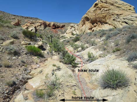
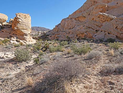
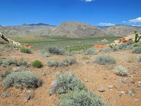
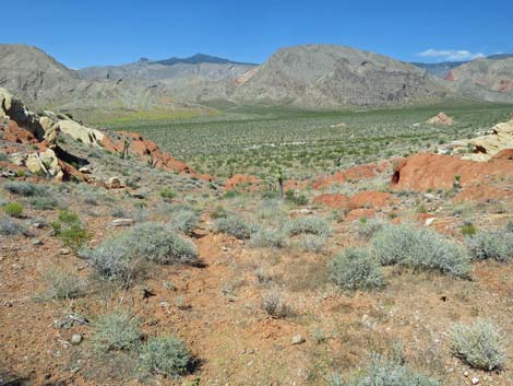
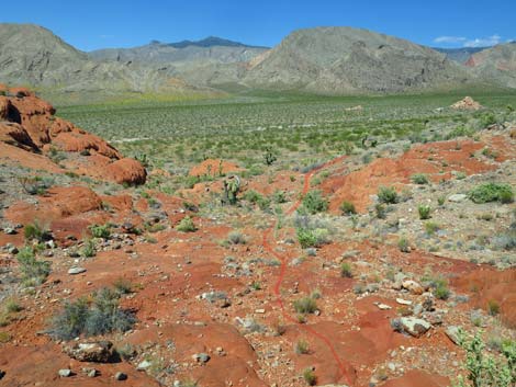
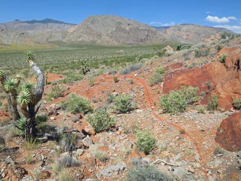
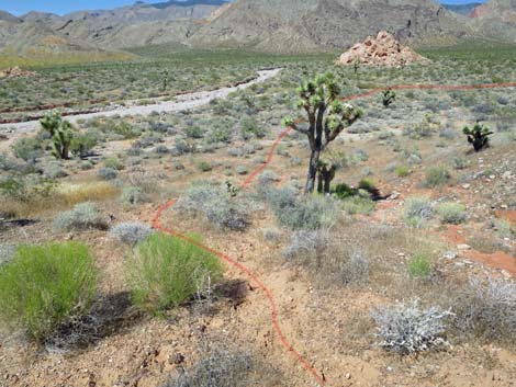
The Hike Departing Doodlebug Arch (Table 1, Waypoint 08), the use-trail runs straight down the hillside towards the wash, but then turns left at a fork in the faint use-trail. Staying left, the use-trail crosses the toe of the sandstone crag that forms the arch, then continues east across the hillside staying well above the canyon bottom. After running more-or-less on the contour, the use-trail soon dips steeply to cross what appears to be a side wash (Wpt. 07). The obvious use-trail continues straight across the wash and up the other side, but the use-trail is the horse route that bypasses interesting water-sculpted sandstone pour-overs where horses would have difficulty finding passage. The apparent "side wash" is the main wash, and hikers should drop into the wash, turn left, and continue up the main canyon. Horsemen should continue straight, as the horse route runs through a gap in the sandstone crags and returns to the main wash beyond the sculpted pour-overs. |
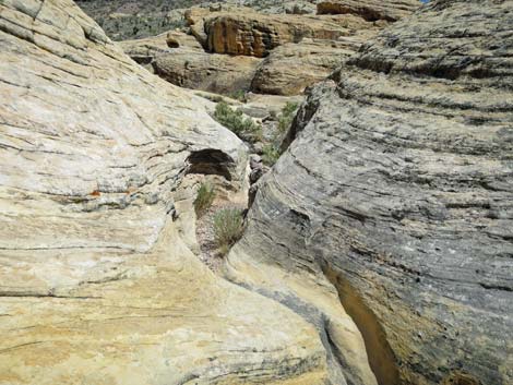
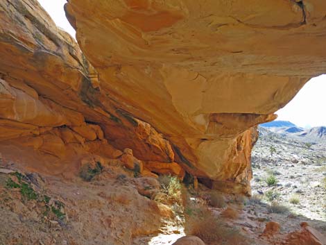 Under Doodlebug Arch (view SW) |
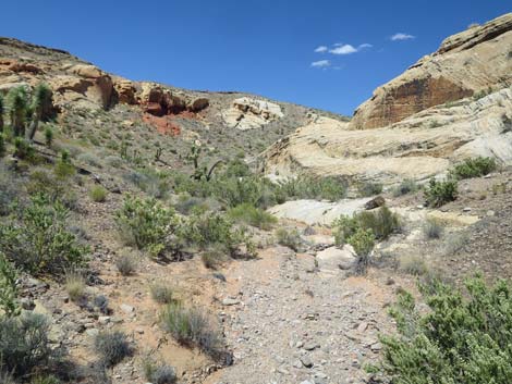
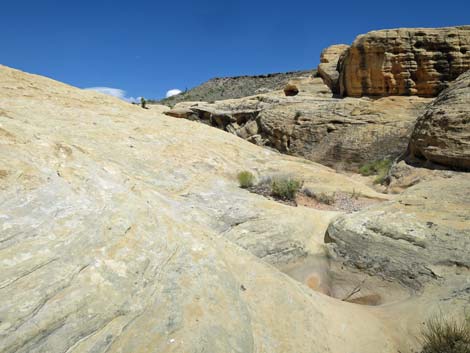
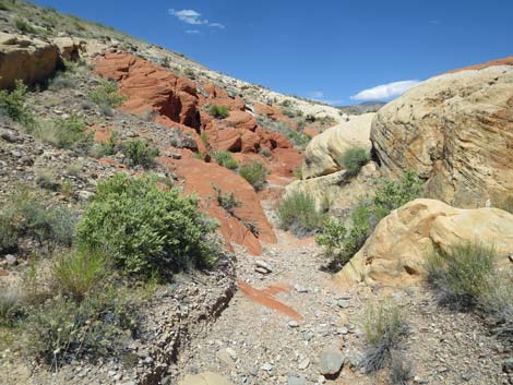
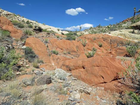
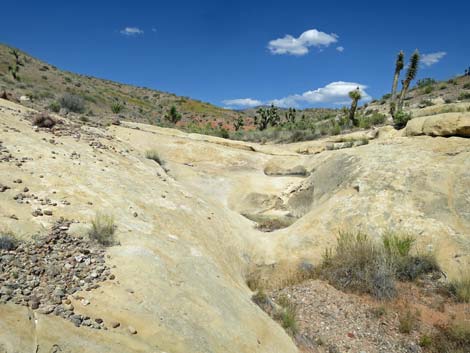
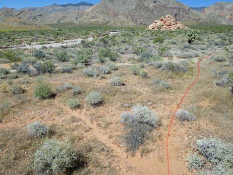
Hikers continuing up the wash will bend to the right and encounter a series of low pour-overs, slickrock, and several tinajas that retain water long after the rains stop. The running water sculpted the narrows with grooves and swirls in the stone. Above the slickrock, hikers return to a gravel wash, and shortly the horse route returns to the main wash (Wpt. 06). Continuing upstream, the route clambers over a jumbled red-sandstone pour-over (more of a cascade-over) and another spot of white sandstone slickrock with tinajas, then continues as a gravel wash with a use-trail on the south side. Following the use-trail for about 100 yards, the use-trail returns to the wash at a nondescript confluence (Wpt. 05) of two washes with some exposed red sandstone in the wash bottom. |
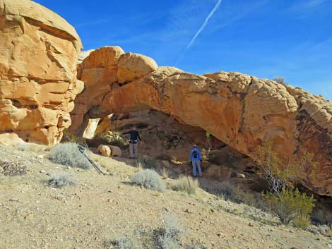
 Hikers preparing to depart Doodlebug Arch (view SW) |
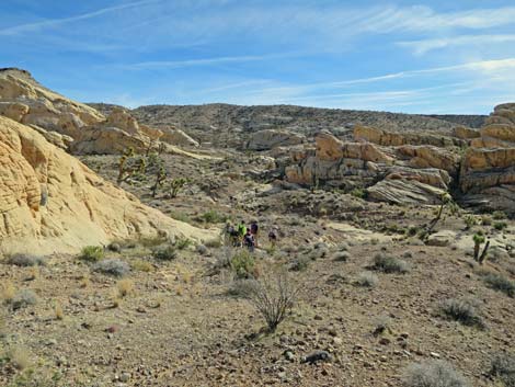
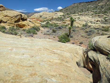
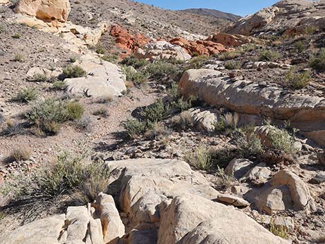
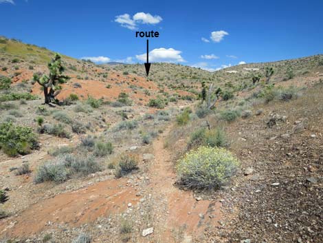
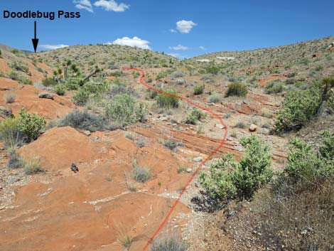
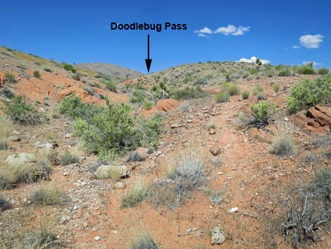
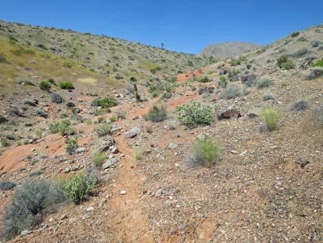
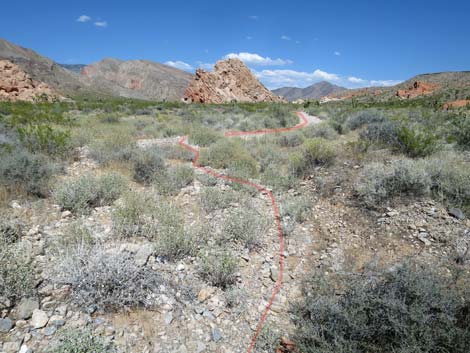
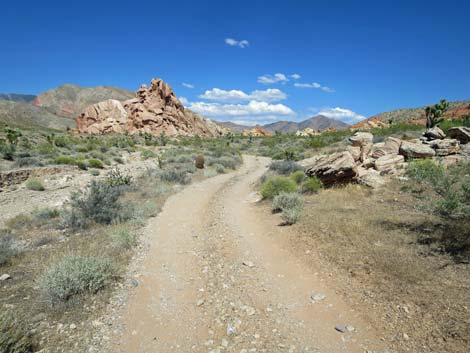
If hikers aren't paying attention, it would be easy to miss the turn in the route and continue straight up the right-hand canyon. However, from the confluence (Wpt. 05), hikers can look left across the red sandstone in the bottom of the wash and notice a bit of a use-trail heading up the left fork. Heading up the left fork, the use-trail becomes more obvious as it climbs the hillside towards the ridgeline above. After passing one more patch of red sandstone, the use-trail climbs atop Doodlebug Pass (Wpt. 04), which provides grand views to the northeast to the Virgin Mountains and the Whitney Pocket area. Descending over Doodlebug Pass (Wpt. 04), the use-trail runs down onto red slickrock. At the bottom of the slickrock, the use-trail resumes and bends right to traverse across the hillside descending at a gentle grade. |
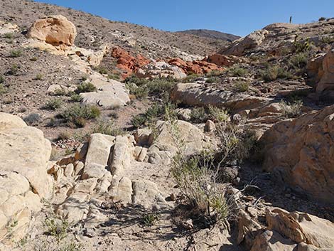
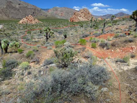
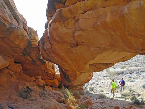 Hikers departing Doodlebug Arch (view SW) |
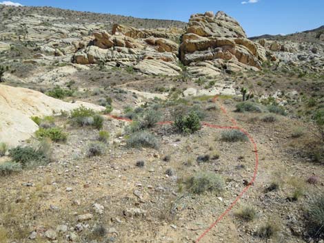
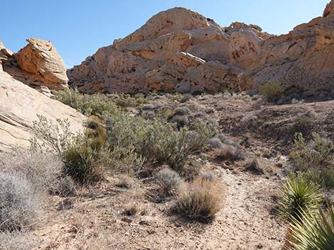
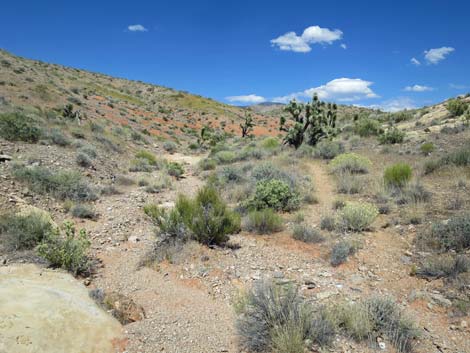
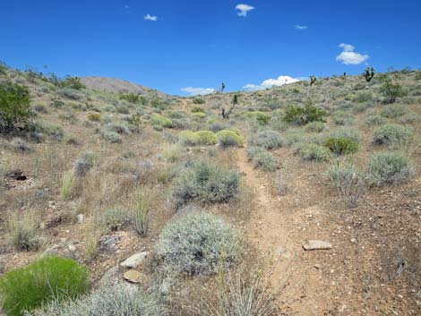
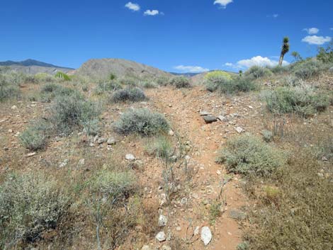
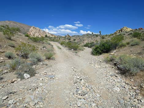
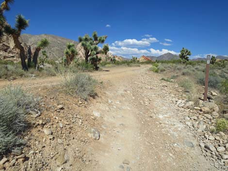
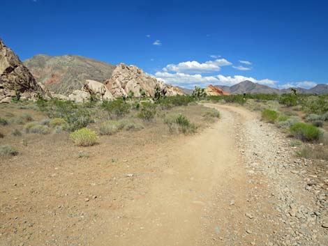
Parts of the use-trail on the hillside are faint, but the route continues across the slope staying more-or-less on the contour until passing the top of an outcrop of fractured red-and-white sandstone. A few yards past the colorful outcrop, the use-trail turns steeply downhill and drops into the wash. The route continues northeast across the wash to intersect a jeep trail (Wpt. 03). Turning right and heading east, the route follows the jeep trail up into a canyon bordered by a high ridge on the right and a string of sandstone crags on the left. The route eventually passes the use-trail (Wpt. 02) where hikers originally departed the jeep trail on the way to Amber Cat Pass. Continuing up the jeep trail, the route returns to the campsite road and heads east to the Whitney Pocket day-use parking area trailhead (Wpt. 01). |
 Hikers descending hillside below Doodlebug Arch (view S) |
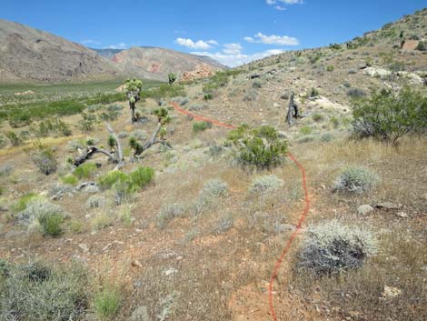
 The route forks; return to trailhead stays left (view SE) |
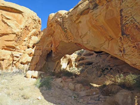
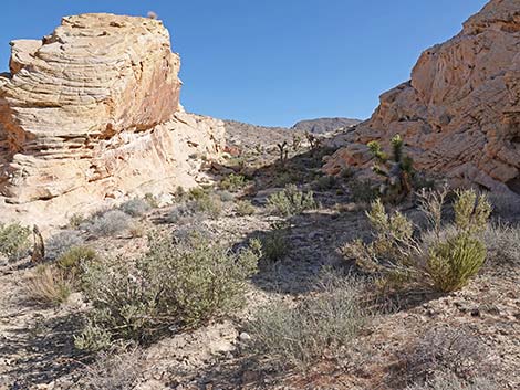
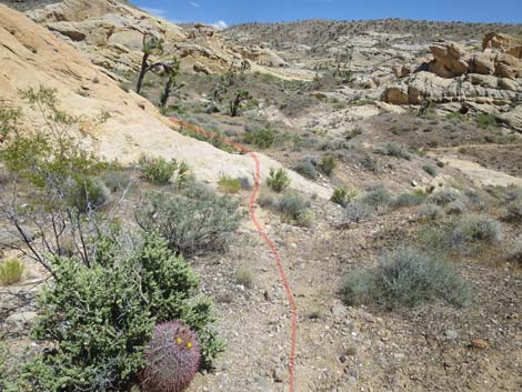 Route crosses sandstone at toe of the arch (view SE) |
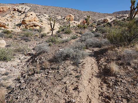
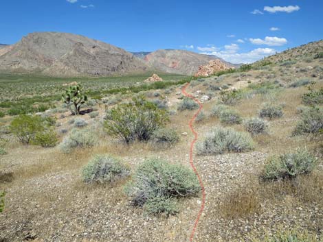
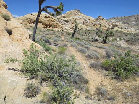 A well used use-trail becomes apparent (view E) |
 The well used use-trail traverses the hillside (view E) |
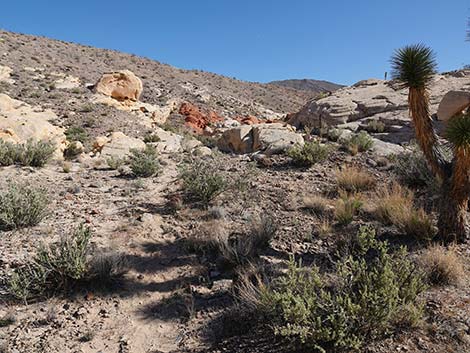
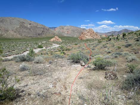
 At wash crossing, hiker and horsemen routes diverge (view E) |
Hiker Route
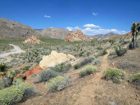
 Hiker route turns up the wash (view N) |
 Hiker route in the wash (view N) |
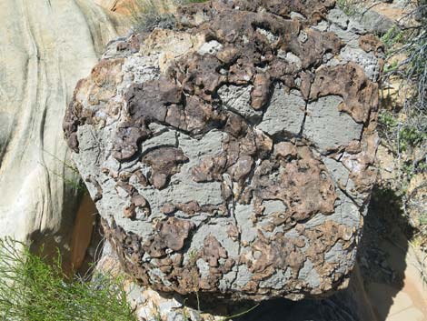 Limestone boulder erratic with fossiliferous materials |
 Route follows wash through sandstone canyon (view E) |
 Short and shallow, but nice water-sculpted narrows (view E) |
 Several tinajas in the sandstone (view E) |
 Crossing off the sandstone back into gravel wash (view NE) |
 More to come ... |
Horsemen Bypass Route
At wash crossing, hiker and horsemen routes diverge (view E) |
 Horsemen route bends left into canyon (view E) |
 Use-trail runs up between sandstone crags (view NE) |
 Use-trail runs up between sandstone crags (view NE) |
 Use-trail emerges from between sandstone crags (view NE) |
 Use-trail runs up over a low rise (view NE) |
 Atop low rise, Doodlebug Wash becomes visible again (view NE) |
 Horsemen route returns to Doodlebug Wash (view NE) |
Routes Converge
 Both routes continues up the main (view NE) |
 Route crosses nice red sandstone (view NE) |
 Route crosses nice white sandstone (view NE) |
 Horse trail parallels with wash (view NE) |
 Horse trail parallels with wash (view E) |
 Horse trail briefly returns to wash, then stays left at fork (view NE) |
 Faint use-trail runs up hillside adjacent to wash (view N) |
 Faint use-trail runs up hillside adjacent to wash (view N) |
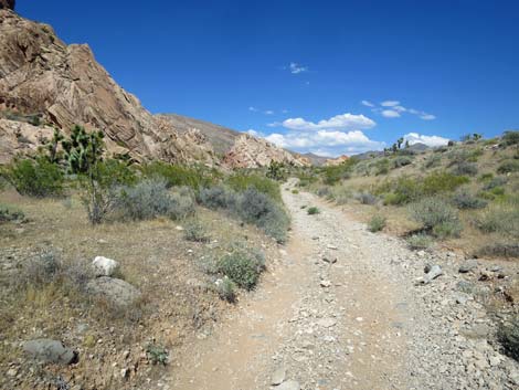
 Use-trail approaching Doodlebug Pass (view NE) |
 Use-trail arriving at Doodlebug Pass (view NE) |
 Use-trail atop Doodlebug Pass (view NE) |
 Doodlebug Pass (view NE) |
 Route starts down use-trail, then crosses slickrock (view NE) |
 Use-trail resumes below the slickrock (view NE) |
 Faint use-trail contours across the hillside (view NE) |
 Faint use-trail contours across the hillside (view NE) |
 Faint use-trail contours across the hillside (view NE) |
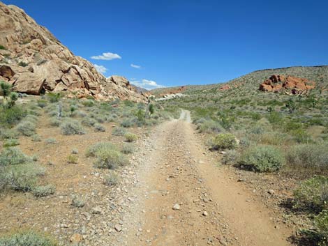
 Use-trail crosses above red-and-white sandstone crag (view E) |
 Beyond sandstone crag, use-trail cuts down hillside (view NE) |
 Use-trail cuts down hillside (view NE) |
 Use-trail cuts crosses side-wash to jeep trail (view NE) |
 Route approaching jeep trail (view NE) |
 Route merges onto jeep trail (view E) |
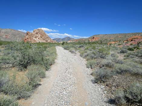
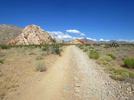
 Route follows jeep trail past sandstone crags (view E) |
 Route follows jeep trail past sandstone boulders (view E) |
 Jeep trail runs in the wash (view E) |
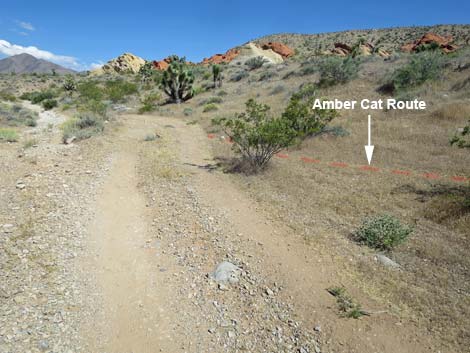 Jeep trail passing trail to Amber Cat Canyon (view E) |
 Jeep trail exits the wash (view E) |
 Jeep trail merges onto campsite road (view E) |
 Jeep trail continues towards main Whitney Pocket area (view E) |
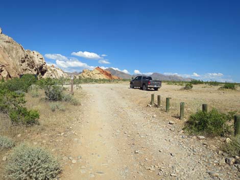
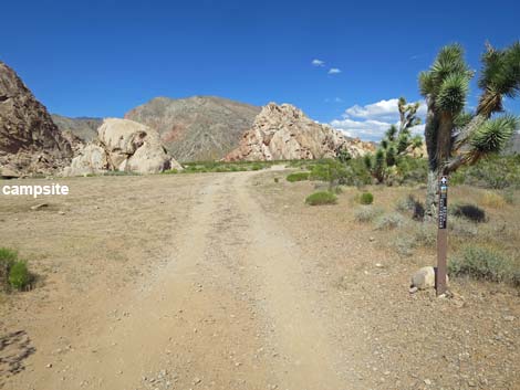 Jeep trail passes a large campsite (view E) |
 Jeep trail continues towards Whitney Pocket parking (view E) |
 Jeep trail arriving at Whitney Pocket trailhead parking (view E) |
More to come ... |
Table 1. Hiking Coordinates and Distances based on GPS Data (NAD27; UTM Zone 11S). Download Hiking GPS Waypoints (gpx) file.
| Wpt. | Location | UTM Easting | UTM Northing | Elevation (ft) | Point-to-Point Distance (mi) | Cumulative Distance (mi) |
|---|---|---|---|---|---|---|
| 08 | Doodlebug Arch | 754040 | 4044968 | 2,838 | 0.00 | 0.00 |
| 07 | Trail Junction | 754104 | 4044940 | 2,692 | 0.06 | 0.06 |
| 06 | Horse Route at Wash | 754222 | 4045068 | 2,736 | 0.15 | 0.21 |
| 05 | Wash Forks | 754372 | 4045124 | 2,778 | 0.12 | 0.33 |
| 04 | Doodlebug Pass | 754494 | 4045242 | 2,976 | 0.11 | 0.44 |
| 03 | Doodlebug Route at Jeep Road | 754887 | 4045454 | 2,893 | 0.30 | 0.74 |
| 02 | Amber Cat route at Jeep Road | 755730 | 4045487 | 3,059 | 0.55 | 1.29 |
| 01 | Trailhead | 756119 | 4045566 | 3,102 | 0.25 | 1.54 |
Happy Hiking! All distances, elevations, and other facts are approximate.
![]() ; Last updated 240325
; Last updated 240325
| Hiking Around Gold Butte | Hiking Around Las Vegas | Glossary | Copyright, Conditions, Disclaimer | Home |