Hiking Around Las Vegas, Gold Butte National Monument
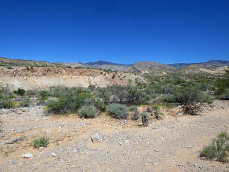
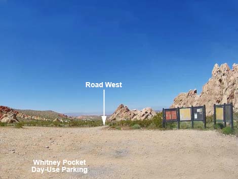 Whitney Pocket day-use parking area (view SW) |
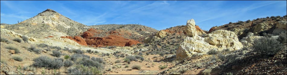
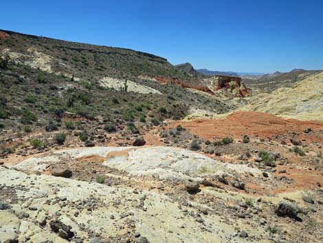
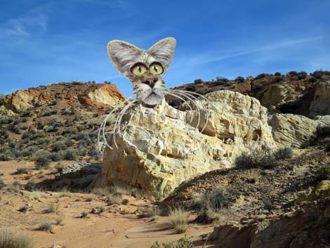
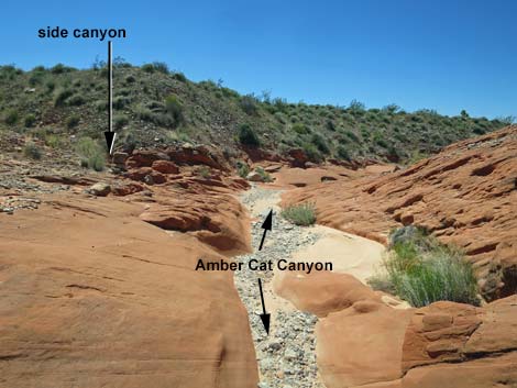
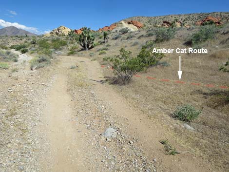
Overview Amber Cat Canyon provides a scenic hike down through an area of colorful (red, white, and amber) sandstone where the geology seems to be all jumbled up. This route runs 2.5 miles round-trip and is fairly easy, but the canyon section of the hike is entirely off-trail with some minor scrambling. Past the free-standing Amber Cat, hikers can turn back or continue onward and complete any of several loops. In the mixed-up geology, fanciful shapes appear on the landscape, but only to those with sufficient imagination. The name of the route is in reference to a feature that I've "seen," but I don't see it, yet to my eye, another feature (or two) almost perfectly resembles an Amber Cat. Hike the hike, turn up your imagination, and see what you see. This hike is accessible in a 2WD vehicle, it is only 2.5 miles round-trip, the terrain is gentle, it starts at Whitney Pocket (a popular camping and picnic area at the end of the pavement), and it can easily be extended to any of several longer loop hikes, but Amber Cat Canyon is not appropriate for horsemen because of slickrock narrows that are dangerous for horses. Link to map. |
 The route stays left past a campsite (view W) |
Watch Out Other than the standard warnings about hiking in the desert, ... this is a fairly safe hike, but some may find the uneven terrain and soft sand tiring, and loose rocks in the wash can be disconcerting. This is a wild and remote area without services of any kind (no restrooms, no water, no gas, no food). Bring what you need to survive. Be prepared and be self-reliant. Nobody will find you if you get lost in this area. Some cell phones work at points along the ridgeline above the canyon. While visiting the area, please respect the land and the other people out there, and try to Leave No Trace of your passage. Also, this is a fairly remote area, so be sure to bring what you need of the 10 Essentials. |
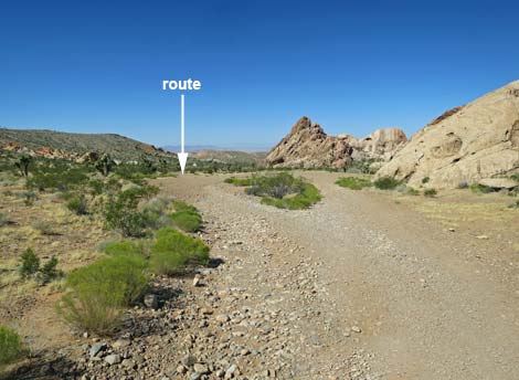
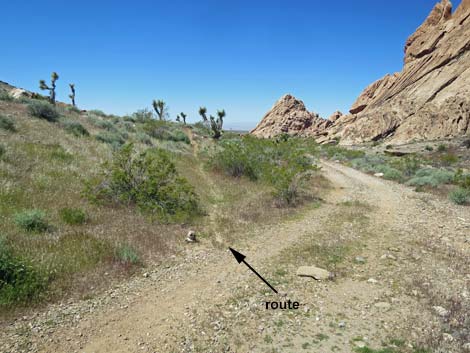
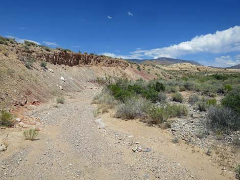
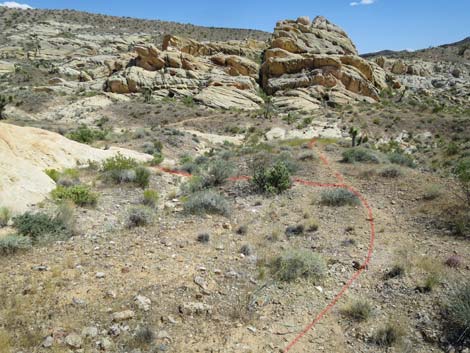
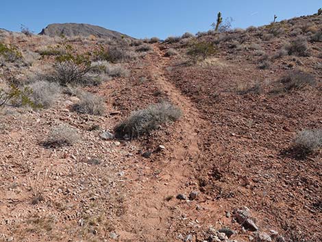
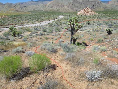
 The dirt road forks; route stays left (view W) |
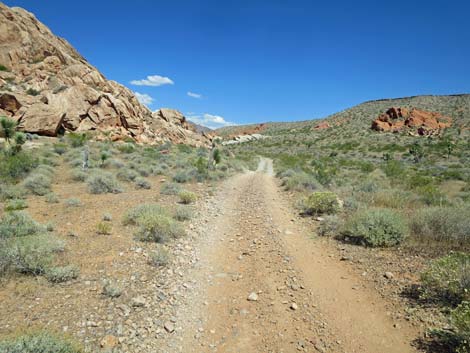
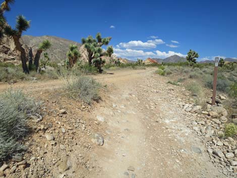
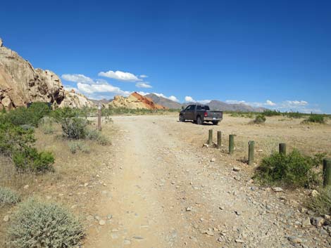
Getting to the Trailhead Amber Cat Canyon is located in the Whitney Pocket area of Gold Butte National Monument at the northeast end of Lake Mead, about 2 hours northeast of Las Vegas in a wild, remote, and scenic area. From town, drive out to Gold Butte National Monument. Drive east on Interstate-15 to Highway 170. Take Exit 112 south towards Riverside and Bunkerville. Drive south across the Virgin River, then quickly turn right onto the paved Gold Butte Road. Follow the pavement (there are no paved side roads) for 21 miles until the pavement ends at Whitney Pocket. Continue south on the unpaved Gold Butte Road for about 120 yards to a graded spur road to the right. Turn right onto the Whitney Pocket Day-Use Parking Lot where visitors will see information signs on the right. The trail starts on the dirt road just west (left) of the signs. Park here; this is the trailhead. |
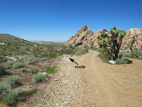
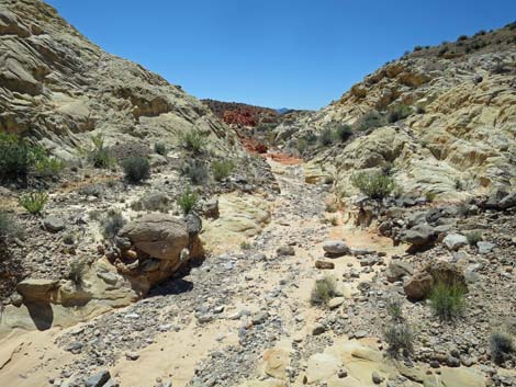
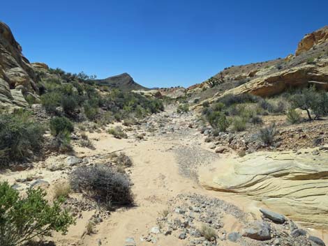
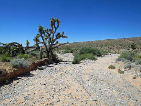
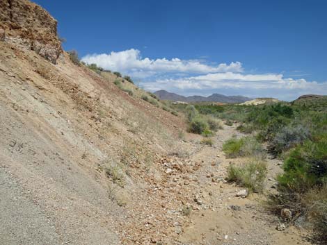
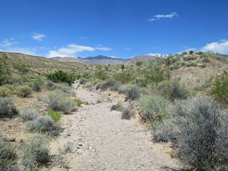
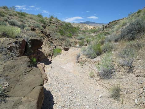
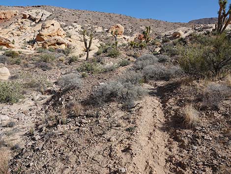
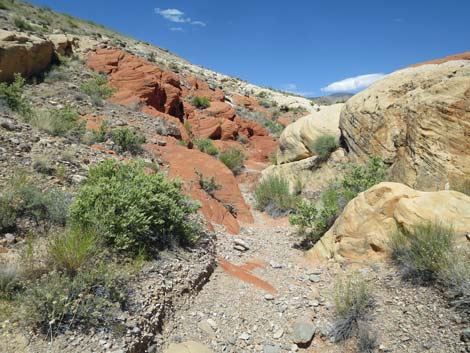
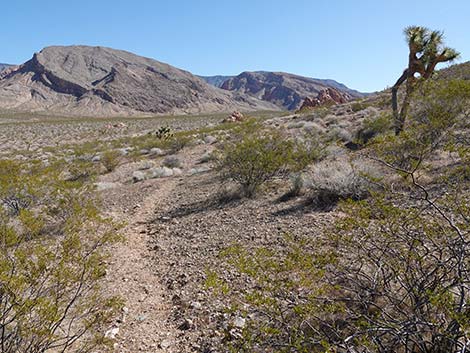
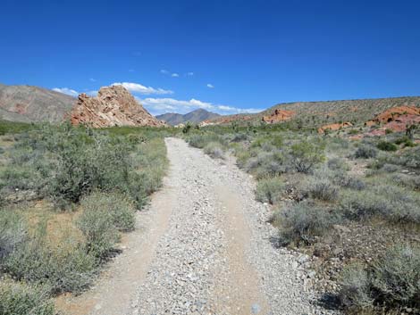
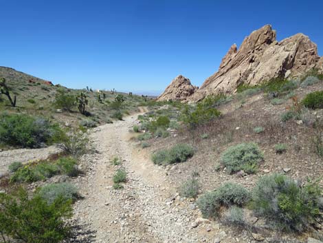 Dirt road drops into a wash (view W) |
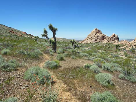
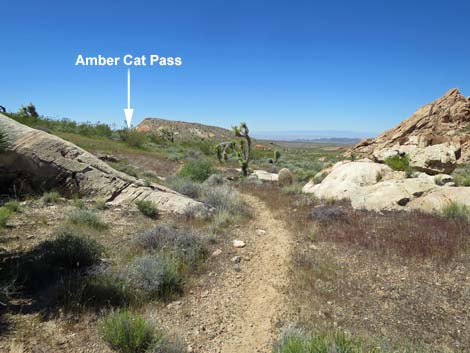
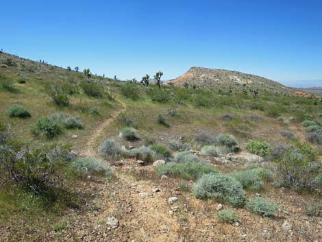
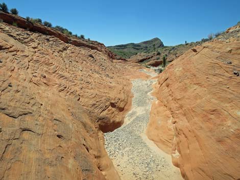
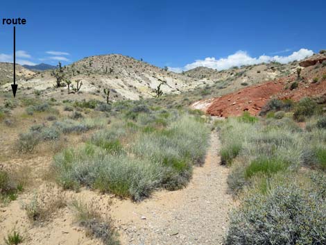
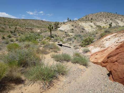
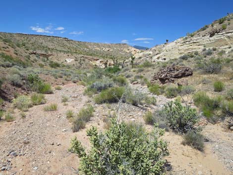
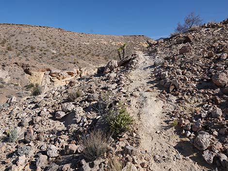
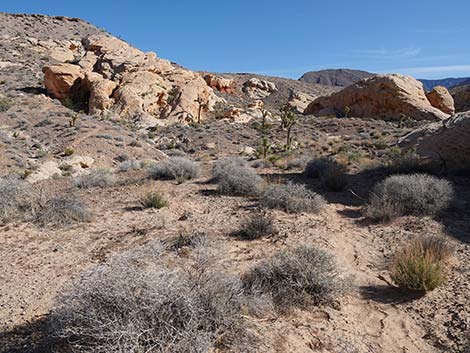
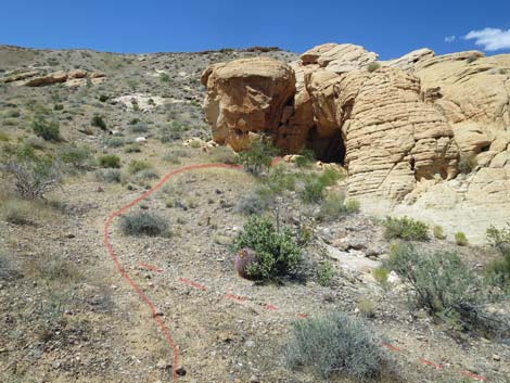
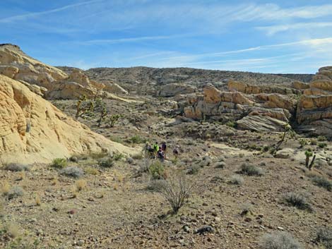
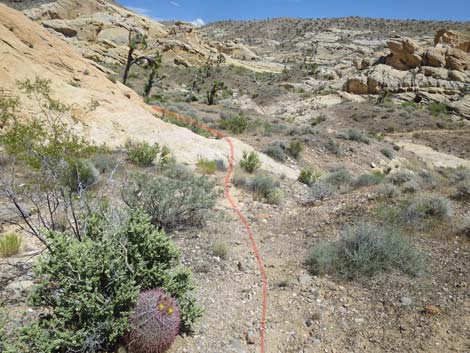
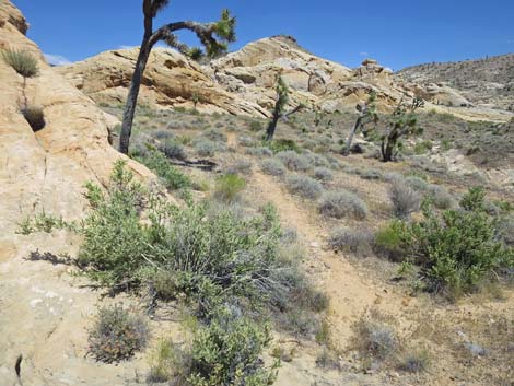
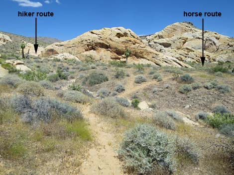
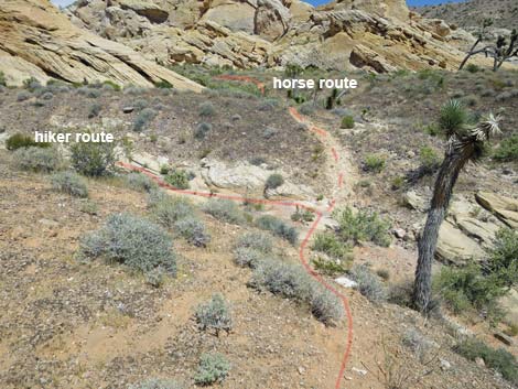
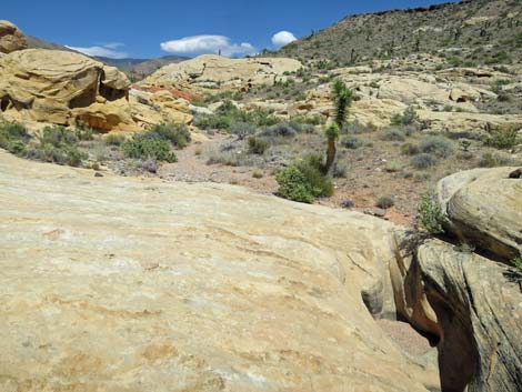
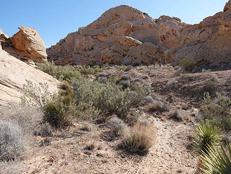
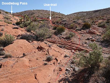
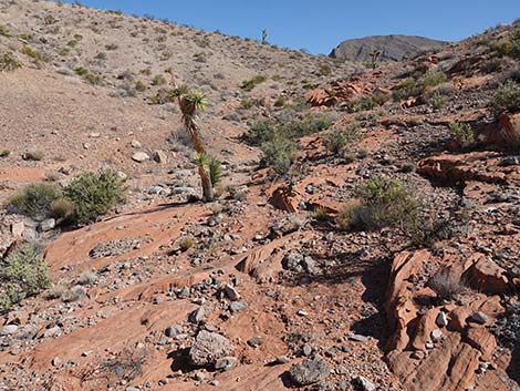
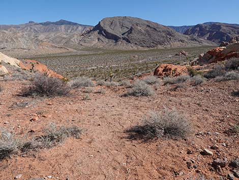
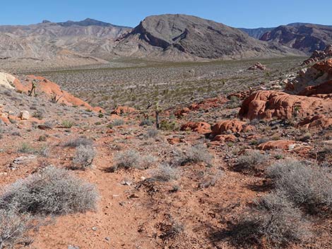
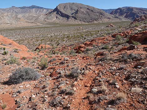
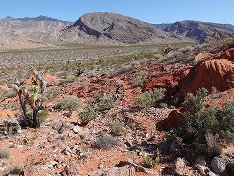
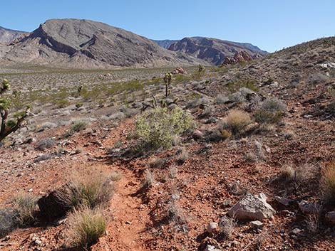
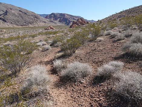
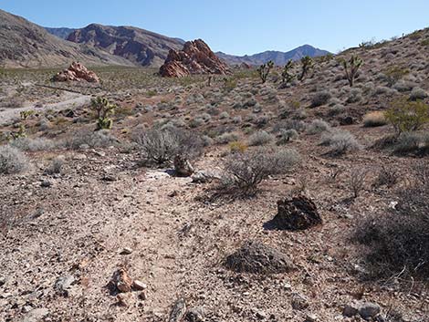
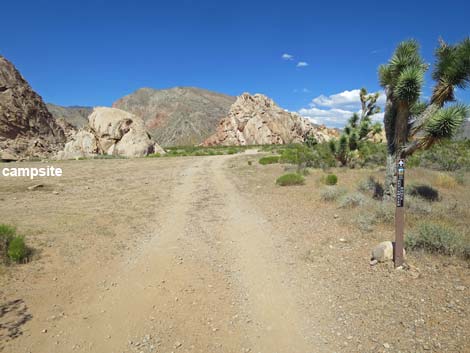
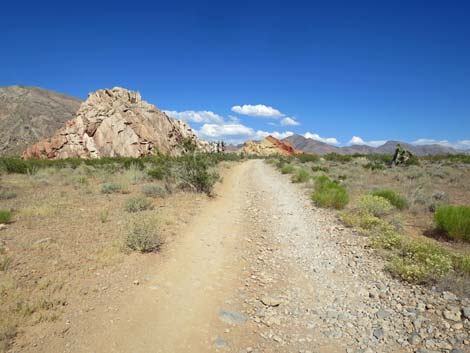
The Hike From the Whitney Pocket Day-Use Trailhead (Table 1, Waypoint 01), the route heads west on a dirt road that leads to two primitive campsites. Staying left at the first campsite (an alternative 2WD trailhead), the road continues west and forks. The route stays left at the fork and follows the jeep trail down towards the wash. For details of getting to the free-standing Amber Cat, see Amber Cat Canyon. The jeep trail crosses the wash, and in about 20 yards, a faint use-trail (Wpt. 13) departs the road to the left. The faint use-trail quickly becomes more apparent as it runs westward on the gentle hillside above the jeep trail. When the use-trail passes through a gap in a low, white sandstone outcrop, Amber Cat Pass comes into view in the distance ahead, which gives hikers a visual target while traversing the hillside. The use-trail climbs gently across the hillside and eventually runs up to Amber Cat Pass (Wpt. 16). |
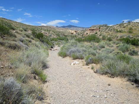
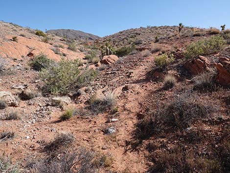
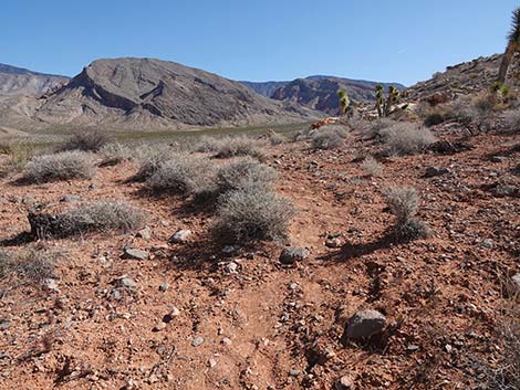
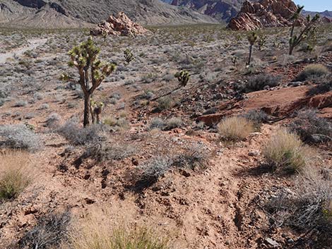
 Across the wash, a faint use-trail departs the road (view W) |
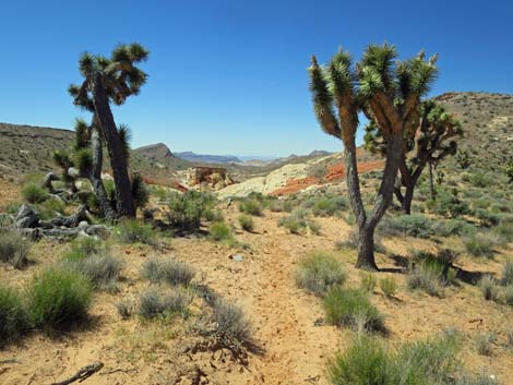
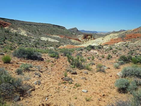
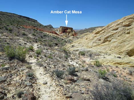
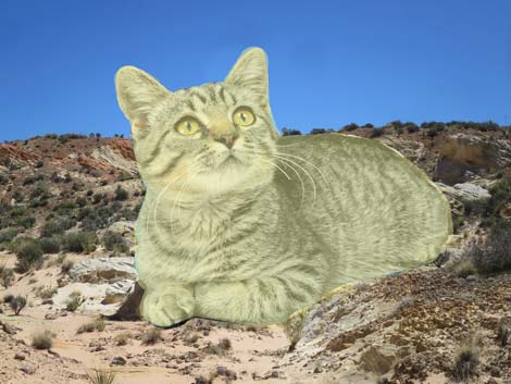
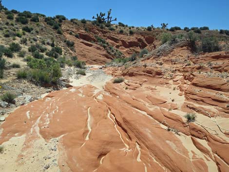
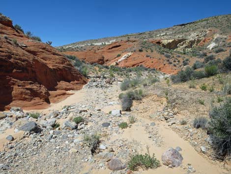
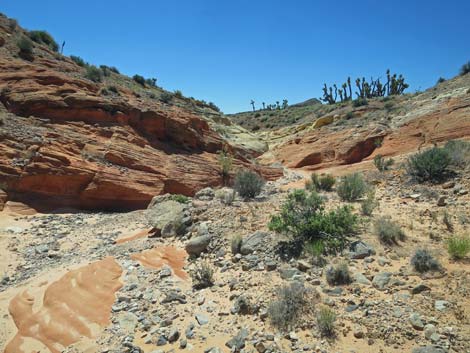
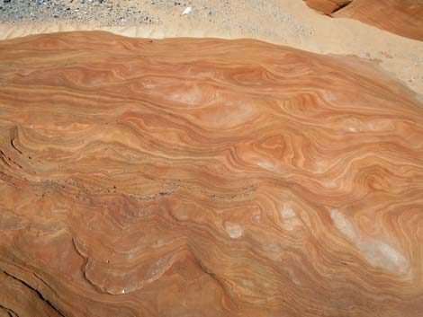
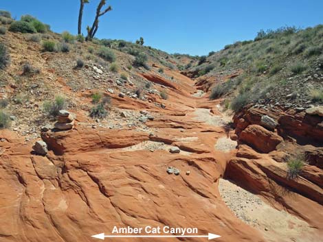
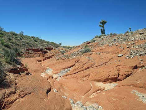
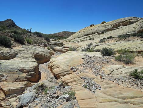
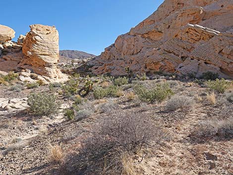
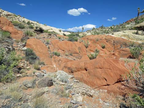
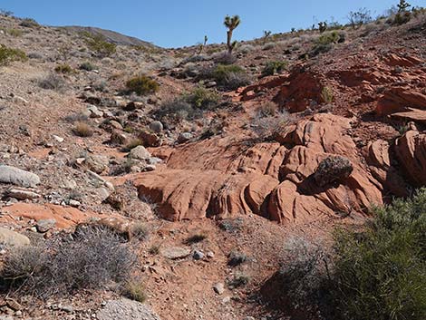
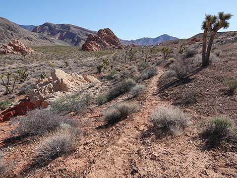
Continuing over Amber Cat Pass (Wpt. 16), the route is clear: just head down into the canyon. In the canyon bottom, and from there on down, the route is a mix of walking down the wash and looking for use-trails that run on sandy soils above the wash. At about 0.9 miles out, hikers arrive at the base of Amber Cat Mesa (Wpt. 15), which was first visible from atop Amber Cat Pass. This flat-topped geologic feature is one of the more curious items in Amber Cat Canyon. I've been told that the "Amber Cat," for which Amber Cat Canyon is named, resides on the high walls of the mesa, but to my eye, it just isn't there. Continuing down the canyon, the route runs in and out of the wash, crossing on and off soft sand, bright red sandstone, white sandstone, the occasional limestone boulder, and even some metamorphic boulders. |
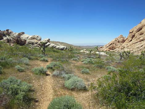
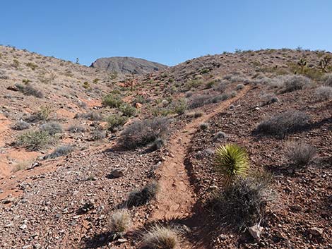
 The use-trail quickly becomes more apparent (view W) |
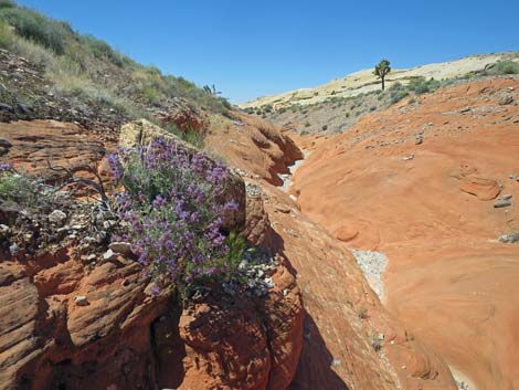
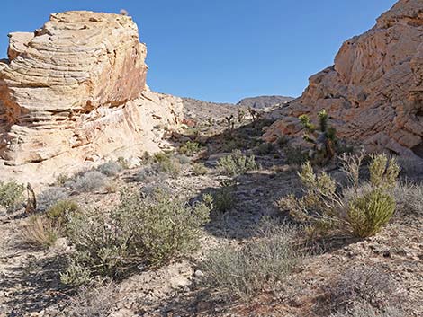
At about 1.15 miles out, the route passes a sandstone formation on the north (right) side of the canyon that resembles an amber cat. With some imagination and the right angle, I can see that, but it isn't very satisfying. Continuing down canyon, at about 1.26 miles out, hikers can look left (east, but it seems south) and see the "real," free standing Amber Cat (Wpt. 14). To my eye, this feature takes little imagination to see a cat crouching in a relaxed pose with its head up, but some say this this is more like an Amber Turtle. I guess it's all in the eye of the beholder. From this point, hikers can return up the canyon or continue down the canyon to make one of several loops (see map for ideas). The Amber Cat Canyon--Doodlebug Canyon Loop Route continues down Amber Cat Canyon. |
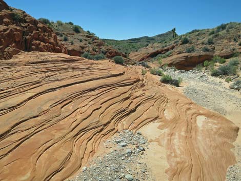
 Use-trail approaching white sandstone crags (view W) |
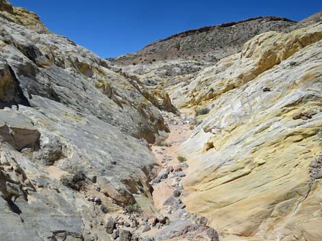
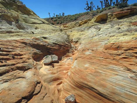
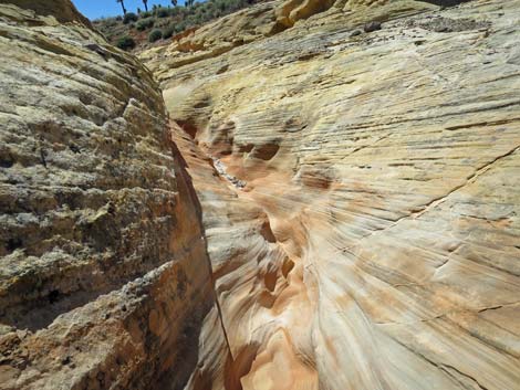
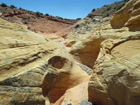
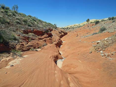
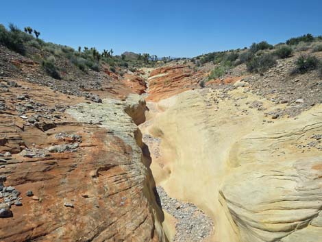
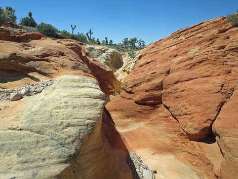
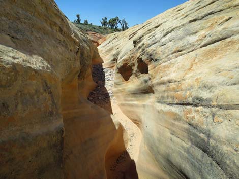
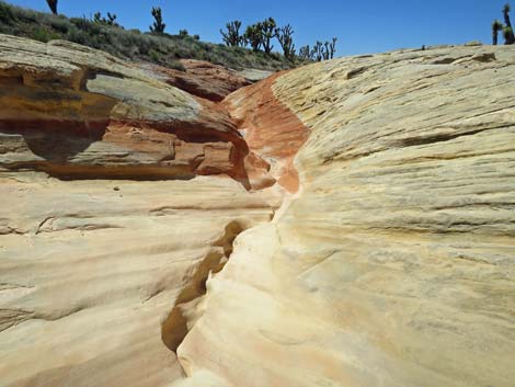
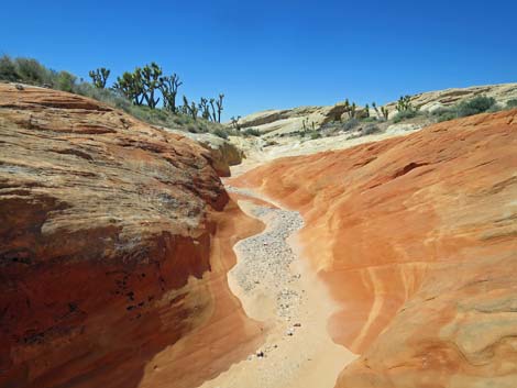
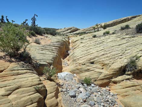
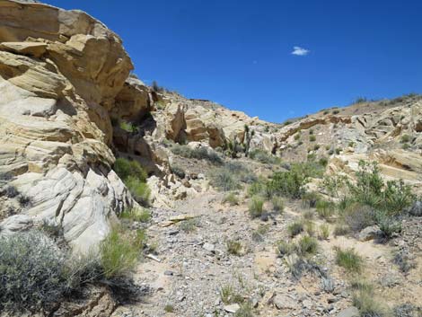
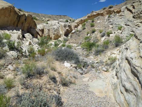
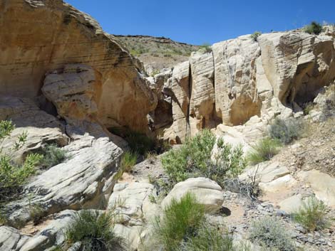
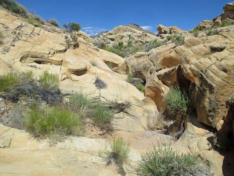
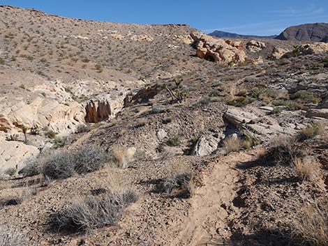
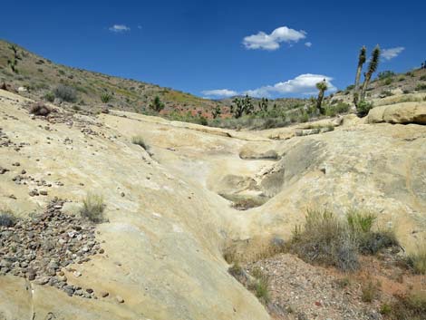
Continuing down canyon past the Amber Cat (Wpt. 14), the route runs through some remarkable areas where eroded red and white sandstone in the wash bottom have been sculpted by the forces of rushing water into several sets of shallow, but very nice narrows. At about 0.2 miles below the Amber Cat, in an area of nicely sculpted red narrows, a side wash (Wpt. 13) comes in from the right (southeast) side. While easy to miss, this side canyon can be used as an alternate route back to the trailhead (be sure to bring a good map). From this confluence, the route continues down through nicely sculpted narrows cut into areas of red and areas of white sandstone. In another 0.3 miles, the route passes the last of the sandstone crags and the wash flows out into a broad, desert valley thickly vegetated with desert shrubs and Joshua Trees. |
 Use-trail passing through gap white sandstone crags (view W) |
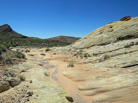
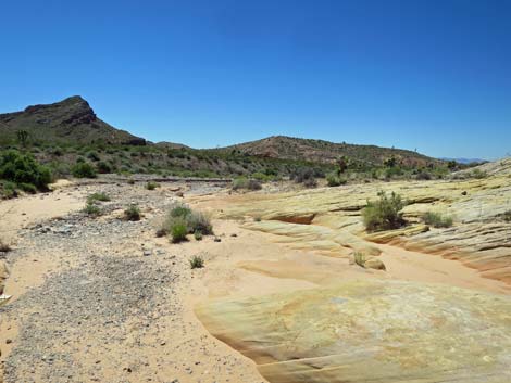
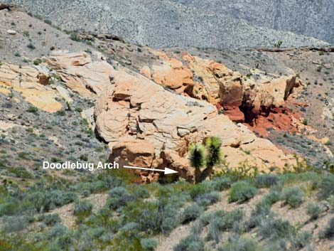
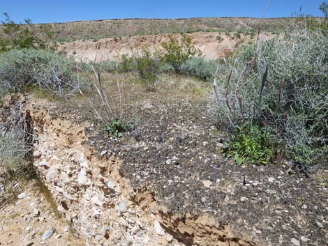
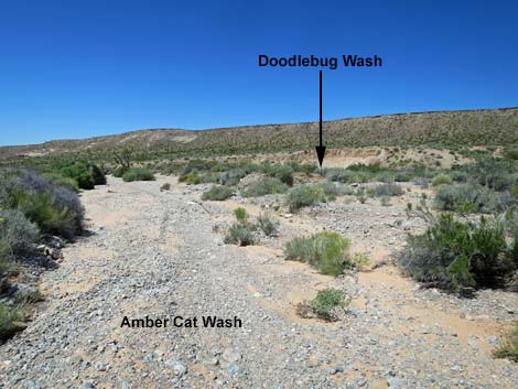
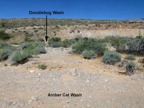
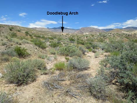
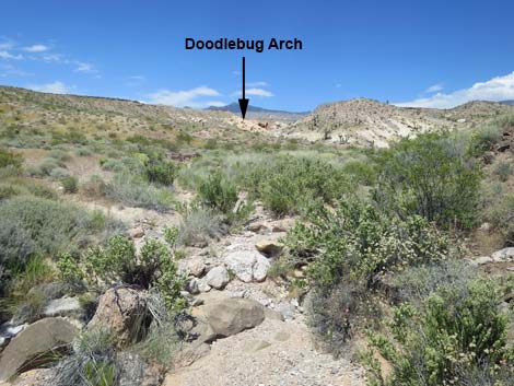
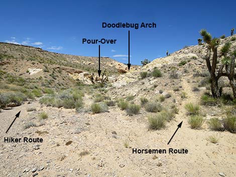
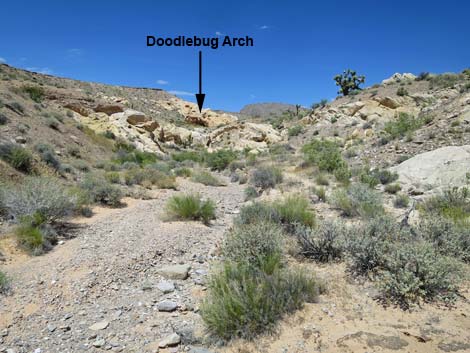
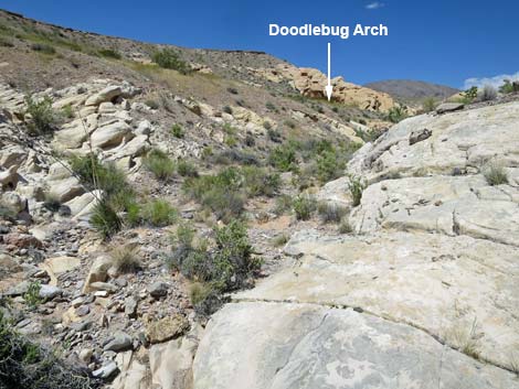
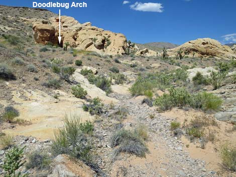
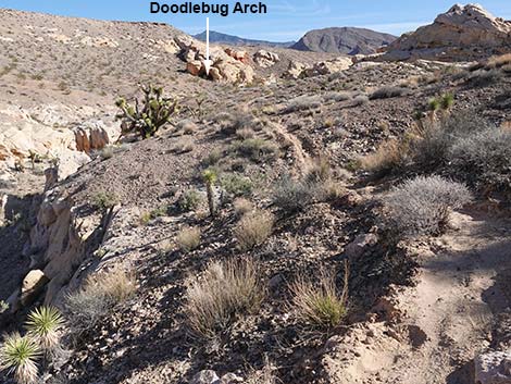
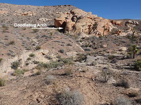
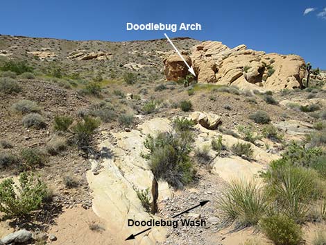
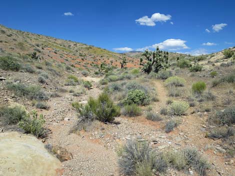
In this broad, open valley, hikers can look right and see Doodlebug Canyon, the major canyon coming down from the north. In the background above Doodlebug Canyon, Virgin Peak stands some 8,000 ft high, and below the peak, white sandstone outcrops can be seen in the canyon. One of those outcrops holds Doodlebug Arch, but it is better to continue down Amber Cat Wash to the confluence with Doodlebug Wash before turning north. While slightly longer, the hiking is much easier in the washes, and the ground in this area is unusually well-crusted with biological soil crust, and we should all avoid busting the crust (learn why). Continuing down Amber Cat Wash, hikers soon arrive at the confluence with Doodlebug Wash (Wpt. 11), which sits adjacent to a colorful cliff of eroding dirt. Here, the route turns right to head northeast up Doodlebug Wash. Initially, Doodlebug Wash runs nearly parallel to Amber Cat Wash, but soon it bends left to run up into Doodlebug Canyon. |
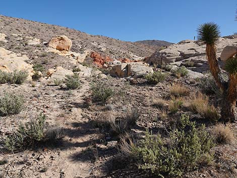
 Use-trail continues towards Amber Cat Pass (view W) |
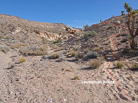
As is often the problem when hiking up a canyon, it can be hard to decide which fork to take when the canyon splits. When hiking up Doodlebug Canyon, hikers should always stay to the left following along the high right to the north. For horsemen, however, it is not so simple. Heading up Doodlebug Canyon, hikers pass two places where the wash cuts through layers of curious, dark-colored conglomerate rock that is a mix of sand and gravels (suggesting an ancient river deposit). It isn't clear if there are two layers of this rock or if it is one layer twisted by geologic processes. Just above the second conglomerate layer, the route passes an outcrop of bright red sandstone on the right edge of the wash that makes a good landmark. This is the first red sandstone outcrop encountered along the wash. |
 Use-trail arriving atop Amber Cat Pass (view SW) |
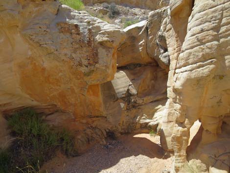
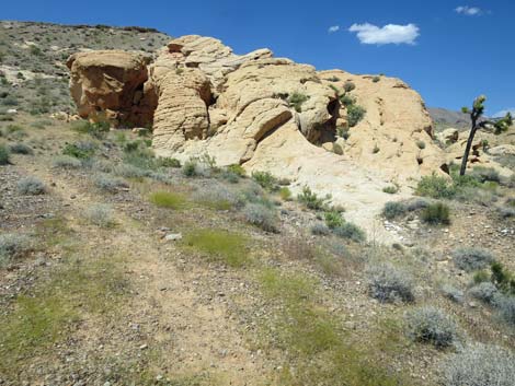
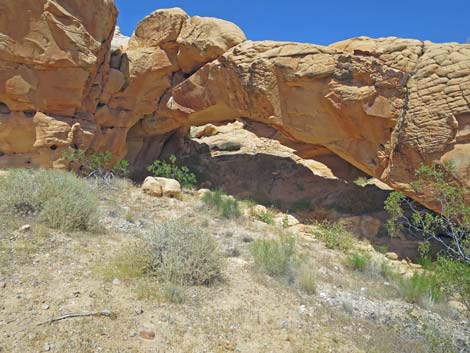
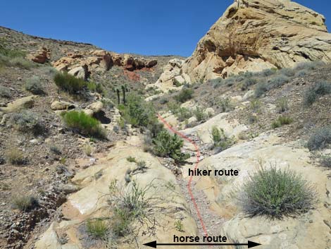
Just past the red sandstone landmark, the wash forks, and the route stays left into the rockier canyon. Passing an enormous gray caliche boulder on the right side of the wash, horsemen should begin looking for use-trails that climb out the right side of the wash onto a broad bench that parallels the wash bottom. Because of a high pour-over up the canyon, horsemen need to take this detour. About 200 yards past the red sandstone outcrop, hikers arrive at the high pour-over (Wpt. 10). It looks difficult to climb, with a twist in the slot that throws one off balance, but it is surprisingly easy if hikers use their left hand to brace against the left wall about halfway up, and there is a hidden handhold for the right hand higher up. Standing atop the pour-over, Doodlebug Arch is visible about 200 yards up the canyon. Following the wash upstream, hikers clamber over two sets of water-sculpted sandstone outcrops and arrive at a point in the wash directly below the arch (Wpt. 09). Here, a tongue of sandstone slickrock leads to a use-trail that runs straight up the hillside to Doodlebug Arch (Wpt. 08). |
 First view into Amber Cat Canyon (view SW from Amber Cat Pass) |
For details of the route from Doodlebug Arch to the trailhead, see Doodlebug Canyon--Eastbound. Horsemen should see the details. Departing Doodlebug Arch (Wpt. 08), the use-trail runs straight down the hillside towards the wash, but then turns left at a fork in the faint use-trail. Staying left, the use-trail crosses the toe of the sandstone crag that forms the arch, then continues east across the hillside staying well above the canyon bottom. After running more-or-less on the contour, the use-trail soon dips steeply to cross what appears to be a side wash (Wpt. 07). The obvious use-trail continues straight across the wash and up the other side, but the use-trail is the horse route that bypasses interesting water-sculpted sandstone pour-overs. The apparent "side wash" is the main wash, and hikers should drop into the wash, turn left, and continue north in the main canyon. Hikers continuing up the wash will bend to the right and encounter a series of low pour-overs, slickrock, and several tinajas that retain water long after the rains stop. |
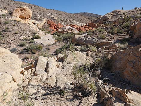
 Route descends slickrock into Amber Cat Canyon (view SW) |
Above the slickrock, hikers return to a gravel wash, and shortly the horse route returns to the main wash (Wpt. 06). Continuing upstream, the route clambers over a jumbled red-sandstone pour-over and a bit of white sandstone slickrock with tinajas, then continues as a gravel wash with a use-trail on the south side. Following the use-trail for about 100 yards, the use-trail returns to the wash at a nondescript confluence (Wpt. 05) of two washes with some exposed red sandstone in the wash bottom. From the confluence (Wpt. 05), hikers can look left across the red sandstone in the bottom of the wash and notice a bit of a use-trail heading up the left fork. Heading up the left fork, the use-trail becomes more obvious as it climbs the hillside towards the ridgeline above. After passing one more patch of red sandstone, the use-trail climbs atop Doodlebug Pass (Wpt. 04). Descending over Doodlebug Pass (Wpt. 04), the use-trail runs down onto red slickrock. At the bottom of the slickrock, the use-trail resumes and bends right to descend gently across the hillside. |
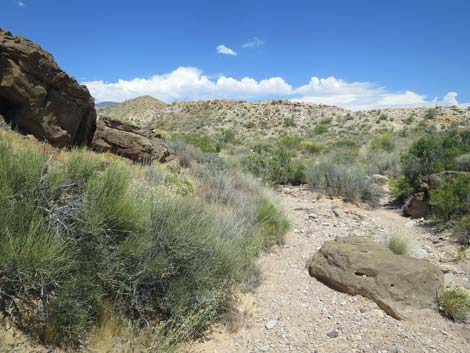
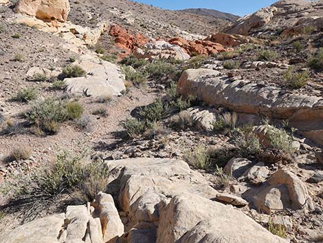
 Parts of the route follow use-trails (view SW) |
Parts of the use-trail on the hillside are faint, but the route continues across the slope staying more-or-less on the contour until passing the top of an outcrop of fractured red-and-white sandstone. A few yards past the colorful outcrop, the use-trail turns steeply downhill and drops into the wash. The route continues northeast across the wash to intersect a jeep trail (Wpt. 03). Turning right and heading east, the route follows the jeep trail up into a canyon bordered by a high ridge on the right and a string of sandstone crags on the left. The route eventually passes the use-trail (Wpt. 02) where hikers originally departed the jeep trail on the way to Amber Cat Pass. Continuing up the jeep trail, the route returns to the campsite road and heads east to the Whitney Pocket day-use parking area trailhead (Wpt. 01). |
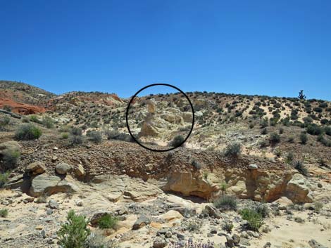
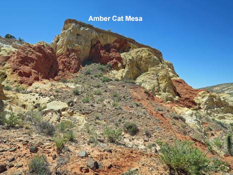 Some say the real Amber Cat is on the side of Amber Cat Mesa |
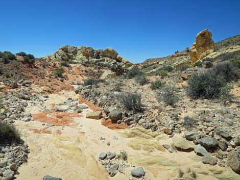
 Route running in the wash bottom (view W) |
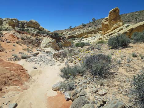
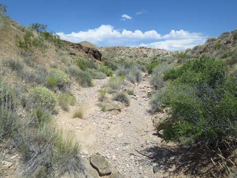
 Easy walking in the canyon bottom (view S) |
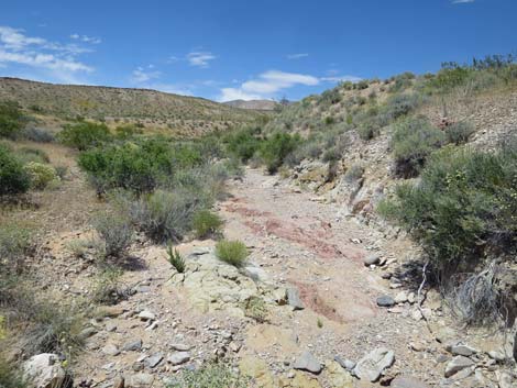
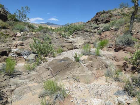
 Colorful sandstone in the wash bottom (view W) |
 Some say the boulder on the right looks like an Amber Cat (view W) |
 This takes some imagination too |
 Soft sand in the wash bottom (view SW) |
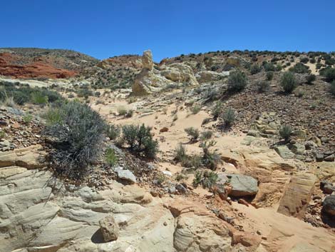
 The free-standing Amber Cat comes into view (view SE) |
 The free-standing Amber Cat (view E from canyon bottom) |
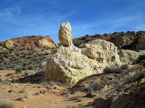 The free-standing Amber Cat takes a bit of imagination ... |
 Some ears and eyes help visualize the free-standing Amber Cat |
 ... but this is how I see the free-standing Amber Cat (view E) |
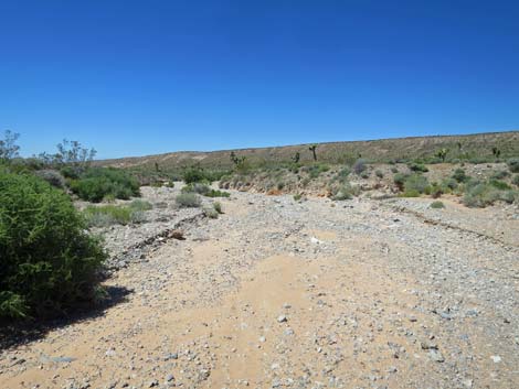
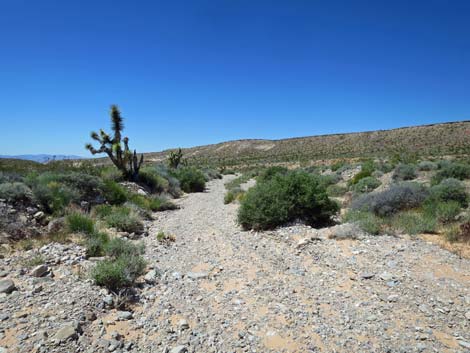
 The route continues down Amber Cat Wash (view SW) |
 The route continues down Amber Cat Wash (view SW) |
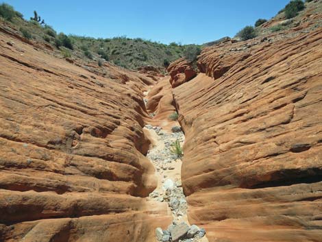
 Sand and gravel give way to a narrow, slickrock wash bottom |
 Horsemen need to exit the wash bottom onto the side-slopes above |
 |
 |
 |
 |
 |
 |
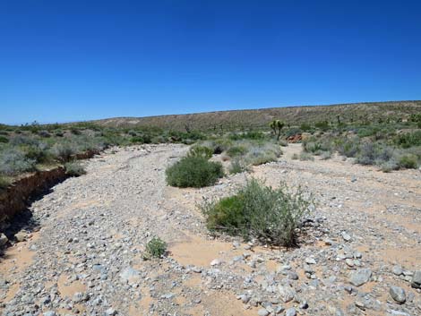
 Amber Cat Wash passes a side canyon (view SW) |
 Side canyon (view S from Amber Cat Wash) |
 The route continues down the slick-rock wash bottom |
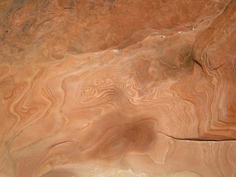
 Interesting erosion patterns on the slick-rock wash bottom |
 |
 |
 |
 |
 |
 |
 |
 |
 |
 |
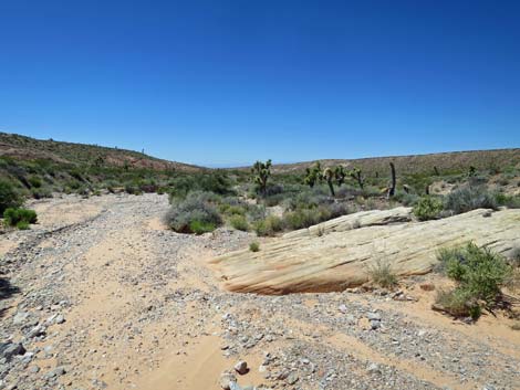
 Approaching the end of the sandstone crags in this area (view SW) |
 Last of the sandstone slickrock in this area (view SW) |
 The route continues down Amber Cat Wash (view SW) |
 One last bit of white sandstone (view W) |
 |
 |
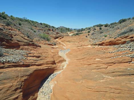
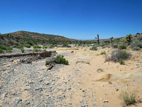
 All forks in the wash lead downstream (view W) |
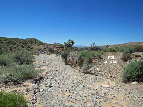 Looks like a road, but it is not: route stays in the wash (view W) |
 Amber Cat Wash (view W) |
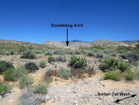 Doodlebug Arch in the distance (view N from Amber Cat Wash) |
 Doodlebug Arch (super-zoom; view N from Amber Cat Wash) |
 Heavy cryptobiotic crust in this area (please don't bust the crust) |
 Approaching confluence of Amber Cat and Doodlebug washes |
 Easy cross-over from Amber Cat Wash to Doodlebug Wash (view N) |
 Doodlebug Wash (view NE from Amber Cat Wash) |
 The route turns up Doodlebug Wash (view NE) |
 Route runs up along colorful, eroding cliffs (view NE) |
 Doodlebug Arch is again visible in the distance (view NE) |
 |
 |
 Doodlebug Wash approaching first conglomerate layer (view NE) |
 Doodlebug Wash at first conglomerate layer (view NE) |
 |
 |
 Doodlebug Wash at second conglomerate layer (view NE) |
 Doodlebug Arch is again visible in the distance (view NE) |
 Route follows the main wash (view NE) |
 Route stays in the main wash (view NE) |
 Approaching an interesting boulder (on right) with fossils (view NE) |
 Horsemen and hiker routes diverge (view N) |
Hiker Route Climbs Pour-Over
 The route continues up Doodlebug Wash (view NE) |
 The route continues up Doodlebug Wash (view NE) |
 The route continues up Doodlebug Wash (view NE) |
 Doodlebug Wash approaching the pour-over (view NE) |
 Doodlebug Wash at the pour-over (view N) |
 Above the pour-over, Doodlebug Wash continues (view NE) |
 Another bit of interesting slickrock in Doodlebug Wash (view NE) |
 Doodlebug Wash approaching Doodlebug Arch (view NE) |
Horsemen Route Bypasses Pour-Over
 Horsemen route climbs out of the wash (view NE) |
 Horsemen route traverses hillsides (view NE) |
 Doodlebug Arch comes into view (view NE) |
 Horsemen route traverses hillsides (view NE) |
 |
 |
 Horsemen route returns to the wash below Doodlebug Arch |
 More to come ... |
The Two Routes Converge Below the Arch
 Doodlebug Arch is visible above Doodlebug Wash (view N) |
 Route approaching Doodlebug Arch (view N) |
 Junction of upstream and downstream routes (view N) |
 Doodlebug Arch (view NE) |
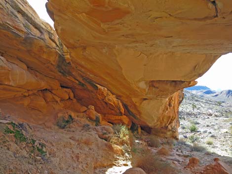 Under Doodlebug Arch (view SW) |
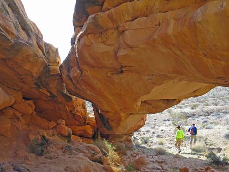 Hikers departing Doodlebug Arch (view SW) |
 Departing hikers descend hillside below Doodlebug Arch (view S) |
 The route forks; return to trailhead stays left (view SE) |
 Route crosses sandstone at toe of the arch (view SE) |
 A well used use-trail becomes apparent (view E) |
 The well used use-trail traverses the hillside (view E) |
 At wash crossing, hiker and horsemen routes diverge (view E) |
Hiker Route Continues Up the Wash
 Hiker route turns up the wash (view N) |
 Hiker route follows wash through sandstone canyon (view E) |
 Crossing off the sandstone back into gravel wash (view NE) |
More to come ... |
Horsemen Route bypasses Slickrock Narrows
At wash crossing, hiker and horsemen routes diverge (view E) |
 Horsemen route bends left into canyon (view E) |
 Use-trail runs up between sandstone crags (view NE) |
 Use-trail runs up between sandstone crags (view NE) |
 Use-trail emerges from between sandstone crags (view NE) |
 Use-trail runs up over a low rise (view NE) |
 Atop low rise, Doodlebug Wash becomes visible again (view NE) |
 Horsemen route returns to Doodlebug Wash (view NE) |
The Two Routes Converge
 The horse route returns to the main wash near here (view NE) |
 Route crosses nice red sandstone (view NE) |
 Route crosses nice white sandstone (view NE) |
 Horse trail parallels with wash (view NE) |
 Eventually the use-trail exits the wash towards Doodlebug Pass |
 Use-trail climbing out along side wash (view NE) |
 |
 |
 |
 |
 Arriving atop Doodlebug Pass (view NE) |
 Doodlebug Pass (view NE) |
 The use-trail continues straight over Doodlebug Pass (view NE) |
 The use-trail continues below Doodlebug Pass (view NE) |
 Use-trail resumes below the slickrock (view NE) |
 Use-trail leaves gully and traverses off across the hillside (view NE) |
 |
 |
 Faint use-trail contours across the hillside (view NE) |
 Use-trail crosses above red-and-white sandstone crag (view E) |
 Best route forks left and drops into wash (view NE) |
 Use-trail cuts down hillside (view NE) |
 Route merges onto jeep trail (view E) |
 Route follows jeep trail past sandstone crags (view E) |
 Jeep trail passing trail to Amber Cat Canyon (view E) |
 Jeep trail merges onto campsite road (view E) |
 Jeep trail passes a large campsite (view E) |
 Jeep trail continues towards Whitney Pocket parking (view E) |
 Jeep trail arriving at Whitney Pocket trailhead parking (view E) |
More to come ... |
Table 1. Hiking Coordinates and Distances based on GPS Data (NAD27; UTM Zone 11S). Download Hiking GPS Waypoints (gpx) file.
| Wpt. | Location | UTM Easting | UTM Northing | Elevation (ft) | Point-to-Point Distance (mi) | Cumulative Distance (mi) |
|---|---|---|---|---|---|---|
| 01 | Trailhead | 756119 | 4045566 | 3,102 | 0.00 | 0.00 |
| 02 | Amber Cat route at Jeep Road | 755730 | 4045487 | 3,059 | 0.25 | 0.25 |
| 16 | Amber Cat Pass | 755128 | 4045286 | 3,071 | 0.41 | 0.66 |
| 15 | Amber Cat Mesa | 754925 | 4045064 | 2,808 | 0.23 | 0.89 |
| 14 | Free Standing Amber Cat | 754636 | 4044703 | 2,726 | 0.37 | 1.26 |
| 13 | Confluence of Washes | 754542 | 4044452 | 2,690 | 0.22 | 1.48 |
| 12 | Confluence of Washes | 754137 | 4044253 | 2,796 | 0.32 | 1.80 |
| 11 | Doodlebug Wash at Amber Cat Wash | 753640 | 4044290 | 2,734 | 0.33 | 2.13 |
| 10 | Pour-Over | 753963 | 4044848 | 2,799 | 0.49 | 2.62 |
| 09 | Wash Below Doodlebug Arch | 754030 | 4044910 | 2,814 | 0.07 | 2.69 |
| 08 | Doodlebug Arch | 754040 | 4044968 | 2,838 | 0.04 | 2.73 |
| 07 | Trail Junction | 754104 | 4044940 | 2,692 | 0.06 | 2.79 |
| 06 | Horse Route at Wash | 754222 | 4045068 | 2,736 | 0.15 | 2.94 |
| 05 | Wash Forks | 754372 | 4045124 | 2,778 | 0.12 | 3.06 |
| 04 | Doodlebug Pass | 754494 | 4045242 | 2,976 | 0.11 | 3.17 |
| 03 | Doodlebug Route at Jeep Road | 754887 | 4045454 | 2,893 | 0.34 | 3.51 |
| 02 | Amber Cat route at Jeep Road | 755730 | 4045487 | 3,059 | 0.51 | 4.02 |
| 01 | Trailhead | 756119 | 4045566 | 3,102 | 0.25 | 4.27 |
Happy Hiking! All distances, elevations, and other facts are approximate.
![]() ; Last updated 240325
; Last updated 240325
| Hiking Around Gold Butte | Hiking Around Las Vegas | Glossary | Copyright, Conditions, Disclaimer | Home |