Hiking Around Las Vegas, Gold Butte National Monument
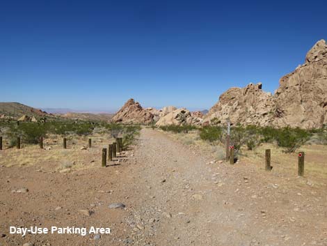
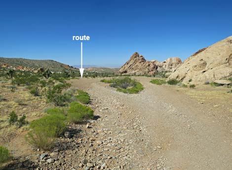
 Whitney Pocket day-use parking area (view SW) |
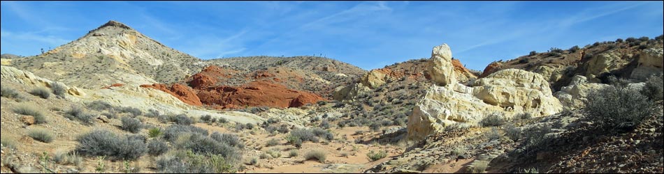
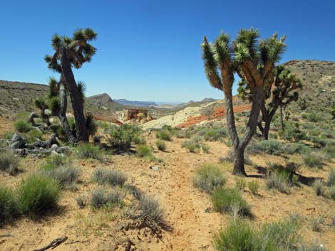
Overview Amber Cat Canyon provides a scenic hike down through an area of colorful (red, white, and amber) sandstone where the geology seems to be all jumbled up. This route runs 2.5 miles round-trip and is fairly easy, but the canyon section of the hike is entirely off-trail with some minor scrambling. Past the free-standing Amber Cat, hikers can turn back or continue onward and complete any of several loops. In the mixed-up geology, fanciful shapes appear on the landscape, but only to those with sufficient imagination. The name of the route is in reference to a feature that I've "seen," but I don't see it, yet to my eye, another feature (or two) almost perfectly resembles an Amber Cat. Hike the hike, turn up your imagination, and see what you see. This hike is accessible in a 2WD vehicle, it is only 2.5 miles round-trip, the terrain is gentle, it starts at Whitney Pocket (a popular camping and picnic area at the end of the pavement), and it can easily be extended to any of several longer loop hikes, but Amber Cat Canyon is not appropriate for horsemen because of slickrock narrows that are dangerous for horses. Link to map. |
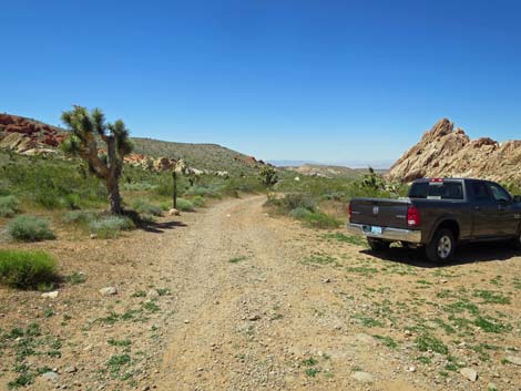
 Dirt road exits the day-use parking area westbound (view W) |
Watch Out Other than the standard warnings about hiking in the desert, ... this is a fairly safe hike, but some may find the uneven terrain and soft sand tiring, and the loose rocks in the wash can be disconcerting. This is a wild and remote area without services of any kind (no restrooms, no water, no gas, no food). Bring what you need to survive. Be prepared and be self-reliant. Nobody will find you if you get lost in this area. Some cell phones work at points along the ridgeline above the canyon. While visiting the area, please respect the land and the other people out there, and try to Leave No Trace of your passage. Also, this is a fairly remote area, so be sure to bring what you need of the 10 Essentials. |
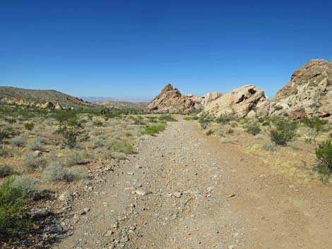 Route follows dirt road (view W) |
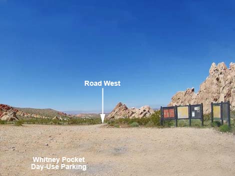
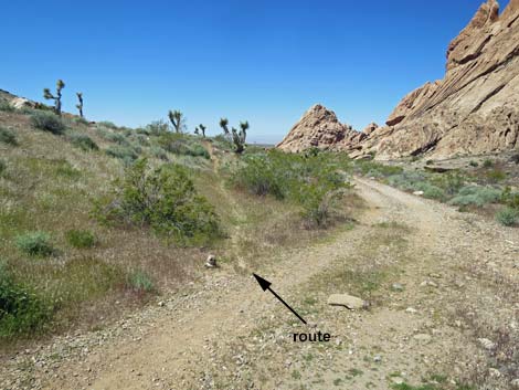
Getting to the Trailhead Amber Cat Canyon is located in the Whitney Pocket area of Gold Butte National Monument at the northeast end of Lake Mead, about 2 hours northeast of Las Vegas in a wild, remote, and scenic area. From town, drive out to Gold Butte National Monument. Drive east on Interstate-15 to Highway 170. Take Exit 112 south towards Riverside and Bunkerville. Drive south across the Virgin River, then quickly turn right onto the paved Gold Butte Road. Follow the pavement (there are no paved side roads) for 21 miles until the pavement ends at Whitney Pocket. Continue south on the unpaved Gold Butte Road for about 120 yards to a graded spur road to the right. Turn right onto the Whitney Pocket Day-Use Parking Lot where visitors will see information signs and toilets (seasonally) on the right. The trail starts on the dirt road just west (left) of the signs. Park here; this is the trailhead. |
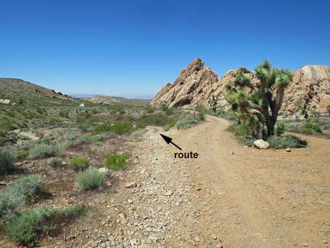
 The route stays left past a campsite (view W) |
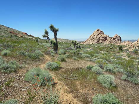
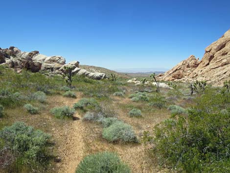
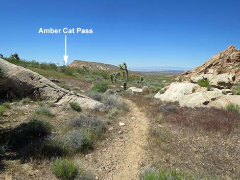
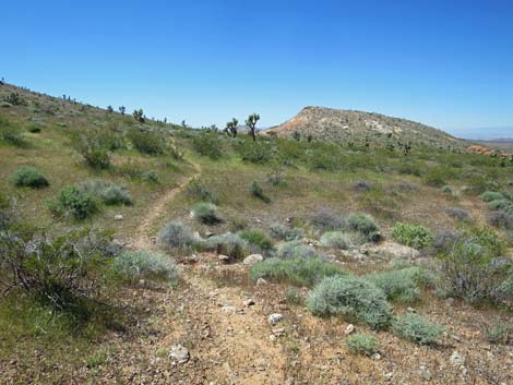
The Hike From the Whitney Pocket Day-Use Trailhead (Table 1, Waypoint 01), the route heads west on a dirt road that leads to two primitive campsites. Staying left at the first campsite (an alternative 2WD trailhead), the road continues west and forks. The route stays left at the fork and follows the jeep trail down towards the wash. The right fork runs a short distance to the second campsite. The jeep trail crosses the wash, and in about 20 yards, a faint use-trail (Wpt. 13) departs the road to the left. The faint use-trail quickly becomes more apparent as it runs westward on the gentle hillside above the jeep trail. When the use-trail passes through a gap in a low, white sandstone outcrop, Amber Cat Pass comes into view, which gives hikers a visual target while traversing the hillside (in case the use-trail becomes too faint). The use-trail is kept open by horsemen, so if they haven't been around, parts of the trail fade out. |
 Last good trailhead parking by the campsite (view W) |
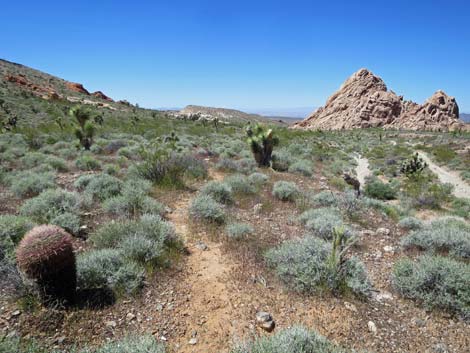
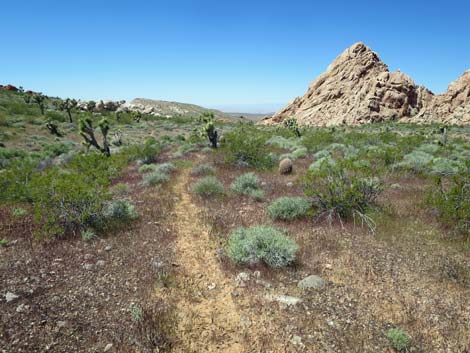
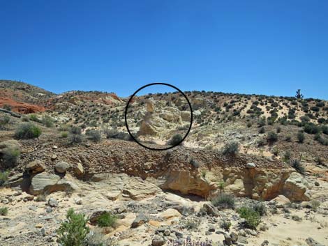
The use-trail climbs gently across the hillside and eventually runs up to Amber Cat Pass (Wpt. 16) where hikers get their first view down into Amber Cat Canyon. In contrast to the previous gently sloping gray-limestone rubble hillside, the view into Amber Cat Canyon is striking. The colors are grand, and the landscape is jumbled. Fortunately, the canyon cuts a pleasant route through this land of colorful sandstone. Continuing over Amber Cat Pass (Wpt. 16), the route is clear: just head down into the canyon. The subtleties of the route, however, require a little bit of attention. From the pass, the route heads straight down the hillside until encountering the first of the slickrock. Hikers can continue straight down, but a use-trail bends left onto sandy soils where horses find better footing. The use-trail soon deposits hikers in the canyon bottom, and from there on down, the route is a mix of walking down the canyon bottom and looking for use-trails that run on sandy soils above the wash. Horseback riders like this route, so when the rocks get too much for horses, they cut up onto the hillsides, which can be helpful for hikers too. |
 The dirt road forks; route stays left (view W) |
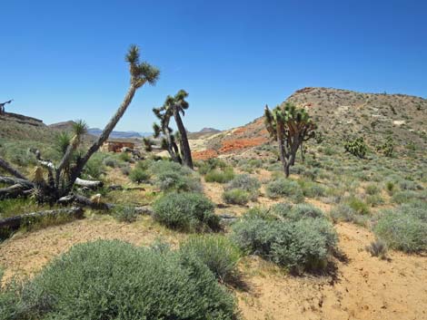
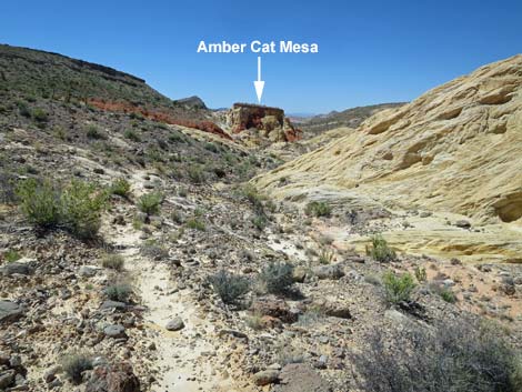
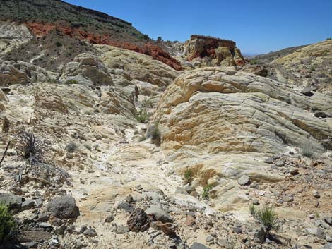
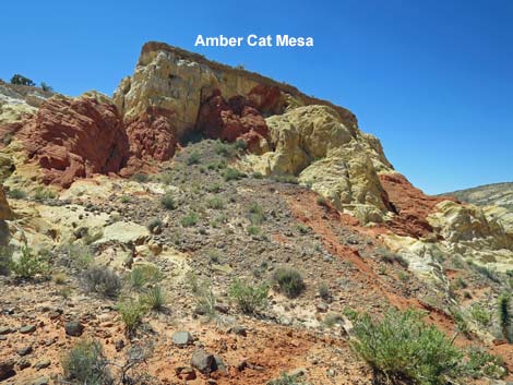
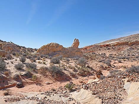
At about 0.9 miles out, hikers arrive at the base of Amber Cat Mesa (Wpt. 11), which was first visible from atop Amber Cat Pass. This flat-topped geologic feature is one of the more curious items in Amber Cat Canyon. The mesa top is capped with caliche, a natural concrete-like substance that is extremely hard and resistant to erosion, so it protects the softer rock below from erosion. The high ridges on both sides of Amber Cat Canyon are also capped with caliche, and back in geologic time, this entire area would have had a continuous layer of caliche covering the landscape. So, in the case of Amber Cat Mesa, the entire block apparently faulted downward while remaining in the same horizontal position, such that the caliche cap on the mesa top now is basically in the same orientation as the caliche cap on the ridges, and therefor in the same orientation as the original, intact landscape. It would have been scary to have been here during the earth quaking that brought the mesa down to the present location. I've been told that the "Amber Cat" for which Amber Cat Canyon is named resides on the high walls of the mesa, but to my eye, it just isn't there. |
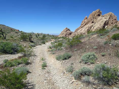 Dirt road drops into a wash (view W) |
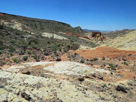
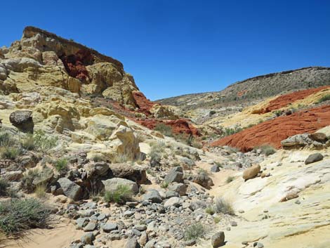
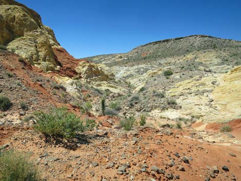
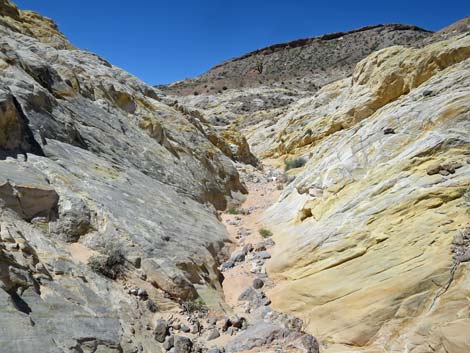
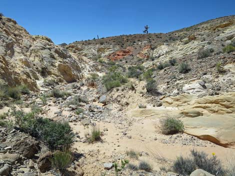
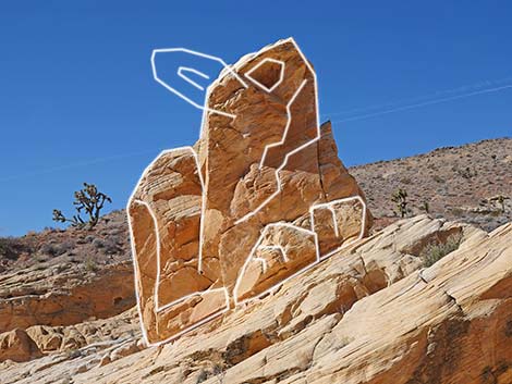
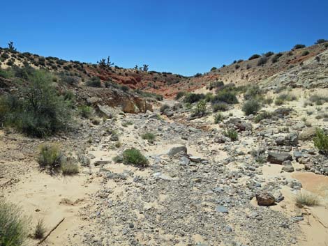
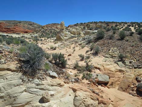
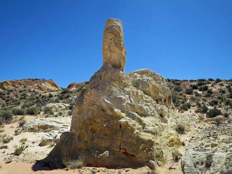
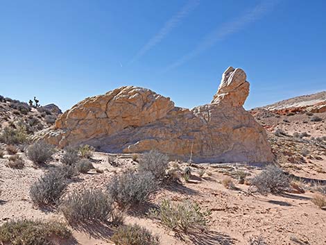
Continuing down the canyon, the route runs in and out of the wash bottom, crossing on and off soft sand, bright red sandstone, white sandstone, the occasional limestone boulder, and even some metamorphic boulders (where did they come from?). At about 1.15 miles out, the route passes a sandstone formation on the north (right) side of the canyon that resembles an amber cat. With some imagination and the right angle, I can see that, but it isn't very satisfying. Continuing down canyon, at about 1.26 miles out, hikers can look left (east, but it seems south) and see the "real," free standing Amber Cat (Wpt. 10). To my eye, this feature takes little imagination to see a cat crouching in a relaxed pose with its head up, but some say this this is more like an Amber Turtle. I guess it's all in the eye of the beholder. From the Amber Cat, hikers can return up the canyon or continue down the canyon to make one of several loops (see the map for two ideas). |
 Across the wash, a faint use-trail departs the road left (view W) |
 The use-trail becomes more apparent (view W) |
 The use-trail runs on hillside above the road and wash (view W) |
 Eventually the use-trail runs away from the road (view W) |
 Use-trail approaching white sandstone crags (view W) |
 Use-trail passing through white sandstone crags (view W) |
 Use-trail continues towards Amber Cat Pass (view W) |
 Use-trail approaching Amber Cat Pass (view SW) |
 Use-trail atop Amber Cat Pass (view SW) |
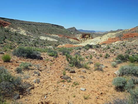 First view into Amber Cat Canyon (view SW from Amber Cat Pass) |
 Traversing slickrock at head of Amber Cat Canyon (view SW) |
 Parts of the route follow use-trails (view SW) |
 Parts of the route traverse slickrock (view SW) |
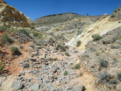
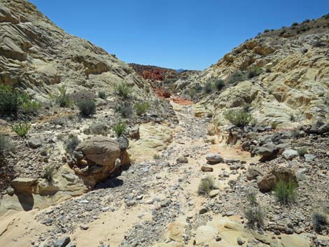
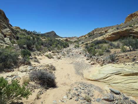
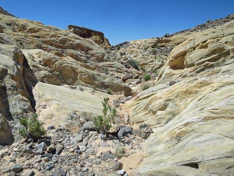 Most of the route follows the wash bottom (view SW) |
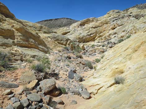 Most of the route follows the wash bottom (view W) |
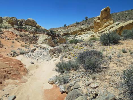
 Curious geologic formation, Amber Cat Mesa, on the left (view SW) |
 Some say the real Amber Cat is on the side of Amber Cat Mesa |
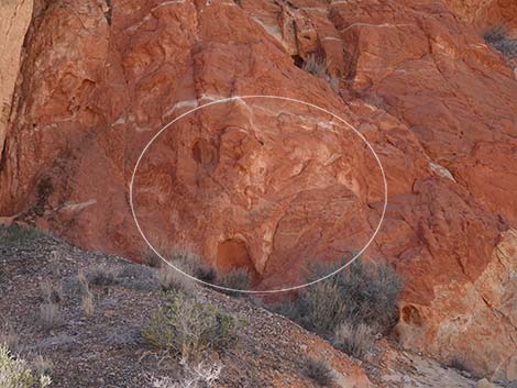 The Amber Cat is formed of amber highlights in the red sandstone |
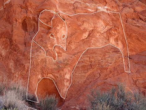 The Amber Cat is formed of amber highlights in the red sandstone |
 Route runs above wash bottom (view W) |
 Route running in the wash bottom (view W) |
 Route running in the wash bottom (view W) |
 Route running above the wash bottom (view SW) |
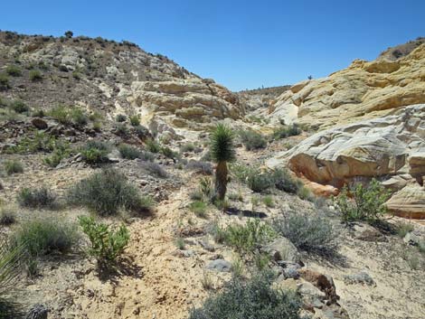
 There is little vegetation, but the species are diverse (view SW) |
 Easy walking in the canyon bottom (view S) |
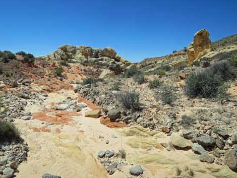 Colorful sandstone in the wash bottom (view W) |
 Some say the boulder on the right looks like an Amber Cat (view W) |
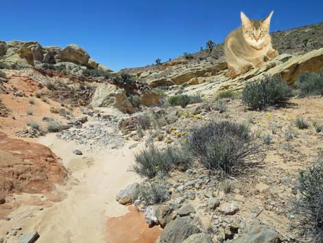 This takes some imagination too |
 The second Amber Cat (view W) |
 The second Amber Cat; just imagine the ears (view W) |
 Soft sand in the wash bottom (view SW) |
 Firm gravels in the wash bottom (view W) |
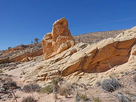
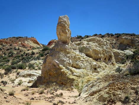
 The free-standing Amber Cat comes into view (view SE) |
 The free-standing Amber Cat (view E from canyon bottom) |
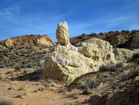 The free-standing Amber Cat stands out in afternoon light (view E) |
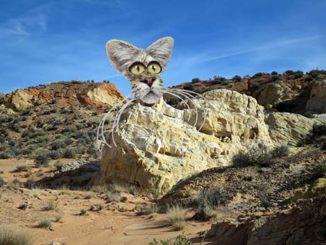 Some ears and eyes help visualize the free-standing Amber Cat |
 The free-standing Amber Cat takes a bit of imagination ... |
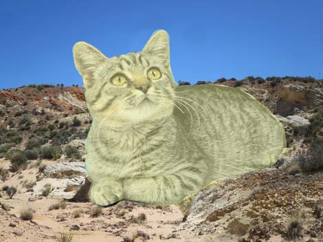 ... but this is how I see the free-standing Amber Cat (view E) |
 The free-standing Amber Cat takes a bit of imagination ... |
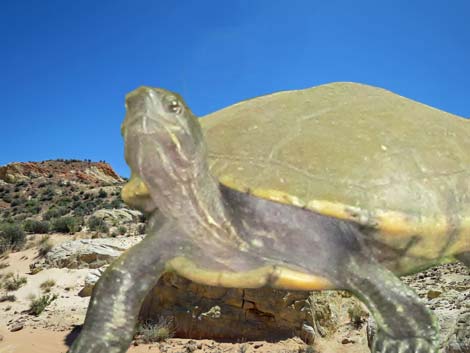 ... and some people see an amber turtle (view E) |
The free-standing Amber Cat takes a bit of imagination ... |
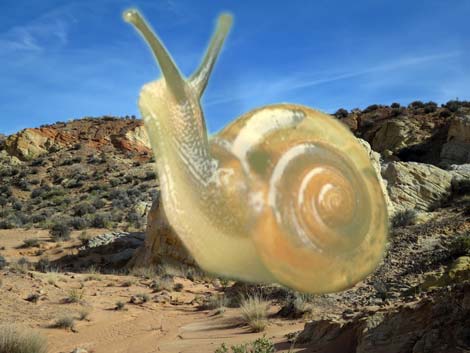 ... and some people even see an amber snail (view E) |
 Looking northwest, the formation looks even more like a snail |
 Looking northwest, the formation looks even more like a snail |
Table 1. Hiking Coordinates and Distances based on GPS Data (NAD27; UTM Zone 11S). Download Hiking GPS Waypoints (gpx) file.
| Wpt. | Location | UTM Easting | UTM Northing | Elevation (ft) | Point-to-Point Distance (mi) | Cumulative Distance (mi) |
|---|---|---|---|---|---|---|
| 01 | Trailhead | 756119 | 4045566 | 3,102 | 0.00 | 0.00 |
| 13 | Trail at Old Road | 755730 | 4045487 | 3,059 | 0.25 | 0.25 |
| 12 | Amber Cat Pass | 755128 | 4045286 | 3,071 | 0.41 | 0.66 |
| 11 | Amber Cat Mesa | 754925 | 4045064 | 2,808 | 0.23 | 0.89 |
| 10 | Free Standing Amber Cat | 754636 | 4044703 | 2,726 | 0.37 | 1.26 |
| 01 | Trailhead | 756119 | 4045566 | 3,102 | 1.26 | 2.52 |
Happy Hiking! All distances, elevations, and other facts are approximate.
![]() ; Last updated 240325
; Last updated 240325
| Hiking Around Gold Butte | Hiking Around Las Vegas | Glossary | Copyright, Conditions, Disclaimer | Home |