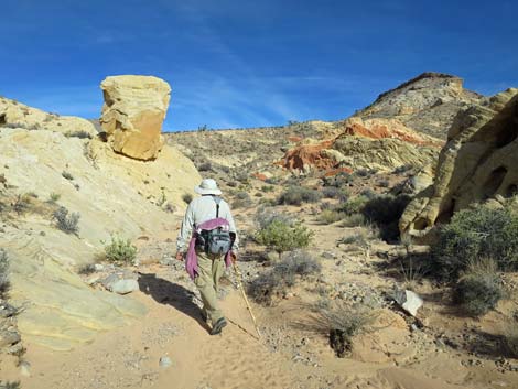
Amber Cat to Trailhead
Hiking Around Las Vegas, Gold Butte National Monument
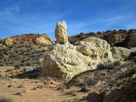 Freestanding Amber Cat (view NE) |
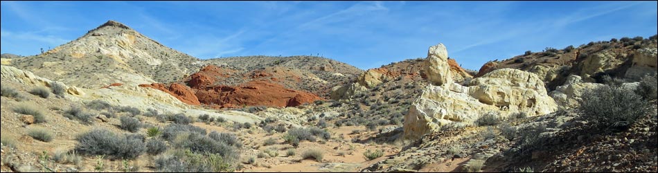
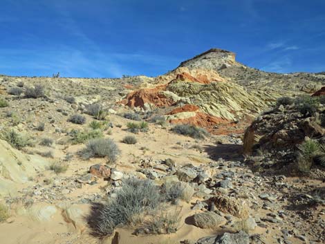
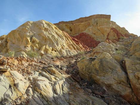
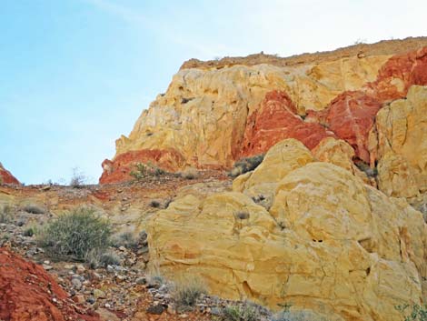
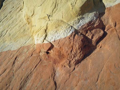
Overview Amber Cat Canyon provides a scenic hike down through an area of colorful (red, white, and amber) sandstone where the geology seems to be all jumbled up. This route runs 2.5 miles round-trip and is fairly easy, but the canyon section of the hike is entirely off-trail with some minor scrambling. Past the free-standing Amber Cat, hikers can head back out or continue on and complete any of several loops. There are two main ways to get to the free-standing Amber Cat: hiking directly from Whitney Pocket (Amber Cat Canyon Route) or hiking from Whitney Pocket down Doodlebug Canyon to Doodlebug Arch, then continuing down Doodlebug Canyon to Amber Cat Wash, and finally hiking back up Amber Cat Wash to the Amber Cat (Doodlebug-Amber Cat Loop). Presented here are details of the route from the Amber Cat directly back to the Whitney Pocket trailhead. For getting to the trailhead and safety concerns, or getting to the free-standing Amber Cat, see Amber Cat Canyon Route and Doodlebug-Amber Cat Loop. |
 The Amber Cat with ears and eyes |
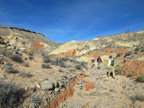
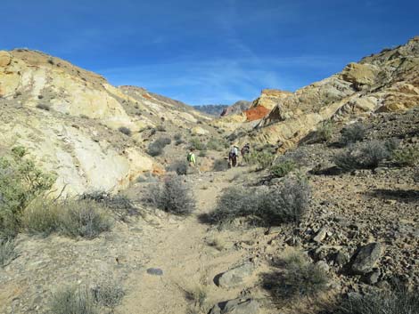
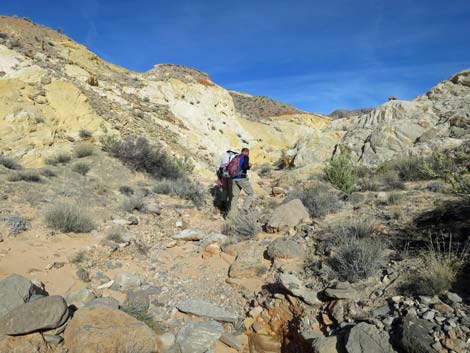
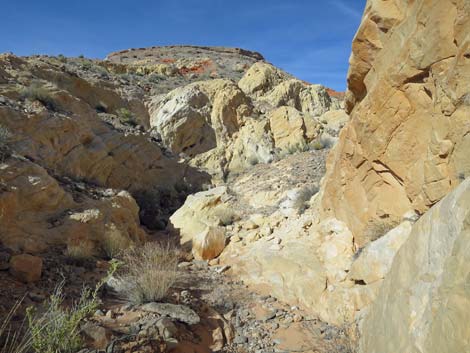
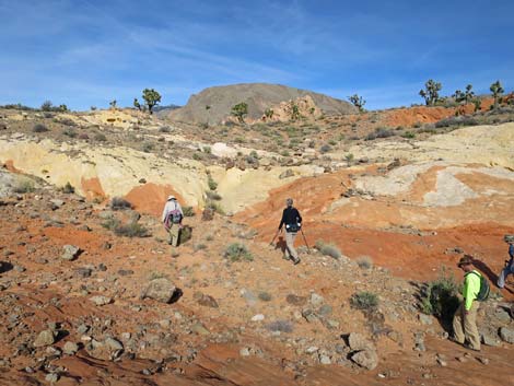
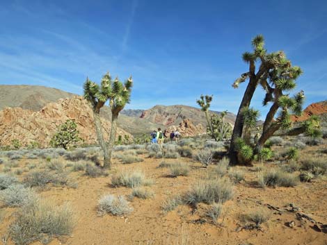
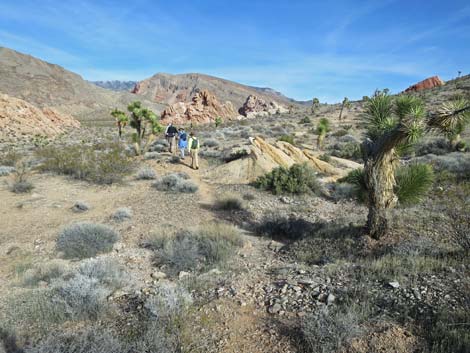
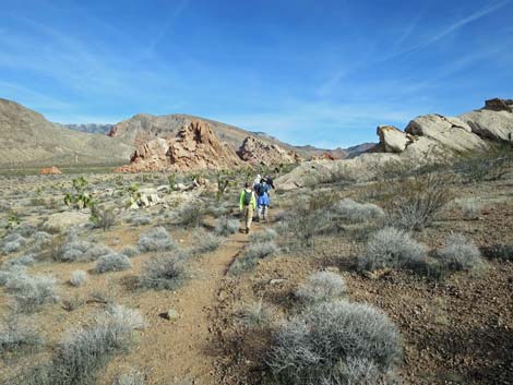
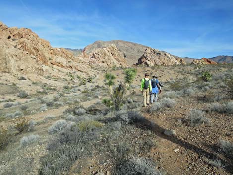
The Hike From the Free-Standing Amber Cat (Table 1, Waypoint 14), hikers return to the wash, turn right, and head upstream following Amber Wash up Amber Cat Canyon. The main wash is easy to follow as hikers proceed through a colorful wonderland of sandstone. As hikers approach Amber Cat Mesa (Wpt. 13), the canyon becomes narrower, the walls grow taller, and the wash more winding as hikers seem to spend more time going side-to-side than straight up the canyon. There are no high pour-overs or other serious obstacles for hikers. Horseman can find their way up the canyon too, but with some climbing onto the wash banks to circumvent minor obstacles. Near the top of the canyon, the grade steepens, but the route becomes less sinuous. While hikers might feel that they are making better forward progress, they are leaving the more interesting parts behind. |
 Hiker continuing up Amber Cat Canyon (view NE) |
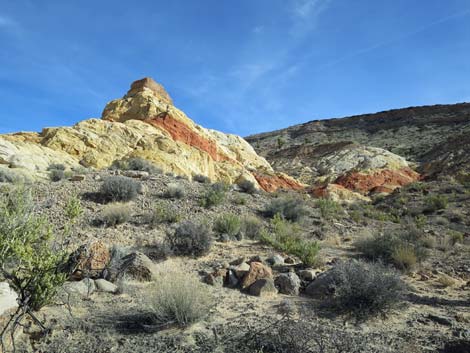
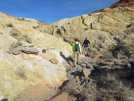
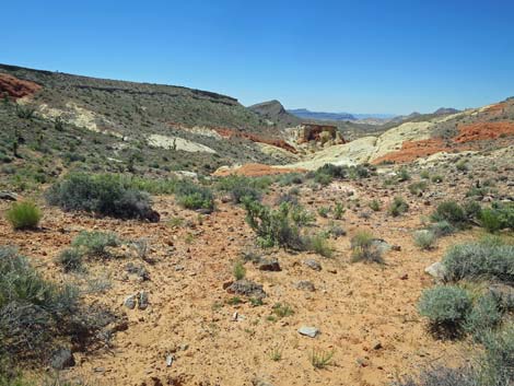
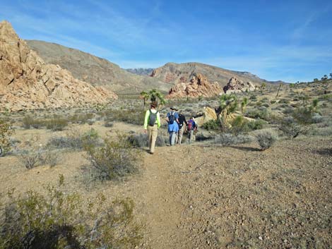
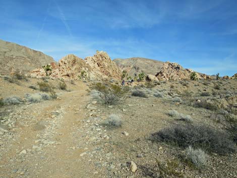
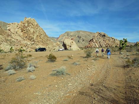
Hikers eventually spend more time walking on sandstone than on wash gravel as the route climbs towards the skyline ahead. A use-trail eventually brings hikers to Amber Cat Pass (Wpt. 16). Atop the pass, it is always worth taking a moment or two to gaze back down Amber Cat Canyon with the interplay of sun and shadows on the jumbled red, white, and yellow sandstone. Descending over Amber Cat Pass (Wpt. 16), a well-defined use-trail runs northeast across the gentle hillside more-or-less on the contour. The use-trail runs below striking red sandstone outcrops, across the toe of a white sandstone outcrop, and across a wash before it finally intersects the jeep trail (Wpt. 02), which the trail has been paralleling for some time. Following the jeep trail east, the road climbs the canyon, eventually joins into the campsite road, and finally arrives back at the Whitney Pocket day-use parking area trailhead (Wpt. 01). |
 |
 |
 |
 |
 Hikers heading up Amber Cat Canyon (view NE) |
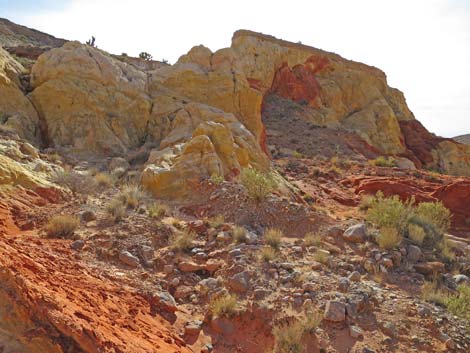
 Amber Cat Mesa; the "real" amber cat is said to be up there (view S) |
 Amber Cat Mesa; the "real" amber cat is said to be up there (view S) Amber Cat Mesa; the "real" amber cat is said to be up there (view S) |
 Hikers heading up Amber Cat Canyon (view NE) |
 Looking back at Amber Cat Mesa (view SW) |
 Continuing up Amber Cat Canyon (view NE) |
 Continuing up Amber Cat Canyon (view NE) |
 Hikers beginning to climb out of Amber Cat Canyon (view NE) |
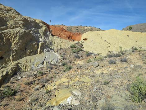
 Interesting patterns in the sandstone |
 Hikers climbing towards Amber Cat Pass (view NE) |
 Amber Cat Pass (view NE) |
 Looking back: Amber Cat Canyon from Amber Cat Pass (view SW) |
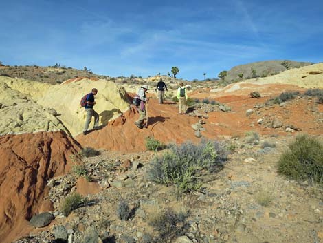
 Hikers descending over Amber Cat Pass (view NE) |
 Hikers on use-trail descending over Amber Cat Pass (view NE) |
 |
 |
 Hikers returning to the old road (view NE) |
 Hikers heading up the old road (view NE) |
 Returning towards Whitney Pocket (view E) |
 Hikers approaching Whitney Pocket trailhead (view E) |
Table 1. Hiking Coordinates and Distances based on GPS Data (NAD27; UTM Zone 11S). Download Hiking GPS Waypoints (gpx) file.
| Wpt. | Location | UTM Easting | UTM Northing | Elevation (ft) | Point-to-Point Distance (mi) | Cumulative Distance (mi) |
|---|---|---|---|---|---|---|
| 14 | Free Standing Amber Cat | 754636 | 4044703 | 2,726 | 0.00 | 0.00 |
| 15 | Amber Cat Mesa | 754925 | 4045064 | 2,808 | 0.37 | 0.37 |
| 16 | Amber Cat Pass | 755128 | 4045286 | 3,071 | 0.23 | 0.60 |
| 02 | Amber Cat route at Jeep Road | 755730 | 4045487 | 3,059 | 0.41 | 1.01 |
| 01 | Trailhead | 756119 | 4045566 | 3,102 | 0.25 | 1.26 |
Happy Hiking! All distances, elevations, and other facts are approximate.
![]() ; Last updated 240325
; Last updated 240325
| Hiking Around Gold Butte | Hiking Around Las Vegas | Glossary | Copyright, Conditions, Disclaimer | Home |