Hiking Around Las Vegas, Death Valley National Park, Death Valley Wilderness Area
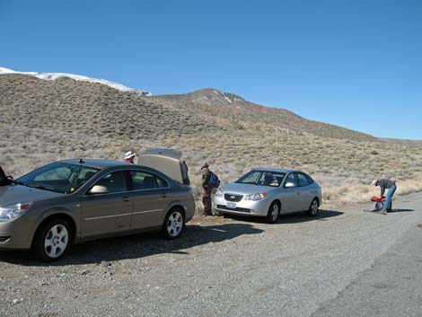
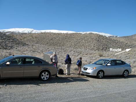 Trailhead parking (view NW) |
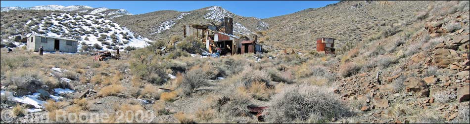
Overview This pleasant hike runs up an old road in a wide canyon for 1.0 miles to a well-preserved mill site that dates from the early 1950s to about 1970 and now is included in the Death Valley Wilderness Area. Hiking up the ridge above the mill site (another 0.25 miles) provides grand views over the area and a way to finish the hike by making a scenic loop back to the road. Please help preserve and protect this site for the enjoyment of future generations! Link to map, elevation profile, and additional photos of the mill site. |
 |
Watch Out Other than the standard warnings about hiking in the desert, ... this hike is fairly safe, but the mill structures are becoming unstable, so it is wise to stay out of the buildings. While hiking, please respect the land and the other people out there, and try to Leave No Trace of your passage. Also, this hike is in a wild and remote area, so be sure to bring the 10 Essentials. This hike runs up into designated wilderness, so be extra careful with the land. |
 Route follows an old road (view SW) |
Getting to the Trailhead This hike is located in Death Valley National Park, about 3 hours northwest of Las Vegas. From town, drive out to Death Valley. From the Furnace Creek Visitor Center (Table 1, Site 712), drive north and west on Highway 190, past Stovepipe Wells, to Emigrant Canyon Road (Site 980). This is just past the old Emigrant Ranger Station, which has the only trees for miles around and makes for a good landmark. Turn left (southeast) onto Emigrant Canyon Road and drive south for 7.1 miles to a wide spot on the west (right) side of the road big enough for 3-4 vehicles (Site 981). This parking area is about 0.5 miles beyond some large water tanks (Journigan's Mill) on the right side of the road. Park here (Site 981); this is the trailhead. |
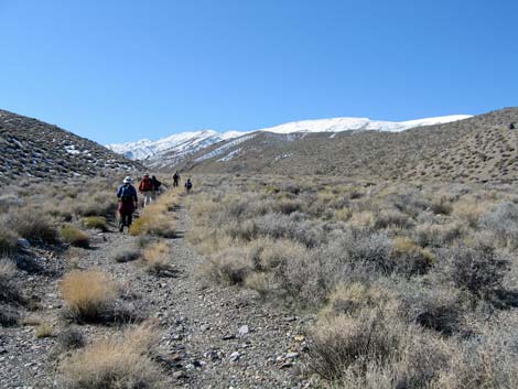
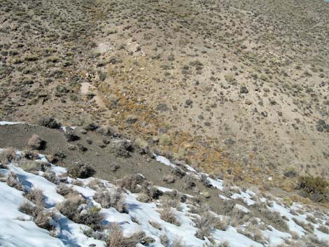
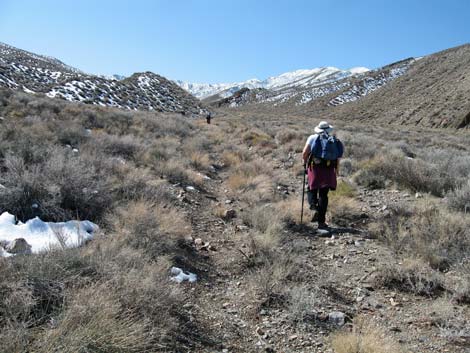 Hiking up the old road (view SW) |
The Hike From the trailhead (Table 2, Waypoint 1), the route begins on the southwest edge of the parking area. Walk around two large piles of dirt and past wilderness area boundary signs that block vehicle access to an old road. Follow the old road northwest and then southwest into a broad canyon (Wpt. 2). The road leads to the mill site (Wpt. 3), about 0.9 miles farther up the canyon. The canyon is well vegetated with an unusually diverse assemblage of low-growing shrubs and grasses. The area is in the Upper Sonoran Life Zone (Mojave Desert Scrub) where blackbrush, broom snakeweed, cheeseweed, California buckwheat, some kind of Senecio (shrub with yellow daisy flowers), lots of turpentinebroom, indigo bush, death valley mormon tea, cottonthorn, and paperbag bush are common. Many other species are present too. A little higher up in elevation, cliffrose and goldenbush become common too. On the ridges, many species of shrubs can be found, but blackbrush is dominant. |
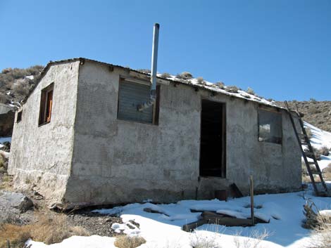
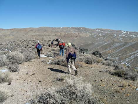
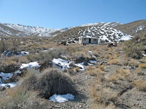 Approaching the Greene-Denner-Drake Mill site (view W) |
The mill site is well preserved. The two-story mill building sits on a low rise overlooking junk cars (Pontiac car and an old pickup truck, probably more in parts), a two-room house, a two-seat outhouse, and out buildings. On the hill above the mill, water tanks overlook the entire scene. A water pipe runs up the gully above the mill to a spring near the ridgetop. The guts of the mill were removed and used elsewhere, but the structure of the building is intact and interesting. The exterior of the house was faced with cement (like stucco). Inside, there is a large living space and a separate bathroom (with a real toilet and bathtub!). Shelves line one wall, bunk beds remain, and a 55-gallon drum was used for a wood stove. They even had electricity. On the back porch sits a refrigerator, and they had hot running water from a wood fired hot water heater (now a nice desert woodrat nest). After inspecting the mill site (don't take anything away!), consider climbing the ridge to the west of the mill site. The top of the ridge provides grand views and makes the return hike, walking the length of the ridge, a loop rather than just backtracking down the canyon bottom. |
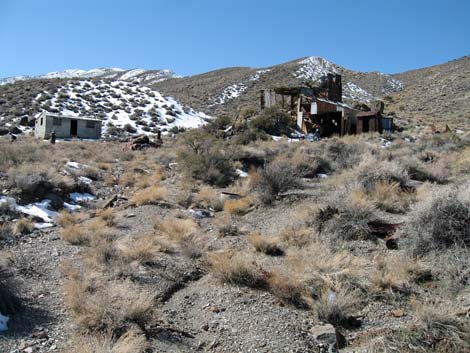 Greene-Denner-Drake Mill site (view W; additional photos) |
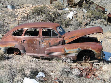 The old Pontiac is now a desert woodrat nest |
 Cement house (additional photos |
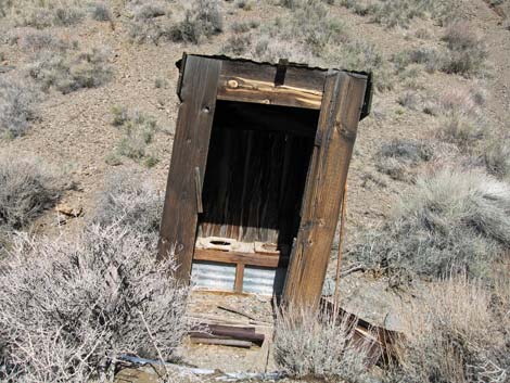 Two-hole outhouse (additional photos |
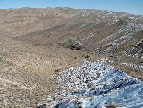
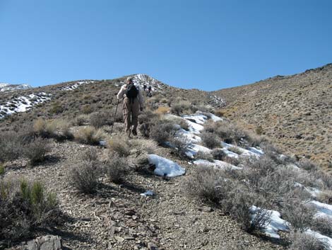 Route continues up ridge above the mill site (view SW) |
 Route continues up ridge above the mill site (view SW) |
 Snow and grand scenery (view N) |
 Looking back down on the mill site (view NE) |
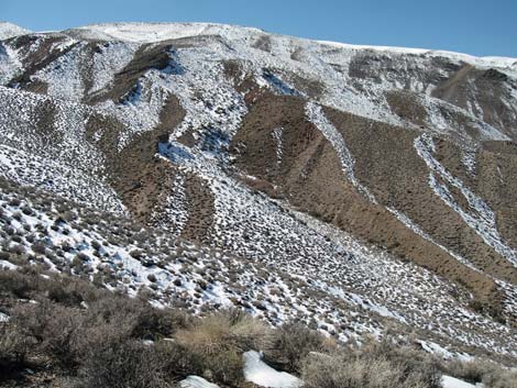 Snow and grand scenery (view S) |
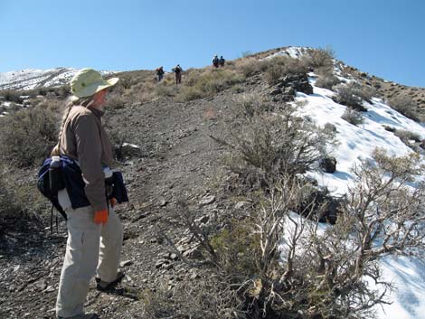
 Approaching a false summit on the ridge (view SW) |
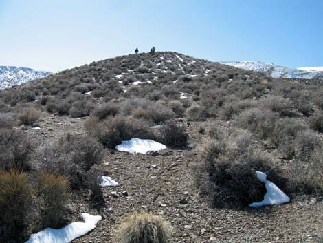
 Hiking out to an overlook (view NE) |
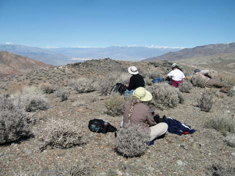 Hikers eating lunch on the overlook (view NE) |
Table 1. Highway Coordinates (NAD27; UTM Zone 11S). Download Highway GPS Waypoints (*.gpx) file.
| Site # | Location | Latitude (N) | Longitude (W) | Easting | Northing | Elevation (ft) | Verified |
| 0712 | Furnace Creek Visitor Center | 36.46159 | 116.86574 | 512030 | 4034954 | -186 | Yes |
| 0980 | Hwy 190 at Emigrant Canyon Rd | 36.49506 | 117.22613 | 479747 | 4038682 | 2,196 | GPS |
| 0981 | Green Mill Parking | 36.40998 | 117.17440 | 484363 | 4029235 | 4,509 | GPS |
Table 2. Hiking Coordinates Based on GPS Data (NAD27; UTM Zone 11S). Download Hiking GPS Waypoints (*.gpx) file.
| Wpt | Location | Easting | Northing | Elevation (ft) | Point-to-Point Distance (mi) | Cumulative Distance (mi) | Verified |
|---|---|---|---|---|---|---|---|
| 01 | Trailhead | 484363.12 | 4029234.84 | 4,509 | 0.00 | 0.00 | GPS |
| 02 | Bottom of Canyon | 484201.92 | 4029237.57 | 4,540 | 0.13 | 0.13 | GPS |
| 03 | Mill Site | 483511.86 | 4028041.57 | 4,992 | 0.89 | 1.02 | GPS |
| 04 | Ridgetop | 483149.23 | 4027904.84 | 5,338 | 0.25 | 1.27 | GPS |
| 01 | Trailhead | 484363.12 | 4029234.84 | 4,509 | 1.32 | 2.59 | GPS |
Happy Hiking! All distances, elevations, and other facts are approximate.
![]() ; Last updated 240324
; Last updated 240324
| Death Valley | Hiking Around Las Vegas | Glossary | Copyright, Conditions, Disclaimer | Home |