Hiking Around Las Vegas, Spring Mountains (Mt. Charleston), Kyle Canyon
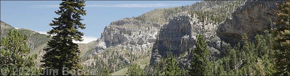
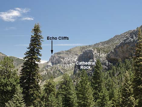 Echo Cliffs and Echo Overlook (view south) |
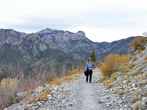
Overview This is a strenuous, 2-mile hike that uses the South Loop Trail to climb to an overlook at the top of the Echo Cliffs. The trail starts by Cathedral Rock and climbs 1,500 feet as it passes through a mixed pine-fir forest, climbs through an avalanche chute, and finally switchbacks up the side of the canyon to the top of the Echo Cliffs from where the views up and down the canyon are grand. Link to map. |
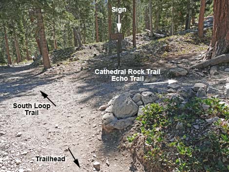
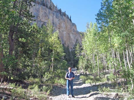
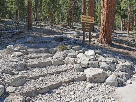 Cathedral Rock - South Loop Trailhead (view W) |
Watch Out Other than the standard warnings about hiking in the desert, ...this is a pretty safe hike, but watch your footing, and that of your kids, near the edge of the overlook. There are places along the trail where a slip would prove hazardous, but nothing out of the ordinary. This trail would be a good hard hike for young kids. During winter, be cautious of avalanche. While hiking, please respect the land and the other people out there, and try to Leave No Trace of your passage. Also, this hike is moderately long, so bring what you need of the 10 Essentials. This hike goes into the Mt. Charleston Wilderness Area, so pay particular attention to respecting the land. |
 |
Getting to the Trailhead This hike is located in Kyle Canyon up in the Spring Mountains National Recreation Area, about 1 hour northwest of Las Vegas. From town, drive out to the Spring Mountains Visitor Center, then continue up the road to the Cathedral Rock Trailhead. |
 Note: the sign is still there, but it's been knocked down (view S) |
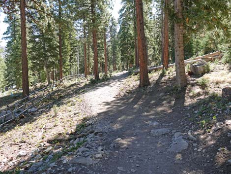
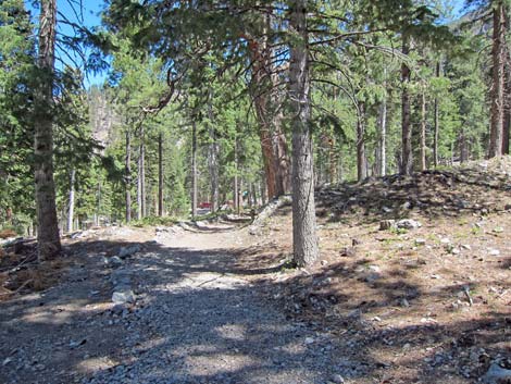
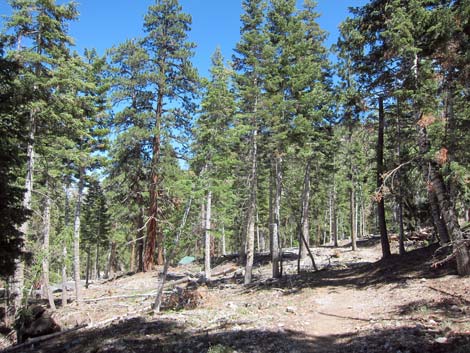
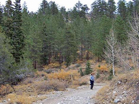
The Hike From the trailhead (Table 1; Waypoint 01), the trail runs up and left about 200 yards to a fork (Wpt. 02). At the fork, the Cathedral Rock Trail turns right, while the South Loop Trail continues straight. Following the South Loop Trail past the picnic area, the trail starts at a fairly steep grade as it runs southeastward towards the base of the gray limestone Echo Cliffs (away from Cathedral Rock). In this area, the trail runs through a fairly thick, mixed forest of Ponderosa pine, white fir, and quaking aspen with lots of shrubs. |
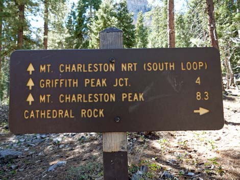 Note: this sign is still there, but it's been knocked down (view S) |
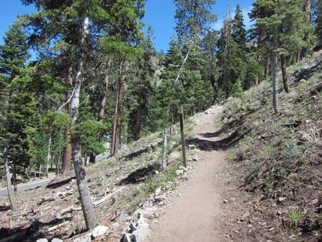
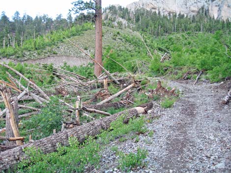
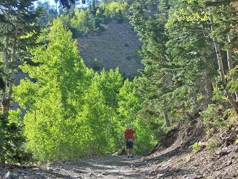
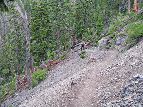
After about 20-25 minutes, the trail joins an old road (Wpt. 03), which is followed up and across a side canyon that comes down from the north face of Griffith Peak and runs through the Echo Cliffs at this point. This is an avalanche chute where the snow knocks down the taller trees and opens the forest for bushes and an aspen thicket. This is a nice area in the late summer and fall when the leaves are changing color. After crossing the avalanche chute, the old road winds around and forks (Wpt. 04). The trail stays right and turns to run very steeply up the east side of the avalanche chute. The trail, such as it is, was an old road, evidence of which can be seen in places. Eventually, the trail runs up against the towering limestone cliffs and is forced to cross the canyon (Wpt 05). Hikers during winter should be careful here because this is an avalanche chute. |
 |
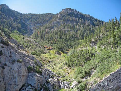
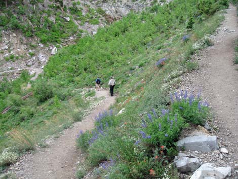
The trail crosses the avalanche chute and switchbacks up the steep west side of the canyon to reach Echo Overlook (Wpt. 06) at the top of the Echo Cliffs. Much of this section is forested, so there is plenty of shade. There are lots of Ponderosa pine and white fir at the overlook, so there is plenty of shade, but hikers will have to get right out on the very edge of the cliff to get a good view of Kyle Canyon and the desert to the east. There is a nice campsite at the overlook. To get back to the trailhead, retrace your steps back down the South Loop Trail. On the way down, stay on the trail and don't cut the switchbacks. Cutting switchbacks damages the trail and the vegetation and it makes trail conditions worse for everyone. For hikers continuing up, the trail runs west along the top of the Echo Cliffs before resuming the climb towards the skyline. |
 |
 |
 Old road crossing base of avalanche chute (view SE) |
 Nice views where trees are knocked down by avalanche |
 Old road forks at far (E) side of avalanche chute (view E) |
 Hiking up along the avalanche chute (view S) |
 Hiking up under limestone cliffs (view S) |
 Avalanche chute (view S) |
 Switchbacking up across avalanche chute (view SE) |
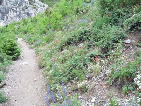 Summer wildflowers in the avalanche chute |
 Hikers descending trail below Echo Overlook (view S) |
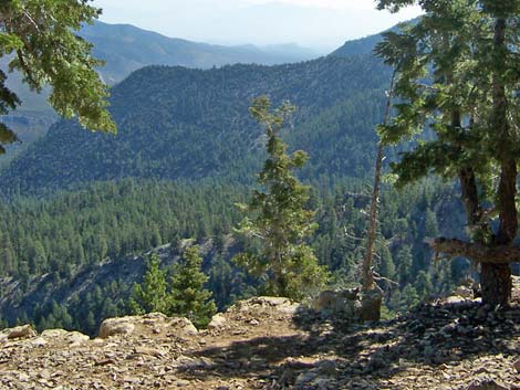 Lower Kyle Canyon (view E from Echo Overlook) |
Table 1. Hiking Coordinates Based on GPS Data (NAD27; UTM Zone 11S). Download hiking GPS Waypoints (*.gpx) file.
| Wpt. | Location | UTM Easting | UTM Northing | Elevation (ft) | Point-to-Point Distance (mi) | Cumulative Distance (mi) | Verified |
|---|---|---|---|---|---|---|---|
| 01 | Cathedral Rock Trailhead | 621731 | 4013026 | 7,713 | 0.00 | 0.00 | Yes |
| 02 | Cathedral-South Loop Trail Junction | 621802 | 4012928 | 7,716 | 0.10 | 0.10 | GPS |
| 03 | Join Old Road | 622189 | 4012283 | 7,914 | 0.56 | 0.66 | GPS |
| 04 | Old Road Forks | 622517 | 4012134 | 8,186 | 0.35 | 1.01 | GPS |
| 05 | Crossing Avalanche Chute | 622283 | 4011678 | 8,585 | 0.35 | 1.36 | GPS |
| 06 | Echo Overlook | 622152 | 4011879 | 9,077 | 0.74 | 2.10 | GPS |
| 01 | Cathedral Rock Trailhead | 621731 | 4013026 | 7,713 | 2.10 | 4.20 | GPS |
Happy Hiking! All distances, elevations, and other facts are approximate.
![]() ; Last updated 240329
; Last updated 240329
| Hiking Around Mt Charleston | Hiking Around Las Vegas | Glossary | Copyright, Conditions, Disclaimer | Home |