Hiking Around Las Vegas, Gold Butte National Monument, Lime Canyon Wilderness Area
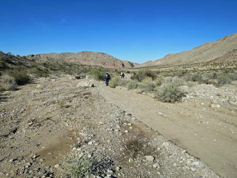
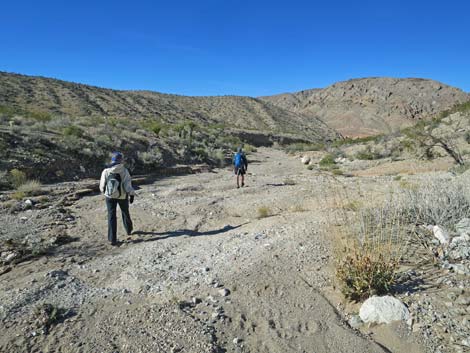
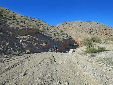
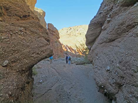
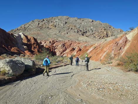
 Hiker departing the trailhead (view W) |
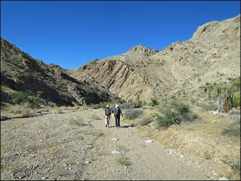
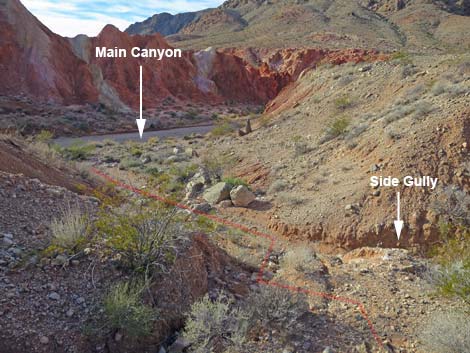
Overview Lime Canyon Wash makes for a fairly easy and interesting route that winds around as it cuts a deep canyon through the heart of Lime Ridge with seven narrow sections. Described here is an 8-mile round-trip hike down through the narrow canyon to a lunch spot, then down the open wash to an area of curious geology where Lime Wash underwent a stream-capture event, turned out of the original canyon, and cut down through red, white, and yellow mudstones intermixed with twisted layers of limestone to begin cutting a new canyon. This hike descends 1.9 miles, all the way through Lime Ridge, then continues down Lime Wash into an area of curious conglomerate rocks and colorful sandstone mixed with volcanic mudstones for a total of 3.9 miles, one way. The hike returns over the same route. Described here is the lower section. For a full description of the upper section, see Lime Canyon -- Upper Canyon Route, and see Lime Canyon -- Two Forks Loop for an even longer hike. Link to hiking map or elevation profile. |
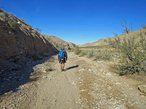
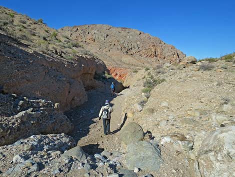
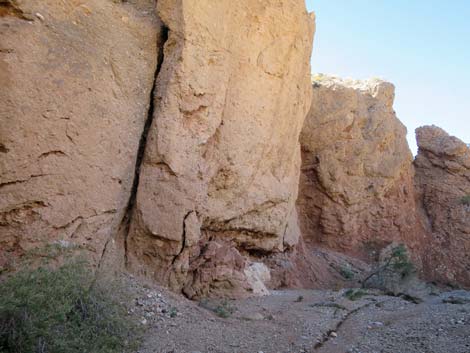
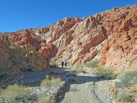
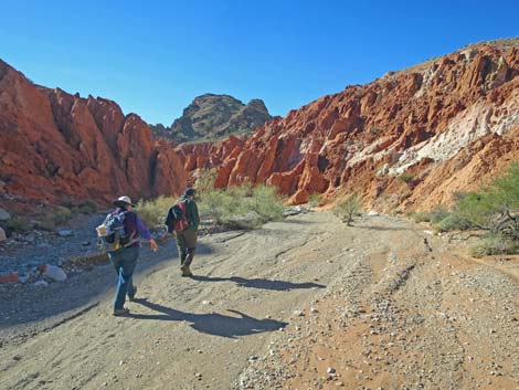
 Hikers in mid-canyon (view W) Hikers in mid-canyon (view W) |
Watch Out Other than the standard warnings about hiking in the desert, ...this is a safe hike, but the area is wild and remote. I encountered no unusual hazards, but be careful out here because even a twisted ankle could be serious. There are two tall pour-overs, but both are easy to bypass, and some of the water-polished rocks in the lower narrows are slippery. This is a wild and remote area without services of any kind (no restrooms, no water, no gas, no food). Bring what you need to survive. Be prepared and self-reliant. Someone will find you eventually if you stay on a main road, but be prepared to survive alone for a day or two. Cell phones only work along parts of the paved road and at the far end of Lime Wash near Lake Mead. While hiking, please respect the land and the other people out there, and try to Leave No Trace of your passage. Also, this is a remote hike, so be sure to bring the 10 Essentials. This hike goes into a federally designated wilderness area, so pay extra attention to respecting the land. |
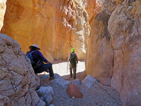
 Approaching the habitation site (view NW) |
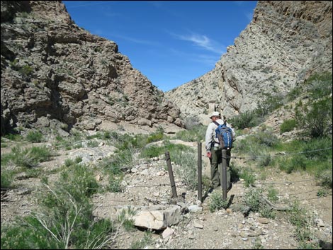
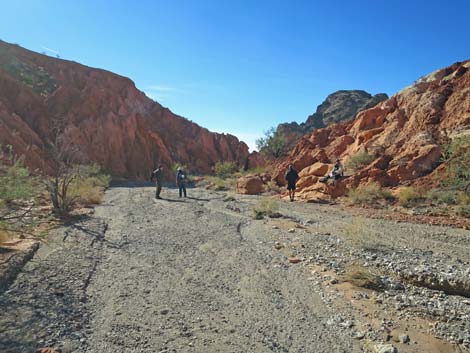
Getting to the Trailhead Lime Canyon is located out in Gold Butte National Monument at the northeast end of Lake Mead, about 3 hours northeast of Las Vegas in a wild, remote, and scenic area. From town, drive out to Gold Butte National Monument. From Whitney Pocket, continue south on the unpaved Gold Butte Road 20 miles to Gold Butte Townsite. From Gold Butte Townsite, drive north on Red Bluff Spring Road. At about 3.4 miles out, a sign on the left used to announce the Lime Canyon Wilderness Area, but it was vandalized and only the broken sign posts remain. Lime Canyon Road branches left to run west 1.0 miles and dead-ends at the start of the Line Canyon Narrows. This road usually is suitable for 2WD-HC vehicles. Park here; this is the trailhead. |
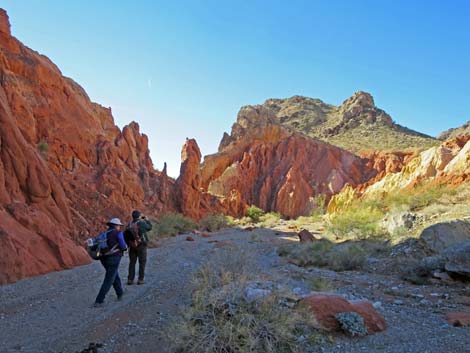
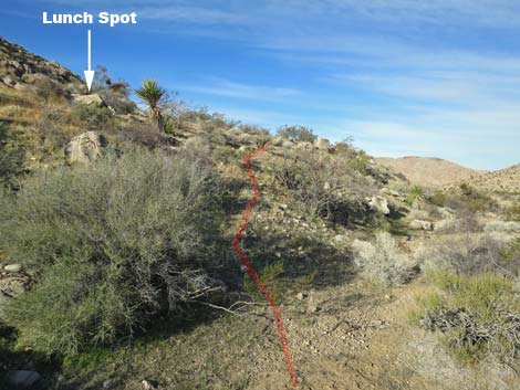 Side spur leads to lunch spot (view W) Side spur leads to lunch spot (view W) |
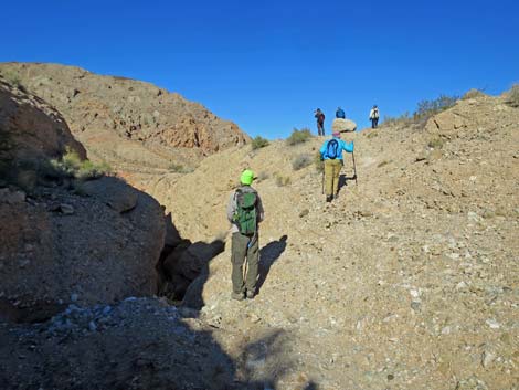
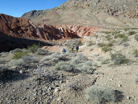
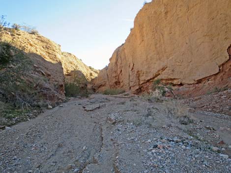
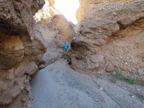
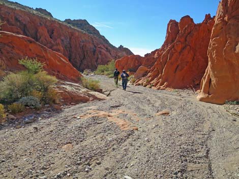
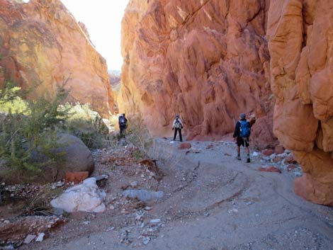
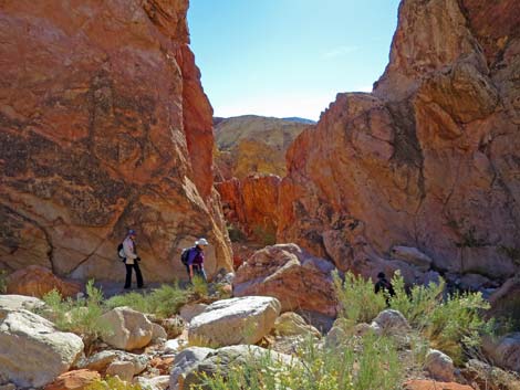
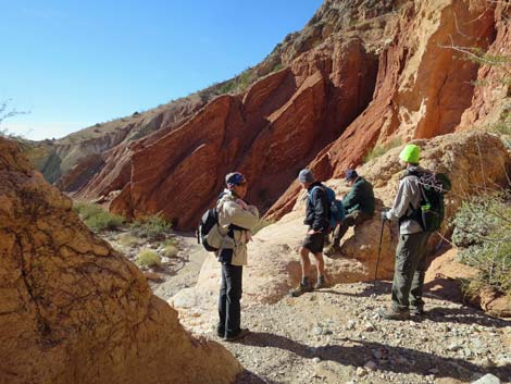
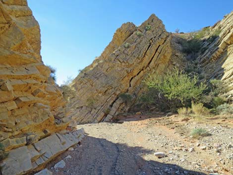
The Hike From the trailhead (Table 1, Waypoint 01), the route starts through the gate and down into the canyon. Just around the first bend, carsonite signs announce the wilderness area boundary. The route runs down the deep, winding, and fairly narrow canyon where spectacular carbonate cliffs rise hundreds of feet to the crest of Lime Ridge. At about 1.8 miles out, the canyon jogs to the right where a habitation site (two shallow alcoves with campfire soot; Wpt. 05) on the left can be seen at the base of the cliff. Just around the corner habitation site, on the other side of the rocky outcrop, a faint animal trail (Wpt. 06) leaves the wash to the left and climbs onto the creosote bush-covered bench where limestone boulders provide an elevated perch upon which to stop and enjoy lunch (Wpt. 07) with grand views down Lime Wash to the west. For hikers who don't want to continue, this is a good place to stop and wait while for the rest of the team continues farther down. |
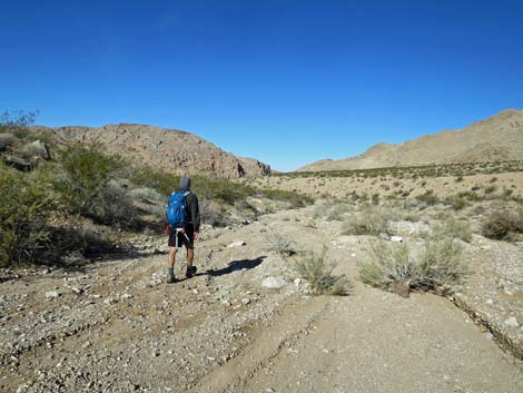
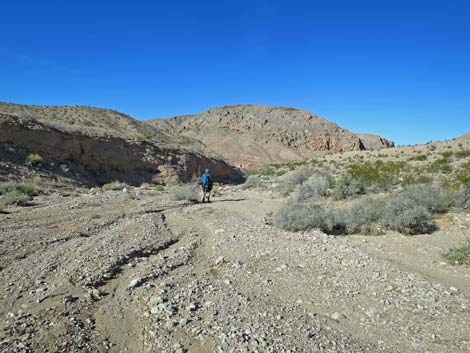
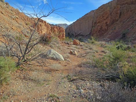
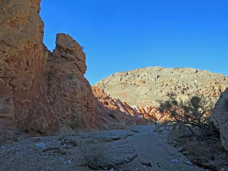
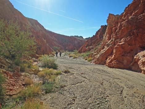
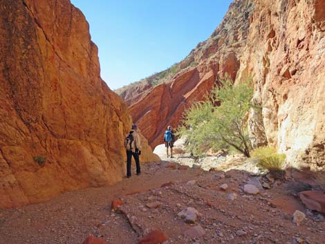
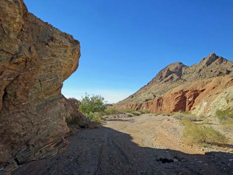
 Canyon begins to open up; end of narrow canyon (view NW) |
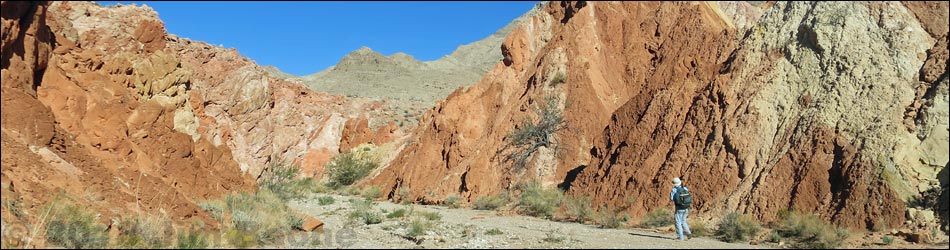
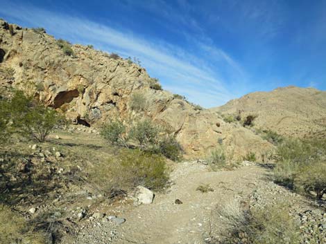
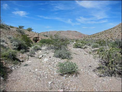
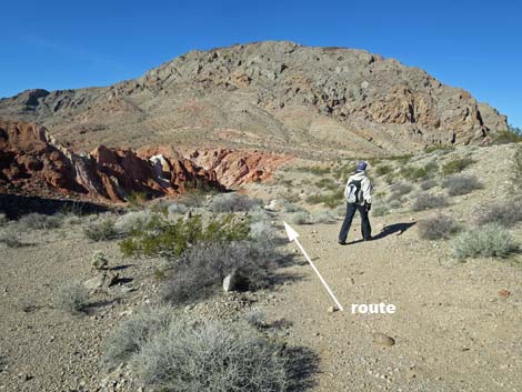
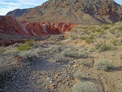
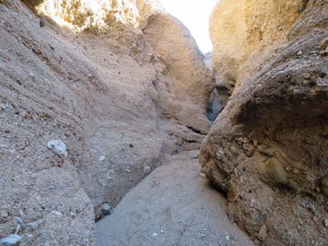
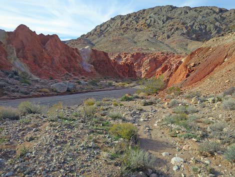
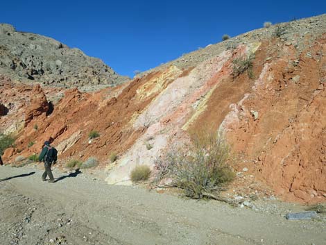
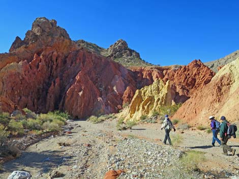
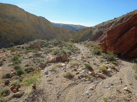
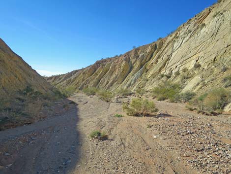
On the west side of Lime Ridge (from the lunch spot westward), the canyon opens up into a broad desert wash between ridges. The ridge in the right is high and rocky, but the ridge on the left is considerably lower and the terrain is more gentle. On the left, the bench above the wash has feral burro trails that provide fairly easy walking. Lower in the canyon, low red cliffs even farther down the wash come into view. Then, about 2.9 miles out and just before the red cliffs, there is a 15-foot pour-over where water suddenly falls into a narrow slot in the floor of the wash (Wpt. 08). This area is geologically curious. The top of the pour-over and the slot are in a layer of conglomerate rock formed from what appears to be riverine alluvial materials. This conglomerate layer overlies a layer of mudstone deposits, and the interface of the two is a mixture of river cobbles and red muds. The mudstone layer is colorful, mostly composed of bright reds, but with yellows, light purples, and dark purples scattered about. When the area is wet from rain, the colors are striking. |
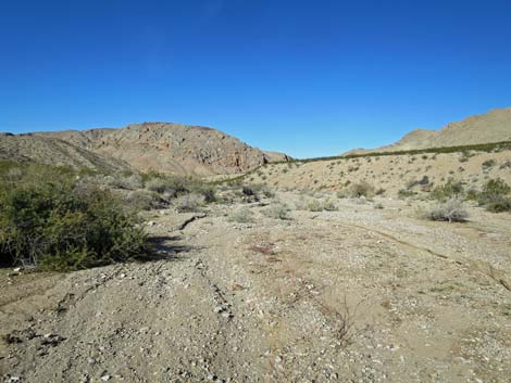
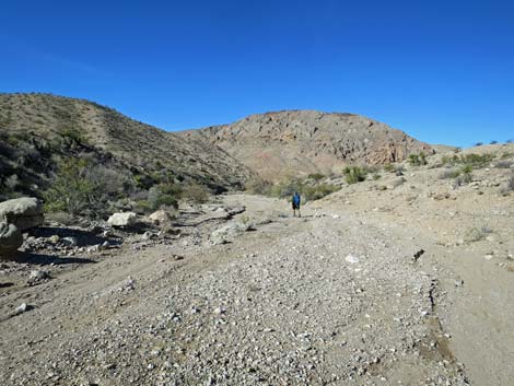
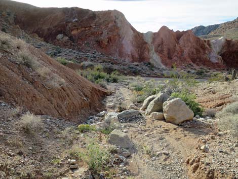
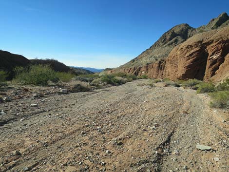
 Broad wash below the main canyon (view NW) |
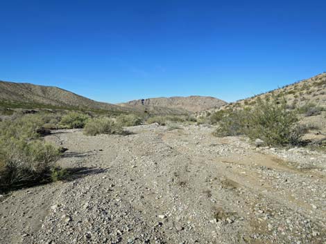
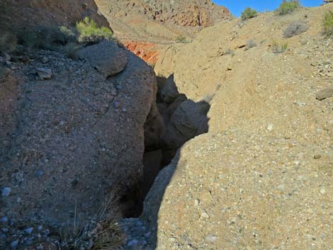
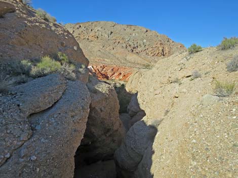
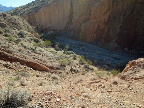
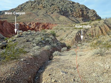
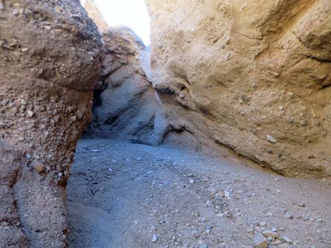
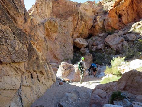
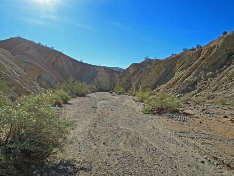
Standing atop the pour-over and looking downstream, the wash continues westward for another 250 yards or so following the same line that it has been following for the last mile, but then instead of bending slightly to the right and continuing northwest down what appears to be the main canyon, the wash abruptly turns left and runs south down into what looks like a side canyon. This is an unusual case of a canyon forking going downstream, probably caused by uplift of the limestone cliffs that form the south side of the "main" canyon. Following the wash, the route passes the conglomerate pour-over on the north side using animal trails and an old mining road, then drops back into the bottom of the wash. It is better for the environment to follow the old road than to shortcut the road and cut straight down into the wash. In the wash, it is worthwhile to hike back up onto the slot canyon to see the pour-over from below. Continuing down from the pour-over, the wash curves south into the "side wash" when it hits the base of the limestone mountain (Wpt. 09). The colorful canyon runs narrow for about 0.3 miles to a narrow slot (Wpt. 10). |
 |
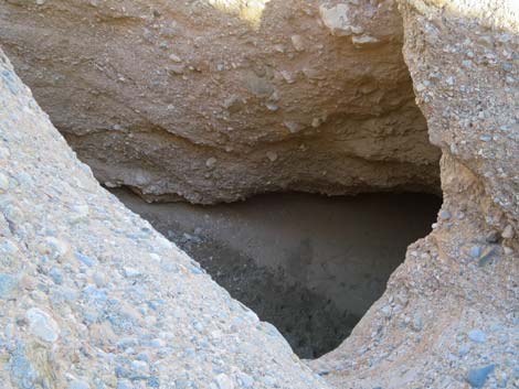
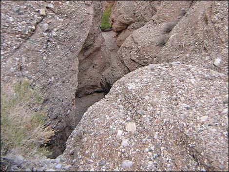
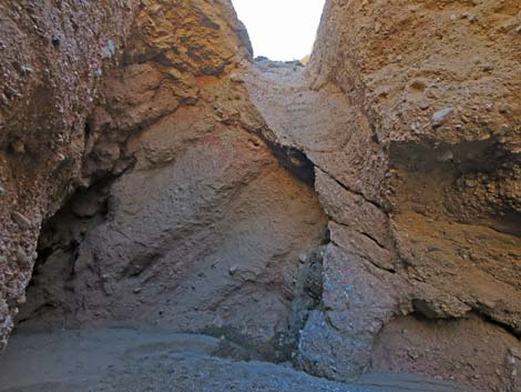
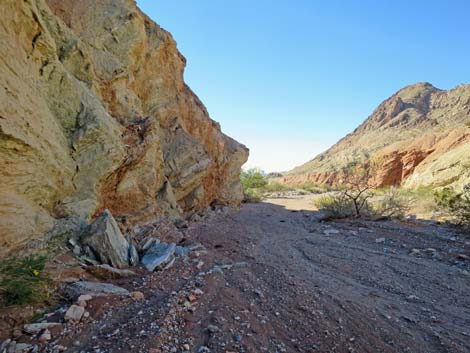
Passing through the narrow slot, the route arrives atop a pour-over (Wpt. 11) that appears to be an imposing 25-feet-high when viewed from above. The vertical fall is only about 12 feet (they always look higher from above), and the pour-over can be passed with a bit of 3rd-class downclimbing. From the top of the pour-over, follow ledges left, then down onto the dirt slope below. In the lower part of the canyon, the red muds give way to yellow mudstones and gray limestones with layers of gypsum materials mixed in. Most of the gypsum lies in parallel layers, but in some places, fractures perpendicular or oblique to those layers produced places where gypsum creates a white cross-hatched or checkerboard pattern in the canyon walls. In some places, the rocks record what looks like mixed layers of mudstone, limestone, and gypsum, perhaps indicating rising and falling water levels in some ancient lake. |
 |
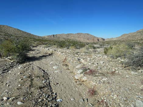
Below the high pour-over, the colorful canyon continues for another 0.3 miles, then begins to open into a broad wash (Wpt. 12). This is a good place to stop and turn back (3.9 miles out), but hikers can continue down the wash for 1.5 miles to the boundary of Lake Mead National Recreation Area, and from there another 3.1 miles to the old high-water mark at the edge of Lake Mead. In addition, hikers might consider hiking the left-fork to right-fork (Two Forks Loop) for a total of 11 miles back to the trailhead. From wherever hikers get, return to the trailhead by retracing your route back up the wash. Be sure to leave more time for going back than it took you to get here -- it's all uphill on the way back. For photos of the return through the main Lime Canyon, see Return Up Lower Canyon and Return Up Upper Canyon. |
 |
 |
 |
 |
 |
 |
 Hiker in the wash (view NW) |
 Hiker at low pour-over (view NW) |
 Hikers below low pour-over (view NW) |
 High pour-over slot (view NW) |
 Looking into the plunge pool (view down) |
 Looking beyond the slot canyon to the red hills (view NW) |
 Pour-over in the wash (view W) |
 Hikers bypassing pour-over on animal trail (view NW) |
 Surprisingly, hikers encounter an old road (view W) |
 Old road (view W) |
 Hikers following old road (view W) |
 Not the best shortcut into the wash below (view SE) |
 Old road continues into a deep side gully (view W) |
 Old road drops steeply into side gully, then out to wash (view SW) |
Detouring Back into the Narrows
 Bottom of the side gully (view S) |
 Back in wash bottom, turn left to visit narrows (view SE) |
 Main wash, returning up towards narrows (view SE) |
 Hiker in the narrows (view SE) |
 Middle narrows (view SE) |
 Approaching end of narrows (view SE) |
 Plunge pool at the top of narrows (view SE) |
 Exiting from the narrows (view W) |
 Large block of conglomerate wall ready to tip into wash (view SW) |
 Hoodoo on canyon wall below narrows (view W) |
Continuing Down the Main Canyon
Bottom of the side gully (view S) |
 Descending into the main wash, turning downstream (view SW) |
 Hikers continuing down the wash (view W) |
 Wild colors in the wall (view W) |
 Hikers entering the lower canyon (view SW) |
 Hikers in the lower canyon (view SW) |
 |
 |
 |
 |
 |
 |
 |
 |
 Hikers passing Ruby-Boulder pour-over (view SE) |
 Hikers arriving at the high pour-over (view SW) |
 Hikers atop the high pour-over (view SW) |
 Canyon below high pour-over (view S) |
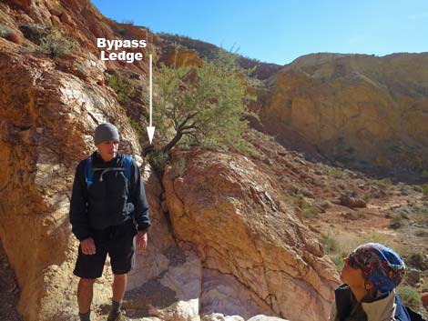 Ledge to bypass the pour-over (view E) |
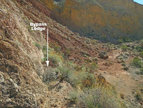 Ledge provides comfortable bypass around the pour-over (view E) |
 Returning to the wash below pour-over (view SW) |
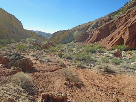
 More narrow bits of canyon (view SW) |
 |
 |
 |
 |
 Approaching end of the Lower Canyon (view SW) |
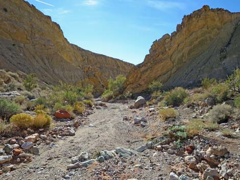
 End of the Lower Canyon (view SW) |
 Open wash below Lower Canyon (view SW) |
 More to come ... |
Table 1. Hiking Coordinates Based on GPS Data (NAD27; UTM Zone 11S). Download Hiking GPS Waypoints (*.gpx) file.
| Wpt. | Location | UTM Easting | UTM Northing | Elevation (ft) | Point-to-Point Distance (mi) | Cumulative Distance (mi) |
|---|---|---|---|---|---|---|
| 01 | Trailhead | 746804 | 4022003 | 2,884 | 0.00 | 0.00 |
| 02 | Big Crook in Wash | 746226 | 4022093 | 2,789 | 0.43 | 0.43 |
| 03 | Top of Next Narrows | 746063 | 4022435 | 2,717 | 0.36 | 0.79 |
| 04 | Below the Narrows | 745357 | 4022734 | 2,576 | 0.81 | 1.60 |
| 05 | Habitation Site | 745083 | 4022889 | 2,582 | 0.20 | 1.80 |
| 06 | Animal Trail Leaves Wash | 745077 | 4022964 | 2,552 | 0.06 | 1.86 |
| 07 | Lunch Rocks | 745032 | 4022954 | 2,552 | 0.04 | 1.90 |
| 08 | Animal Trail | 744616 | 4023151 | 2,398 | 0.29 | 2.19 |
| 09 | Back in Main Wash | 743992 | 4023723 | 2,334 | 0.56 | 2.75 |
| 10 | Slot Canyon with Pour-Over | 743737 | 4023869 | 2,303 | 0.19 | 2.94 |
| 11 | Maximum Point North | 743558 | 4024013 | 2,271 | 0.33 | 3.27 |
| 12 | Deep Narrows | 743339 | 4023728 | 2,203 | 0.27 | 3.54 |
| 13 | 12-ft Pour-Over | 743330 | 4023679 | 2,199 | 0.05 | 3.59 |
| 14 | End of Route | 743055 | 4023294 | 2,123 | 0.34 | 3.93 |
| 01 | Trailhead | 746804 | 4022003 | 2,884 | 3.93 | 7.86 |
Happy Hiking! All distances, elevations, and other facts are approximate.
![]() ; Last updated 240325
; Last updated 240325
| Hiking Around Gold Butte | Hiking Around Las Vegas | Glossary | Copyright, Conditions, Disclaimer | Home |