Hiking Around Las Vegas, Red Rock Canyon NCA, Blue Diamond Hill
 Rock Garden Trailhead (view SE) |
Overview The Rock Garden Trail is one of many trails on the northwest side of Blue Diamond Hill. This trail runs for 1.1 miles from the Cowboy Trail Rides trailhead, up onto Fossil Ridge, and out along the ridgeline to end at the Fossil Trail. This pleasant trail offers grand views, amazing sponge fossils in the trail, and a delightful cactus garden representing most of our local species. This trail provides relatively easy access to the higher Blue Diamond Hill Bike Trails, and it provides great views of the Red Rock Cliffs across the valley to the west and of the La Madre Mountain Range to the north. At the far end of this trail, hikers can make a 2.5-mile loop by taking the Fossil Trail back down to the trailhead or hike farther up the mountain on one of the other Blue Diamond Hill Bike Trails. For hiking back down Fossil Ridge, see Rock Garden Trail--Downhill. Link to map |
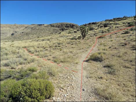
 Rock Garden Trail is the middle of three trails (view SE) |
Watch Out Other than the standard warnings about hiking in the desert, ...this is a pretty safe hike. The Blue Diamond Hill Trails were designed for mountain bikes, so the grades are generally easy, but watch out for bikers careening down the trail. The cowboys use this trail, and as a result, it is rather trashed in some parts and others stink of horse urine; don't step in puddles of "yellow mud." Falls off the ridge into Fossil Canyon would hurt. While hiking, please respect the land and the other people out there, and try to Leave No Trace of your passage. Also, even though this hike is short, be sure to bring what you need of the 10 Essentials. |
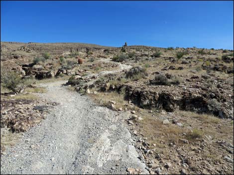
 Start of Rock Garden Trail (view SE) |
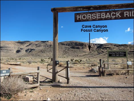
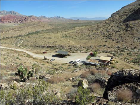
Getting to the Trailhead This hike is located in Red Rock Canyon National Conservation Area, about 30 minutes from town, but not on the Scenic Loop Road. Drive out West Charleston Blvd, past the entrance to the Scenic Loop Drive, to the Cowboy Trail Rides Trailhead on the left. Park here; this is the trailhead. |
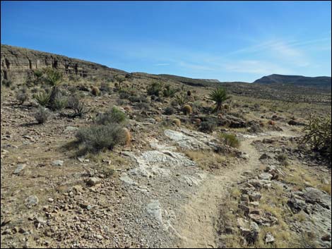
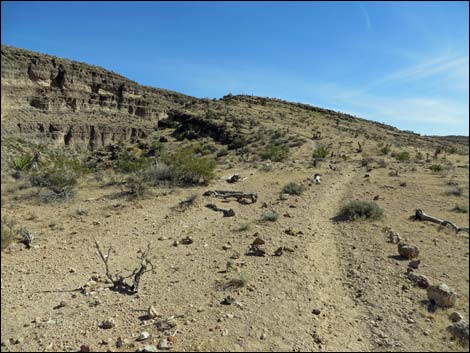
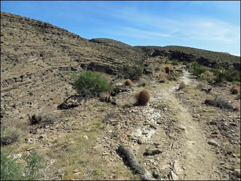
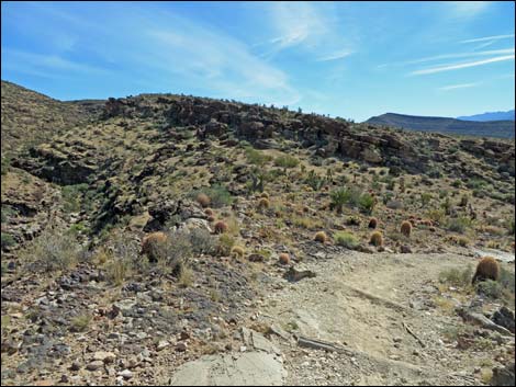
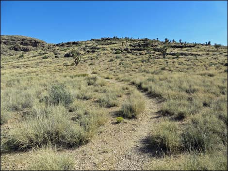 Trail starts across bunchgrass covered desert flats (view SE) |
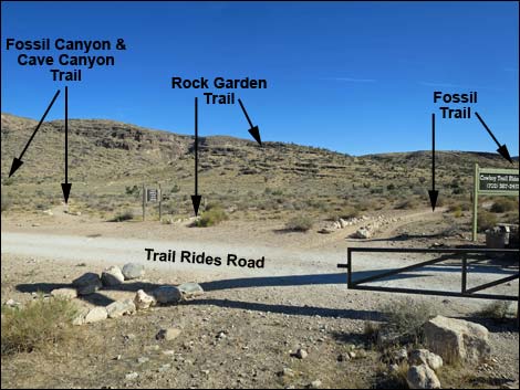
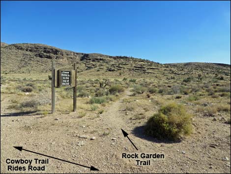
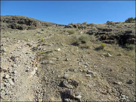
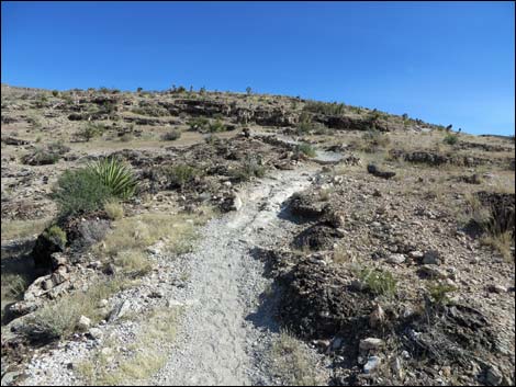
The Hike From the trailhead (Table 1, Waypoint 01), the trail runs under the ranch gate on the Cowboy Trail Rides Road for 6-8 steps, then turns right onto the second of three trails that branch off to the right. The Rock Garden Trail runs southeast towards the toe of Fossil Ridge. Two other trails also start here. The first trail, the Fossil Trail, runs south skirting the west side of Fossil Ridge; and the third trail, Fossil Canyon Trail, runs southeast towards the mouth of Cave Canyon. The Rock Garden Trail runs southeast across desert flats covered with galleta grass and a few Joshua trees to the base of the toe of Fossil Ridge. A use-trail forks left to run towards Fossil Canyon, but the Rock Garden trail climbs steeply onto the toe of the ridge. The initial grade eases somewhat as the trail zig-zags up the hillside, but when pounding up the trail, be sure to stop and notice the sponge fossils in the bedrock underfoot. |
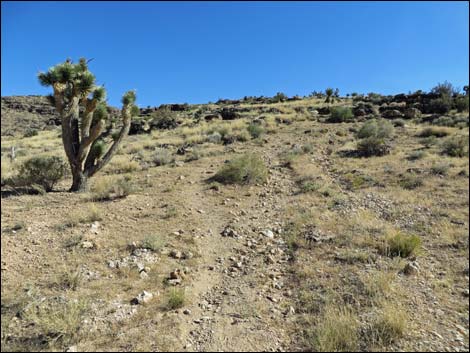
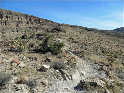
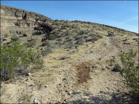
 At base of hill, trail goes up (view SE) |
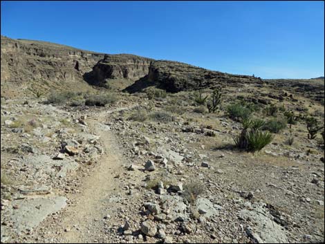
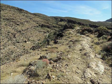
The trail climbs onto the crest of Fossil Ridge (Wpt. 08) where the grade finally eases, then continues southeast along the top of the ridge. The crest of the ridge provides nice views down into the trailhead and horse corral area. Following Fossil Ridge south, the trail passes a junction (Wpt. 07) with a connector trail that drops off the east side of the ridge and heads towards the corrals visible in the bottom of Cave Canyon. Continuing south, the now well-used Rock Garden Trail follows the crest of the ridge with nice views left down into Fossil Canyon and nice views right out to the Red Rocks Cliffs and La Madre Mountains in the distance. Along the ridge, the trail passes the edge of a 2005 fire. The firefighters used the trail as a fireline, so the contrast of the burned west side of the trail and the unburned east side clearly shows how fire affects desert vegetation -- after a decade of regrowth. |
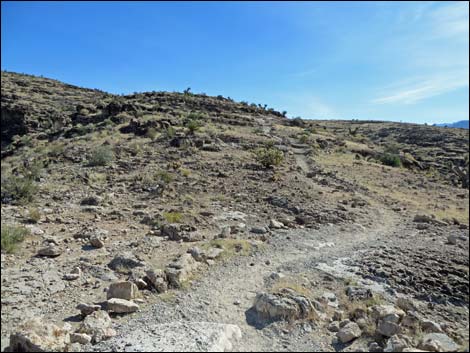
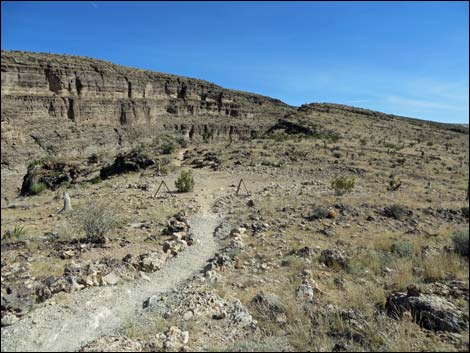
 Trail runs up fairly steep hillside (view SE) |
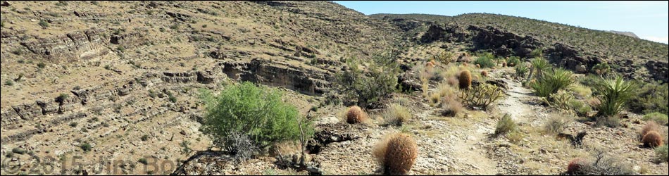
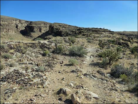
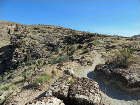
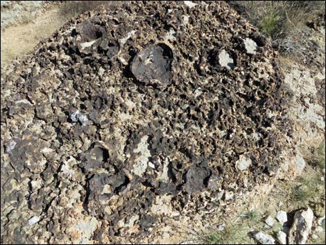
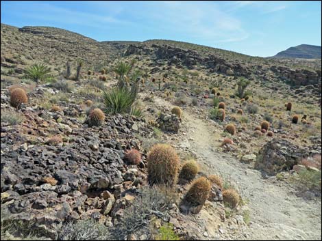
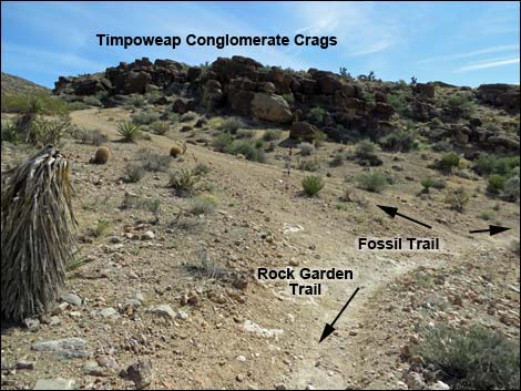
Continuing southeast along the ridgeline, the trail passes bedrock areas with amazing numbers of large fossil sponges eroding out of the stone. This is one of the best places in Red Rock Canyon to see these fossils. After the trail passes the burn area, it runs through an area where cactus seem unusually abundant. In particular, there is a nice stand of barrel cactus high on the ridge. The Rock Garden Trail eventually descends into a saddle below brown, Timpoweap Conglomerate outcrops and ends at an intersection with the Fossil Trail (Wpt. 06). From the end of the Rock Garden Trail, hikers can turn around and walk back to the trailhead (with grand views, not a bad option), turn right and loop back down to the trailhead on the Fossil Trail, or continue left on the Fossil Trail to connect with one of the other Blue Diamond Hill Bike Trails. |
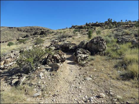 Trail passes through boulders on the hillside (view SE) |
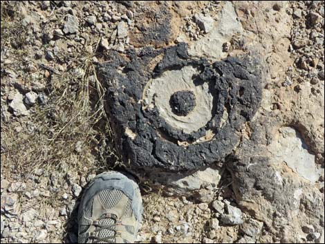 Fossil sponge in the trail |
 Trail remains fairly steep (view SE) |
 Atop the ridge, the grade eases (view SE) |
 Rock Garden Trail approaching cutoff trail to upper corral (view SE) |
 Rock Garden Trail at cutoff trail to upper corral (view SE) |
 Rock Garden Trail continues up the ridgeline at easy grades (view SE) |
 Upper corral (view NE from Rock Garden Trail) |
 |
 |
 |
 |
 Rock Garden Trail (view SE) |
 Rock Garden Trail approaching horse tie-up area (view SE) |
 |
 |
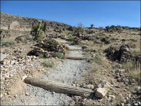 Water bars reduce erosion (view SE) |
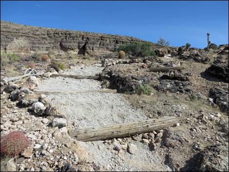 Fill behind water bar makes for nicer trail surface (view SE) |
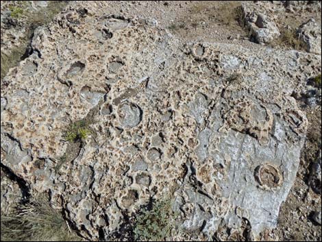 Fossil sponges in bedrock along the trail (view SE) |
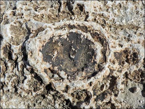 Fossil sponge |
 Fossil sponges in bedrock in the trail (view SE) |
 Fossil sponge |
 Fossil sponges and cactus in bedrock along the trail (view SE) |
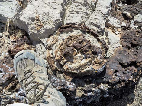 Fossil sponge with foot for size |
 Fossil sponges in bedrock along the trail (view SE) |
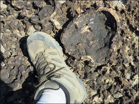 Fossil sponge with foot for size |
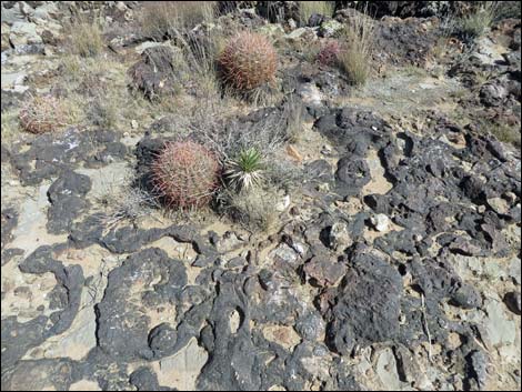 Fossil sponges and cactus in bedrock along the trail (view SE) |
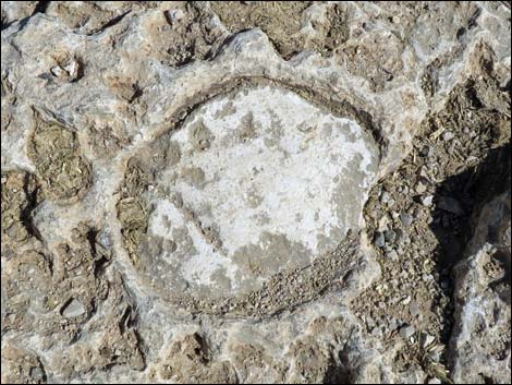 Fossil sponge |
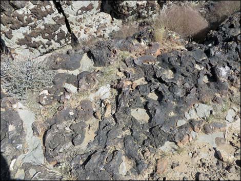 Fossil sponges in bedrock along the trail (view SE) |
 Cactus garden (view SE) |
 Descending through cactus garden towards saddle (view SE) |
 Rock Garden Trail ends at intersection with Fossil Trail (view SE) |
Table 1. Hiking Coordinates Based on GPS Data (NAD27; UTM Zone 11S). Download Hiking GPS Waypoints (*.gpx) file.
| Wpt. | Location | UTM Easting | UTM Northing | Elevation (ft) | Point-to-Point Distance (mi) | Cumulative Distance (mi) | Verified |
|---|---|---|---|---|---|---|---|
| 01 | Trailhead | 641052 | 3998352 | 3,705 | 0.00 | 0.00 | Yes |
| 08 | Crest of Ridge | 641243 | 3998130 | 3,810 | 0.22 | 0.22 | GPS |
| 07 | Trail Junction to Corral | 641283 | 3998058 | 3,820 | 0.05 | 0.27 | GPS |
| 06 | Trail End at Fossil Trail | 641888 | 3997083 | 4,076 | 0.86 | 1.13 | GPS |
Happy Hiking! All distances, elevations, and other facts are approximate.
![]() ; Last updated 240329
; Last updated 240329
| Hiking Around Red Rocks | Hiking Around Las Vegas | Glossary | Copyright, Conditions, Disclaimer | Home |