Backroads Around Las Vegas, Lake Mead National Recreation Area
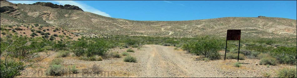
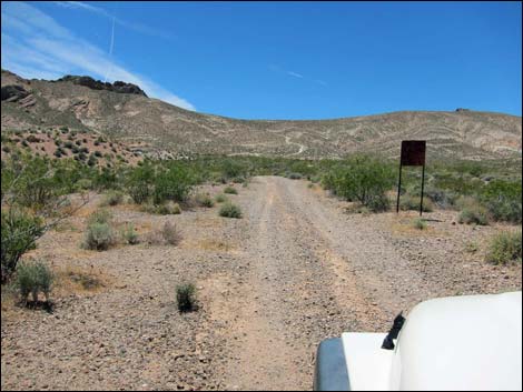
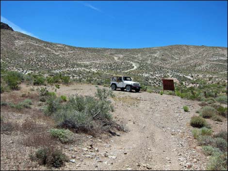
 Bitter Springs Byway at Hidden Valley East Access Road (view SE) |
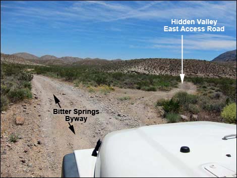
Overview Hidden Valley East Access Road is a 1-mile dirt road off the Bitter Springs Trail Back Country Byway that provides access to the east side of the Muddy Mountain Wilderness Area and Hidden Valley, including Muddy Mountain Peak and Sandstone Arch. Although this road is short, getting there requires driving 10 miles on the Bitter Springs Trail Back Country Byway, a long, rough, and wild road that traverses grand scenery, but many parts are rocky and sandy, requiring 4WD vehicles and relatively slow speeds. Link to map. |
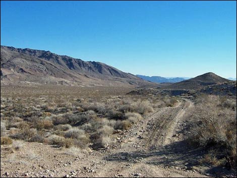
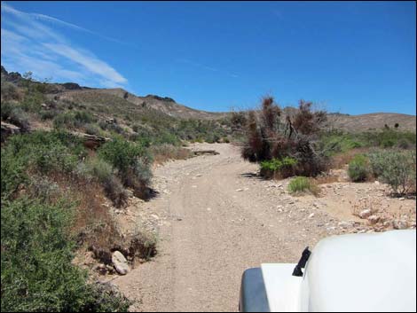 Sandy section; Hidden Valley East Access Road (view W) |
Watch Out Other than the standard warnings about driving in the desert, ...this is a safe road, but it runs into remote country and requires a sturdy 4WD vehicle with good tires to navigate rocks and deep, soft sand. While out, please respect the land and the other people out there, and try to Leave No Trace of your passage. This road is remote, so be sure to bring the 10 Essentials, plus things like extra water, extra food, sleeping gear (in case of being stuck out overnight), a shovel, tow rope, and perhaps a high-lift jack. Please stay on designated roads. Getting to the Roadhead Hidden Valley East Access Road is located off Bitter Springs Trail Back Country Byway, about 10.3 miles east of Highway 169. The Byway is located between Valley of Fire State Park and Lake Mead National Recreation Area. For details of this road, see the Bitter Springs Trail Back Country Byway webpage. |
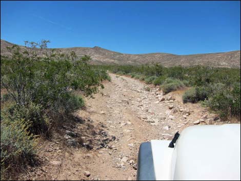 Rocky section; Hidden Valley East Access Road (view SW) |
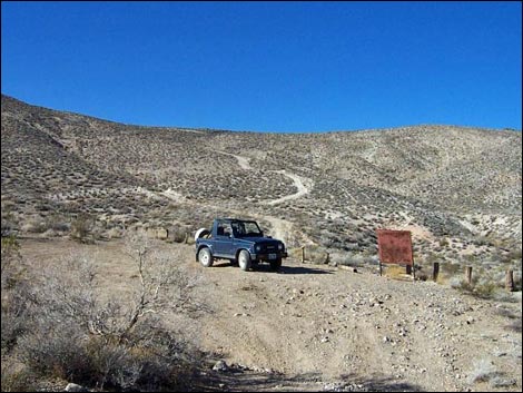
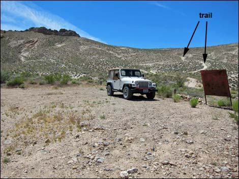
The Road From Bitter Springs Trail Back Country Byway eastbound, Hidden Valley East Access Road (Site 1139) angles off to the right (south). The road runs south for about 0.1 miles to a wash. The road drops into the sandy wash, bends to the right, and runs upstream winding around big rocks and catclaw acacia trees. The road eventually leaves the wash, but it remains rocky much of the way to the parking area at the end of the road. Along the road, a metal sign reads: Muddy Mountains Wilderness Study Area. Road closed at trailhead 1 mile ahead., but it is actually less than 0.2 miles to the trailhead. The parking area is defined by cedar posts and a metal Muddy Mountain Wilderness Area sign. Interestingly, the sign is signed by the diverse group or organizations that came together to establish the area, including wilderness advocates and off-road vehicle organizations. |
 Approaching road sign (view SW) |
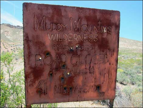 Road sign: road closed ahead (view SW) |
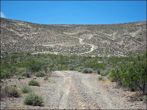 Hidden Valley East Trail in the distance (view SW) |
 Trailhead parking (Nov 2002; view SW) |
 Trailhead parking (May 2011; view SW) |
 Trailhead parking and trailhead sign (view SW) |
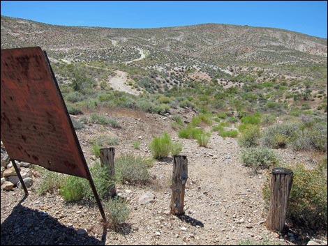 Trailhead sign and trailhead (view SW) |
 Hidden Valley East Access Road (view SE from trailhead parking) |
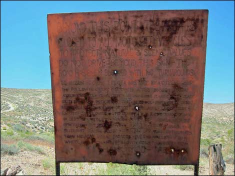 Trailhead sign (view SW) |
Trailhead sign: Beyond this point, the area is closed to all motorized vehicles to protect natural and scenic values. Do not drive beyond this sign. The road has been blocked with no turnarounds. The decision to close this area was made by a citizens group. The following groups participated in this decision making: American Borate Company, Clark county comprehensive planning department, Clark county conservation district, desert tortoise council, fraternity of desert bighorn, Las Vegas Gem Club, High Desert Racing Association, Landcruisers, Las Vegas Jeep Club, Lowell and Ute Leavitt, M/C Racing Association of Nevada, Nevada Department of Wildlife, Nevada Power Company, Nevada Wildlife Federation, Red Rock Audubon Society, Sierra Club, Silverdust Racing Association, Southern Nevada Off Road Enthusiasts, Team Nevada, Vegas Broncos, Vegas Valley Four Wheelers, Charlie Brown Construction, [Magoos P.C.N.?] Thank You -- The BLM |
Table 1. Highway Coordinates Based on GPS Data (NAD27; UTM Zone 11S). Download Highway GPS Waypoints (*.gpx) file.
| Site | Location | UTM Easting | UTM Northing | Latitude (N) | Longitude (W) | Elevation (ft) | Verified |
|---|---|---|---|---|---|---|---|
| 1139 | BS Byway at Hidden Valley East Rd | 708911 | 4024398 | 36.34381 | 114.67215 | 2,939 | Yes |
| 1140 | Hidden Valley East Parking | 707674 | 4023981 | 36.34033 | 114.68604 | 3,049 | Yes |
Happy Hiking! All distances, elevations, and other facts are approximate.
![]() ; Last updated 240326
; Last updated 240326
| Backroads | Hiking Around Las Vegas | Glossary | Copyright, Conditions, Disclaimer | Home |