Hiking Around Las Vegas, Gold Butte National Monument
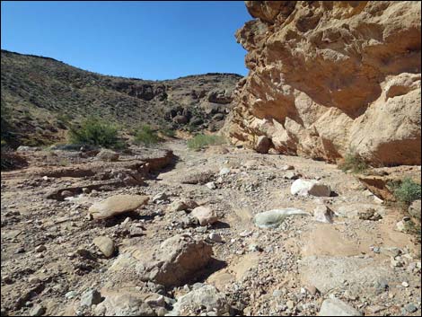
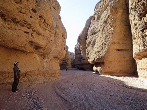
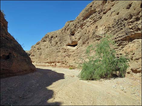
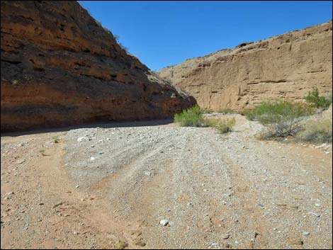
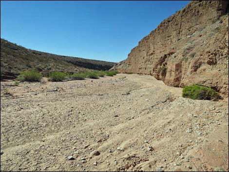
 Mud Wash Narrows trailhead parking (view W) |
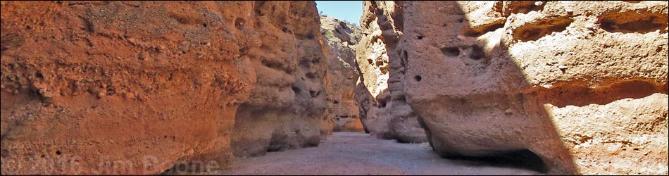
Overview Mud Wash Narrows is a deep, narrow canyon where Mud Wash cut through fanglomerate rocks (conglomerate rock composed of alluvial fan gravels). The canyon is deep and winding, and the most interesting of the hike is the first 0.8 miles. Water and time have eroded the canyon walls into graceful curves and fanciful shapes. This 2-3/4-mile, in-and-out hike starts at the end of Narrows Road North, and although hikers can drive there, it might be easier, and certainly more interesting, to start the hike at the end of Mud Wash Road. Doing so, hikers walk down through the Red Bluff Spring area, then continue down through the narrows; adding 1-1/2 miles (round trip) of easy walking to the hike. This hike follows the Grand Gulch Trail, a wagon route made famous around 1900 when teamsters, using 8- to 12-mule freight wagons, hauled copper ore from Grand Gulch Mine in Arizona to the railroad at St. Thomas. These narrows were the most difficult part of the journey. Link to hiking map. |
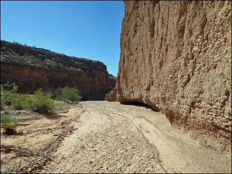
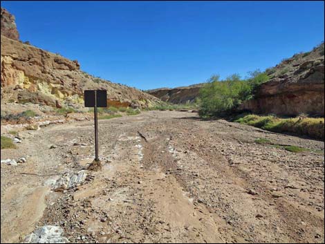
 Sign at the end of the road (view W) |
Watch Out Other than the standard warnings about hiking in the desert, ... this is a fairly safe hike, but do not enter the narrows if thunderstorms to the east threaten to cause flash floods. Teamsters lost wagons, ore, and mules here due to flashfloods -- don't join them! Be careful on smooth rocks with wet, sandy shoes. Red Bluff Spring used to be called "Bitter Spring" and was considered by teamsters to be a good laxative, so be prepared if you choose to drink the water. This is wild and remote country without services of any kind (no restrooms, no water, no gas, no food). Bring what you need to survive. Be prepared and be self-reliant. It is a big place and someone will find you eventually if you stay on main roads, but be prepared to survive alone for a day or two, or even longer on side roads. While hiking, please respect the land and the other people out there, and try to Leave No Trace of your passage. Also, even though this hike is short, the area is remote, so be sure to bring what you need of the 10 Essentials. Cell phones don't work here. |
 Sign at the end of the road (view W) |
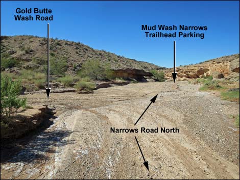
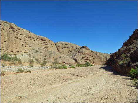
Getting to the Trailhead Mud Wash Narrows is located out in Gold Butte National Monument at the northeast end of Lake Mead, about 3-1/2 hours northeast of Las Vegas in a wild, remote, and scenic area. From town, drive out to Gold Butte National Monument. From Whitney Pocket, continue south on the unpaved Gold Butte Road for 3.9 miles to Mud Wash North Road. Turn right onto Mud Wash North Road and drive southwest and downstream for 3.2 miles to Mud Wash Road. Stay right and merge onto Mud Wash Road, continuing downstream. In Mud Wash, there are two choices. The simplest route is to continue all the way down Mud Wash, but the walk is longer. The more complicated route cuts out of Mud Wash and uses a series of roads to drive to the end of Narrows Road North, but the walk is shorter. |
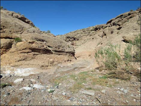
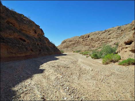
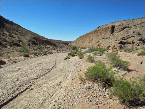
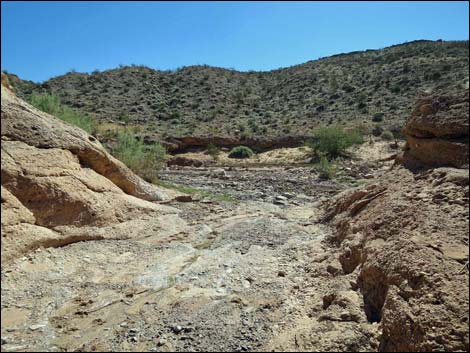
 Mud Wash (view SW) |
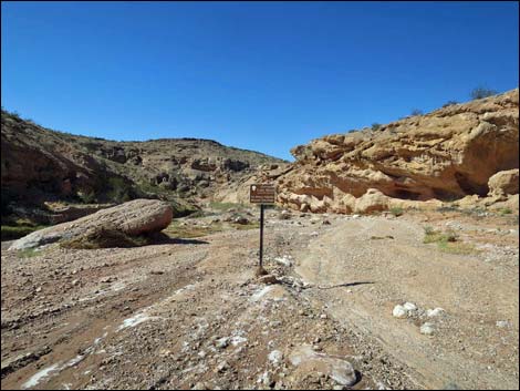
The short and simple drive is to stay on Mud Wash Road, continuing downstream for 5.1 miles to the end of Mud Wash Road. The end is recognized by a signed intersection with Red Bluff Spring Road, which turns left and climbs out of Mud Wash (actually, the name just changes here; it is the same road). Park in the wash before the turn, which is only a few yards upstream from the barbed-wire fence that is intended to keep vehicles and livestock from continuing down the wash and trampling the riparian vegetation at Red Bluff Spring. From there, walk down the wash to the Narrows trailhead. The longer and more complicated drive is to stay on Mud Wash Road for only 1.3 miles, at which point Mud Wash Cutoff Road branches off to the left and runs south into a side canyon. Climbing out of the side canyon, the road runs west 1.9 miles and connects with Red Bluff Spring Road. Turning left onto Red Bluff Spring Road and driving south 0.1 miles, Gold Butte Wash Road branches hard to the right. Gold Butte Wash Road runs northwest 2.3 miles all the way back to Mud Wash. Turning left into Mud Wash, drivers now follow Narrows Road North a few yards down to the trailhead at the end of the road. Note that driving to the trailhead directly via Narrows Road North is not a better way to get there. |
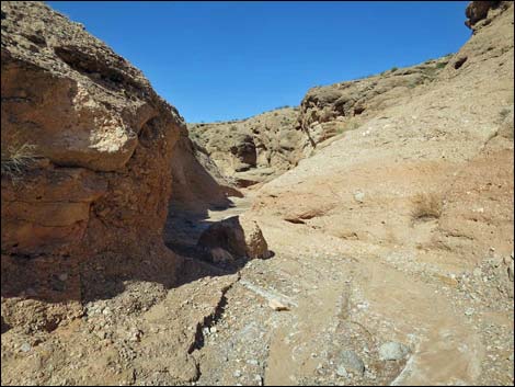
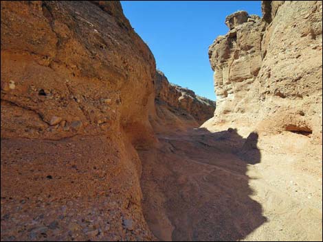
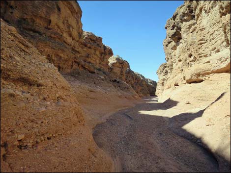
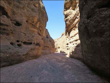
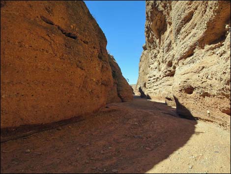
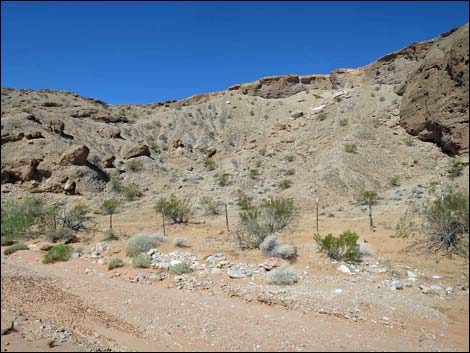
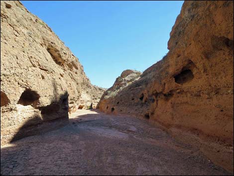
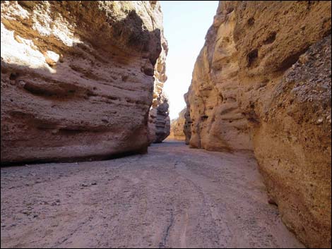
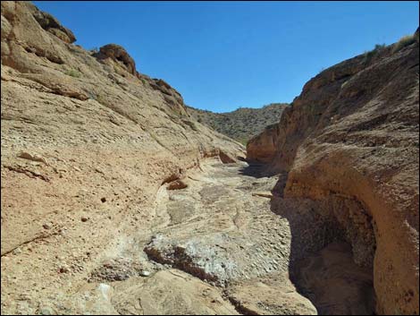
 Abrupt beginning of the narrows (view NW) |
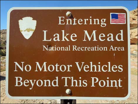
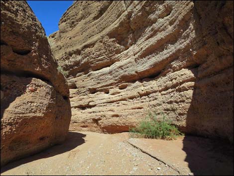
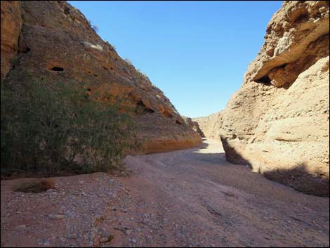
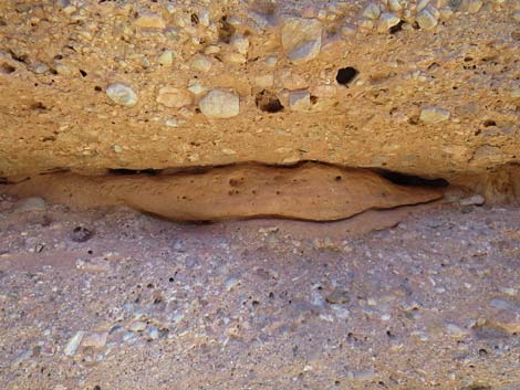
The Hike From the trailhead (Table 1, Waypoint 01), the route follows Mud Wash downstream past a sign announcing the boundary of Lake Mead National Recreation Area. Shortly, the wash curves right and enters the narrows (Wpt. 02). Shallow at first, the narrows get deeper and deeper farther down. The sculpted walls of the canyon reveal their origin and subsequent changes. In places, gravels of the fanglomerate are consistent and uniform, but in others hikers can see different layers of cobbles. The layers are different because they represent different flood events that laid down the gravels before they solidified and the wash cut through them to form the canyon. In some places, hikers can see in the canyon walls the history of erosion and infilling. Apparently, during the history of cutting the canyon, side channels were cut and then refilled with fresh gravels that themselves have subsequently become cemented in place. |
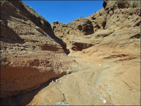
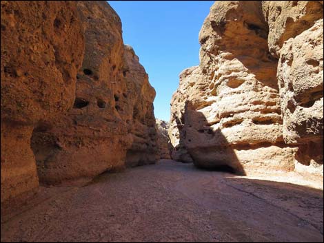
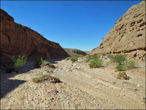
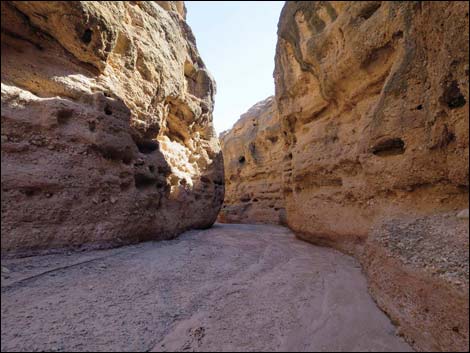
 Entering the narrows (view W) |
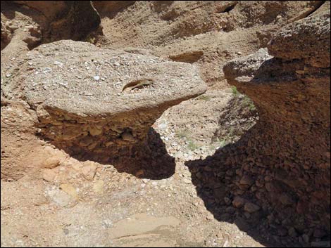
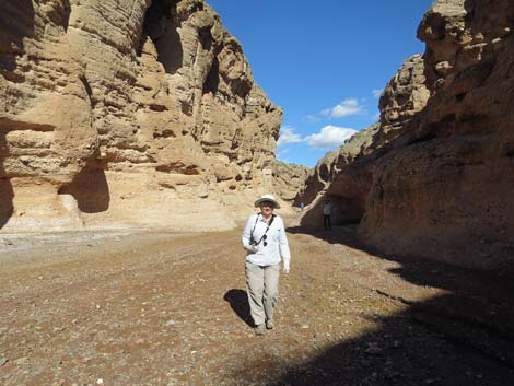
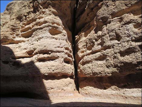
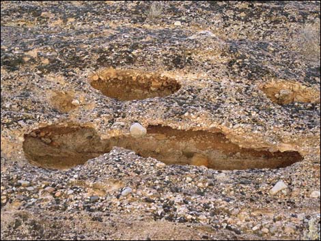
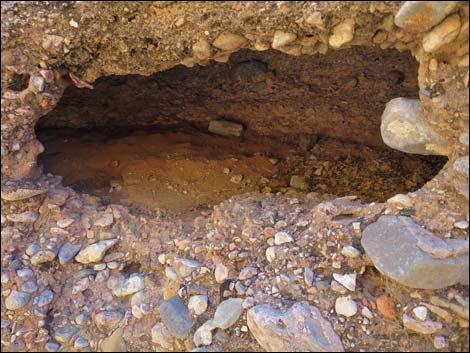
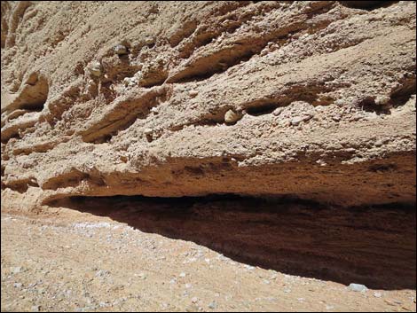
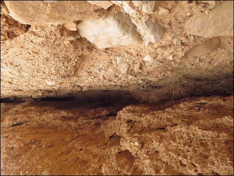
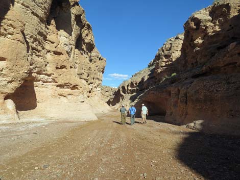
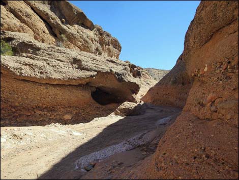
The walls of the canyon also have been fractured vertically such that cracks can be seen cutting both sides of the canyon. Along some of these fractures, calcite (dissolved limestone) seeped into the cracks and solidified along the edges of the crack. These are, in effect, cave formations, but within a very narrow cave. In other places, the walls of the canyon eroded into various sizes and shapes of caves and pockets. Great Horned Owls and Common Ravens have taken up residence in some of the larger holes and alcoves higher up, and often the lower holes take on monster faces with paired eyes and sneering grins appearing out of the rock. Hiking downstream, eventually the narrows open and the canyon walls begin to lie back (Wpt. 03). Hikers can wander down the wash all the way to the Overton Arm of Lake Mead (with lake levels so low, now the Virgin River), but at some point (e.g., Wpt. 04) it makes sense to turn around and head back because it is still more than 3 miles to the Virgin River. Hiking back out the same route, visitors get to experience the narrows in an entirely different way with different perspectives, different lighting, and different angles. Don't discount the benefits of an in-and-out hike. |
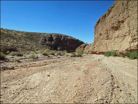
 Upper narrows are shallow (view W) |
 Upper narrows begin to deepen (view W) Upper narrows begin to deepen (view W) |
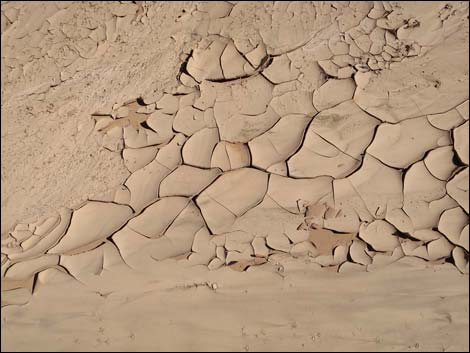
 Interesting erosion patterns |
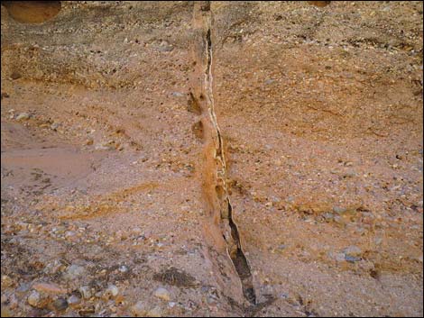 Vertical crack in the fanglomerate rock |
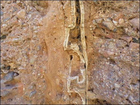 Calcite deposit inside crack (mini cave deposits) |
 Calcite deposit inside crack (mini cave deposits) |
 Middle narrows become deeper (view W) |
 Middle narrows become narrower (view W) |
 |
 |
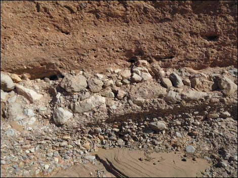 Layers of cobbles in the fanglomerate: results of different floods |
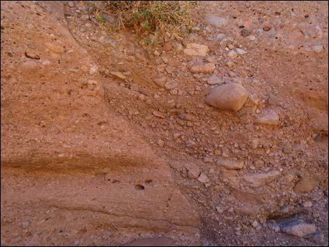 Erosion and re-deposition |
 Cracks in canyon walls sometimes form alcoves - watch for owls |
 Middle narrows are deep (view W) |
 Erosion results in many small caves in canyon walls |
 Erosion results in many small caves in canyon walls |
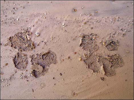 Who's been walking here? Bobcat. |
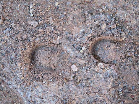 Who's been walking here? Feral burro. |
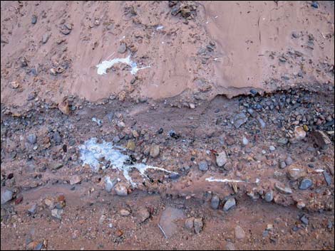 Who's been flying here? Great Horned Owl. |
 Who's been walking here? Beats me. |
 Middle marrows are deep and narrow (view NW) |
 Lower narrows are shallow and narrow (view W) |
 Layers of softer stone erode relatively quickly. |
 Layers of softer stone erode relatively quickly. |
 Lower narrows remain narrow but get shallower (view W) |
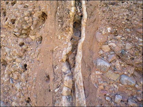
 Desert Willow in lower narrows (view W) |
 The narrow narrows begin to open (view SW) |
 The canyon begins to widen (view W) |
 The canyon walls begin to lay back (view SW) |
 Vertical walls in the wider canyon (view NW) |
 Vertical wall bordering the wash (view SW) |
 Nice walls continue, but the narrows are about done (view SW) |
 Old fencing keeps cattle on one side or the other (view NW) |
 Broad wash and a good place to turn around (view SW) |
Returning Up Mud Wash through Red Bluff Spring
 Starting back into the narrows (view E) |
 Back into the narrows (view E) |
 Middle narrows (view E) |
 Middle narrows (view E) |
 Hikers returning up the middle narrows (view E) |
 The history of flooding is written in these rocks |
 Upper narrows (view E) |
 Upper narrows (view E) |
 Exiting the upper narrows (view E) |
 Wash above the upper narrows (view E) |
 Approaching the trailhead (view E) |
 Returning to the trailhead (view E) |
Table 1. Highway Coordinates based on GPS Data (NAD27; UTM Zone 11S). Download Highway GPS Waypoints (gpx) file.
| Site | Location | UTM Easting | UTM Northing | Latitude (N) | Longitude (W) | Elevation (ft) |
|---|---|---|---|---|---|---|
| 1635 | Narrows Road North at Narrows Trailhead | 745462 | 4038279 | 36.46019 | 114.26088 | 1,556 |
| 1685 | Mud Wash Rd at Red Bluff Spring Rd | 746356 | 4038603 | 36.46288 | 114.25081 | 1,653 |
Table 2. Hiking Coordinates and Distances based on GPS data (NAD27; UTM Zone 11S). Download Hiking GPS Waypoints (*.gpx) file.
| Wpt. | Location | UTM Easting | UTM Northing | Elevation (ft) | Point-to-Point Distance (mi) | Cumulative Distance (mi) |
|---|---|---|---|---|---|---|
| 01 | Trailhead | 745462 | 4038273 | 1,924 | 0.00 | 0.00 |
| 02 | Start Narrows | 745324 | 4038206 | 1,910 | 0.10 | 0.10 |
| 03 | End of Narrow Narrows | 744251 | 4038295 | 1,831 | 0.70 | 0.80 |
| 04 | Good Place to Stop | 743455 | 4038032 | 1,781 | 0.57 | 1.37 |
| 01 | Trailhead | 745462 | 4038273 | 1,924 | 1.37 | 2.74 |
Happy Hiking! All distances, elevations, and other facts are approximate.
![]() ; Last updated 240325
; Last updated 240325
| Gold Butte | Hiking Around Las Vegas | Glossary | Copyright, Conditions, Disclaimer | Home |