Hiking Around Las Vegas, Desert National Wildlife Refuge
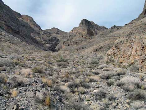
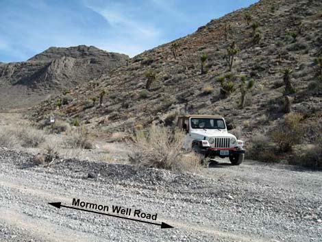 Trailhead parking (view SE from road) |
Overview This is a short hike (3 miles round trip) into an interesting limestone canyon beneath towering cliffs. While this canyon is not unusual in any way, it provides a quick little get away from town for an afternoon hike. The route ends at a 20-ft pour-over, but it can be passed and the adventure continued. Bighorn sheep use the canyon, so keep an eye out for them. Link to a map or elevation profile. For general information on camping, regulations, other issues, and the natural history of the Wildlife Refuge, see the Desert National Wildlife Refuge -- Area Overview page. |
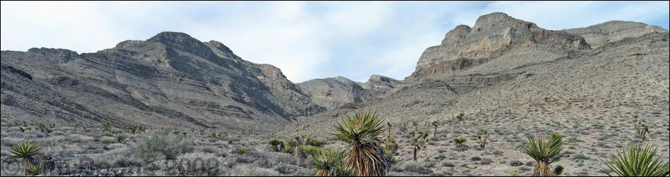
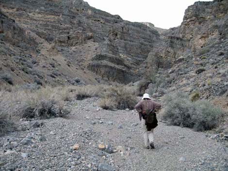
 Yucca Gap Canyon 2 (view NNW) |
Watch Out Other than the standard warnings about hiking in the desert, ... this is a safe hike unless you try climbing the pour-over at the head of the canyon, which requires class-4 scrambling. While hiking, please respect the land and the other people out there, and try to Leave No Trace of your passage. Also, even though this hike is fairly short, it is a bit remote, so be sure to bring the 10 Essentials. This is a wildlife refuge, so pay extra attention to respecting the land. Please, don't bother the bighorn sheep. |
 |
Getting to the Trailhead This hike is located on the Desert National Wildlife Refuge, about 45 minutes north of town. From town, drive out to Corn Creek Field Station and continue east 50 yards to a T-intersection. Turn right onto Mormon Well Road (mile 0.0) and drive south. After about 0.3 miles, the road bends to the left and starts heading east and up towards the mountains. Continue on the main road past Gass Peak Road (mile 4.4) and through Yucca Gap (mile 5.5) to where the canyon opens up again (mile 6.2). Just past the second set of cliffs along the right edge of the road, there is a parking spot on the right with a "No Vehicles Beyond this Point" sign (Site 999). Park here; this is the trailhead. |
 |
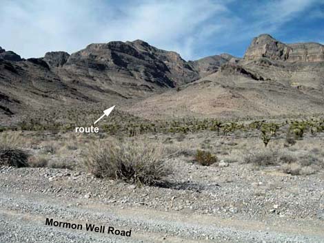
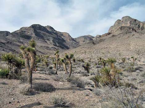
The Hike From the trailhead (Table 2, Waypoint 01), the route runs north, across the broad Yucca Gap Wash, and up into the canyon. There is no trail, but the canyon is broad and without any major forks. This area is entirely within the Upper Sonoran (Mojave Desert Scrub) Life Zone, and common species include Joshua Tree, Mojave Yucca, Mormon tea. Farther up, the Joshua trees drop out, but the shrubs become larger and denser. There is even a desert willow and some cliffrose up there. |
 |
Higher up, keep an eye out for Ivory-spined Utah Agave growing on the canyon walls. Also, watch for fossils in the rocks. We saw lots of corals, a wall of sponges, and one nice snail fossil. At the head of the canyon, the route is blocked by a 20-ft high pour-over (Wpt. 02). This is a good place to stop for an afternoon hike. Sit here, enjoy the quiet and the towering rock walls, and look south across Fossil Ridge into the west side of the Las Vegas Valley. So close, and yet so far away! |
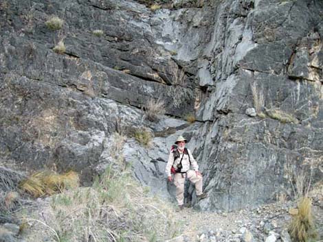 |
The pour-over can be passed on the east side with a bit of class-4 scrambling. The most difficult spots are near the bottom, but there is loose material on the ledges, and a fall from the ledge traverse at the top would be fatal. Shortly above this pour-over is another that looks climbable. When ready, wander back down the canyon. As an alternate ending, consider climbing onto the last peaklet (Wpt. 03) on the west ridge. The rocky outcrop provides great views up and down Yucca Gap. |
Table 1. Highway Coordinates Based on GPS Data (NAD27; UTM Zone 11S). Download Highway GPS Waypoints (*.gpx) file.
| Site | Location | Latitude (N) | Longitude (W) | UTM Easting | UTM Northing | Elevation (feet) | Verified |
|---|---|---|---|---|---|---|---|
| 0999 | Trailhead | 36.44650 | 115.25461 | 656427 | 4034687 | 4,026 | GPS |
Table 2. Hiking Coordinates Based on GPS Data (NAD27, UTM Zone 11S). Download Hiking GPS Waypoints (*.gpx) file.
| Wpt. | Location | Easting | Northing | Elevation (ft) | Point-to-Point Distance (mi) | Cumulative Distance (mi) | Verified |
|---|---|---|---|---|---|---|---|
| 01 | Trailhead | 656427 | 4034687 | 4,026 | 0.00 | 0.00 | GPS |
| 02 | Pour-Over | 656092 | 4036693 | 4,817 | 1.42 | 1.42 | GPS |
| 03 | Knob on Ridge | 656122 | 4035039 | 4,198 | . | . | GPS |
| 01 | Trailhead | 656427 | 4034687 | 4,026 | 1.41 | 2.83 | GPS |
Happy Hiking! All distances, elevations, and other facts are approximate.
![]() ; Last updated 240324
; Last updated 240324
| Hiking Around DNWR | Hiking Around Las Vegas | Glossary | Copyright, Conditions, Disclaimer | Home |